Items Similar to Antique Map of Russia 'in Europe' by W. & A.K. Johnston, circa 1850


Want more images or videos?
Request additional images or videos from the seller
1 of 6
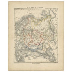
Antique Map of Russia 'in Europe' by W. & A.K. Johnston, circa 1850
$230.24
$353.7634% Off
£171.28
£263.1634% Off
€192
€29534% Off
CA$315.28
CA$484.4234% Off
A$350.55
A$538.6034% Off
CHF 183.04
CHF 281.2334% Off
MX$4,267.04
MX$6,556.1234% Off
NOK 2,335.48
NOK 3,588.3634% Off
SEK 2,188.23
SEK 3,362.1234% Off
DKK 1,461.59
DKK 2,245.6734% Off
Shipping
Retrieving quote...The 1stDibs Promise:
Authenticity Guarantee,
Money-Back Guarantee,
24-Hour Cancellation
About the Item
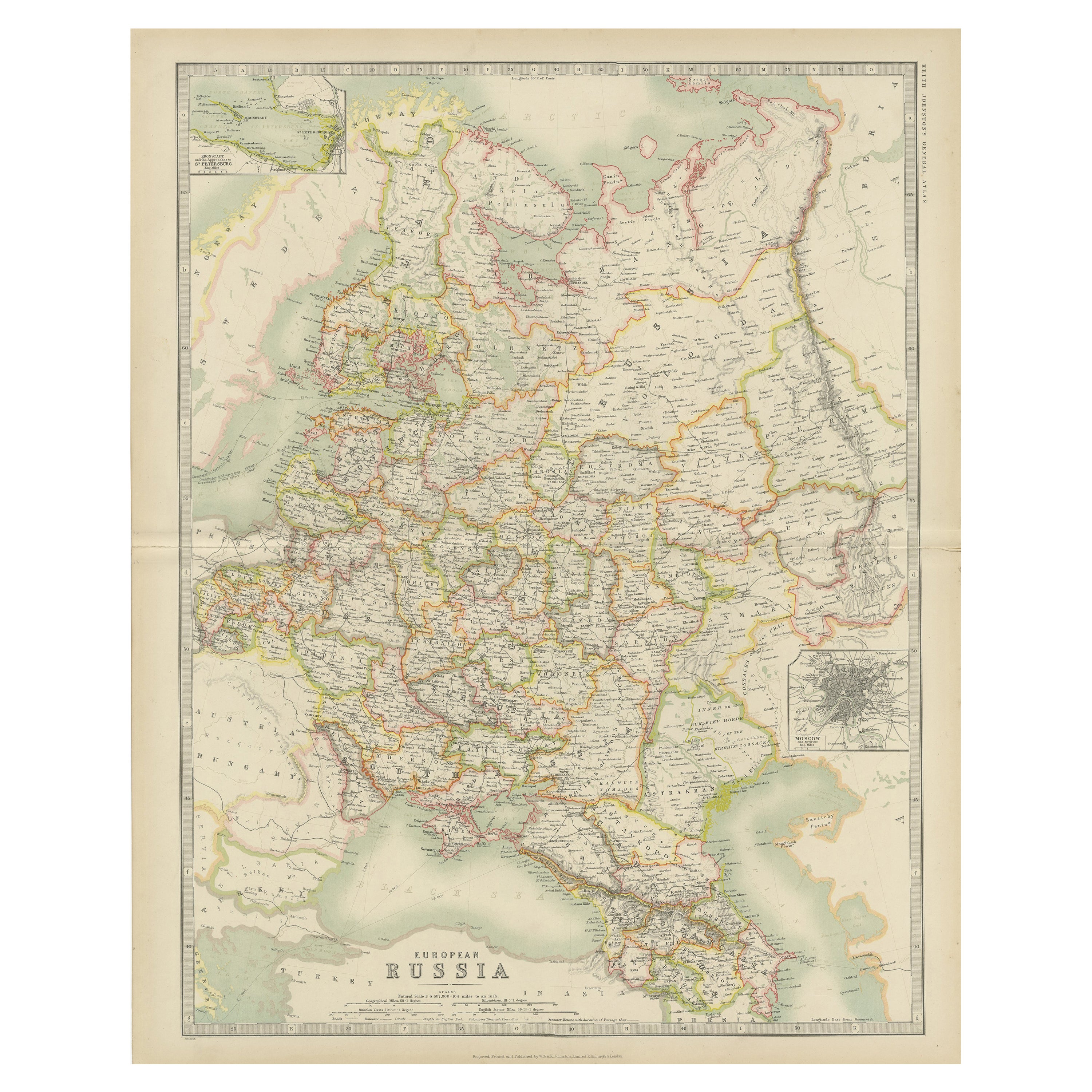
Antique Map: Russia in Europe by W. & A.K. Johnston, Circa 1850
This highly detailed antique map, titled *Russia in Europe,* was created by the esteemed Scottish cartographers W. & A.K. Johnston circa 1850. It provides a comprehensive view of European Russia during the mid-19th century, showcasing the region’s towns, railroads, rivers, lakes, mountains, and other key geographical features.
The map is adorned with a decorative "piano key" border, adding an elegant touch to its practical design. Railroads, an emerging feature of 19th-century transportation, are carefully mapped, alongside sub-oceanic telegraph lines, reflecting the technological advancements of the era. Political boundaries are clearly delineated, providing insight into the territorial divisions of Russia at the time.
W. & A.K. Johnston were highly regarded for their precision and attention to detail, producing some of the most accurate and visually appealing maps of the 19th century. This map exemplifies their craftsmanship, blending functional cartographic detail with aesthetic appeal.
Keywords: antique map Russia, W. & A.K. Johnston, 19th-century European maps, decorative border map, Russian railroads map, Sub-oceanic Telegraph lines, Russia in Europe, mid-19th-century cartography, collectible antique maps, Johnston atlas map.
This map is a valuable artifact for collectors of 19th-century cartography, Russian history enthusiasts, or anyone with an interest in the geopolitical landscape of the time. Its combination of intricate detail and decorative elements makes it an outstanding addition to any collection or display.
- Creator:W. & A.K. Johnston (Artist)
- Dimensions:Height: 25.79 in (65.5 cm)Width: 21.07 in (53.5 cm)Depth: 0.02 in (0.5 mm)
- Materials and Techniques:
- Period:
- Date of Manufacture:circa 1850
- Condition:This map is in good condition. General age-related toning and/or occasional minor defects from handling. Please study scan carefully.
- Seller Location:Langweer, NL
- Reference Number:Seller: BG-004151stDibs: LU305438911323
About the Seller
5.0
Recognized Seller
These prestigious sellers are industry leaders and represent the highest echelon for item quality and design.
Platinum Seller
Premium sellers with a 4.7+ rating and 24-hour response times
Established in 2009
1stDibs seller since 2017
2,510 sales on 1stDibs
Typical response time: <1 hour
- ShippingRetrieving quote...Shipping from: Langweer, Netherlands
- Return Policy
Authenticity Guarantee
In the unlikely event there’s an issue with an item’s authenticity, contact us within 1 year for a full refund. DetailsMoney-Back Guarantee
If your item is not as described, is damaged in transit, or does not arrive, contact us within 7 days for a full refund. Details24-Hour Cancellation
You have a 24-hour grace period in which to reconsider your purchase, with no questions asked.Vetted Professional Sellers
Our world-class sellers must adhere to strict standards for service and quality, maintaining the integrity of our listings.Price-Match Guarantee
If you find that a seller listed the same item for a lower price elsewhere, we’ll match it.Trusted Global Delivery
Our best-in-class carrier network provides specialized shipping options worldwide, including custom delivery.More From This Seller
View AllAntique Map of Russia in Europe, 1842
Located in Langweer, NL
Antique map titled 'Carte de la Russie d'Europe'. Map of Russia in Europe. This map originates from 'Atlas universel de géographie ancienne et moderne (....
Category
Antique 19th Century Maps
Materials
Paper

$229 Sale Price
20% Off
Antique Map of Russia in Europe by Levasseur, '1875'
Located in Langweer, NL
Antique map titled 'Carte générale de la Russie d'Europe (..)'. Large map of Russia in Europe. This map originates from 'Atlas de Géographie Moderne Physique et Politique' by A. Leva...
Category
Antique Late 19th Century Maps
Materials
Paper

$335 Sale Price
20% Off
Antique Map of Russia in Europe by Johnston (1909)
Located in Langweer, NL
Antique map titled 'European Russia'. Original antique map of Russia in Europe. With inset maps of St Petersburg and Moscow. This map originates from the ‘Royal Atlas of Modern Geogr...
Category
Early 20th Century Maps
Materials
Paper
$239 Sale Price
20% Off
Antique Map of Russia in Europe by Tallis, '1851'
Located in Langweer, NL
Antique map titled 'Russia in Europe'. Map of European Russia. Showing vignettes of the Neoskoi Prospect, St. Petersburg, Polish Captives on their way to Siberia, a Russian Bear...
Category
Antique Mid-19th Century Maps
Materials
Paper

$239 Sale Price
20% Off
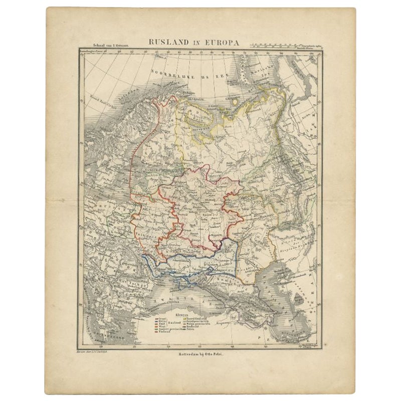
Antique Map of Russia in Europe by Petri, c.1873
Located in Langweer, NL
Antique map titled 'Rusland in Europa'. Old map depicting Russia in Europe. This map originates from 'School-Atlas van alle Deelen der Aarde'. Artists and Engravers: Published by O. ...
Category
Antique 19th Century Maps
Materials
Paper
$93 Sale Price
20% Off
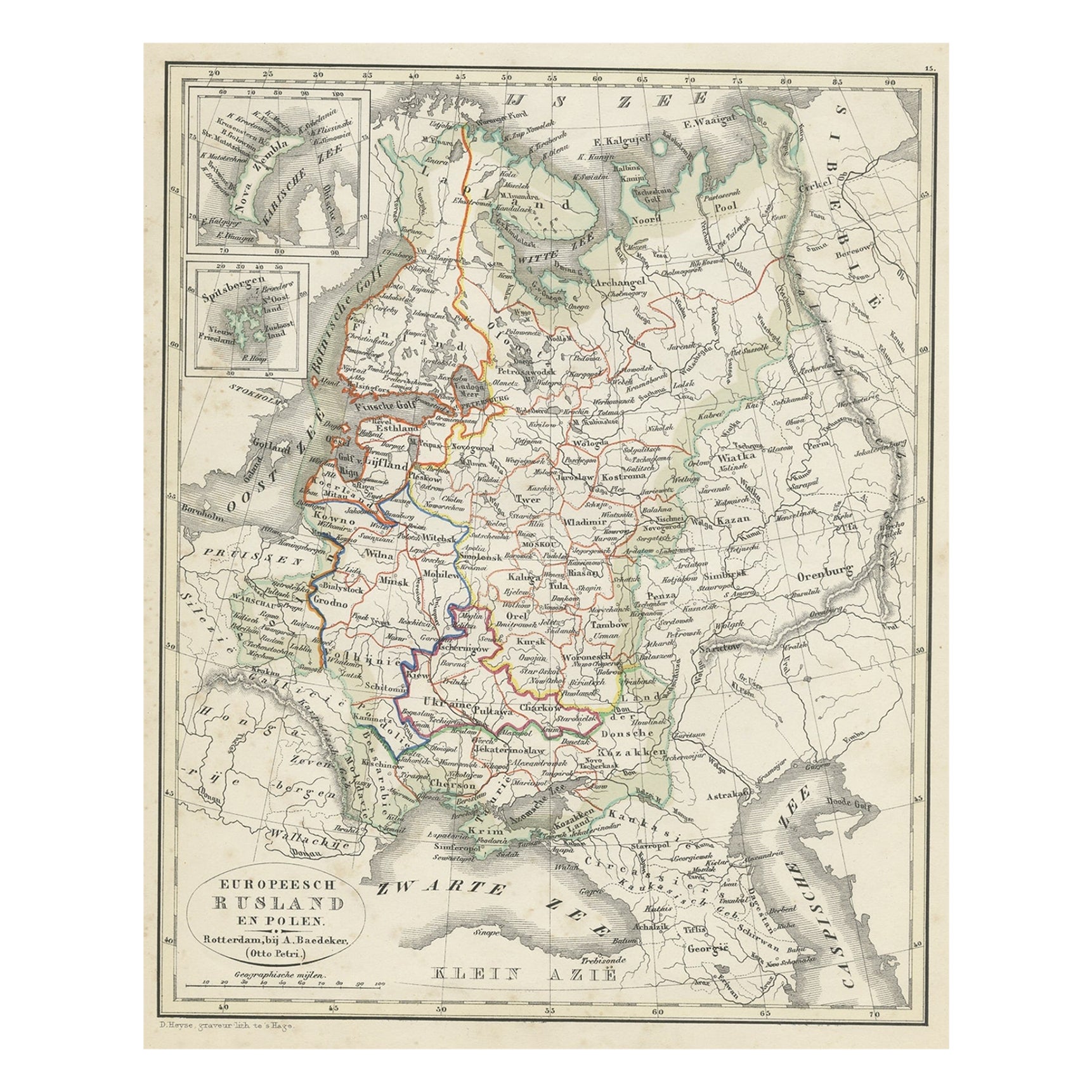
Antique Map of Russia in Europe and Poland from an d Old Dutch Atlas, 1852
Located in Langweer, NL
Description: Antique map titled 'Europeesch Rusland en Polen'.
Map of Russia in Europe and Poland. This map originates from 'School-Atlas van alle deelen der Aarde' by Otto Petri...
Category
Antique 1850s Maps
Materials
Paper

$115 Sale Price
20% Off
You May Also Like
1849 Map of "Europaische Russland", 'Meyer Map of European Russia', Ric. R017
Located in Norton, MA
1849 Map of
"Europaische Russland"
( Meyer Map of European Russia)
Ric.r017
A lovely map of European Russia dating to 1849 by Joseph Meyer. It covers the European portions of...
Category
Antique 19th Century Unknown Maps
Materials
Paper

1853 Map of "Russia in Europe Including Poland" Ric.r016
Located in Norton, MA
Description
Russia in Europe incl. Poland by J Wyld c.1853
Hand coloured steel engraving
Dimension: Paper: 25 cm W x 33 cm H ; Sight: 22 cm W x 28 cm H
Condition: Good ...
Category
Antique 19th Century Unknown Maps
Materials
Paper

Russia in Europe with Poland and Finland. Century Atlas antique vintage map
Located in Melbourne, Victoria
'The Century Atlas. Russia in Europe with Poland and Finland'
Original antique map, 1903.
Central fold as issued. Map name and number printed on the reverse corners.
Sheet 40cm by ...
Category
Early 20th Century Victorian More Prints
Materials
Lithograph

Large Original Antique Map of Poland by Sidney Hall, 1847
Located in St Annes, Lancashire
Great map of Poland
Drawn and engraved by Sidney Hall
Steel engraving
Original colour outline
Published by A & C Black. 1847
Unframed
...
Category
Antique 1840s Scottish Maps
Materials
Paper

1832 Large Map "Russian & Poland" Ric. R0012
Located in Norton, MA
Large map 1832
"Russian & Poland"
Ric.r0012
Russia & Poland, by J. Arrowsmith. London, pubd. 15 Feby. 1832 by J. Arrowsmith, 35 Essex Street, Strand., ...
Category
Antique 19th Century Unknown Maps
Materials
Paper

Russia, Western and Southern Part. Century Atlas antique vintage map
Located in Melbourne, Victoria
'The Century Atlas. Russia, Western and Southern Part'
Original antique map, 1903.
Inset map tilted 'St Petersburg and Environs'.
Central fold as issued. Map name and number printe...
Category
Early 20th Century Victorian More Prints
Materials
Lithograph

More Ways To Browse
In Europe
Gold Modern Coffee Table
Large Side Tables
Japanese Silver Ceramics
One Of A Kind Chair
Used Oak Dining Room Chairs
17th Century Plate
Childrens Vintage Poster
Chinese Ship
Vintage Travel Poster Mid Century
Desk Key
Woven Silk Art
Carved Cabriole Table
Dark Antique Table
White Wooden Table
Antique Wall Table
1960 Chair Wood Danish
Unusual Dining Table