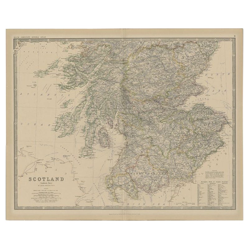
Items Similar to Antique Map of Southern Scotland, 1903, with Coastal and Inland Details

Want more images or videos?
Request additional images or videos from the seller
1 of 10
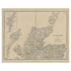
Antique Map of Southern Scotland, 1903, with Coastal and Inland Details
$335.27
£247.84
€280
CA$455.99
A$510.94
CHF 265.96
MX$6,250.52
NOK 3,375.89
SEK 3,188.49
DKK 2,132.06
Shipping
Retrieving quote...The 1stDibs Promise:
Authenticity Guarantee,
Money-Back Guarantee,
24-Hour Cancellation
About the Item
Title: Antique Map of Southern Scotland, 1903, with Coastal and Inland Details
Description:
This exquisite antique map, titled "Scotland (Southern Sheet I)," was engraved and published in 1903 by the esteemed W. & A.K. Johnston firm in Edinburgh and London. A testament to early 20th-century cartography, it meticulously documents the southern half of Scotland, including its rugged coastlines and bustling cities.
The map’s elegant pastel coloring in soft greens, pinks, and yellows delineates county boundaries and enhances the intricate topographical features, from mountain ranges and lochs to rivers and valleys. Major cities such as Edinburgh and Glasgow are clearly marked, along with smaller towns, railway lines, and maritime routes that showcase the region’s vibrant economy during the industrial era.
One of the highlights is the beautifully depicted Hebrides, nestled off the western coast in the Atlantic Ocean. The map’s clarity and precision extend to the smallest islands, reflecting the meticulous craftsmanship of Johnston’s engravers and their dedication to accuracy.
For collectors, historians, and enthusiasts of Scottish heritage, this map provides a window into the past, illustrating a landscape shaped by centuries of cultural and economic evolution. It also highlights the natural beauty of the Highlands and Lowlands, capturing the distinct character of Scotland’s south with an artistry that resonates even today.
Condition report:
This map is in very good antique condition, showing slight toning and minimal foxing around the edges typical for its age. The color palette remains vibrant and the paper stable and clear.
Framing tips:
A classic dark wood frame in walnut or mahogany will enhance the warm pastel tones and intricate detail of this map. A light cream or ivory matting will further highlight the delicate coloring and provide an elegant presentation, making this piece a refined focal point for any home or office space.
- Dimensions:Height: 14.49 in (36.8 cm)Width: 18.9 in (48 cm)Depth: 0.01 in (0.2 mm)
- Materials and Techniques:
- Period:
- Date of Manufacture:1903
- Condition:This map is in very good antique condition, showing slight toning and minimal foxing around the edges typical for its age. The color palette remains vibrant and the paper stable and clear. Folding line as issued.
- Seller Location:Langweer, NL
- Reference Number:Seller: BG-13577-71stDibs: LU3054345241392
About the Seller
5.0
Recognized Seller
These prestigious sellers are industry leaders and represent the highest echelon for item quality and design.
Platinum Seller
Premium sellers with a 4.7+ rating and 24-hour response times
Established in 2009
1stDibs seller since 2017
2,494 sales on 1stDibs
Typical response time: 1 hour
- ShippingRetrieving quote...Shipping from: Langweer, Netherlands
- Return Policy
Authenticity Guarantee
In the unlikely event there’s an issue with an item’s authenticity, contact us within 1 year for a full refund. DetailsMoney-Back Guarantee
If your item is not as described, is damaged in transit, or does not arrive, contact us within 7 days for a full refund. Details24-Hour Cancellation
You have a 24-hour grace period in which to reconsider your purchase, with no questions asked.Vetted Professional Sellers
Our world-class sellers must adhere to strict standards for service and quality, maintaining the integrity of our listings.Price-Match Guarantee
If you find that a seller listed the same item for a lower price elsewhere, we’ll match it.Trusted Global Delivery
Our best-in-class carrier network provides specialized shipping options worldwide, including custom delivery.More From This Seller
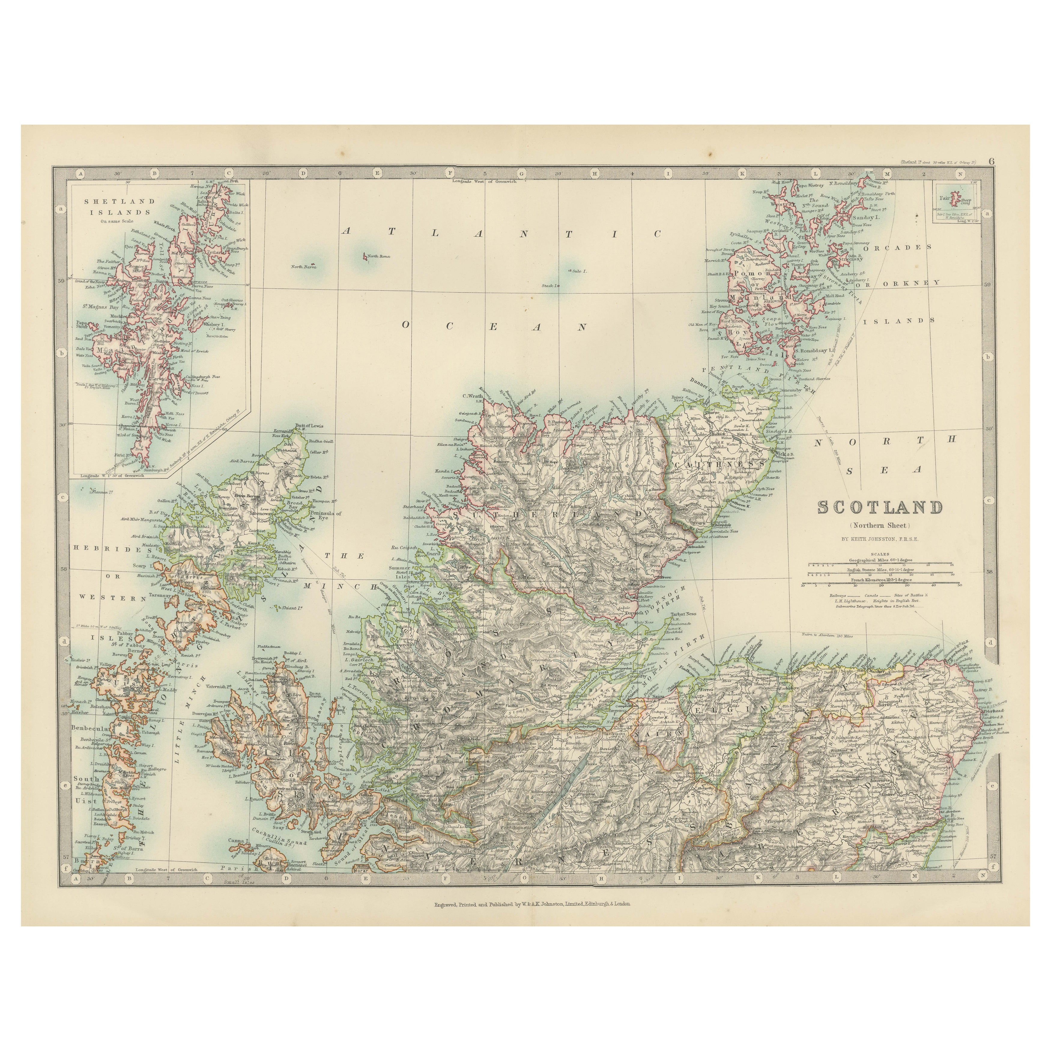
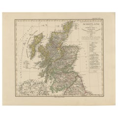
View AllAntique Map of Northern Scotland, 1903, with Intricate Coastal Features
Located in Langweer, NL
Title: Antique Map of Northern Scotland and Islands, 1903, with Intricate Coastal Features
Description:
This striking antique map, titled "Scotland (Northern Sheet I)," was engraved...
Category
Early 20th Century Maps
Materials
Paper
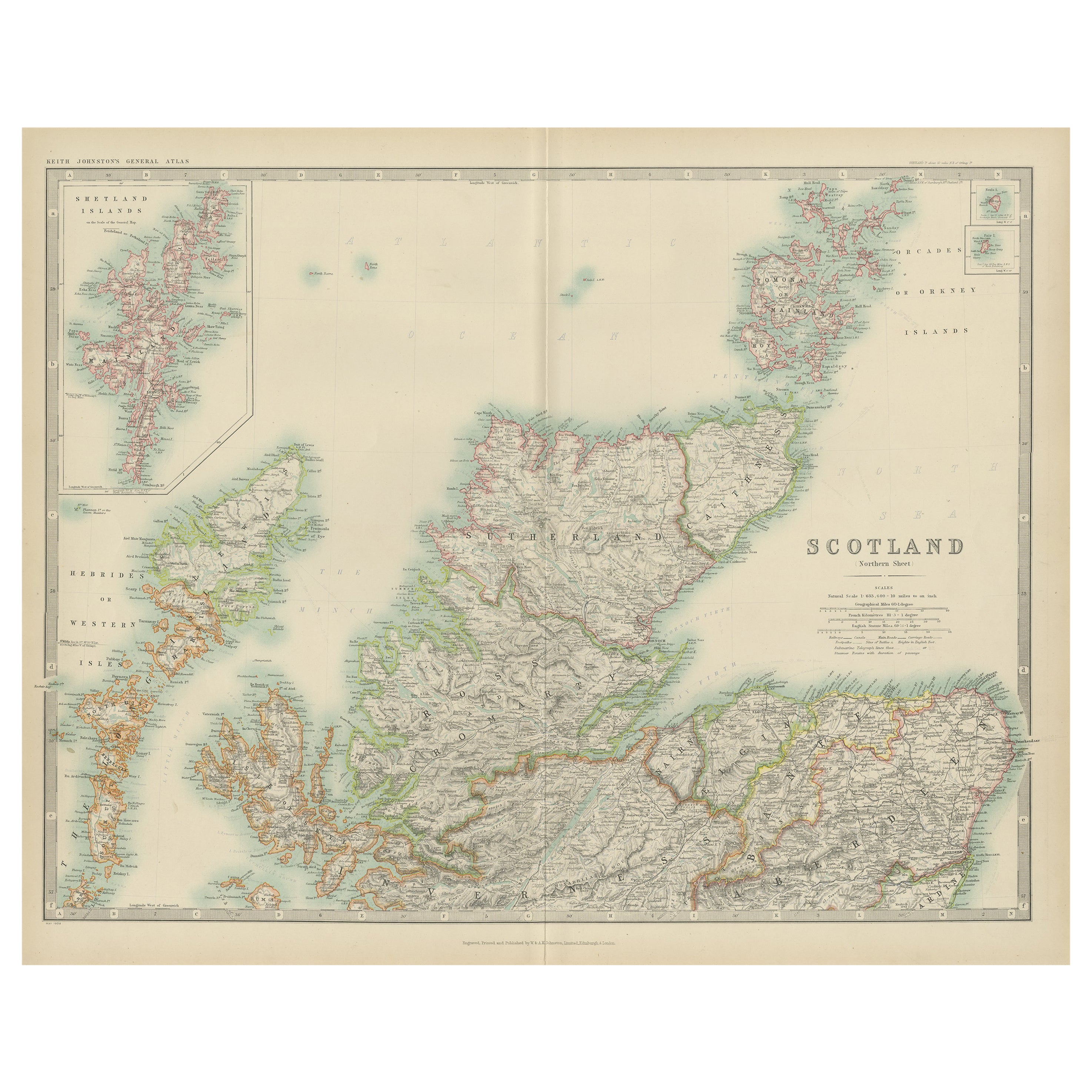
Antique Map of Scotland 'Northern' by Johnston, '1909'
Located in Langweer, NL
Antique map titled 'Scotland'. Original antique map of Scotland. With inset map of the Shetland Islands. This map originates from the ‘Royal Atlas of M...
Category
Early 20th Century Maps
Materials
Paper
$239 Sale Price
20% Off
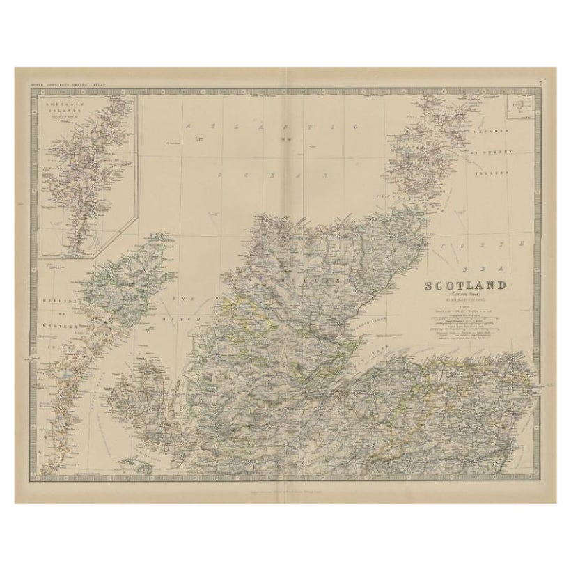
Antique Map of Southern Scotland by Johnston, 1882
Located in Langweer, NL
"Antique map titled 'Scotland'. Old map of Southern Scotland. This map originates from 'The Royal Atlas of Modern Geography, Exhibiting, in a Series of Entirely Original and Authenti...
Category
Antique 19th Century Maps
Materials
Paper
$129 Sale Price
20% Off
Antique Map of Northern Scotland by Johnston, 1882
Located in Langweer, NL
Antique map titled 'Scotland'. Old map of Northern Scotland. This map originates from 'The Royal Atlas of Modern Geography, Exhibiting, in a Series of Entirely Original and Authentic...
Category
Antique 19th Century Maps
Materials
Paper
$100 Sale Price
20% Off
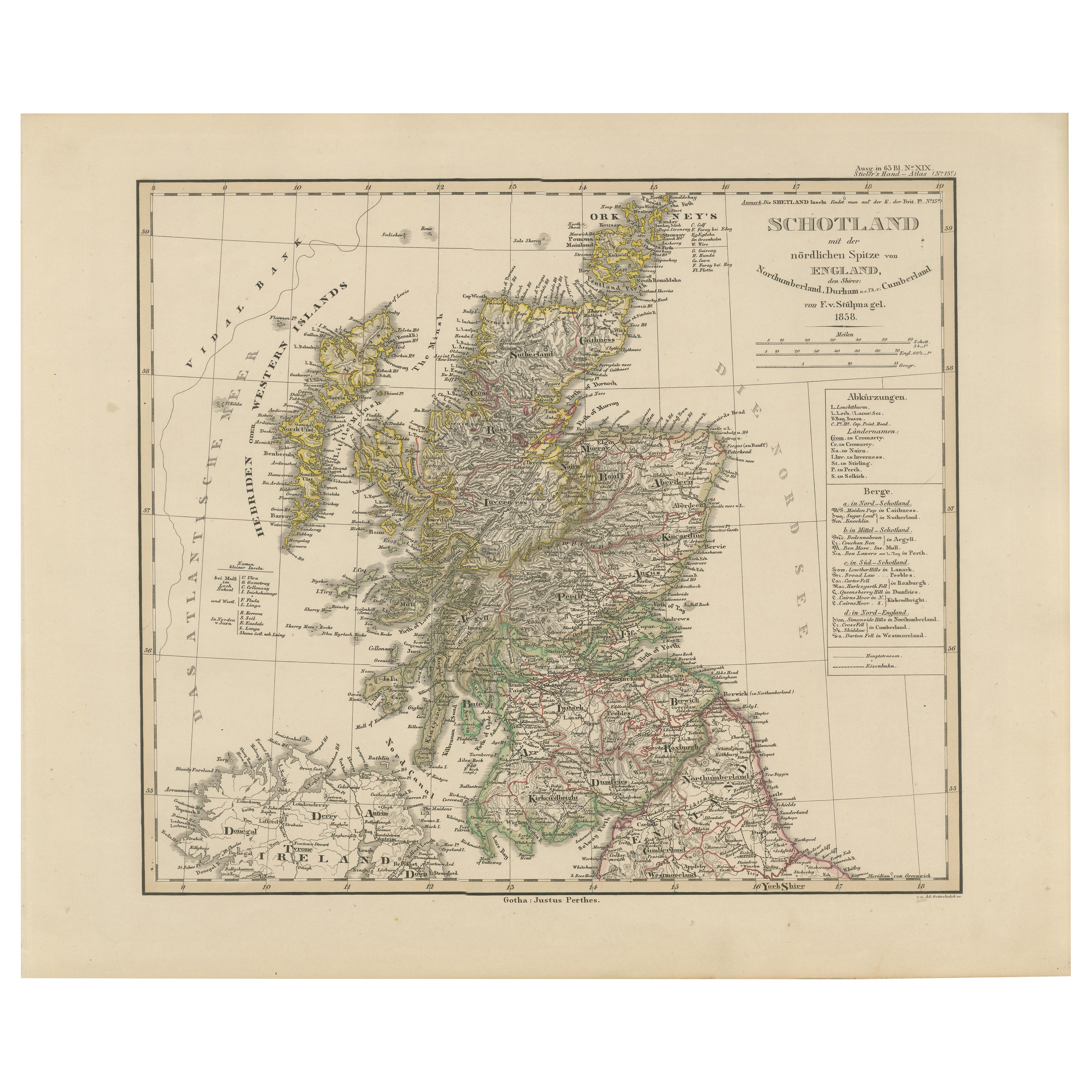
Scotland Map – Highlands, Islands, and Northern England 1858
Located in Langweer, NL
Scotland Map – Highlands, Islands, and Northern England 1858
This attractive antique print shows Scotland and its surroundings titled “Schotland mit der nördlichen Spitze von Englan...
Category
Antique Mid-19th Century German Maps
Materials
Paper
Antique Map of the Northern Part of Scotland by Black '1854'
Located in Langweer, NL
Antique map titled 'Scotland'. Original map of the northern part of Scotland. With an inset map of the Orkney Isles. This map originates from 'General Atlas Of The World: Containing ...
Category
Antique Mid-19th Century Maps
Materials
Paper

$191 Sale Price
20% Off
You May Also Like
Original Antique Map of Scotland by Dower, circa 1835
Located in St Annes, Lancashire
Nice map of Scotland
Drawn and engraved by J.Dower
Published by Orr & Smith. C.1835
Unframed.
Free shipping
Category
Antique 1830s English Maps
Materials
Paper

England and Wales, Northern Part. Century Atlas antique vintage map
Located in Melbourne, Victoria
'The Century Atlas. England and Wales, Northern Part'
Original antique map, 1903.
Central fold as issued. Map name and number printed on the reverse corners.
Sheet 29.5cm by 40cm.
Category
Early 20th Century Victorian More Prints
Materials
Lithograph

Large Original Vintage Map of the United Kingdom, circa 1920
Located in St Annes, Lancashire
Great map of The United Kingdom
Unframed
Original color
By John Bartholomew and Co. Edinburgh Geographical Institute
Published, circa 1920
Free shipping.
Category
Vintage 1920s British Maps
Materials
Paper

England, Scotland & Ireland: A Hand Colored Map of Great Britain by Tirion
By Isaak Tirion
Located in Alamo, CA
This is a hand-colored double page copperplate map of Great Britain entitled "Nieuwe Kaart van de Eilanden van Groot Brittannien Behelzende de Kon...
Category
Antique Mid-18th Century Dutch Maps
Materials
Paper

Large Original Antique Map of Ireland. C.1900
Located in St Annes, Lancashire
Fabulous map of Ireland
Original color.
Engraved and printed by the George F. Cram Company, Indianapolis.
Published, C.1900.
Unframed.
Free shipping.
Category
Antique 1890s American Maps
Materials
Paper

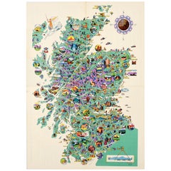
Original Vintage Pictorial Illustrated Map Poster Scotland Mackay Midcentury
Located in London, GB
Original vintage pictorial map poster for Scotland featuring various detailed and colourful illustrations with captions including notable landmarks and ancient buildings, mountains a...
Category
Vintage 1950s British Posters
Materials
Paper
More Ways To Browse
Coastal Antique
Antique Ivory Collectables
Railway Map
Scottish Walnut
Antique Industrial Windows
Solid Mahogany Table
Dessert Glasses
Geometric Glass Table
Mid Century Pin
6x10 Rug
Studded Furniture
Styles Of Antique Desks
Black And White Coffee Table
Metal Relief
Curved Velvet Couch
Velvet Curved Sofa
Wood Round Coffee Tables
Antique Paper Flowers