Items Similar to Antique Map of Southwestern France – With Insets of Paris & Lyon, 1858


Video Loading
Want more images or videos?
Request additional images or videos from the seller
1 of 11
Antique Map of Southwestern France – With Insets of Paris & Lyon, 1858
$459.66
£346.22
€390
CA$633.89
A$712.15
CHF 372.10
MX$8,692.15
NOK 4,724.59
SEK 4,447.21
DKK 2,968.53
About the Item
Antique Map of Southwestern France – With Insets of Paris & Lyon, 1858
Detailed copperplate map of "Südwestliches Frankreich" (Southwestern France), created by Friedrich von Stülpnagel and published by Justus Perthes in Gotha in 1858. This map is part of a four-sheet series of France and offers a detailed depiction of the southwestern regions along the Atlantic coast, including Aquitaine, Gascony, and parts of the Pyrenees, extending to the Spanish border.
One of the unique features of this map is the inclusion of two finely engraved insets:
– "Paris und seine Umgebungen" – a highly detailed street and suburb plan of Paris and its surroundings, capturing the city layout just before Haussmann’s large-scale renovation.
– "Lyon und seine Umgebungen" – a topographical and infrastructural depiction of Lyon and the Rhône valley.
The main map section features cities such as Bordeaux, Pau, Bayonne, and Limoges, along with smaller towns and villages, rivers, roads, and mountain ranges. Departmental borders are delicately hand-colored in red. The topography of the Pyrenees is shown in great relief, emphasizing the region’s dramatic geography.
This map was engraved to a high standard typical of the Justus Perthes cartographic school and demonstrates both political and natural geography. It is of special interest for collectors of French regional maps and 19th-century urban planning, especially given the double inset focus on two of France’s most important cities.
Condition report:
Very good condition. Light age-related toning to outer margins. No tears or repairs. Insets clean and finely detailed. Original hand-coloring remains crisp.
Framing tips:
This piece would be well-complemented by a medium-to-dark wood frame with a neutral mat in ivory or sand tone. The inset city plans make it especially appealing for display in a study, office, or urban-themed collection. A double mat could highlight both the regional and urban elements effectively.
Technique: Copperplate engraving with original hand-coloring
Maker: F. von Stülpnagel, published by Justus Perthes, Gotha, 1858
- Dimensions:Height: 14.77 in (37.5 cm)Width: 17.88 in (45.4 cm)Depth: 0.01 in (0.2 mm)
- Materials and Techniques:Paper,Engraved
- Place of Origin:
- Period:
- Date of Manufacture:1858
- Condition:Very good condition. Light age-related toning to outer margins. No tears or repairs. Insets clean and finely detailed. Original hand-coloring remains crisp.
- Seller Location:Langweer, NL
- Reference Number:Seller: BG-05552-171stDibs: LU3054346116212
About the Seller
5.0
Recognized Seller
These prestigious sellers are industry leaders and represent the highest echelon for item quality and design.
Platinum Seller
Premium sellers with a 4.7+ rating and 24-hour response times
Established in 2009
1stDibs seller since 2017
2,533 sales on 1stDibs
Typical response time: <1 hour
- ShippingRetrieving quote...Shipping from: Langweer, Netherlands
- Return Policy
Authenticity Guarantee
In the unlikely event there’s an issue with an item’s authenticity, contact us within 1 year for a full refund. DetailsMoney-Back Guarantee
If your item is not as described, is damaged in transit, or does not arrive, contact us within 7 days for a full refund. Details24-Hour Cancellation
You have a 24-hour grace period in which to reconsider your purchase, with no questions asked.Vetted Professional Sellers
Our world-class sellers must adhere to strict standards for service and quality, maintaining the integrity of our listings.Price-Match Guarantee
If you find that a seller listed the same item for a lower price elsewhere, we’ll match it.Trusted Global Delivery
Our best-in-class carrier network provides specialized shipping options worldwide, including custom delivery.More From This Seller
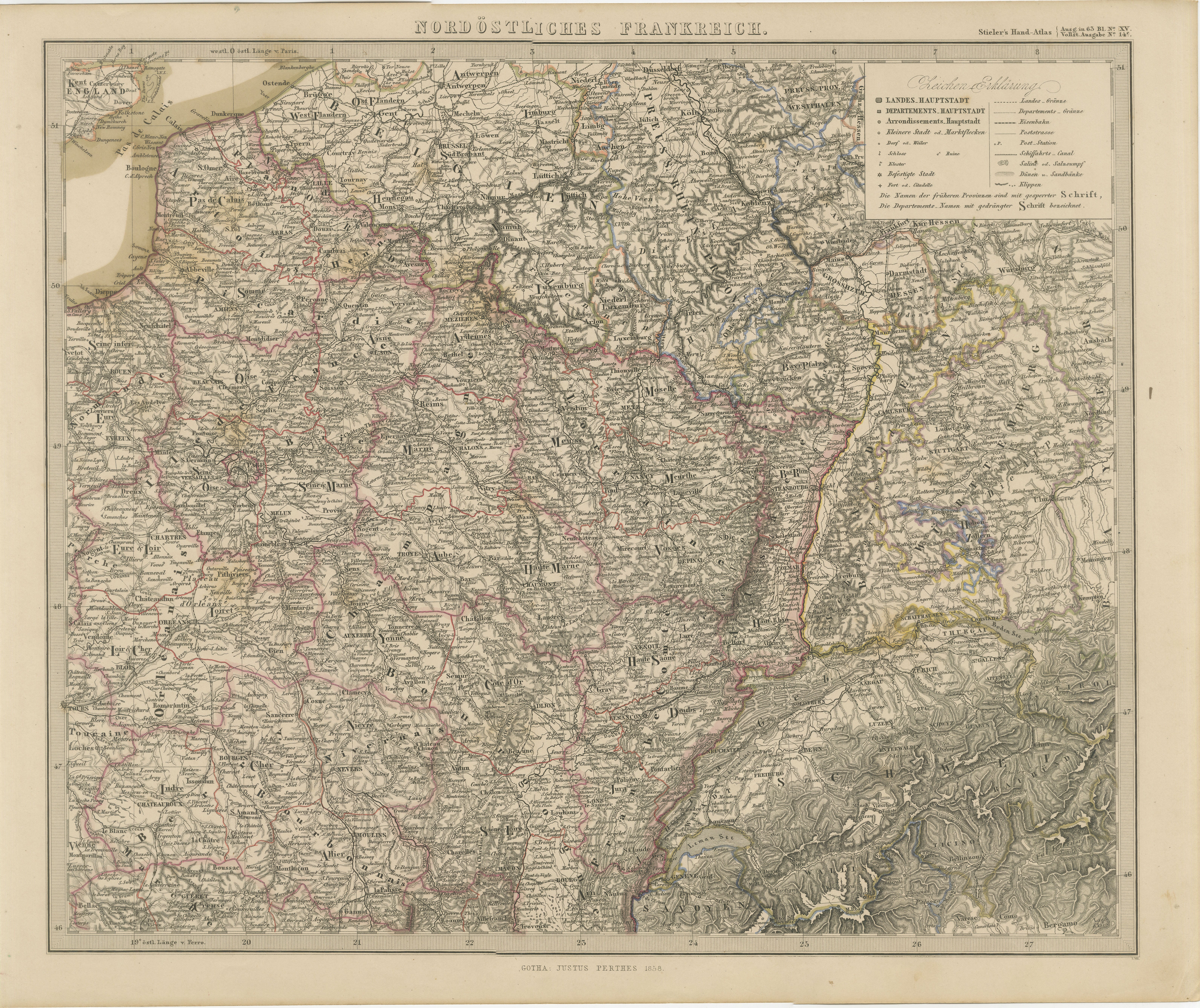
View AllAntique Map of Northeastern France – Alsace, Lorraine & Champagne, 1858
Located in Langweer, NL
Antique Map of Northeastern France – Alsace, Lorraine & Champagne, 1858
Detailed 19th-century engraved map titled "Nordöstliches Frankreich", drawn by Friedrich von Stülpnagel and p...
Category
Antique Mid-19th Century German Maps
Materials
Paper
Antique Map of France, 1903, with Inset of Paris and Corsica
Located in Langweer, NL
Title: Antique Map of France, 1903, with Inset of Paris and Corsica
Description:
This antique map, titled "France," was engraved and published in 1903 by the renowned W. & A.K. John...
Category
Early 20th Century Maps
Materials
Paper

Antique Map of France by A & C. Black, 1870
Located in Langweer, NL
Antique map titled 'France'. Original antique map of France with inset map of France as divided into provinces, before the revolution of 1789 and map of Corsica...
Category
Antique Late 19th Century Maps
Materials
Paper

$259 Sale Price
20% Off
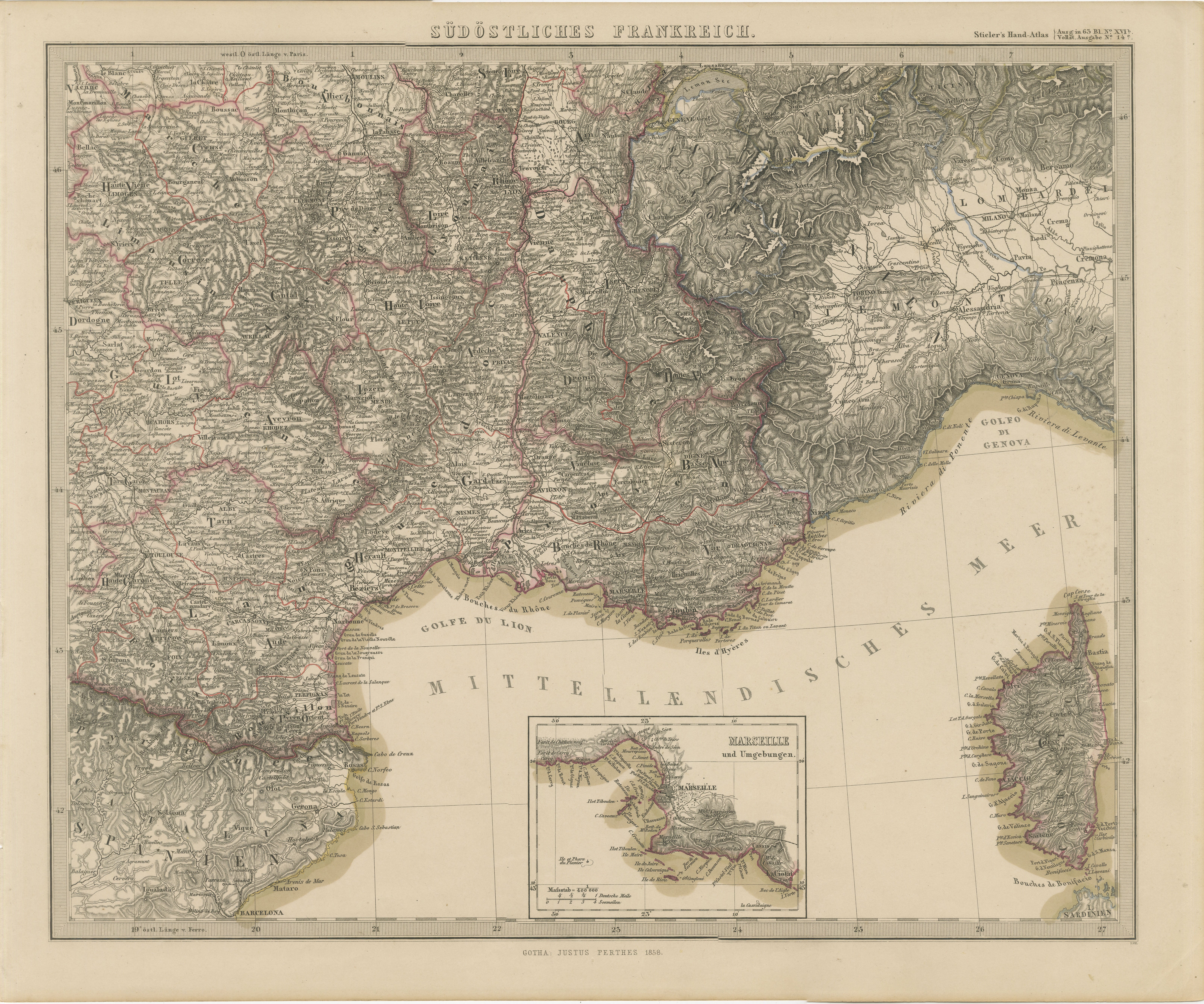
1858 Map of South France with Corsica – Marseille to Italian Border
Located in Langweer, NL
Antique Map of Southeastern France & Corsica – Stülpnagel Engraving, 1858
Highly detailed 19th-century map titled "Südöstliches Frankreich"(Southeastern France), engraved by Friedri...
Category
Antique Mid-19th Century German Maps
Materials
Paper
Antique Map of France by Lapie, 1842
Located in Langweer, NL
Antique map titled 'Carte des Gaules'. Map of France. This map originates from 'Atlas universel de géographie ancienne et moderne (..)' by Pierre M. Lapie and Alexandre E. Lapie. Pie...
Category
Antique Mid-19th Century Maps
Materials
Paper

$471 Sale Price
20% Off
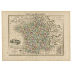
Antique Map of the Departments of France by Migeon, 1880
By J. Migeon
Located in Langweer, NL
Antique map titled 'France par Départements'. Old map of France with a decorative vignette of Strasbourg and an inset map of Corsica. This map originate...
Category
Antique 19th Century Maps
Materials
Paper
$113 Sale Price
20% Off
You May Also Like
France, Northern Part. Century Atlas antique map
Located in Melbourne, Victoria
'The Century Atlas. France, Northern Part.'
Original antique map, 1903.
Inset maps of 'France in Provinces' and 'Paris and Vicinity'.
Central fold as issued. Map name and number pr...
Category
Early 20th Century Victorian More Prints
Materials
Lithograph

Large 19th Century Map of France
Located in Pease pottage, West Sussex
Large 19th Century Map of France.
Remarkable condition, with a pleasing age worn patina.
Recently framed.
France Circa 1874.
Category
Antique Late 19th Century French Maps
Materials
Linen, Paper

La Gironde, France. Antique map of a French department, 1856
By Victor Levasseur
Located in Melbourne, Victoria
'La Gironde', steel engraving with original outline hand-colouring., 1856, from Levasseur's 'Atlas National Illustre'.
This coastal department is the seat of the Bordeaux wine regi...
Category
19th Century Naturalistic Landscape Prints
Materials
Engraving

Map of France - Etching - 1820
Located in Roma, IT
Map of France is an Original Etching realized by an unknown artist of 19th century in 1820.
Very good condition on two sheets of white paper joined at t...
Category
1820s Modern Figurative Prints
Materials
Etching

Pyrenees Orientales, France. Antique map of a French department, 1856
By Victor Levasseur
Located in Melbourne, Victoria
'Dept. des Pyrenees Orientales', steel engraving with original outline hand-colouring., 1856, from Levasseur's 'Atlas National Illustre'.
This area is well-known wine producing reg...
Category
19th Century Naturalistic Landscape Prints
Materials
Engraving

Lozere, France. Antique map of a French department, 1856
By Victor Levasseur
Located in Melbourne, Victoria
'Dept. de La Lozere', steel engraving with original outline hand-colouring., 1856, from Levasseur's 'Atlas National Illustre'.
This remote mountainous part of Languedoc is rural, s...
Category
19th Century Naturalistic Landscape Prints
Materials
Engraving
