Items Similar to Antique Map of Thracia ‘Greece’ by J. Janssonius, circa 1650


Want more images or videos?
Request additional images or videos from the seller
1 of 9
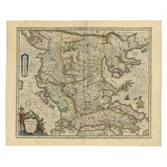
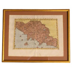
Antique Map of Thracia ‘Greece’ by J. Janssonius, circa 1650
$814.74
$1,018.4220% Off
£606.52
£758.1520% Off
€680
€85020% Off
CA$1,115.99
CA$1,394.9820% Off
A$1,241.22
A$1,551.5320% Off
CHF 648.13
CHF 810.1620% Off
MX$15,104.34
MX$18,880.4220% Off
NOK 8,277.57
NOK 10,346.9620% Off
SEK 7,762.90
SEK 9,703.6320% Off
DKK 5,176.60
DKK 6,470.7520% Off
Shipping
Retrieving quote...The 1stDibs Promise:
Authenticity Guarantee,
Money-Back Guarantee,
24-Hour Cancellation
About the Item
This antique map of Thracia is engraved and published by J. Janssonius after the cartographical sources by Abraham Ortelius. Ornated in the upper left corner with a title cartouche and dedication to Ortelius. Further on we find two extensive text cartouches with listings of place names. In the upper right corner the cartouche 'Loca Circa Byzantium' with a listing of place names belonging to Byzant and in the lower right corner a large text cartouche 'Thraciae Aliquot Incogniti Situs Loca' with a listing of place names belonging to Thraciae. Fine and early historical map on Thracia. The area on this map covers mainly Thracia in Northern Greece and parts of Romania. The map is ornated with three cartouches, in the upper left corner the title cartouche, on the lower and upper right side extensive listings of place name in two cartouches. Villages and towns are shown as miniature views.
- Dimensions:Height: 20.75 in (52.7 cm)Width: 25.2 in (64 cm)Depth: 0.02 in (0.5 mm)
- Materials and Techniques:
- Period:Mid-17th Century
- Date of Manufacture:circa 1650
- Condition:Minor fading. Please study image carefully.
- Seller Location:Langweer, NL
- Reference Number:Seller: BG-092001stDibs: LU305439944931
About the Seller
5.0
Recognized Seller
These prestigious sellers are industry leaders and represent the highest echelon for item quality and design.
Platinum Seller
Premium sellers with a 4.7+ rating and 24-hour response times
Established in 2009
1stDibs seller since 2017
2,508 sales on 1stDibs
Typical response time: <1 hour
- ShippingRetrieving quote...Shipping from: Langweer, Netherlands
- Return Policy
Authenticity Guarantee
In the unlikely event there’s an issue with an item’s authenticity, contact us within 1 year for a full refund. DetailsMoney-Back Guarantee
If your item is not as described, is damaged in transit, or does not arrive, contact us within 7 days for a full refund. Details24-Hour Cancellation
You have a 24-hour grace period in which to reconsider your purchase, with no questions asked.Vetted Professional Sellers
Our world-class sellers must adhere to strict standards for service and quality, maintaining the integrity of our listings.Price-Match Guarantee
If you find that a seller listed the same item for a lower price elsewhere, we’ll match it.Trusted Global Delivery
Our best-in-class carrier network provides specialized shipping options worldwide, including custom delivery.More From This Seller
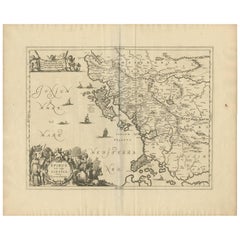
View AllAntique Map of Greece by J. Jansson, circa 1653
Located in Langweer, NL
This is an authentic antique map of the Greece by Jan Jansson. The map was published in Amsterdam, circa 1653. This striking 17th century map of Greece was based on “Totius Graeciae ...
Category
Antique Mid-17th Century Maps
Materials
Paper

$843 Sale Price
20% Off
Antique Map of Greece by Allard (c.1698)
Located in Langweer, NL
Antique map titled 'Hellas seu Graecia Universa' Detailed map of Greece, with Crete, the Aegean Islands, and part of Turkey. With two cartouches, compass rose and scale. Carolus Alla...
Category
Antique Late 17th Century Maps
Materials
Paper

$939 Sale Price
20% Off
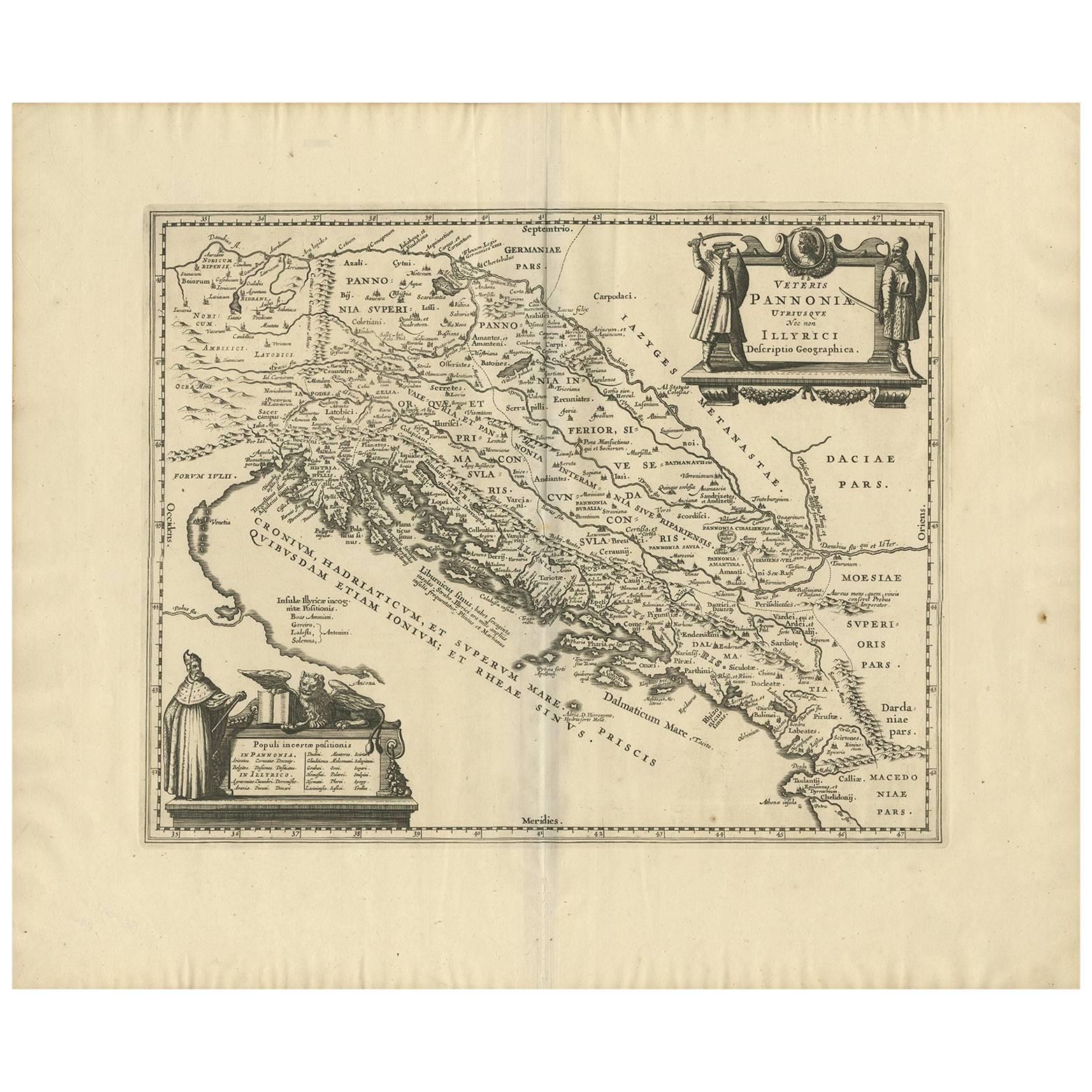
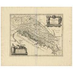
Antique Map of the Adriatic Sea and the Balkan by J. Janssonius, circa 1650
Located in Langweer, NL
Striking large-scale map of the Greater Balkans. Decorated with two large-scale cartouches, one showing two swordsman at odds with one another and the other ...
Category
Antique Mid-17th Century Maps
Materials
Paper
$910 Sale Price
20% Off
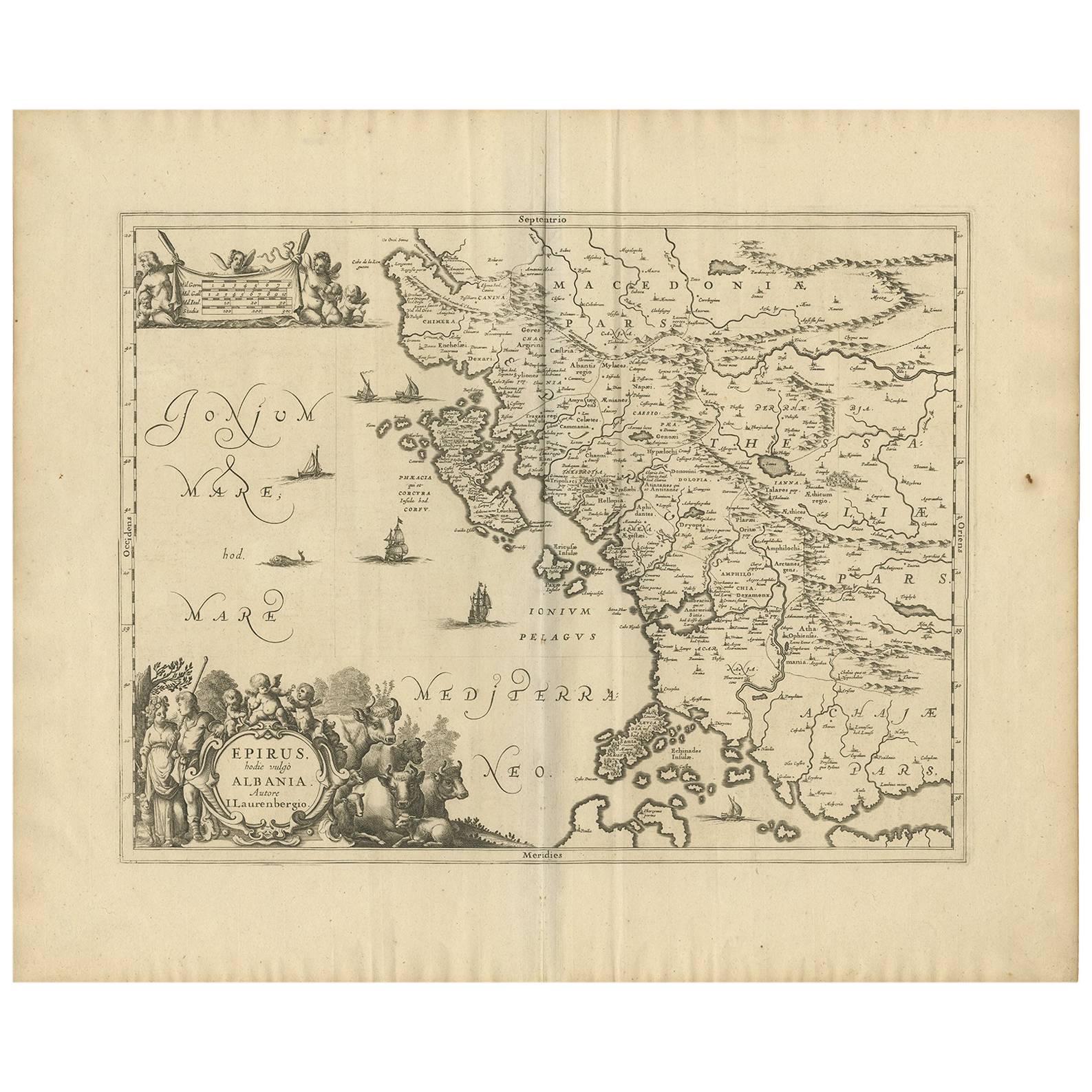
Antique Map of Epirus 'Albania, Greece' by J. Janssonius, circa 1650
Located in Langweer, NL
This map covers the northwestern coast of Greece and part of present-day Albania. The map was drawn by Johannes Wilhelm Laurenberg, a mathematician and historian who produced several...
Category
Antique Mid-17th Century Maps
Materials
Paper
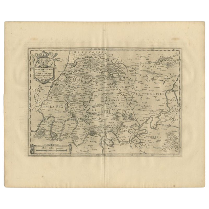
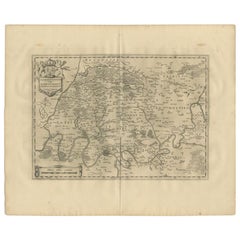
Antique Map of the Region of 'Île de France' by Janssonius, 1657
By Johannes Janssonius
Located in Langweer, NL
Antique map of France titled 'Ager Parisiensis vulgo l'Isle de France'. Old map of Paris and adjacent regions. This map originates from 'Atlas Novus, ...
Category
Antique 17th Century Maps
Materials
Paper
$407 Sale Price
20% Off
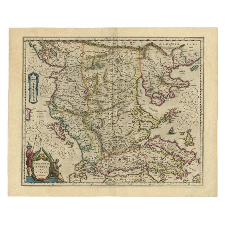
Antique Map of Macedonia by the Famous Mapmaker Blaeu, c.1650
Located in Langweer, NL
Antique map titled 'Macedonia, Epirus et Achaia'.
Ornated with a nice allegoric cartouche, one ship and a milage scale. Macedonia is shown in the centre of the map. With many detai...
Category
Antique 17th Century Maps
Materials
Paper
$1,102 Sale Price
20% Off
You May Also Like
Southern Greece: A Large 17th C. Hand-colored Map by Sanson and Jaillot
By Nicolas Sanson
Located in Alamo, CA
This large original hand-colored copperplate engraved map of southern Greece and the Pelopponese Peninsula entitled "La Moree Et Les Isles De Zante, Cefalonie, Ste. Marie, Cerigo & C...
Category
Antique 1690s French Maps
Materials
Paper

Map of Greece - Original Etching by Antonio Zatta - 18th Century
Located in Roma, IT
This Map of Greece is an etching realized by Antonio Zatta, Cartographer, publisher and typographer.
The state of preservation of the artwork is good except for the worn paper and t...
Category
1780s Figurative Prints
Materials
Etching

Antique Map - Mar Di Athiopia - Etching by Johannes Janssonius - 1650s
By Johannes Janssonius
Located in Roma, IT
Antique Map - Mar Di Athiopia is an antique map realized in 1650 by Johannes Janssonius (1588-1664).
The Map is Hand-colored etching, with coeval watercolorang.
Good conditions wit...
Category
1650s Modern Figurative Prints
Materials
Etching

18th Century Map of the Southern Balkans by Giovanni Maria Cassini
By Giovanni Maria Cassini
Located in Hamilton, Ontario
18th century map by Italian engraver Giovanni Maria Cassini (Italy 1745-1824).
Map of the Southern Balkans: Rome. Hand colored and copper engraved print done in the year 1788. It in...
Category
Antique 18th Century Italian Maps
Materials
Paper

$795 Sale Price
36% Off
1562 Map of Toscana Nuova Tavola by Girolamo Ruscelli
Located in Chapel Hill, NC
A 1562 map of Toscana Nuova Tavola by Girolamo Ruscelli. Tuscany is the heart of Italy & birthplace of the Italian language. Early hand-coloring. Copper plate engraving. Interestingl...
Category
Antique 16th Century Italian Renaissance Maps
Materials
Paper
Greece, "Graeciae Antiquae"" A 17th Century Hand-colored Map by Sanson
By Nicolas Sanson
Located in Alamo, CA
This is an original 17th century hand colored copperplate engraved map of Greece entitled "Graeciae Antiquae Tabula Hanc Geographicam" by Nicolas d'Abbeville Sanson, engraved and pub...
Category
Antique Mid-17th Century French Maps
Materials
Paper

More Ways To Browse
1960 Chair Wood Danish
Unusual Dining Table
Mdf Table
Showcase Coffee Table
Silver Ladle
Scalloped Table
Brazil Wood Chairs
Vintage Art Deco Side Tables
Window Display
1960s Cushion Chair
Green Brown Oriental Rug
Authentic Models
Aesthetic Dining Room Chairs
Antique English Porcelain
Blue Cup
Marble Wood Console Console
Steel Tube Furniture
17th Century Italian Furniture