Items Similar to Antique Map of Ukraine, Bulgaria, Romania, Servia & Surroundings by N. Visscher

Want more images or videos?
Request additional images or videos from the seller
1 of 10
Antique Map of Ukraine, Bulgaria, Romania, Servia & Surroundings by N. Visscher
$829.83
$1,037.2920% Off
£617.31
£771.6420% Off
€692
€86520% Off
CA$1,136.32
CA$1,420.4020% Off
A$1,263.44
A$1,579.3020% Off
CHF 659.70
CHF 824.6220% Off
MX$15,379.11
MX$19,223.8820% Off
NOK 8,417.45
NOK 10,521.8120% Off
SEK 7,886.75
SEK 9,858.4320% Off
DKK 5,267.81
DKK 6,584.7720% Off
Shipping
Retrieving quote...The 1stDibs Promise:
Authenticity Guarantee,
Money-Back Guarantee,
24-Hour Cancellation
About the Item
Antique map titled 'Exactissima Tabula qua tam Danubii Fluvii Pars Inferior, a Belgrado Urbe usq ad ejus ostia, et minores in eum influentes, Fluvii quam Regiones adjacentes, ut Transylvania, Valachia, Moldovia, Bulgaria, Bessarabia et Romonia, aliiq Ucraniae ac Podoliae.'
Detailed map of the lower Danube, extending from Belgrade to the Black Sea. The map extends to Constantinople and the Bosphorus Straits in the southeast to the Ukraine and Podolia in the northeast, and from northern Greece in the southwest to the southern part of the Kingdom of Poland in the northwest, centered on Bulgaria and Valachia. Published circa 1700.
Contemporary coloring.
- Dimensions:Height: 20.4 in (51.8 cm)Width: 24.02 in (61 cm)Depth: 0.02 in (0.5 mm)
- Materials and Techniques:
- Period:
- Date of Manufacture:circa 1700
- Condition:Small tear at the bottom of the centre fold. Please study image carefully.
- Seller Location:Langweer, NL
- Reference Number:Seller: BG-063841stDibs: LU305439810701
About the Seller
5.0
Recognized Seller
These prestigious sellers are industry leaders and represent the highest echelon for item quality and design.
Platinum Seller
Premium sellers with a 4.7+ rating and 24-hour response times
Established in 2009
1stDibs seller since 2017
2,510 sales on 1stDibs
Typical response time: <1 hour
- ShippingRetrieving quote...Shipping from: Langweer, Netherlands
- Return Policy
Authenticity Guarantee
In the unlikely event there’s an issue with an item’s authenticity, contact us within 1 year for a full refund. DetailsMoney-Back Guarantee
If your item is not as described, is damaged in transit, or does not arrive, contact us within 7 days for a full refund. Details24-Hour Cancellation
You have a 24-hour grace period in which to reconsider your purchase, with no questions asked.Vetted Professional Sellers
Our world-class sellers must adhere to strict standards for service and quality, maintaining the integrity of our listings.Price-Match Guarantee
If you find that a seller listed the same item for a lower price elsewhere, we’ll match it.Trusted Global Delivery
Our best-in-class carrier network provides specialized shipping options worldwide, including custom delivery.More From This Seller
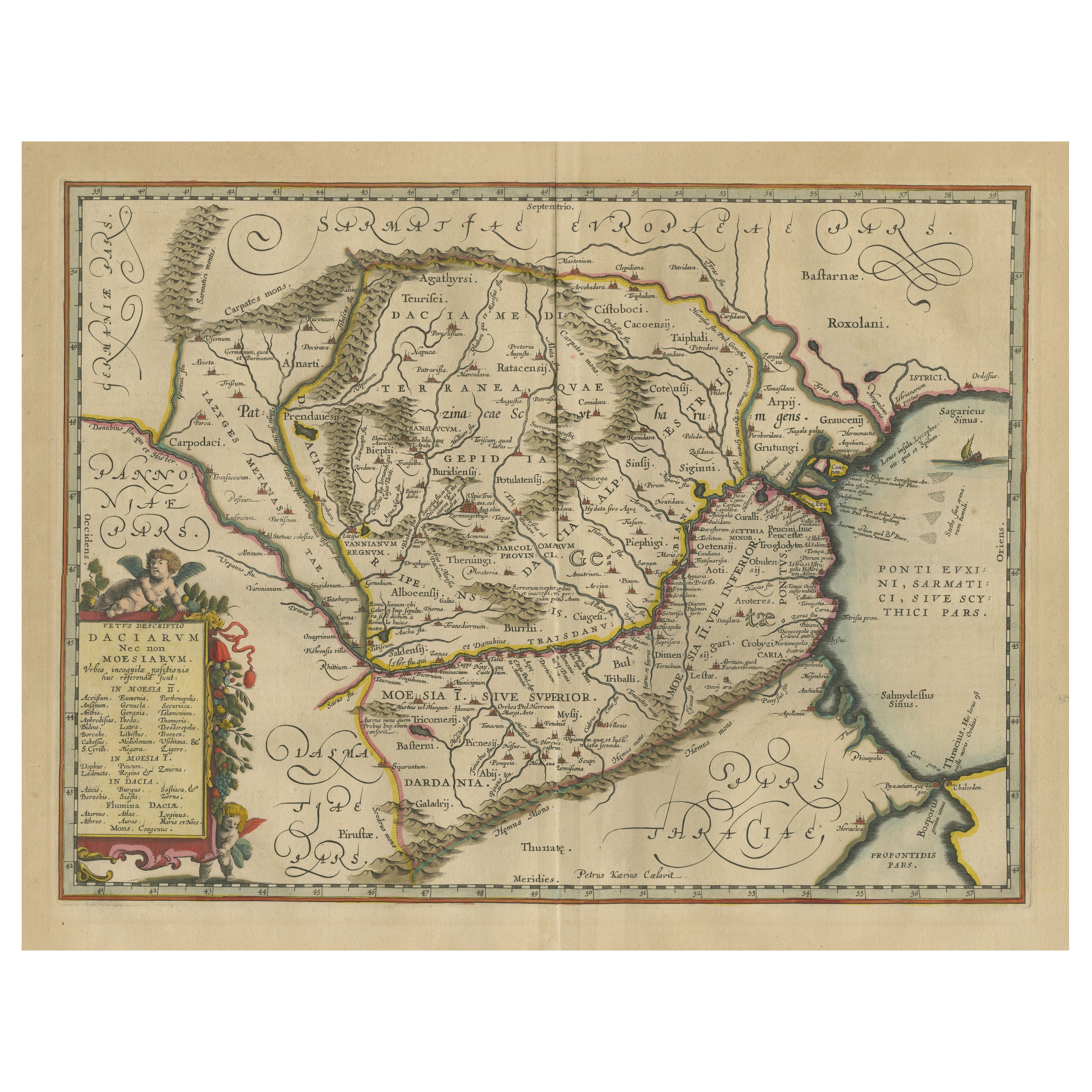
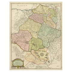
View AllAntique Map of Romania and Bulgaria Centered on the Danube River
Located in Langweer, NL
Antique map titled 'Vetus descriptio Daciarum nec non Moesiarum'. Impressive map of the area of Romania and Bulgaria centered on the Danube River. The map is based on Ortelius' map o...
Category
Antique Mid-17th Century Maps
Materials
Paper
$661 Sale Price
20% Off
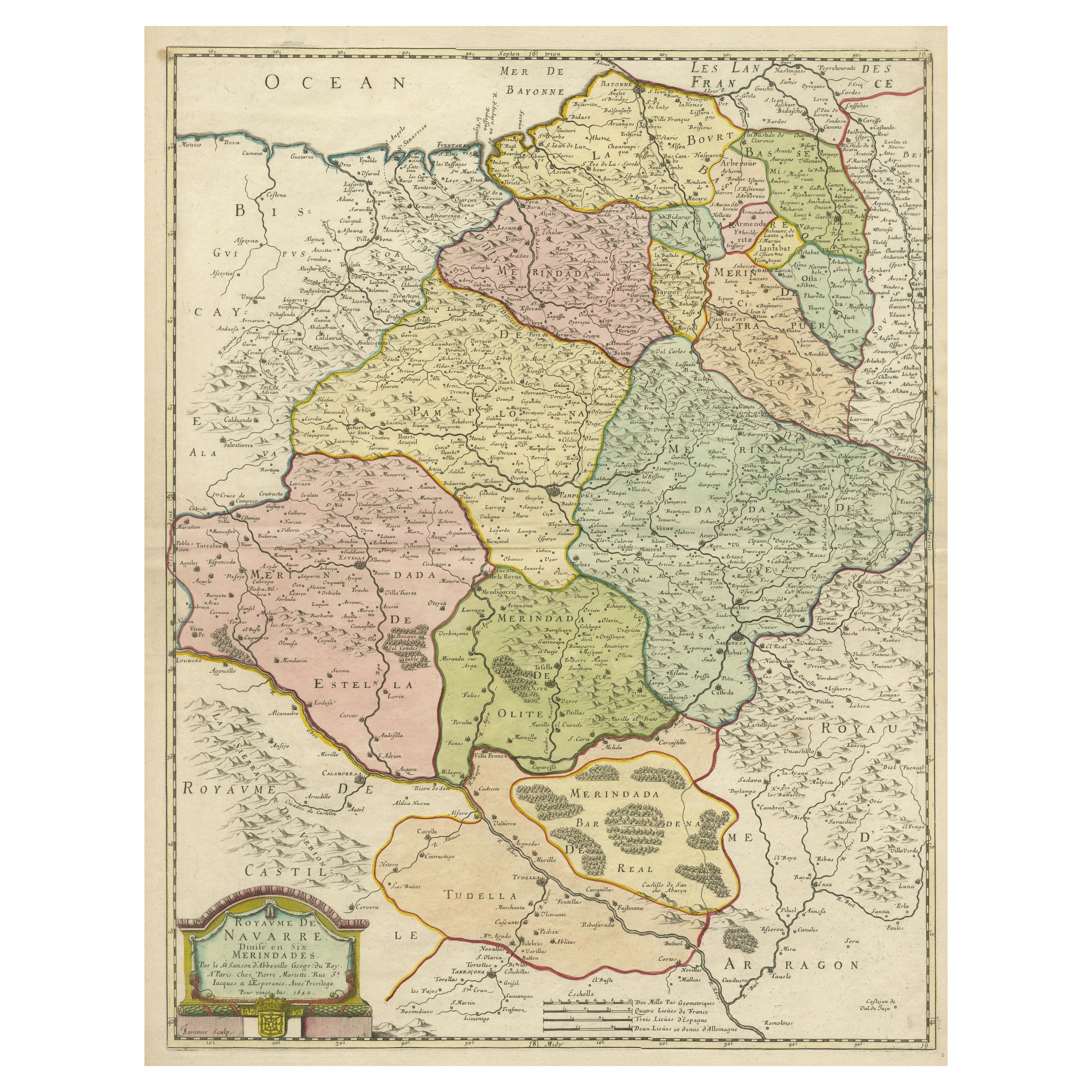
Antique Map of the Province of Navarre with the City of Pamplona, Spain
Located in Langweer, NL
Antique map titled 'Royaume de Navarre (..)'. Decorative map of the province Navarre (Spanish: Navarra) in Northern Spain centered on the city of Pamplona. Published by N. Sanson, 16...
Category
Antique Mid-17th Century Maps
Materials
Paper
$566 Sale Price
20% Off
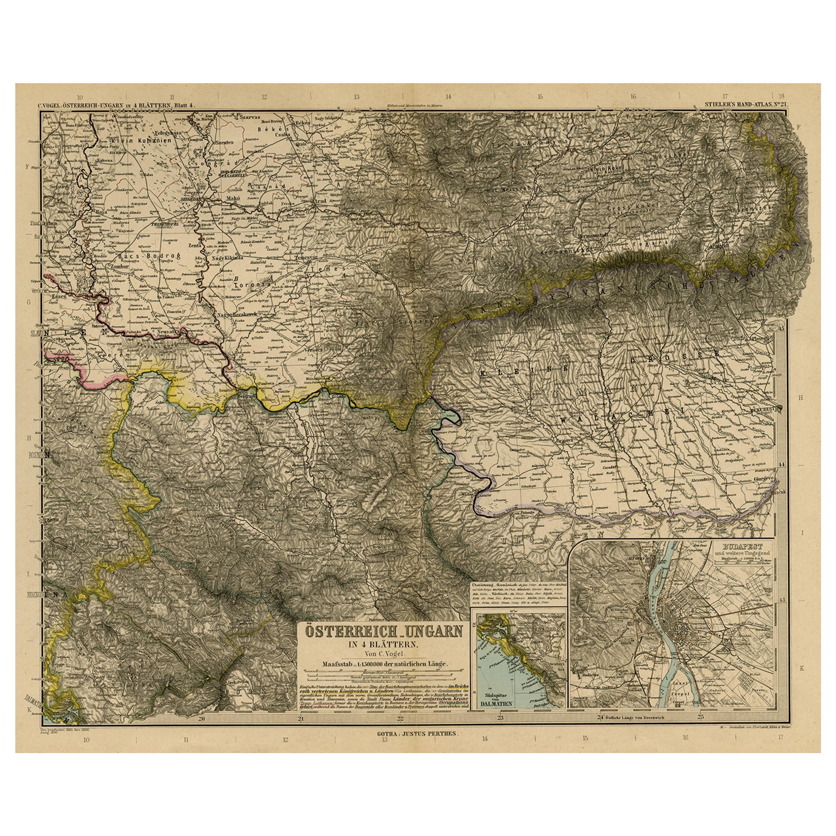
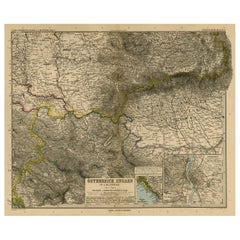
Antique Map of Eastern Europe, Incl Montenegro & Serbia & a Budapest Map, 1890
Located in Langweer, NL
Antique map titled 'Osterreich-Ungarn in 4 Blattern, Blatt 4.'
Map of Eastern Europe, with Montenegro in the lower left corner, the southern ...
Category
Antique 1890s Maps
Materials
Paper
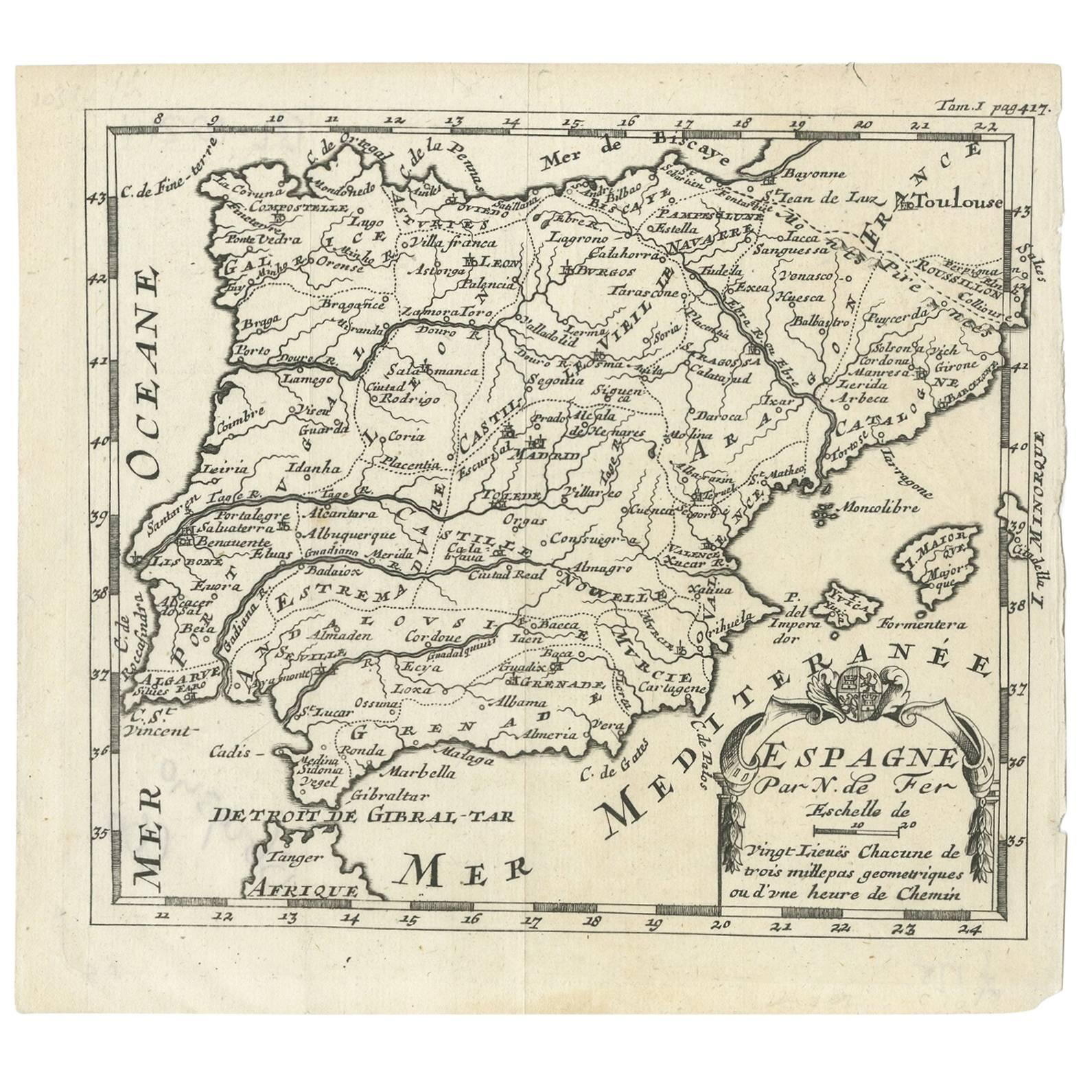
Antique Map of Spain by N. de Fer, circa 1700
Located in Langweer, NL
Antique map of Spain and Portugal with a title cartouche. Nicolas de Fer was the youngest son of the Paris printer and publisher Antoine de Fer. At the ...
Category
Antique Early 18th Century Maps
Materials
Paper
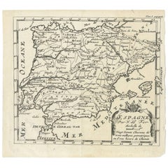
$153 Sale Price
20% Off
Antique Map of Russia 'in Europe' by W. & A.K. Johnston, circa 1850
By W. & A.K. Johnston
Located in Langweer, NL
Antique Map: Russia in Europe by W. & A.K. Johnston, Circa 1850
This highly detailed antique map, titled *Russia in Europe,* was created by the esteemed Scottish cartographers W. ...
Category
Antique Mid-19th Century Maps
Materials
Paper

$230 Sale Price
34% Off
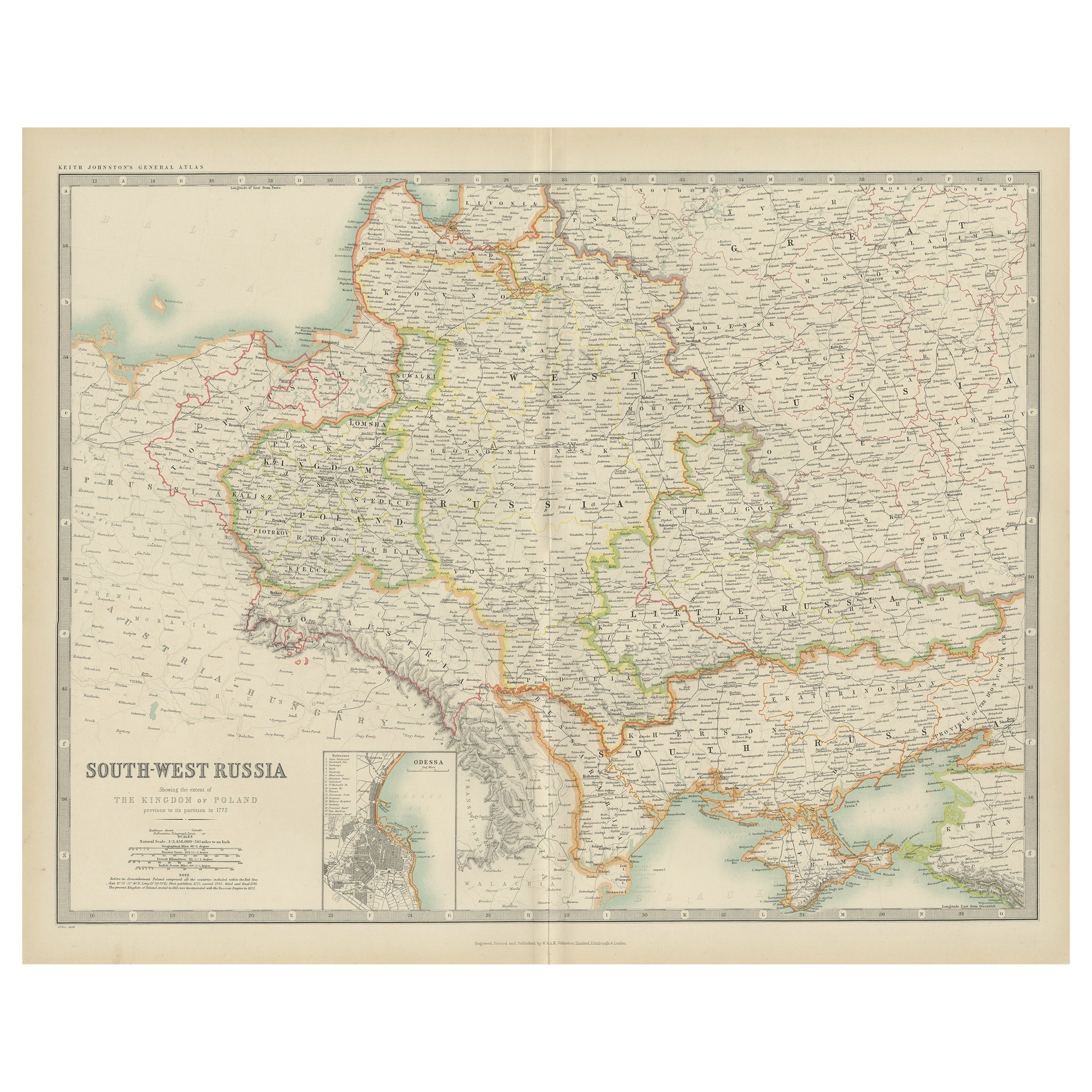
Antique Map of South-West Russia by Johnston (1909)
Located in Langweer, NL
Antique map titled 'South-West Russia'. Original antique map of South-West Russia. With inset map of Odessa. This map originates from the ‘Royal Atlas of Modern Geography’. Published...
Category
Early 20th Century Maps
Materials
Paper
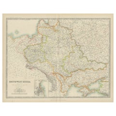
$239 Sale Price
20% Off
You May Also Like
Large Original Vintage Map of Spain, circa 1920
Located in St Annes, Lancashire
Great map of Spain
Original color.
Good condition
Published by Alexander Gross
Unframed.
Category
Vintage 1920s English Maps
Materials
Paper

1849 Map of "Europaische Russland", 'Meyer Map of European Russia', Ric. R017
Located in Norton, MA
1849 Map of
"Europaische Russland"
( Meyer Map of European Russia)
Ric.r017
A lovely map of European Russia dating to 1849 by Joseph Meyer. It covers the European portions of...
Category
Antique 19th Century Unknown Maps
Materials
Paper

Russia, Western and Southern Part. Century Atlas antique vintage map
Located in Melbourne, Victoria
'The Century Atlas. Russia, Western and Southern Part'
Original antique map, 1903.
Inset map tilted 'St Petersburg and Environs'.
Central fold as issued. Map name and number printe...
Category
Early 20th Century Victorian More Prints
Materials
Lithograph

Original Antique Map of Hungary, Arrowsmith, 1820
Located in St Annes, Lancashire
Great map of Hungary
Drawn under the direction of Arrowsmith.
Copper-plate engraving.
Published by Longman, Hurst, Rees, Orme and Brown, 1820
Unframed.
Category
Antique 1820s English Maps
Materials
Paper

Russia in Europe with Poland and Finland. Century Atlas antique vintage map
Located in Melbourne, Victoria
'The Century Atlas. Russia in Europe with Poland and Finland'
Original antique map, 1903.
Central fold as issued. Map name and number printed on the reverse corners.
Sheet 40cm by ...
Category
Early 20th Century Victorian More Prints
Materials
Lithograph

Original Antique Map of Spain and Portugal, circa 1790
Located in St Annes, Lancashire
Super map of Spain and Portugal
Copper plate engraving by A. Bell
Published, circa 1790.
Unframed.
Category
Antique 1790s English Other Maps
Materials
Paper

More Ways To Browse
Carved Cabriole Table
Dark Antique Table
Antique Wall Table
1960 Chair Wood Danish
Unusual Dining Table
Antique Dutch Plates
Mdf Table
Showcase Coffee Table
Space Age Orange
Vallauris France
Silver Ladle
Scalloped Table
Brazil Wood Chairs
Vintage Art Deco Side Tables
Window Display
1960s Cushion Chair
Green Brown Oriental Rug
Authentic Models