Items Similar to Antique Plan of the City of Calcutta 'India' by Letts, 1883


Want more images or videos?
Request additional images or videos from the seller
1 of 5
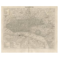
Antique Plan of the City of Calcutta 'India' by Letts, 1883
$354.44
$443.0420% Off
£265.67
£332.0920% Off
€300
€37520% Off
CA$486.93
CA$608.6720% Off
A$543.62
A$679.5220% Off
CHF 284.85
CHF 356.0620% Off
MX$6,654.40
MX$8,31820% Off
NOK 3,617.56
NOK 4,521.9520% Off
SEK 3,410.90
SEK 4,263.6220% Off
DKK 2,283.71
DKK 2,854.6420% Off
Shipping
Retrieving quote...The 1stDibs Promise:
Authenticity Guarantee,
Money-Back Guarantee,
24-Hour Cancellation
About the Item
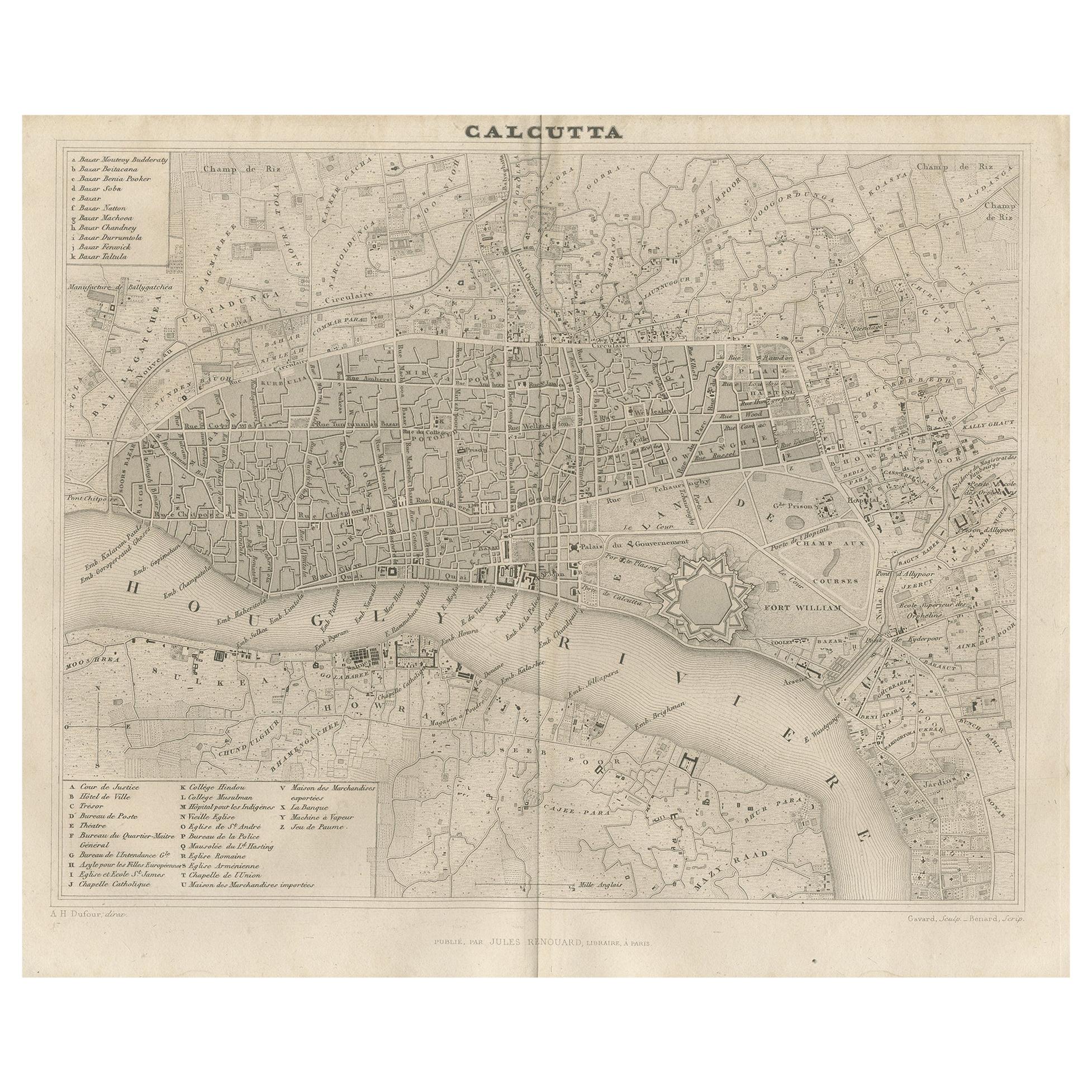
Beautiful colored plan showing buildings (with key), Fort William, race ground, canals, railroads, etc. This plan originates from Letts's Popular Atlas.
- Dimensions:Height: 12.72 in (32.3 cm)Width: 17.01 in (43.2 cm)Depth: 0.02 in (0.5 mm)
- Materials and Techniques:
- Period:
- Date of Manufacture:1883
- Condition:Please study image carefully.
- Seller Location:Langweer, NL
- Reference Number:Seller: BG-067441stDibs: LU305439811151
About the Seller
5.0
Recognized Seller
These prestigious sellers are industry leaders and represent the highest echelon for item quality and design.
Platinum Seller
Premium sellers with a 4.7+ rating and 24-hour response times
Established in 2009
1stDibs seller since 2017
2,511 sales on 1stDibs
Typical response time: <1 hour
- ShippingRetrieving quote...Shipping from: Langweer, Netherlands
- Return Policy
Authenticity Guarantee
In the unlikely event there’s an issue with an item’s authenticity, contact us within 1 year for a full refund. DetailsMoney-Back Guarantee
If your item is not as described, is damaged in transit, or does not arrive, contact us within 7 days for a full refund. Details24-Hour Cancellation
You have a 24-hour grace period in which to reconsider your purchase, with no questions asked.Vetted Professional Sellers
Our world-class sellers must adhere to strict standards for service and quality, maintaining the integrity of our listings.Price-Match Guarantee
If you find that a seller listed the same item for a lower price elsewhere, we’ll match it.Trusted Global Delivery
Our best-in-class carrier network provides specialized shipping options worldwide, including custom delivery.More From This Seller
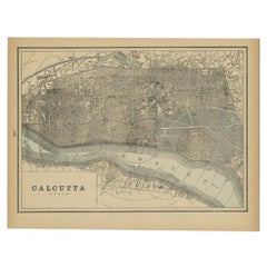
View AllRare Antique Map of Calcutta 'Kolkata' in India, 1893
Located in Langweer, NL
Antique map titled 'Calcutta (India)'. Old map of Calcutta/Kolkata, India. On verso, a map of Egypt, Arabia, Upper Nubia and Abyssinia. Originates from 'The Columbian World's Fair at...
Category
Antique 19th Century Maps
Materials
Paper
$245 Sale Price
20% Off
Antique Map of the City of Kolkata by Balbi '1847'
Located in Langweer, NL
Antique map titled 'Calcutta'. Original antique map of the city of Kolkata, India. This map originates from 'Abrégé de Géographie (..)' by Adrien Balbi. Published 1847.
Category
Antique Mid-19th Century Maps
Materials
Paper
$141 Sale Price
20% Off
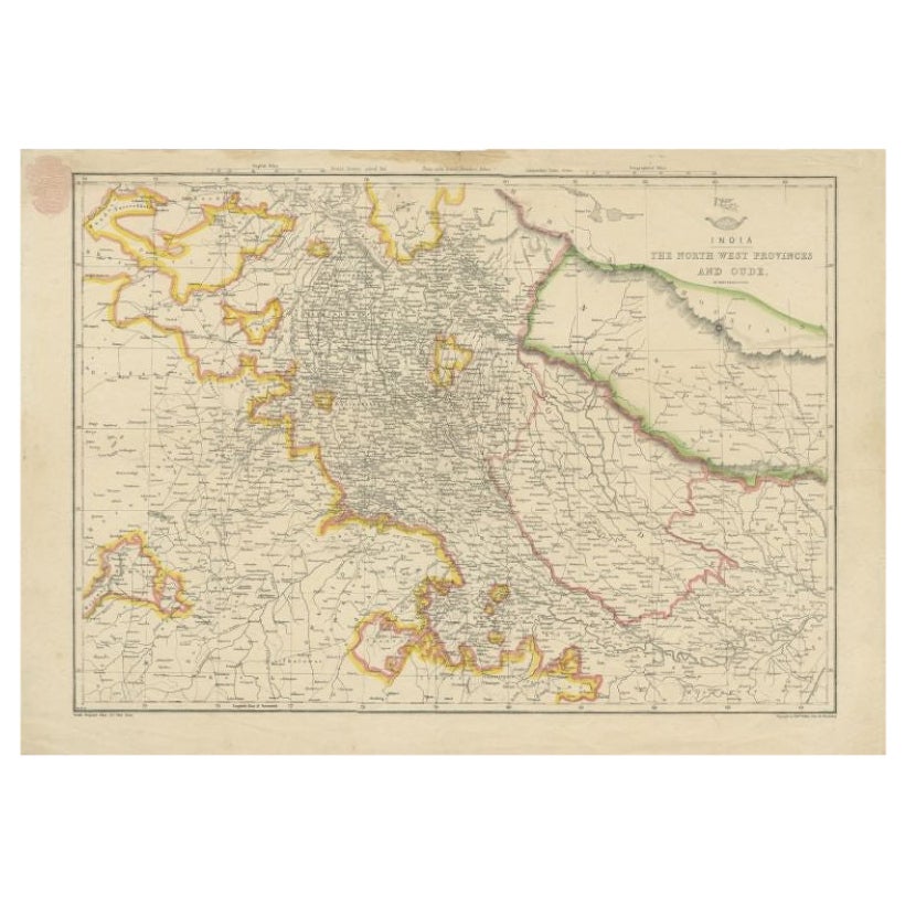
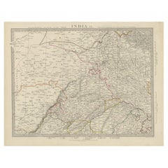
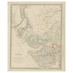
Antique Map of Northwestern India by Weller, 1857
Located in Langweer, NL
Antique map titled 'India, The North West Provinces and Oude'.Detailed map of the northwestern part of India, extending to the Himalaya Mountains. Shows part of Nepal including Dharm...
Category
Antique 19th Century Maps
Materials
Paper
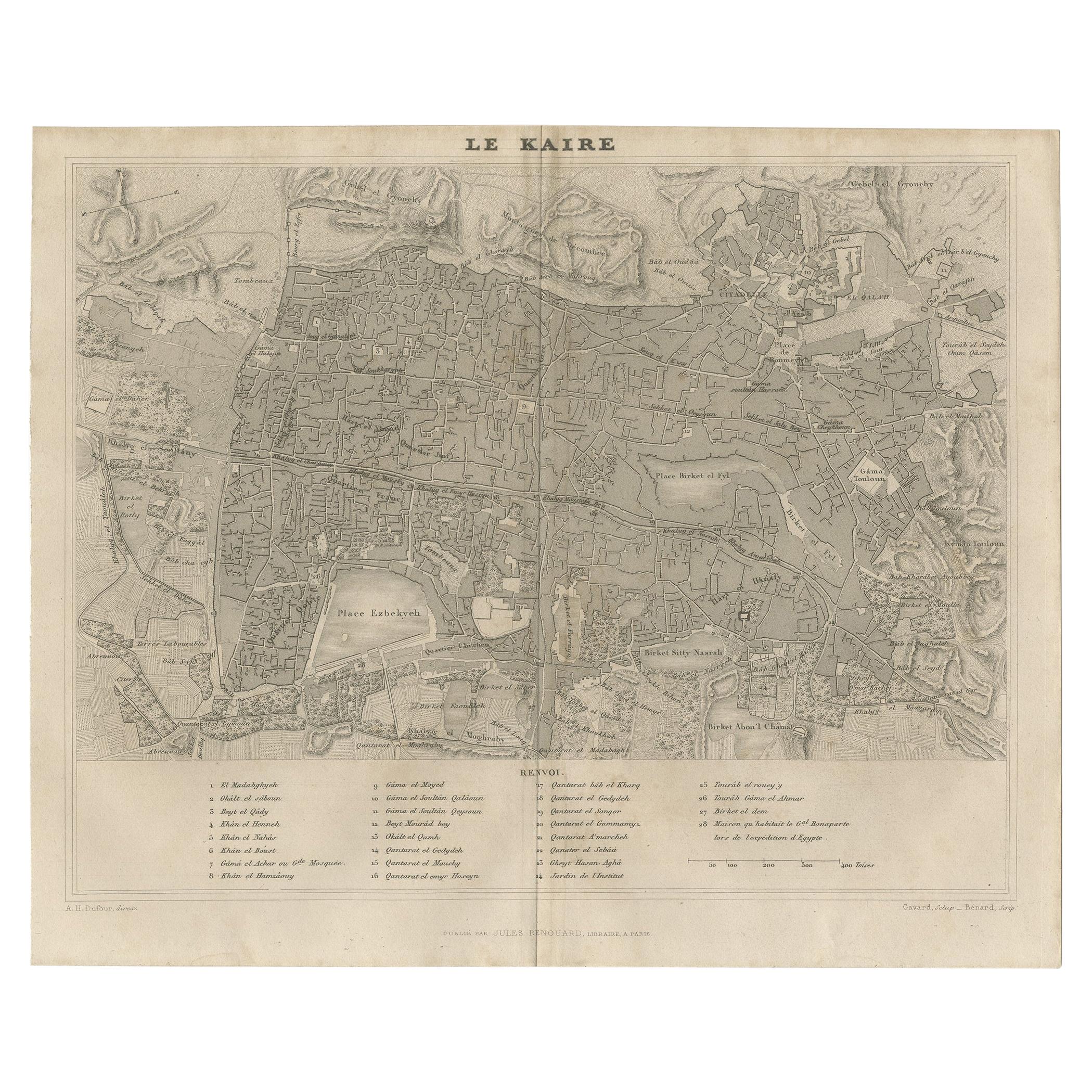
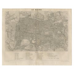
Antique Map of Cairo and Surroundings by Balbi '1847'
Located in Langweer, NL
Antique map titled 'Le Kaire'. Original antique map of Cairo and surroundings, Egypt. This map originates from 'Abrégé de Géographie (..)' by Adrien Balbi. Published 1847.
Category
Antique Mid-19th Century Maps
Materials
Paper
$141 Sale Price
20% Off
Antique Map of the Region of Delhi in India, 1833
Located in Langweer, NL
Antique map titled 'India IX'. Old steel engraved map of the region of Delhi, with great detail.
Artists and Engravers: Engraved by J. & C. Walker. Published under the superinten...
Category
Antique 19th Century Maps
Materials
Paper
$378 Sale Price
20% Off
Antique Map of the Region of Gujarat and Cutch in India, 1833
Located in Langweer, NL
Antique map titled 'India V'. Old steel engraved map of the region of Gujarat and Cutch showing great detail.
Artists and Engravers: Engraved by J. & C. Walker. Published under the...
Category
Antique 19th Century Maps
Materials
Paper
$274 Sale Price
20% Off
You May Also Like
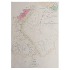
Large Original Antique City Plan of Lucknow, India. Edward Weller, 1861
Located in St Annes, Lancashire
Great city plan of Lucknow
Lithograph engraving by Edward Weller
Original colour
Published, 1861
Unframed
Good condition / slight corner loss bottom right shown in last image
...
Category
Antique 1860s English Victorian Maps
Materials
Paper
Original Antique Map or City Plan of Rome, Italy. Circa 1835
Located in St Annes, Lancashire
Nice map of Rome
Drawn and engraved by J.Dower
Published by Orr & Smith. C.1835
Unframed.
Free shipping
Category
Antique 1830s English Maps
Materials
Paper

Original Antique Map or City Plan of Venice, Italy. Circa 1835
Located in St Annes, Lancashire
Nice map of Venice
Drawn and engraved by J.Dower
Published by Orr & Smith. C.1835
Unframed.
Free shipping
Category
Antique 1830s English Maps
Materials
Paper

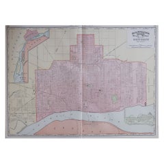
Large Original Antique City Plan of Detroit, USA, 1894
By Rand McNally & Co.
Located in St Annes, Lancashire
Fabulous colorful map of Detroit
Original color
By Rand, McNally & Co.
Published, 1894
Unframed
Free shipping.
Category
Antique 1890s American Maps
Materials
Paper
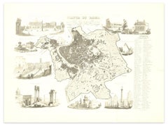
Map of Ancient Rome - Original Etching by Alessandro Moschetti - 1848
By Alessandro Moschetti
Located in Roma, IT
Plan of Rome is a beautiful original black and white etching, a rare and antique illustrated map of the eternal city of Rome, published in 1848.
Image Di...
Category
1840s Figurative Prints
Materials
Etching
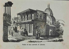
View of a District of Calcutta - Lithograph - 1862
Located in Roma, IT
View of a district of Calcutta is a lithograph realized in 1864.
Good conditions.
The artwork belongs to the Suite Uses and customs of all the peoples of the universe, or History ...
Category
1840s Modern Figurative Prints
Materials
Lithograph
More Ways To Browse
Carved Cabriole Table
Dark Antique Table
Antique Wall Table
1960 Chair Wood Danish
Unusual Dining Table
Antique Dutch Plates
Mdf Table
Showcase Coffee Table
Space Age Orange
Vallauris France
Silver Ladle
Scalloped Table
Brazil Wood Chairs
Vintage Art Deco Side Tables
Window Display
1960s Cushion Chair
Green Brown Oriental Rug
Authentic Models