Items Similar to Antique Print of the Malabar Coast of India showing the VOC establishments, 1726


Want more images or videos?
Request additional images or videos from the seller
1 of 7
Antique Print of the Malabar Coast of India showing the VOC establishments, 1726
$268.38
$335.4820% Off
£199.79
£249.7420% Off
€224
€28020% Off
CA$367.62
CA$459.5220% Off
A$408.87
A$511.0920% Off
CHF 213.50
CHF 266.8820% Off
MX$4,975.55
MX$6,219.4320% Off
NOK 2,726.73
NOK 3,408.4120% Off
SEK 2,557.19
SEK 3,196.4920% Off
DKK 1,705.23
DKK 2,131.5420% Off
Shipping
Retrieving quote...The 1stDibs Promise:
Authenticity Guarantee,
Money-Back Guarantee,
24-Hour Cancellation
About the Item
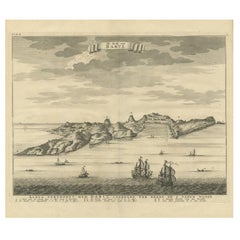
Dutch print with the title: Platte Grond van t'Fort Tricoen male met de daar aangelegen Pagoods-Berg (Trincomalee, Sri Lanka)
The map is taken from: 'Oud en Nieuw Oost-Indiën' van François Valentyn.
1) Ottens, Frederik (engraver / etcher)
2) Braam, J. van (publisher)
3) Linden, Gerard onder de (publisher)
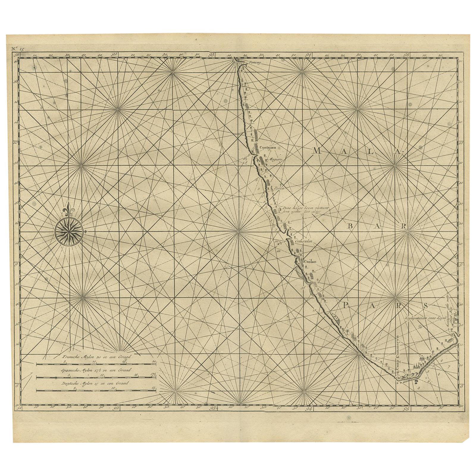
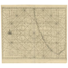
MALABAR COAST
Sea chart of the Malabar Coast, also known as the Pepper Coast, in southwestern India. It features the most significant VOC (Dutch East India Company) establishments along this coast. A compass rose is depicted in the west; scale bars are present in the lower left. Blank verso.
Hand-colored copper engraving, published in 1724-1726 in Dordrecht by Joannes van Braam and Gerard Onder de Linden in "Oud en nieuw Oost-Indiën," encompassing a precise and extensive narrative of Dutch power in those regions, along with a comprehensive description of the Moluccas... and all the islands under their administration; the Dutch comptoir in Surat, and the lives of the Great Moguls (...), by François Valentyn.
Immerse yourself in the enchanting allure of the Malabar Coast with this captivating sea chart. Originating from the southwestern shores of India, this hand-colored copper engraving beautifully showcases the Pepper Coast, renowned as the Malabar Coast. It meticulously highlights the notable Dutch East India Company (VOC) establishments that dotted this coastal paradise.
Crafted with intricate detail and artistic precision, this map unveils the strategic points of interest along the coast, complemented by a compass rose in the western expanse and scale bars for navigational guidance in the lower left. No text on the verso.
Published between 1724-1726 in Dordrecht by Joannes van Braam and Gerard Onder de Linden as part of "Oud en nieuw Oost-Indiën," this captivating engraving forms part of François Valentyn's meticulous narrative. Offering a vivid portrayal of Dutch power in the region, it presents a rich tapestry of descriptions encompassing the Moluccas, the Dutch comptoir in Surat, and intriguing insights into the lives of the Great Moguls. An evocative piece, it invites you on a historical voyage through the treasures and maritime legacy of the Malabar Coast.
- Dimensions:Height: 13.39 in (34 cm)Width: 16.74 in (42.5 cm)Depth: 0 in (0.02 mm)
- Materials and Techniques:Paper,Engraved
- Period:1720-1729
- Date of Manufacture:1726
- Condition:Almost excellent condition, especially considering its age. A view folding lines are visible. The coloring is from recent years on a slightly discolored sheet due to age. Study the image carefully.
- Seller Location:Langweer, NL
- Reference Number:Seller: BG-13424-191stDibs: LU3054337348962
About the Seller
5.0
Recognized Seller
These prestigious sellers are industry leaders and represent the highest echelon for item quality and design.
Platinum Seller
Premium sellers with a 4.7+ rating and 24-hour response times
Established in 2009
1stDibs seller since 2017
2,510 sales on 1stDibs
Typical response time: <1 hour
- ShippingRetrieving quote...Shipping from: Langweer, Netherlands
- Return Policy
Authenticity Guarantee
In the unlikely event there’s an issue with an item’s authenticity, contact us within 1 year for a full refund. DetailsMoney-Back Guarantee
If your item is not as described, is damaged in transit, or does not arrive, contact us within 7 days for a full refund. Details24-Hour Cancellation
You have a 24-hour grace period in which to reconsider your purchase, with no questions asked.Vetted Professional Sellers
Our world-class sellers must adhere to strict standards for service and quality, maintaining the integrity of our listings.Price-Match Guarantee
If you find that a seller listed the same item for a lower price elsewhere, we’ll match it.Trusted Global Delivery
Our best-in-class carrier network provides specialized shipping options worldwide, including custom delivery.More From This Seller
View AllAntique Map of Malabar Coast by Valentijn, 1726
By F. Valentijn
Located in Langweer, NL
Untitled sea chart of the coast of Malabar, India. This print originates from 'Oud en Nieuw Oost-Indiën' by F. Valentijn.
Category
Antique Early 18th Century Dutch Maps
Materials
Paper
$431 Sale Price
20% Off
Antique Map of the Gulf of Bengal by J.N. Bellin, circa 1760
Located in Langweer, NL
Beautiful chart of the Gulf of Bengal. The map extends from Malabar to Sumatra and today Phuket area in Thailand. Including Pegu, Ceylon, and the Andaman and Nicobar Islands. Numerou...
Category
Antique Mid-18th Century Maps
Materials
Paper

$330 Sale Price
20% Off
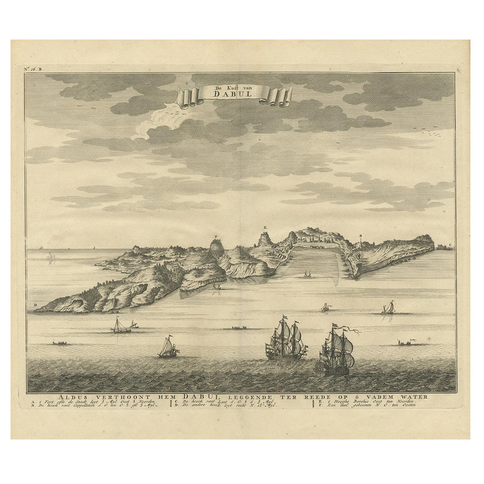
Antique Print of the Coast of Dabhol 'India', 1726
By F. Valentijn
Located in Langweer, NL
Antique print titled 'De Kust van Dabul'. Antique print of the coastline near Dabhol in India. This print originates from 'Oud en Nieuw Oost-Indiën' by F. Valentijn.
Category
Antique Early 18th Century Dutch Prints
Materials
Paper
$345 Sale Price
23% Off
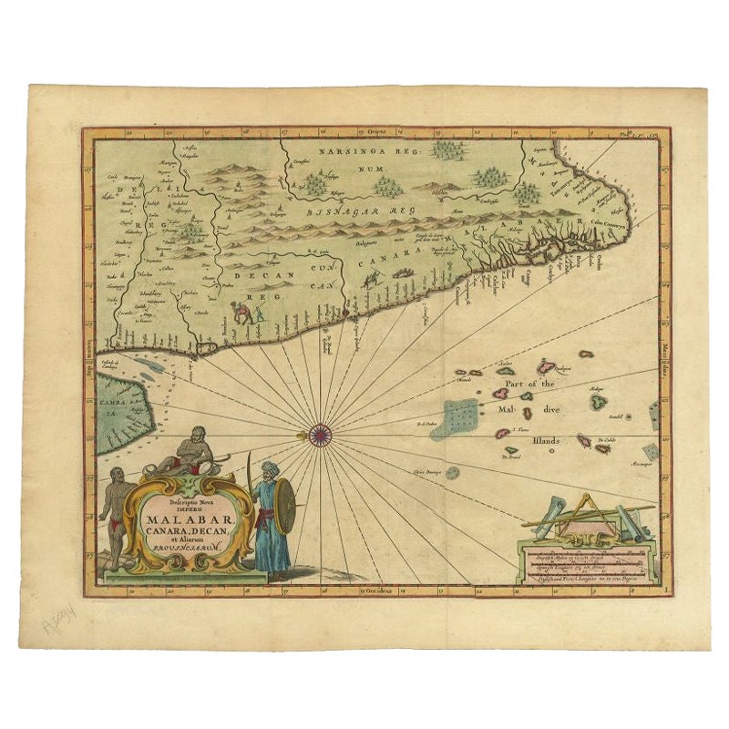
Antique Map of the Malabar Coast by Baldaeus, 1744
By Philip Baldaeus
Located in Langweer, NL
Antique map titled 'Descriptio Nova Imperii Malabar (..).' Nice map of the Malabar Coast. This map was published in 'The True and Exact Description of th...
Category
Antique 18th Century Maps
Materials
Paper
$333 Sale Price
20% Off
1705 Sanson Map of Southern India and Malabar with an Inset Map
Located in Langweer, NL
Title: 1705 Sanson Map of Southern India and Malabar with an Inset Map
Description: This finely engraved and beautifully hand-colored antique map, published in 1705, depicts south...
Category
Antique Early 1700s Maps
Materials
Paper

$738 Sale Price
20% Off
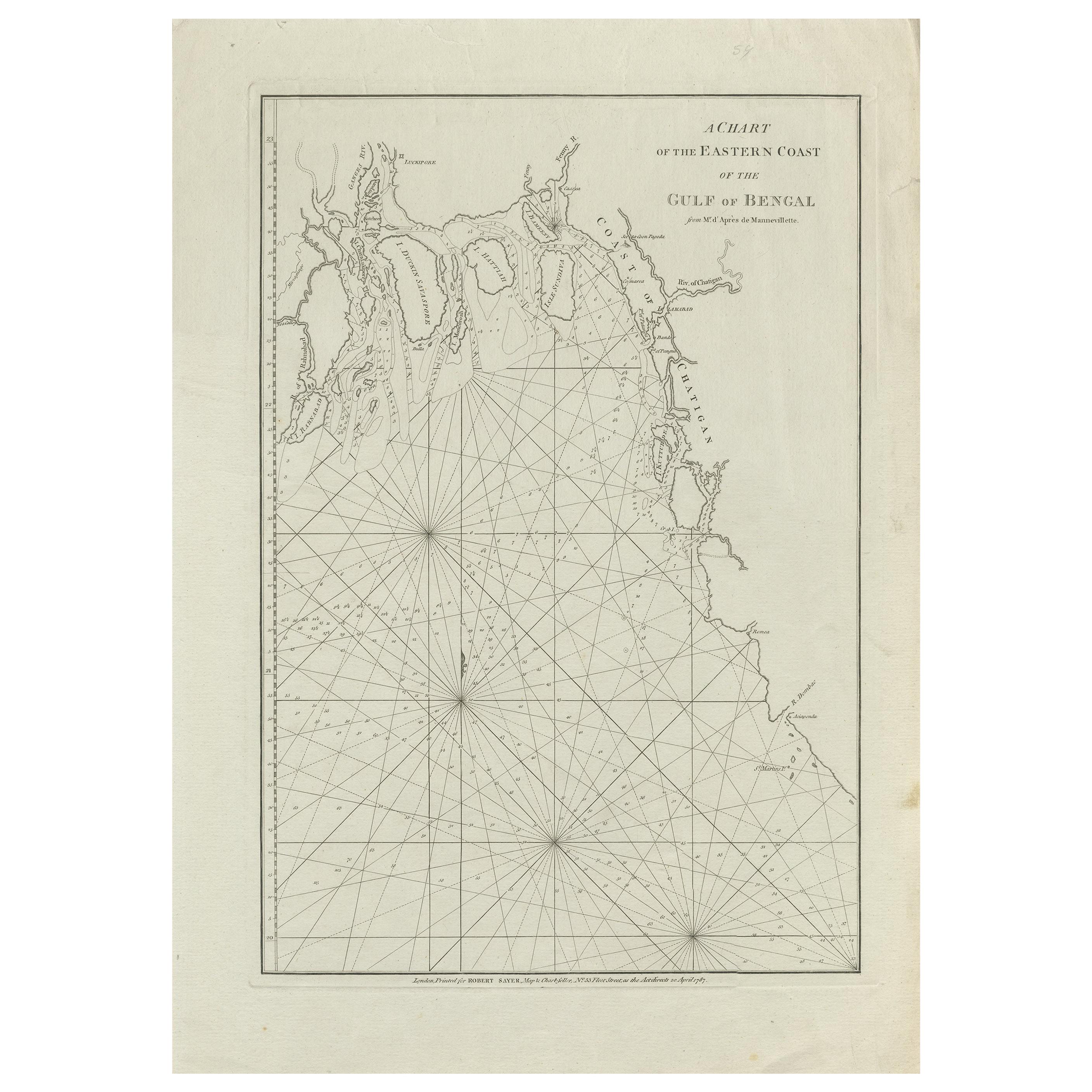
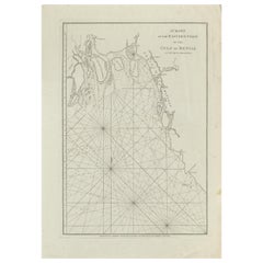
Antique Map of the Bay of Bengal Printed for Robert Sayer, 1787
Located in Langweer, NL
Antique map titled 'A Chart of the Eastern Coast of the Gulf of Bengal'. Original antique map of the Bay of Bengal. The Bay of Bengal is the northeastern...
Category
Antique Late 18th Century Maps
Materials
Paper
$479 Sale Price
20% Off
You May Also Like
West Coast of Africa, Guinea & Sierra Leone: An 18th Century Map by Bellin
By Jacques-Nicolas Bellin
Located in Alamo, CA
Jacques Bellin's copper-plate map entitled "Partie de la Coste de Guinee Dupuis la Riviere de Sierra Leona Jusquau Cap das Palmas", depicting the coast of Guinea and Sierra Leone in ...
Category
Antique Mid-18th Century French Maps
Materials
Paper

Antique Map - Mare Pacificum - Etching by Johannes Janssonius - 1650s
By Johannes Janssonius
Located in Roma, IT
Mare Pacificum is an antique map realized in 1650 by Johannes Janssonius (1588-1664).
The Map is Hand-colored etching, with coeval watercolorang.
Good conditions with slight foxing...
Category
1650s Modern Figurative Prints
Materials
Etching

Original Antique Map of South America. C.1780
Located in St Annes, Lancashire
Great map of South America
Copper-plate engraving
Published C.1780
Two small worm holes to left side of map
Unframed.
Category
Antique Early 1800s English Georgian Maps
Materials
Paper

Antique Voc Print Holland Malaysia Old Map Melaka History, 1663
Located in Amsterdam, Noord Holland
From my own collection I offer this impressive Antique print of the city of Malakka
A very interesting piece for collectors . It is an museum piece from the Dutch Institute of Orien...
Category
Antique 17th Century European Paintings
Materials
Paper

$293 Sale Price
20% Off
Antique Map - Gallia - Etching by Johannes Janssonius - 1650s
By Johannes Janssonius
Located in Roma, IT
Antique Map - Gallia is an antique map realized in 1650 by Johannes Janssonius (1588-1664).
The Map is Hand-colored etching, with coeval watercoloring.
Good conditions with slight ...
Category
1650s Modern Figurative Prints
Materials
Etching

Antique French Map of Asia Including China Indoneseia India, 1783
Located in Amsterdam, Noord Holland
Very nice map of Asia. 1783 Dedie au Roy.
Additional information:
Country of Manufacturing: Europe
Period: 18th century Qing (1661 - 1912)
Condition: Overall Condition B (Good Used)...
Category
Antique 18th Century European Maps
Materials
Paper

$648 Sale Price
20% Off
More Ways To Browse
Dutch East India Company
Voc Antique
Dutch Voc
Hand Colored Copper Engraving
Malabar Furniture
Dutch Tapestry
Francois Gerard
Van Braam
Vintage Art Deco Rugs
Vintage Serving Forks
Herati Rug
Italian Wood Console Tables
Maison Jansen Argentina
Antique Oushak
Mid Century Danish Directors Chairs
Moller 70
Wood Relief Art
Argentina Travel Poster