Items Similar to Antique Ptolemaic Map of Ceylon or nowadays Sri Lanka
Want more images or videos?
Request additional images or videos from the seller
1 of 6
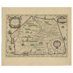
Antique Ptolemaic Map of Ceylon or nowadays Sri Lanka
$661.38
$826.7220% Off
£492.26
£615.3220% Off
€552
€69020% Off
CA$905.92
CA$1,132.4020% Off
A$1,007.58
A$1,259.4720% Off
CHF 526.13
CHF 657.6620% Off
MX$12,261.17
MX$15,326.4620% Off
NOK 6,719.44
NOK 8,399.3020% Off
SEK 6,301.65
SEK 7,877.0620% Off
DKK 4,202.18
DKK 5,252.7320% Off
Shipping
Retrieving quote...The 1stDibs Promise:
Authenticity Guarantee,
Money-Back Guarantee,
24-Hour Cancellation
About the Item
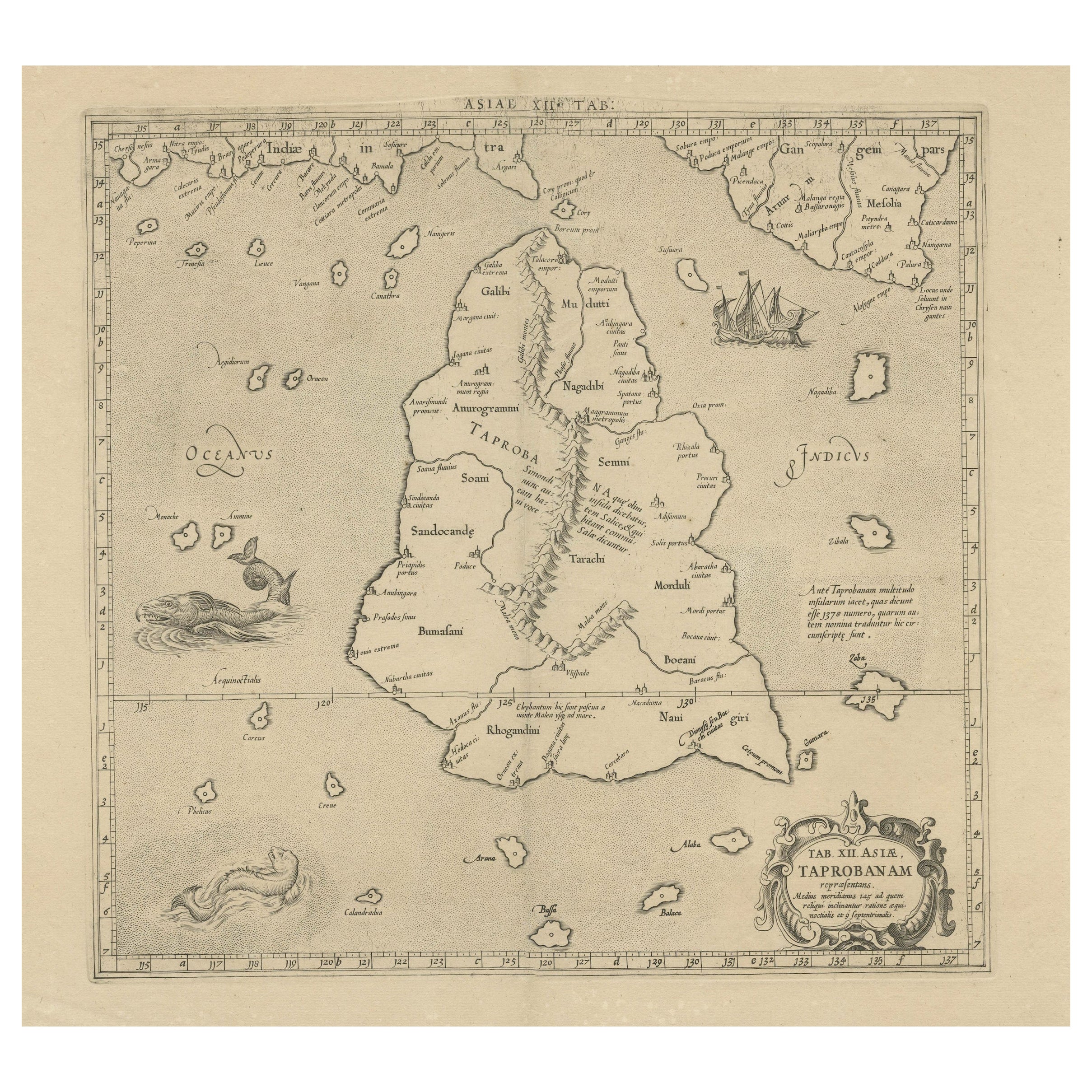
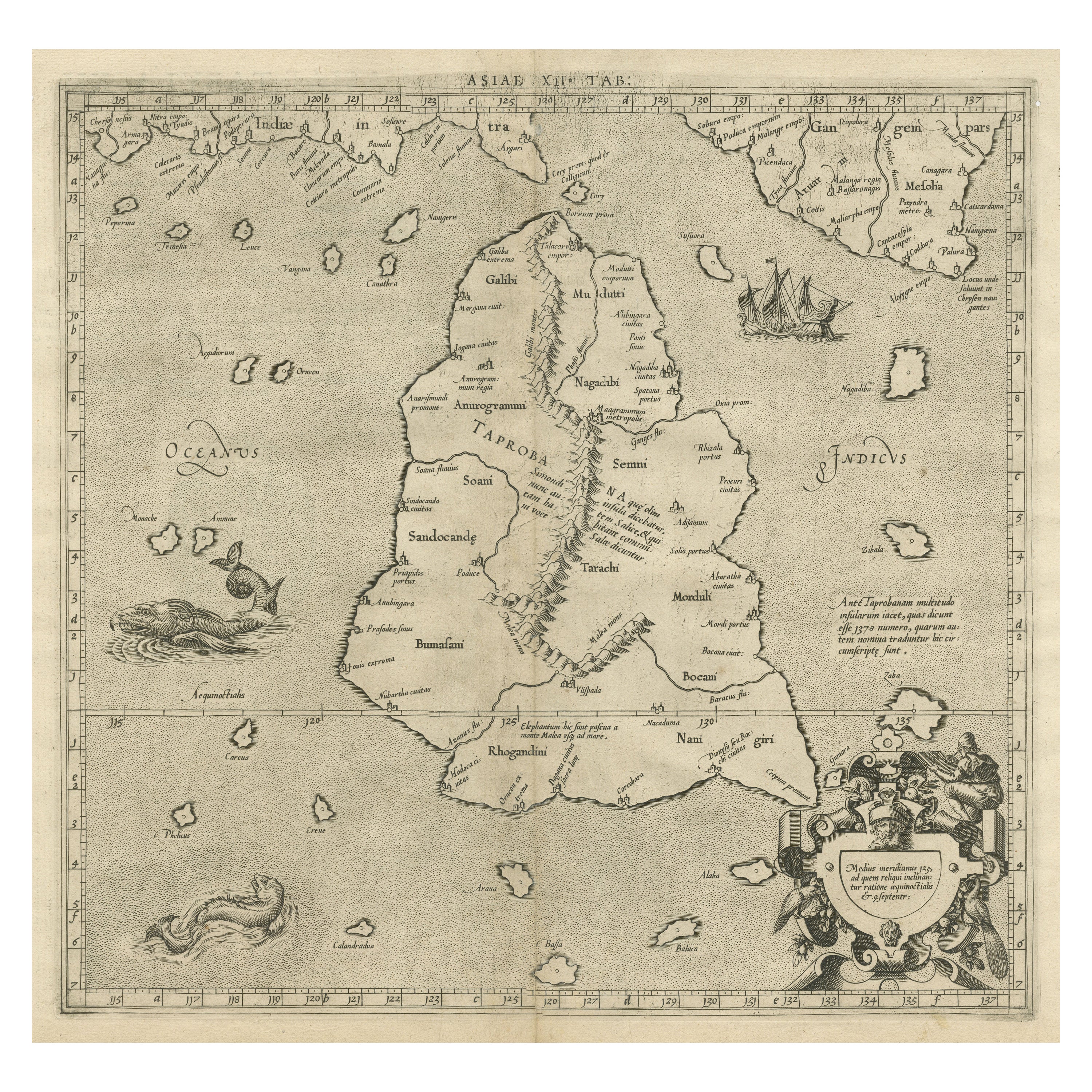
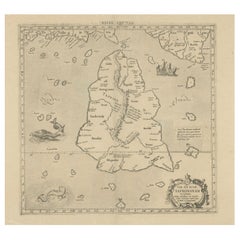
Antique map titled 'Tab XII. Asiae Taprobanam'. Ptolemaic map of Sri Lanka. Ptolemy drew on the accounts of travelers and sailors and though the information was secondhand and often inaccurate it represented the most advanced account of the world's geography at that time. This map depicts the island with the typical misconceptions of Ptolemy with the island straddling the Equator and nearly divided by a ridge of mountains. A small part of India is incorrectly shown in the northeast corner of the map. The stipple engraved sea is filled with an oriental ship and two great sea monsters. The handsome map is further embellished with a strapwork title cartouche.
Published by G. Mercator, circa 1730. While perhaps most famous for his maps of the modern World and the first to use the name "Atlas" to describe a book of maps, one of Mercator's life works was a corrected and improved edition of maps based upon the work of Claudius Ptolemy.
- Dimensions:Height: 19.3 in (49 cm)Width: 22.92 in (58.2 cm)Depth: 0.02 in (0.5 mm)
- Materials and Techniques:
- Period:
- Date of Manufacture:c.1730
- Condition:General age-related toning. Original folding line. Couple very tiny holes, also affecting image. Minor wear and soiling. Blank verso. Please study image carefully.
- Seller Location:Langweer, NL
- Reference Number:Seller: BG-135581stDibs: LU3054336087002
About the Seller
5.0
Recognized Seller
These prestigious sellers are industry leaders and represent the highest echelon for item quality and design.
Platinum Seller
Premium sellers with a 4.7+ rating and 24-hour response times
Established in 2009
1stDibs seller since 2017
2,508 sales on 1stDibs
Typical response time: <1 hour
- ShippingRetrieving quote...Shipping from: Langweer, Netherlands
- Return Policy
Authenticity Guarantee
In the unlikely event there’s an issue with an item’s authenticity, contact us within 1 year for a full refund. DetailsMoney-Back Guarantee
If your item is not as described, is damaged in transit, or does not arrive, contact us within 7 days for a full refund. Details24-Hour Cancellation
You have a 24-hour grace period in which to reconsider your purchase, with no questions asked.Vetted Professional Sellers
Our world-class sellers must adhere to strict standards for service and quality, maintaining the integrity of our listings.Price-Match Guarantee
If you find that a seller listed the same item for a lower price elsewhere, we’ll match it.Trusted Global Delivery
Our best-in-class carrier network provides specialized shipping options worldwide, including custom delivery.More From This Seller
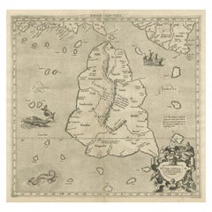
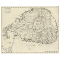
View AllRare Original Antique Ptolemy Map of Ceylon, Present Day Sri Lanka
Located in Langweer, NL
Original antique map titled 'Tab XII Asiae Taprobanam (..)'. For this map of Toprobana (Sri Lanka), Ptolemy drew on the accounts of travelers and sailors and though the information was secondhand and often inaccurate, it represented the most advanced account of the world's geography at that time. This map depicts the island with the typical misconceptions of the period with the enlarged island straddling the Equator and nearly divided by a ridge of mountains. A small part of India is incorrectly shown in the northeast corner of the map and a spurious coastline labeled Gangem fills the upper right corner. The stipple engraved sea contains an oriental ship...
Category
Antique Late 17th Century Maps
Materials
Paper
$738 Sale Price
20% Off
Mercator's Ptolemaic map of Taprobana, (Ceylon) Sri Lanka
Located in Langweer, NL
Antique map titled 'Asiae XII Tab'. Mercator's Ptolemaic map of Taprobana. The map shows Ptolemy's erroneous location of the island of Sri Lanka near the equator, with a bit of India...
Category
Antique 16th Century Maps
Materials
Paper
$555 Sale Price
20% Off
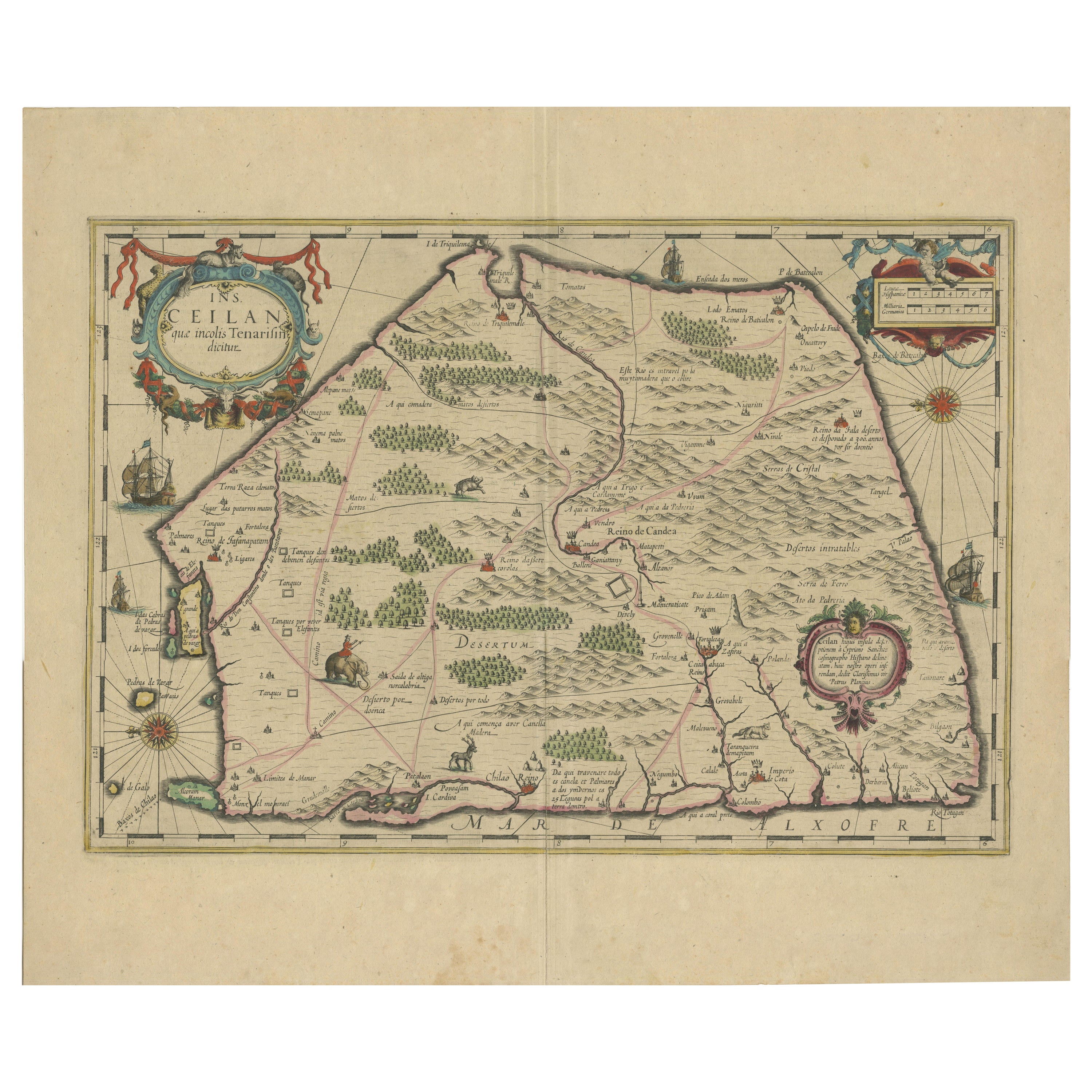
1638 Plancius Detailed Map of Sri Lanka or Ceylon with Decorative Cartouches
Located in Langweer, NL
"1638 Plancius Detailed Map of Sri Lanka with Decorative Cartouches"
This beautifully detailed map of Sri Lanka, titled "Ins. Ceilan," was engraved by P. Plancius from a design by C...
Category
Antique 1630s Maps
Materials
Paper
$1,380 Sale Price
20% Off
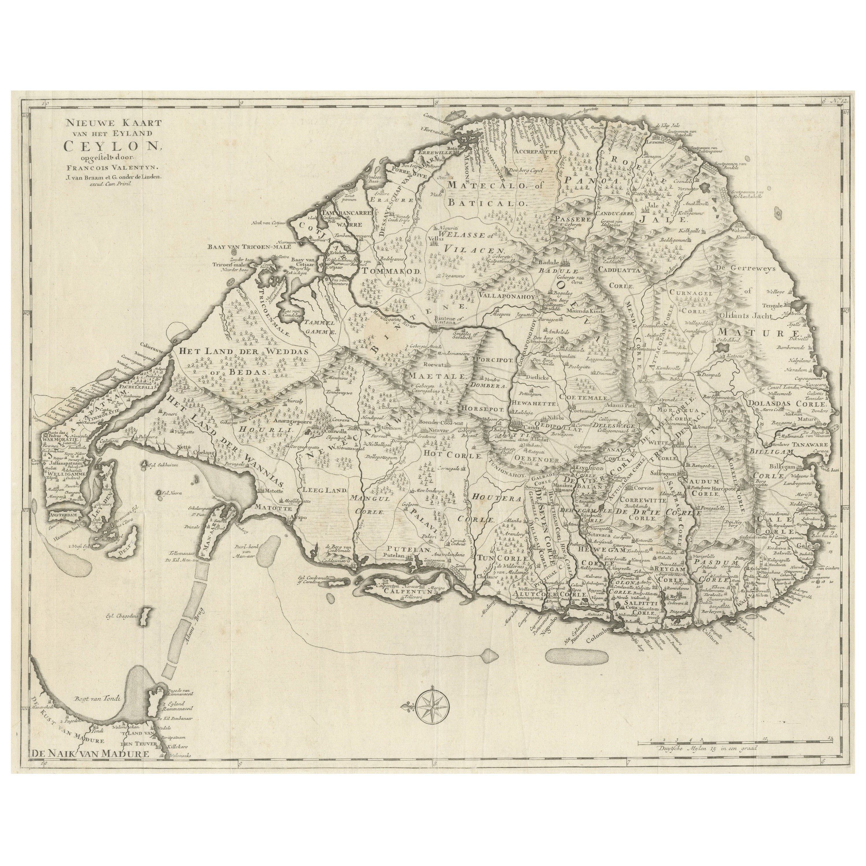
Large Antique Map of Ceylon, Sri Lanka
Located in Langweer, NL
Antique map titled 'Nieuwe Kaart van het Eyland Ceylon opgestelt door Francois Valentyn'. Beautiful map of Sri Lanka. Originates from 'Oud en Nieuw Oost ...
Category
Antique Mid-18th Century Maps
Materials
Paper
$757 Sale Price
20% Off
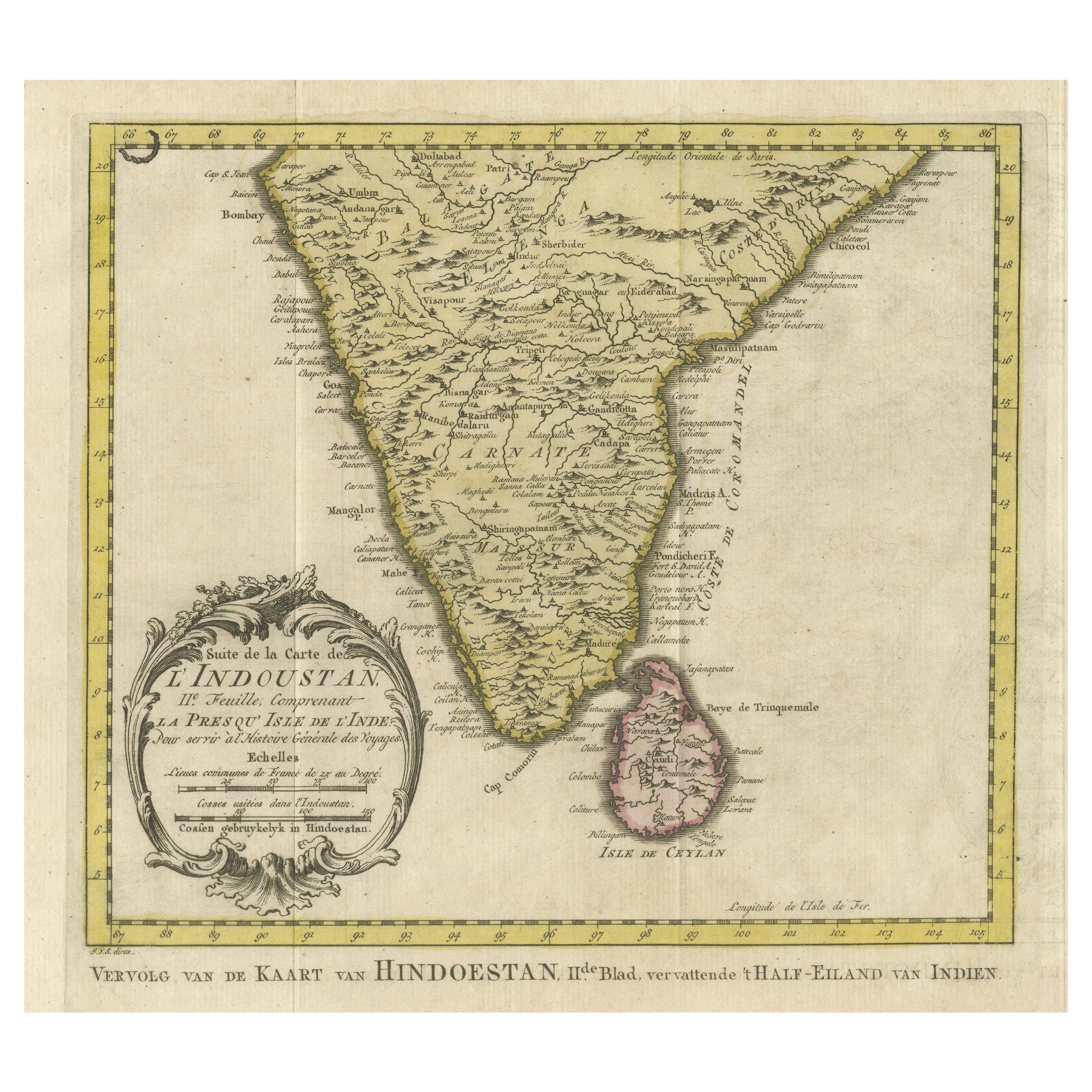
Original Antique Map of Southern India and Ceylon 'Present-Day Sri Lanka'
By Jakob van der Schley
Located in Langweer, NL
Antique map titled 'Suite de la Carte de l'Indoustan (..) - Vervolg van de Kaart van Hindoestan (..)'. Original antique map of Southern India and Ceylon (present-day Sri Lanka). This...
Category
Antique Mid-18th Century Maps
Materials
Paper
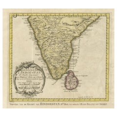
$805 Sale Price
20% Off
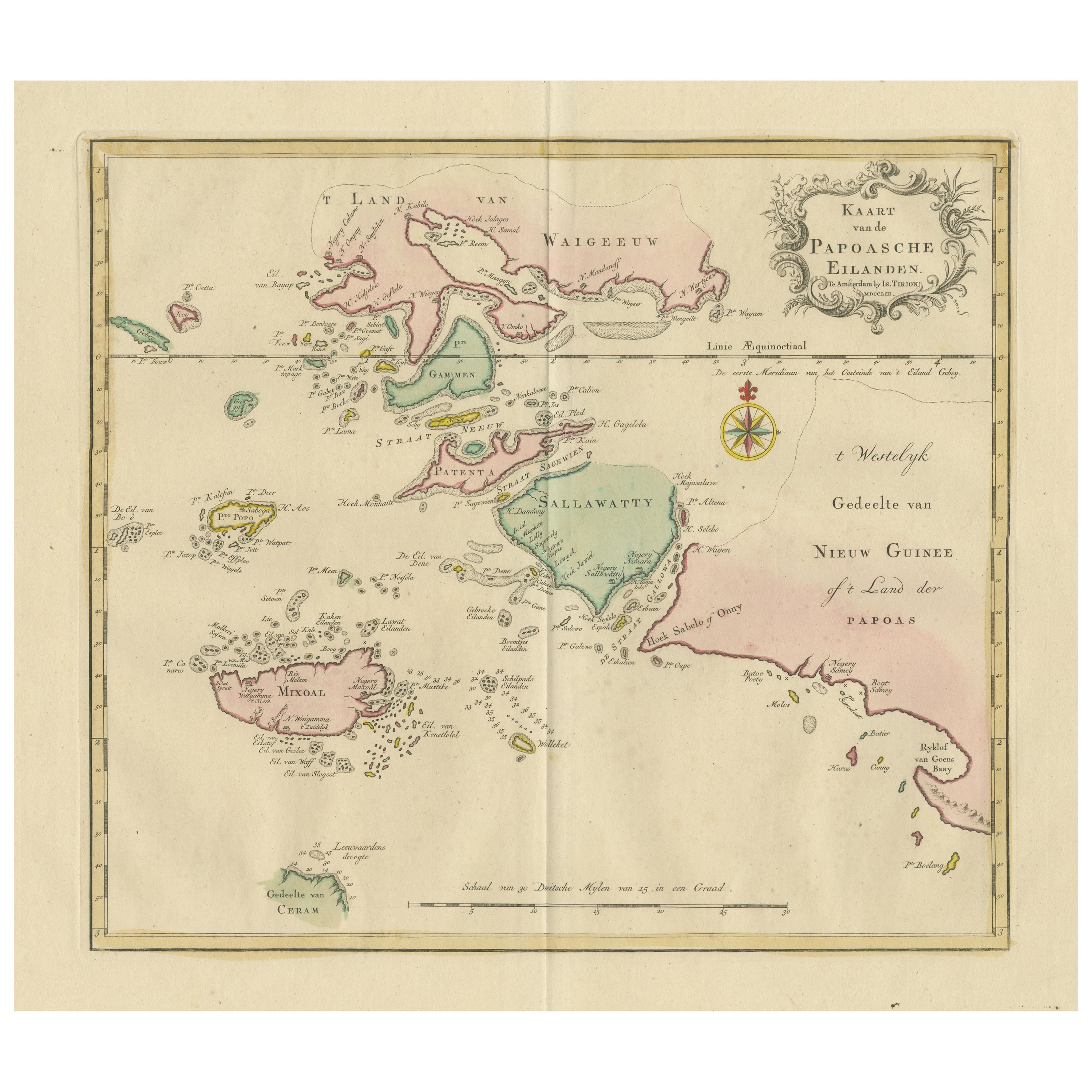
Antique Map extending from the Spice Islands to the west of Papua New Guinea
Located in Langweer, NL
Antique map titled 'Kaart van de Papoasche Eilanden'. Beautiful original old map extending from the Spice Islands (Sallawatty, Patenta, Gammen, Land van Waigeeuw, Popo, Misool, and part of Seram) to the western end of Papua New Guinea. Many smaller islands are detailed, and depth soundings are shown near Seram and to the east of Misool. This map originates from 'Nieuwe en Beknopte Hand-Atlas, bestaande in eene Verzameling van eenige der algemeenste en nodigste Landkaarten' by I. Tirion. Published circa 1770.
Tirion was born in Utrecht in 1705. He moved to Amsterdam in 1725 and set up shop on Damrak as a book publisher. Tirion quick rose in prominence by publishing pamphlets, historical works, and, most importantly...
Category
Antique Late 18th Century Maps
Materials
Paper
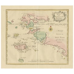
$469 Sale Price
20% Off
You May Also Like
Antique 1803 Italian Map of Asia Including China Indoneseia India
Located in Amsterdam, Noord Holland
Antique 1803 Italian Map of Asia Including China Indoneseia India
Very nice map of Asia. 1803.
Additional information:
Type: Map
Country of Manufacturing: Europe
Period: 19th centu...
Category
Antique 19th Century European Maps
Materials
Paper

$584 Sale Price
20% Off
West Coast of Africa, Guinea & Sierra Leone: An 18th Century Map by Bellin
By Jacques-Nicolas Bellin
Located in Alamo, CA
Jacques Bellin's copper-plate map entitled "Partie de la Coste de Guinee Dupuis la Riviere de Sierra Leona Jusquau Cap das Palmas", depicting the coast of Guinea and Sierra Leone in ...
Category
Antique Mid-18th Century French Maps
Materials
Paper

Original Antique Map of South America. C.1780
Located in St Annes, Lancashire
Great map of South America
Copper-plate engraving
Published C.1780
Two small worm holes to left side of map
Unframed.
Category
Antique Early 1800s English Georgian Maps
Materials
Paper

Southern Greece: A Large 17th C. Hand-colored Map by Sanson and Jaillot
By Nicolas Sanson
Located in Alamo, CA
This large original hand-colored copperplate engraved map of southern Greece and the Pelopponese Peninsula entitled "La Moree Et Les Isles De Zante, Cefalonie, Ste. Marie, Cerigo & C...
Category
Antique 1690s French Maps
Materials
Paper

Original Antique Map of South East Asia by Thomas Clerk, 1817
Located in St Annes, Lancashire
Great map of South East Asia
Copper-plate engraving
Drawn and engraved by Thomas Clerk, Edinburgh.
Published by Mackenzie And Dent, 1817
Unframed.
Category
Antique 1810s English Maps
Materials
Paper

Map of the East Indies: An Original 18th Century Hand-colored Map by E. Bowen
Located in Alamo, CA
This is an original 18th century hand-colored map entitled "An Accurate Map of the East Indies Exhibiting the Course of the European Trade both on the Continent and Islands" by Emanu...
Category
Mid-18th Century Old Masters Landscape Prints
Materials
Engraving

More Ways To Browse
Antique Ceylon
Ceylon Furniture
Book Divider
Sea Monster
Giacometti Chairs
Antique Rug Wool Navy Blue Red
Bauhaus Flower Stand
French Table With Drawers
North Carolina Furniture
Antique Silver Platter
Boat Blueprint
Cream Plates
Vintage Art Deco Rugs
Vintage Serving Forks
Brewery Signs
Herati Rug
Venice Wood
Gold Leaf Furniture Black