Items Similar to Decorative Antique Map of Cyprus and Asia Minor by Christoph Weigel, Circa 1720


Want more images or videos?
Request additional images or videos from the seller
1 of 6
Decorative Antique Map of Cyprus and Asia Minor by Christoph Weigel, Circa 1720
$632.41
$790.5120% Off
£468.65
£585.8120% Off
€528
€66020% Off
CA$863.36
CA$1,079.1920% Off
A$960.45
A$1,200.5620% Off
CHF 503.48
CHF 629.3520% Off
MX$11,736.43
MX$14,670.5420% Off
NOK 6,411.17
NOK 8,013.9620% Off
SEK 6,035.23
SEK 7,544.0420% Off
DKK 4,020.15
DKK 5,025.1820% Off
Shipping
Retrieving quote...The 1stDibs Promise:
Authenticity Guarantee,
Money-Back Guarantee,
24-Hour Cancellation
About the Item
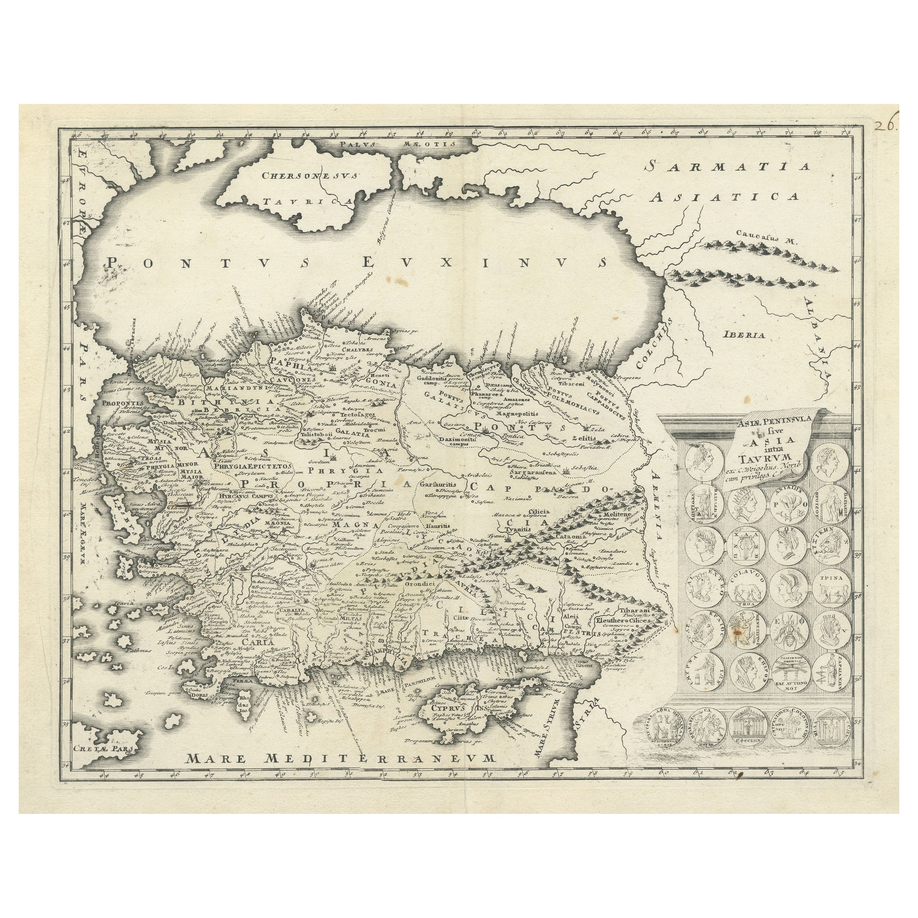
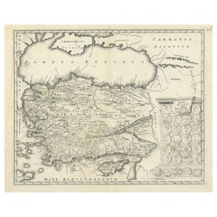
Title: Asiae Peninsula sive Asia Intra Taurum by Christoph Weigel, Circa 1720 – Decorative Antique Map of Cyprus and Asia Minor
Description: This rare antique map, titled *Asiae Peninsula sive Asia Intra Taurum*, was published by the renowned German engraver and cartographer Christoph Weigel around 1720. The map offers a detailed representation of Cyprus and Asia Minor, showcasing the geographical knowledge and features known to the ancient world. It provides insight into regions that were historically significant, including Cappadocia, Galatia, Lydia, Phrygia, and Pontus, among others.
What makes this map particularly unique is its decorative elements, including an inset featuring 27 medallions of ancient coins or representations of classical symbols. These medallions offer additional context to the historical significance of the region and make the map visually appealing to collectors of both historical and artistic cartography.
Weigel's maps are known for their clarity and precision, and this example is no exception, with beautiful hand-colored details that highlight the different regions. The Black Sea (Pontus Euxinus) and Mediterranean Sea (Mare Mediterraneum) are clearly marked, along with important ancient cities and topographical features such as mountain ranges.
The important places on the *Asiae Peninsula sive Asia Intra Taurum* map by Christoph Weigel include:
- Cyprus: The island is prominently displayed in the Mediterranean Sea.
- Pontus Euxinus: The ancient name for the Black Sea, located in the northern part of the map.
- Cappadocia: An important historical region in central Asia Minor.
- Galatia: A notable area in north-central Asia Minor.
- Phrygia: A region in west-central Asia Minor, known in ancient times.
- Lydia: A region located in the western part of Asia Minor.
- Pamphylia: A coastal region in southern Asia Minor.
- Cilicia: A region located to the southeast of Asia Minor, near the Mediterranean coast.
- Bithynia: A region in the northwest of Asia Minor.
- Iberia: Found in the eastern part of the map, referring to a region that is part of modern-day Georgia.
- Caucasus Mountains: Depicted in the eastern section, part of the geographical border of Asia Minor.
These places are historically significant and represent important regions in ancient geography, particularly during the Hellenistic and Roman periods. The map captures the regions as they were understood by ancient geographers.
This map is a valuable piece for collectors of antique maps, particularly those interested in Asia Minor, ancient geography, and historical cartography. Weigel was a key figure in the early 18th-century German mapmaking world, and his works are cherished for their combination of geographical accuracy and artistic elegance.
Condition: Very good to excellent, with well-preserved hand coloring, minor age-related wear on the edges, and wide margins.
Keywords that may help attract collectors or enthusiasts interested in historical maps of Cyprus, Asia Minor, and ancient geography:
- Antique map of Cyprus
- Historical map of Asia Minor
- 18th-century map of Asia
- Christoph Weigel map
- Ancient geography map
- Decorative antique map
- Maps of Cappadocia and Galatia
- Asia Peninsula map
- Pontus Euxinus map
- Black Sea historical map
- Medallion map
- Classical cartography
- Ancient cities map
- Maps of the Mediterranean Sea
- Historical map with medallions
- Weigel cartographer map
- Rare map of ancient world
- 18th-century German maps
- Collectible map of Asia Minor
- Ancient coin map insert
- Hellenistic period geography
- Ancient history maps
Using these keywords will help enhance visibility for collectors or enthusiasts interested in the geography of ancient Asia Minor, Cyprus, and classical cartography.
- Dimensions:Height: 14.57 in (37 cm)Width: 18.12 in (46 cm)Depth: 0 in (0.02 mm)
- Materials and Techniques:Paper,Engraved
- Period:1720-1729
- Date of Manufacture:Circa 1720
- Condition:Condition: Very good to excellent, with well-preserved hand coloring, minor age-related wear on the edges, and wide margins. Please study the images carefully.
- Seller Location:Langweer, NL
- Reference Number:Seller: BG-136121stDibs: LU3054341469312
About the Seller
5.0
Recognized Seller
These prestigious sellers are industry leaders and represent the highest echelon for item quality and design.
Platinum Seller
Premium sellers with a 4.7+ rating and 24-hour response times
Established in 2009
1stDibs seller since 2017
2,494 sales on 1stDibs
Typical response time: 1 hour
- ShippingRetrieving quote...Shipping from: Langweer, Netherlands
- Return Policy
Authenticity Guarantee
In the unlikely event there’s an issue with an item’s authenticity, contact us within 1 year for a full refund. DetailsMoney-Back Guarantee
If your item is not as described, is damaged in transit, or does not arrive, contact us within 7 days for a full refund. Details24-Hour Cancellation
You have a 24-hour grace period in which to reconsider your purchase, with no questions asked.Vetted Professional Sellers
Our world-class sellers must adhere to strict standards for service and quality, maintaining the integrity of our listings.Price-Match Guarantee
If you find that a seller listed the same item for a lower price elsewhere, we’ll match it.Trusted Global Delivery
Our best-in-class carrier network provides specialized shipping options worldwide, including custom delivery.More From This Seller
View AllMap of Asia Minor & Cyprus with Medallions – Weigel Engraving c.1720
Located in Langweer, NL
Map of Asia Minor & Cyprus with Medallions – Weigel Engraving c.1720
This finely engraved antique map, titled Asiae Peninsula sive Asia intra Taurum, presents an early 18th-century ...
Category
Antique Early 18th Century German Maps
Materials
Paper
$450 Sale Price
20% Off
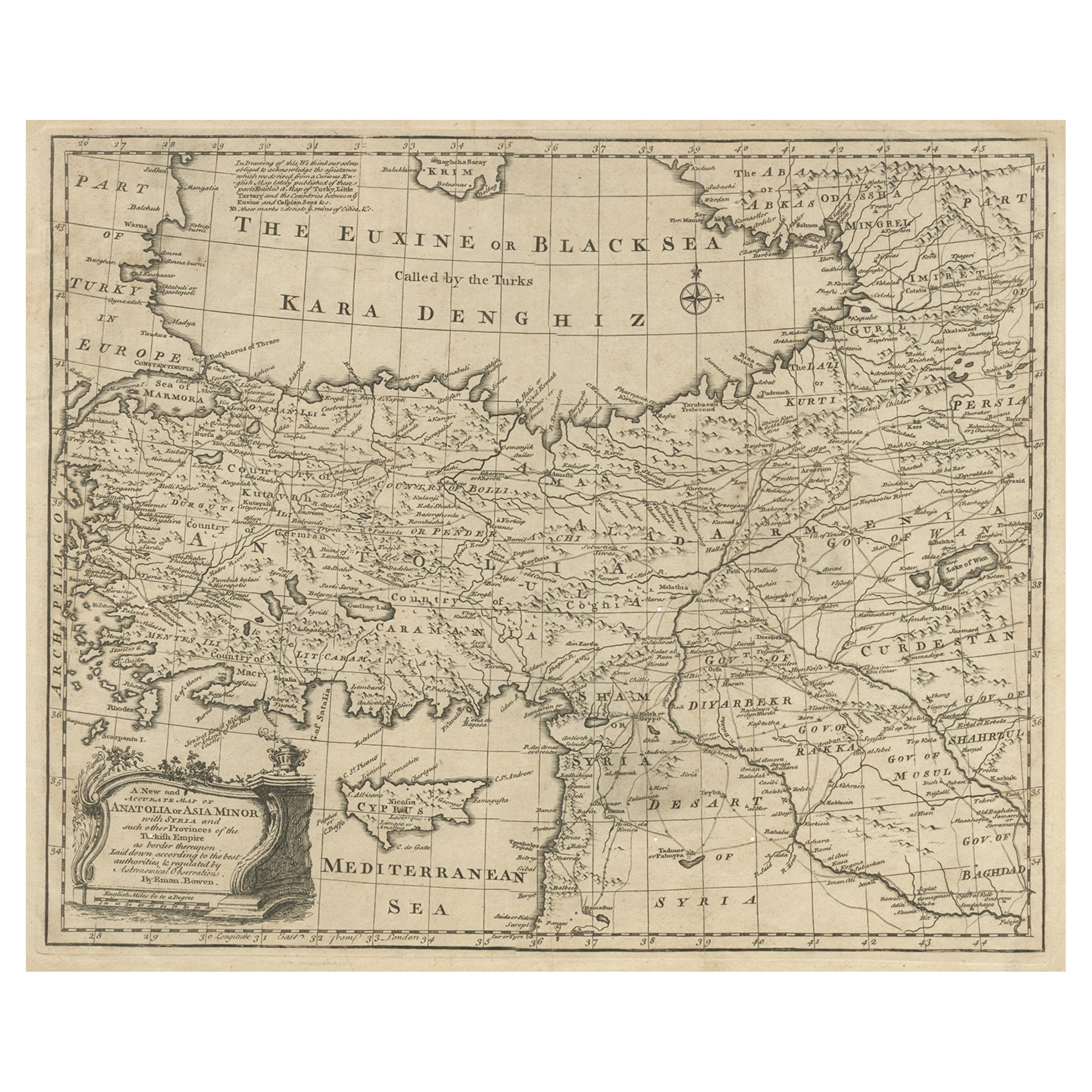
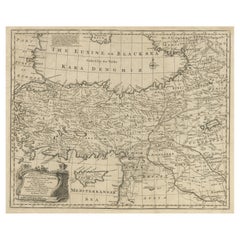
Antique Map of Asia Minor with Cyprus, Syria and Turkey and the Black Sea, 1747
Located in Langweer, NL
Antique map Middle East titled 'A New and accurate map of Anatolia or Asia Minor, with Syria and such other provinces of the Turkish Empire (.....
Category
Antique 18th Century Maps
Materials
Paper
$431 Sale Price
20% Off
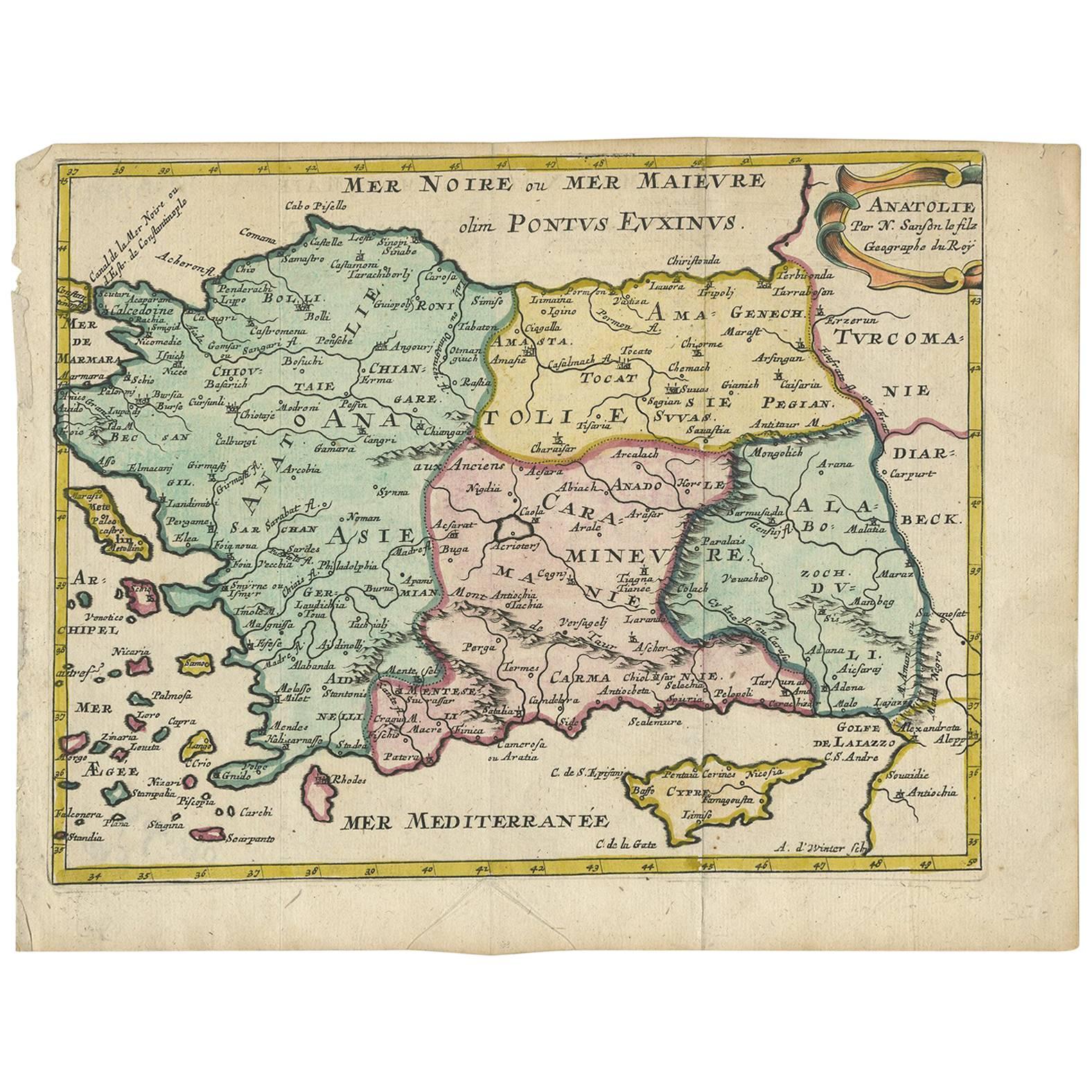
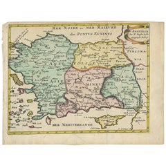
Antique Map of Turkey with Cyprus and Greece Islands by N. Sanson, circa 1652
Located in Langweer, NL
Antique map of Turkey, Anatolie with Cyprus and the Greece islands. Attractive scrolled title cartouche to top right corner. Blank verso.
Category
Antique Mid-17th Century Maps
Materials
Paper
Antique Map of Eastern Mediterranean and Asia Minor by a Benedictine, c.1725
Located in Langweer, NL
Antique map titled 'Byzondere Afbeelding der Landschappen, van de Apostelen bevaren en doorwandelt om het Evangelium J. C. te Prediken.' Map of the lands travelled by the Apostles to...
Category
Antique 18th Century Maps
Materials
Paper

$287 Sale Price
20% Off
Antique Map of Greece by Seutter or Lotter, 'c.1740'
Located in Langweer, NL
Antique map titled 'Graecia pars Septentrionalis'. Original antique map of Greece, uncommon. Signed cum Gratia et Privil. S.R.I. Vicariatus (..)'. Published by Seutter or Lotter, cir...
Category
Antique Mid-18th Century Maps
Materials
Paper

$661 Sale Price
35% Off
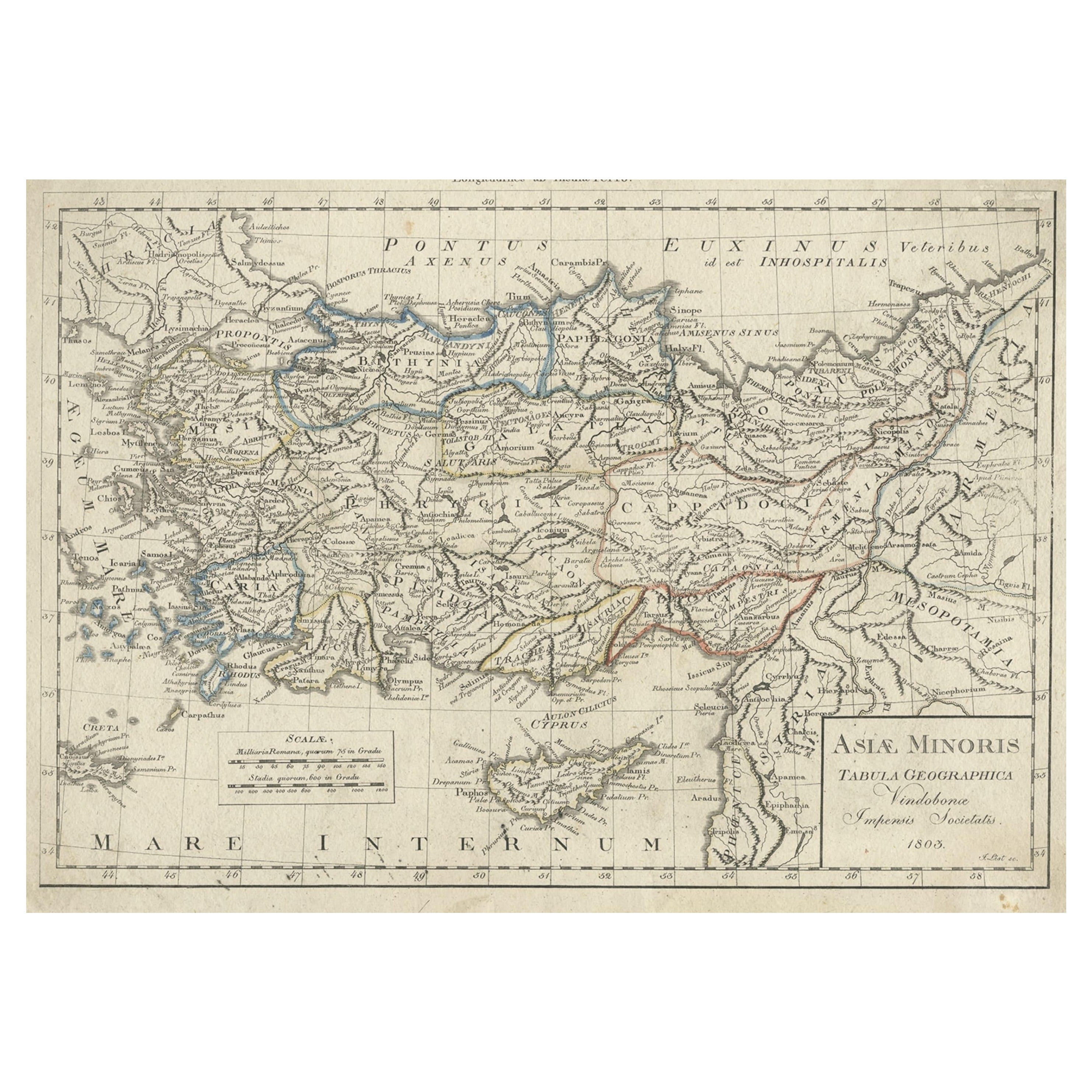
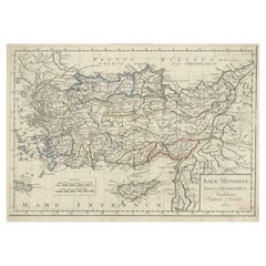
Antique Map of Asia Minor, Present-day Turkey and Cyprus, 1803
Located in Langweer, NL
Antique map titled 'Asiae Minoris Tabula Geographica'. Uncommon antique map of Asia minor, comprising most of what is present-day Turkey. Source unknown, to be determined.
Artists...
Category
Antique 19th Century Maps
Materials
Paper
$172 Sale Price
20% Off
You May Also Like
Hand-Colored 18th Century Homann Map of the Black Sea, Turkey and Asia Minor
By Johann Baptist Homann
Located in Alamo, CA
An attractive original early 18th century hand-colored map of the Black Sea and Turkey entitled "Carte de L'Asie Minevre ou de la Natolie et du Pont Evxin Tiree des Voyages et des Ob...
Category
Antique Early 18th Century German Maps
Materials
Paper

Southern Greece: A Large 17th C. Hand-colored Map by Sanson and Jaillot
By Nicolas Sanson
Located in Alamo, CA
This large original hand-colored copperplate engraved map of southern Greece and the Pelopponese Peninsula entitled "La Moree Et Les Isles De Zante, Cefalonie, Ste. Marie, Cerigo & C...
Category
Antique 1690s French Maps
Materials
Paper

Southern & Eastern Europe: A Large 17th C. Hand-colored Map by Sanson & Jaillot
By Nicolas Sanson
Located in Alamo, CA
This large hand-colored map entitled "Estats de L'Empire des Turqs en Europe, ou sont les Beglerbeglicz our Gouvernements" was originally created by Nicholas Sanson d'Abbeville and t...
Category
Antique 1690s French Maps
Materials
Paper

Hand-Colored 18th Century Homann Map of the Danube, Italy, Greece, Croatia
By Johann Baptist Homann
Located in Alamo, CA
"Fluviorum in Europa principis Danubii" is a hand colored map of the region about the Danube river created by Johann Baptist Homann (1663-1724) in his 'Atlas Novus Terrarum', publish...
Category
Antique Early 18th Century German Maps
Materials
Paper

18th Century Map of the Southern Balkans by Giovanni Maria Cassini
By Giovanni Maria Cassini
Located in Hamilton, Ontario
18th century map by Italian engraver Giovanni Maria Cassini (Italy 1745-1824).
Map of the Southern Balkans: Rome. Hand colored and copper engraved print done in the year 1788. It in...
Category
Antique 18th Century Italian Maps
Materials
Paper

$795 Sale Price
36% Off
Original Antique Map of Ancient Greece, Achaia, Corinth, 1786
Located in St Annes, Lancashire
Great map of Ancient Greece. Showing the region of Thessaly, including Mount Olympus
Drawn by J.D. Barbie Du Bocage
Copper plate engraving by P.F Tardieu
Original hand color...
Category
Antique 1780s French Other Maps
Materials
Paper

More Ways To Browse
Antique Ancient Key
German Coins
Ancient Coins
Engraved Coin
Rare Roman Coins
Antique Coins And Medallions
Lydia Coin
Tables With Inlaid Wood
World War Table
Antonio Jacobsen
Ariston Chairs
Coffee Tables Europe
Marble Top Dining Tables
Nordiska Argentina
Pink And Black Rug
Black Wooden Chair
Orrefors Embassy
Black Ebonized