Items Similar to England & Wales in 1857 – Decorative Antique Map with Rail Routes


Video Loading
Want more images or videos?
Request additional images or videos from the seller
1 of 11
England & Wales in 1857 – Decorative Antique Map with Rail Routes
$496.04
£373.44
€420
CA$683.33
A$765.29
CHF 399.32
MX$9,347.68
NOK 5,080.45
SEK 4,788.94
DKK 3,197.10
About the Item
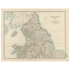
Antique Map of England & Wales – Hand-Colored Engraving by Stülpnagel, 1857
Fine 19th-century map titled "England und Wales", drawn and engraved by Friedrich von Stülpnagel and published by Justus Perthes in Gotha in 1857. This highly detailed copperplate engraving presents the entirety of England and Wales with remarkable clarity, showcasing county borders, cities, rail lines, and major roads.
Each historic county is outlined in hand-applied color, with careful attention to the geography and political divisions of mid-Victorian Britain. Major cities—including London, Manchester, Liverpool, Birmingham, Bristol, and Cardiff—are prominently featured, alongside a dense network of smaller towns and transport routes. The Welsh coastline and mountainous regions are engraved with topographical detail, and the Isle of Man is also clearly included.
An inset at upper right zooms in on the far northeast of England (Die Nordspitze von England), showing the border region between Northumberland and Scotland. A secondary inset at the lower right corner displays the English Channel crossing to Calais, France.
This map reflects Britain during the peak of its industrial expansion and rail development. The layout shows significant early rail lines and their interconnections across the country. It offers both historical interest and aesthetic appeal for collectors of British history, cartography, or 19th-century travel.
Published by the renowned German cartographic firm Justus Perthes and executed by one of its leading cartographers, this map is a classic example of precise, decorative, and scholarly European mapmaking.
Condition report:
Very good condition. Minor age-related toning at the margins. Original hand-coloring is vivid and intact. No tears, foxing, or repairs noted. Please refer to the image for detail.
Framing tips:
A classic map like this pairs well with a black or dark mahogany frame and an off-white mat. A fine red or navy accent line may complement the county border colors. Suitable for display in an office, library, or collection of British or Victorian-era artifacts.
Technique: Copperplate engraving with original hand-coloring
Maker: F. von Stülpnagel, published by Justus Perthes, Gotha, 1857
- Dimensions:Height: 14.77 in (37.5 cm)Width: 17.88 in (45.4 cm)Depth: 0.01 in (0.2 mm)
- Materials and Techniques:Paper,Engraved
- Place of Origin:
- Period:
- Date of Manufacture:1857
- Condition:Very good condition. Minor age-related toning at the margins. Original hand-coloring is vivid and intact. No tears, foxing, or repairs noted. Please refer to the image for detail.
- Seller Location:Langweer, NL
- Reference Number:Seller: BG-05552-201stDibs: LU3054346116872
About the Seller
5.0
Recognized Seller
These prestigious sellers are industry leaders and represent the highest echelon for item quality and design.
Platinum Seller
Premium sellers with a 4.7+ rating and 24-hour response times
Established in 2009
1stDibs seller since 2017
2,533 sales on 1stDibs
Typical response time: <1 hour
- ShippingRetrieving quote...Shipping from: Langweer, Netherlands
- Return Policy
Authenticity Guarantee
In the unlikely event there’s an issue with an item’s authenticity, contact us within 1 year for a full refund. DetailsMoney-Back Guarantee
If your item is not as described, is damaged in transit, or does not arrive, contact us within 7 days for a full refund. Details24-Hour Cancellation
You have a 24-hour grace period in which to reconsider your purchase, with no questions asked.Vetted Professional Sellers
Our world-class sellers must adhere to strict standards for service and quality, maintaining the integrity of our listings.Price-Match Guarantee
If you find that a seller listed the same item for a lower price elsewhere, we’ll match it.Trusted Global Delivery
Our best-in-class carrier network provides specialized shipping options worldwide, including custom delivery.More From This Seller
View AllAntique Map of England and Wales, Also Showing the English Channel
Located in Langweer, NL
Antique map titled 'England and Wales'. Original antique map of England and Wales. Drawn and engraved by J. Dower. Originates from 'A General Descriptive Atlas Of The Earth, Containi...
Category
Antique Mid-19th Century Maps
Materials
Paper

$141 Sale Price
20% Off
Antique Map of England and Wales, 1903, with Detailed Counties and Railways
Located in Langweer, NL
Title: Antique Map of England and Wales, 1903, with Detailed Counties and Railways
Description:
This beautifully detailed antique map, titled "England and Wales," was engraved and p...
Category
Early 20th Century Maps
Materials
Paper
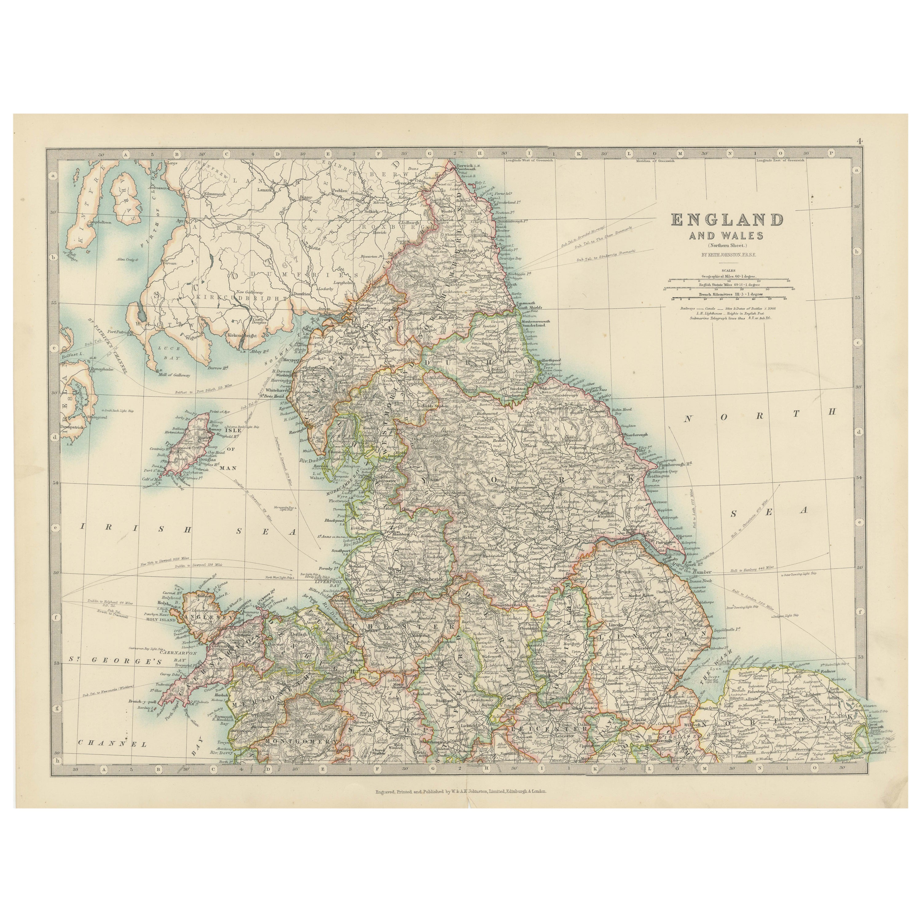
Antique Map of England and Wales 'North' by A.K. Johnston, 1865
Located in Langweer, NL
Antique map titled 'England and Wales (Northern Sheet)'. This map originates from the ‘Royal Atlas of Modern Geography’ by Alexander Keith Johnston. Published by William Blackwood an...
Category
Antique Mid-19th Century Maps
Materials
Paper

$259 Sale Price
20% Off
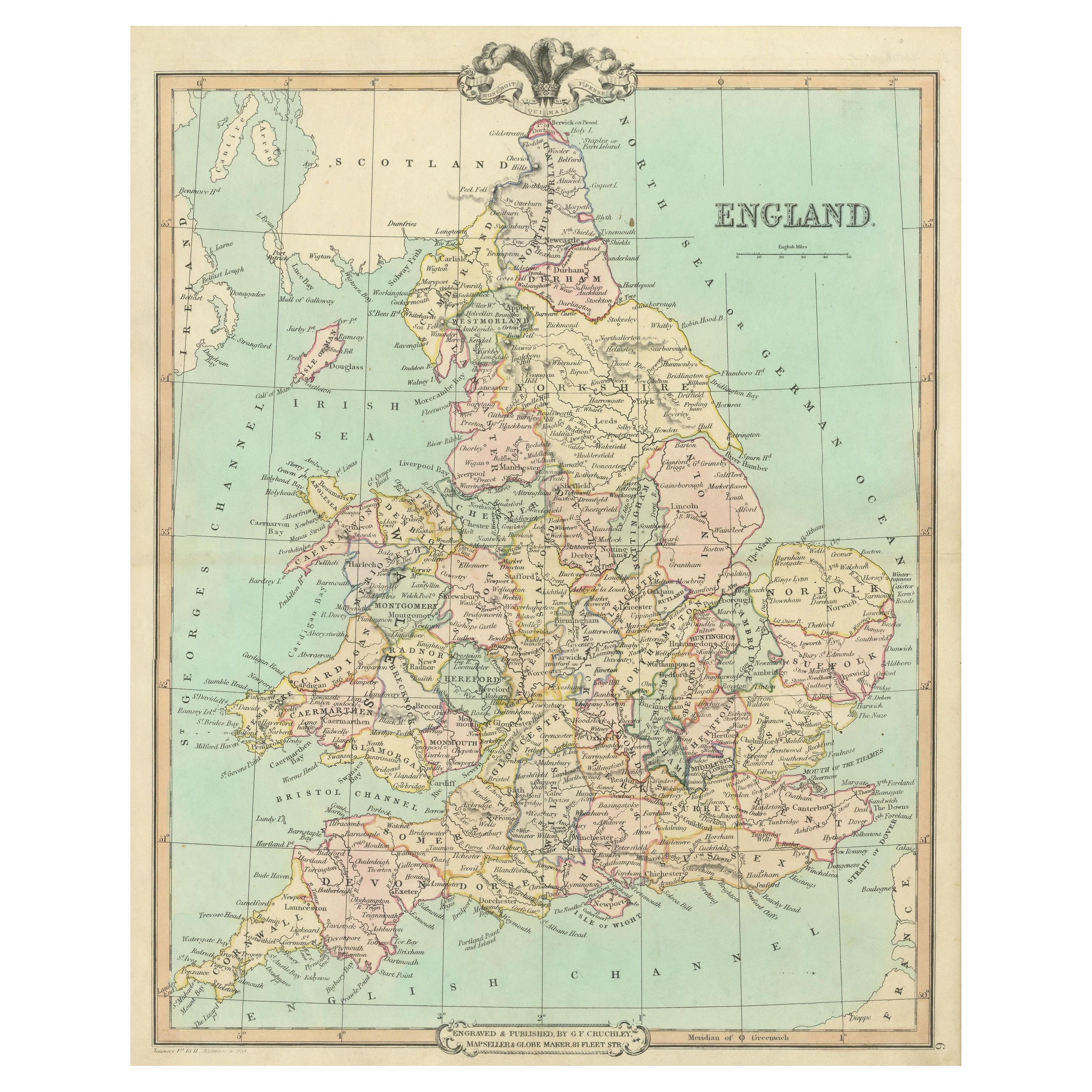
Antique Map of England and Wales, Also Including the Isle of Man
Located in Langweer, NL
Antique map titled 'England'. Original antique map of England and Wales from Northumberland to Cornwall from the St. George Channel east as far as the Strait of Dover. The Isle of Ma...
Category
Antique Mid-19th Century Maps
Materials
Paper

$368 Sale Price
20% Off
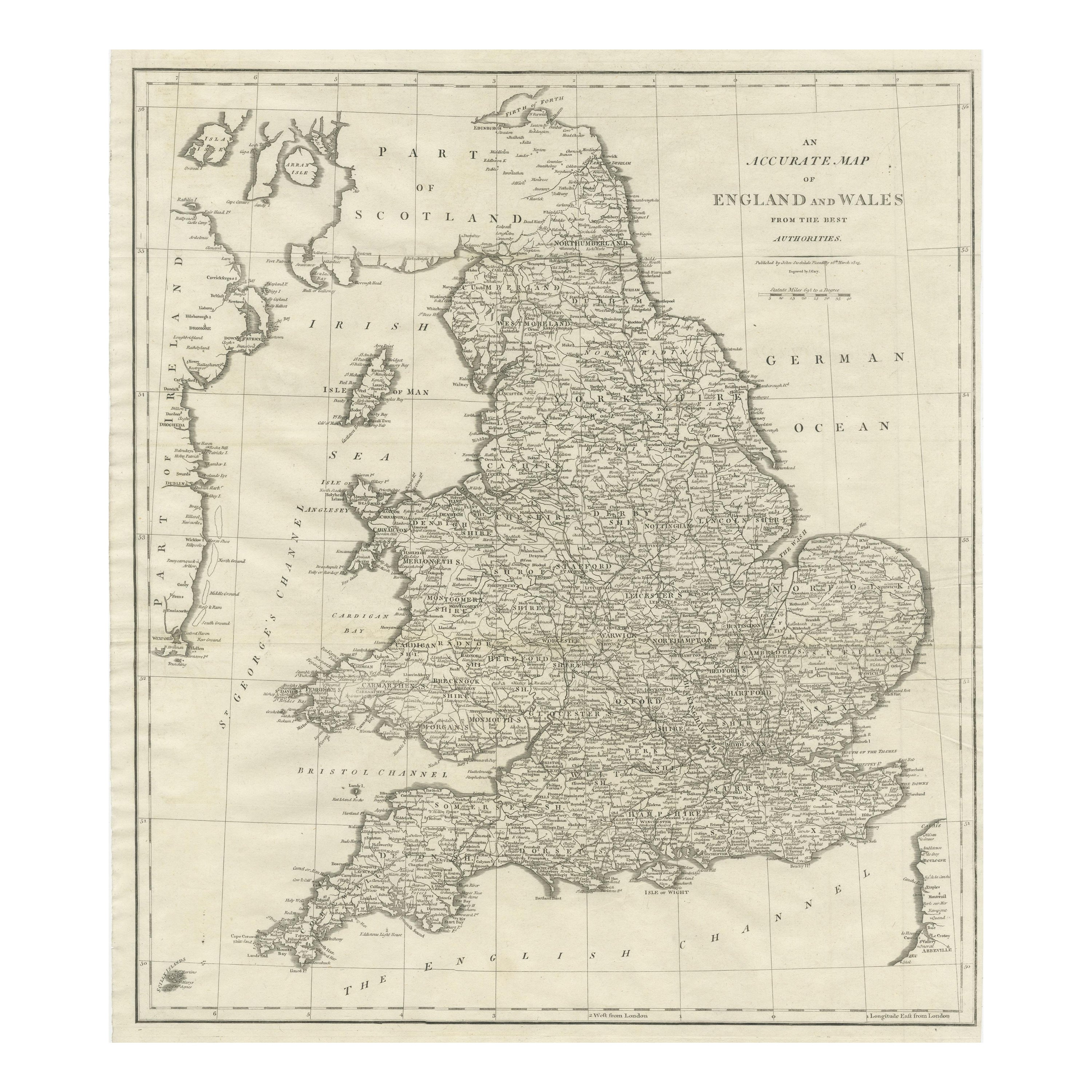
Large Antique Map of England and Wales
Located in Langweer, NL
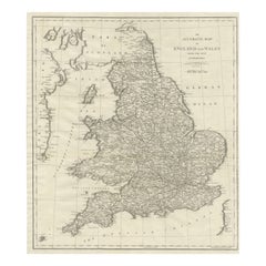
Antique map titled 'An Accurate Map of England and Wales'. Original old map of England and Wales. Engraved by John Cary. Originates from 'New British Atlas' by John Stockdale, publis...
Category
Antique Early 19th Century Maps
Materials
Paper
$311 Sale Price
20% Off
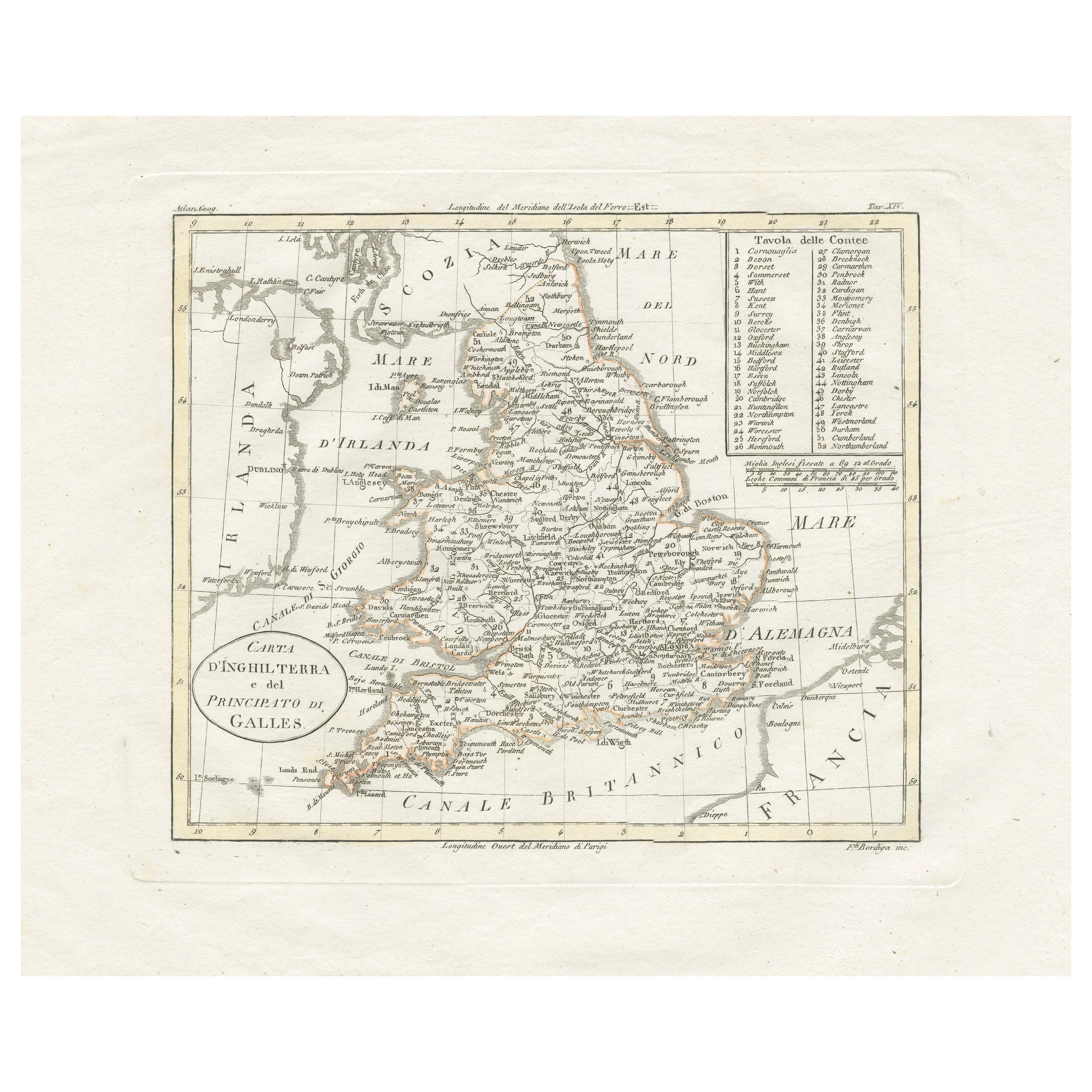
Detailed Antique Map of Britain, Wales and the Coast of Ireland
Located in Langweer, NL
Antique map titled 'Carta d'Inghilterra e del Principato di Galles'. Detailed map of Britain, Wales and the coast of Ireland with a list of counties. This map originates from 'Nuovo ...
Category
Antique Mid-19th Century Maps
Materials
Paper

$245 Sale Price
20% Off
You May Also Like
England and Wales, Northern Part. Century Atlas antique vintage map
Located in Melbourne, Victoria
'The Century Atlas. England and Wales, Northern Part'
Original antique map, 1903.
Central fold as issued. Map name and number printed on the reverse corners.
Sheet 29.5cm by 40cm.
Category
Early 20th Century Victorian More Prints
Materials
Lithograph

Large Original Vintage Map of the United Kingdom, circa 1920
Located in St Annes, Lancashire
Great map of The United Kingdom
Unframed
Original color
By John Bartholomew and Co. Edinburgh Geographical Institute
Published, circa 1920
Free shipping.
Category
Vintage 1920s British Maps
Materials
Paper

Original Antique Map of The World by Dower, circa 1835
Located in St Annes, Lancashire
Nice map of the World
Drawn and engraved by J.Dower
Published by Orr & Smith. C.1835
Unframed.
Free shipping
Category
Antique 1830s English Maps
Materials
Paper

Old Horizontal Map of England
By Tasso
Located in Alessandria, Piemonte
ST/520 - Old rare Italian map of England, dated 1826-1827 - by Girolamo Tasso, editor in Venise, for the atlas of M.r Le-Sage.
Category
Antique Early 19th Century Italian Other Prints
Materials
Paper

Vicinity of London, England, United Kingdom. Century Atlas antique map
Located in Melbourne, Victoria
'The Century Atlas. Vicinity of London, England, United Kingdom.'
Original antique map, 1903.
Central fold as issued. Map name and number printed on the reverse corners.
Sheet 29.5...
Category
Early 20th Century Victorian More Prints
Materials
Lithograph

John Senex (1678-1740) - 18th Century Engraving, A New Map of Great Britain
By John Senex
Located in Corsham, GB
A New Map of Great Britain - Corrected from the Observations Communicated to the Royal Society at London. By John Senex F.R.S. A double-page engraved map on 2 sheets joined, with lat...
Category
18th Century More Prints
Materials
Engraving
