Items Similar to Gold Rush Era Masterpiece: The Tallis & Rapkin Rare Map of Pre-Queensland, 1851


Want more images or videos?
Request additional images or videos from the seller
1 of 8
Gold Rush Era Masterpiece: The Tallis & Rapkin Rare Map of Pre-Queensland, 1851
$555.94
$694.9220% Off
£413.86
£517.3320% Off
€464
€58020% Off
CA$761.50
CA$951.8720% Off
A$846.95
A$1,058.6920% Off
CHF 442.25
CHF 552.8120% Off
MX$10,306.49
MX$12,883.1120% Off
NOK 5,648.23
NOK 7,060.2820% Off
SEK 5,297.04
SEK 6,621.3020% Off
DKK 3,532.27
DKK 4,415.3420% Off
Shipping
Retrieving quote...The 1stDibs Promise:
Authenticity Guarantee,
Money-Back Guarantee,
24-Hour Cancellation
About the Item
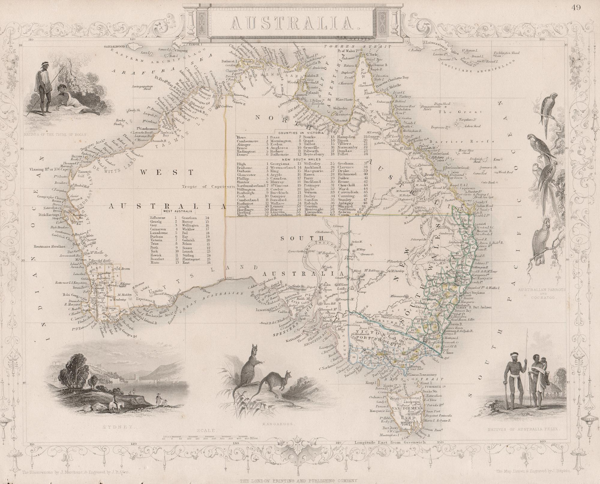
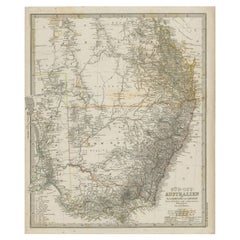
The image is an original historical map of Australia from the year 1851, created by John Rapkin with illustrations by J. Marchant and engravings by J. B. Allen. The map was published by John Tallis & Company, which was one of the most renowned cartographic publishing firms in the 19th century.
An attractive steel engraved map of the continent with good detail along the coastlines that contrasts dramatically with the complete lack of detail in the interior. Tallis filled the blank interior with tables listing county names. The surrounding vignettes include Natives of the Tribe of Bogan, Australian Parrots and Cockatoo, Natives of Australia Felix, Kangaroos, and Sydney.
Here are some key descriptions and interesting facts about the map:
1. **Age and Rarity**: The map dates back to 1851, which is a significant period for Australia as it was just a few years after the discovery of gold in 1851. This would make it a valuable collector's item due to its historical context.
2. **Absence of Queensland**: Notably, the map does not include Queensland, which indicates it was created before Queensland was established as a separate colony in 1859. This highlights the evolving political boundaries of Australia during the 19th century.
3. **Goldfields Marked**: The map shows the locations of goldfields, which is particularly interesting since the 1850s was the decade of the Australian gold rushes. This detail would have been of immense practical importance at the time and now serves as a historical record of the early economic drivers in the region.
4. **Illustrations**: The map features illustrations by J. Marchant, which likely depict scenes typical of the era, such as local wildlife like kangaroos, and cultural images, such as depictions of Indigenous Australians.
5. **Engravings**: The engravings by J. B. Allen add a layer of craftsmanship to the map, making it not just a navigational tool but also a piece of art.
6. **Publisher's Prestige**: John Tallis & Company was known for their detailed and decorative maps, which often included vignettes and ornamental borders. Their work is well-regarded by map collectors and historians.
7. **Artistry and Accuracy**: The combination of accurate cartographic information and artistic embellishments make this map an exemplary piece from the mid-19th century.
This title highlights the map's historical significance related to the Gold Rush, the absence of Queensland, the prestigious creators, and its status as a collectible item. It would likely attract collectors interested in unique historical documents, maps, and Australian history.
- Dimensions:Height: 104.34 in (265 cm)Width: 14.26 in (36.2 cm)Depth: 0 in (0.02 mm)
- Materials and Techniques:Paper,Engraved
- Period:
- Date of Manufacture:1851
- Condition:Good, with some minor soiling mostly in the blank margins. Lower border cut short and not straight, but not affecting the image. Study the scans carefully.`.
- Seller Location:Langweer, NL
- Reference Number:Seller: BG-137281stDibs: LU3054338602692
About the Seller
5.0
Recognized Seller
These prestigious sellers are industry leaders and represent the highest echelon for item quality and design.
Platinum Seller
Premium sellers with a 4.7+ rating and 24-hour response times
Established in 2009
1stDibs seller since 2017
2,510 sales on 1stDibs
Typical response time: <1 hour
- ShippingRetrieving quote...Shipping from: Langweer, Netherlands
- Return Policy
Authenticity Guarantee
In the unlikely event there’s an issue with an item’s authenticity, contact us within 1 year for a full refund. DetailsMoney-Back Guarantee
If your item is not as described, is damaged in transit, or does not arrive, contact us within 7 days for a full refund. Details24-Hour Cancellation
You have a 24-hour grace period in which to reconsider your purchase, with no questions asked.Vetted Professional Sellers
Our world-class sellers must adhere to strict standards for service and quality, maintaining the integrity of our listings.Price-Match Guarantee
If you find that a seller listed the same item for a lower price elsewhere, we’ll match it.Trusted Global Delivery
Our best-in-class carrier network provides specialized shipping options worldwide, including custom delivery.More From This Seller
View AllAntique Detailed Map of New South Wales, Queensland & Victoria, Australia, 1865
Located in Langweer, NL
Antique map Australia titled 'South Australia, New South Wales, Victoria & Queensland'. Old map depicting South Australia including New South Wal...
Category
Antique 19th Century Maps
Materials
Paper

$335 Sale Price
20% Off
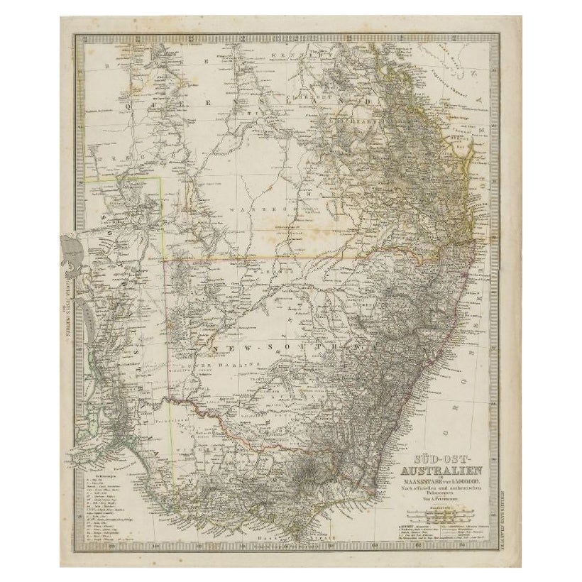
Antique Map of South East Australia by Stieler, c.1848
By Thomas Kitchin
Located in Langweer, NL
Antique map Australia titled 'Süd-Ost Australien'. Detailed map of South East Australia. Orginates from 'Stieler's Hand Atlas', published in Germ...
Category
Antique 19th Century Maps
Materials
Paper
$57 Sale Price
20% Off
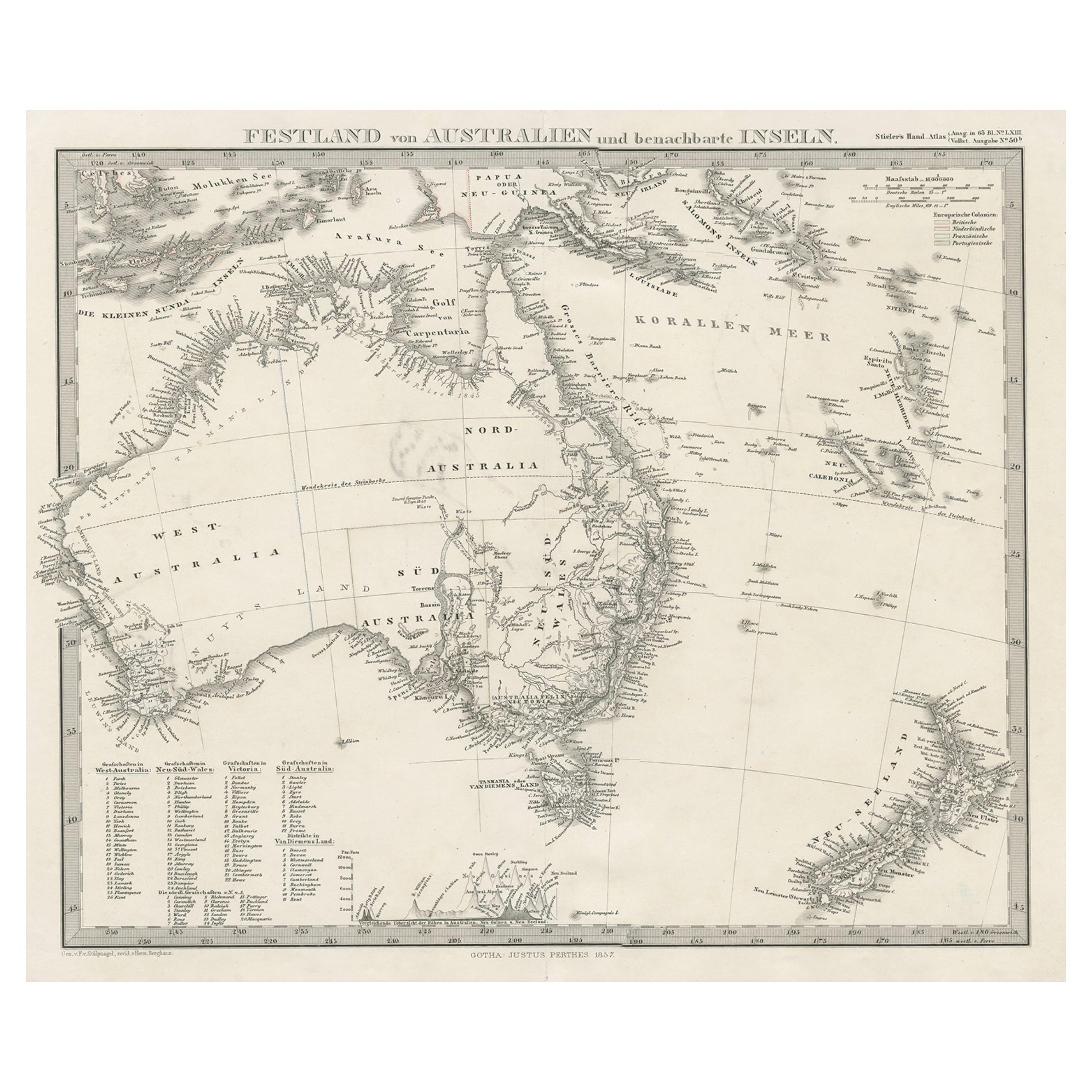
German Antique Map of Australia and New Zealand, 1857
Located in Langweer, NL
Antique map Australia titled 'Festland von Australien und benachbarte Inseln'. Detailed map of Australia and New Zealand, including excellent det...
Category
Antique 19th Century Maps
Materials
Paper

$239 Sale Price
20% Off
Antique Map of Southeastern Australia by F. von Stülpnagel, 1850
Located in Langweer, NL
Antique map titled 'Süd-Östlichen Australien'. Map of southeastern Australia with inset maps of southwest Australia and Tasmania compiled by the military cartographer Friedrich von S...
Category
Antique Mid-19th Century Maps
Materials
Paper

$171 Sale Price
35% Off
German Antique Map of Australia, Meyers, 1885
Located in Langweer, NL
Australien.' (Map of Australia. With inset maps of the large cities and Tasmania.) This attractive original old antique print / plate / map originate...
Category
Antique 19th Century Maps
Materials
Paper

$76 Sale Price
20% Off
Antique Map of South Australia, Victoria, Queensland and New South Wales, c.1860
Located in Langweer, NL
Antique map Australia titled 'South Australia, New South Wales, Victoria & Queensland'. Old map depicting South Australia including New South Wal...
Category
Antique 19th Century Maps
Materials
Paper

$325 Sale Price
20% Off
You May Also Like
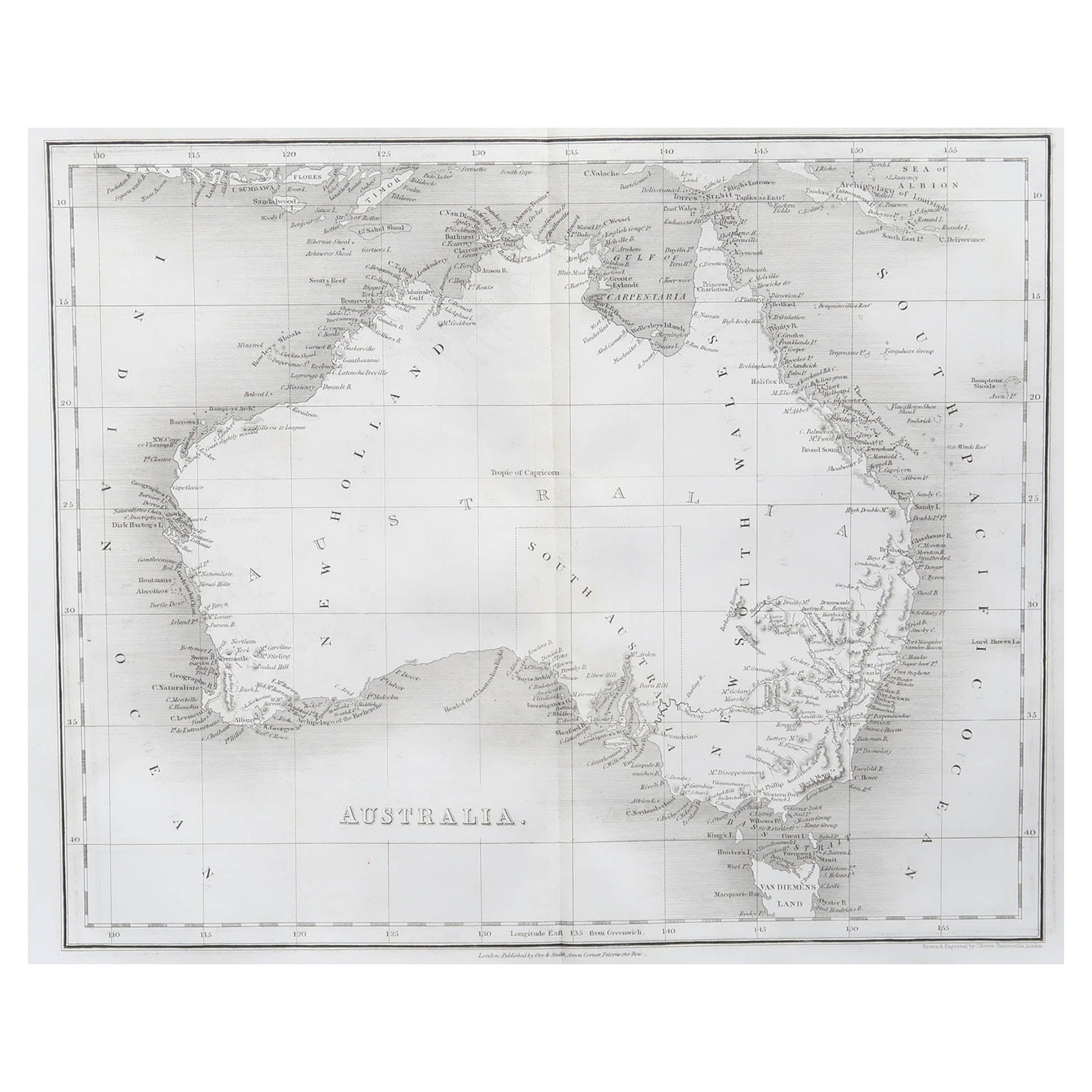
Australia, Tallis antique map, 1851
Located in Melbourne, Victoria
'Australia'
With decorative border surrounds and vignettes including a view of Sydney, Kangaroos, Natives of Australia Felix, Australian Parrots and Cockatoos and Natives of the Tri...
Category
19th Century Naturalistic Landscape Prints
Materials
Engraving

Original Antique Map of Australia by Dower, circa 1835
Located in St Annes, Lancashire
Nice map of Australia
Drawn and engraved by J.Dower
Published by Orr & Smith. C.1835
Unframed.
Free shipping
Category
Antique 1830s English Maps
Materials
Paper

Large Original Antique Map of Australia by Sidney Hall, 1847
Located in St Annes, Lancashire
Great map of Australia
Drawn and engraved by Sidney Hall
Steel engraving
Original colour outline
Published by A & C Black. 1847
Unframed
Free shipping.
Category
Antique 1840s Scottish Maps
Materials
Paper

Original Antique Map of Tasmania, Australia by Dower, circa 1835
Located in St Annes, Lancashire
Nice map of Tasmania
Drawn and engraved by J.Dower
Published by Orr & Smith. C.1835
Unframed.
Free shipping
Category
Antique 1830s English Maps
Materials
Paper

New South Wales, Australia, antique mid 19th century engraved John Tallis map
Located in Melbourne, Victoria
'New South Wales'
With decorative border surrounds and vignettes of 'Sydney Cove'. 'The Murray' and 'Xanthorrhea'.
'Drawn and engraved by J Rapkin'. Published by John Tallis.
375m...
Category
1840s Victorian Landscape Prints
Materials
Engraving

1851 Map of "Independent Tartary", Ric. R018
Located in Norton, MA
1851 Map of
Independent Tartary
"Russia"
Ric.r018
A highly decorative 1851 map of Independent Tartary by John Tallis and John Rapkin. Covers the regions between the Caspian Sea and Lake Bakquash and between Russia and Afghanistan. These include the ancient Silk Route kingdoms of Khiva, Tartaria, Kokand, and Bokhara. Today this region roughly includes Kazakhstan, Uzbekistan, Turkmenistan, Kyrgyzstan, and Tajikistan. This wonderful map offers a wealth of detail for anyone with an interest in the Central Asian portion of the ancient Silk Road. Identifies various caravan routes, deserts, wells, and stopping points, including the cities of Bokhara and Samarkand. Three vignettes by W. Bragg decorate the map, these including an image of Tartars on a Journey, a horseback Bride Chase, and a tartar camp site. Surrounded by a vine motif border. Engraved by J. Rapkin for John Tallis's 1851 Illustrated Atlas .
Tartary Antique Map...
Category
Antique 19th Century Unknown Maps
Materials
Paper

More Ways To Browse
Used Office Furniture Sydney
Parrots Engraving
Antique Kangaroo
Kangaroo Table
20th Century Spanish Table
Antonio Bellini
Antique Oushak Carpets
Blue Coffee Tables
German Bauhaus Posters
1945 Chair Juhl
Antique Three Leg Table
Folke Arstrom
Silver Over Copper
Vintage Barware Glasses
Antique Etched Glass
Antique French Shell
Coffee Table Black Italian Modern
Christofle America