
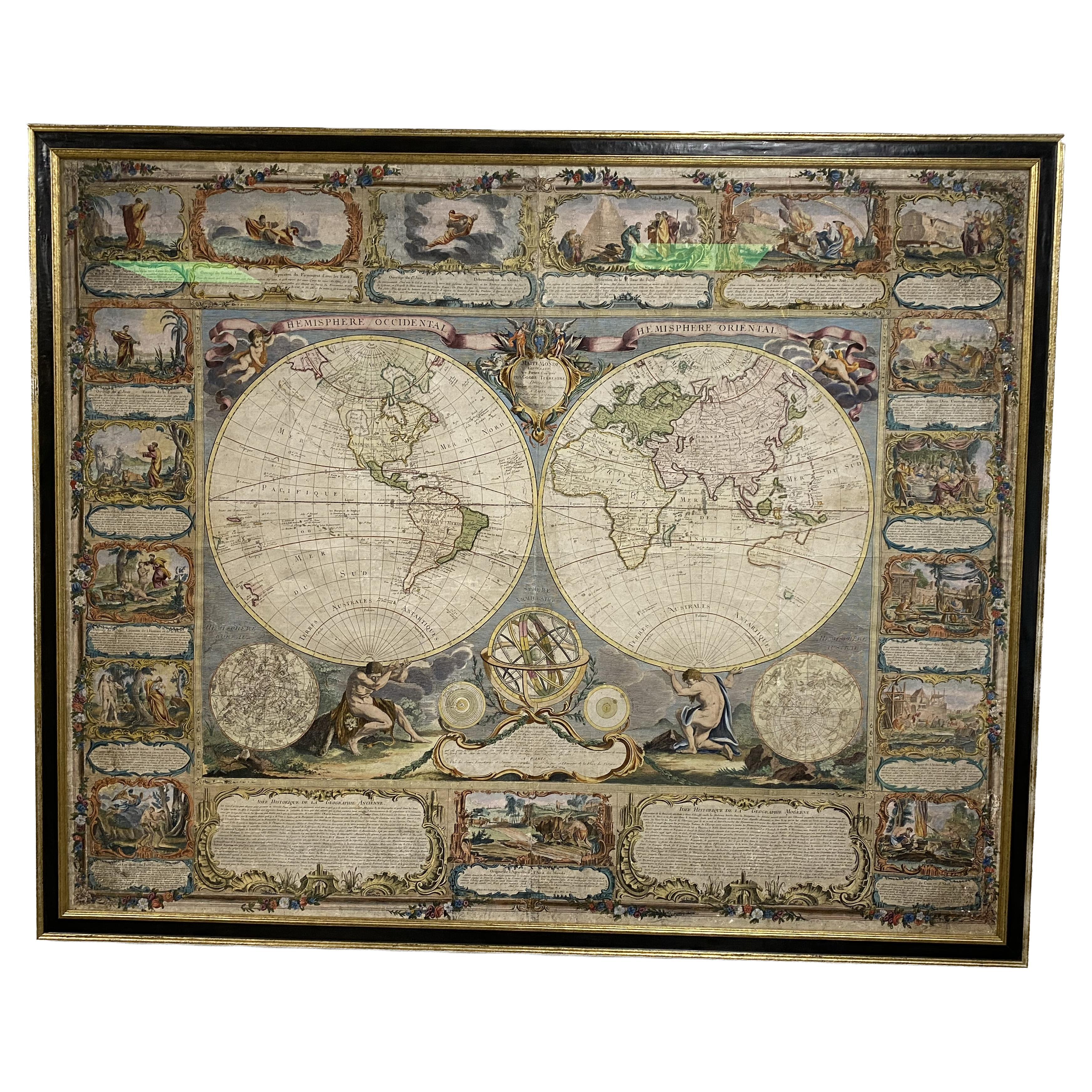
Hand-Colored Map of the World from 1794
View Similar Items


1 of 9
Hand-Colored Map of the World from 1794
$6,800List Price
About the Item
- Creator:Laurie & Whittle (Maker)
- Dimensions:Height: 31 in (78.74 cm)Width: 38 in (96.52 cm)Depth: 0.02 in (0.51 mm)
- Materials and Techniques:
- Place of Origin:
- Period:1790-1799
- Date of Manufacture:1794
- Condition:Wear consistent with age and use. has light original creases.
- Seller Location:New York, NY
- Reference Number:Seller: 1201621stDibs: LU138222571672
Authenticity Guarantee
In the unlikely event there’s an issue with an item’s authenticity, contact us within 1 year for a full refund. DetailsMoney-Back Guarantee
If your item is not as described, is damaged in transit, or does not arrive, contact us within 7 days for a full refund. Details24-Hour Cancellation
You have a 24-hour grace period in which to reconsider your purchase, with no questions asked.Vetted Professional Sellers
Our world-class sellers must adhere to strict standards for service and quality, maintaining the integrity of our listings.Price-Match Guarantee
If you find that a seller listed the same item for a lower price elsewhere, we’ll match it.Trusted Global Delivery
Our best-in-class carrier network provides specialized shipping options worldwide, including custom delivery.You May Also Like
Colored wall map of the WORLD
By Chambon
Located in ZWIJNDRECHT, NL
“Mappe Monde, contenant les Parties Connues du Globe Terrestre”
CHAMBON, Gobert-Denis (France, 17.. - 1781)
Paris, Longchamps et Janvier, 1754
Size H. 115 x W. 145 cm.
Gobert-Denis Chambon made copper engraving after the work of Guillaume De L’Isle, published in 1754 by Jean Janvier and S.G. Longschamps.
A huge wall map of the world in two hemispheres printed on two sheets, depicting the Eastern and Western hemispheres supported by two male figures, decorated at the bottom right and left with two celestial hemispheres (boreal and southern) and at the bottom in the middle with an armillary sphere, in addition.
This map is most notable for its depiction of the Sea of Japan labeled "Mer de Corée" and of "Mer de L'Ouest" or Sea of the West - a great sea, easily the size of the Mediterranean, to flow from the then-known Strait of Juan de Fuca...
Category
Antique Mid-18th Century French French Provincial Maps
Materials
Wood, Paper

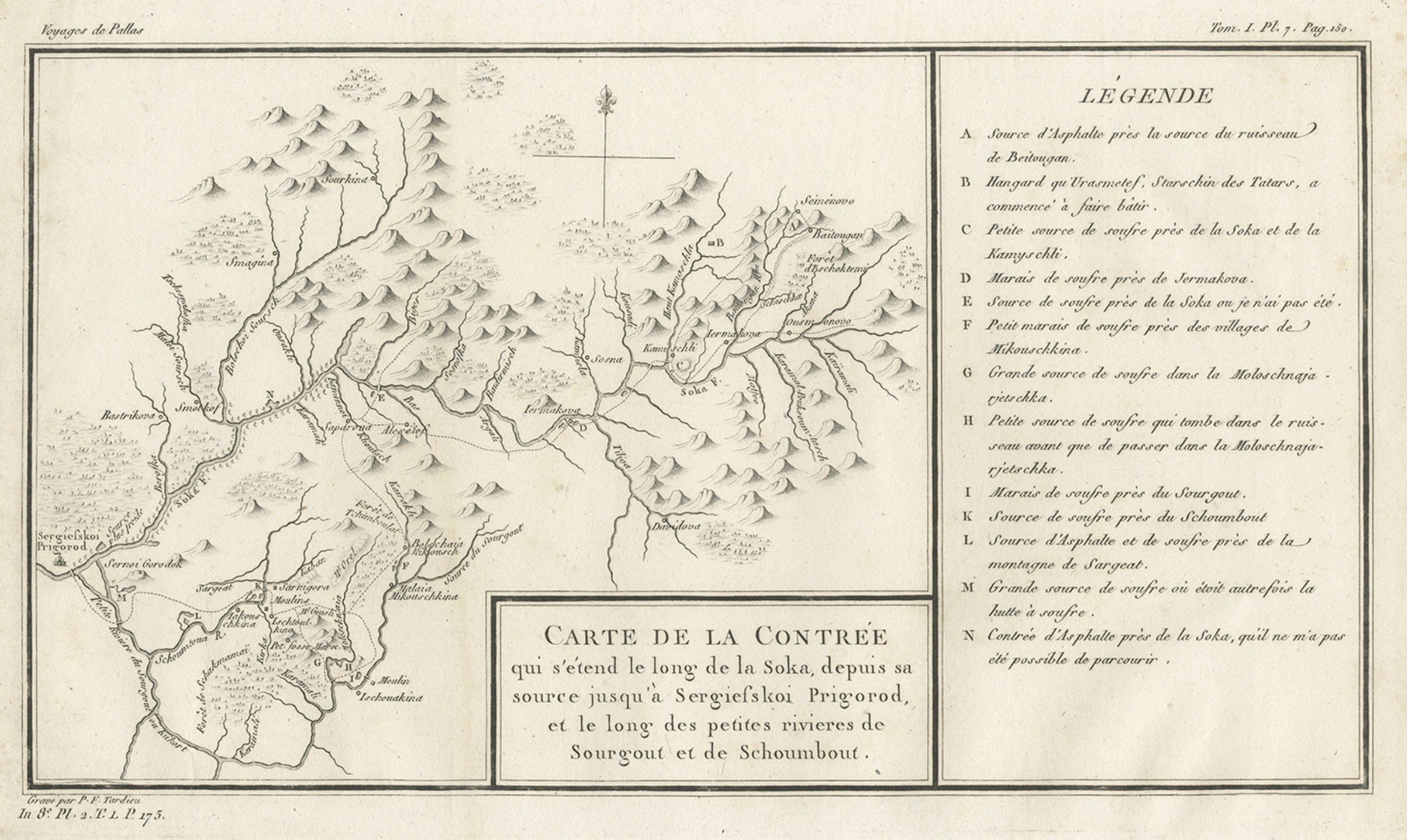
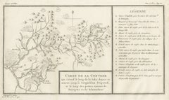
Antique Map of the Region of the Sok River in Russia, 1794
Located in Langweer, NL
Antique map titled 'Carte de la Contrée qui s’étend le long de la Soka, depuis sa source jusquá Sergiefskoi Prigorod et le long des petites rivieres de Sourgout et de Schoumbout’.
...
Category
Antique 18th Century Maps
Materials
Paper
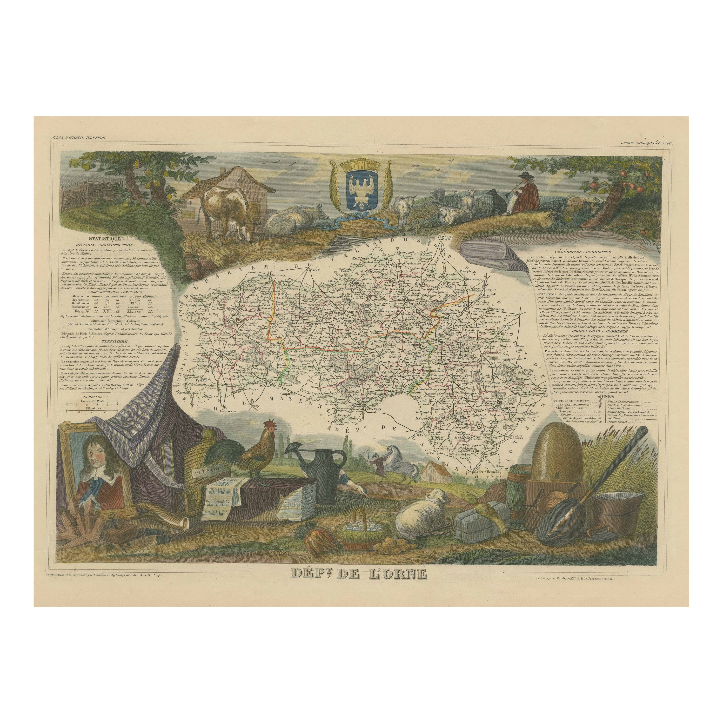
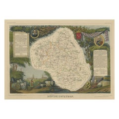
Hand Colored Antique Map of the Department of Orne, France
By Victor Levasseur
Located in Langweer, NL
Antique map titled 'Dépt. de l'Orne'. Map of the French department of Orne, France. This area, part of Normandy, includes the village of Camembert, where the famous Camembert cheese ...
Category
Antique Mid-19th Century Maps
Materials
Paper

$325 Sale Price
20% Off
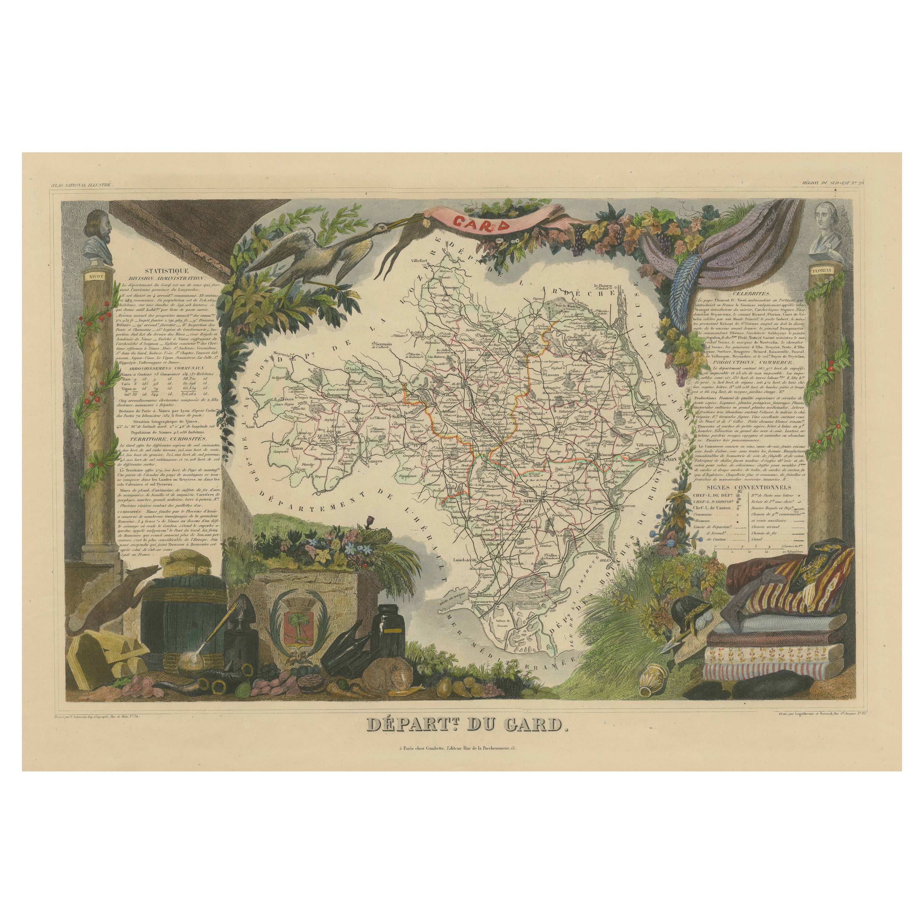
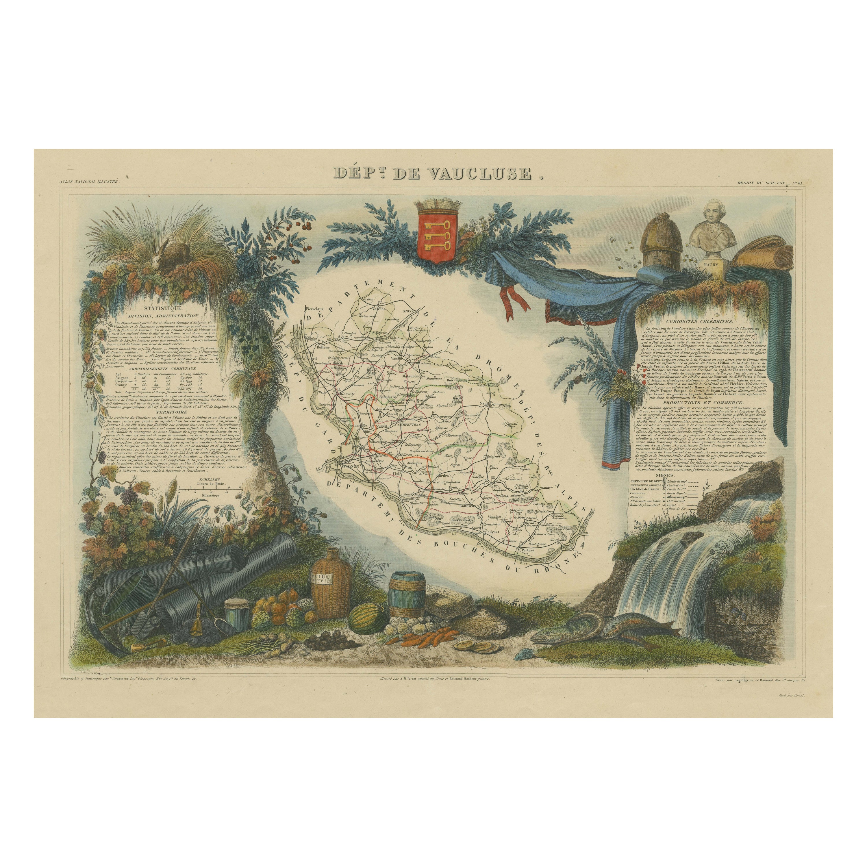
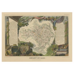
Hand Colored Antique Map of the Department of Gard, France
By Victor Levasseur
Located in Langweer, NL
Antique map titled 'Départ. Du Gard'. Map of the French department of Gard, France. This area of France is known mainly for its red wine and production of Bleu des Causses, a soft an...
Category
Antique Mid-19th Century Maps
Materials
Paper
$325 Sale Price
20% Off
Hand Colored Antique Map of the department of Aveyron, France
By Victor Levasseur
Located in Langweer, NL
Antique map titled 'Dépt. de l'Aveyron'. Map of the French department of Aveyron, France. This area of France, centered on Rodez, is famous for its production of Roquefort, a flavorful ewe's milk blue...
Category
Antique Mid-19th Century Maps
Materials
Paper
$325 Sale Price
20% Off
Hand Colored Antique Map of the department of Somme, France
By Victor Levasseur
Located in Langweer, NL
Antique map titled 'Dépt de la Somme'. Map of the French department of Somme, France. This area is home to the region of Picardy, which produces Maroilles, a popular French cheese. T...
Category
Antique Mid-19th Century Maps
Materials
Paper
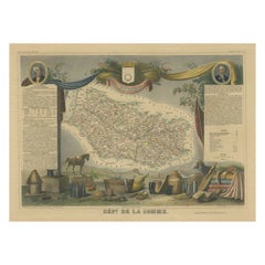
$325 Sale Price
20% Off