Items Similar to The Highlands and Lowlands of Scotland as Mapped in 1882

Want more images or videos?
Request additional images or videos from the seller
1 of 6
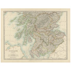
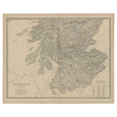
The Highlands and Lowlands of Scotland as Mapped in 1882
$425.32per set
£318.81per set
€360per set
CA$584.32per set
A$652.34per set
CHF 341.82per set
MX$7,985.28per set
NOK 4,341.07per set
SEK 4,093.08per set
DKK 2,740.45per set
About the Item
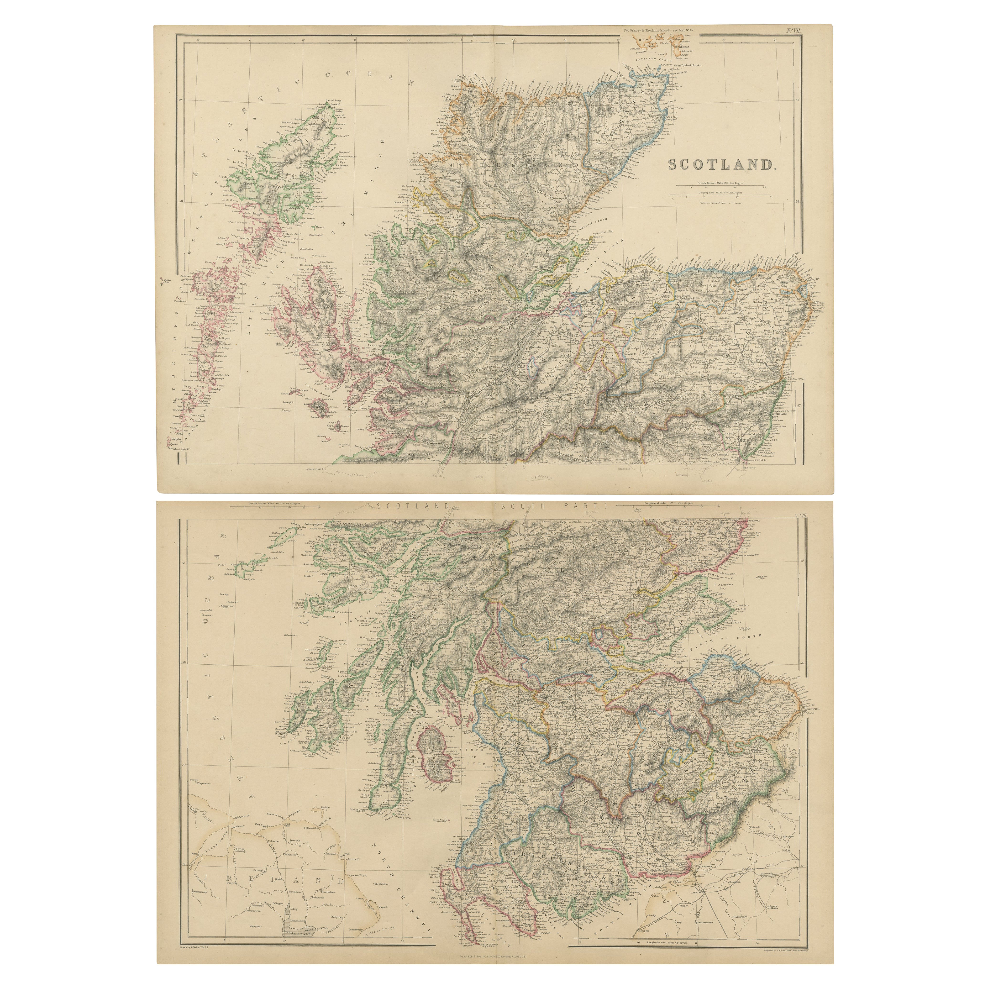
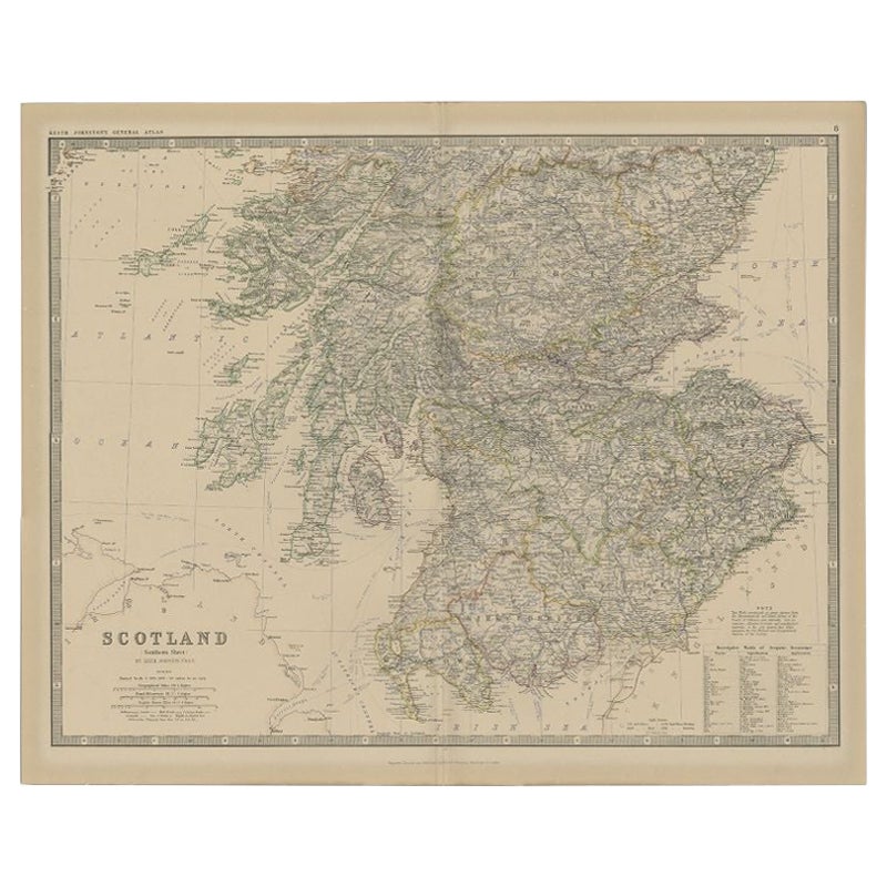
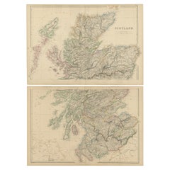
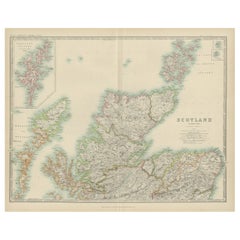
Title: 1882 Blackie Atlas Maps of Scotland: Northern and Southern Regions
Description: These two maps from the 1882 Blackie Atlas provide a detailed representation of Scotland, split into the northern and southern regions. They offer a comprehensive view of the country's geography, topography, and major settlements during the late 19th century. The maps include the rugged Highlands, the Inner and Outer Hebrides, and the Lowlands, capturing Scotland’s diverse landscapes.
The northern map focuses on the Highlands and Islands, showcasing the intricate coastline and numerous islands such as the Orkneys and Shetlands. Major features include mountain ranges, rivers, and small towns scattered across the sparsely populated region.
The southern map highlights the Lowlands, including major cities like Edinburgh and Glasgow. It also covers the borders with England and the fertile agricultural regions. The Firths of Clyde and Forth are prominent, along with other key waterways.
Both maps include clear labels of towns, rivers, mountain ranges, and political boundaries, offering a snapshot of Scotland’s historical geography.
Condition Report: The maps are in good condition for their age, with minor discoloration typical of 19th-century paper. The edges show slight wear, and there are faint fold lines, as expected from atlas use. The printed details remain sharp, and the coloring, used to distinguish regions and boundaries, is vibrant and intact.
Tips on How to Frame These Maps:
1. Choose classic wooden or metal frames with a neutral or antique finish to complement the vintage nature of the maps. Dark wood tones such as walnut or mahogany pair well with the historical theme.
2. Use acid-free matting to protect the paper from aging and ensure the maps are preserved long-term.
3. Opt for UV-protective glass to prevent fading from light exposure.
4. For a professional and polished look, float mount the maps to showcase their edges, or use a wide mat border for a clean presentation.
5. When displaying the maps together, align them vertically to maintain their regional continuity.
Recommended Matting Color:
Use neutral or earth-toned matting, such as cream, beige, or light gray, to complement the maps’ natural aged tones. A subtle green mat can also work well, reflecting the natural landscape of Scotland. Avoid bright or bold colors that may distract from the intricate details of the maps.
- Dimensions:Height: 14.97 in (38 cm)Width: 11.03 in (28 cm)Depth: 0.01 in (0.2 mm)
- Sold As:Set of 2
- Materials and Techniques:
- Period:
- Date of Manufacture:1882
- Condition:Good condition for their age. The paper has aged to a warm, creamy tone typical of late 19th-century publications. Edges show minor wear, consistent with use and age and printed text and lines remain crisp and clear. Folding lines as issued.
- Seller Location:Langweer, NL
- Reference Number:Seller: BG-13601-2-17, -181stDibs: LU3054343551742
About the Seller
5.0
Recognized Seller
These prestigious sellers are industry leaders and represent the highest echelon for item quality and design.
Platinum Seller
Premium sellers with a 4.7+ rating and 24-hour response times
Established in 2009
1stDibs seller since 2017
2,513 sales on 1stDibs
Typical response time: <1 hour
- ShippingRetrieving quote...Shipping from: Langweer, Netherlands
- Return Policy
Authenticity Guarantee
In the unlikely event there’s an issue with an item’s authenticity, contact us within 1 year for a full refund. DetailsMoney-Back Guarantee
If your item is not as described, is damaged in transit, or does not arrive, contact us within 7 days for a full refund. Details24-Hour Cancellation
You have a 24-hour grace period in which to reconsider your purchase, with no questions asked.Vetted Professional Sellers
Our world-class sellers must adhere to strict standards for service and quality, maintaining the integrity of our listings.Price-Match Guarantee
If you find that a seller listed the same item for a lower price elsewhere, we’ll match it.Trusted Global Delivery
Our best-in-class carrier network provides specialized shipping options worldwide, including custom delivery.More From This Seller
View AllSet of 2 Antique Maps of Scotland by W. G. Blackie, 1859
Located in Langweer, NL
Antique map titled 'Scotland'. Original antique map of Scotland. This map originates from ‘The Imperial Atlas of Modern Geography’. Published by W. G. Blackie, 1859.
Category
Antique Mid-19th Century Maps
Materials
Paper
$307 Sale Price / set
35% Off
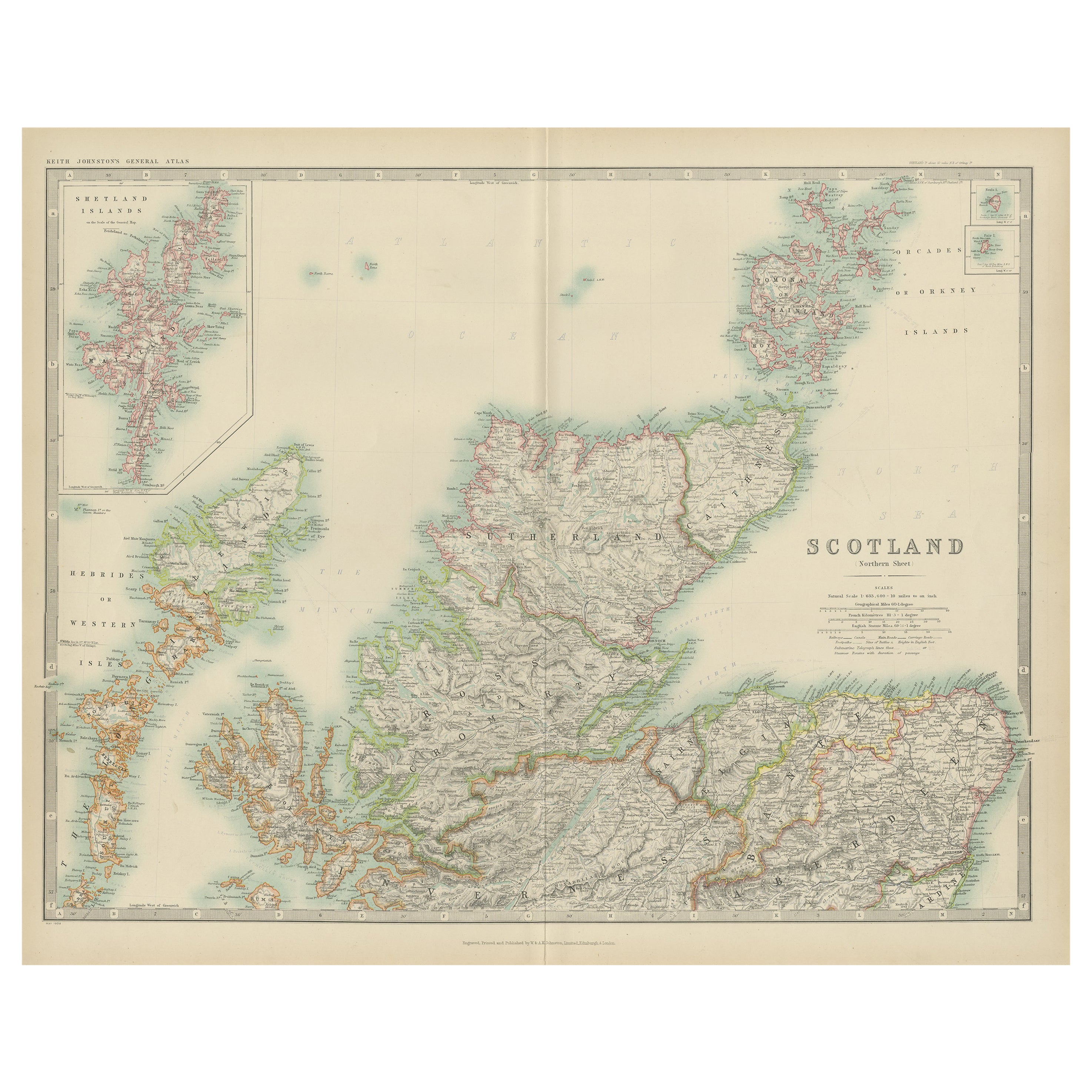
Antique Map of Scotland 'Northern' by Johnston, '1909'
Located in Langweer, NL
Antique map titled 'Scotland'. Original antique map of Scotland. With inset map of the Shetland Islands. This map originates from the ‘Royal Atlas of M...
Category
Early 20th Century Maps
Materials
Paper
$236 Sale Price
20% Off
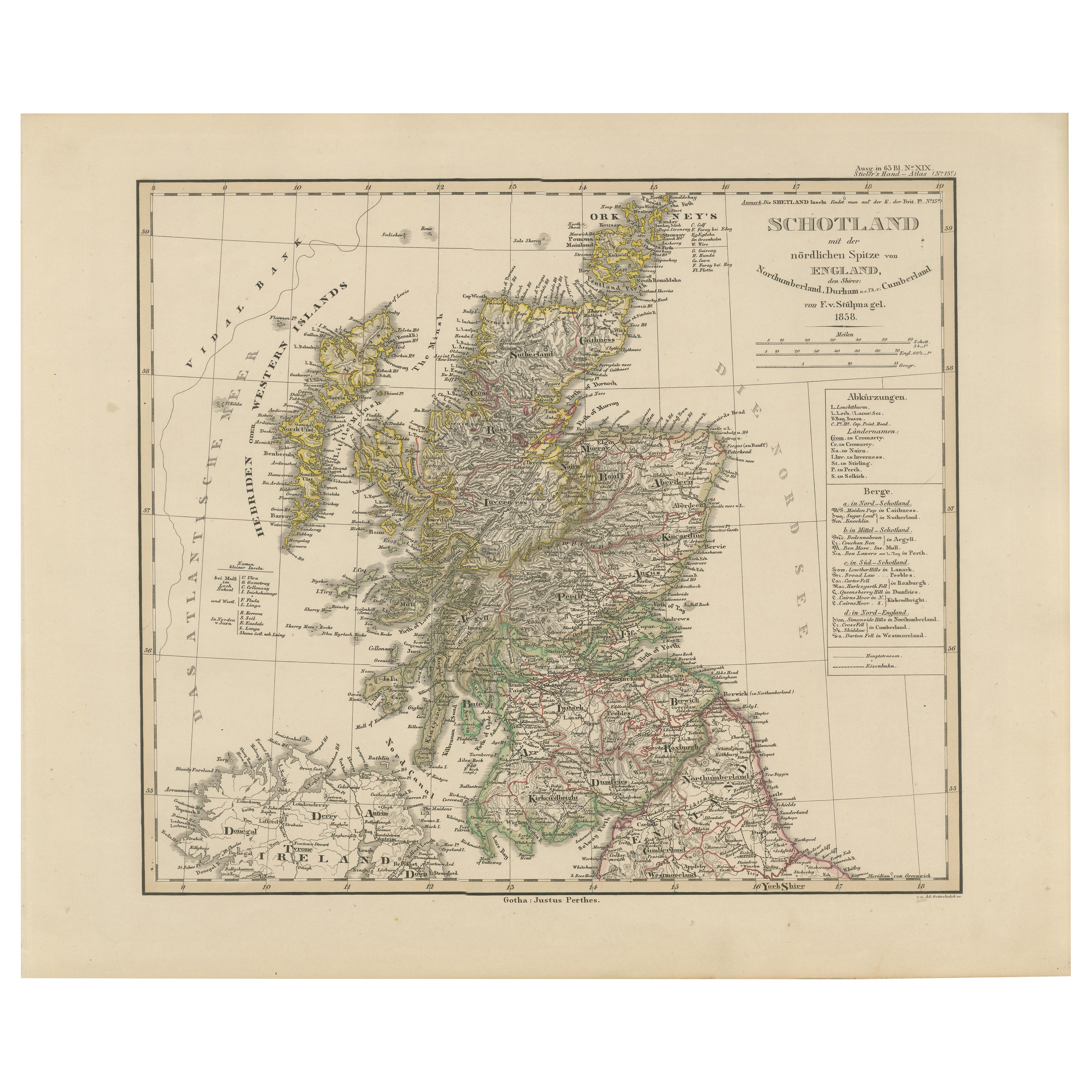
Scotland Map – Highlands, Islands, and Northern England 1858
Located in Langweer, NL
Scotland Map – Highlands, Islands, and Northern England 1858
This attractive antique print shows Scotland and its surroundings titled “Schotland mit der nördlichen Spitze von Englan...
Category
Antique Mid-19th Century German Maps
Materials
Paper
Antique Map of Southern Scotland, 1903, with Coastal and Inland Details
Located in Langweer, NL
Title: Antique Map of Southern Scotland, 1903, with Coastal and Inland Details
Description:
This exquisite antique map, titled "Scotland (Southern Sheet I)," was engraved and publis...
Category
Early 20th Century Maps
Materials
Paper
Antique Map of the Northern Part of Scotland by Black '1854'
Located in Langweer, NL
Antique map titled 'Scotland'. Original map of the northern part of Scotland. With an inset map of the Orkney Isles. This map originates from 'General Atlas Of The World: Containing ...
Category
Antique Mid-19th Century Maps
Materials
Paper

$189 Sale Price
20% Off
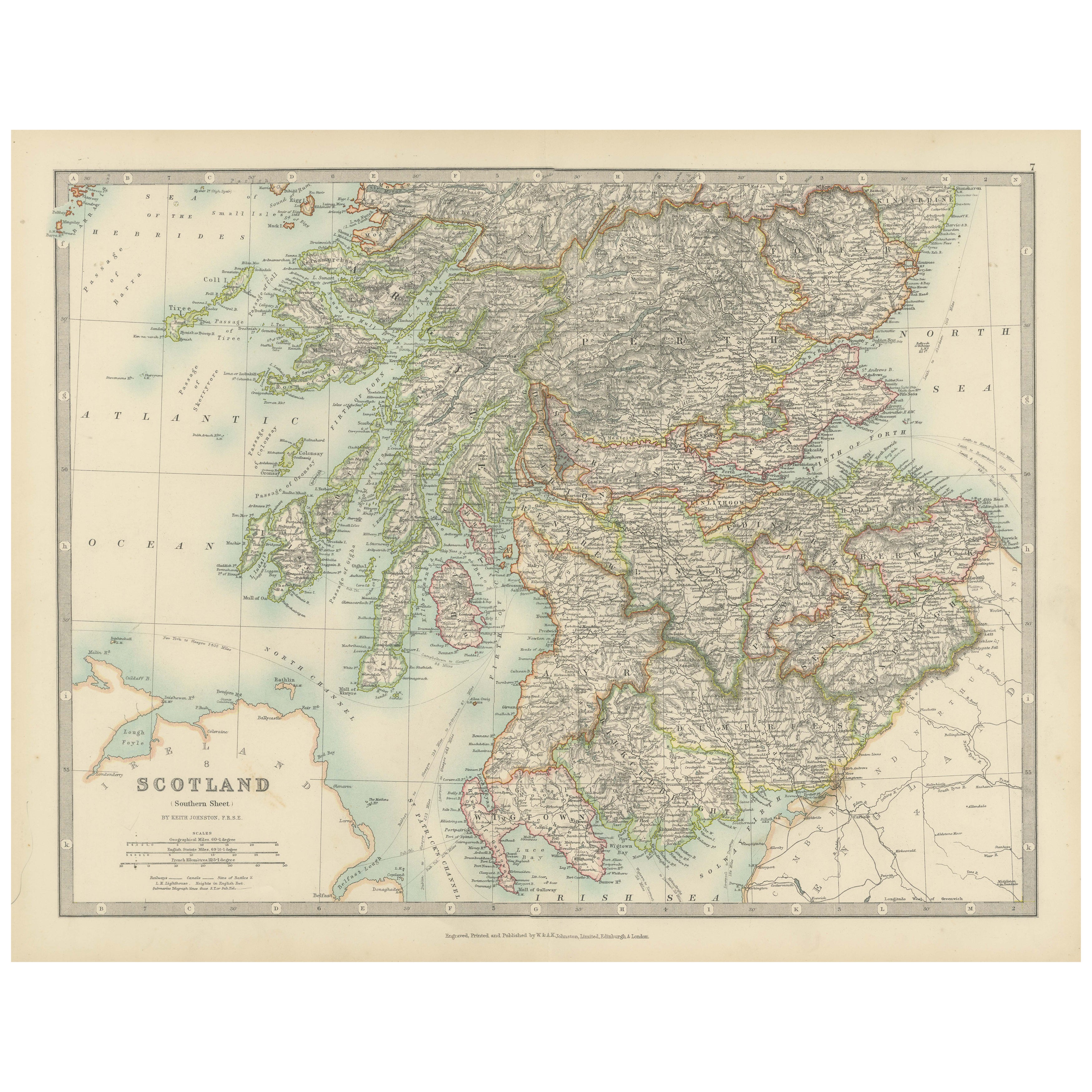
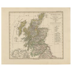
Antique Map of Southern Scotland by Johnston, 1882
Located in Langweer, NL
"Antique map titled 'Scotland'. Old map of Southern Scotland. This map originates from 'The Royal Atlas of Modern Geography, Exhibiting, in a Series of Entirely Original and Authenti...
Category
Antique 19th Century Maps
Materials
Paper
$127 Sale Price
20% Off
You May Also Like
Original Antique Map of Scotland by Dower, circa 1835
Located in St Annes, Lancashire
Nice map of Scotland
Drawn and engraved by J.Dower
Published by Orr & Smith. C.1835
Unframed.
Free shipping
Category
Antique 1830s English Maps
Materials
Paper

England, Scotland & Ireland: A Hand Colored Map of Great Britain by Tirion
By Isaak Tirion
Located in Alamo, CA
This is a hand-colored double page copperplate map of Great Britain entitled "Nieuwe Kaart van de Eilanden van Groot Brittannien Behelzende de Kon...
Category
Antique Mid-18th Century Dutch Maps
Materials
Paper

Map Huntingdonshire R Scott Archibald Fullarton & Co Glasgow
Located in BUNGAY, SUFFOLK
Folding Map of Huntingdonshire by R Scott with distances from London and reference to the hundreds.
Published by Archibald Fullarton & Co Glasgow. Measure: 40...
Category
Antique 19th Century English Victorian Maps
Materials
Paper

Large Original Vintage Map of the United Kingdom, circa 1920
Located in St Annes, Lancashire
Great map of The United Kingdom
Unframed
Original color
By John Bartholomew and Co. Edinburgh Geographical Institute
Published, circa 1920
Free shipping.
Category
Vintage 1920s British Maps
Materials
Paper

Original Antique English County Map, Herefordshire, J & C Walker, 1851
Located in St Annes, Lancashire
Great map of Herefordshire
Original colour
By J & C Walker
Published by Longman, Rees, Orme, Brown & Co. 1851
Unframed.
Category
Antique 1850s English Other Maps
Materials
Paper

England and Wales, Northern Part. Century Atlas antique vintage map
Located in Melbourne, Victoria
'The Century Atlas. England and Wales, Northern Part'
Original antique map, 1903.
Central fold as issued. Map name and number printed on the reverse corners.
Sheet 29.5cm by 40cm.
Category
Early 20th Century Victorian More Prints
Materials
Lithograph

More Ways To Browse
Scottish Walnut
Post Modern High Chairs
Vintage Vine Rug
Silver Metal Chair
Swedish Kilim
Vintage Scandanavian Chairs
Vintage Tropical Furniture
19th Century Red Glass
Antique French Console Table Tables
French 50s
Rusted Metal Art
Silver Bowl Large
Antique French Silk
Down Couch
Cobalt Blue Glass
Used Lighter Art
Blue Edge Glass
Mahogany 1950s Furniture