Items Similar to Historic 1864 Civil War Map of Pennsylvania and New Jersey with Coastal Focus
Want more images or videos?
Request additional images or videos from the seller
1 of 10
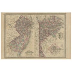
Historic 1864 Civil War Map of Pennsylvania and New Jersey with Coastal Focus
$401.60
£301.74
€340
CA$553.01
A$618.92
CHF 323.98
MX$7,518.70
NOK 4,113.73
SEK 3,882
DKK 2,587.74
About the Item
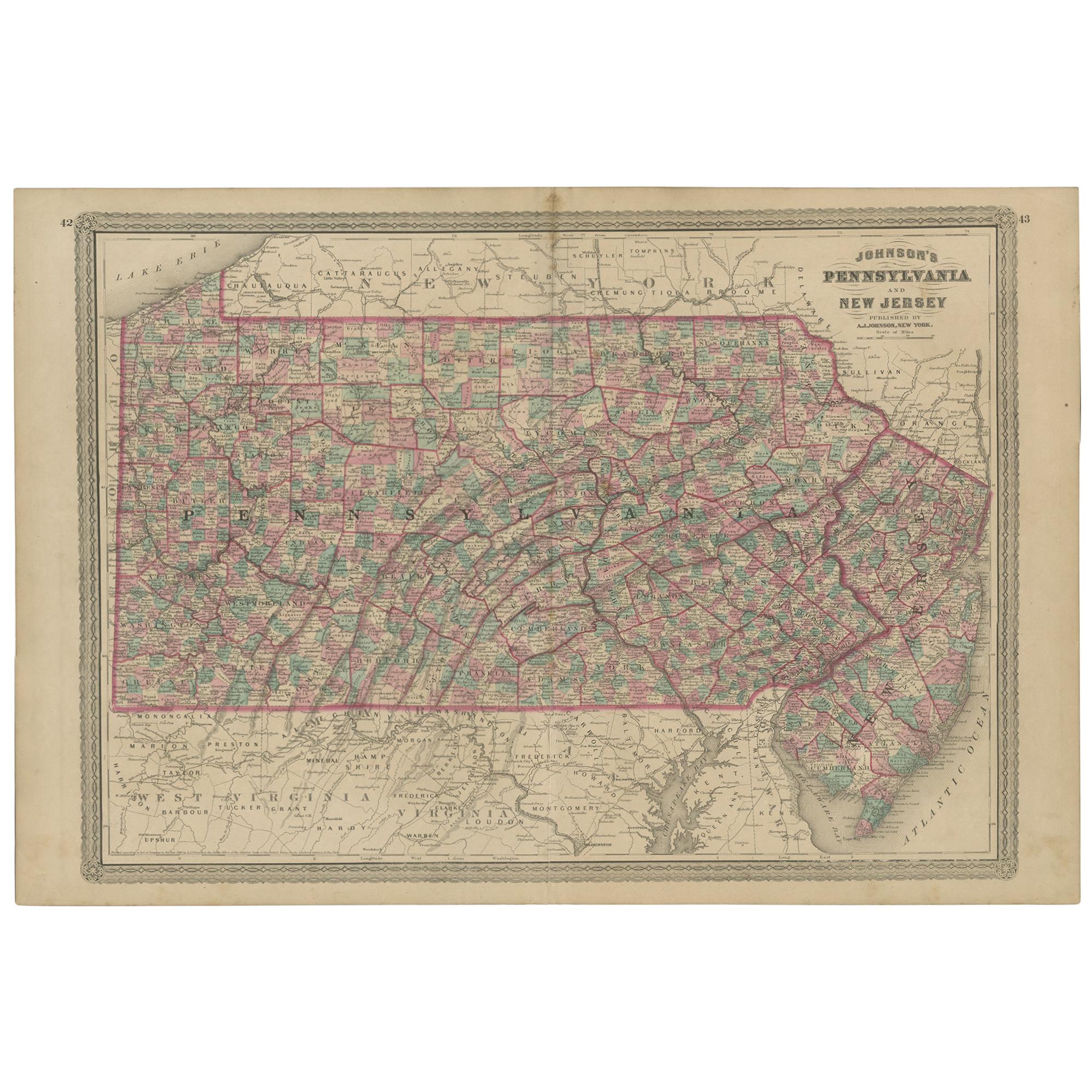
Title: Historic 1864 Civil War Map of Pennsylvania and New Jersey with Coastal Focus
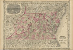
Description: This meticulously crafted antique map, titled "Johnson's Pennsylvania and New Jersey," was published in 1864 by Johnson and Ward, a renowned American mapmaking firm celebrated for their detailed and visually appealing atlases during the mid-19th century.
The map intricately illustrates the states of Pennsylvania and New Jersey, showcasing counties, towns, railroads, and geographical features of the period. Each county is outlined in a vibrant pink, with a soft green wash filling the background, creating a striking contrast that highlights the region’s topography. A decorative border frames the map, adding to its antique charm, while the map prominently features the Atlantic Ocean coastline along New Jersey, with fine engravings of Cape May and the Delaware Bay.
The map was produced using the steel engraving technique, known for its precision and ability to render fine lines and intricate details, as evident in the crisp text and delicate linework.
What makes this map particularly fascinating is its historical context—created during the Civil War, it captures Pennsylvania and New Jersey at a critical time, reflecting their roles as key Union states with major cities like Philadelphia and Trenton, both vital to the war effort. The map also highlights the Allegheny Mountains in Pennsylvania and the early infrastructure like railroads, offering a glimpse into the region’s economic and industrial significance.
Collectors and historians will treasure this map for its ability to transport viewers to a pivotal moment in American history, blending functional cartography with artistic elegance, making it an exceptional piece for any collection of antique maps or Northeast memorabilia.
Condition Report: The map is in good condition for its age, with light toning and minor foxing along the edges. Small tears are present at the fold lines, but there are no significant losses. The colors remain vivid, and the paper is intact with slight wear.
Framing Tips: Use an acid-free mat to prevent discoloration and UV-protective glass to shield from light damage. A classic wooden frame with a gold accent enhances the map’s vintage charm. Avoid tight pressing to reduce stress on the folds.
Matting Board Color Recommendation
The map features a color palette consistent with the previous maps in the series, with pink county outlines, green background shading, and black engravings on a cream-colored paper. The decorative border adds an ornate touch, and the overall aesthetic is delicate and antique.
A soft ivory or off-white matting board is recommended, as it complements the aged cream tone of the map’s paper, creating a cohesive and elegant look. This neutral color allows the pink and green hues to stand out without distraction, maintaining a classic, museum-quality presentation that appeals to collectors. It also enhances the map’s historical charm by blending seamlessly with its vintage appearance.
For a subtle contrast, a pale sage green could also work, picking up on the green shading in the map while keeping the focus on its details. Avoid bold or dark colors like red or navy, as they could overpower the map’s delicate tones and detract from its antique appeal. Ensure the matting board is acid-free to protect the map from long-term damage. A double mat with a slightly darker shade (like a light beige) for the inner layer can add depth while keeping the presentation refined.
- Dimensions:Height: 18 in (45.7 cm)Width: 26.38 in (67 cm)Depth: 0.01 in (0.2 mm)
- Materials and Techniques:
- Period:
- Date of Manufacture:1864
- Condition:The map is in good condition for its age, with light toning and minor foxing along the edges. Small tears are present at the fold lines, but there are no significant losses. The colors remain vivid, and the paper is intact with slight wear.
- Seller Location:Langweer, NL
- Reference Number:Seller: BG-13952-241stDibs: LU3054345077242
About the Seller
5.0
Recognized Seller
These prestigious sellers are industry leaders and represent the highest echelon for item quality and design.
Platinum Seller
Premium sellers with a 4.7+ rating and 24-hour response times
Established in 2009
1stDibs seller since 2017
2,534 sales on 1stDibs
Typical response time: <1 hour
- ShippingRetrieving quote...Shipping from: Langweer, Netherlands
- Return Policy
Authenticity Guarantee
In the unlikely event there’s an issue with an item’s authenticity, contact us within 1 year for a full refund. DetailsMoney-Back Guarantee
If your item is not as described, is damaged in transit, or does not arrive, contact us within 7 days for a full refund. Details24-Hour Cancellation
You have a 24-hour grace period in which to reconsider your purchase, with no questions asked.Vetted Professional Sellers
Our world-class sellers must adhere to strict standards for service and quality, maintaining the integrity of our listings.Price-Match Guarantee
If you find that a seller listed the same item for a lower price elsewhere, we’ll match it.Trusted Global Delivery
Our best-in-class carrier network provides specialized shipping options worldwide, including custom delivery.More From This Seller
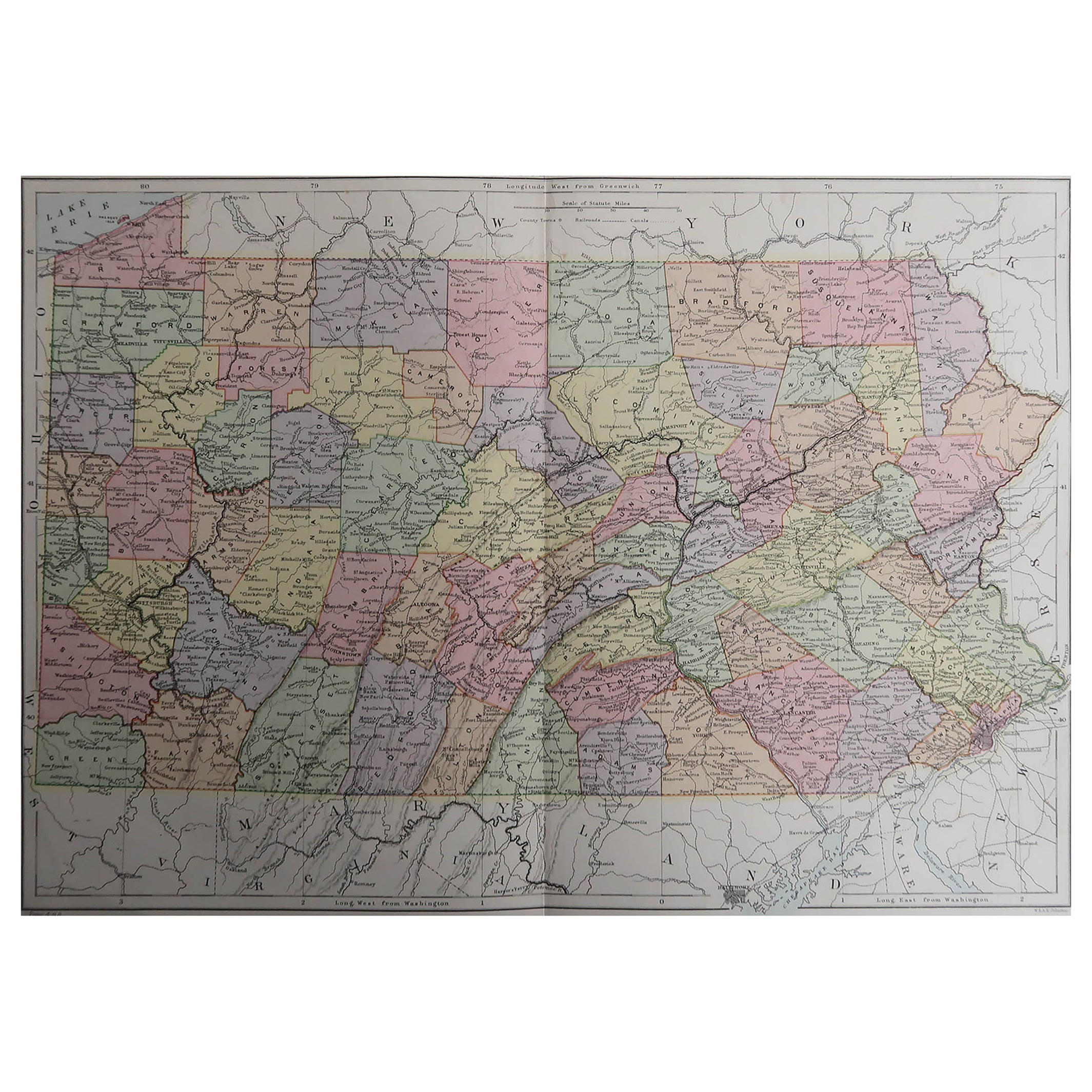
View AllAntique Map of Pennsylvania and New Jersey by Johnson, 1872
Located in Langweer, NL
Antique map titled 'Johnson's Pennsylvania and New Jersey'. Original map showing Pennsylvania and New Jersey. This map originates from 'Johnson's New Illustrated Family Atlas of the ...
Category
Antique Late 19th Century Maps
Materials
Paper

$236 Sale Price
20% Off
1864 Johnson's Map of Virginia, Delaware, and Maryland with Fort Monroe Inset
Located in Langweer, NL
Title: 1864 Johnson's Map of Virginia, Delaware, and Maryland with Fort Monroe Inset
Description: This 1864 map titled "Johnson's Virginia, Delaware, and ...
Category
Antique 1860s Maps
Materials
Paper
$283 Sale Price
20% Off
Antique Map of New Jersey
Located in Langweer, NL
Antique map titled 'Colton's New Jersey'. This rare hand colored map of New Jersey is a copper plate engraving dating to 1855. Produced by the import...
Category
Antique Mid-19th Century Maps
Materials
Paper

$188 Sale Price
20% Off
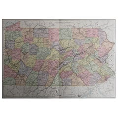
Original Antique Map of Pennsylvania Showing Interesting Statistics Etc, 1825
Located in Langweer, NL
Attractive map of Pennsylvania with bordercoloring of the county and showing the various towns, roads, rivers, bridges, and a host of other details...
Category
Antique 1820s Maps
Materials
Paper
$330 Sale Price
20% Off
Antique Map of New Jersey, Delaware and Maryland by Johnson, 1872
Located in Langweer, NL
Antique map titled 'Johnson's New Jersey (..). Two maps on one sheet showing New Jersey, Delaware and Maryland. With inset map of the district of Columbia...
Category
Antique Late 19th Century Maps
Materials
Paper
$283 Sale Price
20% Off
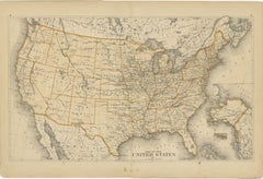
1874 Map of the United States with Territorial Boundaries
Located in Langweer, NL
Title: 1874 Map of the United States with Territorial Boundaries
Description: This is an 1874 map titled "Map of the United States," showcasing the country during a period of rapid ...
Category
Antique 1870s Maps
Materials
Paper
$245 Sale Price
20% Off
You May Also Like
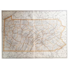
Original Antique Map of the American State of Pennsylvania, 1889
Located in St Annes, Lancashire
Great map of Pennsylvania
Drawn and Engraved by W. & A.K. Johnston
Published By A & C Black, Edinburgh.
Original colour
Unframed.
Repair to a minor tear on bottom edge.
Category
Antique 1880s Scottish Victorian Maps
Materials
Paper
Original Antique Map of the American State of Pennsylvania( Eastern Part ), 1903
Located in St Annes, Lancashire
Antique map of Pennsylvania ( Eastern part )
Published By A & C Black. 1903
Original colour
Good condition
Unframed.
Free shipping
Category
Antique Early 1900s English Maps
Materials
Paper

Large Original Antique Map of Pennsylvania, USA, 1894
By Rand McNally & Co.
Located in St Annes, Lancashire
Fabulous map of Pennsylvania
Original color.
By Rand, McNally & Co.
Published, 1894.
Unframed.
Free shipping.
Category
Antique 1890s American Maps
Materials
Paper
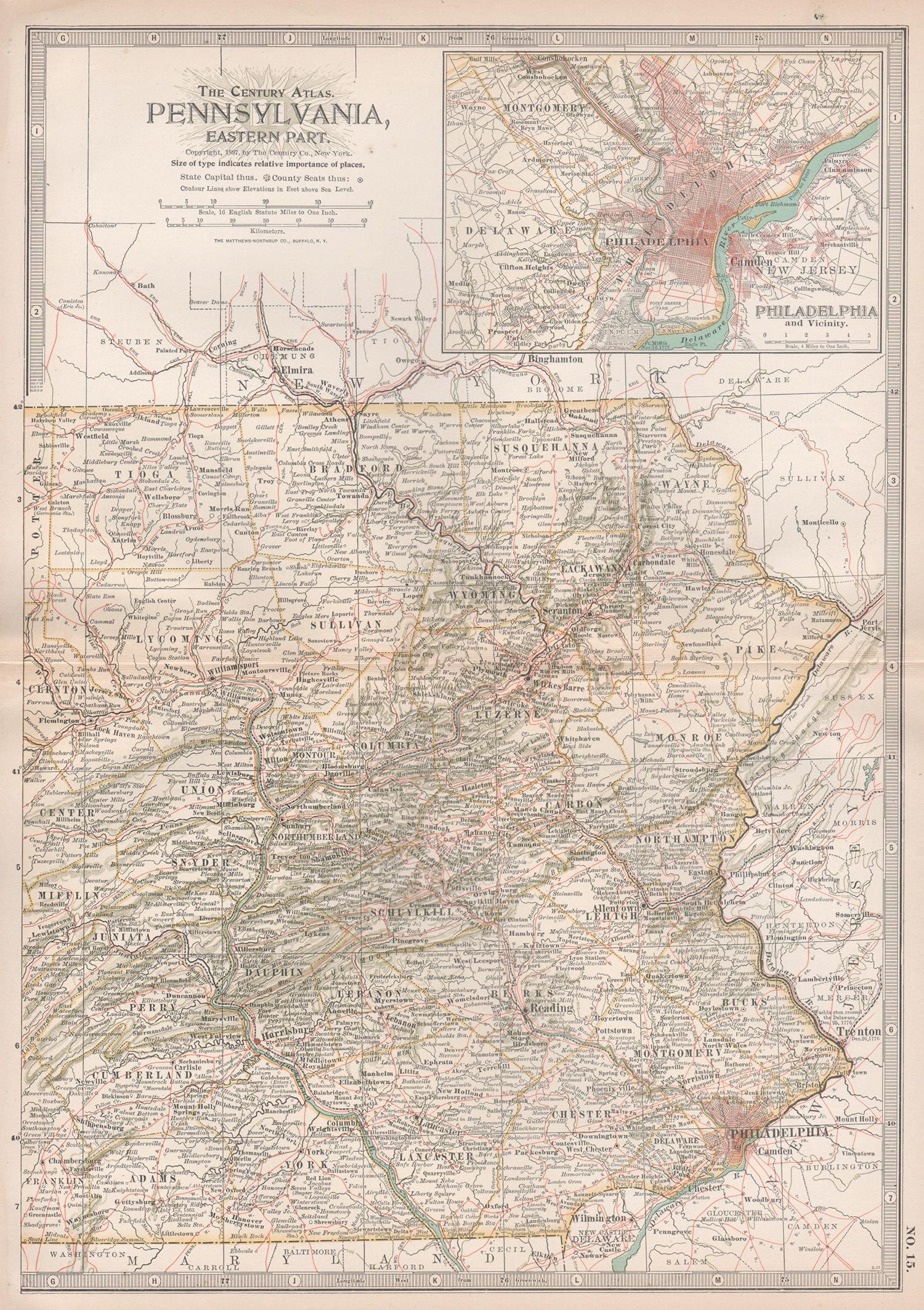
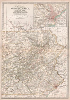
Pennsylvania, Eastern Part. USA. Century Atlas state antique vintage map
Located in Melbourne, Victoria
'The Century Atlas. Pennsylvania, Eastern Part.'
Original antique map, 1903.
Central fold as issued. Map name and number printed on the reverse corners.
Sheet 40cm by 29.5cm.
Category
Early 20th Century Victorian More Prints
Materials
Lithograph
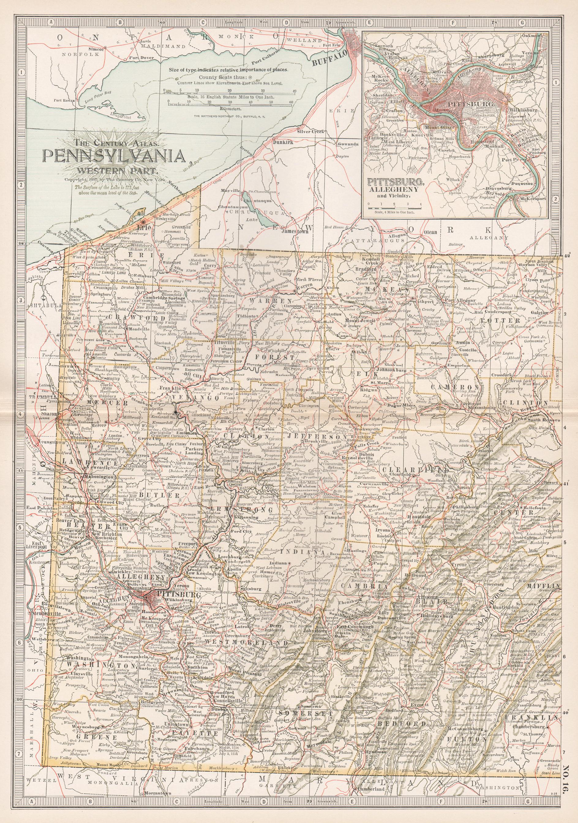
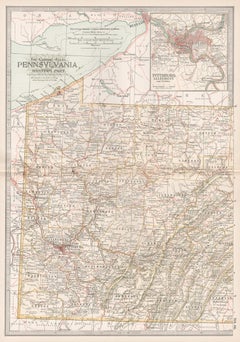
Pennsylvania, Western Part. USA Century Atlas state antique vintage map
Located in Melbourne, Victoria
'The Century Atlas. Pennsylvania, Western Part'
Original antique map, 1903.
Central fold as issued. Map name and number printed on the reverse corners.
Sheet 40cm by 29.5cm.
Category
Early 20th Century Victorian More Prints
Materials
Lithograph
Original Antique Map of the American State of Pennsylvania( Western Part ), 1903
Located in St Annes, Lancashire
Antique map of Pennsylvania ( Western part )
Published By A & C Black. 1903
Original colour
Good condition
Unframed.
Free shipping
Category
Antique Early 1900s English Maps
Materials
Paper

More Ways To Browse
Antique Ivory Collectables
Antique Delaware
New Jersey 19th Century
Antique Furniture Delaware
Pink Cape
Antique Navy Memorabilia
Silver Bowl Large
Down Couch
Used Lighter Art
Blue Edge Glass
Mahogany 1950s Furniture
Solid Mahogany Table
Dessert Glasses
Geometric Glass Table
Mid Century Pin
6x10 Rug
Studded Furniture
Styles Of Antique Desks