Items Similar to Large Antique Map of Gaul, or France in Ancient Roman Times, circa 1760
Want more images or videos?
Request additional images or videos from the seller
1 of 11
Large Antique Map of Gaul, or France in Ancient Roman Times, circa 1760
$437.92
$547.4120% Off
£331.74
£414.6720% Off
€376
€47020% Off
CA$606.68
CA$758.3620% Off
A$680.44
A$850.5520% Off
CHF 356.33
CHF 445.4220% Off
MX$8,267.98
MX$10,334.9720% Off
NOK 4,524.85
NOK 5,656.0620% Off
SEK 4,289.88
SEK 5,362.3520% Off
DKK 2,862.78
DKK 3,578.4720% Off
About the Item
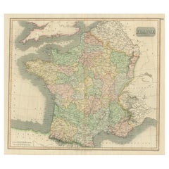
Original antique map titled 'Gallia Antiqua ex Aevi Romani Monumentis (..)'. Large map of Gaul, or France in ancient Roman times, showing Roman provinces. Inset bottom left a detailed map of Roman Provence. Published by D'Anville, circa 1760.
- Dimensions:Height: 22.37 in (56.8 cm)Width: 32.49 in (82.5 cm)Depth: 0.02 in (0.5 mm)
- Materials and Techniques:Paper,Engraved
- Place of Origin:
- Period:
- Date of Manufacture:circa 1760
- Condition:Wear consistent with age and use. General age-related toning. Original folding line. Shows some wear and staining, blank verso. Please study images carefully.
- Seller Location:Langweer, NL
- Reference Number:Seller: BG-12763-11stDibs: LU3054331150382
About the Seller
5.0
Recognized Seller
These prestigious sellers are industry leaders and represent the highest echelon for item quality and design.
Platinum Seller
Premium sellers with a 4.7+ rating and 24-hour response times
Established in 2009
1stDibs seller since 2017
2,517 sales on 1stDibs
Typical response time: <1 hour
- ShippingRetrieving quote...Shipping from: Langweer, Netherlands
- Return Policy
Authenticity Guarantee
In the unlikely event there’s an issue with an item’s authenticity, contact us within 1 year for a full refund. DetailsMoney-Back Guarantee
If your item is not as described, is damaged in transit, or does not arrive, contact us within 7 days for a full refund. Details24-Hour Cancellation
You have a 24-hour grace period in which to reconsider your purchase, with no questions asked.Vetted Professional Sellers
Our world-class sellers must adhere to strict standards for service and quality, maintaining the integrity of our listings.Price-Match Guarantee
If you find that a seller listed the same item for a lower price elsewhere, we’ll match it.Trusted Global Delivery
Our best-in-class carrier network provides specialized shipping options worldwide, including custom delivery.More From This Seller
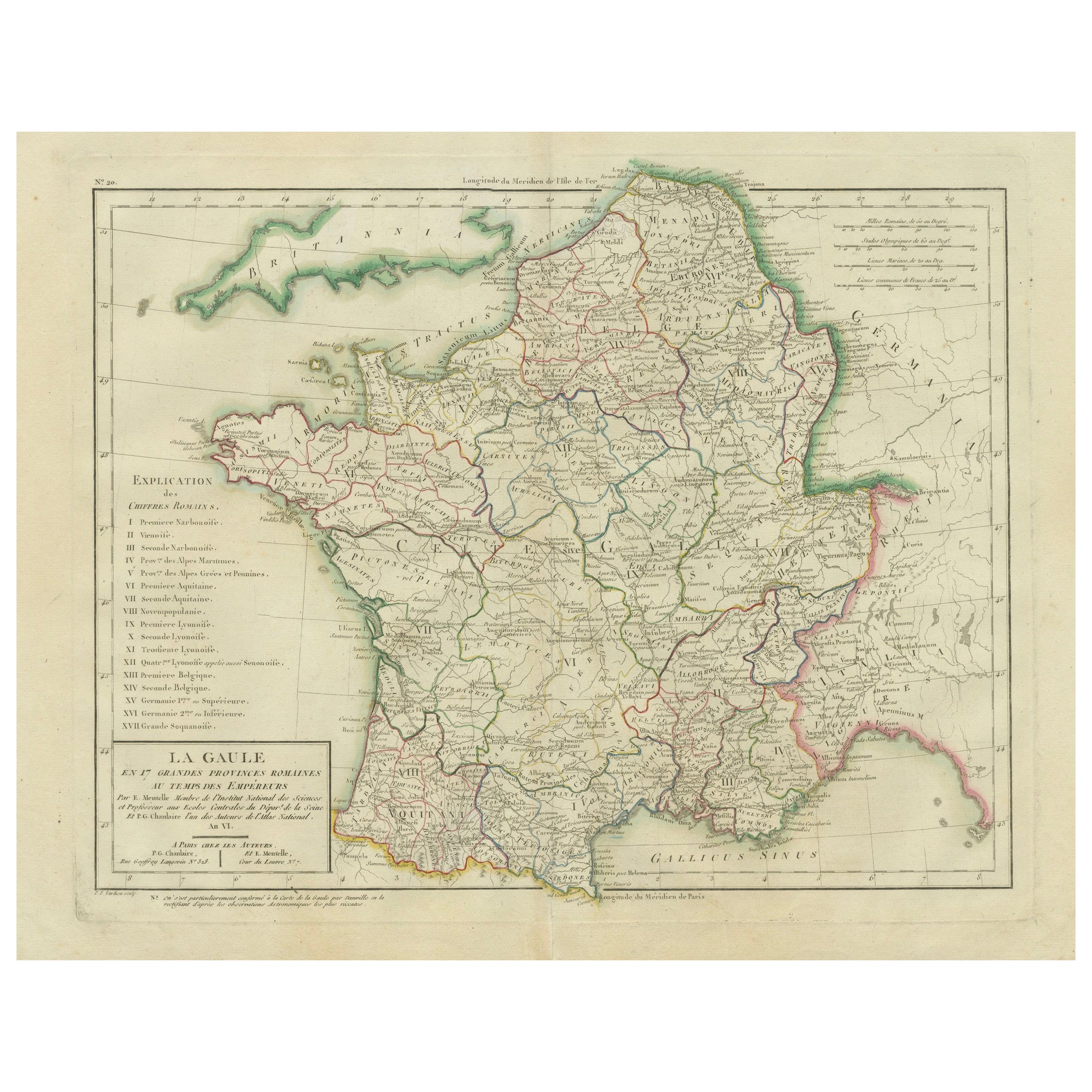
View AllMap of Ancient Gaul & Roman Provinces: Early 19th Century - 1802 Tardieu Atlas
Located in Langweer, NL
### Antique Map Description
**Title:** La Gaule et Ses Grandes Dignités Romaines au Temps des Empereurs
**Publication Details:**
- **Atlas Title:** Nouvel Atlas Universel de Géogra...
Category
Antique Early 1800s Maps
Materials
Paper
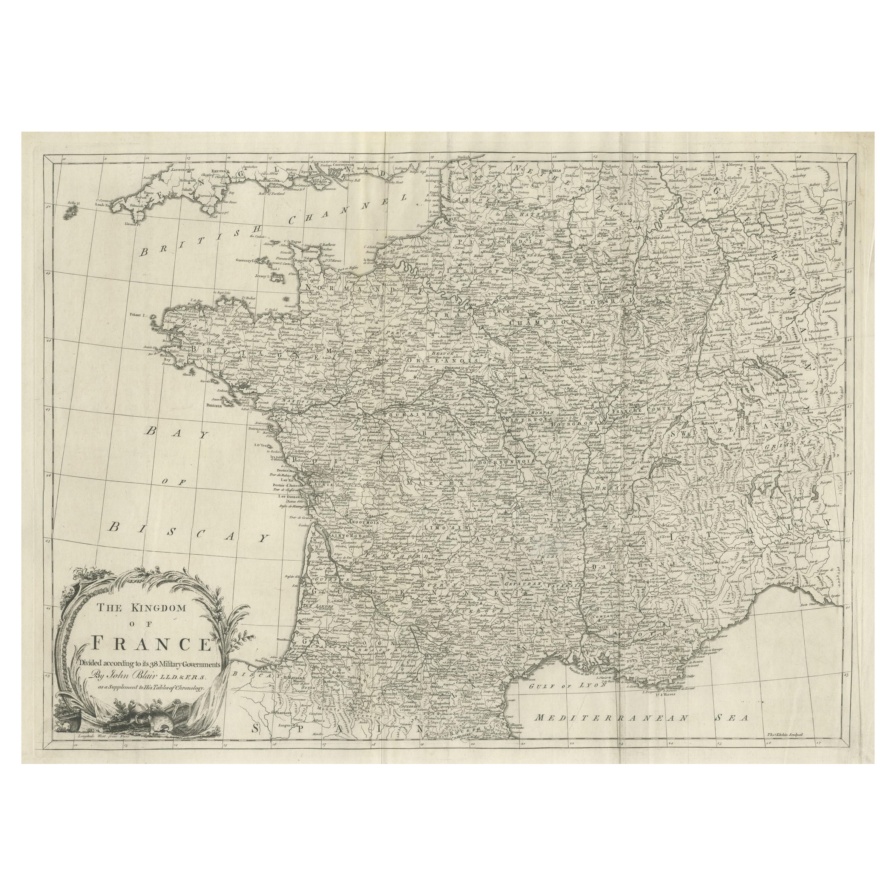
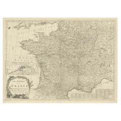
Large Antique Map of the Kingdom of France
Located in Langweer, NL
Antique map titled 'The Kingdom of France (..)'. Large antique map of the Kingdom of France. Engraved by T. Kitchin. Published J. Blair, circa 1779.
Category
Antique Late 18th Century Maps
Materials
Paper
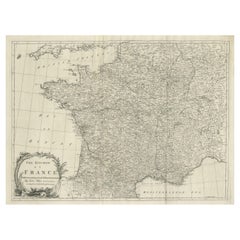
$642 Sale Price
20% Off
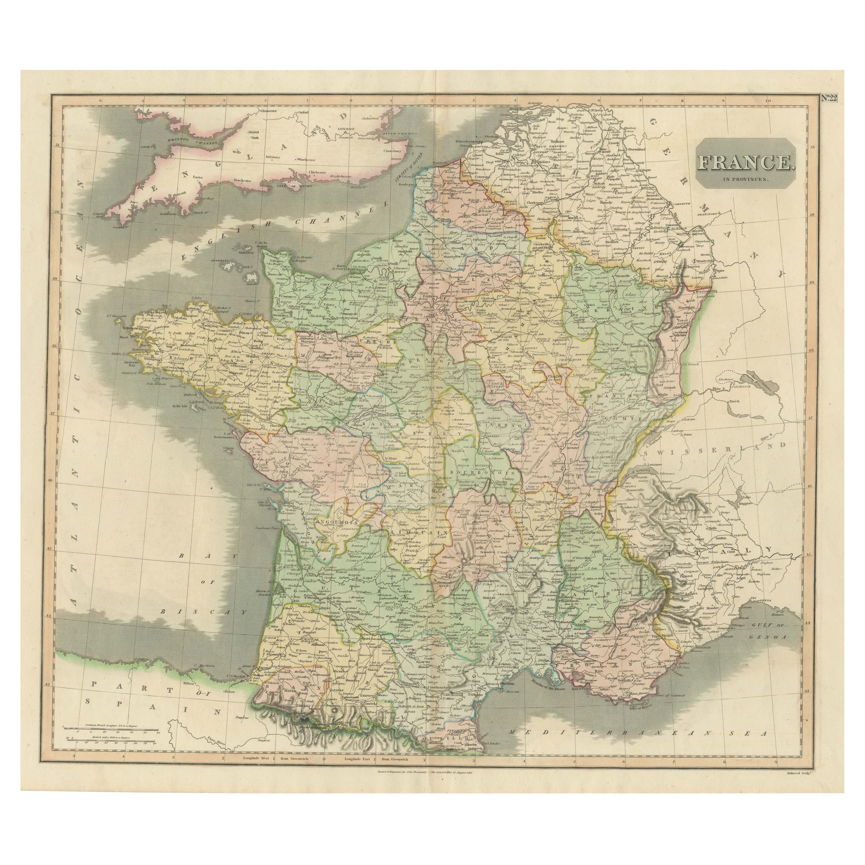
Large Antique Map of France with Original Hand Coloring
Located in Langweer, NL
Antique map titled 'France in Provinces'. Beautiful antique map of France. Drawn and engraved for John Thomson's 'New General Atlas' published circa 1814.
Category
Antique Early 19th Century Maps
Materials
Paper
$409 Sale Price
20% Off
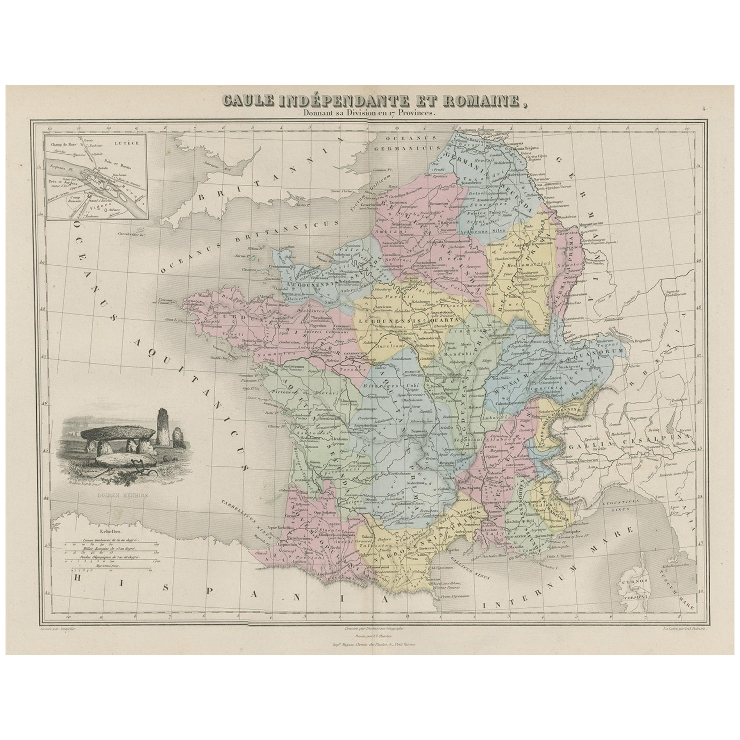
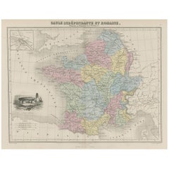
Antique Map of France in Ancient Roman Times, 1880
Located in Langweer, NL
Antique map titled 'Gaule indépendante et Romaine'.
Old map of Gaul or France in ancient Roman times. The map covers from the southern part of England (Britannia) to the north of S...
Category
Antique 19th Century Maps
Materials
Paper
$177 Sale Price
20% Off
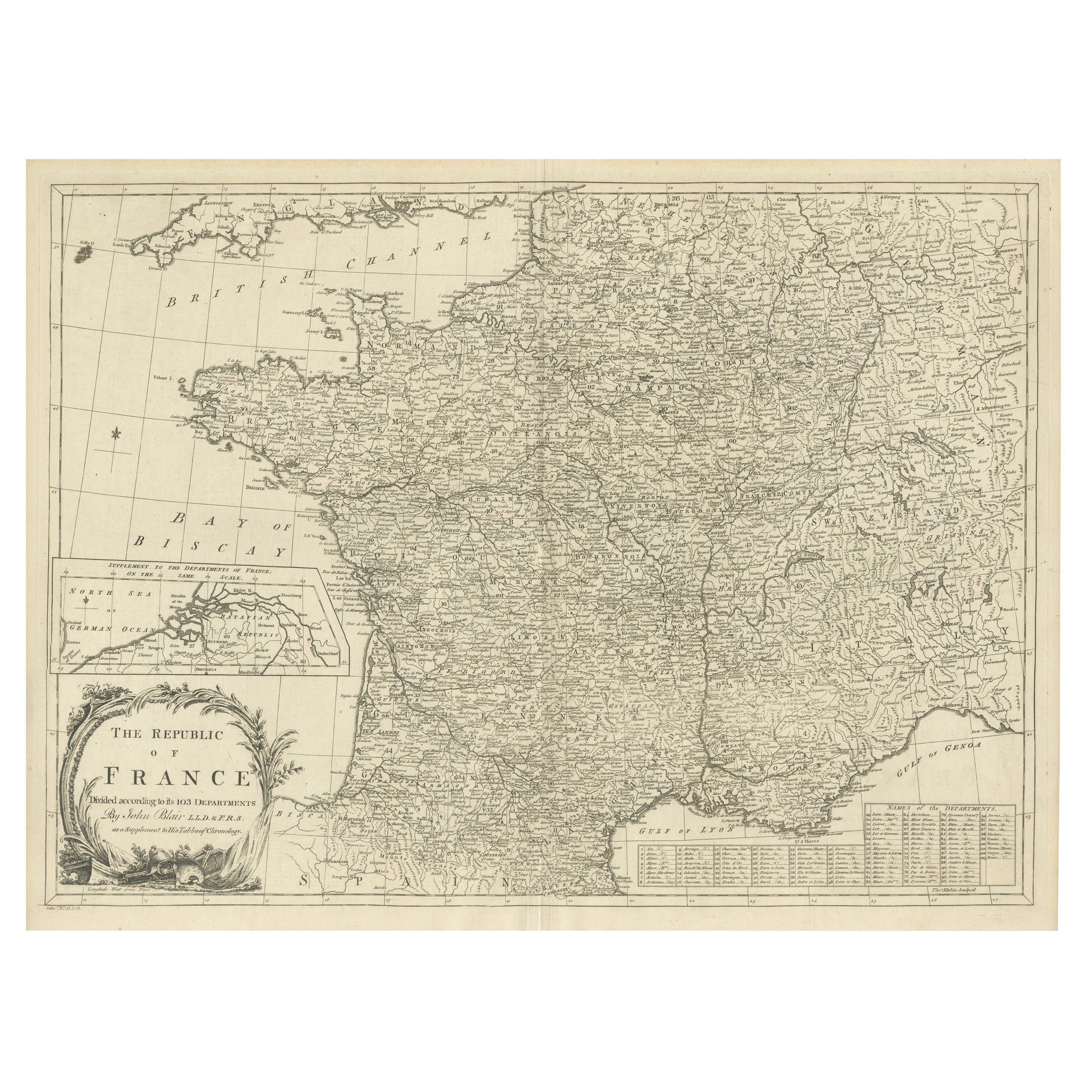
Antique Map of France with Inset showing the Northern Departments
Located in Langweer, NL
Antique map titled 'The Republic of France divided according to its 103 Departments'. Decorative map of France. Includes a large cartouche and an in...
Category
Antique Late 18th Century Maps
Materials
Paper
$614 Sale Price
20% Off
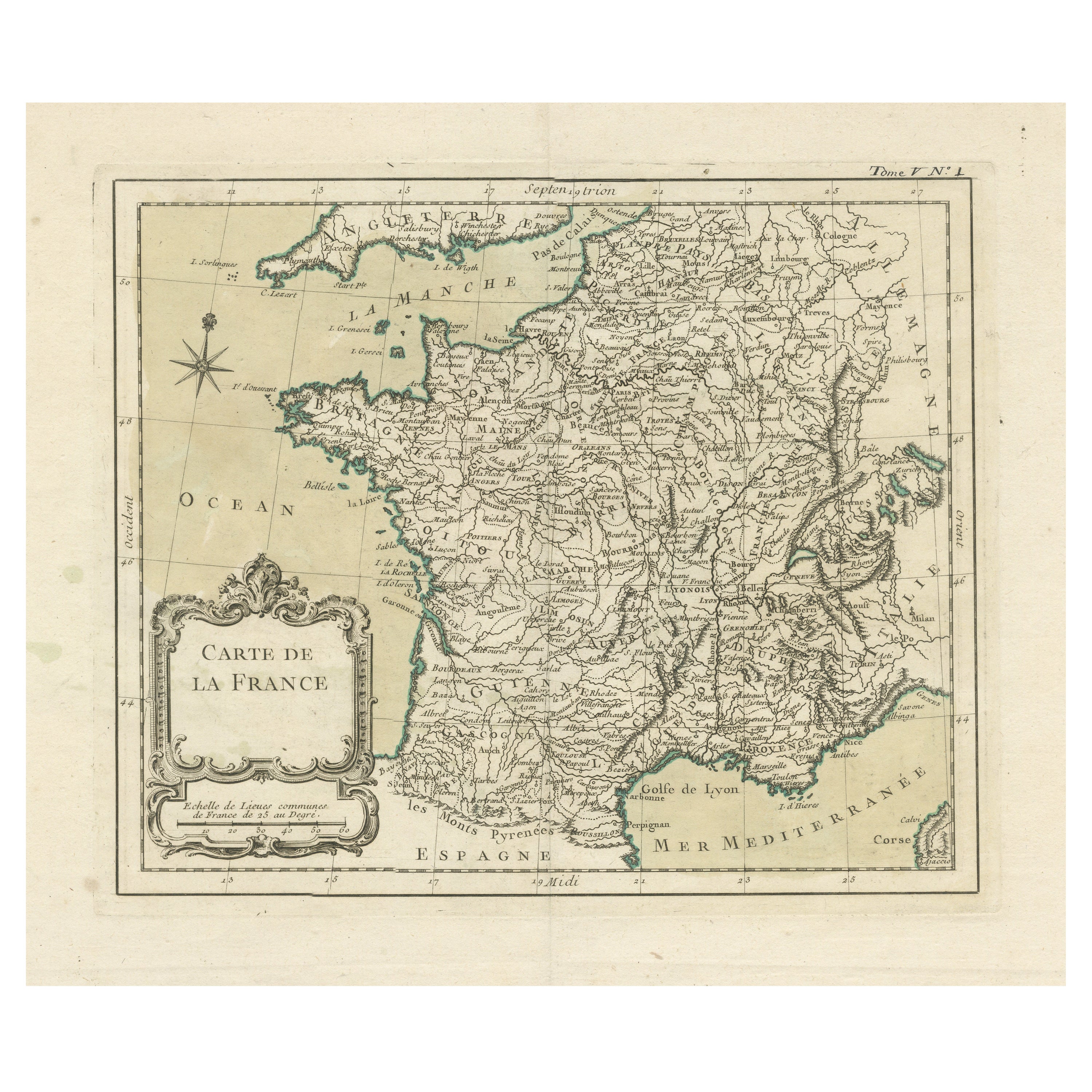
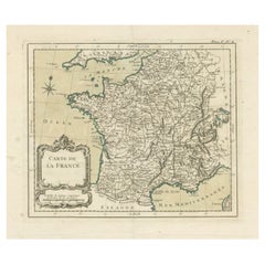
Antique Map of France with Decorative Title Cartouche
Located in Langweer, NL
Antique map titled 'Carte de la France'. Original old map of France. This map originates from 'Le Petit Atlas Maritime Recueil De Cartes et Plans Des Quatre Parties Du Monde (..) by ...
Category
Antique Mid-18th Century Maps
Materials
Paper
$223 Sale Price
20% Off
You May Also Like
Large 19th Century Map of France
Located in Pease pottage, West Sussex
Large 19th Century Map of France.
Remarkable condition, with a pleasing age worn patina.
Recently framed.
France Circa 1874.
Category
Antique Late 19th Century French Maps
Materials
Linen, Paper

Antique Map of France
Located in Dallas, TX
Nice antique map of France in wood frame. This would make a great gift for a collector. A wonderful accessory!
Category
Early 20th Century Decorative Art
Materials
Glass, Wood, Paper

$1,760
The Normandy Region of France: A 17th C. Hand-colored Map by Sanson and Jaillot
By Nicolas Sanson
Located in Alamo, CA
This large hand-colored map entitled "Le Duché et Gouvernement de Normandie divisée en Haute et Basse Normandie en divers Pays; et par evêchez, avec le Gouvernement General du Havre ...
Category
Antique 1690s French Maps
Materials
Paper

France, Northern Part. Century Atlas antique map
Located in Melbourne, Victoria
'The Century Atlas. France, Northern Part.'
Original antique map, 1903.
Inset maps of 'France in Provinces' and 'Paris and Vicinity'.
Central fold as issued. Map name and number pr...
Category
Early 20th Century Victorian More Prints
Materials
Lithograph

Ancient National Atlas of France with Marengo
Located in Alessandria, Piemonte
Ancient National Atlas of France with the department of Marengo: a rare French etching dated 1806.
ST/178.
Category
Antique Early 19th Century French Other Prints
Materials
Paper

$745 Sale Price
20% Off
Map of France - Etching - 1820
Located in Roma, IT
Map of France is an Original Etching realized by an unknown artist of 19th century in 1820.
Very good condition on two sheets of white paper joined at t...
Category
1820s Modern Figurative Prints
Materials
Etching

More Ways To Browse
Antique Gallia
Antique Map Of Cornwall
Coronelli Globe
Vintage Bartholomew Maps
Antique Alabama Map
Cape Cod Map
Goa France
Antique Planisphere
Charlotte Reine
Dutch Malacca
Gabon Antique Map
J And C Bavaria
Map Of Barbados
Montreal Map
Antique Furniture Toledo Ohio
Laos Antique Map
Orinoco Furniture
Johann Baptist Homann On Sale