Items Similar to Map of Aube France with Troyes and Champagne Wine Region, 19th Century


Want more images or videos?
Request additional images or videos from the seller
1 of 10
Map of Aube France with Troyes and Champagne Wine Region, 19th Century
$143.90
£107.05
€120
CA$197.05
A$219.09
CHF 114.40
MX$2,666.90
NOK 1,459.67
SEK 1,367.64
DKK 913.49
Shipping
Retrieving quote...The 1stDibs Promise:
Authenticity Guarantee,
Money-Back Guarantee,
24-Hour Cancellation
About the Item
Map of Aube France with Troyes and Champagne Vineyards by Vuillemin, 19th c
Description:
This 19th-century map of the Aube department in the Grand Est region of northeastern France was engraved by Alexandre Vuillemin and published by Migeon in Paris as part of the Nouvel Atlas Illustré. Combining fine cartography with historical and cultural illustration, the map offers a visual journey through one of France’s most historically rich and agriculturally significant regions.
Aube is part of the historic Champagne region, and the map clearly displays its towns, rivers, and roadways, all bordered in hand-applied pastel pink. The capital city of Troyes is prominently positioned at the center, surrounded by a dense network of communes. To the right, a finely engraved vignette shows the town of Nogent-sur-Seine, situated along the banks of the river, offering a calm and picturesque atmosphere.
Two prominent portraits are featured in the lower left corner: Denis Diderot, the Enlightenment philosopher and editor of the Encyclopédie, who was born in Langres just outside Aube but is associated with the regional intellectual landscape; and Georges Cuvier, a pioneering naturalist who laid the foundations for paleontology. Their inclusion highlights the region’s contribution to French intellectual and scientific advancement.
Aube plays a major role in France’s wine culture as part of the southern Champagne-producing area. The Côte des Bar, located in the southern part of Aube, is especially known for producing high-quality Pinot Noir grapes, crucial for blending in Champagne production. While less internationally known than the vineyards of Reims and Épernay to the north, the vineyards around Bar-sur-Seine and Bar-sur-Aube have gained increasing recognition for their elegant and expressive sparkling wines.
Alexandre Vuillemin was a leading 19th-century French cartographer celebrated for merging technical accuracy with decorative and educational value. His maps are valued today for their aesthetic qualities and insight into the political and cultural geography of the time. The publisher Migeon specialized in illustrated educational works, bringing finely engraved atlases to a broad audience.
Condition summary:
Very good condition with minimal toning and a few scattered foxing spots, mostly confined to the margins. Original hand coloring remains vibrant and the engraving is clear and sharp.
Framing tips:
This map pairs well with a dark or gold-toned frame. A soft beige or off-white mat will complement the pink border color and engraved details. Use UV-filtering glass for preservation and to maintain the crispness of the print.
- Dimensions:Height: 10.28 in (26.1 cm)Width: 12.8 in (32.5 cm)Depth: 0.01 in (0.2 mm)
- Materials and Techniques:Paper,Engraved
- Place of Origin:
- Period:
- Date of Manufacture:circa 1850
- Condition:Very good condition with minimal toning and a few scattered foxing spots, mostly confined to the margins. Original hand coloring remains vibrant and the engraving is clear and sharp.
- Seller Location:Langweer, NL
- Reference Number:Seller: BG-13331-91stDibs: LU3054345359582
About the Seller
5.0
Recognized Seller
These prestigious sellers are industry leaders and represent the highest echelon for item quality and design.
Platinum Seller
Premium sellers with a 4.7+ rating and 24-hour response times
Established in 2009
1stDibs seller since 2017
2,510 sales on 1stDibs
Typical response time: <1 hour
- ShippingRetrieving quote...Shipping from: Langweer, Netherlands
- Return Policy
Authenticity Guarantee
In the unlikely event there’s an issue with an item’s authenticity, contact us within 1 year for a full refund. DetailsMoney-Back Guarantee
If your item is not as described, is damaged in transit, or does not arrive, contact us within 7 days for a full refund. Details24-Hour Cancellation
You have a 24-hour grace period in which to reconsider your purchase, with no questions asked.Vetted Professional Sellers
Our world-class sellers must adhere to strict standards for service and quality, maintaining the integrity of our listings.Price-Match Guarantee
If you find that a seller listed the same item for a lower price elsewhere, we’ll match it.Trusted Global Delivery
Our best-in-class carrier network provides specialized shipping options worldwide, including custom delivery.More From This Seller
View AllMap of Allier France with Saint-Pourçain Wine Region by Vuillemin, 19th c
Located in Langweer, NL
Map of Allier France with Saint-Pourçain Wine Region by Vuillemin, 19th c
This decorative 19th-century map of Allier, a central department of France, comes from the celebrated Nouve...
Category
Antique Mid-19th Century French Maps
Materials
Paper

Map of Aude France with Carcassonne and Languedoc Vineyards, 19th Century
Located in Langweer, NL
Map of Aude France with Carcassonne and Languedoc Vineyards, 19th Century
Description:
This elegant 19th-century map of Aude, a department in southern France along the Mediterranean...
Category
Antique Mid-19th Century French Maps
Materials
Paper

Map of Aisne France with Soissons and Champagne Vineyards by Vuillemin, 19th c
Located in Langweer, NL
Map of Aisne France with Soissons and Champagne Vineyards by Vuillemin, 19th c
Description:
This richly detailed 19th-century engraved and hand-colored map of the department of Aisn...
Category
Antique Mid-19th Century French Maps
Materials
Paper

Map of Côtes-du-Nord France with Saint-Brieuc and Brittany Coastline, c.1850
Located in Langweer, NL
Map of Côtes-du-Nord France with Saint-Brieuc and Brittany Coastline, 19th c
Description:
This elegant 19th-century map of Côtes-du-Nord, the historic name for what is now known as ...
Category
Antique Mid-19th Century French Maps
Materials
Paper

Map of Ariège France with Foix and Pyrenees Landscape by Vuillemin, 19th c
Located in Langweer, NL
Map of Ariège France with Foix and Pyrenees Landscape by Vuillemin, 19th c
Description:
This beautifully detailed 19th-century map of the Ariège department in southwestern France wa...
Category
Antique Mid-19th Century French Maps
Materials
Paper

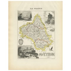
Map of Aveyron France with Rodez, Millau and Wine Routes, 19th Century
Located in Langweer, NL
Map of Aveyron France with Rodez, Millau and Wine Routes, 19th Century
Description:
This detailed and decorative 19th-century map of Aveyron, a department in southern France, was dr...
Category
Antique Mid-19th Century French Maps
Materials
Paper
You May Also Like
Aube, France. Antique map of a French department, 1856
By Victor Levasseur
Located in Melbourne, Victoria
'Dept. de L'Aube', steel engraving with original outline hand-colouring., 1856, from Levasseur's 'Atlas National Illustre'.
This area of France is known for its production of Chaou...
Category
19th Century Naturalistic Landscape Prints
Materials
Engraving

Aude, France. Antique map of a French department, 1856
By Victor Levasseur
Located in Melbourne, Victoria
'Dept. de L' Aude', steel engraving with original outline hand-colouring., 1856, from Levasseur's 'Atlas National Illustre'.
This area of France is famous for its wide variety of v...
Category
19th Century Naturalistic Landscape Prints
Materials
Engraving

Large 19th Century Map of France
Located in Pease pottage, West Sussex
Large 19th Century Map of France.
Remarkable condition, with a pleasing age worn patina.
Recently framed.
France Circa 1874.
Category
Antique Late 19th Century French Maps
Materials
Linen, Paper

Saone and Loire, France. Antique map of a French department, 1856
By Victor Levasseur
Located in Melbourne, Victoria
'Dept. de Saone et Loire', steel engraving with original outline hand-colouring., 1856, from Levasseur's Atlas National Illustre.
The French department of Saone et Loire is at the ...
Category
19th Century Naturalistic Landscape Prints
Materials
Engraving

Indre and Loire, France. Antique map of a French department, 1856
By Victor Levasseur
Located in Melbourne, Victoria
'Dept. d'Indre et Loire', steel engraving with original outline hand-colouring., 1856, from Levasseur's 'Atlas National Illustre'.
This area is known for its production of Chenin b...
Category
19th Century Naturalistic Landscape Prints
Materials
Engraving

1771 Bonne Map of Poitou, Touraine and Anjou, France, Ric.a015
Located in Norton, MA
1771 Bonne Map of Poitou,
Touraine and Anjou, France
Ric.a015
1771 Bonne map of Potiou, Touraine and Anjou entitled "Carte des Gouvernements D'Anjou et du Saumurois, de la Touraine, du Poitou,du Pays d'aunis, Saintonge?Angoumois,"
Carte des gouvernements d'Anjou et du Saumurois, de la Touraine, du Poitou, du Pays d'Aunis, Saintonge-Angoumois. Projettee et assujettie au ciel par M. Bonne, Hyd. du Roi. A Paris, Chez Lattre, rue St. Jacques a la Ville de Bord(ea)ux. Avec priv. du Roi. 1771. Arrivet inv. & sculp., Atlas moderne ou collection de cartes sur toutes...
Category
Antique 17th Century Unknown Maps
Materials
Paper

More Ways To Browse
Vineyard Furniture
French Wine Map
Antique Glass Bank
Vineyard Furniture International
19th Century Champagne Glasses
Pink Wine Glass
Nouvel Glass
Wine Filter
Epernay France
Epernay France Champagne Glasses
6x10 Rug
Styles Of Antique Desks
Black And White Coffee Table
Metal Relief
Curved Velvet Couch
Velvet Curved Sofa
Wood Round Coffee Tables
Antique Paper Flowers