Items Similar to Map of Corrèze France with Brive, Tulle and Dordogne River Landscape, c.1850


Want more images or videos?
Request additional images or videos from the seller
1 of 10
Map of Corrèze France with Brive, Tulle and Dordogne River Landscape, c.1850
$141.52
£105.93
€120
CA$194.77
A$217.09
CHF 113.90
MX$2,651.01
NOK 1,442.21
SEK 1,363.11
DKK 913.52
About the Item
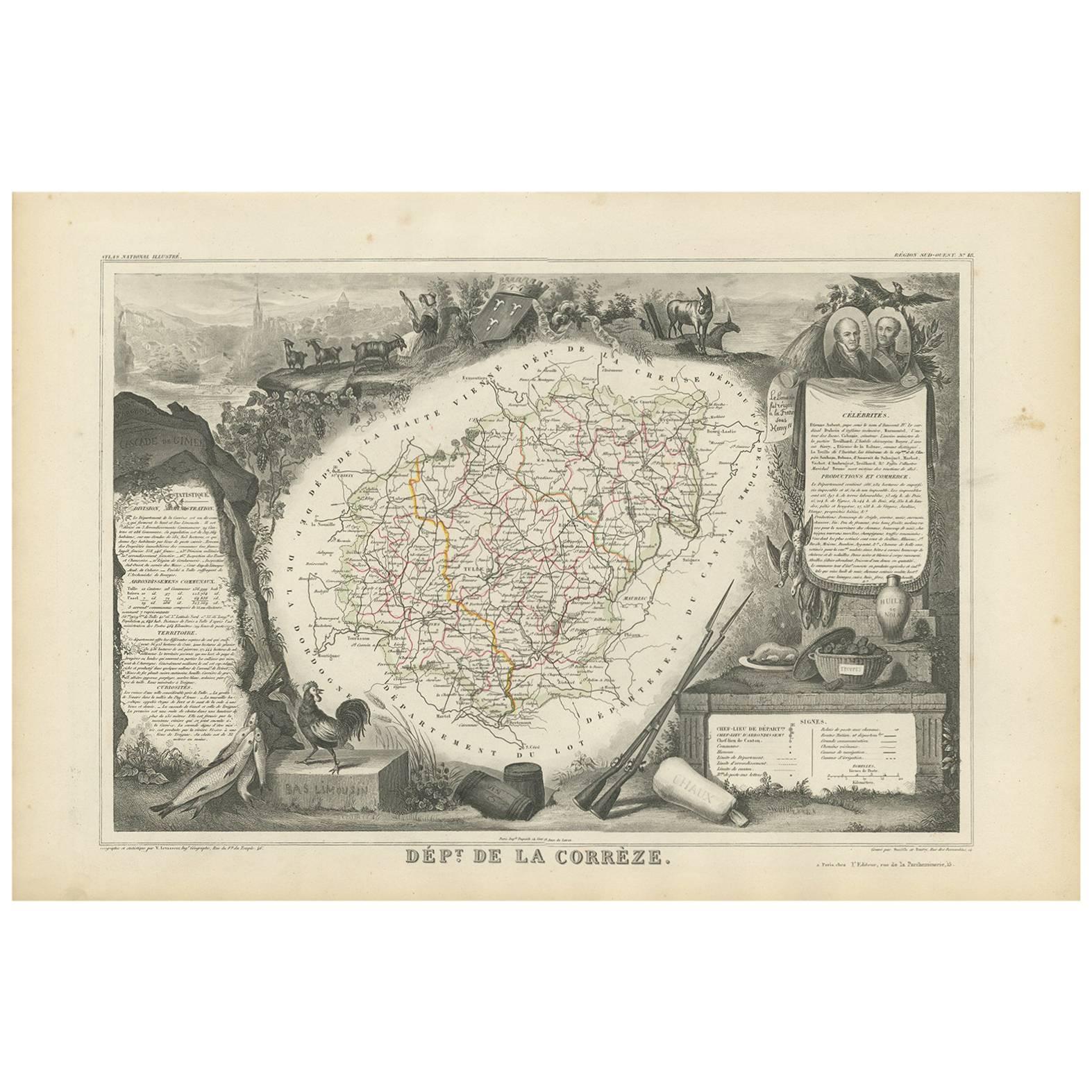
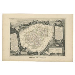
Map of Corrèze France with Brive, Tulle and Dordogne River Landscape
Description:
This finely detailed 19th-century map of the Corrèze department in southwestern France was published by Migeon in Paris and drawn by Alexandre Vuillemin for the *Nouvel Atlas Illustré*. It combines geographic accuracy with artistic decoration, offering a compelling glimpse into a historic region characterized by river valleys, forested hills, and medieval towns.
The map is bordered in soft green watercolor and shows the entire department, with clear labeling of towns, roads, and rivers. Brive-la-Gaillarde, the economic hub of Corrèze, and Tulle, the departmental capital, are centrally placed. The surrounding communes are precisely marked, and the map’s topography reflects the rolling uplands and river-carved valleys that define the region’s geography.
In the lower right is a charming vignette of a rural landscape showing a winding road, a carriage, steep cliffs, and a village spire—likely referencing the scenic Dordogne River valley that runs along the southern border of Corrèze. To the top right is a portrait of Charles de Rémusat, a notable philosopher and politician associated with the region. At bottom left, the departmental coat of arms and a pastoral scene of livestock and woodland enhance the map’s decorative features.
Corrèze is known for its traditional rural life, historic villages, and agricultural heritage. While not a major wine-producing area, the region is part of the greater Massif Central and benefits from a mild, humid climate suited for chestnuts, walnuts, cattle farming, and artisanal cheeses. Nearby Dordogne vineyards, as well as those from the Côtes de Brive, sometimes classified as IGP (Indication Géographique Protégée), complement the region’s modest but growing viticultural identity. The area is also rich in architectural heritage, with medieval hill towns like Collonges-la-Rouge and Turenne attracting cultural tourism.
This map is a classic example of 19th-century French cartographic art that balances precision and decoration. It is ideal for collectors interested in French regional history, rural culture, or decorative engravings.
Condition summary:
Very good condition with some light age-related toning and minor foxing in the margins. The engraved lines remain crisp and the original hand-coloring is clear and vibrant.
Framing tips:
A dark walnut or olive-toned frame will pair well with the green border of the map. A natural white or soft tan mat will highlight both the map and the engraved vignettes. Use UV-protective glass to preserve the print’s color and detail over time.
- Dimensions:Height: 10.28 in (26.1 cm)Width: 12.8 in (32.5 cm)Depth: 0.01 in (0.2 mm)
- Materials and Techniques:Paper,Engraved
- Place of Origin:
- Period:
- Date of Manufacture:circa 1850
- Condition:Very good condition with some light age-related toning and minor foxing in the margins. The engraved lines remain crisp and the original hand-coloring is clear and vibrant.
- Seller Location:Langweer, NL
- Reference Number:Seller: BG-13331-181stDibs: LU3054345363602
About the Seller
5.0
Recognized Seller
These prestigious sellers are industry leaders and represent the highest echelon for item quality and design.
Platinum Seller
Premium sellers with a 4.7+ rating and 24-hour response times
Established in 2009
1stDibs seller since 2017
2,517 sales on 1stDibs
Typical response time: <1 hour
- ShippingRetrieving quote...Shipping from: Langweer, Netherlands
- Return Policy
Authenticity Guarantee
In the unlikely event there’s an issue with an item’s authenticity, contact us within 1 year for a full refund. DetailsMoney-Back Guarantee
If your item is not as described, is damaged in transit, or does not arrive, contact us within 7 days for a full refund. Details24-Hour Cancellation
You have a 24-hour grace period in which to reconsider your purchase, with no questions asked.Vetted Professional Sellers
Our world-class sellers must adhere to strict standards for service and quality, maintaining the integrity of our listings.Price-Match Guarantee
If you find that a seller listed the same item for a lower price elsewhere, we’ll match it.Trusted Global Delivery
Our best-in-class carrier network provides specialized shipping options worldwide, including custom delivery.More From This Seller
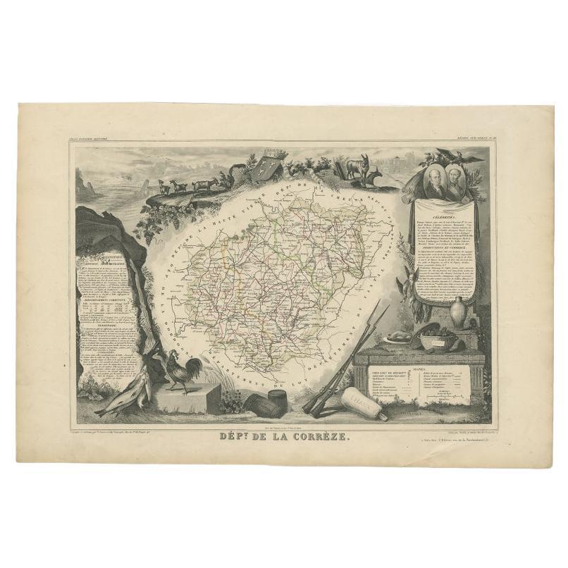
View AllAntique Map of Corrèze ‘France’ by V. Levasseur, 1854
By Victor Levasseur
Located in Langweer, NL
Antique map titled 'Dépt. da la Corrèze'. Map of the French department of Correze, France. This area of France is known for its production of Straw Wine, a sweet red or white wine. T...
Category
Antique Mid-19th Century Maps
Materials
Paper
$169 Sale Price
20% Off
Antique Map of the Famous French Wine Area of Correze, 1854
Located in Langweer, NL
Antique map titled 'Dépt. da la Corrèze'. Map of the French department of Correze, France. This area of France is known for its production of straw wine, a sweet red or white wine. T...
Category
Antique 19th Century Maps
Materials
Paper
$113 Sale Price
20% Off
Map of Côtes-du-Nord France with Saint-Brieuc and Brittany Coastline, c.1850
Located in Langweer, NL
Map of Côtes-du-Nord France with Saint-Brieuc and Brittany Coastline, 19th c
Description:
This elegant 19th-century map of Côtes-du-Nord, the historic name for what is now known as ...
Category
Antique Mid-19th Century French Maps
Materials
Paper

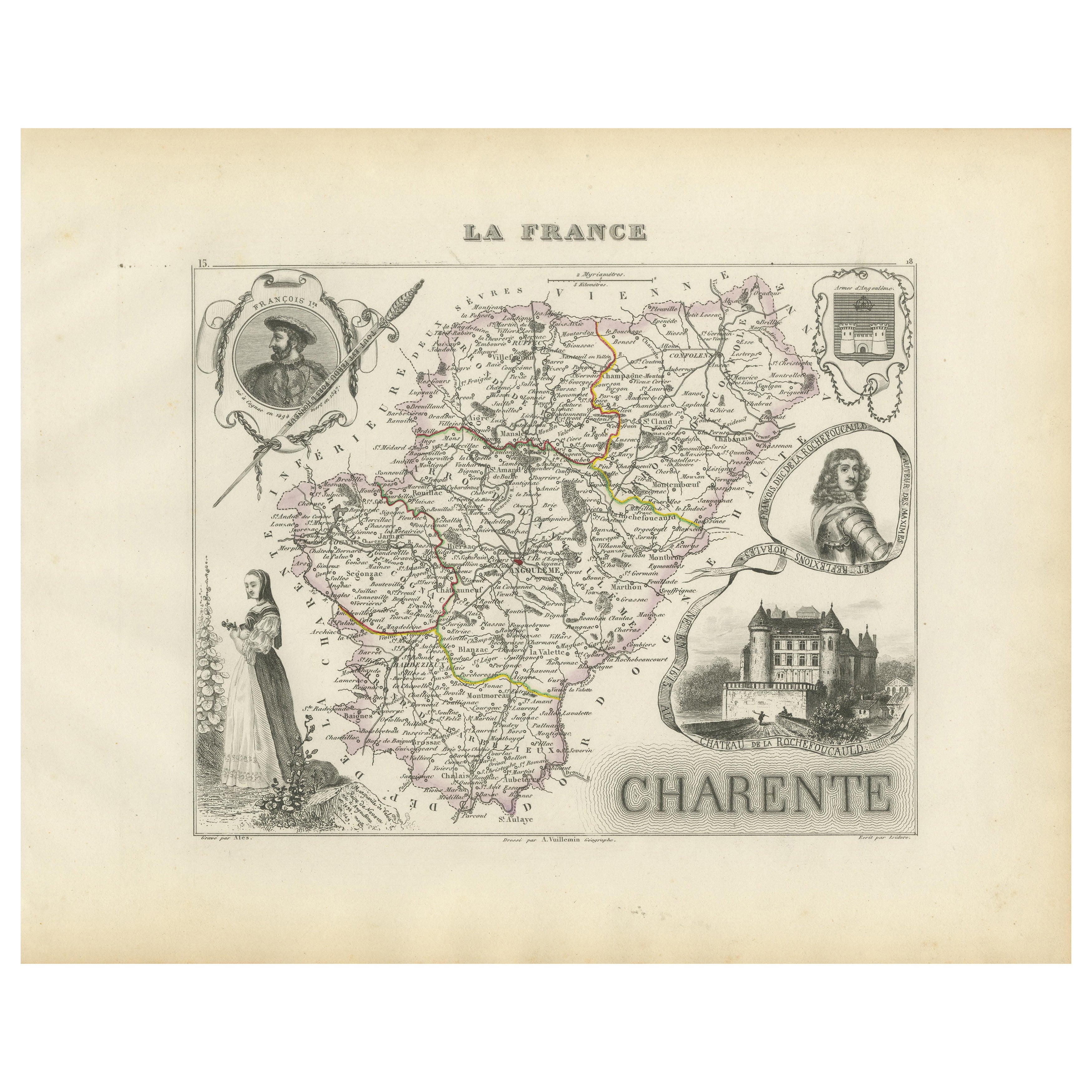
Map of Charente France with Cognac Region and Château de La Rochefoucauld, 1850
Located in Langweer, NL
Map of Charente France with Cognac Region and Château de La Rochefoucauld, 19th c
Description:
This richly illustrated 19th-century map of the Charente department in southwestern Fr...
Category
Antique Mid-19th Century French Maps
Materials
Paper

Map of Ariège France with Foix and Pyrenees Landscape by Vuillemin, 19th c
Located in Langweer, NL
Map of Ariège France with Foix and Pyrenees Landscape by Vuillemin, 19th c
Description:
This beautifully detailed 19th-century map of the Ariège department in southwestern France wa...
Category
Antique Mid-19th Century French Maps
Materials
Paper

Map of Aude France with Carcassonne and Languedoc Vineyards, 19th Century
Located in Langweer, NL
Map of Aude France with Carcassonne and Languedoc Vineyards, 19th Century
Description:
This elegant 19th-century map of Aude, a department in southern France along the Mediterranean...
Category
Antique Mid-19th Century French Maps
Materials
Paper

You May Also Like
Lozere, France. Antique map of a French department, 1856
By Victor Levasseur
Located in Melbourne, Victoria
'Dept. de La Lozere', steel engraving with original outline hand-colouring., 1856, from Levasseur's 'Atlas National Illustre'.
This remote mountainous part of Languedoc is rural, s...
Category
19th Century Naturalistic Landscape Prints
Materials
Engraving

Saone and Loire, France. Antique map of a French department, 1856
By Victor Levasseur
Located in Melbourne, Victoria
'Dept. de Saone et Loire', steel engraving with original outline hand-colouring., 1856, from Levasseur's Atlas National Illustre.
The French department of Saone et Loire is at the ...
Category
19th Century Naturalistic Landscape Prints
Materials
Engraving

Indre and Loire, France. Antique map of a French department, 1856
By Victor Levasseur
Located in Melbourne, Victoria
'Dept. d'Indre et Loire', steel engraving with original outline hand-colouring., 1856, from Levasseur's 'Atlas National Illustre'.
This area is known for its production of Chenin b...
Category
19th Century Naturalistic Landscape Prints
Materials
Engraving

L'Isere, France. Antique map of French department, 1856
By Victor Levasseur
Located in Melbourne, Victoria
'Dept. de L'Isere', Steel engraving with original outline hand-colouring., 1856, from Levasseur's 'Atlas National Illustre'.
This area is known for its production of Bleu du Vercor...
Category
19th Century Naturalistic Landscape Prints
Materials
Engraving

Jura, France. Antique map of a French department, 1856
By Victor Levasseur
Located in Melbourne, Victoria
'Dept. du Jura', steel engraving with original outline hand-colouring., 1856, from Levasseur's 'Atlas National Illustre'.
The Jura wines are very distinctive and unusual, such as V...
Category
19th Century Naturalistic Landscape Prints
Materials
Engraving

Aude, France. Antique map of a French department, 1856
By Victor Levasseur
Located in Melbourne, Victoria
'Dept. de L' Aude', steel engraving with original outline hand-colouring., 1856, from Levasseur's 'Atlas National Illustre'.
This area of France is famous for its wide variety of v...
Category
19th Century Naturalistic Landscape Prints
Materials
Engraving

More Ways To Browse
Green River Furniture
Antique Village Soft
Antique Olive Color
C Milder
French Wine Map
Oliver Charles
Antique Wine Labels
Oliver Arms
Antique Cattle Prints
Nouvel Glass
6x10 Rug
Styles Of Antique Desks
Black And White Coffee Table
Metal Relief
Curved Velvet Couch
Velvet Curved Sofa
Wood Round Coffee Tables
Antique Paper Flowers