Items Similar to Map of Southern Spain Depicting Castile, Andalusia, Granada, Murcia and Valencia

Want more images or videos?
Request additional images or videos from the seller
1 of 11
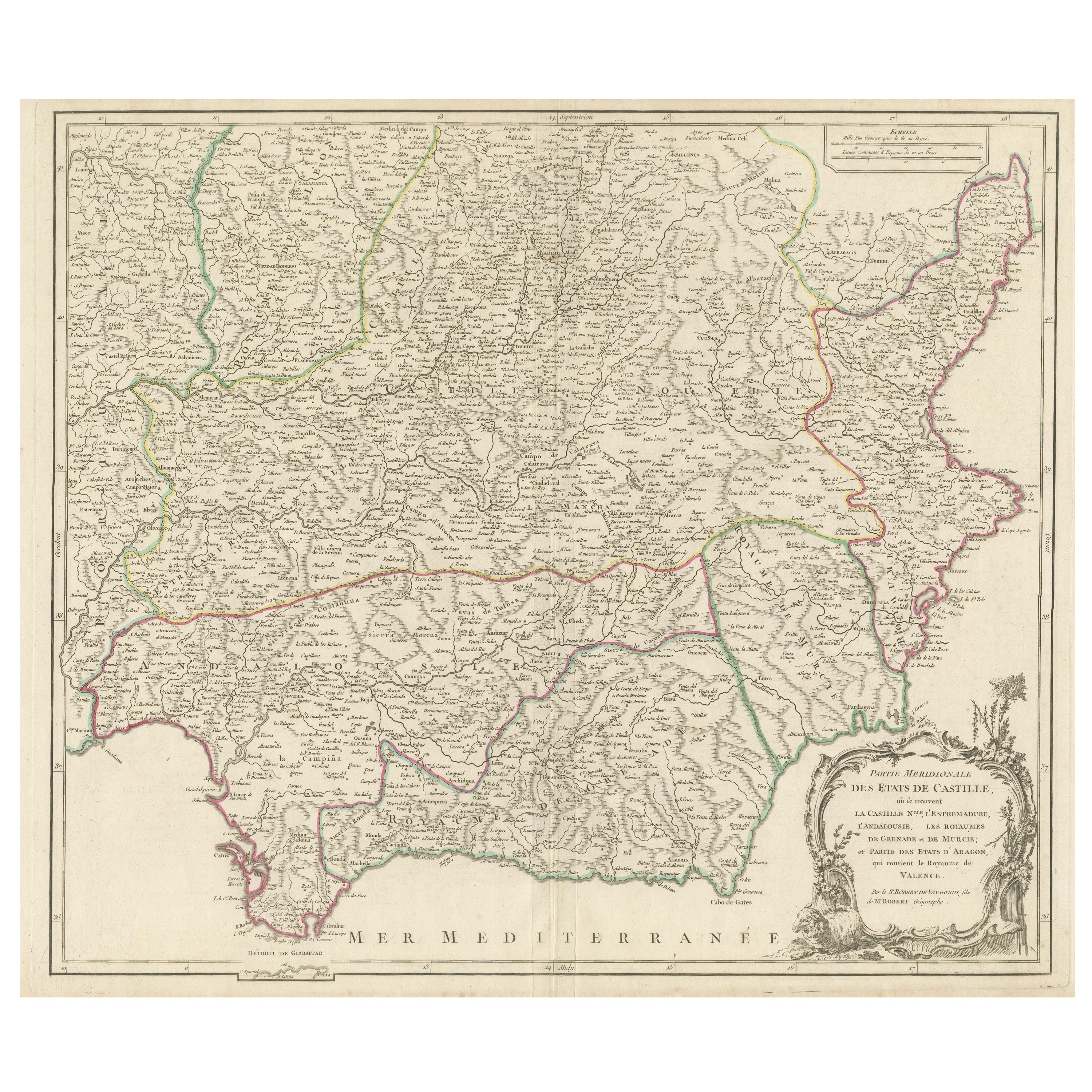
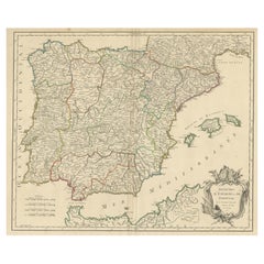
Map of Southern Spain Depicting Castile, Andalusia, Granada, Murcia and Valencia
$633.17
$791.4620% Off
£471.01
£588.7620% Off
€528
€66020% Off
CA$867.02
CA$1,083.7820% Off
A$964.01
A$1,205.0120% Off
CHF 503.35
CHF 629.1920% Off
MX$11,734.35
MX$14,667.9320% Off
NOK 6,422.56
NOK 8,028.2020% Off
SEK 6,017.63
SEK 7,522.0420% Off
DKK 4,019.37
DKK 5,024.2220% Off
Shipping
Retrieving quote...The 1stDibs Promise:
Authenticity Guarantee,
Money-Back Guarantee,
24-Hour Cancellation
About the Item
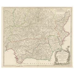
Antique map titled 'Partie Meridionale Des Etats de Castille (..)'. Decorative and highly detailed map of the southern part of Castile, Spain, including a decorative cartouche. Published R. Vaugondy, circa 1751.
Description:
This historical map, titled *"Partie Méridionale des États de Castille"*, was created in 1751 by the acclaimed French cartographer Robert de Vaugondy. The map details the southern part of Spain, highlighting the regions historically recognized as New Castile, Estremadura, Andalusia, and the Kingdoms of Granada, Murcia, and parts of the Kingdom of Valencia. This map is part of a comprehensive series illustrating the various regions of Spain during the 18th century.
Notable Features:
- **Cartographer:** Robert de Vaugondy, a prominent French geographer, is known for his meticulously accurate maps. He was appointed the official cartographer to the King of France and is celebrated for his detailed representations of European geography during the 18th century.
- Important Places:
- **Madrid** (central to the map, serving as the heart of New Castile and the capital of Spain).
- **Toledo** (an ancient city, rich in history, located south of Madrid).
- **Seville** (a key city in Andalusia, known for its historical and cultural significance, including the Giralda and the Cathedral of Seville).
- **Granada** (home to the Alhambra, this city was the last stronghold of the Moors in Spain).
- **Murcia** (an important city in the southeast, known for its baroque architecture and the Segura River).
- **Valencia** (featured prominently along the Mediterranean coast, renowned for its port and the Silk Exchange, a UNESCO World Heritage site).
- **Cádiz** (situated on the southwestern coast, it is one of the oldest continuously inhabited cities in Western Europe).
- **Gibraltar** (depicted near the southern tip, a strategically important location commanding access to the Mediterranean).
Map Details:
- **Scale:** The map includes a detailed scale bar, allowing for accurate distance measurement.
- **Borders:** Each region is clearly delineated with color-coded borders, making it easy to distinguish between the various historical kingdoms and regions.
- **Geographical Features:** The map offers a detailed portrayal of the mountainous regions, river systems, and the extensive coastline along the Mediterranean Sea and the Atlantic Ocean.
This map is not only an invaluable tool for historical reference but also a work of art, reflecting the geographical understanding and political boundaries of southern Spain in the mid-18th century. It is an essential addition to any collection focused on the history of European cartography or Spanish history.
Gilles Robert de Vaugondy (1688-1766) and his son Didier Robert de Vaugondy (1723-1786) were leading cartographers in France during the 18th century. They served both as geographer to the king of France. The father, Gilles is also known as ‘Le Sieur’ or ‘Monsieur Robert’. He descended from the Nicolas Sanson family through Sanson's grandson Pierre Moulard-Sanson, from whom he inherited Sanson's cartographic material. After Hubert Jaillot died in 1712, the Vaugondy's acquired numerous copies of his maps and plates, which formed the basis of their beautiful Atlas Universel (1757).
- Dimensions:Height: 21.97 in (55.8 cm)Width: 30.83 in (78.3 cm)Depth: 0.02 in (0.5 mm)
- Materials and Techniques:
- Period:
- Date of Manufacture:c.1751
- Condition:General age-related toning. Minor wear, original folding line. Blank verso. Please study image carefully.
- Seller Location:Langweer, NL
- Reference Number:Seller: BG-13430-21stDibs: LU3054339031702
About the Seller
5.0
Recognized Seller
These prestigious sellers are industry leaders and represent the highest echelon for item quality and design.
Platinum Seller
Premium sellers with a 4.7+ rating and 24-hour response times
Established in 2009
1stDibs seller since 2017
2,510 sales on 1stDibs
Typical response time: <1 hour
- ShippingRetrieving quote...Shipping from: Langweer, Netherlands
- Return Policy
Authenticity Guarantee
In the unlikely event there’s an issue with an item’s authenticity, contact us within 1 year for a full refund. DetailsMoney-Back Guarantee
If your item is not as described, is damaged in transit, or does not arrive, contact us within 7 days for a full refund. Details24-Hour Cancellation
You have a 24-hour grace period in which to reconsider your purchase, with no questions asked.Vetted Professional Sellers
Our world-class sellers must adhere to strict standards for service and quality, maintaining the integrity of our listings.Price-Match Guarantee
If you find that a seller listed the same item for a lower price elsewhere, we’ll match it.Trusted Global Delivery
Our best-in-class carrier network provides specialized shipping options worldwide, including custom delivery.More From This Seller
View AllDetailed Engraving Highlighting Key Regions of Southern Spain and Castile, 1752
Located in Langweer, NL
Antique map titled 'Partie Meridionale Des Etats de Castille (..)'. Decorative and highly detailed map of the southern part of Castile, Spain, including a decorative cartouche. Publi...
Category
Antique Mid-18th Century Maps
Materials
Paper
$633 Sale Price
20% Off
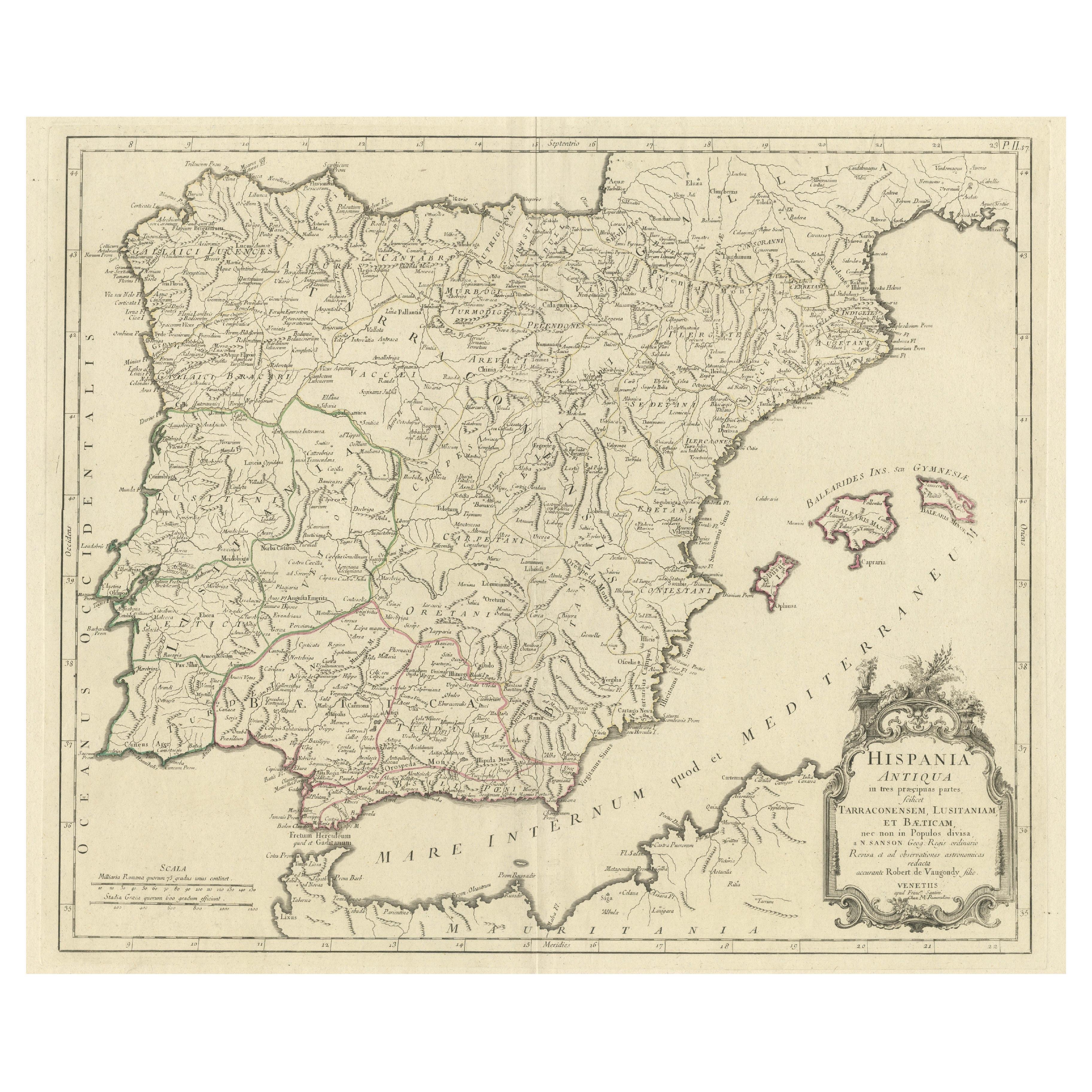
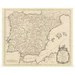
Old Map of Ancient Spain and Portugal – Hispania Antiqua Featuring Roman Cities
Located in Langweer, NL
Title: "Hispania Antiqua in Tres Praecipuas Partes Divisa: Tarraconensem, Lusitaniam, et Bæticam" by Robert de Vaugondy, 18th Century
Description:
This beautifully detailed map titl...
Category
Antique Late 18th Century Maps
Materials
Paper
$633 Sale Price
20% Off
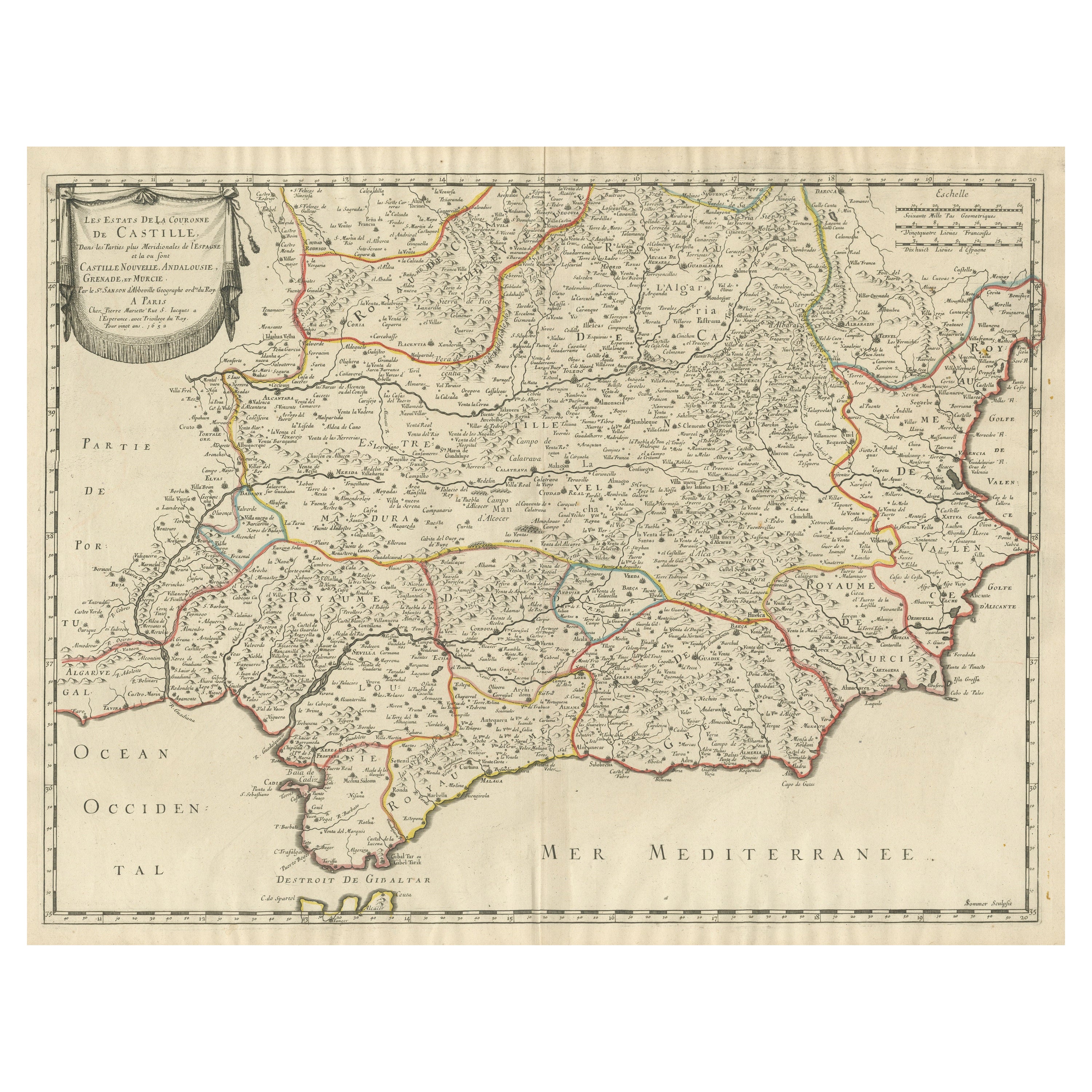
Large Map of Castile's Southern Realms - Granada, Andalusia, and Murcia, 1652
Located in Langweer, NL
This antique map, titled 'Les Etats de la Couronne de Castille', represents the southern regions of the Crown of Castile, specifically the territories of Andalusia, Granada, and Murc...
Category
Antique Mid-17th Century Maps
Materials
Paper

$460 Sale Price
20% Off
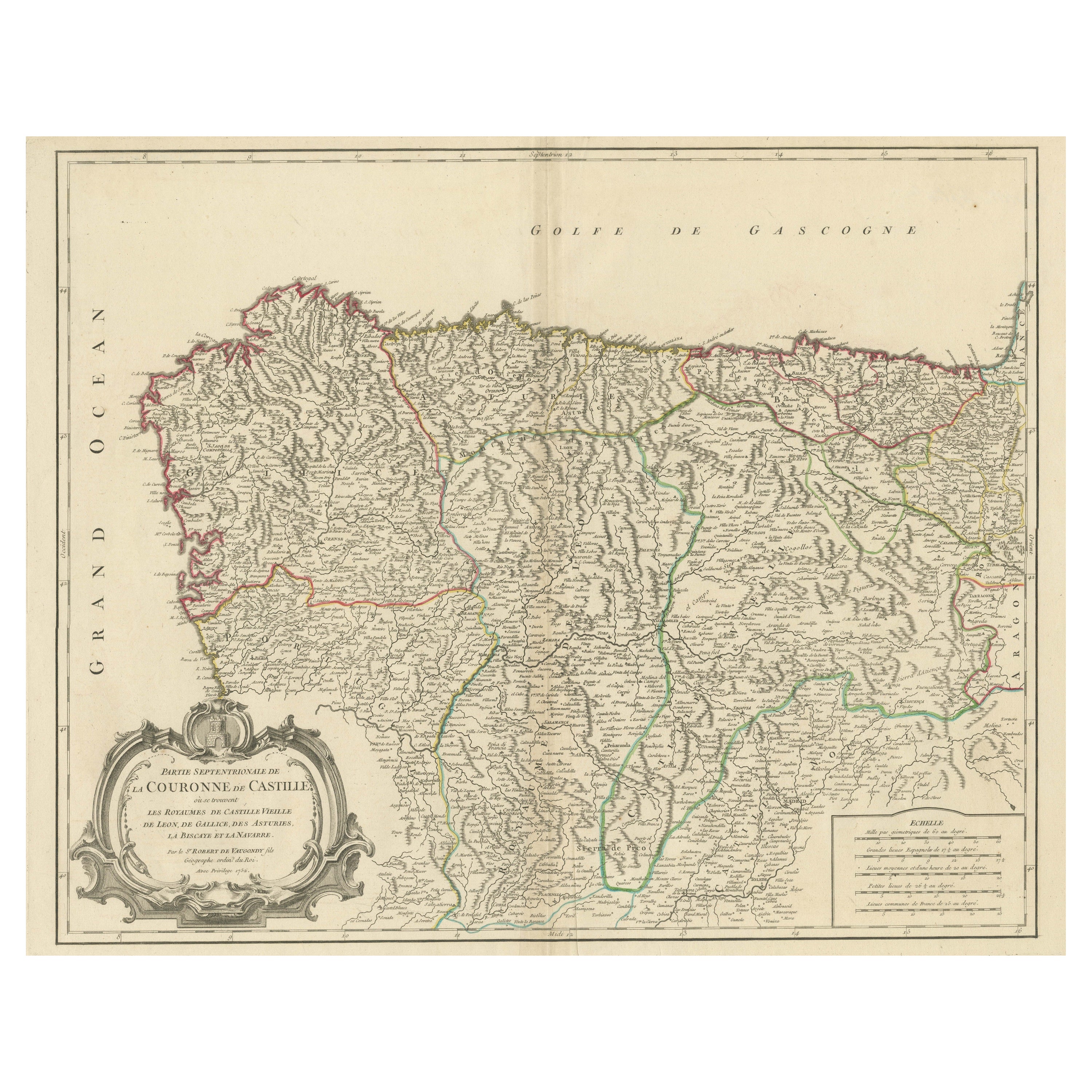
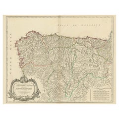
Map of Kingdoms of Castile, León, Galicia, Asturias, Biscay and Navarre in Spain
Located in Langweer, NL
Antique map titled 'Partie Septentrionale de la Couronne de Castille (..)'. Decorative and highly detailed map of Northwestern Spain, including Gallicia...
Category
Antique Mid-18th Century Maps
Materials
Paper
$633 Sale Price
20% Off
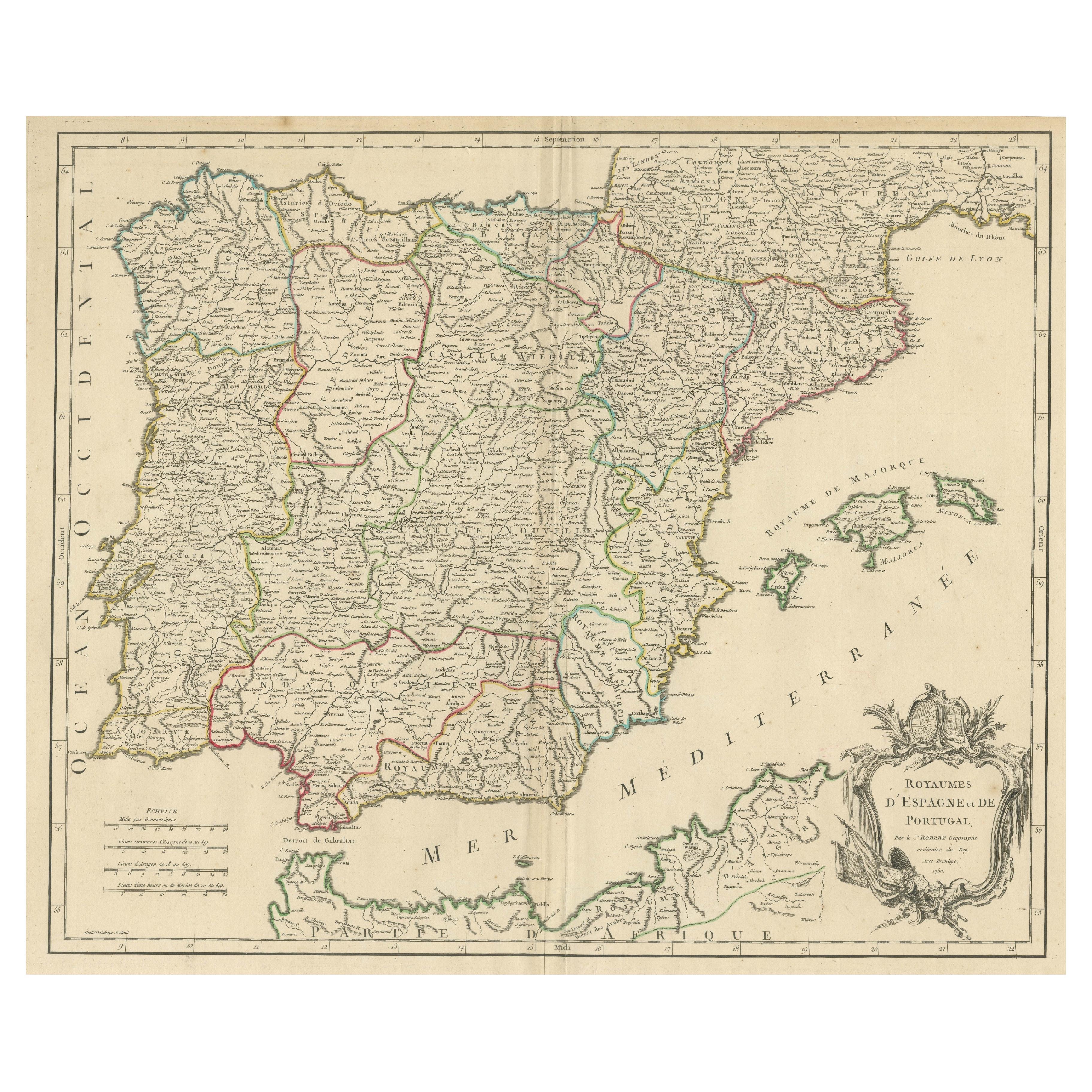
Large 1750 Map of the Kingdoms of Spain and Portugal by Robert de Vaugondy
Located in Langweer, NL
1750 Map of the Kingdoms of Spain and Portugal by Robert de Vaugondy
Description:
This map, titled *"Royaumes d'Espagne et de Portugal,"* was created in 1750 by the esteemed French ...
Category
Antique Mid-18th Century Maps
Materials
Paper
$623 Sale Price
20% Off
Large Antique Map of Ancient Spain and Portugal, Published in circa 1760
Located in Langweer, NL
Antique map titled 'Hispania Antiqua (..)'. Map of ancient Spain and Portugal. Engraved by G. Delahaye. Published circa 1760, by or after Sanson & Vaugondy.
Category
Antique Mid-18th Century Maps
Materials
Paper
$422 Sale Price
20% Off
You May Also Like
1751 Map of Spain Castilla Robert De Vaugondy 1st Edition, Ric.a001
Located in Norton, MA
Large Spain Castilla Robert De Vaugondy
1751 1st Edition
-Colored- Ric.a001
Coming from a family of cartographers, a descendant of the famous Nicolas Sanson and ordinary geographer of the king, Gilles Robert de Vaugondy makes himself known by his maps of the French provinces.
He published an Essay on the History of Geography (1755) from which he excluded the physical geography "too systematic". After a Small Atlas (1748), he draws a universal Atlas (1758), a portable Atlas (1762).
His Atlas of the revolutions of the globe remains unpublished. His warnings and prefaces, his book reviews reveal a Cartesian mind and solid knowledge.
Very early, he associates with his works his son Didier who publishes, since 1742, the methodical tables of Nicolas Sanson, two Globes, one terrestrial, the other celestial (1752).
He is credited with a map of Poland...
Category
Antique 18th Century Unknown Maps
Materials
Paper

Original Antique Map of Spain and Portugal, circa 1790
Located in St Annes, Lancashire
Super map of Spain and Portugal
Copper plate engraving by A. Bell
Published, circa 1790.
Unframed.
Category
Antique 1790s English Other Maps
Materials
Paper

Map of the Kingdom of Sardinia and Part of the Kingdom of Genoa, Rome
By Giovanni Maria Cassini
Located in Hamilton, Ontario
18th century map by Italian engraver Giovanni Maria Cassini (Italy 1745-1824). Map of Part of the Kingdom of Sardinia and Part of the Kingdom of Genoa: Rome. This is a hand colored a...
Category
Antique 18th Century Italian Maps
Materials
Paper

$795 Sale Price
36% Off
Geographical Antique Map of Principality of Monaco
By Bruno Santini
Located in Alessandria, Piemonte
ST/609 - Interesting antique color map of Monaco Principality in French language : "Carte qui contient le Principauté de Piémont, le Monferrat et la comté de...
Category
Antique Late 18th Century Italian Other Maps
Materials
Paper

Large 19th Century Map of France
Located in Pease pottage, West Sussex
Large 19th Century Map of France.
Remarkable condition, with a pleasing age worn patina.
Recently framed.
France Circa 1874.
Category
Antique Late 19th Century French Maps
Materials
Linen, Paper

Large Original Vintage Map of Spain, circa 1920
Located in St Annes, Lancashire
Great map of Spain
Original color.
Good condition
Published by Alexander Gross
Unframed.
Category
Vintage 1920s English Maps
Materials
Paper

More Ways To Browse
Antique Key Heart
18th Century Art Tools
Silk Map
Alhambra Furniture
Cathedral Plates
Spanish Andalusia
Toledo Plate
Antique Toledo Scale Scales
Antique Toledo Scale
20th Century Spanish Table
Antonio Bellini
Antique Oushak Carpets
Blue Coffee Tables
German Bauhaus Posters
1945 Chair Juhl
Antique Three Leg Table
Folke Arstrom
Silver Over Copper