Items Similar to Northern Hemisphere Star Map – Constellations & Astronomical Chart, c.1858
Video Loading
Want more images or videos?
Request additional images or videos from the seller
1 of 11
Northern Hemisphere Star Map – Constellations & Astronomical Chart, c.1858
$512.68
£386.66
€440
CA$708.83
A$794.01
CHF 417.04
MX$9,654.91
NOK 5,281.12
SEK 5,013.21
DKK 3,349.57
About the Item
Northern Hemisphere Star Map – Constellations & Astronomical Chart c.1858
This attractive antique print shows the northern starry sky titled “Der nördliche gestirnte Himmel”, meaning “The Northern Starry Sky”. The map presents a detailed celestial chart with constellations finely engraved and illustrated with classical figures such as Pegasus, Andromeda, Hercules, and Orion. The Milky Way is shown as a shaded band crossing the chart, with star positions marked in yellow and constellation lines neatly overlaid in blue.
Published around 1858 by Justus Perthes in Gotha as part of Adolf Stieler’s renowned Hand-Atlas, this chart was engraved by skilled cartographers under the editorial supervision of Heinrich Berghaus. Stieler’s Hand-Atlas is celebrated for its precision and clarity, and its astronomical plates were used for education, navigation, and scientific reference throughout Europe.
This star map is significant as it reflects mid-19th-century astronomical knowledge and artistry, combining scientific accuracy with decorative engraving. It allowed users to identify stars and constellations visible in the northern hemisphere at various times of year, and the depiction of mythological figures enhanced understanding of classical celestial cartography traditions.
Technique: Copperplate engraving with original hand colouring, used here to highlight stars in yellow and constellation illustrations in pale blue for clarity.
Condition summary: Excellent condition with strong impression, minimal toning, and no tears or repairs noted. Colours remain vivid. Paper is firm with only minor age-related signs near margins.
Framing tips: This celestial chart will look stunning in a black or dark wood frame to accentuate the delicate blue engravings and yellow star highlights. A wide white or cream mount will enhance contrast and draw attention to its intricate detail. UV-protective glass is recommended to preserve colour clarity and prevent fading over time.
- Dimensions:Height: 17.88 in (45.4 cm)Width: 14.77 in (37.5 cm)Depth: 0.01 in (0.2 mm)
- Materials and Techniques:Paper,Engraved
- Place of Origin:
- Period:
- Date of Manufacture:1858
- Condition:Condition summary: Excellent condition with strong impression, minimal toning, and no tears or repairs noted. Colours remain vivid. Paper is firm with only minor age-related signs near margins.
- Seller Location:Langweer, NL
- Reference Number:Seller: BG-05552-41stDibs: LU3054345808562
About the Seller
5.0
Recognized Seller
These prestigious sellers are industry leaders and represent the highest echelon for item quality and design.
Platinum Seller
Premium sellers with a 4.7+ rating and 24-hour response times
Established in 2009
1stDibs seller since 2017
2,517 sales on 1stDibs
Typical response time: <1 hour
- ShippingRetrieving quote...Shipping from: Langweer, Netherlands
- Return Policy
Authenticity Guarantee
In the unlikely event there’s an issue with an item’s authenticity, contact us within 1 year for a full refund. DetailsMoney-Back Guarantee
If your item is not as described, is damaged in transit, or does not arrive, contact us within 7 days for a full refund. Details24-Hour Cancellation
You have a 24-hour grace period in which to reconsider your purchase, with no questions asked.Vetted Professional Sellers
Our world-class sellers must adhere to strict standards for service and quality, maintaining the integrity of our listings.Price-Match Guarantee
If you find that a seller listed the same item for a lower price elsewhere, we’ll match it.Trusted Global Delivery
Our best-in-class carrier network provides specialized shipping options worldwide, including custom delivery.More From This Seller
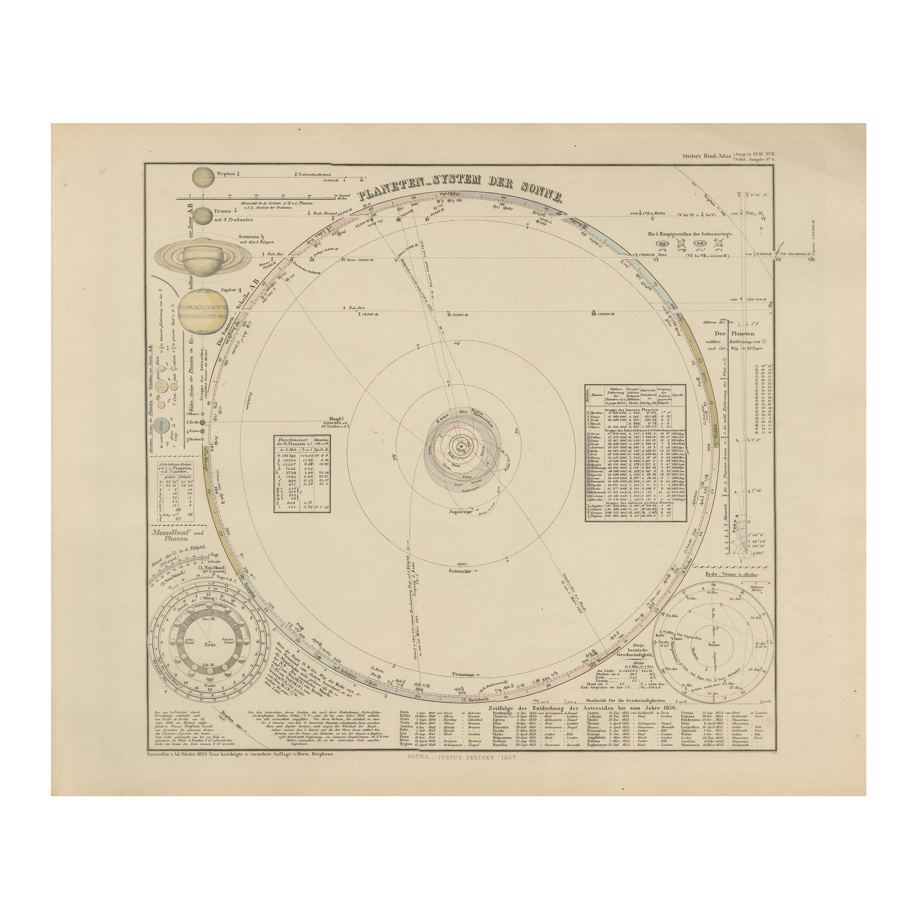
View AllSolar System Map – Planetary Orbits and Data Chart, Published in 1857
Located in Langweer, NL
Solar System Map – Planetary Orbits and Data Chart 1857
This antique print shows a detailed diagram of the solar system titled “Planeten-System der Sonne” meaning “Planetary System ...
Category
Antique Mid-19th Century German Maps
Materials
Paper
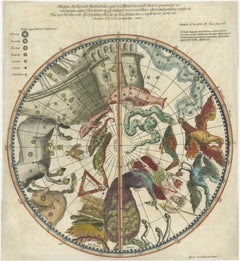
1711 Star Chart of Southern Sky with Mythical Constellations and Exotic Animals
Located in Langweer, NL
1711 Star Chart of the Southern Sky - "Mappa Stellarum Australium quae in Altitudine Poli Borei Graduum"
This beautiful star chart, engraved by Arnold van Westerhout in 1711, shows ...
Category
Antique 1710s Maps
Materials
Paper
$1,574 Sale Price
20% Off
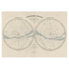
Antique Map of the Night Skies of the Northern and Southern Hemispheres, 1880
Located in Langweer, NL
Antique world map titled 'Planisphère en Céleste'.
This map depicts the night skies of both the northern and southern hemispheres. This map originates from 'Géographie Universell...
Category
Antique 1880s Maps
Materials
Paper
$270 Sale Price
20% Off
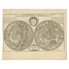
Antique Planisphere with Constellations by Bion, 1751
Located in Langweer, NL
Antique map titled 'Planisphere Celeste'. Planisphere with various constellations. This map originates from 'L'Usage des globes célestes et terrestres et des sphères (..)' by N. Bion...
Category
Antique Mid-19th Century Maps
Materials
Paper
$186 Sale Price
20% Off
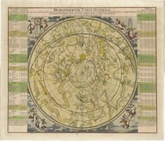
1730 Southern Hemisphere Celestial Chart with Zodiac Signs and Decorative Putti
Located in Langweer, NL
Title: 1730 Southern Hemisphere Celestial Chart with Zodiac Signs and Decorative Putti
Description: This stunning 1730 celestial map, "Hemisphaerium Coeli Australe," showcases the S...
Category
Antique 1730s Prints
Materials
Paper
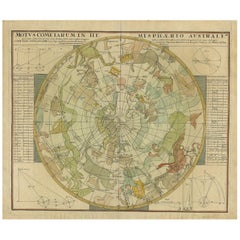
Antique Chart of the Passage of Comets in the Southern Sky, circa 1740
Located in Langweer, NL
Antique map titled 'Motus Comtarum in Hemispaerio Australi (..)'. This uncommon chart depicts the passage of comets in the southern sky between the years 1530-1704. Centered on the ecliptic poles and shows the constellation figures based on classical mythology, without showing the stars. The paths of dozens of comets are illustrated, eincluding those sighted by Tycho Brahe...
Category
Antique Mid-18th Century Maps
Materials
Paper
$2,183 Sale Price
25% Off
You May Also Like
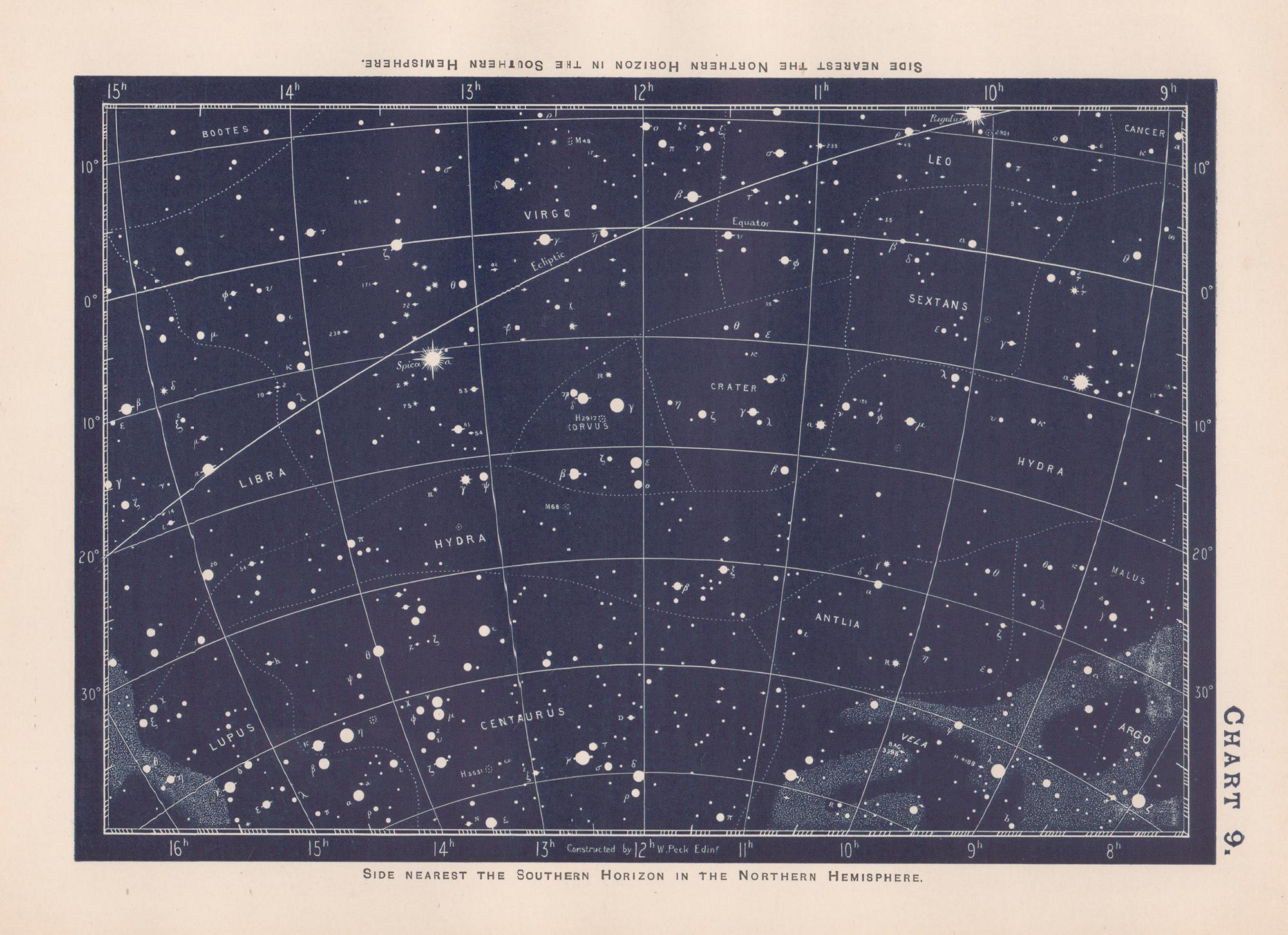
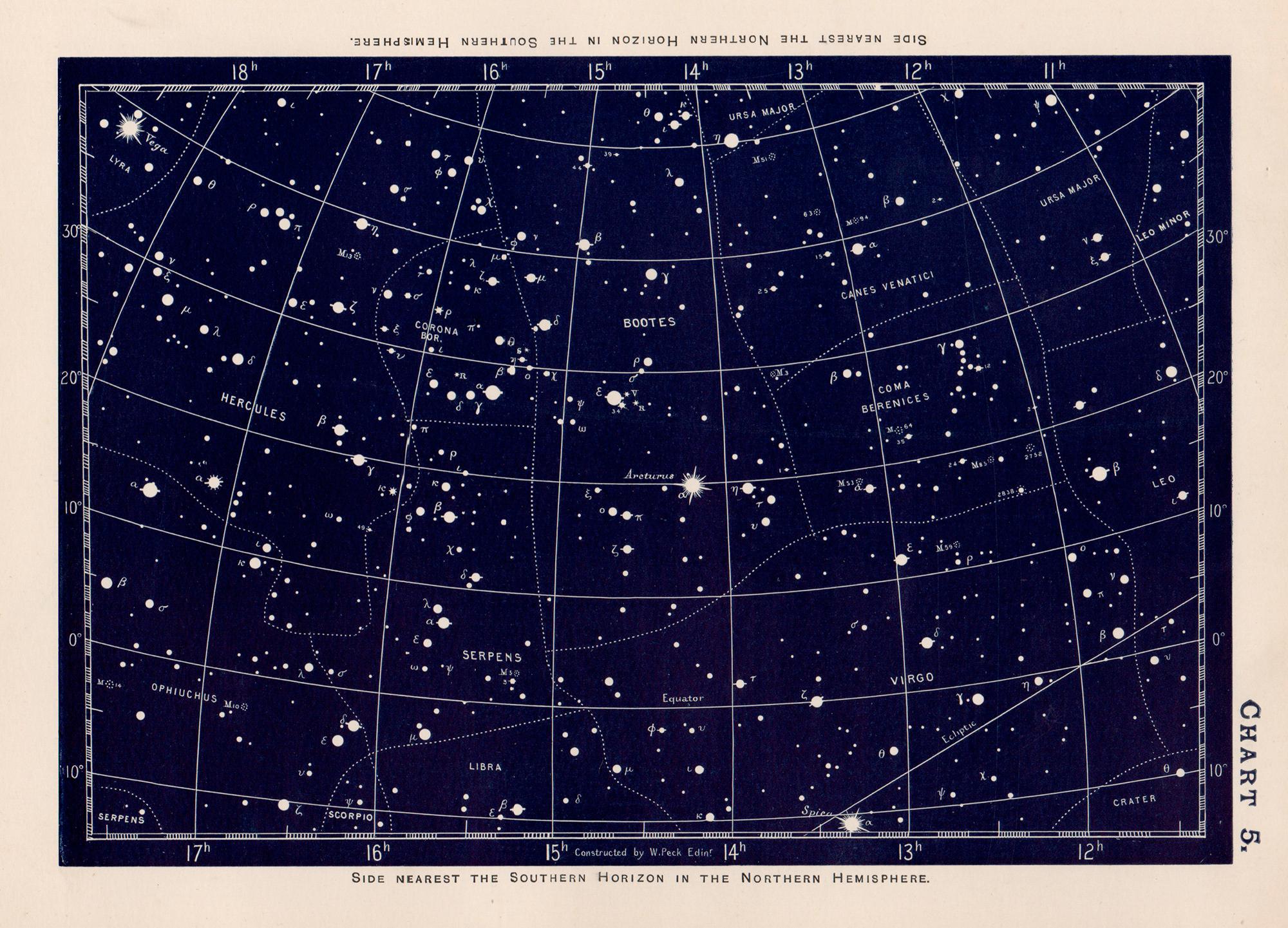
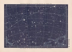
Star Chart. Antique Astronomy celestial print
Located in Melbourne, Victoria
Colour lithograph, 1890. 210mm by 285mm (sheet). From W Peck's 'A Handbook and Atlas of Astronomy', 1890. Sir William Peck FRSE FRAS (1862 – 1925) was a Scottish astronomer and scien...
Category
Late 19th Century Victorian More Prints
Materials
Lithograph
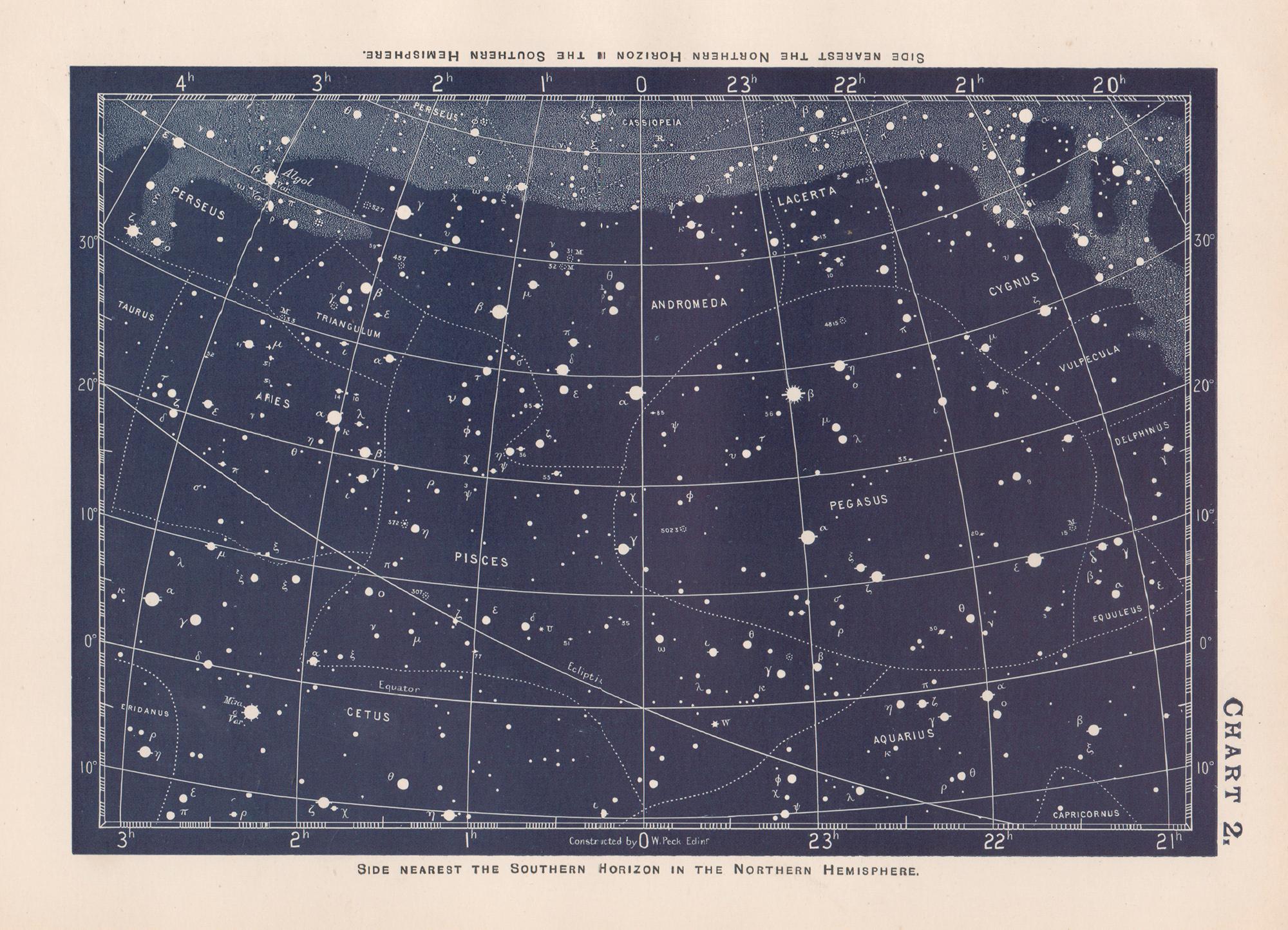
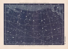
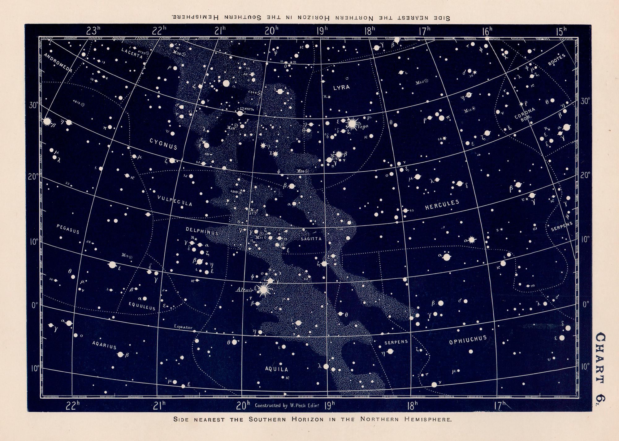
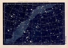
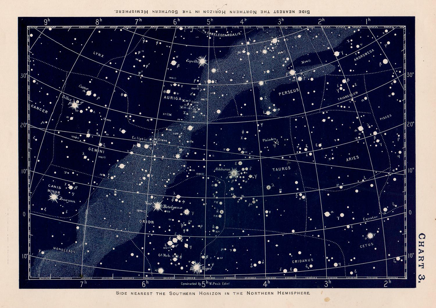
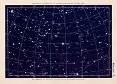
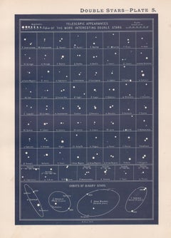
Double Stars. Antique Astronomy science print
Located in Melbourne, Victoria
Colour lithograph, 1890. 285mm by 210mm (sheet). From W Peck's 'A Handbook and Atlas of Astronomy', 1890. Sir William Peck FRSE FRAS (1862 – 1925) was a Scottish astronomer and scien...
Category
Late 19th Century Victorian More Prints
Materials
Lithograph
More Ways To Browse
Wood Minimalist Chair
Antique Imperial Furniture
Gold Modern Coffee Table
Large Side Tables
18th Century Gilded Furniture
Japanese Silver Ceramics
One Of A Kind Chair
Used Oak Dining Room Chairs
17th Century Plate
Childrens Vintage Poster
Chinese Ship
Nursery Art
Vintage Travel Poster Mid Century
Desk Key
Woven Silk Art
Carved Cabriole Table
Dark Antique Table
White Wooden Table