Items Similar to Oak Framed Large Scale Map of Europe from 1810-1815
Want more images or videos?
Request additional images or videos from the seller
1 of 9
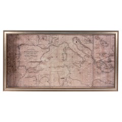
Oak Framed Large Scale Map of Europe from 1810-1815
On Hold
$1,800
On Hold
£1,367.14
On Hold
€1,579.50
On Hold
CA$2,522.76
On Hold
A$2,823.45
On Hold
CHF 1,473.62
On Hold
MX$34,431.52
On Hold
NOK 18,860.37
On Hold
SEK 17,853.76
On Hold
DKK 11,787.62
Shipping
Retrieving quote...The 1stDibs Promise:
Authenticity Guarantee,
Money-Back Guarantee,
24-Hour Cancellation
About the Item
Antique map recently paired with reclaimed oak moldings upcycled into a frame. The map is part of the Harding European History Series and features Europe from 1810-1815 around the time of Napoleon. This one-of-a-kind piece was handcrafted in our shop in Scranton PA. Please note, this item is located in one of our NYC locations.
- Dimensions:Height: 74 in (187.96 cm)Width: 55.125 in (140.02 cm)Depth: 2 in (5.08 cm)
- Materials and Techniques:
- Place of Origin:
- Period:
- Date of Manufacture:Early 20th Century
- Condition:Wear consistent with age and use.
- Seller Location:New York, NY
- Reference Number:Seller: Q2864961stDibs: LU973640979532
About the Seller
5.0
Vetted Professional Seller
Every seller passes strict standards for authenticity and reliability
Established in 2002
1stDibs seller since 2013
1,348 sales on 1stDibs
Typical response time: <1 hour
- ShippingRetrieving quote...Shipping from: New York, NY
- Return Policy
Authenticity Guarantee
In the unlikely event there’s an issue with an item’s authenticity, contact us within 1 year for a full refund. DetailsMoney-Back Guarantee
If your item is not as described, is damaged in transit, or does not arrive, contact us within 7 days for a full refund. Details24-Hour Cancellation
You have a 24-hour grace period in which to reconsider your purchase, with no questions asked.Vetted Professional Sellers
Our world-class sellers must adhere to strict standards for service and quality, maintaining the integrity of our listings.Price-Match Guarantee
If you find that a seller listed the same item for a lower price elsewhere, we’ll match it.Trusted Global Delivery
Our best-in-class carrier network provides specialized shipping options worldwide, including custom delivery.More From This Seller
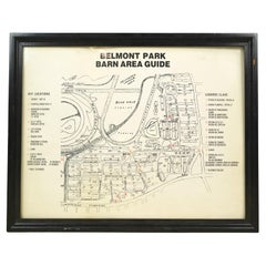
View AllFramed Belmont Park Racetrack Barn Area Guide Map
Located in New York, NY
This piece was acquired from the Belmont Park racetrack in Elmont, New York. It displays an itemized map of the barn area at Belmont Park. It is made of acrylic with a black wood fra...
Category
20th Century American Maps
Materials
Acrylic, Wood
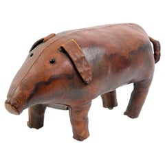
Antique Hand Sewn Large Scale Leather Pig Piggy Hog
Located in New York, NY
This little piggy pig is at market! Early 20th Century antique hand sewn leather. This baby hog has sparkling black glass eyes. This can be seen at o...
Category
Early 20th Century Industrial Models and Miniatures
Materials
Leather
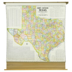
1850-1960 Cram's Superior Latest Federal Census Texas Map
By G. F. Cram Company
Located in New York, NY
The 1850-1960 Cram's Superior Latest Federal Census Texas Map, crafted from pine wood, steel, and canvas, is a valuable historical cartographic piece. Publi...
Category
Vintage 1910s American Maps
Materials
Canvas
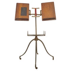
Antique Victorian Cast Iron & Oak Dictionary Stand
Located in New York, NY
Antique 1890s dictionary stand with a cast iron base featuring four curved legs ending in small casters. The top features two adjustable oak book rests, designed to hold large books ...
Category
Antique Late 19th Century American Victorian Musical Instruments
Materials
Iron
Bronze Plaque w Eagle Logo The Fraternal Order of Eagles
Located in New York, NY
Early 20th Century rectangular cast bronze wall plaque from Steubenville of "The Fraternal Order of Eagles". Please note, this item is located in our Scranton, PA location.
Category
Early 20th Century American Historical Memorabilia
Materials
Bronze
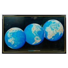
1990 Triple Perspective Planet Earth Map Framed Poster
Located in New York, NY
This decorative poster features a map of the Earth with a unique triple perspective view. It is enclosed in a black plastic frame, and the glass covering the poster is still intact. ...
Category
1990s American Posters
Materials
Glass, Plastic, Paper
You May Also Like
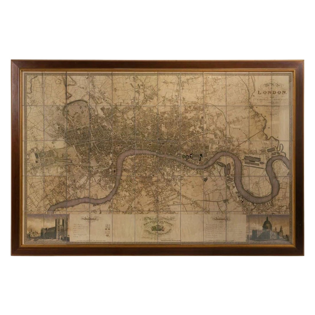
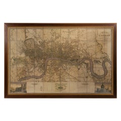
Large Scale Map of the London Metropolis
Located in Dallas, TX
The product is a large scale map of the London Metropolis, specifically focusing on the city in intricate detail. It would be a valuable collectible for those interested in maps and ...
Category
Mid-20th Century English Maps
Materials
Paper
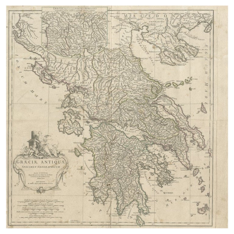
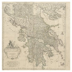
Large Scale Map of Greece with Inset Map of Macedonia, c.1786
Located in Langweer, NL
Antique map titled 'Graeciae Antiquae'. Large scale map of Greece, extends south to the island of Cythera. Inset map shows details of Macedonia. Publis...
Category
Antique 18th Century Maps
Materials
Paper
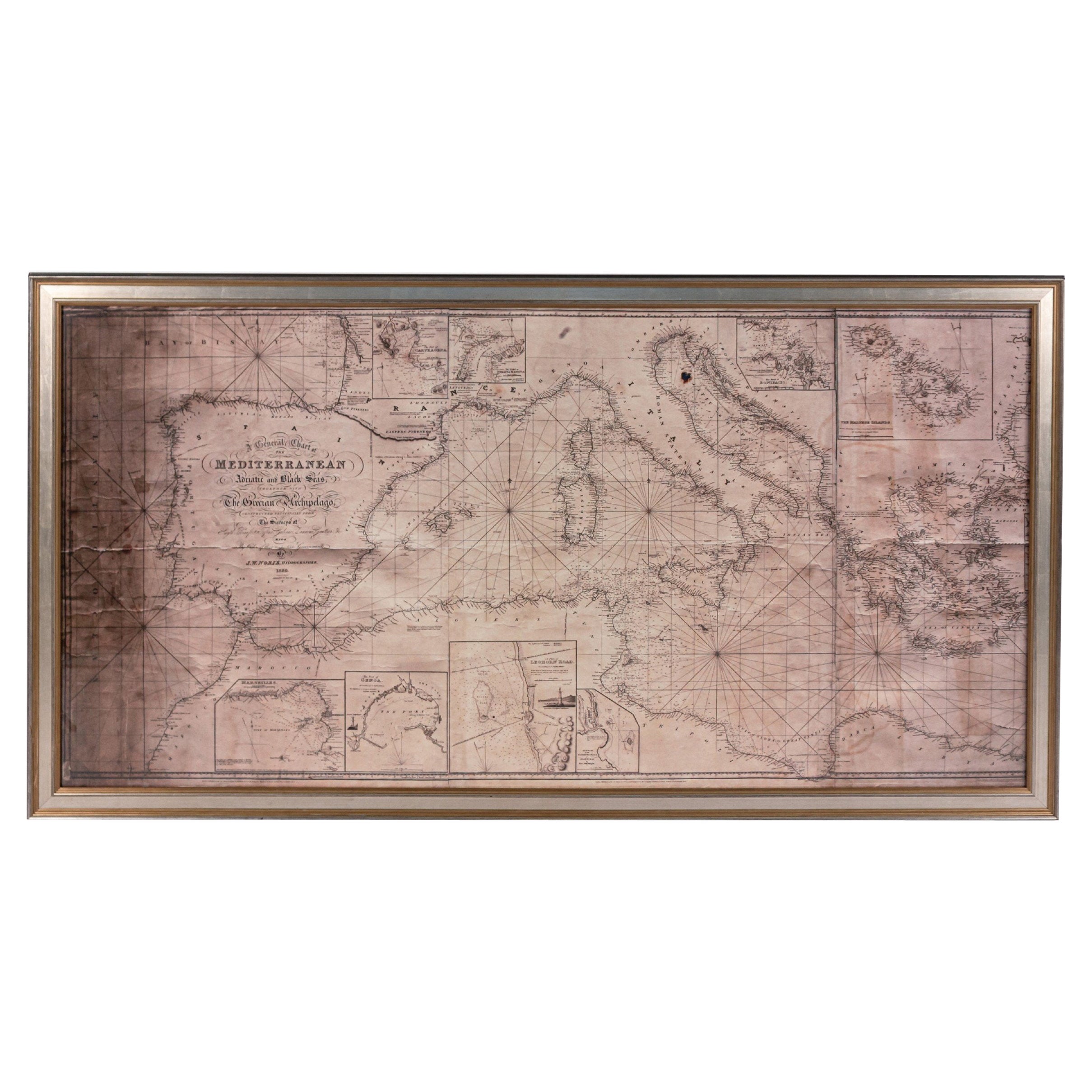
Large Framed Map of the Mediterranean
Located in Queens, NY
Large map/chart chart of The Mediterranean and the Grecian Archipelago showing Italy, Sardinia, Corsica, part of France, etc. in a black frame.
Category
20th Century French Mid-Century Modern Maps
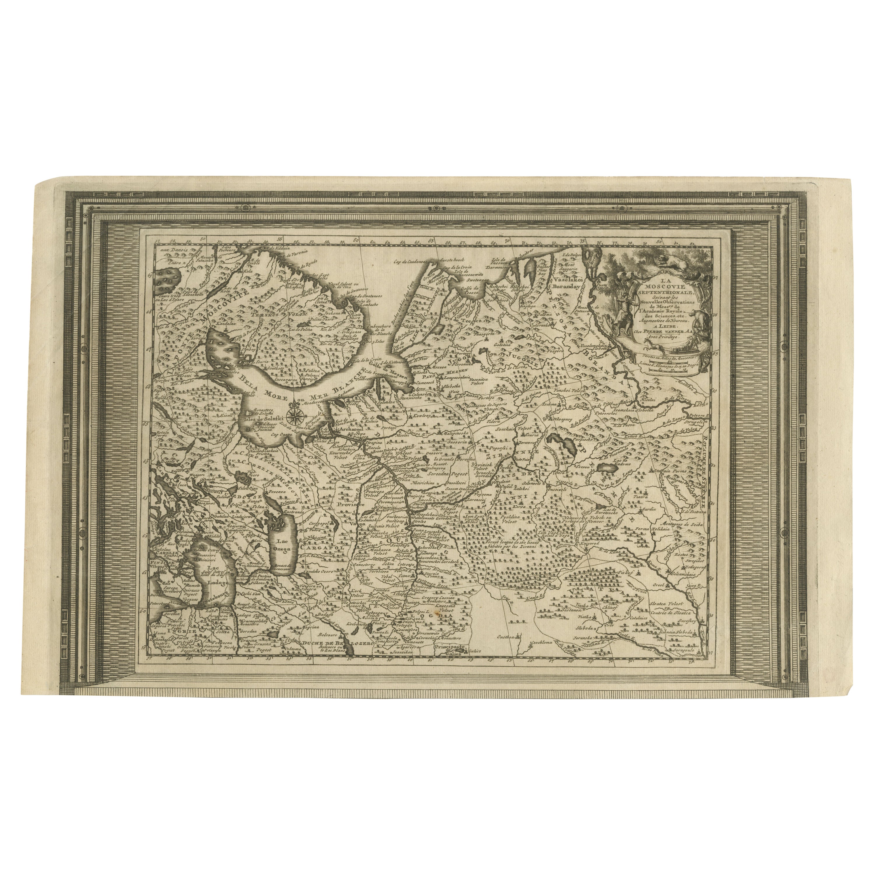
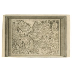
Antique Map of European Russia with Picture Frame Border
Located in Langweer, NL
Antique map titled 'La Moscovie Septentrionale (..)'. Decorative example of van der Aa's map of the northern part of European Russia. With the picture frame border, which appeared in...
Category
Antique Early 18th Century Maps
Materials
Paper
$360 Sale Price
20% Off
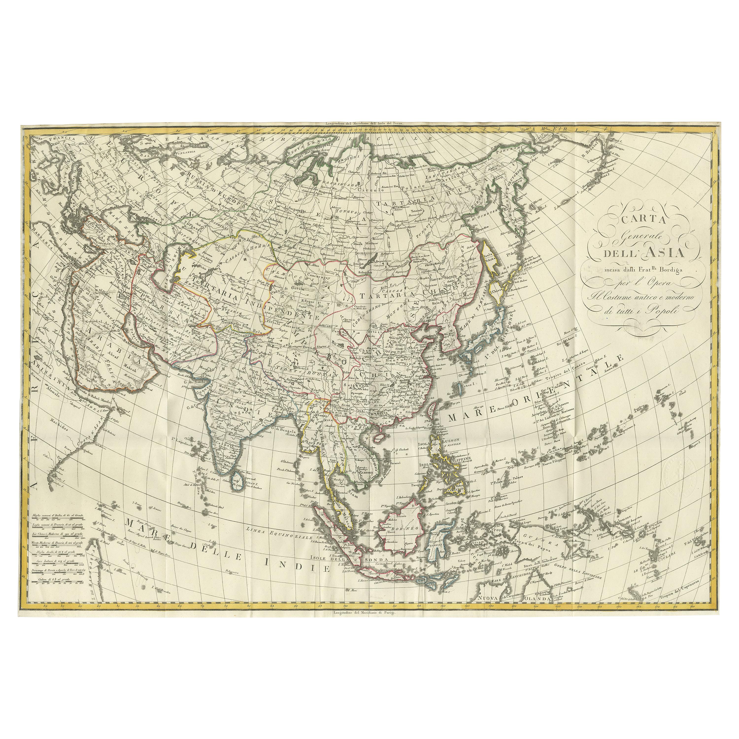
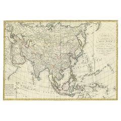
Antique Map of Asia by Ferrario '1815'
Located in Langweer, NL
Antique map titled 'Carta generale dell' Asia (..)'. Original antique map of Asia. This map originates from ' Le Costume Ancien et Moderne' by Jule...
Category
Antique Early 19th Century Maps
Materials
Paper
$901 Sale Price
20% Off
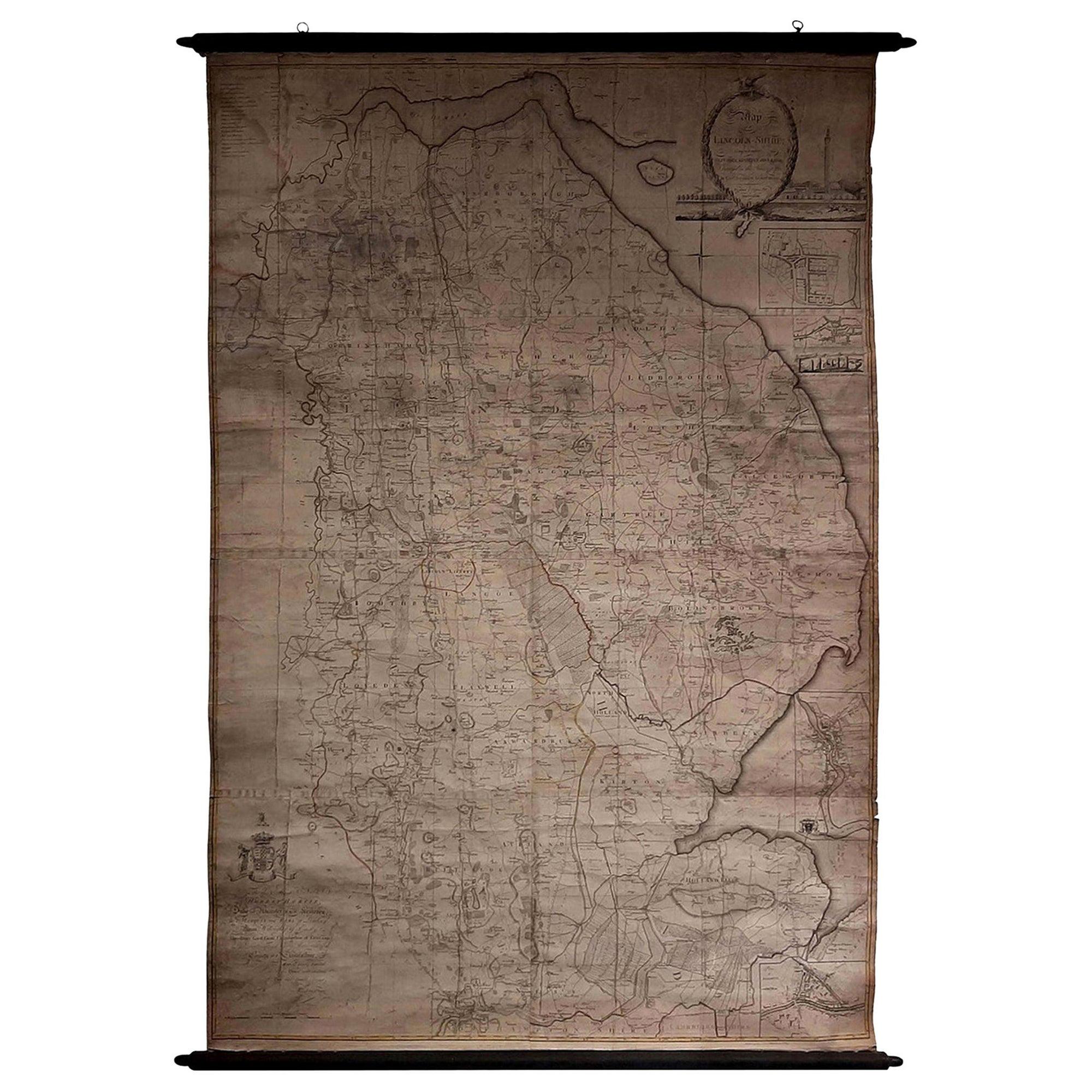
Large Scale Antique Scroll Map of Lincolnshire, England, Dated 1778
Located in St Annes, Lancashire
Wonderful scroll map of Lincolnshire
By Captain Armstrong, 1778
Copper plate engraving on paper laid on canvas
Original ebonized wood frame with lovely t...
Category
Antique 1770s English Georgian Maps
Materials
Wood, Paper

$760 Sale Price
84% Off
Free Shipping
More Ways To Browse
Coffee Table Black Italian Modern
Christofle America
Iranian Silk Rug Carpet
Poul Moller
Tables With Inlaid Wood
World War Table
Antonio Jacobsen
Ariston Chairs
Coffee Tables Europe
Marble Top Dining Tables
Nordiska Argentina
Pink And Black Rug
Black Wooden Chair
Orrefors Embassy
Black Ebonized
Elios Chair
Panache Designs
Plata Lappas