Belgian Maps
to
2
2
1
1
1
1
1
1
1
9,350
717
324
211
148
2
2
2
Place of Origin: Belgian
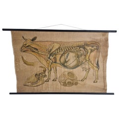
Antique Linen Anatomical School Poster from the Cow, 1950s
Located in Leuven, Vlaams Gewest
1950s didactical anatomical school poster of the cow.
Used to explain and show the anatomical aspect of a cow to the pupils.
Printed on linen.
Cool curio item to decorate a ...
Category
1950s Vintage Belgian Maps
Materials
Linen
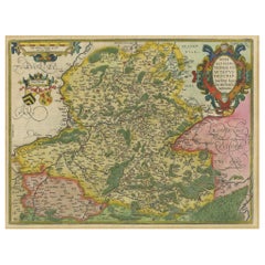
Hainaut Map Ortelius 1590 – Rare Hand-Colored French-Belgian Border Map
Located in Langweer, NL
Decorative 16th Century Map of Northern France by Ortelius, circa 1590
This richly colored antique map titled *Nobilis Hannoniae Comitatus Descriptio* depicts the County of Hainaut ...
Category
16th Century Antique Belgian Maps
Materials
Paper
Related Items
Four 18th Century Engraved and Hand-Colored Maps by Weigel
By Christoph Weigel
Located in Copenhagen, K
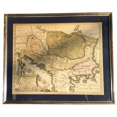
Small collection of four engraved maps of Italy, Balkan and of Central Asia.
Two are of Italy, one Corsica and Northern Italy and the other of the Southern Italian boot...
Category
18th Century Antique Belgian Maps
Materials
Paper
$450 / item
H 15.75 in W 18.12 in D 0.79 in
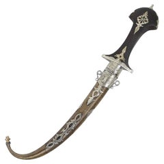
Moroccan Khoumya Dagger Vintage from 1950s
By Berber Tribes of Morocco
Located in North Hollywood, CA
Moroccan Tribal Khoumya Collector Dagger, vintage from the 1950s.
Handcrafted by Artisans in Morocco, very fine quality craftsmanship with a wooden grip engraved with Moroccan silver...
Category
20th Century Moorish Belgian Maps
Materials
Metal, Nickel
Mexico City by Braun & Hogenberg c. 1590
By Georg Braun and Frans Hogenberg
Located in Stamford, CT
Mexico by Braun & Hogenberg c. 1590
Category
Mid-19th Century Spanish Colonial Antique Belgian Maps
Materials
Glass, Wood, Paper
1940s Large Medical School Anatomical Heart Model
Located in Montclair, NY
A circa 1940s to mid 1950s large anatomical model of the human heart used to teach anatomy in medical school. Hand painted in multi color mat enamel with all the chambers and parts o...
Category
1940s Mid-Century Modern Vintage Belgian Maps
Materials
Plaster, Wood, Rubber
Antique under the Water School Specimen
Located in Berghuelen, DE
Antique under the water school specimen.
An antique natural wunderkammer glass display with marine life in the depths of the sea. The specimen is set ...
Category
Early 20th Century Mid-Century Modern Belgian Maps
Materials
Glass, Wood
A rare model of a sailing boat, Belgium 1940.
Located in Milan, IT
A rare model of a sailing boat according to the “Tuiga” (Giraf, built in United Kingdom in 1909), one of the few sailing yachts in the 24-30 m. size range. Designed and built by the ...
Category
Mid-20th Century Belgian Maps
Materials
Brass
Three-Dimensional Midcentury Italian Wall Plaster Didactic Anatomical, 1950s
Located in Reggio Emilia, IT
Italian midcentury three-dimensional didactic anatomical panel in plaster with Antonio Vallardi Milano label, Italy 1950s
Please note that the item is original of the period and t...
Category
1950s Mid-Century Modern Vintage Belgian Maps
Materials
Plaster, Wood
$405 Sale Price
20% Off
H 10.24 in W 14.97 in D 2.37 in
Midcentury Molecular Models Set from the 1950s, 7 Pieces
Located in Wien, AT
7-part set of different molecular models for chemistry lessons. Made in the Czech Republic in the 1950s. Sturdy iron wire construction with bakelite balls. Excellent original conditi...
Category
1950s Mid-Century Modern Vintage Belgian Maps
Materials
Metal
Color print from the 1950s depicting the single-engine biplane SAML S 2 1917
Located in Milan, IT
Color print from the 1950s depicting the SAML S 2 single-engine biplane, produced in 1916 by the Italian company Società Anonima Meccanica Lombarda (SAML). It was a training and reco...
Category
Mid-20th Century Belgian Maps
Materials
Paper
$436
H 11.4 in W 23.6 in D 0.7 in
Large 1950s Vintage Scientific Anatomical Human 3D Educational Eye Eyeball Model
Located in Lafayette, IN
1950's Vintage scientific human 3d eyeball model. Hand-painted with wonderful original patina!
Category
1950s Vintage Belgian Maps
Materials
Rubber
$499 Sale Price
75% Off
H 13 in W 10 in D 9 in
Antique Anatomical Wall Chart Depicting the Human Skeleton
Located in Berghuelen, DE
Antique Anatomical Wall Chart Depicting the Human Skeleton
A rare 19th century anatomical wall chart depicting the human skeleton. On the sides On the...
Category
Early 20th Century Victorian Belgian Maps
Materials
Paper
1950s Anatomical Teaching Model Of Normal Size Depicting A Hoolow Foot
Located in Milan, IT
Anatomical teaching model of normal size depicting a hollow foot in section showing a strong accentuation of the plantar arch and how the foot rest is mainly on the forefoot and heel...
Category
1950s Vintage Belgian Maps
Materials
Plastic
Previously Available Items
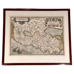
"Terra Sancta" Map of the Holy Land by Abraham Ortelius (1527-1598) Framed
By Abraham Ortelius
Located in San Francisco, CA
Abraham Ortelius (1527-1598) was a cartographer, geographer and map maker from Antwerp in the Spanish Netherlands. He created the first modern atlas, titled in Latin "Theatrum Orbis ...
Category
17th Century Baroque Antique Belgian Maps
Materials
Paper
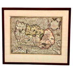
Map of Ireland Titled "Hiberniae Britannicae Insulae Nova Descriptio Irland"
By Abraham Ortelius
Located in San Francisco, CA
Abraham Ortelius (1527-1598) was a cartographer, geographer and maker from Antwerp in the Spanish Netherlands. He created the first modern atlas titled in Latin Theatrum Orbis Terrar...
Category
Early 18th Century Antique Belgian Maps
Materials
Paper
School Chart or Pull Down Map of Geography of the Netherlands, 1950s
Located in Hemiksem, VAN
A beautiful old school map of the Netherlands, painted on linen. The map shows the 3 different reliefs (low, middle, high) of the Netherlands. The beau...
Category
1950s Mid-Century Modern Vintage Belgian Maps
Materials
Linen, Paint
XL Old School Map of Belgium 'Printed by Procure', 1950s
Located in Oostende, BE
XL Old school map of Belgium (Printed by Procure). Presumably from around 1950-1960.
Category
1950s Mid-Century Modern Vintage Belgian Maps
Materials
Metal
Antique Map of Mexico by Ortelius, circa 1602
By Abraham Ortelius
Located in Langweer, NL
Antique map titled 'Hispaniae Novae Sivae Magnae Recens Et Vera Descriptio 1579'. Map of western New Spain, showing the recently-created Spanish settlements, many rivers, and large l...
Category
Early 17th Century Antique Belgian Maps
Materials
Paper
Vintage schoolhouse map of North America
Located in Houston, TX
This unique and colorful map of North America is hand-painted on linen. Original dowel rods are intact. It is in the Flemish language.
Category
1950s Vintage Belgian Maps
Vintage Hand-Painted Map of Roman Empire
Located in Houston, TX
Hand-painted school chart in Flemish depicting the Roman Empire and its two chief rivals. The chart identifies the physcial borders of the three empires and the major cities in each....
Category
1950s Vintage Belgian Maps
Dual Sided Plastic School Map of the Congo in French
Located in Houston, TX
Map is dual sided with one side depicting the administrative divisions of the African country of Zaire/ Congo and the other side depicting the industrial an...
Category
Belgian Maps
Vintage Belgian Teaching Map of the World
Located in Houston, TX
Cool, graphic teaching map on which teachers would chalk. Faint chalk marks remain. "Baert, Brussel" is printed at the bottom. This map is large scale
Category
1950s Vintage Belgian Maps
Vintage Belgian Map of France
Located in Houston, TX
Very colorful and graphic map of France in Flemish showing topography of the region. We have numerous other charts and maps of varied subject matter. Pl...
Category
1940s Vintage Belgian Maps
Hand-painted map of Belgium. Newly framed.
Located in Houston, TX
Wonderful, hand-painted map of Beglium in the Flemish language.
Category
1930s Vintage Belgian Maps
Hand-painted map of the Belgian Congo
Located in Houston, TX
Wonderful hand-painted large-scale map used in Belgian school.
Category
1940s Vintage Belgian Maps
Recently Viewed
View AllMore Ways To Browse
Antique Wellington Chests
Antonio Cassi Ramelli
Archimede Seguso Birds
Art Deco Coasters
Art Deco Footballer
Art Deco Music Cabinet
Art Deco Waterfall Bedroom Furniture
Art Deco Waterfall Bedroom
Art Deco Whisky
Art Foulard
Art Nouveau Sunflower
Arts And Crafts Silver Coffee Pot
Asian Pink Bowl
Avesn Vase
Baccarat Carafe
Bakelite Bird
Bakelite Cocktail Picks
Bamboo Ikebana Vase
