Items Similar to Original Antique English County Map - Monmouthshire. J & C Walker. 1851

Want more images or videos?
Request additional images or videos from the seller
1 of 5
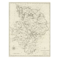
Original Antique English County Map - Monmouthshire. J & C Walker. 1851
$50
£37.94
€43.38
CA$69.84
A$77.65
CHF 40.54
MX$945.17
NOK 517.32
SEK 484.71
DKK 323.75
Shipping
Retrieving quote...The 1stDibs Promise:
Authenticity Guarantee,
Money-Back Guarantee,
24-Hour Cancellation
About the Item
Great map of Monmouthshire
Original colour
By J & C Walker
Published by Longman, Rees, Orme, Brown & Co. 1851
Unframed.
- Dimensions:Height: 13.75 in (34.93 cm)Width: 17.25 in (43.82 cm)Depth: 0.07 in (1.78 mm)
- Style:Other (In the Style Of)
- Materials and Techniques:Paper,Other
- Place of Origin:
- Period:
- Date of Manufacture:1851
- Condition:Wear consistent with age and use.
- Seller Location:St Annes, GB
- Reference Number:1stDibs: LU1836334068602
About the Seller
4.9
Platinum Seller
Premium sellers with a 4.7+ rating and 24-hour response times
1stDibs seller since 2016
3,115 sales on 1stDibs
Typical response time: 1 hour
Associations
International Confederation of Art and Antique Dealers' Associations
- ShippingRetrieving quote...Shipping from: St Annes, United Kingdom
- Return Policy
Authenticity Guarantee
In the unlikely event there’s an issue with an item’s authenticity, contact us within 1 year for a full refund. DetailsMoney-Back Guarantee
If your item is not as described, is damaged in transit, or does not arrive, contact us within 7 days for a full refund. Details24-Hour Cancellation
You have a 24-hour grace period in which to reconsider your purchase, with no questions asked.Vetted Professional Sellers
Our world-class sellers must adhere to strict standards for service and quality, maintaining the integrity of our listings.Price-Match Guarantee
If you find that a seller listed the same item for a lower price elsewhere, we’ll match it.Trusted Global Delivery
Our best-in-class carrier network provides specialized shipping options worldwide, including custom delivery.More From This Seller
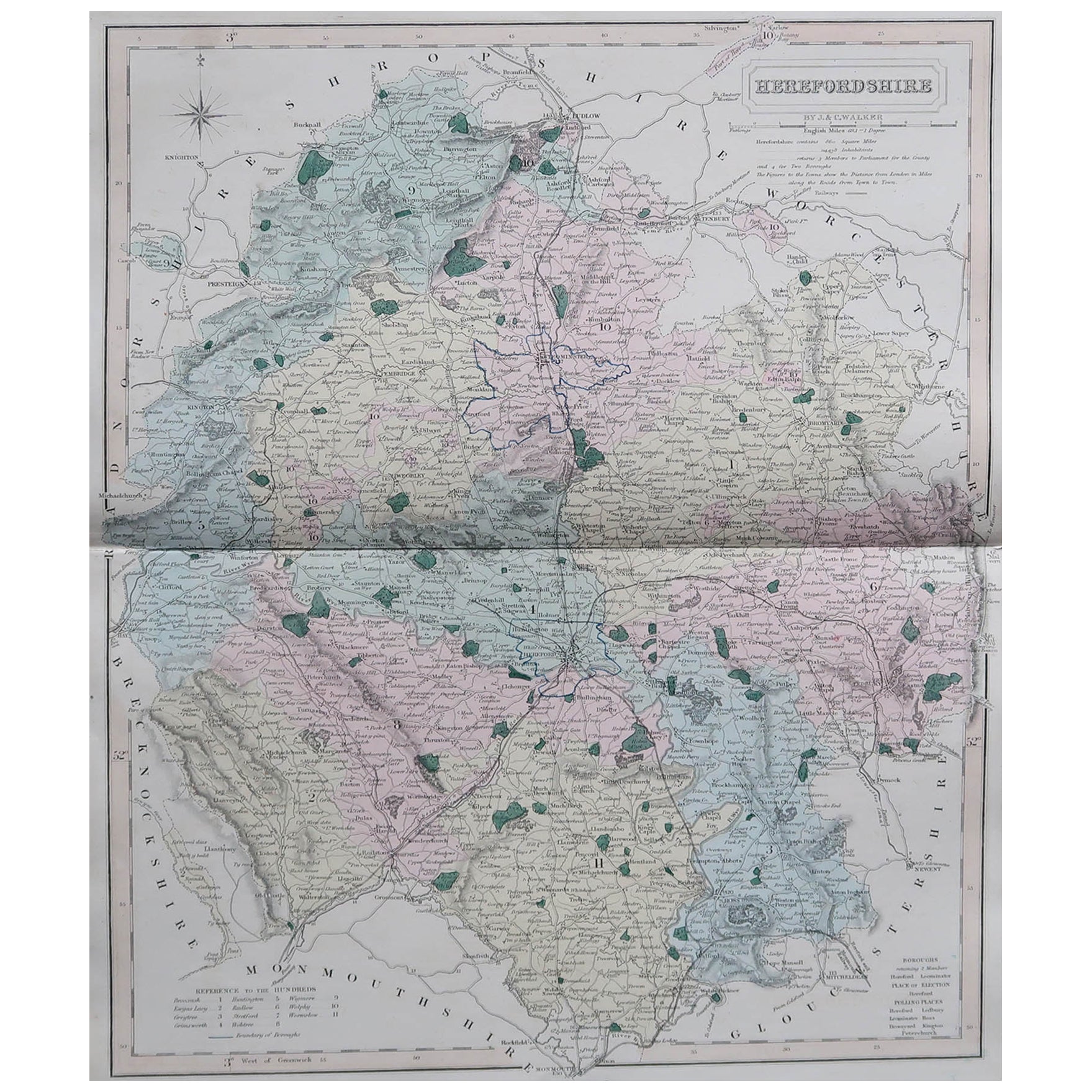
View AllOriginal Antique English County Map, Herefordshire, J & C Walker, 1851
Located in St Annes, Lancashire
Great map of Herefordshire
Original colour
By J & C Walker
Published by Longman, Rees, Orme, Brown & Co. 1851
Unframed.
Category
Antique 1850s English Other Maps
Materials
Paper

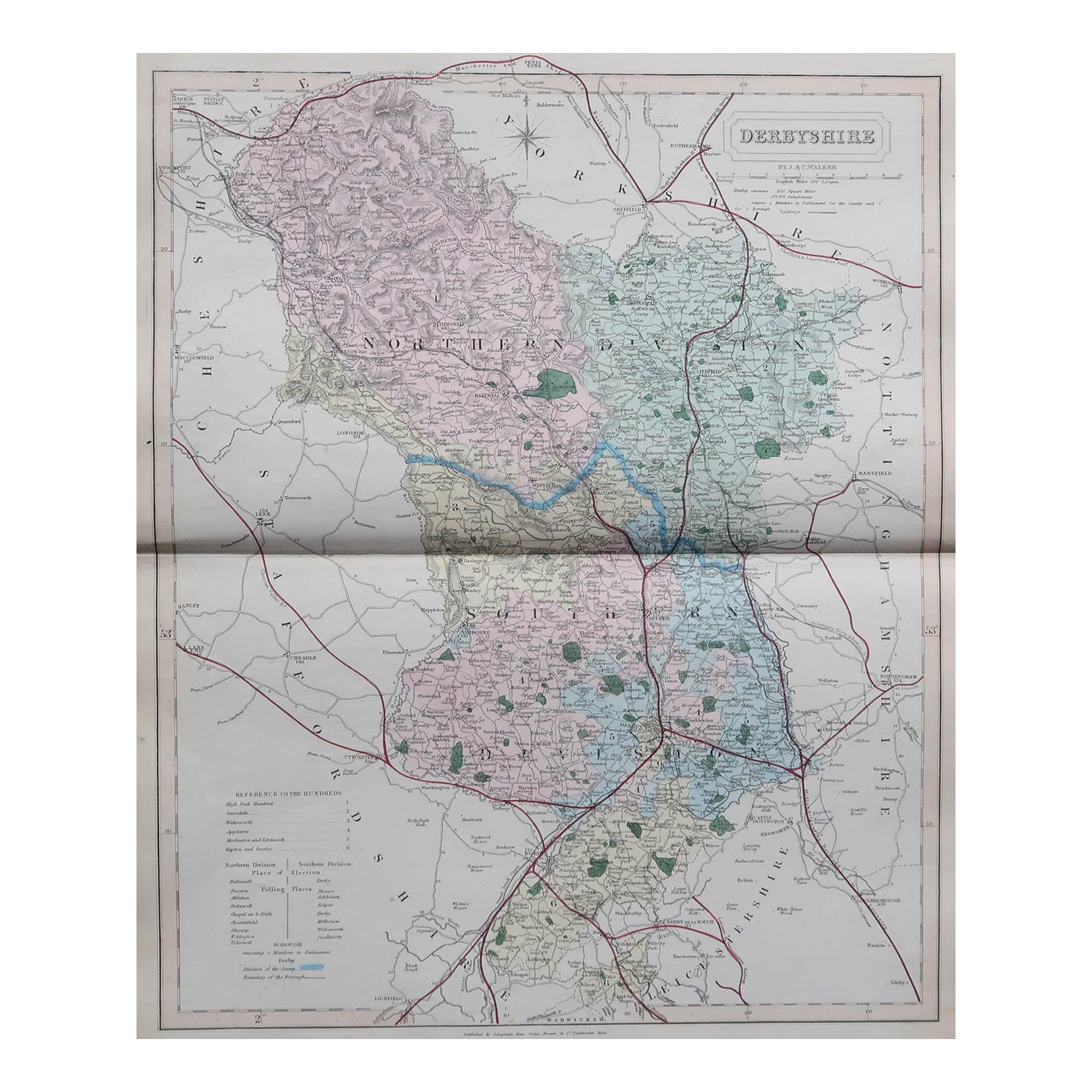
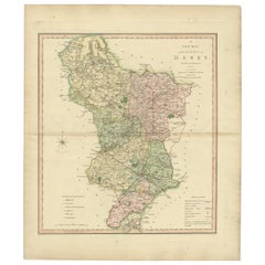
Original Antique English County Map, Derbyshire, J & C Walker, 1851
Located in St Annes, Lancashire
Great map of Derbyshire
Original colour
By J & C Walker
Published by Longman, Rees, Orme, Brown & Co. 1851
Unframed.
Category
Antique 1850s English Other Maps
Materials
Paper

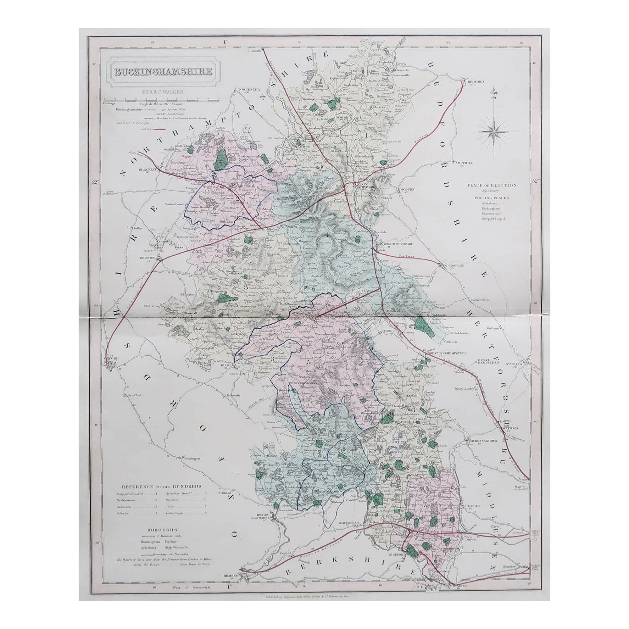
Original Antique English County Map, Buckinghamshire, J & C Walker, 1851
Located in St Annes, Lancashire
Great map of Buckinghamshire
Original colour
By J & C Walker
Published by Longman, Rees, Orme, Brown & Co. 1851
Unframed.
Category
Antique 1850s English Other Maps
Materials
Paper

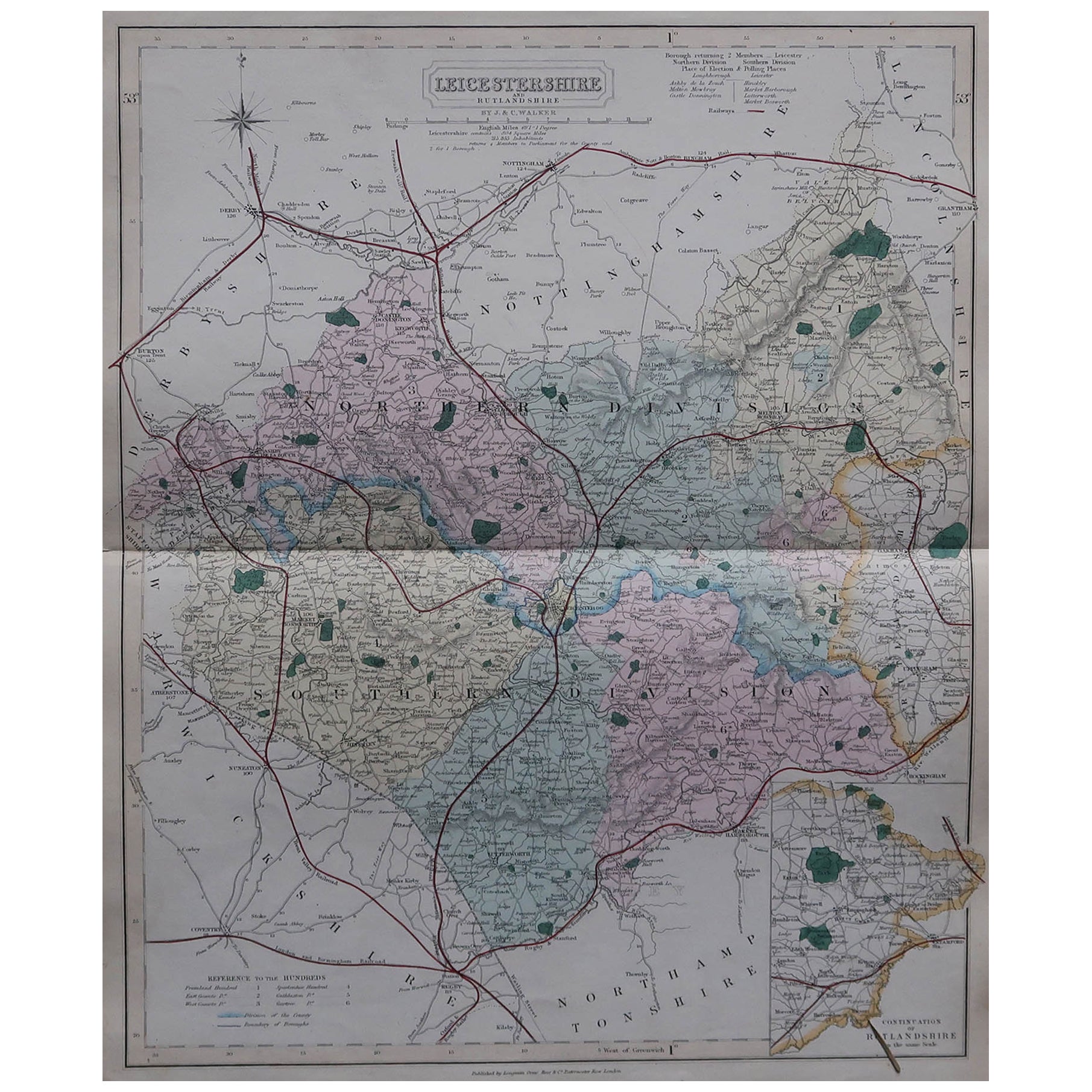
Original Antique English County Map, Leicestershire, J & C Walker, 1851
Located in St Annes, Lancashire
Great map of Leicestershire
Original colour
By J & C Walker
Published by Longman, Rees, Orme, Brown & Co. 1851
Unframed.
Category
Antique 1850s English Other Maps
Materials
Paper

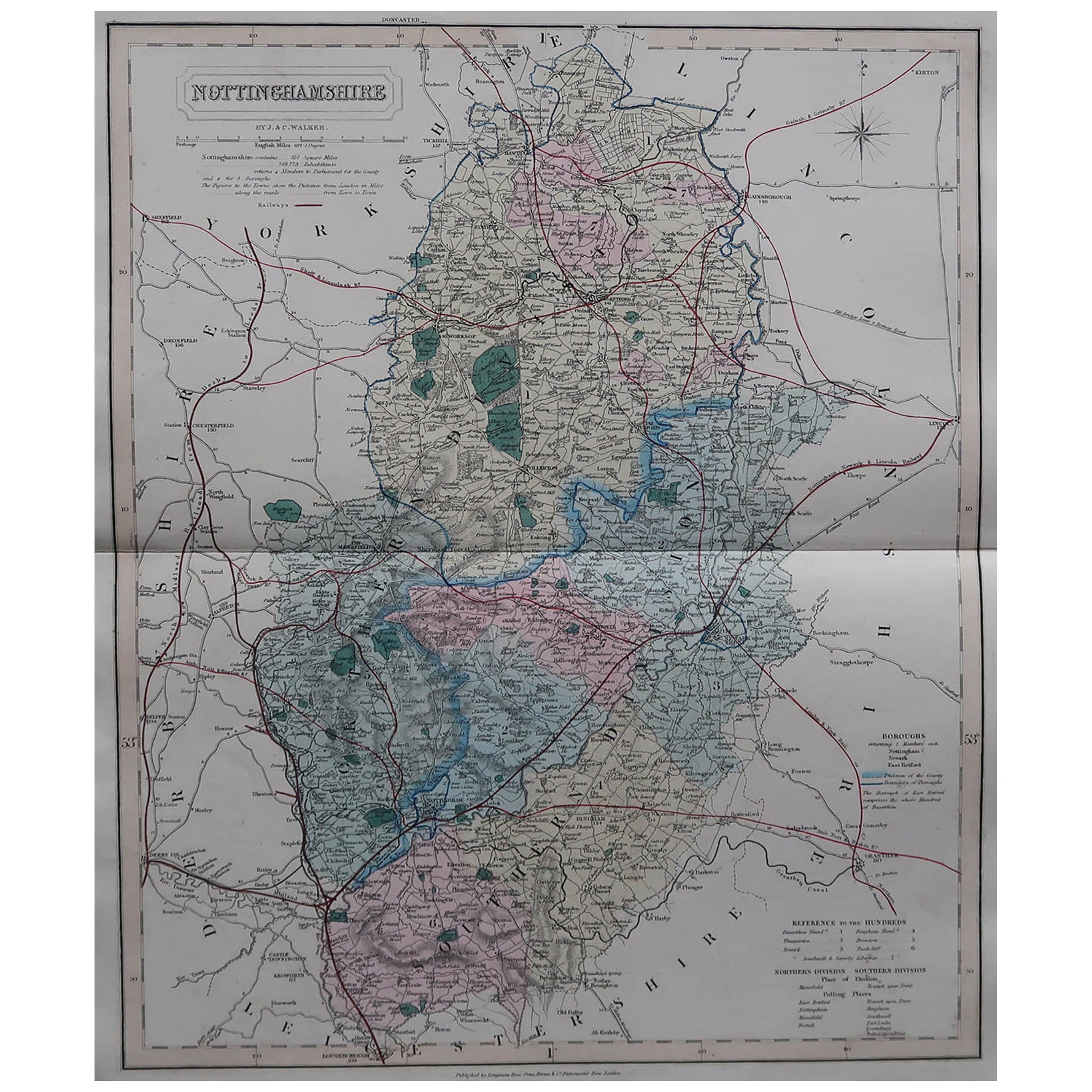
Original Antique English County Map, Nottinghamshire, J & C Walker, 1851
Located in St Annes, Lancashire
Great map of Nottinghamshire
Original colour
By J & C Walker
Published by Longman, Rees, Orme, Brown & Co. 1851
Unframed.
Category
Antique 1850s English Other Maps
Materials
Paper

Original Antique English County Map, Cambridgeshire, J & C Walker, 1851
Located in St Annes, Lancashire
Great map of Cambridgeshire
Original colour
By J & C Walker
Published by Longman, Rees, Orme, Brown & Co. 1851
Unframed.
Category
Antique 1850s English Other Maps
Materials
Paper

You May Also Like
Large Antique County Map of Huntingdonshire, England
Located in Langweer, NL
Antique map titled 'A Map of Huntingdonshire from the best Authorities'. Original old county map of Huntingdonshire, England. Engraved by John Cary. Originates from 'New British Atla...
Category
Antique Early 19th Century Maps
Materials
Paper
$220 Sale Price
20% Off
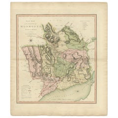
Antique County Map of Monmouthshire, England, circa 1804
Located in Langweer, NL
Antique county map of Monmouthshire first published circa 1800. Villages, towns, and cities illustrated include Newport, Chepstow, Rockfield, and P...
Category
Antique Early 1800s Maps
Materials
Paper
$311 Sale Price
20% Off
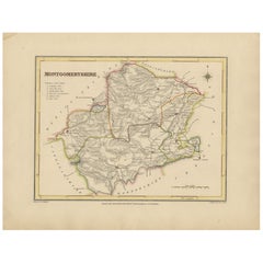
Old Map of Montgomeryshire by 1844 – Welshpool Llanidloes Newtown Machynlleth
Located in Langweer, NL
Title: Old Map of Montgomeryshire by Samuel Lewis 1844 – Welshpool Llanidloes Newtown Machynlleth
Description: This 1844 map of Montgomeryshire was engraved for Samuel Lewis’ Topographical Dictionary of Wales. It highlights principal towns such as Welshpool, Llanidloes, Newtown, and Machynlleth, with rivers, roads, and hill shading showing the region's terrain. The hand-colored borders mark the administrative divisions, and a decorative compass rose and union reference chart are included.
Condition:
The map is in good condition with light age toning and wide clean margins. The engraving is clear and the original hand coloring remains vibrant. No tears or major imperfections are present.
Framing suggestions:
An acid-free mat in ivory or soft beige will complement the aged paper tone. A dark wood, black, or antique gold frame will suit the historic style. UV-protective glass is recommended to preserve the colors. A beautiful display piece for those with ties to mid-Wales or an interest in antique cartography.
Keywords:
Montgomeryshire map 1844 Samuel Lewis antique...
Category
Antique 1840s Maps
Materials
Paper
$230 Sale Price
20% Off
Antique Decorative and Detailed County Map of Cumberland, England, 1804
Located in Langweer, NL
Antique county map of Cumberland first published c.1800. Villages, towns, and cities illustrated include Carlisle, Penrith, Copeland Forest, and Wigt...
Category
Antique Early 1800s Maps
Materials
Paper
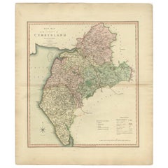
$311 Sale Price
20% Off
Antique County Map of Derbyshire, England, 1804
Located in Langweer, NL
Antique county map of Derbyshire first published, circa 1800. Villages, towns, and cities illustrated include Chesterfield, Wirksworth, Derby, and ...
Category
Antique Early 1800s Maps
Materials
Paper
$311 Sale Price
20% Off
Antique Map of England & Wales by Wyld '1845'
Located in Langweer, NL
Antique map titled 'England & Wales'. Original antique map of England & Wales. This map originates from 'An Atlas of the World, Comprehending Se...
Category
Antique Mid-19th Century Maps
Materials
Paper

$135 Sale Price
24% Off