Items Similar to Original Antique Map of The Austrian Empire, 1882

Want more images or videos?
Request additional images or videos from the seller
1 of 6
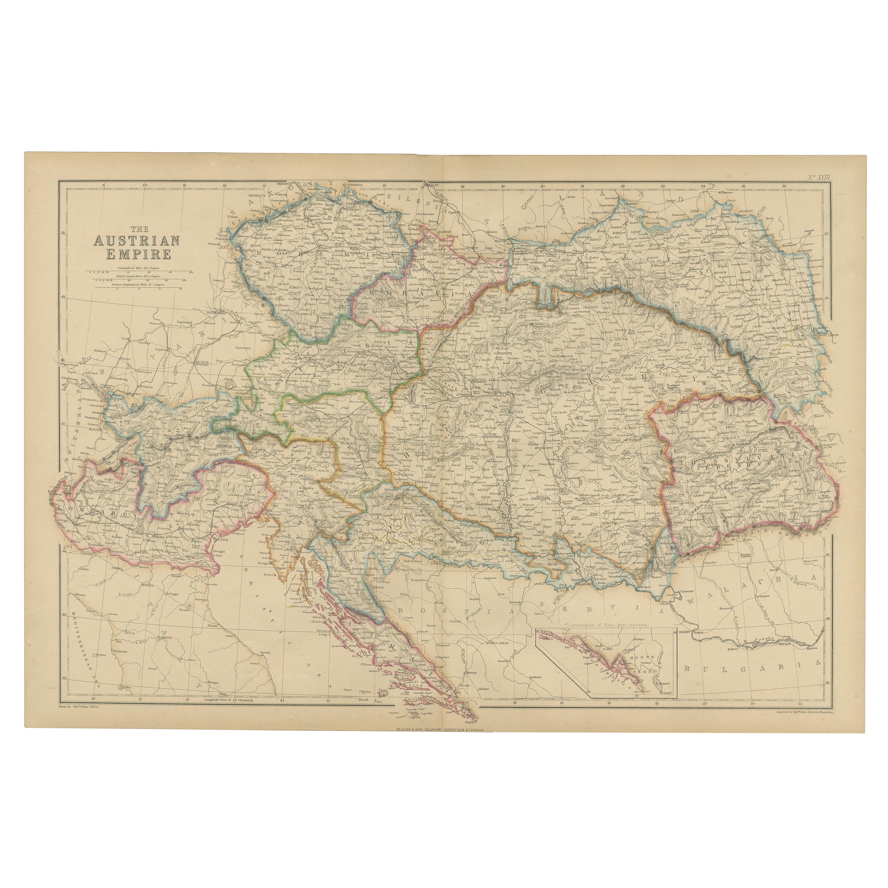
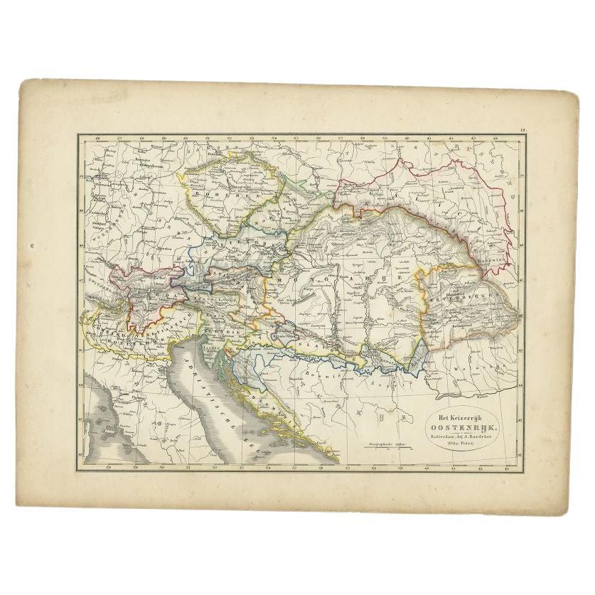
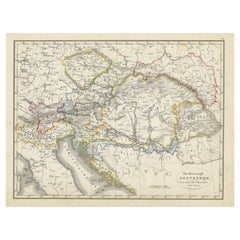
Original Antique Map of The Austrian Empire, 1882
$201.29
$251.6120% Off
£149.85
£187.3120% Off
€168
€21020% Off
CA$275.71
CA$344.6420% Off
A$306.65
A$383.3220% Off
CHF 160.13
CHF 200.1620% Off
MX$3,731.66
MX$4,664.5820% Off
NOK 2,045.05
NOK 2,556.3120% Off
SEK 1,917.89
SEK 2,397.3720% Off
DKK 1,278.93
DKK 1,598.6620% Off
Shipping
Retrieving quote...The 1stDibs Promise:
Authenticity Guarantee,
Money-Back Guarantee,
24-Hour Cancellation
About the Item
Step into the past with an original Antique Map of The Austrian Empire from the esteemed 'Comprehensive Atlas and Geography of the World,' meticulously crafted in 1882. This intricate map beautifully delineates the Austrian Empire's territories, showcasing its political boundaries, cities, rivers, and diverse landscapes with unparalleled detail.
More than a map, it's a doorway to a captivating historical era. Bursting with vibrant colors and intricate engravings, this piece brings the 19th-century world to life on your wall, offering a glimpse into the rich history and cultural tapestry of the Austrian Empire.
Ideal for history enthusiasts, collectors, or admirers of antique craftsmanship, this map serves as both an exquisite display and a testament to cartographic mastery. It embodies an era of exploration and scholarly dedication, preserving a snapshot of the Austrian Empire's grandeur.
Beyond its cartographic significance, it's a time-traveling artifact yearning to grace your home or office walls. Acquire this antique map today and let its historical charm captivate your space, inviting you on an immersive journey through the storied landscapes of the majestic Austrian Empire.
- Dimensions:Height: 14.97 in (38 cm)Width: 22.45 in (57 cm)Depth: 0 in (0.02 mm)
- Materials and Techniques:
- Period:
- Date of Manufacture:1882
- Condition:Good condition, folding line in the middle. The outer borders are slightly yellowish discolored due to age, but not the image. This map is ideal for framing. Study the image carefully.
- Seller Location:Langweer, NL
- Reference Number:Seller: BG-13601-2-281stDibs: LU3054337278012
About the Seller
5.0
Recognized Seller
These prestigious sellers are industry leaders and represent the highest echelon for item quality and design.
Platinum Seller
Premium sellers with a 4.7+ rating and 24-hour response times
Established in 2009
1stDibs seller since 2017
2,510 sales on 1stDibs
Typical response time: <1 hour
- ShippingRetrieving quote...Shipping from: Langweer, Netherlands
- Return Policy
Authenticity Guarantee
In the unlikely event there’s an issue with an item’s authenticity, contact us within 1 year for a full refund. DetailsMoney-Back Guarantee
If your item is not as described, is damaged in transit, or does not arrive, contact us within 7 days for a full refund. Details24-Hour Cancellation
You have a 24-hour grace period in which to reconsider your purchase, with no questions asked.Vetted Professional Sellers
Our world-class sellers must adhere to strict standards for service and quality, maintaining the integrity of our listings.Price-Match Guarantee
If you find that a seller listed the same item for a lower price elsewhere, we’ll match it.Trusted Global Delivery
Our best-in-class carrier network provides specialized shipping options worldwide, including custom delivery.More From This Seller
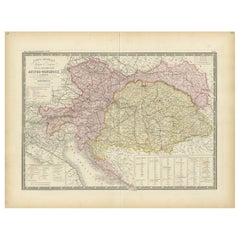
View AllAntique Map of the Austrian Empire by W. G. Blackie, 1859
Located in Langweer, NL
Antique map titled 'The Austrian Empire'. Original antique map of the Austrian Empire with inset map of Montenegro. This map originates from ‘The Imperial Atlas of Modern Geography’....
Category
Antique Mid-19th Century Maps
Materials
Paper
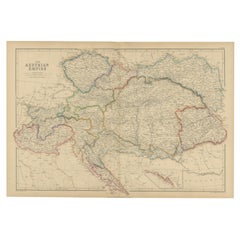
$209 Sale Price
30% Off
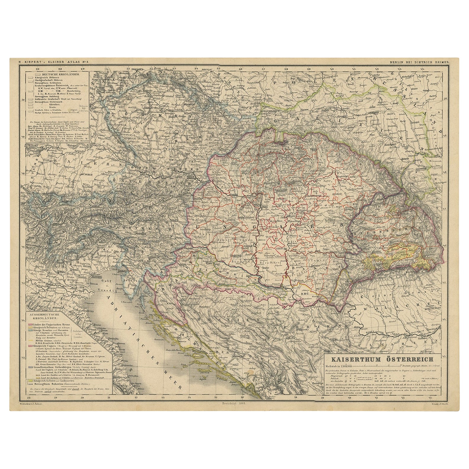
Old German Map of the Austrian Empire, ca.1870
Located in Langweer, NL
Antique map titled 'Kaiserthum Österreich'.
Old map of the Austrian Empire. This map originates from 'H. Kiepert's Kleiner Atlas der Neueren Geographie für Schule und Haus'.
Arti...
Category
Antique 1870s Maps
Materials
Paper
$277 Sale Price
20% Off
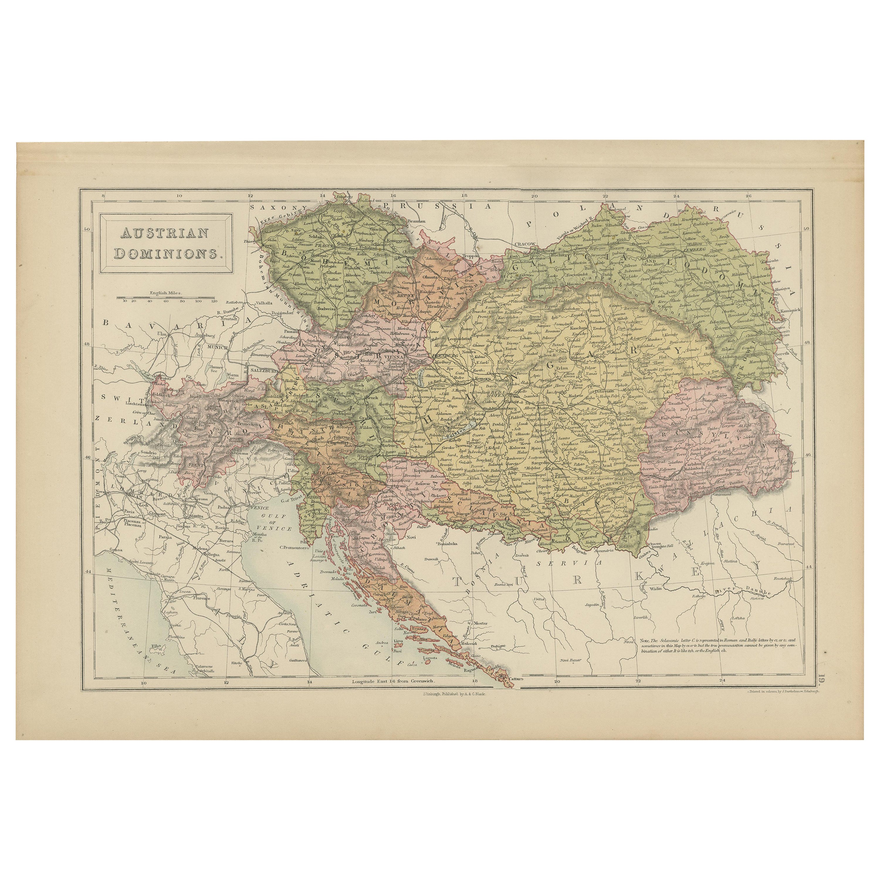
Antique Map of Austrian Dominions by A & C. Black, 1870
Located in Langweer, NL
Antique map titled 'Austrian Dominions'. Original antique map of Austrian Dominions. This map originates from ‘Black's General Atlas of The Worl...
Category
Antique Late 19th Century Maps
Materials
Paper
$167 Sale Price
20% Off
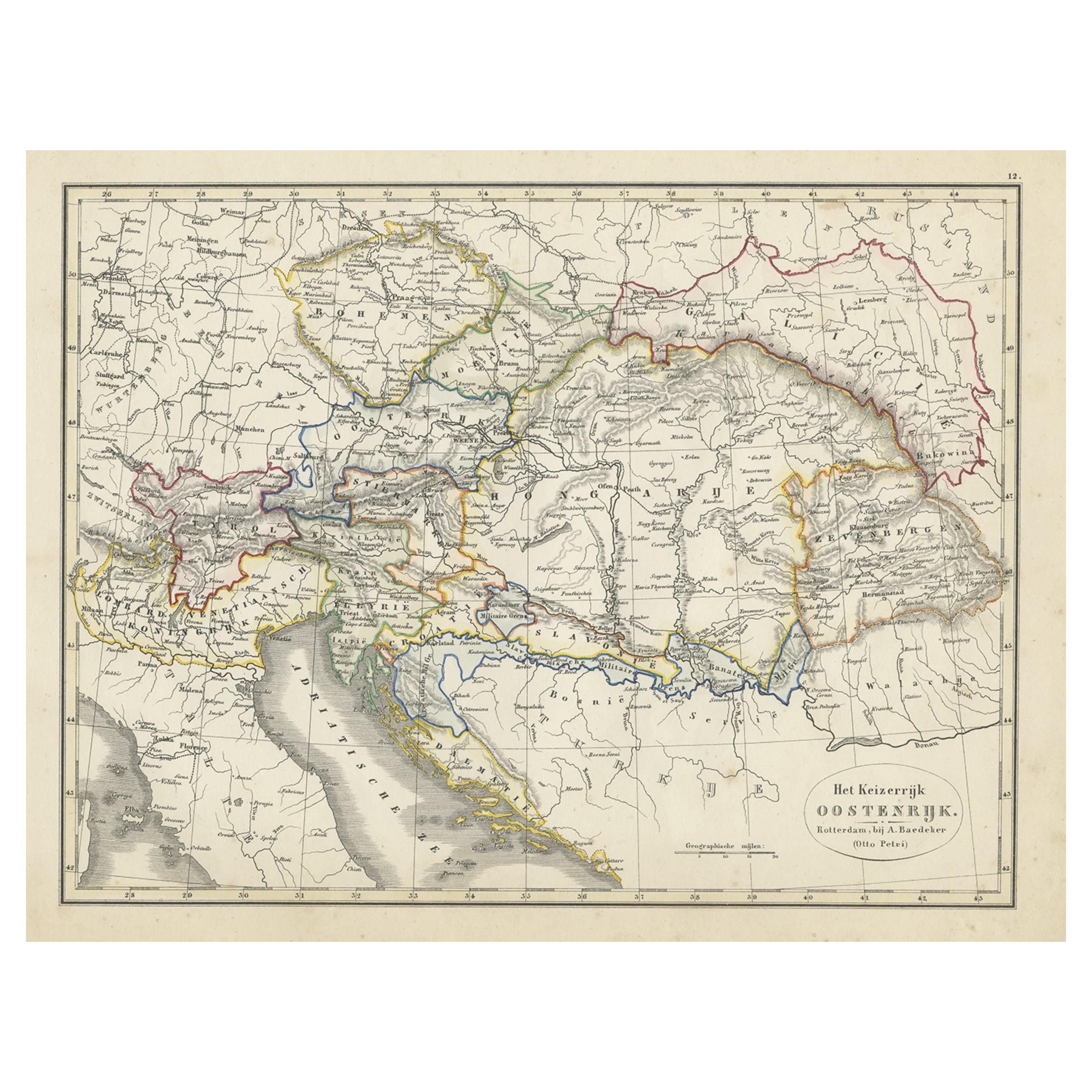
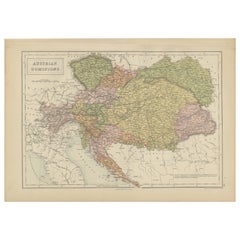
Original Antique Map of Austria from an Old Dutch School Atlas, 1852
Located in Langweer, NL
Antique map titled 'Het Keizerrijk Oostenrijk'.
Map of the Austrian Empire. This map originates from 'School-Atlas van alle deelen der Aarde' by Otto Petri...
Category
Antique 1850s Maps
Materials
Paper
$182 Sale Price
20% Off
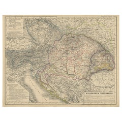
Antique Map of Austria-Hungary by Levasseur, '1875'
Located in Langweer, NL
Antique map titled 'Carte générale de la Monarchie Austro-Hongroise (..)'. Large map of Austria-Hungary. This map originates from 'Atlas de Géographie M...
Category
Antique Late 19th Century Maps
Materials
Paper
$311 Sale Price
35% Off
Antique Map of the Austrian Empire by Petri, 1852
Located in Langweer, NL
Antique map titled 'Het Keizerrijk Oostenrijk'. Map of the Austrian Empire. This map originates from 'School-Atlas van alle deelen der Aarde' by Otto Petri....
Category
Antique 19th Century Maps
Materials
Paper

$115 Sale Price
20% Off
You May Also Like
Austria-Hungary, Western Part. Century Atlas antique vintage map
Located in Melbourne, Victoria
'The Century Atlas. Austria-Hungary, Western Part'
Original antique map, 1903.
Central fold as issued. Map name and number printed on the reverse corners.
Sheet 40cm by 29.5cm.
Category
Early 20th Century Victorian More Prints
Materials
Lithograph

Large Original Antique Map of Poland by Sidney Hall, 1847
Located in St Annes, Lancashire
Great map of Poland
Drawn and engraved by Sidney Hall
Steel engraving
Original colour outline
Published by A & C Black. 1847
Unframed
...
Category
Antique 1840s Scottish Maps
Materials
Paper

German Empire, Southwestern Part. Century Atlas antique vintage map
Located in Melbourne, Victoria
'The Century Atlas. German Empire, Southwestern Part'
Original antique map, 1903.
Central fold as issued. Map name and number printed on the reverse co...
Category
Early 20th Century Victorian More Prints
Materials
Lithograph

1849 Map of "Europaische Russland", 'Meyer Map of European Russia', Ric. R017
Located in Norton, MA
1849 Map of
"Europaische Russland"
( Meyer Map of European Russia)
Ric.r017
A lovely map of European Russia dating to 1849 by Joseph Meyer. It covers the European portions of...
Category
Antique 19th Century Unknown Maps
Materials
Paper

1853 Map of "Russia in Europe Including Poland" Ric.r016
Located in Norton, MA
Description
Russia in Europe incl. Poland by J Wyld c.1853
Hand coloured steel engraving
Dimension: Paper: 25 cm W x 33 cm H ; Sight: 22 cm W x 28 cm H
Condition: Good ...
Category
Antique 19th Century Unknown Maps
Materials
Paper

Map of Eastern Roman Empire -Vintage Offset Print - Early 20th Century
Located in Roma, IT
This map of Eastern Roman Empire is a vintage offset print realized in the early 20th Century.
The state of preservation of the artwork is aged with dif...
Category
Early 20th Century Figurative Prints
Materials
Offset

More Ways To Browse
Austrian Empire
Antique Rug Wool Navy Blue Red
Antique Silver Platter
Boat Blueprint
Cream Plates
Vintage Art Deco Rugs
Vintage Serving Forks
Brewery Signs
Herati Rug
Gold Leaf Furniture Black
Italian Wood Console Tables
Maison Jansen Argentina
Antique Oushak
Mid Century Danish Directors Chairs
Moller 70
Wood Relief Art
Argentina Travel Poster
Century Furniture Faux Bamboo