Items Similar to Original Antique Map of The London Underground. 1911

Want more images or videos?
Request additional images or videos from the seller
1 of 5
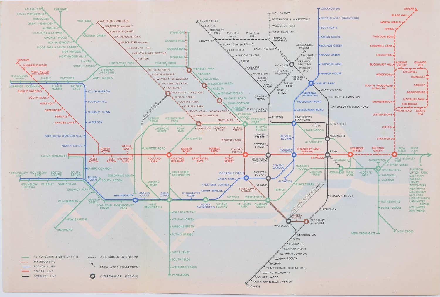
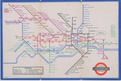
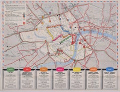
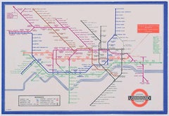
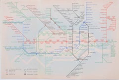
Original Antique Map of The London Underground. 1911
$295
£225.23
€260.25
CA$414.12
A$461.58
CHF 242.18
MX$5,636.70
NOK 3,066.49
SEK 2,898.30
DKK 1,942.38
About the Item
Superb map of The London Underground
Published by Ward Lock, 1911
Folding map. Printed on paper
Unframed.
Good condition/ Minor repair to an edge tear on right edge ( shown in images )
Free shipping
- Dimensions:Height: 10 in (25.4 cm)Width: 13.5 in (34.29 cm)Depth: 0.07 in (1.78 mm)
- Materials and Techniques:
- Place of Origin:
- Period:1910-1919
- Date of Manufacture:1911
- Condition:Wear consistent with age and use.
- Seller Location:St Annes, GB
- Reference Number:1stDibs: LU1836345454412
About the Seller
4.9
Platinum Seller
Premium sellers with a 4.7+ rating and 24-hour response times
1stDibs seller since 2016
3,116 sales on 1stDibs
Typical response time: 1 hour
Associations
International Confederation of Art and Antique Dealers' Associations
- ShippingRetrieving quote...Shipping from: St Annes, United Kingdom
- Return Policy
Authenticity Guarantee
In the unlikely event there’s an issue with an item’s authenticity, contact us within 1 year for a full refund. DetailsMoney-Back Guarantee
If your item is not as described, is damaged in transit, or does not arrive, contact us within 7 days for a full refund. Details24-Hour Cancellation
You have a 24-hour grace period in which to reconsider your purchase, with no questions asked.Vetted Professional Sellers
Our world-class sellers must adhere to strict standards for service and quality, maintaining the integrity of our listings.Price-Match Guarantee
If you find that a seller listed the same item for a lower price elsewhere, we’ll match it.Trusted Global Delivery
Our best-in-class carrier network provides specialized shipping options worldwide, including custom delivery.More From This Seller
View AllLarge Original Vintage Map of the United Kingdom, circa 1920
Located in St Annes, Lancashire
Great map of The United Kingdom
Unframed
Original color
By John Bartholomew and Co. Edinburgh Geographical Institute
Published, circa 1920
Free shipping.
Category
Vintage 1920s British Maps
Materials
Paper

Original Large Antique Map of Paris, France by John Dower, 1861
Located in St Annes, Lancashire
Fabulous monochrome map of Paris.
Vignettes of St Germain En Laye, Saint Cloud, Versailles and Fontainbleau.
Unframed.
Drawn by J.Dower.
Lithography by Weller. 4 sheets joined to...
Category
Antique 1860s English Victorian Maps
Materials
Paper

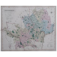
Original Antique English County Map, Buckinghamshire, J & C Walker, 1851
Located in St Annes, Lancashire
Great map of Buckinghamshire
Original colour
By J & C Walker
Published by Longman, Rees, Orme, Brown & Co. 1851
Unframed.
Category
Antique 1850s English Other Maps
Materials
Paper

Antique Map of American Cities, Vignette of New York City, circa 1920
Located in St Annes, Lancashire
Great maps of American Cities
Unframed
Original color
By John Bartholomew and Co. Edinburgh Geographical Institute
Published, circa 1920
Category
Vintage 1920s British Maps
Materials
Paper

Original Antique English County Map, Warwickshire, J & C Walker, 1851
Located in St Annes, Lancashire
Great map of Warwickshire
Original colour
By J & C Walker
Published by Longman, Rees, Orme, Brown & Co. 1851
Unframed.
Category
Antique 1850s English Other Maps
Materials
Paper

Original Antique English County Map, Hertfordshire. J & C Walker, 1851
Located in St Annes, Lancashire
Great map of Hertfordshire
Original colour
By J & C Walker
Published by Longman, Rees, Orme, Brown & Co. 1851
Unframed.
Category
Antique 1850s English Other Maps
Materials
Paper
You May Also Like
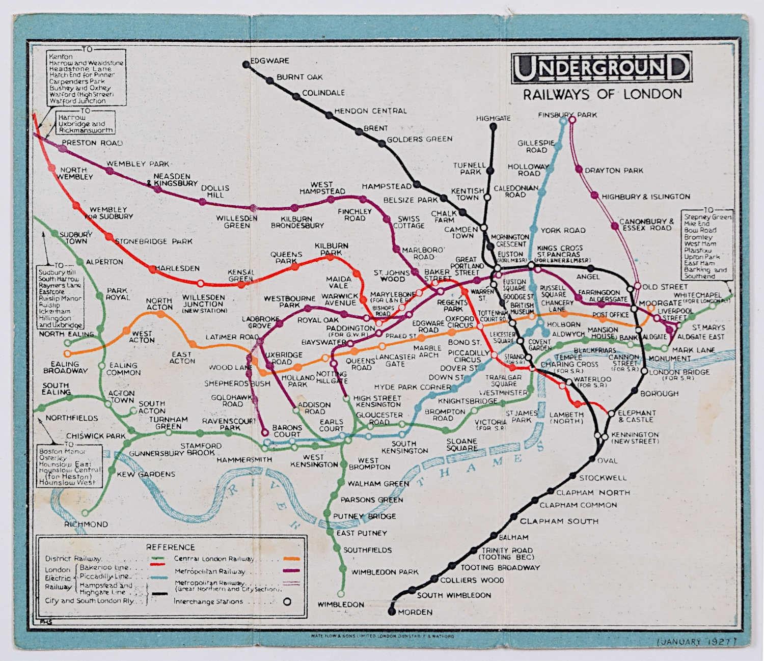
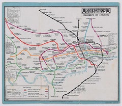
January 1927 London Underground Pocket Map Fred Stingemore pre Harry Beck
Located in London, GB
To see our other original vintage travel posters including more London Transport posters, scroll down to "More from this Seller" and below it click on "See all from this Seller" - or send us a message if you cannot find the poster you want.
Fred Stingemore (1890-1954)
London Underground Railways Pocket Map
January 1927
Lithograph, linen-based card
Bi-fold pocket map
12.5 x 15 cm (unfolded)
Stingemore spent forty years in the London Transport drawing office, but is best known as the artist behind the map that preceeded Harry Beck...
Category
1920s Modern More Prints
Materials
Lithograph
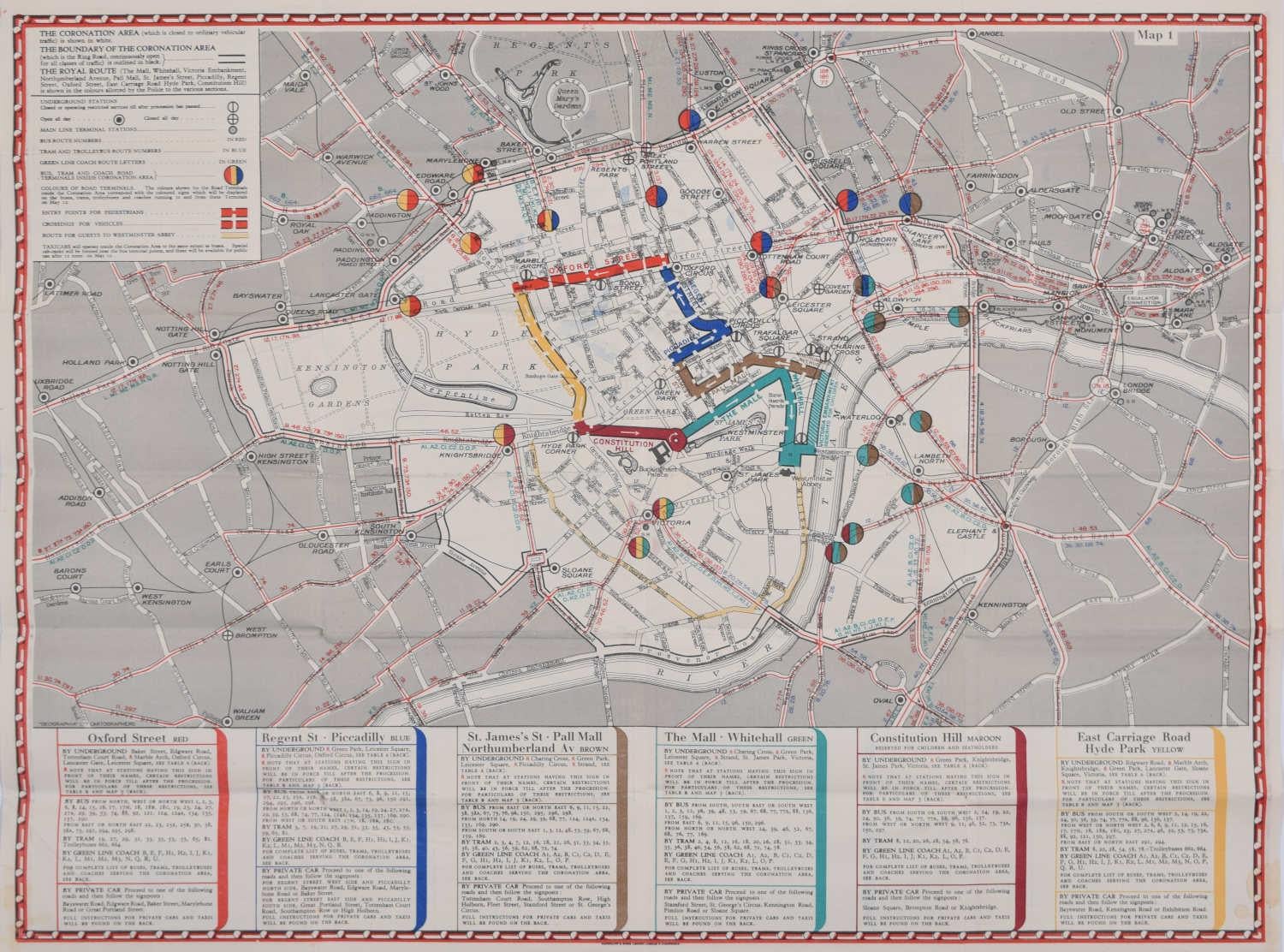
1937 Coronation Map for London Transport
Located in London, GB
To see more, scroll down to "More from this Seller" and below it click on "See all from this Seller."
Coronation Arrangements – Map of London (1...
Category
1950s Landscape Prints
Materials
Lithograph
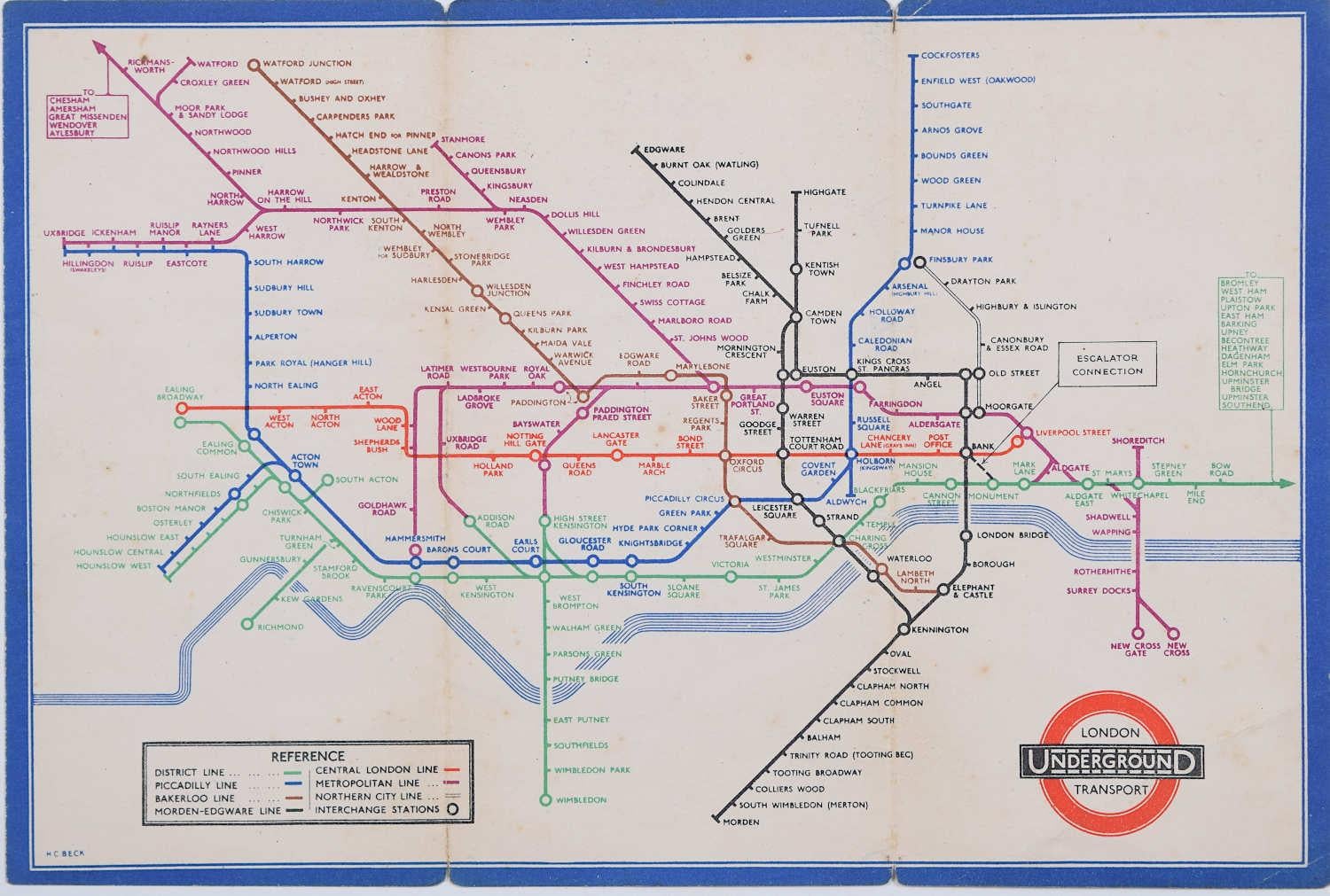
H C Beck September 1936 No 2 London Underground Pocket Map Harry Beck
By Harry Beck
Located in London, GB
To see our other original vintage travel posters including more London Transport posters, scroll down to "More from this Seller" and below it click on "See all from this Seller" - or...
Category
1930s Modern More Prints
Materials
Lithograph
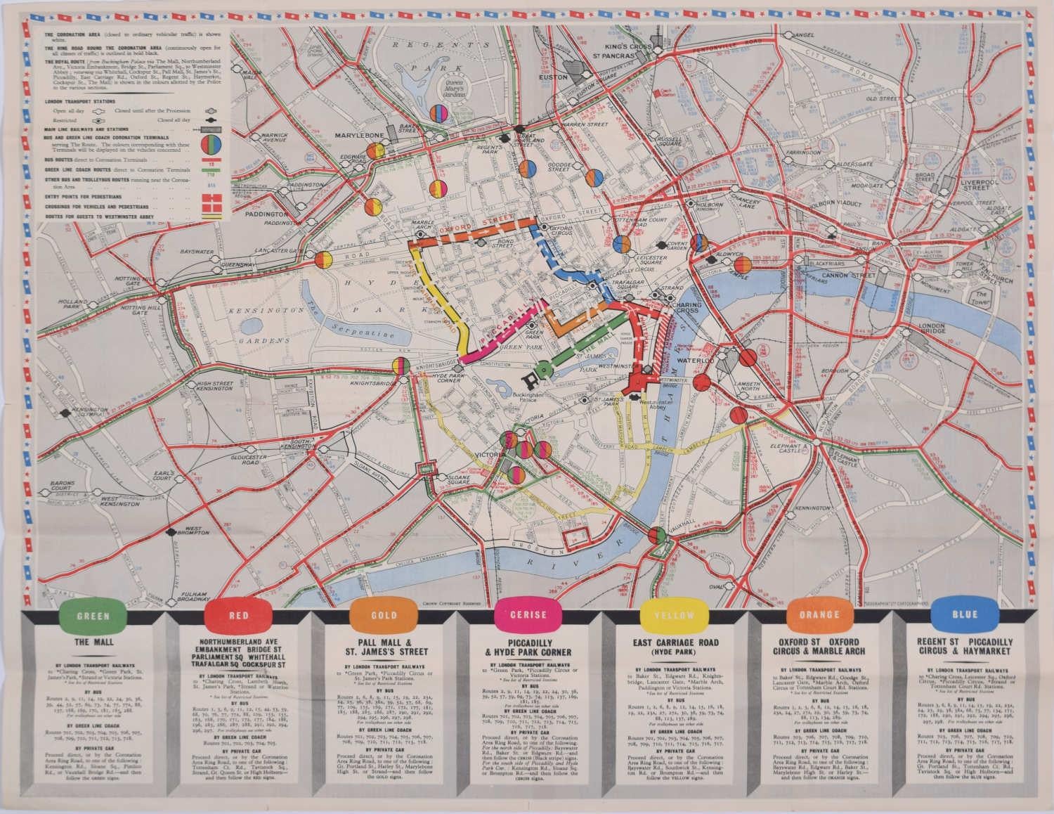
1953 Coronation Map for London Transport
Located in London, GB
To see more, scroll down to "More from this Seller" and below it click on "See all from this Seller."
Coronation Arrangements – Map of London (1...
Category
1950s Landscape Prints
Materials
Lithograph
H C Beck September 1933 London Underground Pocket Map (First Year of Issue)
By Harry Beck
Located in London, GB
To see our other original vintage travel posters including more London Transport posters, scroll down to "More from this Seller" and below it click on "See all from this Seller" - or...
Category
1930s Modern More Prints
Materials
Lithograph
1938 No 2 London Underground Pocket Map 'Zero' Hans Schleger after Harry Beck
By Zero Hans Schleger
Located in London, GB
To see our other original vintage travel posters including more London Transport posters, scroll down to "More from this Seller" and below it click on "See all from this Seller" - or send us a message if you cannot find the poster you want.
'Zero' Hans Schleger
London Underground Railways Pocket Map
1938 No. 2
Lithograph
14.5 x 20.5 cm
An early edition of London Transport's iconic map, precursor to all other similar maps of other transport systems worldwide. The 1939 edition was designed by Hans Schleger, unlike the 1933 - first published - edition of Harry Beck...
Category
1930s Modern More Prints
Materials
Lithograph
More Ways To Browse
Lock Of London
Styles Of Antique Desks
Black And White Coffee Table
Curved Velvet Couch
Velvet Curved Sofa
Wood Round Coffee Tables
Antique Paper Flowers
Oak Brutalist
Used College Furniture
Wood Minimalist Chair
2002 Lamp
Antique Imperial Furniture
Gold Modern Coffee Table
Large Side Tables
18th Century Gilded Furniture
Fluted Column
Japanese Silver Ceramics
One Of A Kind Chair