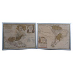
Items Similar to Pair Antique Italian Maps of the North American Eastern Seaboard

Want more images or videos?
Request additional images or videos from the seller
1 of 14
Pair Antique Italian Maps of the North American Eastern Seaboard
$3,800per set
£2,870.48per set
€3,317.45per set
CA$5,340.02per set
A$5,937.18per set
CHF 3,126.28per set
MX$72,035.85per set
NOK 39,580.30per set
SEK 36,997.93per set
DKK 24,756.76per set
About the Item
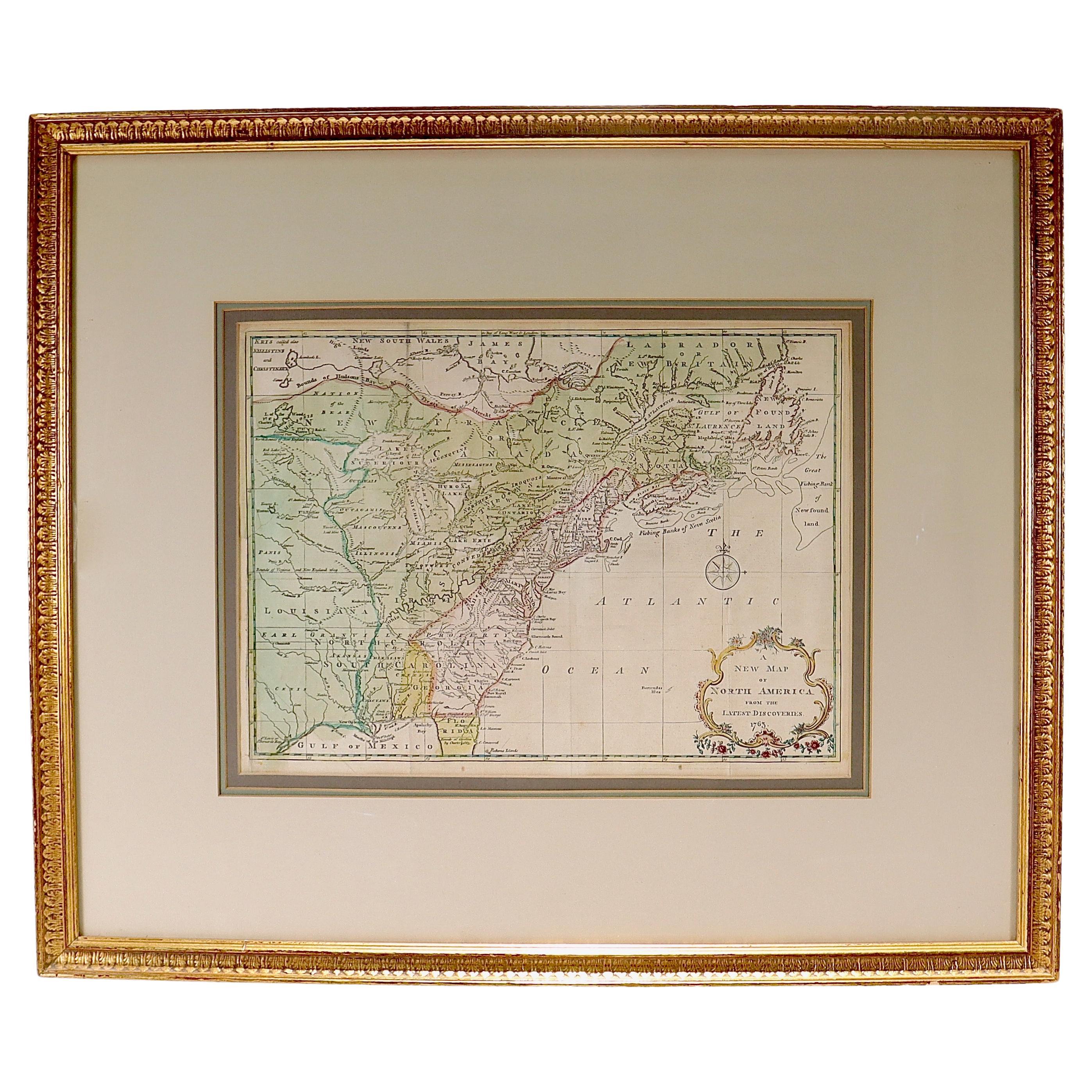
Pair antique Italian maps of the North American Eastern Seaboard. Late 18th early 19th century original Italian documentation of the East Coast of the United States from Passamaquaddy Bay at the tip of Maine to the City of Savannah in Georgia. The antique pair in vintage matted brass edged wood frames. Italy, late 1700’s.
Dimensions: 24.5" W x 17.75" H x .5" D
- Dimensions:Height: 17.75 in (45.09 cm)Width: 24.5 in (62.23 cm)Depth: 0.5 in (1.27 cm)
- Sold As:Set of 2
- Materials and Techniques:
- Place of Origin:
- Period:
- Date of Manufacture:18th Century
- Condition:Wear consistent with age and use.
- Seller Location:New York, NY
- Reference Number:1stDibs: LU1084245647982
About the Seller
4.9
Platinum Seller
Premium sellers with a 4.7+ rating and 24-hour response times
Established in 1993
1stDibs seller since 2014
590 sales on 1stDibs
Typical response time: <1 hour
- ShippingRetrieving quote...Shipping from: New York, NY
- Return Policy
Authenticity Guarantee
In the unlikely event there’s an issue with an item’s authenticity, contact us within 1 year for a full refund. DetailsMoney-Back Guarantee
If your item is not as described, is damaged in transit, or does not arrive, contact us within 7 days for a full refund. Details24-Hour Cancellation
You have a 24-hour grace period in which to reconsider your purchase, with no questions asked.Vetted Professional Sellers
Our world-class sellers must adhere to strict standards for service and quality, maintaining the integrity of our listings.Price-Match Guarantee
If you find that a seller listed the same item for a lower price elsewhere, we’ll match it.Trusted Global Delivery
Our best-in-class carrier network provides specialized shipping options worldwide, including custom delivery.More From This Seller
View AllMap of the Republic of Genoa
Located in New York, NY
Framed antique hand-coloured map of the Republic of Genoa including the duchies of Mantua, Modena, and Parma.
Europe, late 18th century.
Dimension: 25...
Category
Antique Late 18th Century European Maps

Antique Map of Italy by Andriveau-Goujon, 1843
By Andriveau-Goujon
Located in New York, NY
Antique Map of Italy by Andriveau-Goujon, 1843. Map of Italy in two parts by Andriveau-Goujon for the Library of Prince Carini at Palazzo Carini i...
Category
Antique 1840s French Maps
Materials
Linen, Paper

$3,350 / set
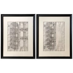
Pair of Engravings of Architectural Studies by Alessandro Specchi
By Alessandro Specchi
Located in New York, NY
Pair of engravings of architectural studies by Alessandro Specchi. Pair of original engravings of architectural studies in black painted frames of the staircase in Palazzo Barberini,...
Category
Antique Late 17th Century Italian Decorative Art
Materials
Paper
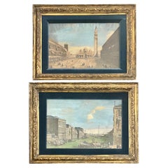
Pair Hand-Colored Venetian Engravings after Canaletto
Located in New York, NY
Pair hand-colored Venetian engravings after Canaletto. 18th century hand-colored Venetian engravings in period gilt frames after Canaletto (1697-1768) with view of the Grand Canal t...
Category
Antique 18th Century Italian Prints
Materials
Gesso, Giltwood, Paper
Italian Lake Palace Ink Drawing
Located in New York, NY
Italian Lake Palace Ink Drawing. Italian ink drawing of island palace La Casina Vanvitelliana sul Lago Fusaro. Eighteenth century ink on paper drawing in a...
Category
Antique 18th Century Italian Drawings
Materials
Gesso, Giltwood, Paper
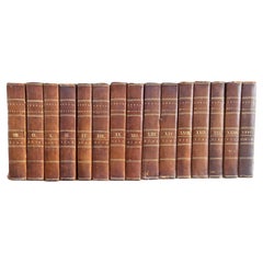
Inverary Set of Fifteen Leather Bound Books
Located in New York, NY
Inverary set of fifteen leather bound books. The Annual Register or A View of the History, Politics, and Literature for the year comprising the years 1765-1792: volume 8, 9, 10, 11,...
Category
Antique 18th Century English Books
Materials
Leather, Paper
You May Also Like
Antique Lithography Map, Cumberland, English, Framed, Cartography, Victorian
Located in Hele, Devon, GB
This is an antique lithography map of Cumberland. An English, framed atlas engraving of cartographic interest, dating to the mid 19th century and la...
Category
Antique Mid-19th Century British Victorian Maps
Materials
Wood

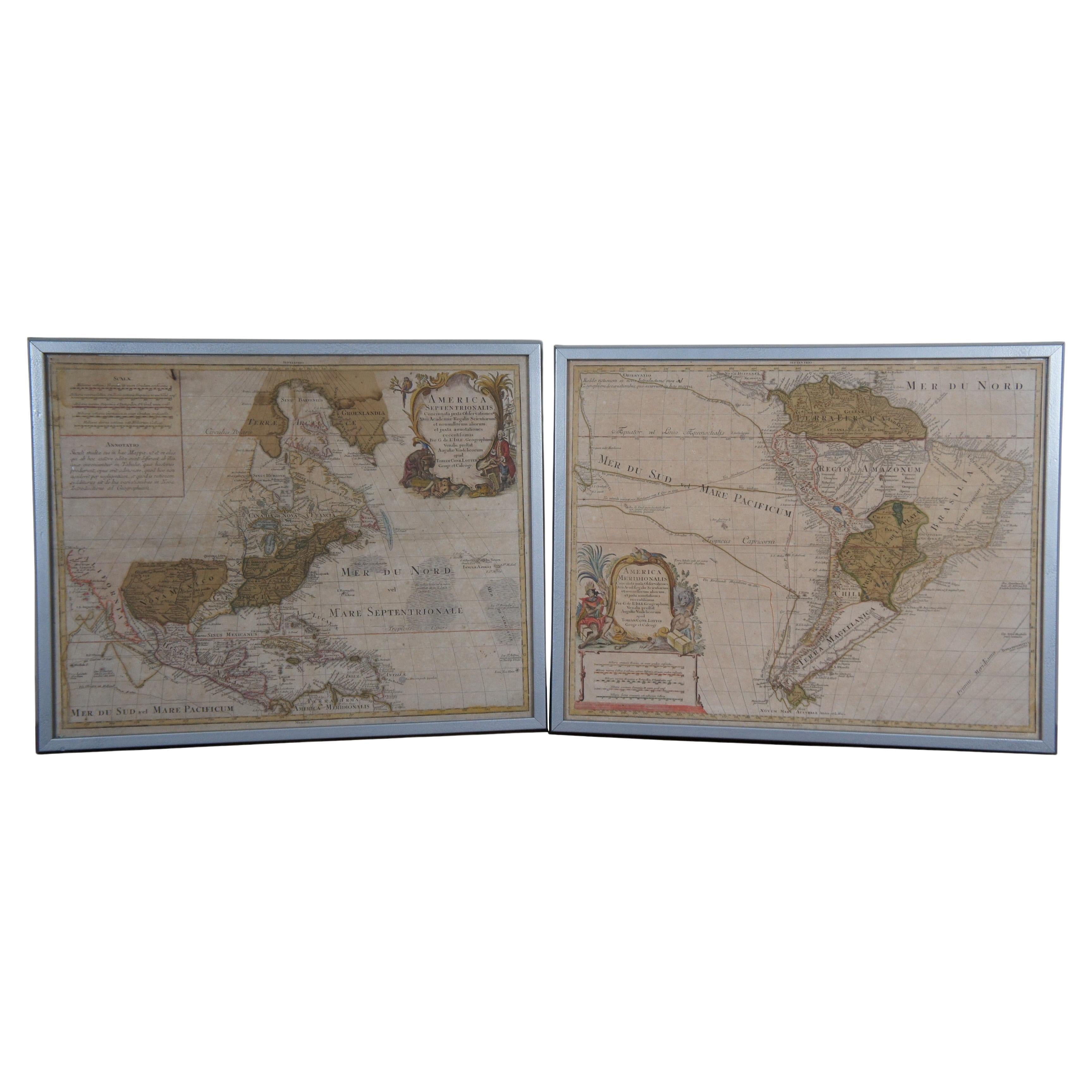
18th Century Antique Conrad Lotter Septentrionalis Meridionalis American Maps
Located in Dayton, OH
Pair of rare hand colored maps from the 1770's, depicting "America Septentrionalis" (North America), engraved by Georg Friedrich Lotter and America Meridionalis (South America), engr...
Category
Antique 18th Century Maps
Materials
Paper
$2,400 Sale Price
20% Off
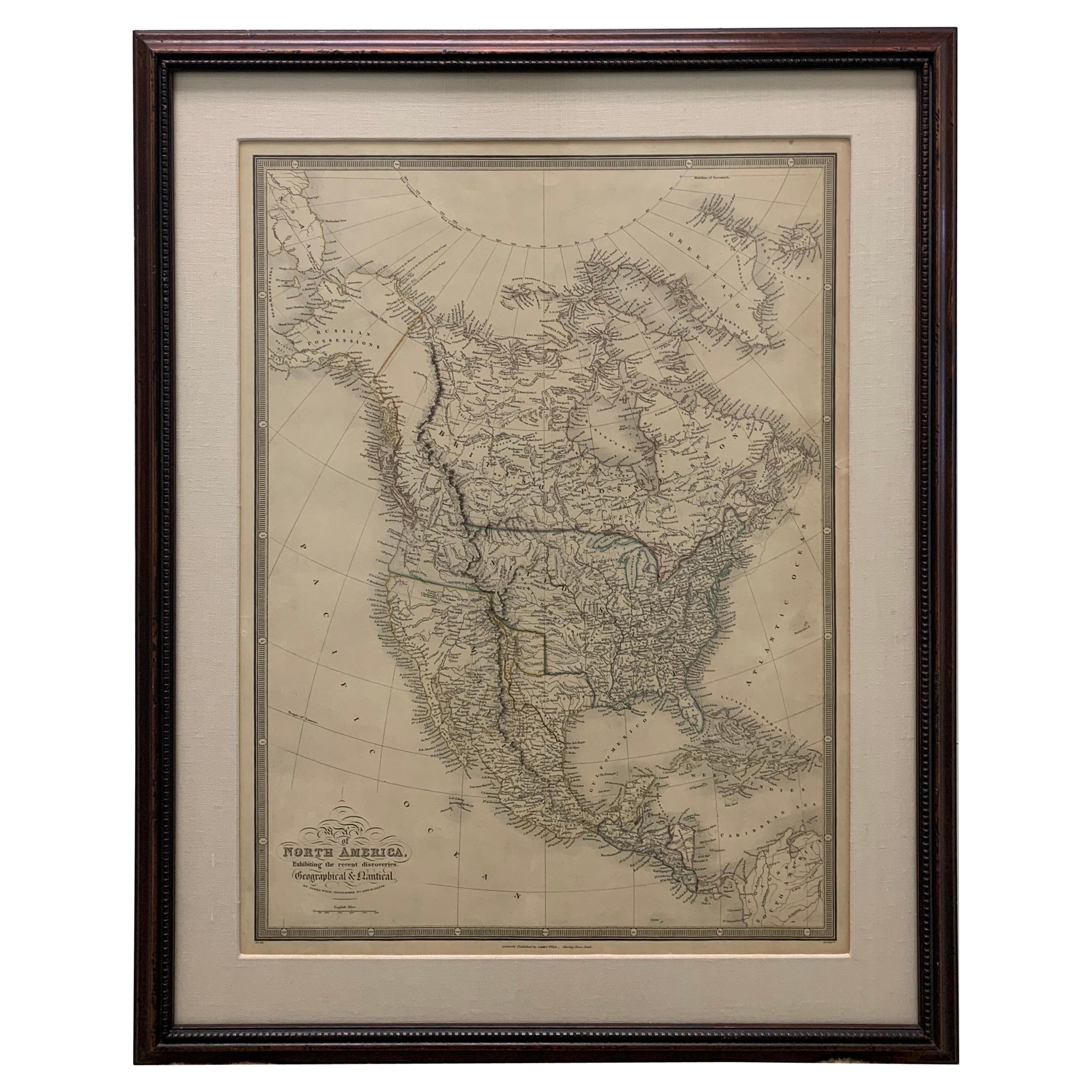
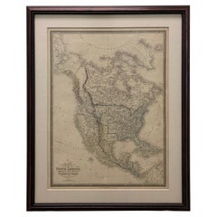
Framed 1838 North America & Recent Discoveries Map
Located in Stamford, CT
1838 map of North America & recent discoveries. Engraved color map by J. Wyld, London, England. This map shows Texas as a Republic without its panhandle.
Framed in brown carved wood...
Category
Antique 1830s American American Classical Maps
Materials
Glass, Wood, Paper
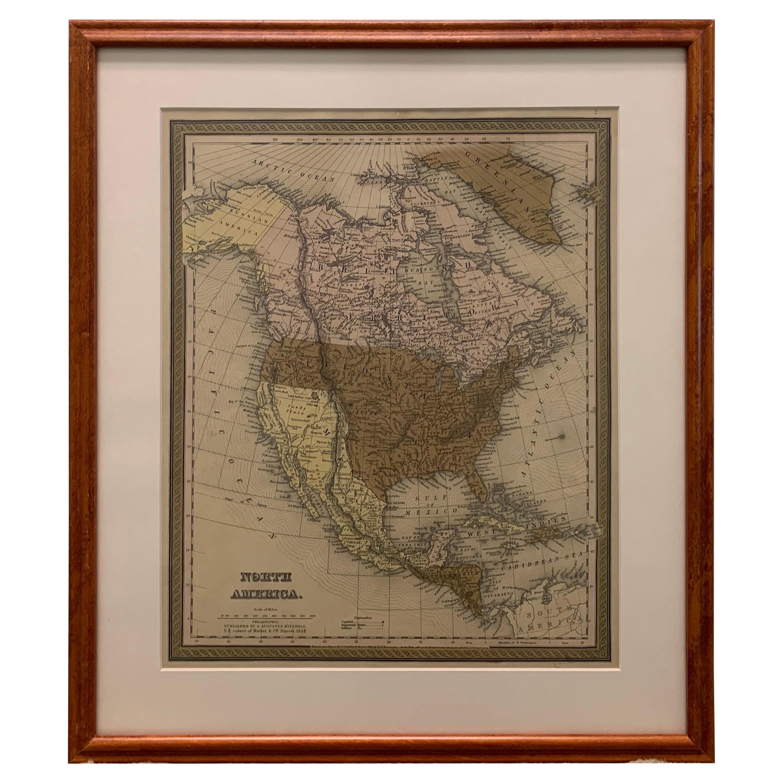
Large 1848 North America & Territories Map
Located in Stamford, CT
Framed 1848 S. Augustus and Mitchell, Philadelphia , PA North America and territories map.
Featuring the United States, Canada (British Territory) and Mexican Territories.
As found...
Category
Antique 1840s American American Classical Maps
Materials
Glass, Wood, Paper

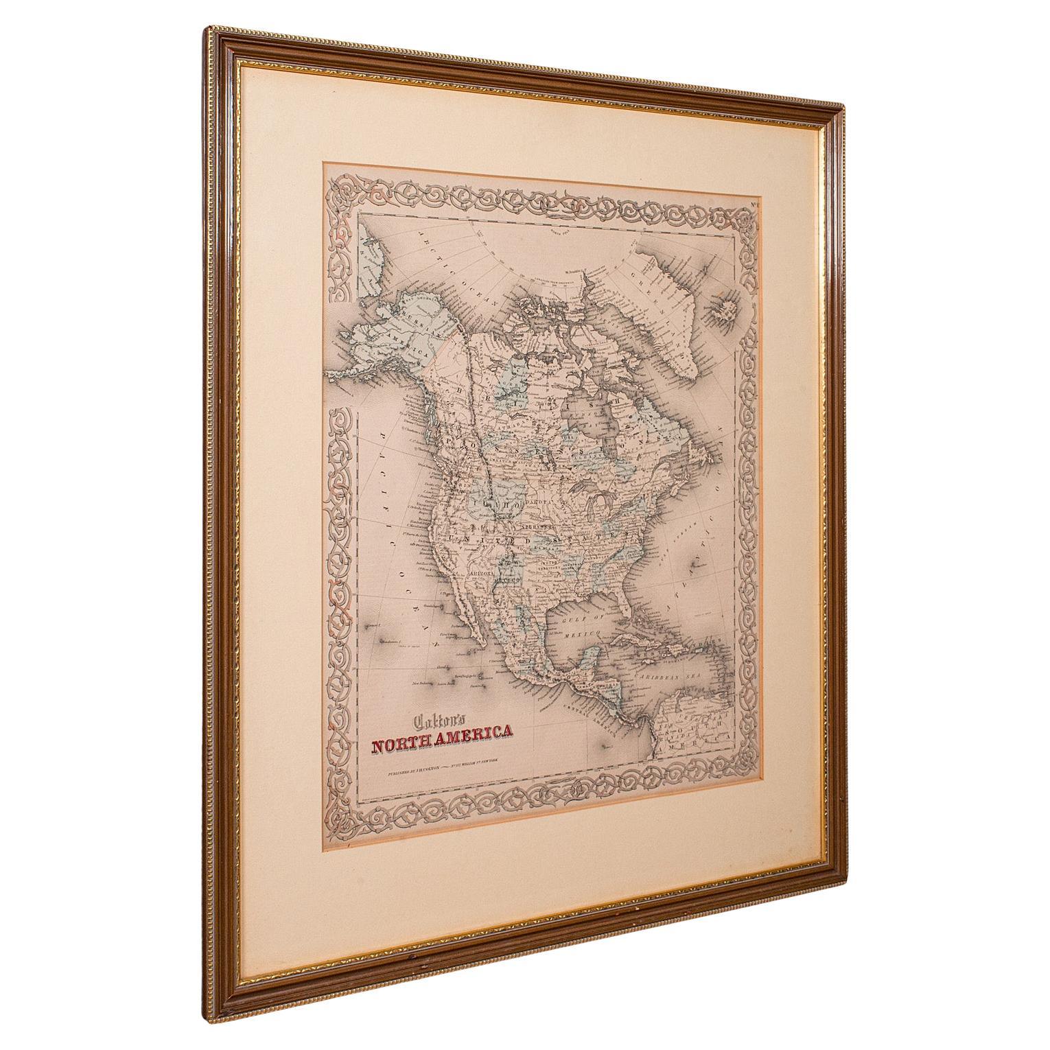
Antique North America Map, USA, Canada, Mexico, Cartography, Colton, Victorian
Located in Hele, Devon, GB
This is an antique North America map. A USA, framed lithography atlas engraving of the continent by JH Colton, dating to the Victorian period and later, circa 1860.
Fascinating, large framed map...
Category
Antique Mid-19th Century American Victorian Maps
Materials
Paper

New Map of North America from the Latest Discoveries, 1763
Located in Philadelphia, PA
A fine antique 18th century map of the North American seaboard.
Entitled "A New Map of North America from the Latest Discoveries 1763".
By the Cartographer/Engraver - John Spil...
Category
Antique Mid-18th Century English Georgian Maps
Materials
Paper

More Ways To Browse
18th Century American Antiques
Used Furniture Maine
Furniture From Maine
Antique Early 1700s
Used Furniture North Bay
Savannah Antiques
Styles Of Antique Desks
Black And White Coffee Table
Curved Velvet Couch
Velvet Curved Sofa
Wood Round Coffee Tables
Antique Paper Flowers
Oak Brutalist
Used College Furniture
Wood Minimalist Chair
2002 Lamp
Antique Imperial Furniture
Gold Modern Coffee Table