Items Similar to Phoenician Trade Routes – Antique Map of Europe and the Mediterranean, 1748


Want more images or videos?
Request additional images or videos from the seller
1 of 10
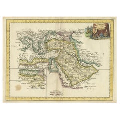
Phoenician Trade Routes – Antique Map of Europe and the Mediterranean, 1748
$344.90
£256.64
€290
CA$473.87
A$528.88
CHF 278.25
MX$6,424.48
NOK 3,527.51
SEK 3,301.31
DKK 2,207.66
About the Item
Phoenician Trade Routes – Antique Map of Europe and the Mediterranean, 1748
This antique German map titled Vorstellung von Europa zur Erläuterung der Schifffahrt der Phönicier auf dem Mittelländischen Meer (Representation of Europe for the Explanation of the Navigation of the Phoenicians on the Mediterranean Sea) offers a fascinating historical interpretation of the Mediterranean and adjacent regions through the lens of ancient Phoenician maritime activity. Created around 1748 by Kreitz, this copper-engraved map was published to illustrate the extent of Phoenician trade and exploration, which flourished from around 1500 to 300 BCE.
The map spans from the Atlantic coast of Hispania and Mauretania in the west to Mesopotamia and the Caspian Sea in the east, and from southern England and Tartary in the north to the deserts of North Africa and Arabia in the south. Highlighted regions include ancient Europe (Germania, Gallia, Hispania, Italia, Thracia, Macedonia), Asia Minor (Phrygia, Lydia, Cilicia, Cappadocia), Mesopotamia (Babylonia, Assyria, Chaldea), and important islands like Cyprus, Crete, Sicily, and the Balearic Isles.
Cartographic elements reflect historical names and classical geography, including:
Atlantisches Meer (Atlantic Ocean)
Mittelländisches Meer (Mediterranean Sea)
Schwartze Meer (Black Sea)
Ancient cities such as Babylon and Tarsus
Mountain ranges like Ararat
Rivers including the Danube and Euphrates
The map combines geographic knowledge of the early modern period with classical nomenclature, designed to visualize how the ancient Phoenicians may have navigated and influenced trade across the Mediterranean. It reflects Enlightenment-era interest in antiquity, biblical history, and classical civilizations.
Published in Nuremberg, this map would likely have accompanied a scholarly or educational atlas of the mid-18th century. Its purpose was both didactic and decorative, appealing to collectors, educators, and those fascinated by the ancient world.
Condition: Very good condition. Strong impression with original hand coloring. Minor age-toning to the edges and faint centerfold creases. Wide margins preserved, but left margin short. Visible plate mark.
Framing tips: A classic antique gold or walnut frame paired with a cream or parchment-colored mat will enhance the historic and academic character of this early map. Ideal for libraries, offices, or study rooms.
Technique: Copper engraving with original hand color
Maker: Kreitz, published c.1744, likely Nuremberg
- Dimensions:Height: 7.49 in (19 cm)Width: 13.08 in (33.2 cm)Depth: 0.01 in (0.2 mm)
- Materials and Techniques:Paper,Engraved
- Period:
- Date of Manufacture:1748
- Condition:Condition: Very good condition. Strong impression with original hand coloring. Minor age-toning to the edges and faint centerfold creases. Wide margins preserved, but left margin short. Visible plate mark.
- Seller Location:Langweer, NL
- Reference Number:Seller: BG-06655-181stDibs: LU3054346172472
About the Seller
5.0
Recognized Seller
These prestigious sellers are industry leaders and represent the highest echelon for item quality and design.
Platinum Seller
Premium sellers with a 4.7+ rating and 24-hour response times
Established in 2009
1stDibs seller since 2017
2,565 sales on 1stDibs
Typical response time: <1 hour
- ShippingRetrieving quote...Shipping from: Langweer, Netherlands
- Return Policy
Authenticity Guarantee
In the unlikely event there’s an issue with an item’s authenticity, contact us within 1 year for a full refund. DetailsMoney-Back Guarantee
If your item is not as described, is damaged in transit, or does not arrive, contact us within 7 days for a full refund. Details24-Hour Cancellation
You have a 24-hour grace period in which to reconsider your purchase, with no questions asked.Vetted Professional Sellers
Our world-class sellers must adhere to strict standards for service and quality, maintaining the integrity of our listings.Price-Match Guarantee
If you find that a seller listed the same item for a lower price elsewhere, we’ll match it.Trusted Global Delivery
Our best-in-class carrier network provides specialized shipping options worldwide, including custom delivery.More From This Seller
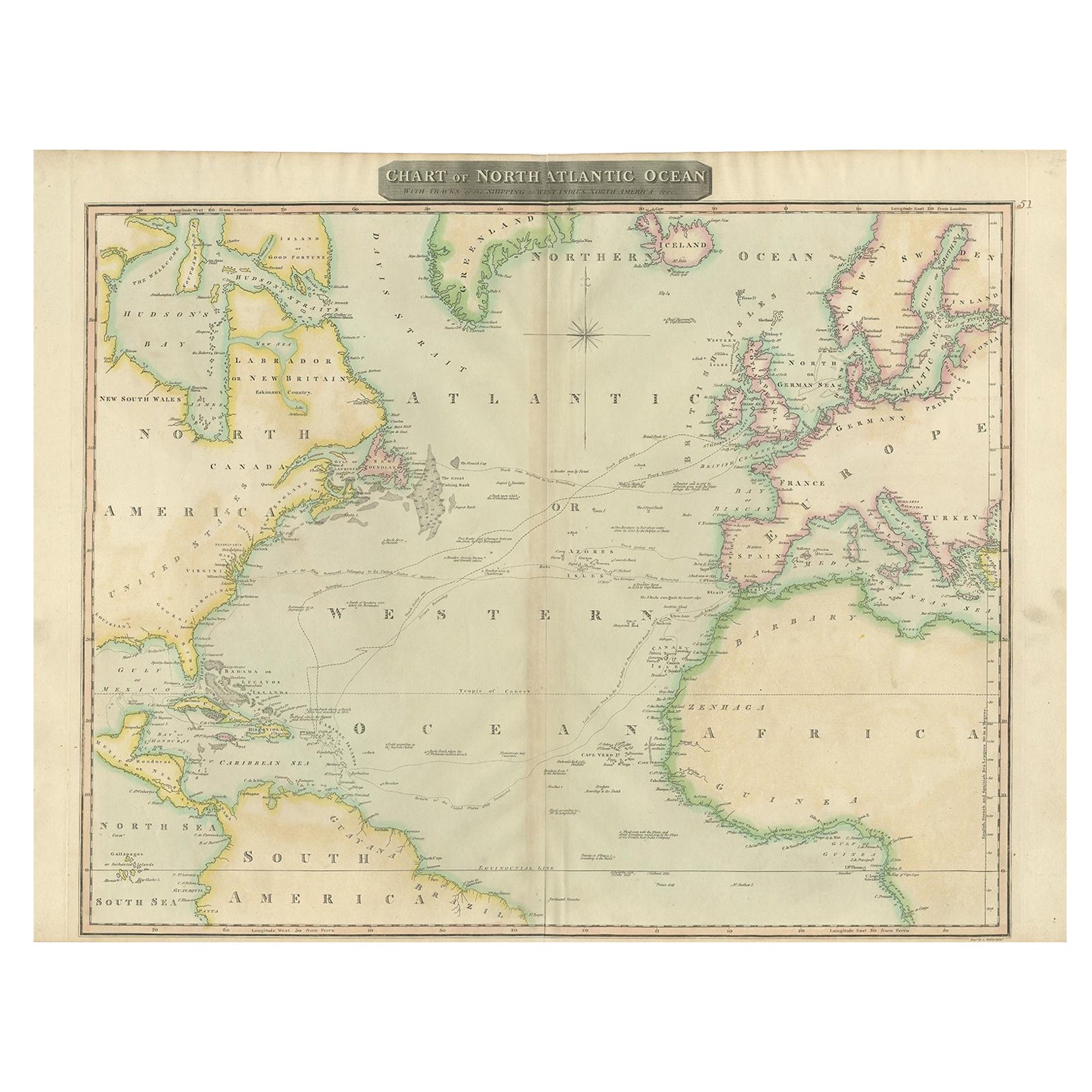
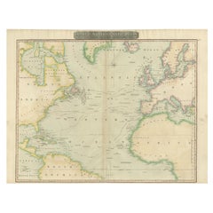
View AllInteresting Map of the Atlantic Showing Nelson's and Trade Routes, 1817
By John Thomson
Located in Langweer, NL
Antique map titled 'Chart of the North Atlantic Ocean with Tracks of the Shipping to West Indies, North America, &cc'. Large map of the Atlantic, showing the tracks of the ships trad...
Category
Antique 19th Century Maps
Materials
Paper
$523 Sale Price
20% Off
Free Shipping
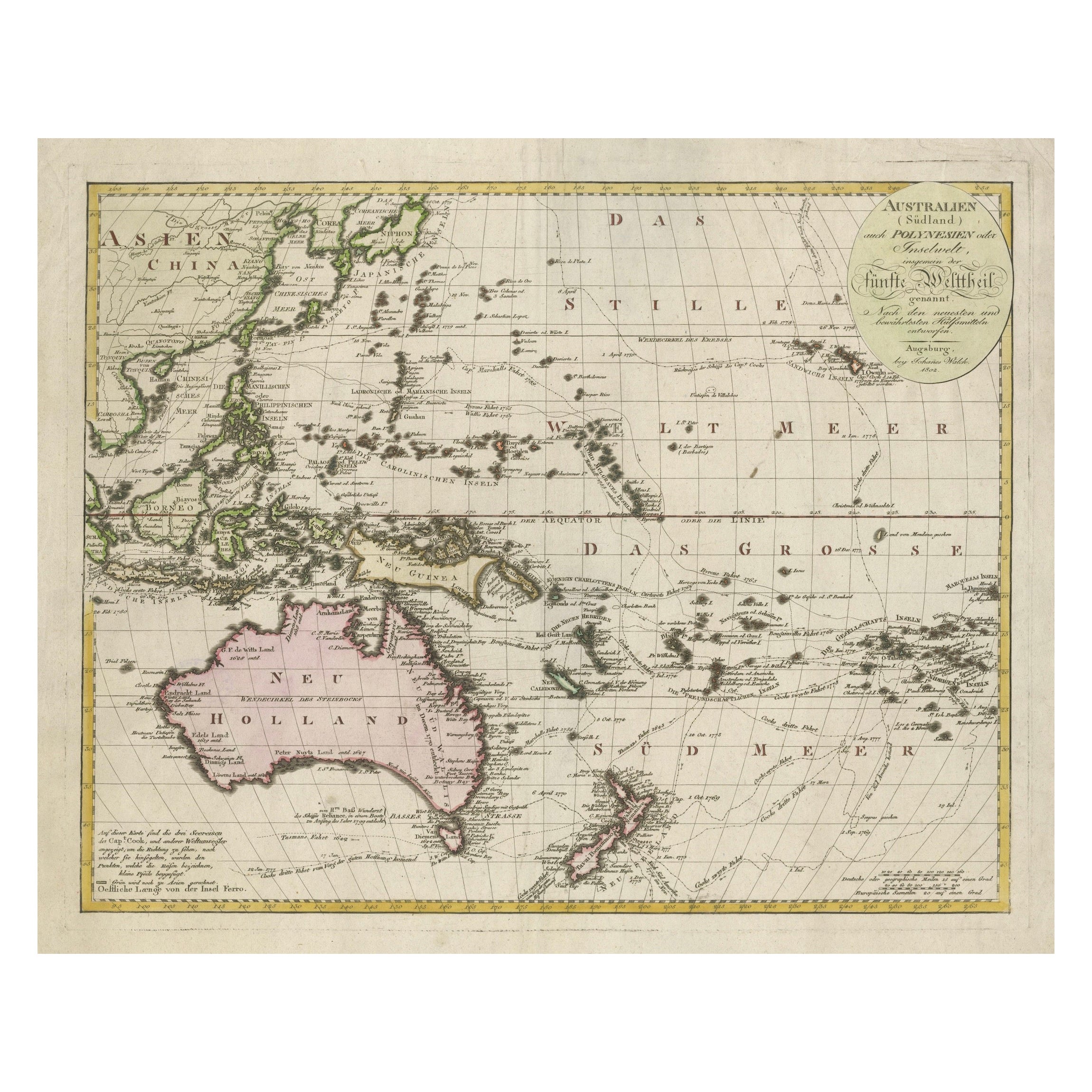
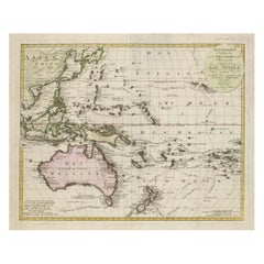
1802 Map of Australasia and the South Pacific - European Exploration Routes
Located in Langweer, NL
1802 Johann Walch Map of Australasia and the South Pacific - European Exploration Routes
This 1802 map by Johann Walch provides a highly detailed view of Australasia and the South P...
Category
Antique Early 1800s Maps
Materials
Paper
$1,712 Sale Price
20% Off
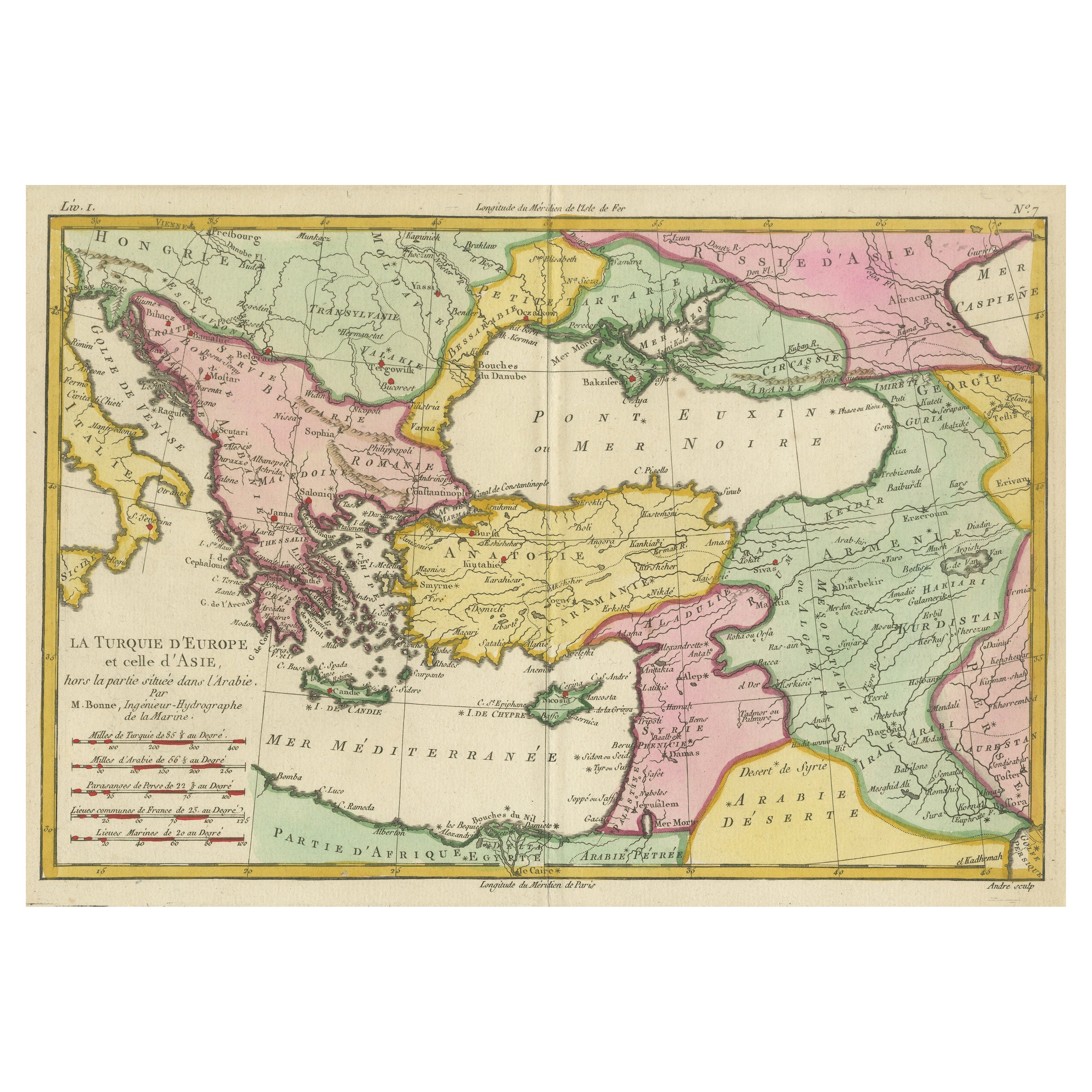
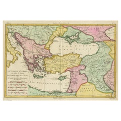
Antique Map of the Eastern Mediterranean and the Balkans
Located in Langweer, NL
Antique map titled 'La Turquie d'Europe et celle d'Asie'. Attractive double page map of the Eastern Mediterranean and the Balkans by R. Bonne. Originates from 'Atlas de Toutes les Pa...
Category
Antique Late 18th Century Maps
Materials
Paper
$513 Sale Price
20% Off
Antique Map of the Holy Land by Keur, 1748
Located in Langweer, NL
Antique Map Holy Land titled 'De Gelegentheyd van t'Paradys ende t'Landt Canaan, Mitsgaders d'eerst bewoonde Landen der Patriarchen'. Includes five decorative vignettes, including No...
Category
Antique 18th Century Maps
Materials
Paper

$331 Sale Price
20% Off
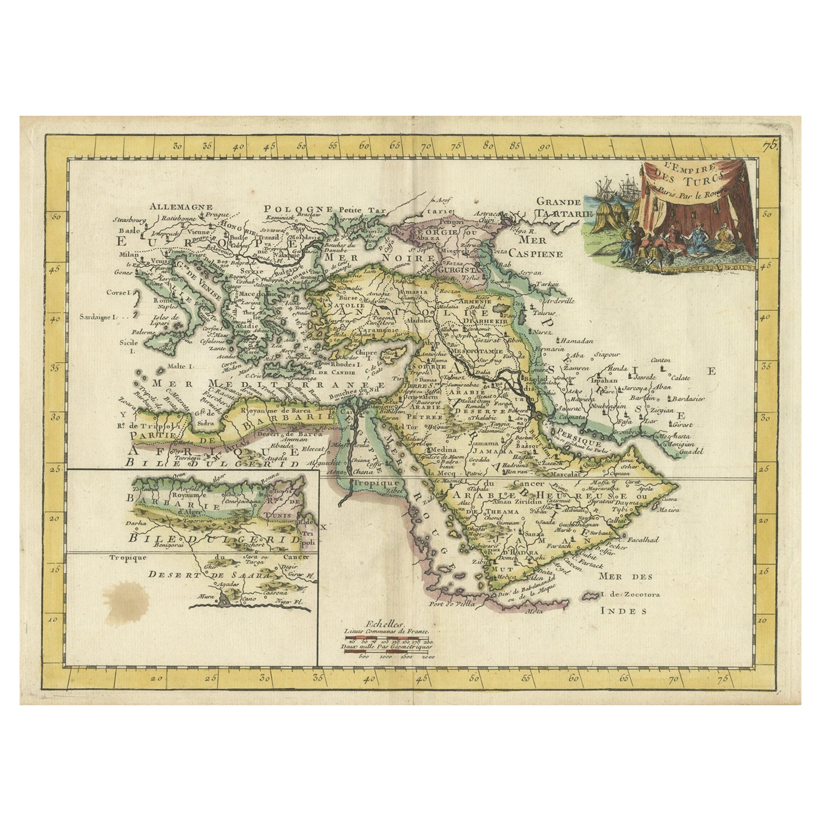
Orginal Antique Handcolored Map of the Turkish Empire, 1748
Located in Langweer, NL
Antique map titled 'L'Empire des Turcs'. Old map of the Turkish Empire with an inset of the North African regions. Originates from 'Atlas Nouveau Portatif' by G.L. le Rouge.
Artis...
Category
Antique 18th Century Maps
Materials
Paper
$340 Sale Price
35% Off
Antique Map of the Eastern Mediterranean, C.1710
Located in Langweer, NL
Antique map Middle East titled 'De Beschryving van de Reysen Pauli en van de Andere Apostelen'. Antique map of the Eastern Mediterranean with det...
Category
Antique 18th Century Maps
Materials
Paper

You May Also Like
Large Framed Map of the Mediterranean
Located in Queens, NY
Large map/chart chart of The Mediterranean and the Grecian Archipelago showing Italy, Sardinia, Corsica, part of France, etc. in a black frame.
Category
20th Century French Mid-Century Modern Maps
Original Antique Map of Europe, Arrowsmith, 1820
Located in St Annes, Lancashire
Great map of Europe
Drawn under the direction of Arrowsmith.
Copper-plate engraving.
Published by Longman, Hurst, Rees, Orme and Brown, 1820
...
Category
Antique 1820s English Maps
Materials
Paper

Large Original Antique Map of Europe by Sidney Hall, 1847
Located in St Annes, Lancashire
Great map of Europe
Drawn and engraved by Sidney Hall
Steel engraving
Original colour outline
Published by A & C Black. 1847
Unframed
Free shipping.
Category
Antique 1840s Scottish Maps
Materials
Paper

Original Antique Map of The Philippines. C.1900
Located in St Annes, Lancashire
Fabulous map of The Philippines
Original color.
Engraved and printed by the George F. Cram Company, Indianapolis.
Published, C.1900.
Unframed.
Free shipping.
Category
Antique 1890s American Maps
Materials
Paper

Huge Europe and Asia Vintage Wall Map
Located in San Diego, CA
A huge Europe and Asia vintage wall map, circa 1950s. The map is in fair vintage condition and measures 78"W x 73"H". #2863
Category
Mid-20th Century American Maps
Materials
Paper
$380 Sale Price
20% Off
Original Antique Map of The London Underground. 1911
Located in St Annes, Lancashire
Superb map of The London Underground
Published by Ward Lock, 1911
Folding map. Printed on paper
Unframed.
Good condition/ Minor repair to an edge tear on right edge ( shown in ...
Category
Vintage 1910s English Maps
Materials
Canvas, Paper