Items Similar to Plan of Cincinnati Map, USA c.1870 – Hand-Colored Street Plan with Wards

Video Loading
Want more images or videos?
Request additional images or videos from the seller
1 of 12
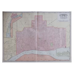
Plan of Cincinnati Map, USA c.1870 – Hand-Colored Street Plan with Wards
$302.82
£229.39
€260
CA$419.52
A$470.52
CHF 246.40
MX$5,717.22
NOK 3,128.89
SEK 2,966.41
DKK 1,979.58
About the Item
Plan of Cincinnati Map, USA c.1870 – Hand-Colored Street Plan with Wards
This is a finely engraved and hand-colored street plan titled Plan of Cincinnati and Vicinity, published in the United States circa 1870. It shows the detailed layout of Cincinnati, Ohio, with its wards shaded in pastel pink, green, yellow, and blue wash colors.
The map details streets, railroads, canals, bridges, and significant urban features. It includes ward numbers clearly marked, the Miami Canal, Mill Creek, and the Ohio River with Covington, Kentucky, visible across the river. The floral decorative border surrounding the map is typical of American atlas city plans from the mid to late 19th century, adding decorative appeal.
This city plan reflects Cincinnati’s urban development during the post-Civil War industrial boom when it was known as the “Queen City of the West,” a major trade, manufacturing, and cultural center along the Ohio River. Such plans were included in county and state atlases or urban directories for civic reference, property sales, and promotional publications.
Condition report:
Good condition. Strong impression with bright original hand coloring. Light general age toning and minor marginal handling marks typical for antique atlas maps. One tear in lower border touching image. Wide margins and plate mark intact.
Framing suggestion:
Frame with a simple black or dark wood frame and an archival off-white or cream mat to highlight the pastel coloring and decorative floral border. UV-protective glass is recommended to preserve paper quality and prevent fading.
- Dimensions:Height: 12.29 in (31.2 cm)Width: 15.36 in (39 cm)Depth: 0.01 in (0.2 mm)
- Materials and Techniques:
- Place of Origin:
- Period:
- Date of Manufacture:circa 1870
- Condition:Good condition. Strong impression with bright original hand coloring. Light general age toning and minor marginal handling marks typical for antique atlas maps. One tear in lower border touching image. Wide margins and plate mark intact.
- Seller Location:Langweer, NL
- Reference Number:Seller: BG-13952-291stDibs: LU3054345730462
About the Seller
5.0
Recognized Seller
These prestigious sellers are industry leaders and represent the highest echelon for item quality and design.
Platinum Seller
Premium sellers with a 4.7+ rating and 24-hour response times
Established in 2009
1stDibs seller since 2017
2,517 sales on 1stDibs
Typical response time: <1 hour
- ShippingRetrieving quote...Shipping from: Langweer, Netherlands
- Return Policy
Authenticity Guarantee
In the unlikely event there’s an issue with an item’s authenticity, contact us within 1 year for a full refund. DetailsMoney-Back Guarantee
If your item is not as described, is damaged in transit, or does not arrive, contact us within 7 days for a full refund. Details24-Hour Cancellation
You have a 24-hour grace period in which to reconsider your purchase, with no questions asked.Vetted Professional Sellers
Our world-class sellers must adhere to strict standards for service and quality, maintaining the integrity of our listings.Price-Match Guarantee
If you find that a seller listed the same item for a lower price elsewhere, we’ll match it.Trusted Global Delivery
Our best-in-class carrier network provides specialized shipping options worldwide, including custom delivery.More From This Seller
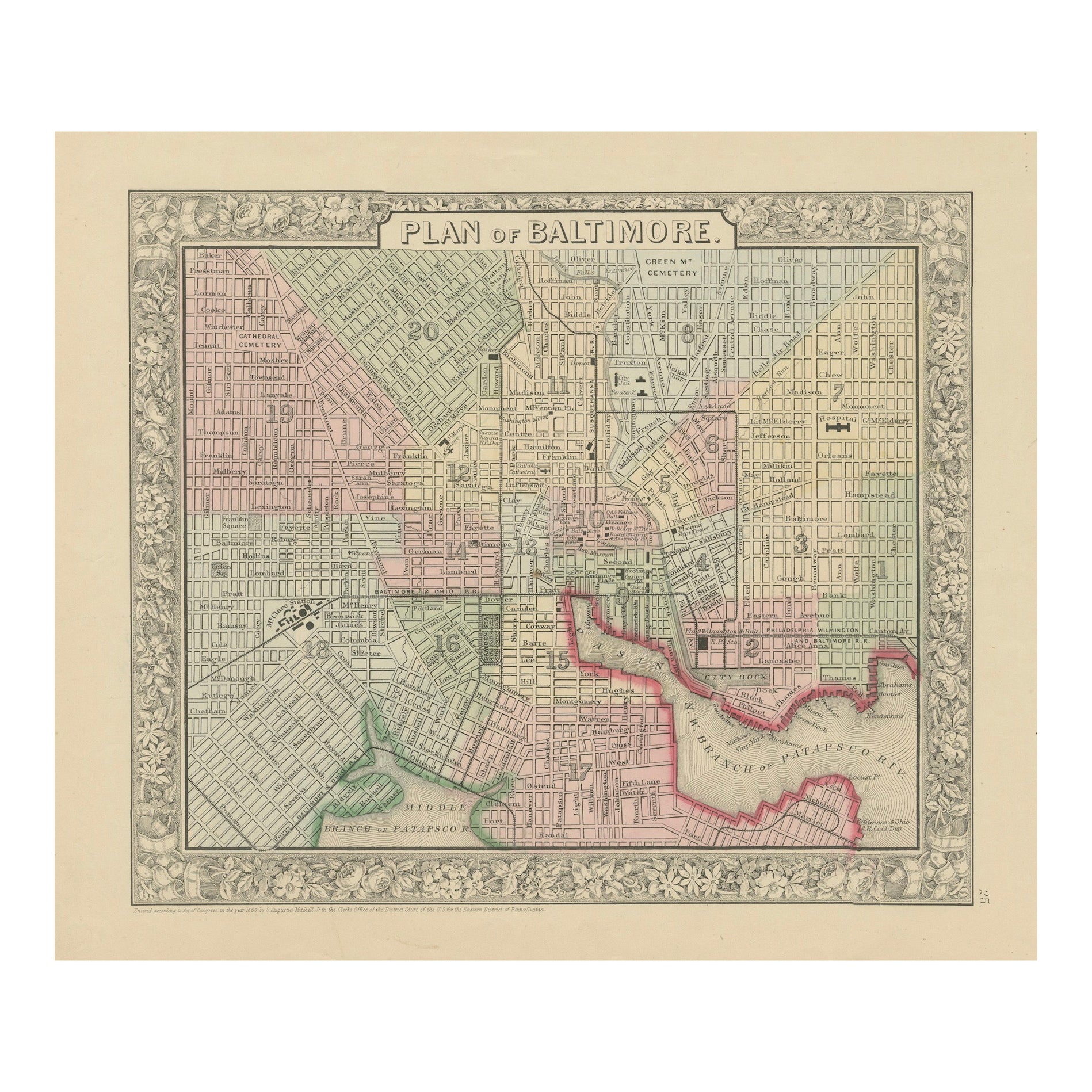
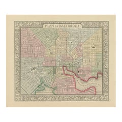
View AllPlan of Baltimore City Map, USA c.1870 – Hand-Colored Street Plan
Located in Langweer, NL
Plan of Baltimore City Map, USA c.1870 – Hand-Colored Street Plan
This is a finely engraved and hand-colored street plan titled Plan of Baltimore, published in the United States cir...
Category
Antique Mid-19th Century American Maps
Materials
Paper
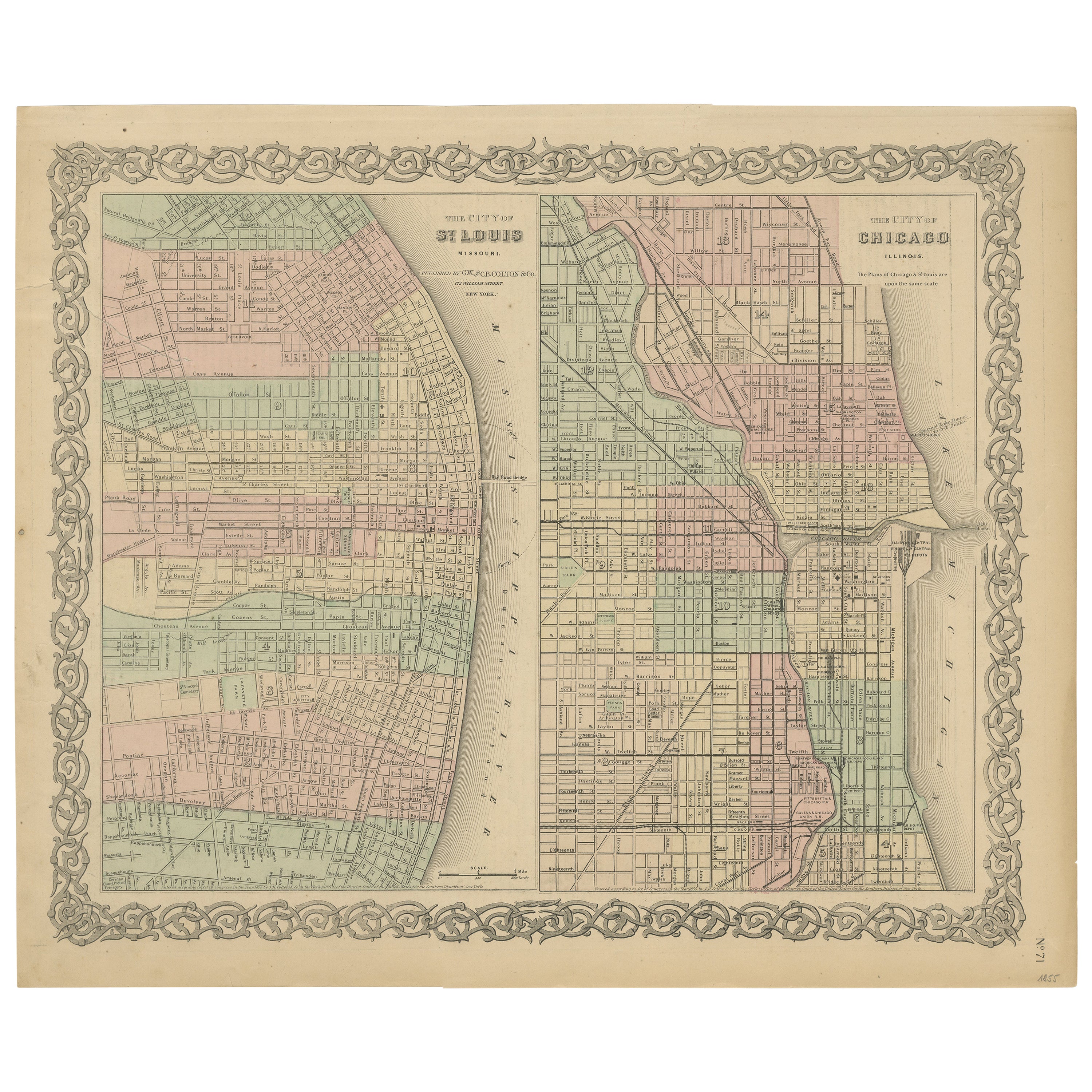
Antique Map of St. Louis and Chicago
Located in Langweer, NL
Antique map titled 'The City of St. Louis Missouri - The City of Chicago Illinois'. Dual map on single page showing St. Louis and Chicago. Finely produ...
Category
Antique Mid-19th Century Maps
Materials
Paper

$139 Sale Price
20% Off
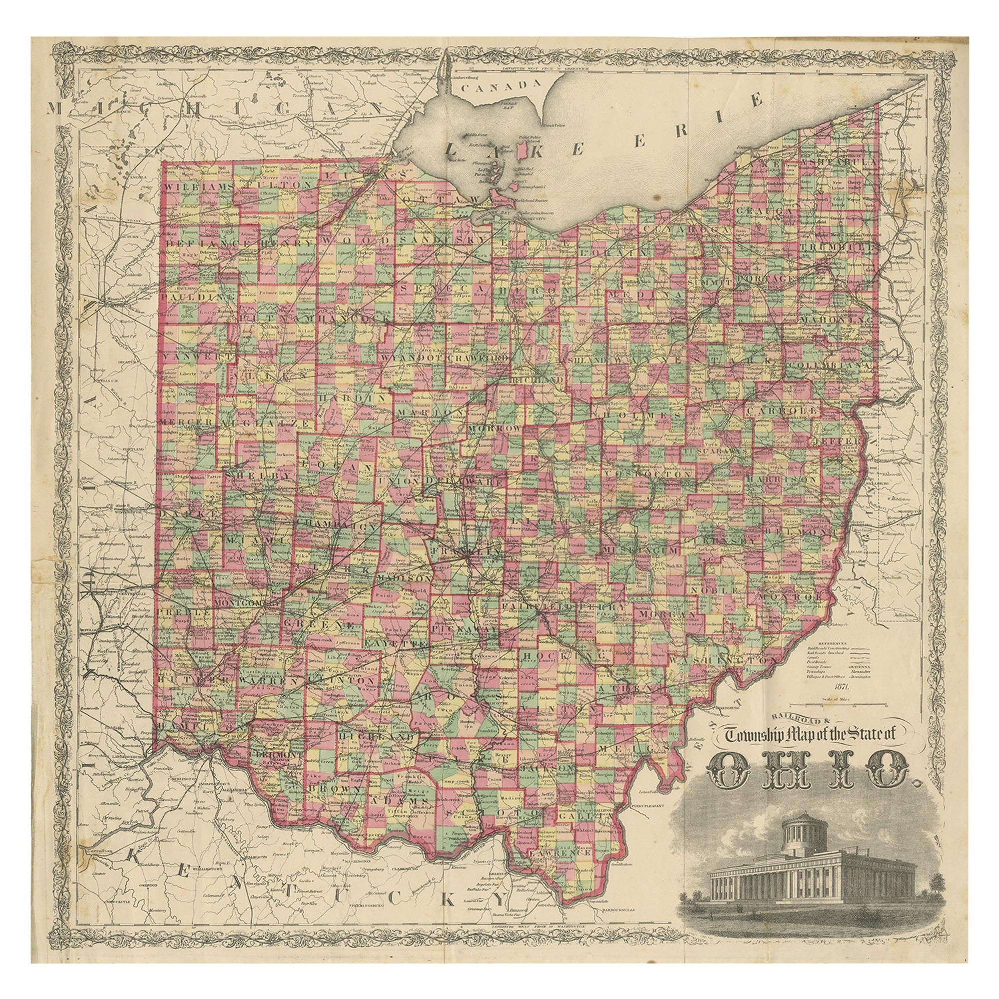
Antique Map of the State of Ohio by Titus '1871'
Located in Langweer, NL
Antique map titled 'Railroad & Township Map of the State of Ohio'. Original antique map of the State of Ohio. This map originates from 'Atlas of Preble County Ohio' by C.O. Titus. Pu...
Category
Antique Late 19th Century Maps
Materials
Paper

$1,048 Sale Price
25% Off
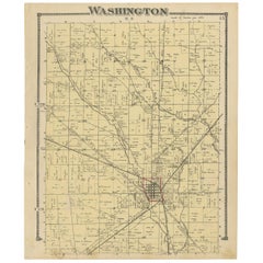
Antique Map of Washington County 'Ohio' by Titus, 1871
Located in Langweer, NL
Antique map titled 'Washington'. Original antique map of Washington, Ohio. This map originates from 'Atlas of Preble County Ohio' by C.O. Titus. Published, 1871.
Category
Antique Late 19th Century Maps
Materials
Paper
$218 Sale Price
24% Off
Rare 1864 Ohio Civil War Era Map with State Capitol Illustration
Located in Langweer, NL
Title: Johnson's Ohio Antique Map by Johnson and Ward, 1864
Description: This exquisite antique map, titled "Johnson's Ohio," was published in 1864 by Johnson and Ward, a prominent ...
Category
Antique 1860s Maps
Materials
Paper
Antique Map of Pennsylvania and New Jersey by Johnson, 1872
Located in Langweer, NL
Antique map titled 'Johnson's Pennsylvania and New Jersey'. Original map showing Pennsylvania and New Jersey. This map originates from 'Johnson's New Illustrated Family Atlas of the ...
Category
Antique Late 19th Century Maps
Materials
Paper

$232 Sale Price
20% Off
You May Also Like
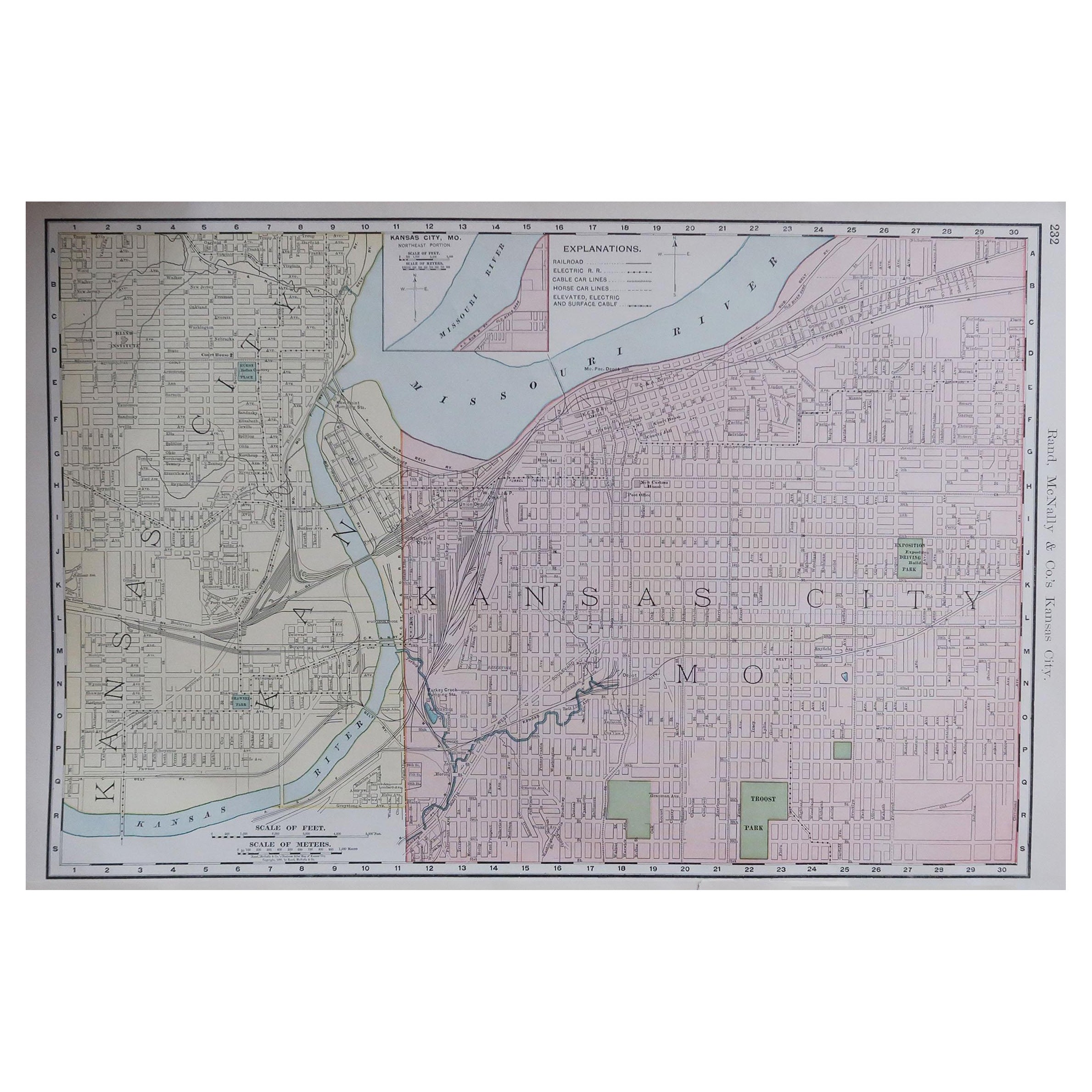
Original Antique City Plan of Kansas City, USA. 1894
By Rand McNally & Co.
Located in St Annes, Lancashire
Fabulous colorful map of Kansas City
Original color
By Rand, McNally & Co.
Published, 1894
Unframed
Slightly reduced bottom margin.
Free shipping.
Category
Antique 1890s American Maps
Materials
Paper

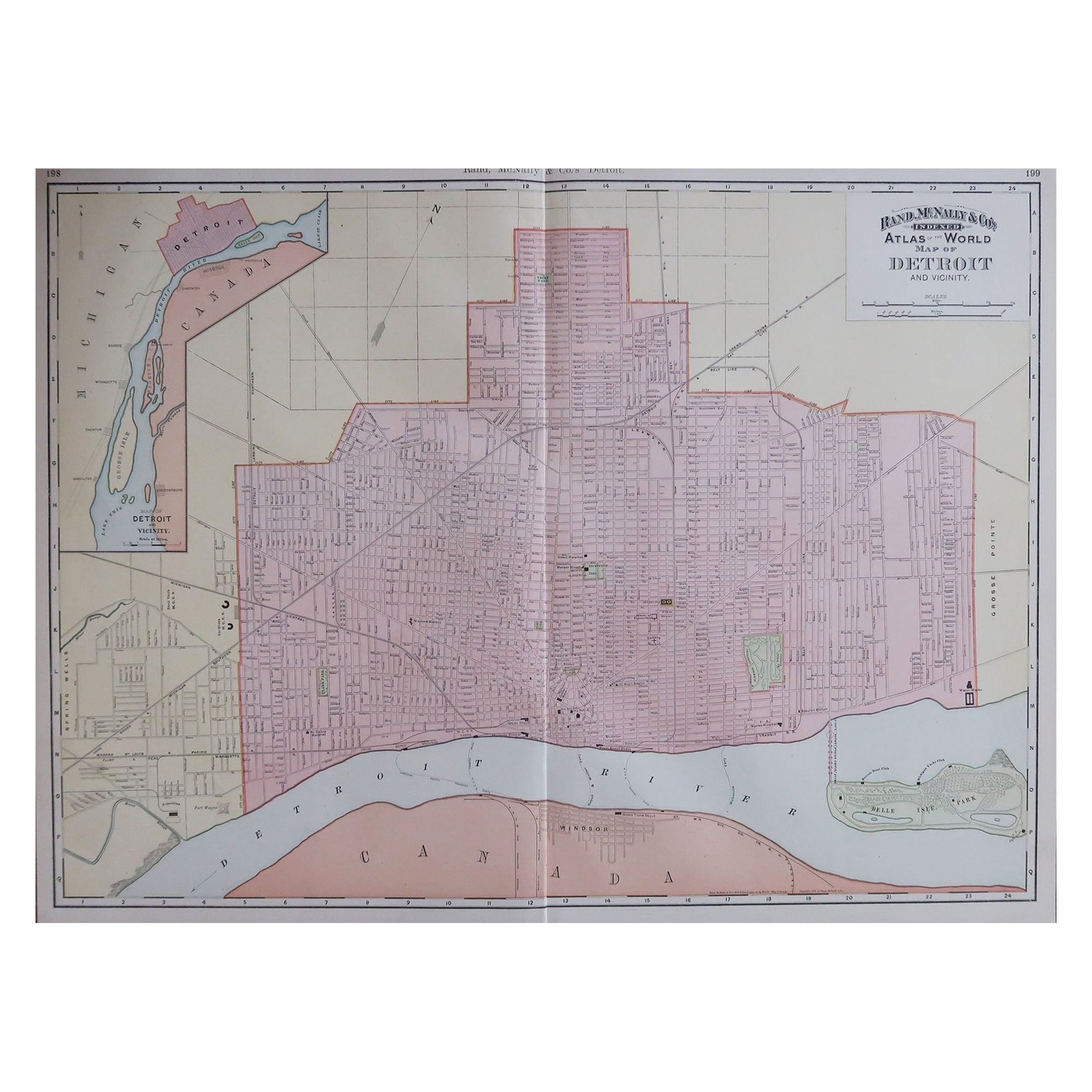
Large Original Antique City Plan of Detroit, USA, 1894
By Rand McNally & Co.
Located in St Annes, Lancashire
Fabulous colorful map of Detroit
Original color
By Rand, McNally & Co.
Published, 1894
Unframed
Free shipping.
Category
Antique 1890s American Maps
Materials
Paper
Large Original Antique City Plan of Montreal, Canada, circa 1900
By Rand McNally & Co.
Located in St Annes, Lancashire
Fabulous colorful map of Montreal
Original color
By Rand, McNally & Co.
Published, circa 1900
Unframed
Minor edge tears
Free shipping.
Category
Antique Early 1900s American Maps
Materials
Paper

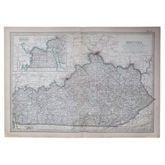
Original Antique Map of the American State of Kentucky, 1903
Located in St Annes, Lancashire
Antique map of Kentucky
Published By A & C Black. 1903
Original colour
Good condition
Unframed.
Free shipping
Category
Antique Early 1900s English Maps
Materials
Paper
Original Antique Map of the American State of Ohio ( Southern Part ), 1903
Located in St Annes, Lancashire
Antique map of Ohio ( Southern part )
Published By A & C Black. 1903
Original colour
Good condition
Unframed.
Free shipping
Category
Antique Early 1900s English Maps
Materials
Paper

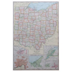
Large Original Antique Map of Ohio, Usa, C.1900
Located in St Annes, Lancashire
Fabulous map of Ohio
Original color.
Engraved and printed by the George F. Cram Company, Indianapolis.
Published, C.1900.
Unframed.
Free shipping.
Category
Antique 1890s American Maps
Materials
Paper
More Ways To Browse
Antique Street Light
Ward Furniture Mid Century
Cincinnati Furniture
Miami Used Office Furniture
Kentucky Antique Furniture
Antique Furniture Directory
Antique Furniture Cincinnati
Used Furniture Cincinnati Ohio
Ohio Antique Plates
Curved Velvet Couch
Velvet Curved Sofa
Wood Round Coffee Tables
Oak Brutalist
Used College Furniture
Wood Minimalist Chair
Antique Imperial Furniture
Gold Modern Coffee Table
Large Side Tables