Items Similar to Rare 1864 Civil War Era Map of Arkansas, Mississippi, and Louisiana
Want more images or videos?
Request additional images or videos from the seller
1 of 10
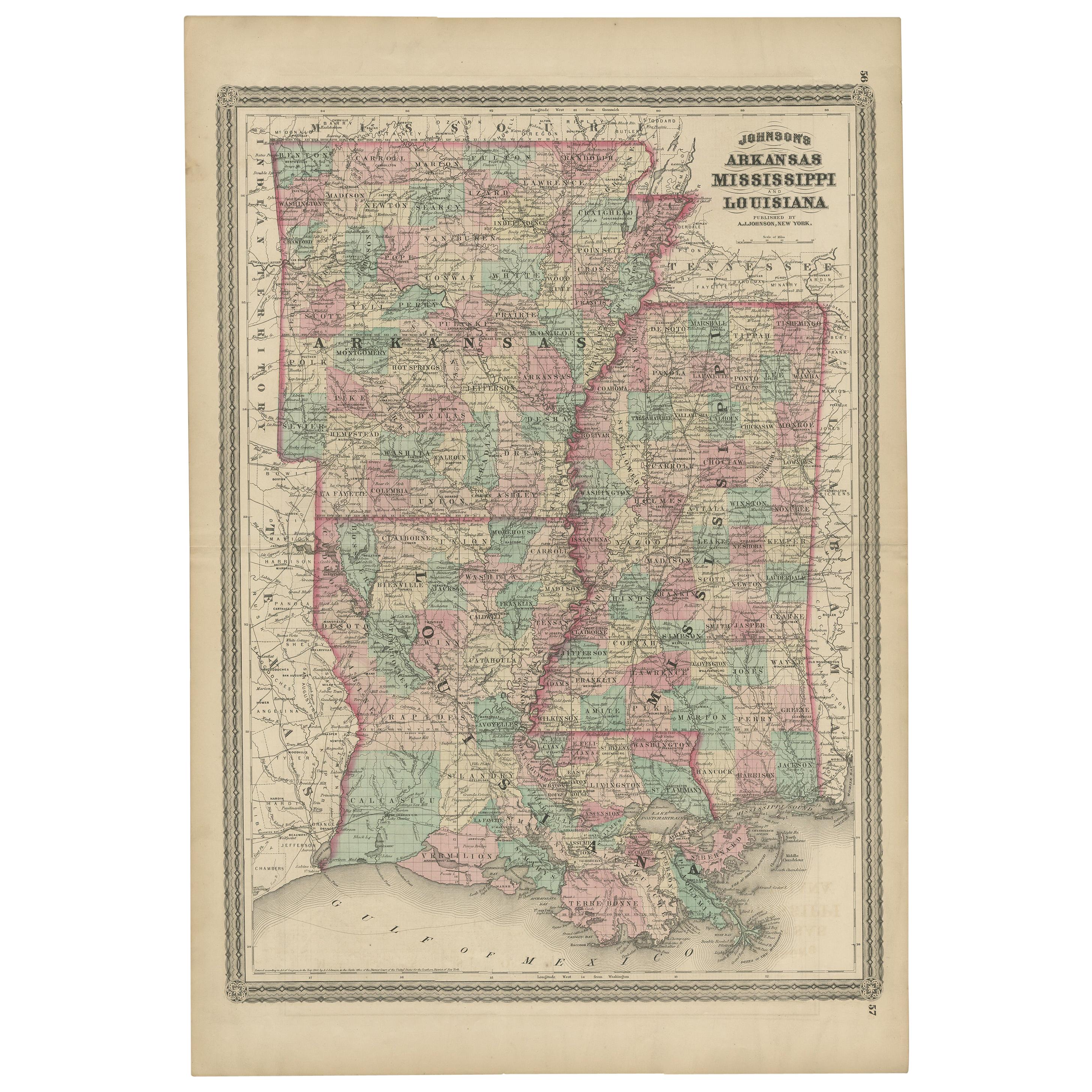
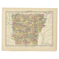
Rare 1864 Civil War Era Map of Arkansas, Mississippi, and Louisiana
$396.17
£298.78
€340
CA$547.73
A$613.55
CHF 322.26
MX$7,460.61
NOK 4,080.87
SEK 3,873.84
DKK 2,588.30
About the Item
Title: Rare 1864 Civil War Era Map of Arkansas, Mississippi, and Louisiana
Description: This captivating antique map, titled "Johnson's Arkansas, Mississippi, and Louisiana," was published in 1864 by Johnson and Ward, a distinguished American mapmaking firm renowned for their detailed and visually appealing atlases during the mid-19th century.
The map meticulously illustrates the states of Arkansas, Mississippi, and Louisiana, detailing counties, towns, railroads, and geographical features of the era. Each county is outlined in a vivid pink, with a subtle green wash filling the background, creating a harmonious contrast that highlights the region’s topography. A decorative border frames the map, adding to its antique charm, while the map includes notable geographical markers like the Mississippi River and the Gulf of Mexico coastline.
The map was produced using the steel engraving technique, prized for its precision and ability to render fine lines and intricate details, as seen in the crisp text and delicate linework.
What makes this map particularly compelling is its historical context—created during the Civil War, it captures these Southern states at a critical juncture, reflecting their strategic importance with detailed depictions of infrastructure such as railroads and waterways. The map provides a window into the region’s role in the Confederacy, offering insights into its economic and military landscape.
Collectors and historians will treasure this map for its ability to transport viewers to a transformative period in American history, blending functional cartography with artistic elegance, making it an exceptional piece for any collection of antique maps or Civil War artifacts.
Condition Report: The map is in good condition for its age, with light toning and minor foxing along the edges. Small tears are present at the fold lines, but there are no significant losses. The colors remain bright, and the paper is intact with slight wear.
Framing Tips: Use an acid-free mat to prevent discoloration and UV-protective glass to shield from light damage. A soft ivory or off-white matting board is recommended, as it complements the aged cream tone of the map’s paper, creating a cohesive and elegant look. This neutral color allows the pink and green hues to stand out without distraction, maintaining a classic, museum-quality presentation that appeals to collectors. It also enhances the map’s historical charm by blending seamlessly with its vintage appearance.
For a subtle contrast, a pale beige could also work, adding a touch of warmth while keeping the focus on the map’s details. Avoid bold or dark colors like red or navy, as they could overpower the map’s delicate tones and detract from its antique appeal. A classic wooden frame with a gold accent enhances the map’s vintage charm. Avoid tight pressing to reduce stress on the folds.
- Dimensions:Height: 26.38 in (67 cm)Width: 18 in (45.7 cm)Depth: 0.01 in (0.2 mm)
- Materials and Techniques:
- Period:
- Date of Manufacture:1864
- Condition:The map is in good condition for its age, with light toning and minor foxing along the edges. Small tears are present at the fold lines, but there are no significant losses. The colors remain bright, and the paper is intact with slight wear.
- Seller Location:Langweer, NL
- Reference Number:Seller: BG-13952-161stDibs: LU3054345073892
About the Seller
5.0
Recognized Seller
These prestigious sellers are industry leaders and represent the highest echelon for item quality and design.
Platinum Seller
Premium sellers with a 4.7+ rating and 24-hour response times
Established in 2009
1stDibs seller since 2017
2,517 sales on 1stDibs
Typical response time: <1 hour
- ShippingRetrieving quote...Shipping from: Langweer, Netherlands
- Return Policy
Authenticity Guarantee
In the unlikely event there’s an issue with an item’s authenticity, contact us within 1 year for a full refund. DetailsMoney-Back Guarantee
If your item is not as described, is damaged in transit, or does not arrive, contact us within 7 days for a full refund. Details24-Hour Cancellation
You have a 24-hour grace period in which to reconsider your purchase, with no questions asked.Vetted Professional Sellers
Our world-class sellers must adhere to strict standards for service and quality, maintaining the integrity of our listings.Price-Match Guarantee
If you find that a seller listed the same item for a lower price elsewhere, we’ll match it.Trusted Global Delivery
Our best-in-class carrier network provides specialized shipping options worldwide, including custom delivery.More From This Seller
View AllAntique Map of Arkansas, Mississippi and Louisiana by Johnson, 1872
Located in Langweer, NL
Antique map titled 'Johnson's Arkansas (..)'. Original map of Arkansas, Mississippi and Louisiana. This map originates from 'Johnson's New Illustrated ...
Category
Antique Late 19th Century Maps
Materials
Paper

$233 Sale Price
20% Off
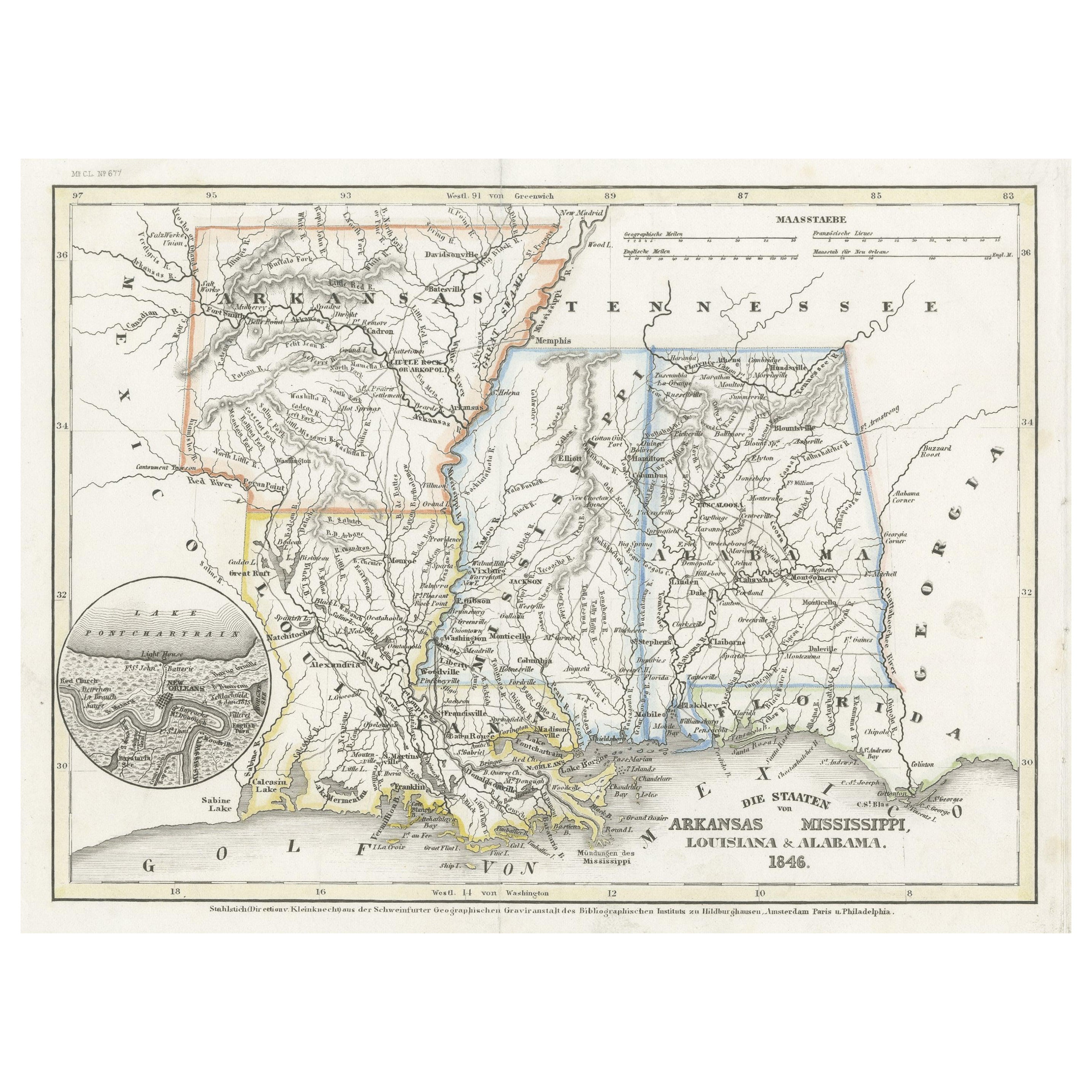
Antique Map of the Southern United States with Inset Map of New Orleans
Located in Langweer, NL
Antique map titled 'Die Staaten von Arkansas Mississippi, Louisiana & Alabama'. Detailed map of the region, which includes the Florida Panhandle. Shows many roads, rivers, forts, etc...
Category
Antique Mid-19th Century Maps
Materials
Paper
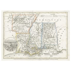
$130 Sale Price
20% Off
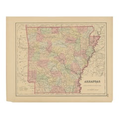
Arkansas Map by Colton, USA Published c.1864 – Hand-Colored County Map
Located in Langweer, NL
Arkansas Map by Colton, USA Published c.1864 – Hand-Colored County Map
This is a finely engraved and hand-colored map titled Arkansas, published by G.W. & C.B. Colton & Co. in New Y...
Category
Antique Mid-19th Century American Maps
Materials
Paper
Antique Map of Arkansas
Located in Langweer, NL
Antique map titled 'Arkansas'. Original antique map of Arkansas, United States. This print originates from 'Encyclopaedia Britannica', Ninth Edition. P...
Category
Antique Late 19th Century Maps
Materials
Paper
$270 Sale Price
20% Off
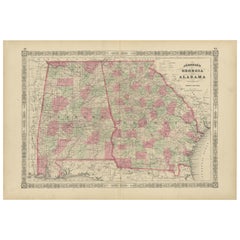
Historic 1864 Civil War Map of Georgia and Alabama with Coastal Focus
Located in Langweer, NL
Title: Historic 1864 Civil War Map of Georgia and Alabama with Coastal Focus
Description: This intricately detailed antique map, titled "Johnson's Georgia and Alabama," was publishe...
Category
Antique 1860s Maps
Materials
Paper
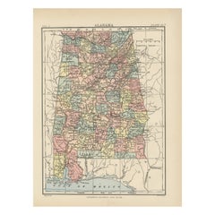
Antique Map of Alabama
Located in Langweer, NL
Antique map titled 'Alabama'. Original antique map of Alabama, United States. This print originates from 'Encyclopaedia Britannica', Ninth Editi...
Category
Antique Late 19th Century Maps
Materials
Paper
$270 Sale Price
20% Off
You May Also Like
Original Antique Map of the American State of Mississippi, 1903
Located in St Annes, Lancashire
Antique map of Mississippi
Published By A & C Black. 1903
Original colour
Good condition
Unframed.
Free shipping
Category
Antique Early 1900s English Maps
Materials
Paper

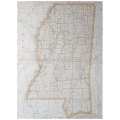
Large Original Antique Map of Mississippi, USA, 1894
By Rand McNally & Co.
Located in St Annes, Lancashire
Fabulous map of Mississippi
Original color
By Rand, McNally & Co.
Published, 1894
Unframed
Free shipping.
Category
Antique 1890s American Maps
Materials
Paper
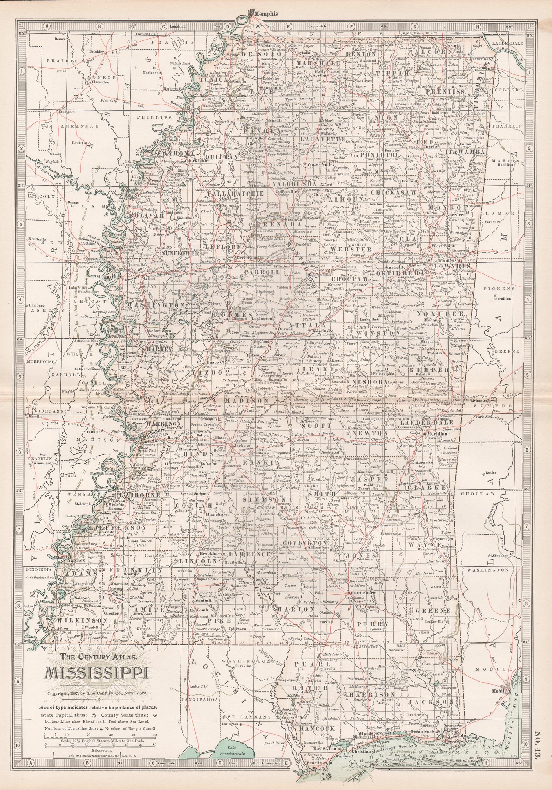
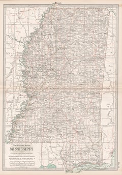
Mississippi. USA Century Atlas state antique vintage map
Located in Melbourne, Victoria
'The Century Atlas. Mississippi'
Original antique map, 1903.
Central fold as issued. Map name and number printed on the reverse corners.
Sheet 40cm by 29.5cm.
Category
Early 20th Century Victorian More Prints
Materials
Lithograph
Original Antique Map of the American State of Louisiana, 1903
Located in St Annes, Lancashire
Antique map of Louisiana
Published By A & C Black. 1903
Original colour
Good condition
Unframed.
Free shipping
Category
Antique Early 1900s English Maps
Materials
Paper

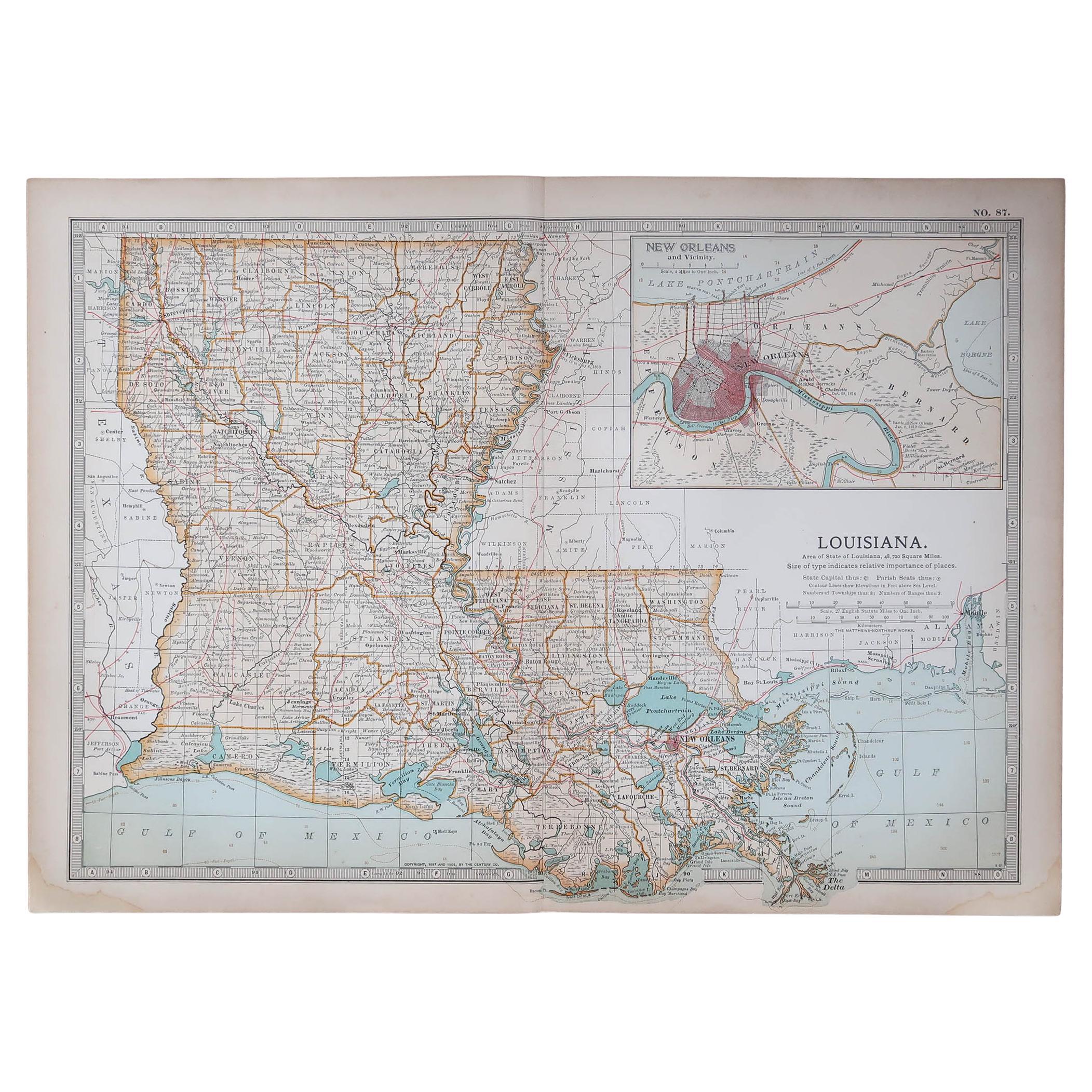
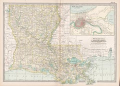
Louisiana. USA Century Atlas state antique vintage map
Located in Melbourne, Victoria
'The Century Atlas. Louisiana'
Inset map of 'New Orleans and Vicinity'.
Original antique map, 1903.
Central fold as issued. Map name and number printed on the reverse corners.
Shee...
Category
Early 20th Century Victorian More Prints
Materials
Lithograph
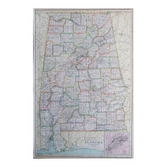
Large Original Antique Map of Alabama, USA, C.1900
Located in St Annes, Lancashire
Fabulous map of Alabama
Original color
Engraved and printed by the George F. Cram Company, Indianapolis.
Published, C.1900
Unframed
Repair to a minor edge tear top left corner
...
Category
Antique 1890s American Maps
Materials
Paper
More Ways To Browse
Antique Ivory Collectables
Louisiana Furniture
Foldable Military
Arkansas Furniture
Antique Wash Stand
Louisiana Antique Furniture
Louisiana Antiques
Used Furniture In Arkansas
Louisiana Museum
Silver Bowl Large
Down Couch
Used Lighter Art
Blue Edge Glass
Mahogany 1950s Furniture
Solid Mahogany Table
Dessert Glasses
Geometric Glass Table
Mid Century Pin