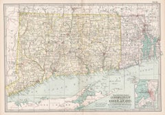
Items Similar to Rare 1864 Civil War Era Map of Massachusetts, Connecticut, and Rhode Island

Want more images or videos?
Request additional images or videos from the seller
1 of 10
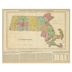
Rare 1864 Civil War Era Map of Massachusetts, Connecticut, and Rhode Island
$419.29
£317.62
€360
CA$580.87
A$651.48
CHF 341.17
MX$7,916.15
NOK 4,332.30
SEK 4,107.33
DKK 2,740.96
About the Item
Title: Rare 1864 Civil War Era Map of Massachusetts, Connecticut, and Rhode Island
Description: This exquisite antique map, titled "Johnson's Massachusetts, Connecticut, and Rhode Island," was published in 1864 by Johnson and Ward, a prominent American mapmaking firm known for their detailed and aesthetically pleasing atlases during the mid-19th century.
The map intricately details the New England states of Massachusetts, Connecticut, and Rhode Island, showcasing counties, towns, railroads, and geographical features of the period. Each county is outlined in a striking pink hue, with a delicate green wash filling the background, creating a visually appealing contrast. A decorative border frames the map, adding to its antique charm, while an inset in the top right corner provides a detailed plan of "The City of Boston," highlighting its streets and key landmarks.
The map was created using the steel engraving technique, a method favored for its precision and ability to produce fine lines and detailed illustrations, evident in the crisp text and ornate design elements.
What makes this map particularly interesting is its historical context—produced during the Civil War, it reflects the industrial and cultural significance of New England, a region critical to the Union’s war effort, with its dense network of railroads and bustling cities like Boston. The map also captures coastal details, including Cape Cod, Nantucket, and Martha’s Vineyard, offering a glimpse into the maritime importance of the area.
Collectors and historians will appreciate the map’s ability to transport viewers back to a pivotal moment in American history, blending functional cartography with artistic beauty, making it a standout piece for any collection of antique maps or New England memorabilia.
Condition Report: The map is in good condition for its age, with light toning and minor foxing along the edges. Small tears are present at the fold lines, but there are no significant losses. The colors remain vibrant, and the paper is intact with slight wear.
Framing Tips: Use an acid-free mat to prevent discoloration and UV-protective glass to shield from light damage. A soft ivory or off-white matting board is recommended, as it complements the aged cream tone of the map’s paper, creating a cohesive and elegant look. This neutral color allows the pink and green hues to stand out without distraction, maintaining a classic, museum-quality presentation that appeals to collectors. It also enhances the map’s historical charm by blending seamlessly with its vintage appearance.
For a subtle contrast, a pale gray could also work, adding a cool tone that complements the green shading while keeping the focus on the map’s details. Avoid bold or dark colors. A classic wooden frame with a gold accent enhances the map’s vintage charm. Avoid tight pressing to reduce stress on the folds.
- Dimensions:Height: 18 in (45.7 cm)Width: 26.38 in (67 cm)Depth: 0.01 in (0.2 mm)
- Materials and Techniques:
- Period:
- Date of Manufacture:1864
- Condition:The map is in good condition for its age, with light toning and minor foxing along the edges. Small tears are present at the fold lines, but there are no significant losses. The colors remain vibrant, and the paper is intact with slight wear.
- Seller Location:Langweer, NL
- Reference Number:Seller: BG-13952-181stDibs: LU3054345074002
About the Seller
5.0
Recognized Seller
These prestigious sellers are industry leaders and represent the highest echelon for item quality and design.
Platinum Seller
Premium sellers with a 4.7+ rating and 24-hour response times
Established in 2009
1stDibs seller since 2017
2,517 sales on 1stDibs
Typical response time: <1 hour
- ShippingRetrieving quote...Shipping from: Langweer, Netherlands
- Return Policy
Authenticity Guarantee
In the unlikely event there’s an issue with an item’s authenticity, contact us within 1 year for a full refund. DetailsMoney-Back Guarantee
If your item is not as described, is damaged in transit, or does not arrive, contact us within 7 days for a full refund. Details24-Hour Cancellation
You have a 24-hour grace period in which to reconsider your purchase, with no questions asked.Vetted Professional Sellers
Our world-class sellers must adhere to strict standards for service and quality, maintaining the integrity of our listings.Price-Match Guarantee
If you find that a seller listed the same item for a lower price elsewhere, we’ll match it.Trusted Global Delivery
Our best-in-class carrier network provides specialized shipping options worldwide, including custom delivery.More From This Seller
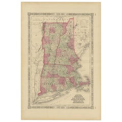
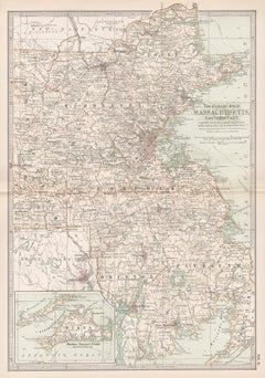
View AllRare 1864 Civil War Era Map of Vermont, New Hampshire, and Southern New England
Located in Langweer, NL
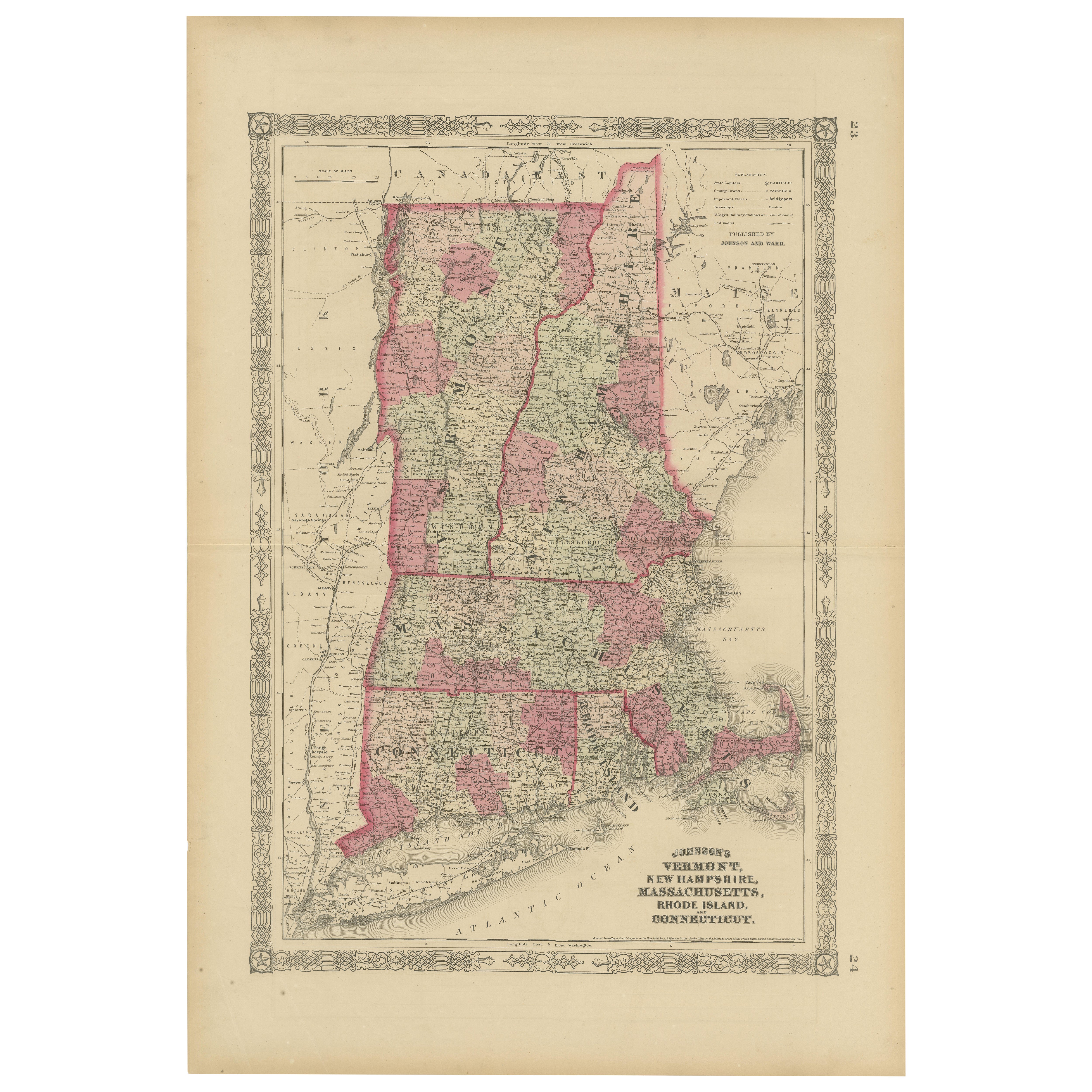
Title: Rare 1864 Civil War Era Map of Vermont, New Hampshire, and Southern New England
Description: This finely detailed antique map, titled "Johnson's Vermont, New Hampshire, Massa...
Category
Antique 1860s Maps
Materials
Paper
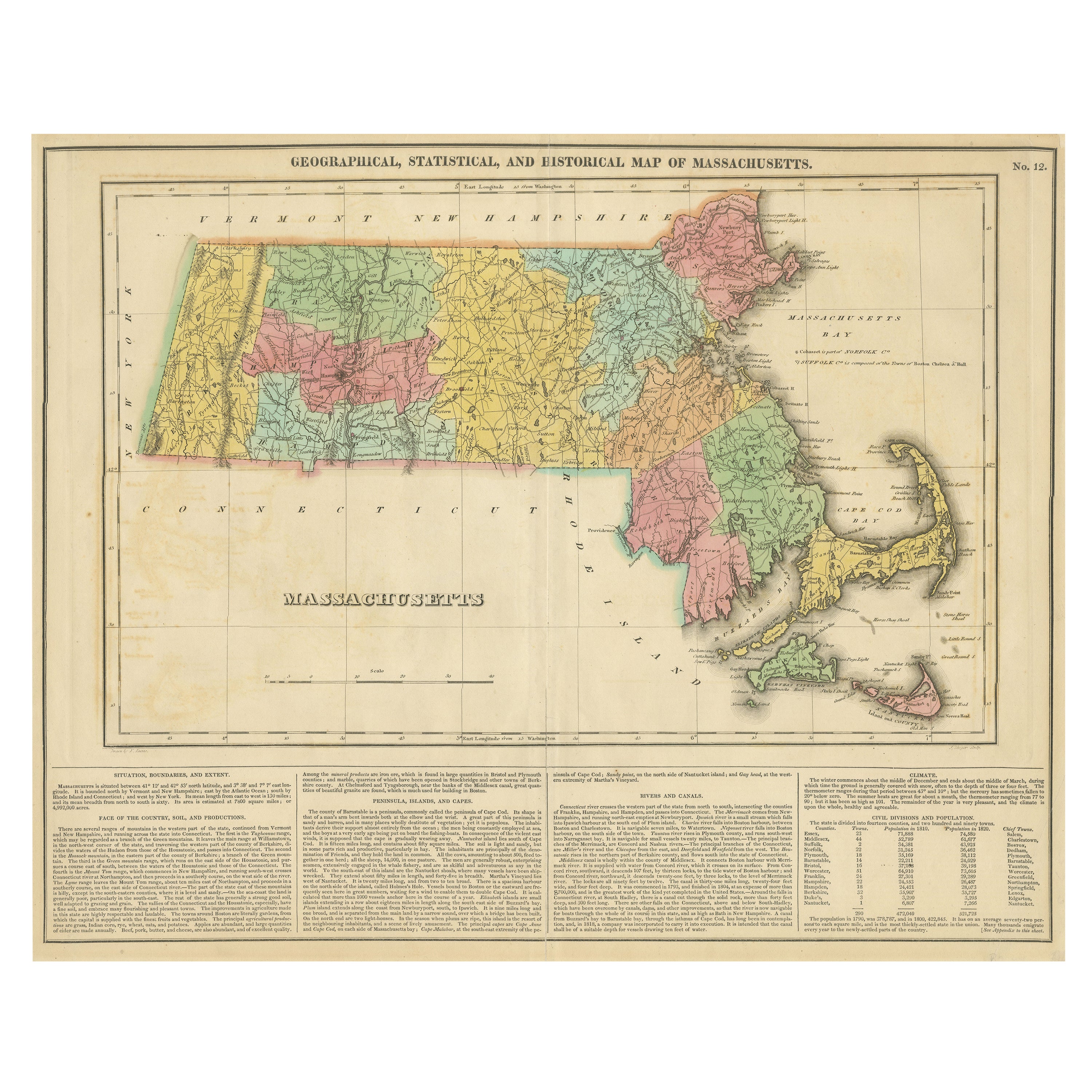
Antique Geographical, Historical and Statistical Map of Massachusetts, 1822
Located in Langweer, NL
This attractive map of Massachusetts presents a finely detailed overview of the state in the first quarter of the 19th century.
Transportation ...
Category
Antique 1820s Maps
Materials
Paper
$354 Sale Price
20% Off
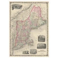
Large Antique Map of New England with decorative Vignettes
Located in Langweer, NL
Antique map titled 'Johnson's New England'. Large map of New England, comprising the states Connecticut, Maine, Massachusetts, New Hampshire, Rhode ...
Category
Antique Mid-19th Century Maps
Materials
Paper
$363 Sale Price
20% Off
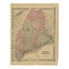
Maine County Map – Johnson, Hand-Colored, USA c.1864
Located in Langweer, NL
Johnson’s Maine Map, USA Published c.1864 – Hand-Colored County Map
This is a finely engraved and hand-colored map titled Johnson’s Maine, published by Johnson and Ward in New York ...
Category
Antique Mid-19th Century American Maps
Materials
Paper
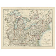
Antique Map of the Northeast USA - Vibrant 1903 Cartographic Detail
Located in Langweer, NL
Map of the Northeastern United States of North America, 1903
This striking antique map titled “United States of North America (North Eastern Sheet)” was created by the renowned Scot...
Category
Early 20th Century Maps
Materials
Paper
1864 Johnson's Map of New York State with City Insets
Located in Langweer, NL
Title: 1864 Johnson's Map of New York State with City Insets
Description: This 1864 map, titled "Johnson's New York," was published by Johnson and Ward and features a detailed depic...
Category
Antique 1860s Maps
Materials
Paper

$261 Sale Price
20% Off
You May Also Like
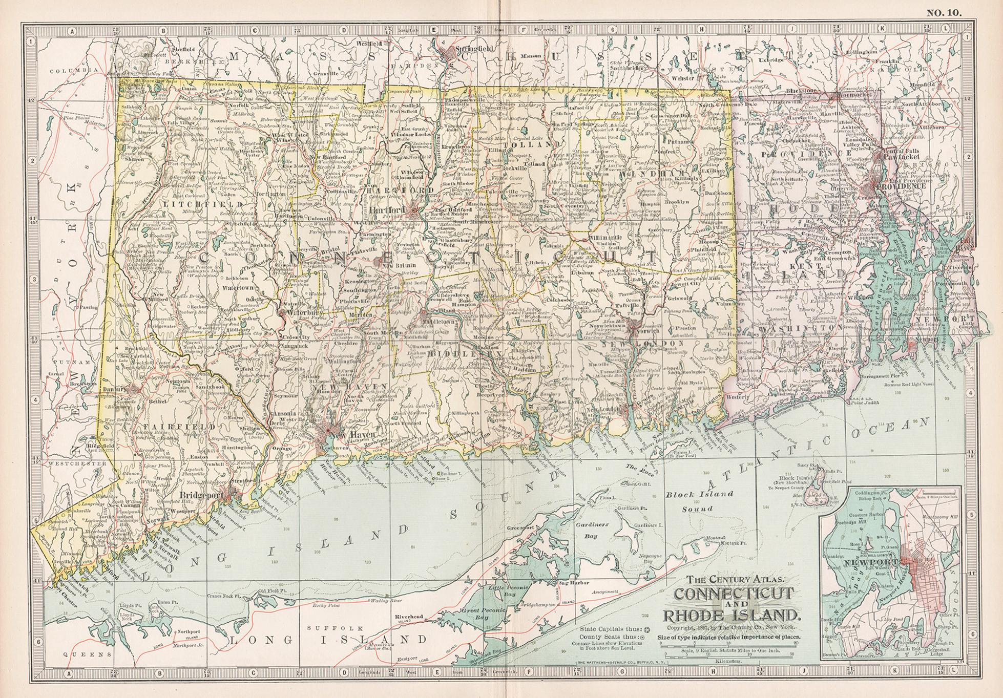
Connecticut and Rhode Island. USA. Century Atlas state antique vintage map
Located in Melbourne, Victoria
'The Century Atlas. Connecticut and Rhode Island.'
Original antique map, 1903.
Central fold as issued. Map name and number printed on the reverse corners.
Sheet 29.5cm by 40cm.
Category
Early 20th Century Victorian More Prints
Materials
Lithograph
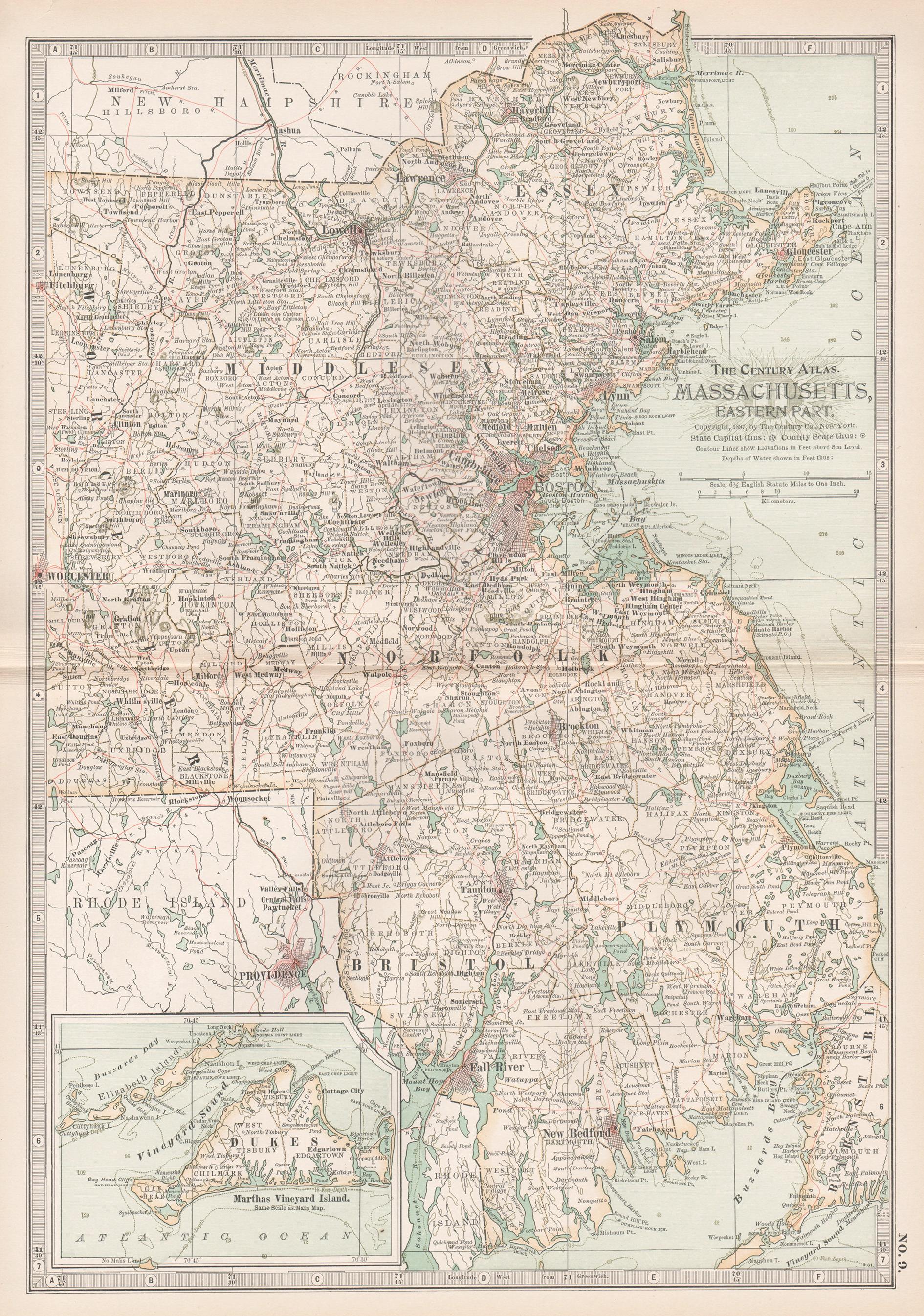
Massachusetts, Eastern Part. USA. Century Atlas state antique vintage map
Located in Melbourne, Victoria
'The Century Atlas. Massachusetts, Eastern Part'
Original antique map, 1903.
Central fold as issued. Map name and number printed on the reverse corners.
Sheet 40cm by 29.5cm.
Category
Early 20th Century Victorian More Prints
Materials
Lithograph
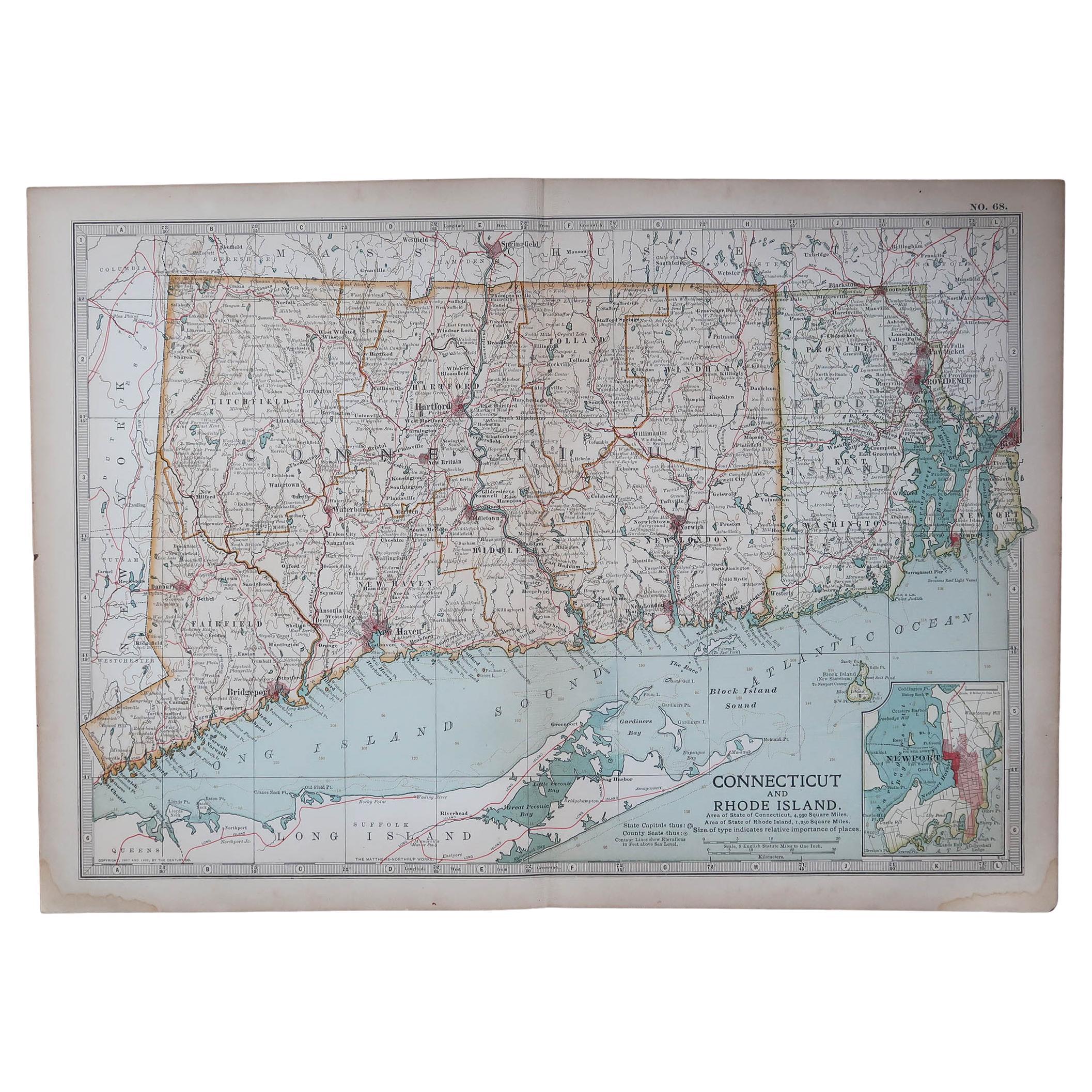
Original Antique Map of the American State of Connecticut & Rhode Island, 1903
Located in St Annes, Lancashire
Antique map of Connecticut and Rhode Island
Published By A & C Black. 1903
Original colour
Good condition
Unframed.
Free shipping
Category
Antique Early 1900s English Maps
Materials
Paper

Original Antique Map of the American State of Massachusetts, 1903
Located in St Annes, Lancashire
Antique map of Vermont and New Hampshire
Published By A & C Black. 1903
Original colour
Good condition
Unframed.
Free shipping
Category
Antique Early 1900s English Maps
Materials
Paper

1854 Map of Massachusetts, Connecticut and Rhode Island, Antique Wall Map
Located in Colorado Springs, CO
This striking wall map was published in 1854 by Ensign, Bridgman & Fanning and has both full original hand-coloring and original hardware. This impression is both informative and highly decorative.
The states are divided into counties, outlined in red, green, and black, and subdivided into towns. Roads, canals, and railroad lines are prominently depicted, although they are not all labeled. The mapmakers also marked lighthouses, banks, churches, and prominent buildings, with a key at right. The map is an informative and comprehensive overview of the infrastructural development of New England prior to the Civil War. Physical geographies depicted include elevation, conveyed with hachure marks, rivers and lakes. The impression features an inset map of Boston...
Category
Antique 19th Century American Maps
Materials
Paper

Large Original Antique Map of Massachusetts, USA, circa 1900
Located in St Annes, Lancashire
Fabulous map of Massachusetts
In 2 sheets. They can be joined but I have not done it
Original color
Engraved and printed by the George F. Cram ...
Category
Antique 1890s American Maps
Materials
Paper

More Ways To Browse
Connecticut Used Furniture
Rhode Island Furniture
Codor Design
Antique Ivory Collectables
Antique Furniture Massachusetts
Massachusetts Antiques
Antique Furniture Connecticut
Antique Wash Stand
Pink Cape
Used Office Furniture Rhode Island
Used Furniture Cape Cod
Corner Wash Stand
Antique Cooling Board
Union Street Glass
Silver Bowl Large
Down Couch
Used Lighter Art
Blue Edge Glass