Items Similar to Rare 1864 Ohio Civil War Era Map with State Capitol Illustration
Want more images or videos?
Request additional images or videos from the seller
1 of 10
Rare 1864 Ohio Civil War Era Map with State Capitol Illustration
$401.60
£301.74
€340
CA$553.01
A$618.92
CHF 323.98
MX$7,518.70
NOK 4,113.73
SEK 3,882
DKK 2,587.74
About the Item
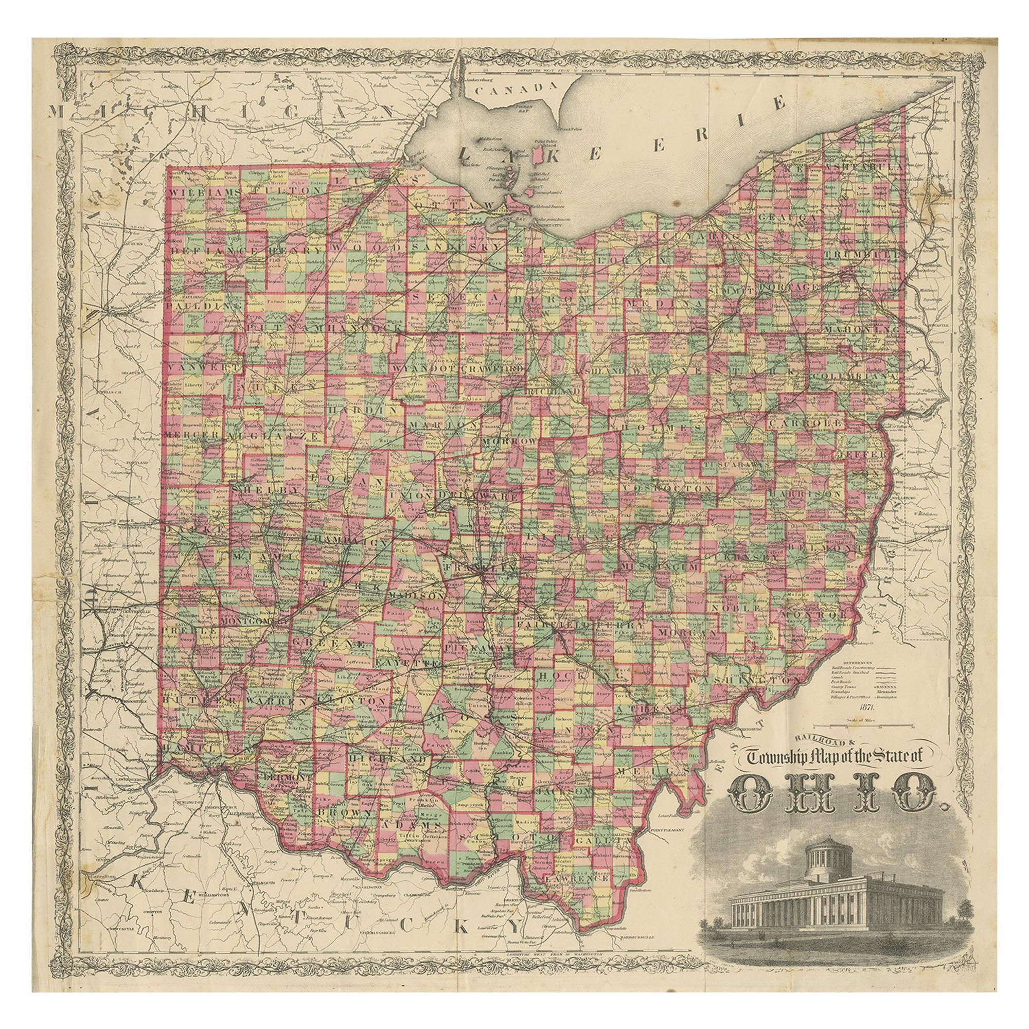
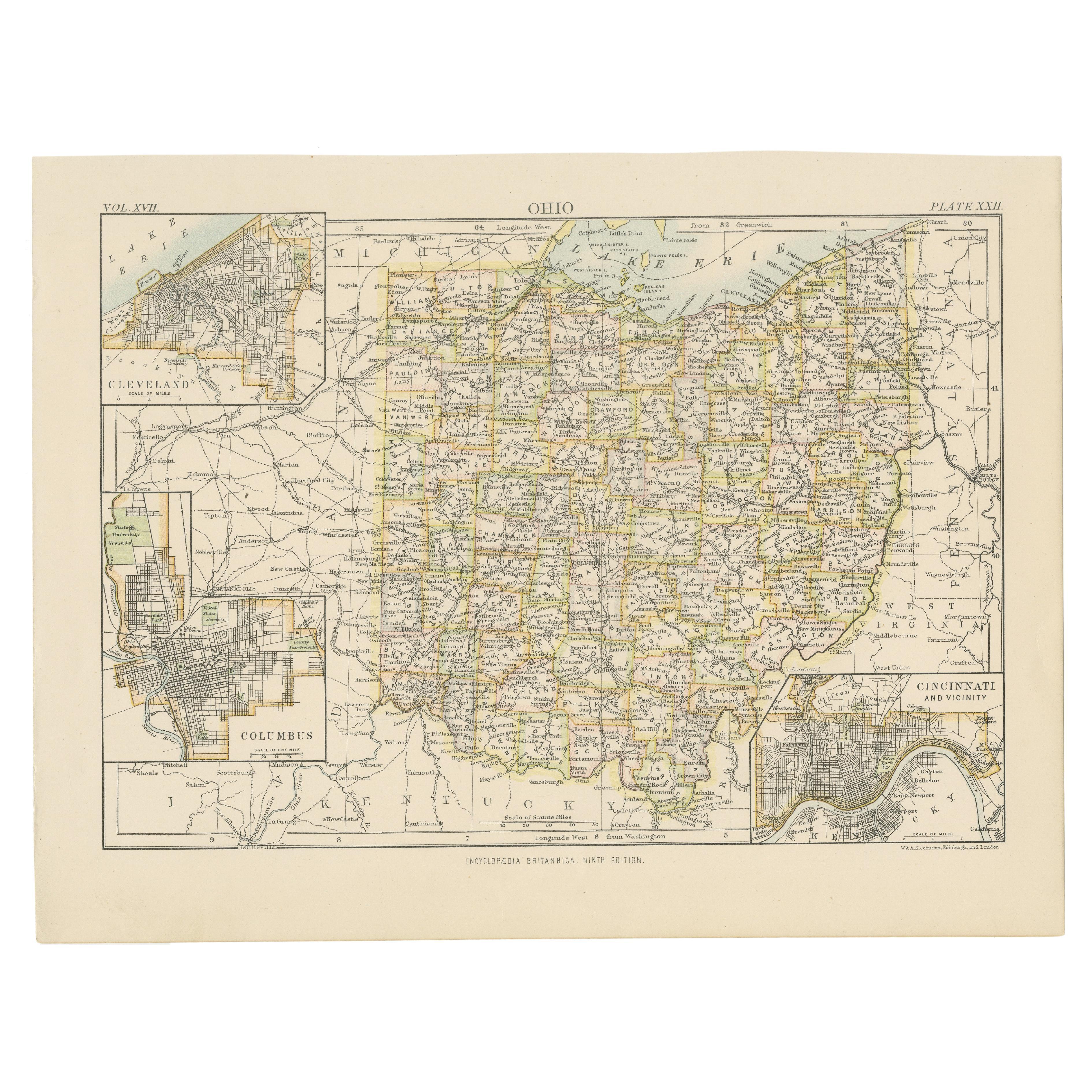
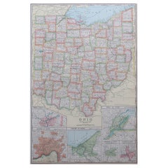
Title: Johnson's Ohio Antique Map by Johnson and Ward, 1864
Description: This exquisite antique map, titled "Johnson's Ohio," was published in 1864 by Johnson and Ward, a prominent American mapmaking firm known for their detailed and beautifully crafted atlases during the mid-19th century.
The map showcases the state of Ohio with intricate detail, highlighting counties, towns, railroads, and geographical features of the time. Each county is outlined in a striking pink hue, with a delicate green wash filling the background, creating a visually appealing contrast. A decorative border frames the map, adding to its aesthetic charm, while an inset illustration of the State Capitol at Columbus provides a historical glimpse into Ohio's architectural past.
The map was created using the steel engraving technique, a method favored for its precision and ability to produce fine lines and detailed illustrations, which is evident in the crisp text and ornate design elements. What makes this map particularly interesting is its historical context—produced during the Civil War, it reflects Ohio's role as a key state in the Union, with its burgeoning infrastructure and political significance. Collectors and historians alike will appreciate the map's ability to transport viewers back to a pivotal moment in American history, offering insights into the state's development and the cartographic artistry of the era. The map's combination of functional geography and decorative elements makes it a standout piece for any collection of antique maps or Americana.
Condition Report: The map is in good condition for its age, with light toning and minor foxing along the edges. There are a few small tears at the fold lines, but no significant losses and one small piece of tape at the bottom. The colors remain vibrant, and the paper is intact with slight wear.
Framing Tips: Use an acid-free mat to prevent discoloration, and opt for UV-protective glass to shield from light damage. A simple wooden frame with a gold finish complements the map's vintage aesthetic. Ensure the map is not pressed tightly to avoid stress on the folds.
- Dimensions:Height: 18 in (45.7 cm)Width: 26.38 in (67 cm)Depth: 0.01 in (0.2 mm)
- Materials and Techniques:
- Period:
- Date of Manufacture:1864
- Condition:The map is in good condition for its age, with light toning and minor foxing along the edges. There are a few small tears (one small tape) at the fold lines, but no significant losses. Colors remain vibrant, and the paper is intact with slight wear.
- Seller Location:Langweer, NL
- Reference Number:Seller: BG-13952-141stDibs: LU3054345073692
About the Seller
5.0
Recognized Seller
These prestigious sellers are industry leaders and represent the highest echelon for item quality and design.
Platinum Seller
Premium sellers with a 4.7+ rating and 24-hour response times
Established in 2009
1stDibs seller since 2017
2,534 sales on 1stDibs
Typical response time: <1 hour
- ShippingRetrieving quote...Shipping from: Langweer, Netherlands
- Return Policy
Authenticity Guarantee
In the unlikely event there’s an issue with an item’s authenticity, contact us within 1 year for a full refund. DetailsMoney-Back Guarantee
If your item is not as described, is damaged in transit, or does not arrive, contact us within 7 days for a full refund. Details24-Hour Cancellation
You have a 24-hour grace period in which to reconsider your purchase, with no questions asked.Vetted Professional Sellers
Our world-class sellers must adhere to strict standards for service and quality, maintaining the integrity of our listings.Price-Match Guarantee
If you find that a seller listed the same item for a lower price elsewhere, we’ll match it.Trusted Global Delivery
Our best-in-class carrier network provides specialized shipping options worldwide, including custom delivery.More From This Seller
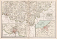
View AllAntique Map of the State of Ohio by Titus '1871'
Located in Langweer, NL
Antique map titled 'Railroad & Township Map of the State of Ohio'. Original antique map of the State of Ohio. This map originates from 'Atlas of Preble County Ohio' by C.O. Titus. Pu...
Category
Antique Late 19th Century Maps
Materials
Paper

$1,063 Sale Price
25% Off
Antique Map of Ohio, with Inset Maps of Cleveland, Columbus and Cincinnati
Located in Langweer, NL
Antique map titled 'Ohio'. Original antique map of Ohio, United States. With inset maps of Cleveland, Columbus and Cincinnati. This print originates from 'Encyclopaedia Britannica', ...
Category
Antique Late 19th Century Maps
Materials
Paper
$274 Sale Price
20% Off
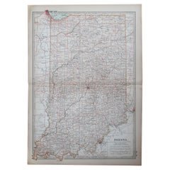
Decorative 1864 Civil War Era Map of Indiana with Lake Michigan Detail
Located in Langweer, NL
Title: Rare 1864 Civil War Era Map of Indiana with Lake Michigan Detail
Description: This finely detailed antique map, titled "Johnson's Indiana," was published in 1864 by Johnson a...
Category
Antique 1860s Maps
Materials
Paper

Rare 1864 Civil War Era Map of Michigan and Wisconsin with Great Lakes Detail
Located in Langweer, NL
Title: Rare 1864 Civil War Era Map of Michigan and Wisconsin with Great Lakes Detail
Description: This beautifully crafted antique map, titled "Johnson's Michigan and Wisconsin," wa...
Category
Antique 1860s Maps
Materials
Paper
Antique Map of Indiana by Johnson, 1872
Located in Langweer, NL
Antique map titled 'Johnson's Indiana'. Original map of Indiana. This map originates from 'Johnson's New Illustrated Family Atlas of the World' by A.J. ...
Category
Antique Late 19th Century Maps
Materials
Paper

$177 Sale Price
40% Off
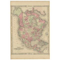
Rare 1864 Civil War Era Map of North America with Detailed Borders
Located in Langweer, NL
Title: Rare 1864 Civil War Era Map of North America with Detailed Borders
Description: This remarkable antique map, titled "Johnson's North America," was published in 1864 by Johnso...
Category
Antique 1860s Maps
Materials
Paper
You May Also Like
Ohio, Northern Part. USA. Century Atlas state antique vintage map
Located in Melbourne, Victoria
'The Century Atlas. Ohio, Northern Part'
Original antique map, 1903.
Central fold as issued. Map name and number printed on the reverse corners.
Sheet 29.5cm by 40cm.
Category
Early 20th Century Victorian More Prints
Materials
Lithograph
Large Original Antique Map of Ohio, Usa, C.1900
Located in St Annes, Lancashire
Fabulous map of Ohio
Original color.
Engraved and printed by the George F. Cram Company, Indianapolis.
Published, C.1900.
Unframed.
Free shipping.
Category
Antique 1890s American Maps
Materials
Paper
Original Antique Map of the American State of Ohio ( Northern Part ), 1903
Located in St Annes, Lancashire
Antique map of Ohio ( Northern part )
Published By A & C Black. 1903
Original colour
Good condition
Unframed.
Free shipping
Category
Antique Early 1900s English Maps
Materials
Paper

Original Antique Map of the American State of Ohio ( Southern Part ), 1903
Located in St Annes, Lancashire
Antique map of Ohio ( Southern part )
Published By A & C Black. 1903
Original colour
Good condition
Unframed.
Free shipping
Category
Antique Early 1900s English Maps
Materials
Paper

Ohio, Southern Part. USA. Century Atlas state antique vintage map
Located in Melbourne, Victoria
'The Century Atlas. Ohio, Southern Part'
Original antique map, 1903.
Central fold as issued. Map name and number printed on the reverse corners.
Sheet 29.5cm by 40cm.
Category
Early 20th Century Victorian More Prints
Materials
Lithograph
Original Antique Map of the American State of Indiana, 1903
Located in St Annes, Lancashire
Antique map of Indiana
Published By A & C Black. 1903
Original colour
Good condition
Unframed.
Free shipping
Category
Antique Early 1900s English Maps
Materials
Paper
More Ways To Browse
Rare Antique Keys
Used Furniture Columbus
Silver Bowl Large
Down Couch
Used Lighter Art
Blue Edge Glass
Mahogany 1950s Furniture
Solid Mahogany Table
Dessert Glasses
Geometric Glass Table
Mid Century Pin
6x10 Rug
Studded Furniture
Styles Of Antique Desks
Black And White Coffee Table
Metal Relief
Curved Velvet Couch
Velvet Curved Sofa