Items Similar to Relief Atlas Map of Asia by Hachette – Antique French Map, circa 1883


Video Loading
Want more images or videos?
Request additional images or videos from the seller
1 of 11
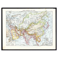
Relief Atlas Map of Asia by Hachette – Antique French Map, circa 1883
$454.42
£342.72
€390
CA$628.28
A$703.78
CHF 369.65
MX$8,557.76
NOK 4,681
SEK 4,443.52
DKK 2,968.94
About the Item
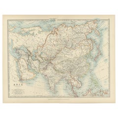
Antique Map of Asia – Relief Atlas Map by Hachette, circa 1883
Description:
This antique map titled “Asie” was published by Hachette in Paris around 1883 and originates from their educational “Atlas en relief.” The map depicts the entire continent of Asia with shaded relief to illustrate the topography and elevations across the vast landmass.
The map shows political boundaries, major cities, rivers, and mountain ranges as known in the late 19th century. The hypsometric tinting uses a scale of colours from green lowlands to brown high mountains, providing a clear visual understanding of Asia’s physical geography, including the Himalayas, Tibetan Plateau, and extensive mountain systems of Central Asia. European colonial possessions in Asia are indicated with different coloured outlines, representing British, Russian, Portuguese, and Spanish territories.
Key features include India under British rule, the Russian Empire stretching into Siberia and Central Asia, China with historical provinces, the Japanese archipelago, Southeast Asia with the Dutch East Indies, and the Philippine Islands. The map also depicts sea routes and major oceanic expanses like the Indian Ocean, Arabian Sea, and Pacific regions. It is titled at the top “Asie” with publication details below: “E. Hachette, Editeur, 79, Rue Serpente, à Paris.”
Condition:
Good condition overall. Clean impression with original colouring intact. Minor age toning and some faint foxing in the wide margins, not affecting the printed area.
Framing tip:
This map of Asia will display beautifully when float-mounted in a dark wood or black frame to emphasise its pastel colours and engraved detail. Ideal for study walls, travel-themed interiors, or antique map collections focusing on 19th-century educational cartography.
- Dimensions:Height: 10.12 in (25.7 cm)Width: 12.84 in (32.6 cm)Depth: 0.01 in (0.2 mm)
- Materials and Techniques:
- Place of Origin:
- Period:
- Date of Manufacture:circa 1883
- Condition:Good condition overall. Clean impression with original colouring intact. Minor age toning and some faint foxing in the wide margins, not affecting the printed area.
- Seller Location:Langweer, NL
- Reference Number:Seller: BG-13384-351stDibs: LU3054345657902
About the Seller
5.0
Recognized Seller
These prestigious sellers are industry leaders and represent the highest echelon for item quality and design.
Platinum Seller
Premium sellers with a 4.7+ rating and 24-hour response times
Established in 2009
1stDibs seller since 2017
2,517 sales on 1stDibs
Typical response time: <1 hour
- ShippingRetrieving quote...Shipping from: Langweer, Netherlands
- Return Policy
Authenticity Guarantee
In the unlikely event there’s an issue with an item’s authenticity, contact us within 1 year for a full refund. DetailsMoney-Back Guarantee
If your item is not as described, is damaged in transit, or does not arrive, contact us within 7 days for a full refund. Details24-Hour Cancellation
You have a 24-hour grace period in which to reconsider your purchase, with no questions asked.Vetted Professional Sellers
Our world-class sellers must adhere to strict standards for service and quality, maintaining the integrity of our listings.Price-Match Guarantee
If you find that a seller listed the same item for a lower price elsewhere, we’ll match it.Trusted Global Delivery
Our best-in-class carrier network provides specialized shipping options worldwide, including custom delivery.More From This Seller
View AllAntique Map of Asia with Intricate Provincial Boundaries, Published in 1903
Located in Langweer, NL
Title: Antique Map of Asia, 1903, with Intricate Provincial Boundaries and Coastal Features
Description:
This antique map, titled "Asia," was engraved and published in 1903 by the r...
Category
Early 20th Century Maps
Materials
Paper
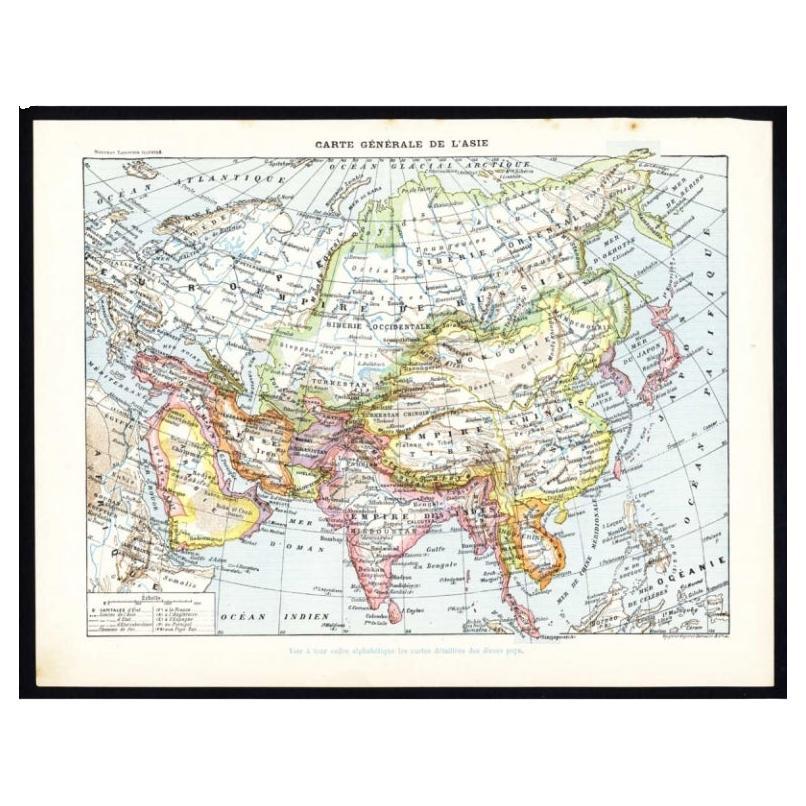
Antique Map of Asia by Larousse, 1897
Located in Langweer, NL
Front: 'Carte Generale de l'Asie.' (General map of Asia). Rear: 'Asie.' (Asia, scenes of Asia, nature, plants and animals, people, costume).' This rare early lithographic print origi...
Category
Antique 19th Century Maps
Materials
Paper
$69 Sale Price
20% Off
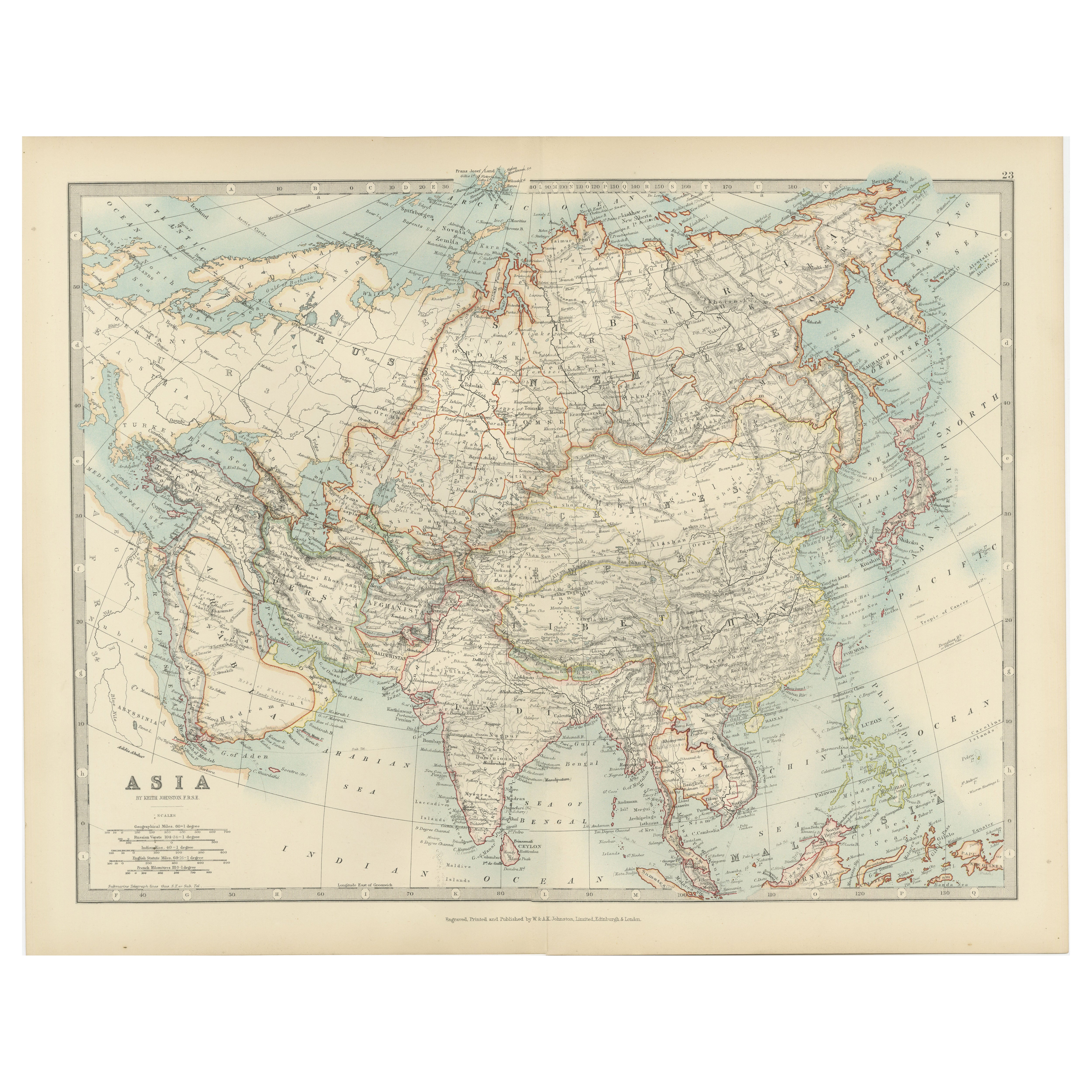
Antique Map of Asia by K. Johnston, circa 1879
Located in Langweer, NL
No. 28 of Keith Johnston's General Atlas. Published by William Blackwood & Sons Edinburgh & London, circa 1879.
Category
Antique Late 19th Century Maps
Materials
Paper

$247 Sale Price
20% Off
Antique Map of Asia by Johnston '1909'
Located in Langweer, NL
Antique map titled 'Asia'. Depicting China, Japan, Indonesia, India, Arabia and more. This map originates from the ‘Royal Atlas of Modern Geography’. Published by W. & A.K. Johnston,...
Category
Early 20th Century Maps
Materials
Paper
$232 Sale Price
20% Off
Antique Map of Asia by A & C, Black, 1870
Located in Langweer, NL
Antique map titled 'Asia'. Original antique map of Asia. This map originates from ‘Black's General Atlas of The World’. Published by A & C. Black, 1870.
Category
Antique Late 19th Century Maps
Materials
Paper

$233 Sale Price
20% Off
Historical Map Depicting the Continent of Asia, 1882
Located in Langweer, NL
This 1882 map presents a meticulously detailed representation of the continent of Asia, a testament to the cartographic skills of the era. Published as a...
Category
Antique 1880s Maps
Materials
Paper

$269 Sale Price
30% Off
You May Also Like
Original Antique Map of The Eastern Hemisphere by Dower, circa 1835
Located in St Annes, Lancashire
Nice map of the Eastern Hemisphere
Drawn and engraved by J.Dower
Published by Orr & Smith. C.1835
Unframed.
Free shipping
Category
Antique 1830s English Maps
Materials
Paper

Large Original Antique Map of Asia by Sidney Hall, 1847
Located in St Annes, Lancashire
Great map of Asia
Drawn and engraved by Sidney Hall
Steel engraving
Original colour outline
Published by A & C Black. 1847
Unframed
Free shipping
Category
Antique 1840s Scottish Maps
Materials
Paper

Antique 1803 Italian Map of Asia Including China Indoneseia India
Located in Amsterdam, Noord Holland
Antique 1803 Italian Map of Asia Including China Indoneseia India
Very nice map of Asia. 1803.
Additional information:
Type: Map
Country of Manufacturing: Europe
Period: 19th centu...
Category
Antique 19th Century European Maps
Materials
Paper

$584 Sale Price
20% Off
China and Japan, English antique map by Alexander Keith Johnston, 1901
Located in Melbourne, Victoria
'China and Japan', antique lithographic map by Keith Johnston.
Central vertical fold as issued.
495mm by 625mm (sheet)
Alexander Keith Johnston FRS...
Category
Early 20th Century Victorian More Prints
Materials
Lithograph

Large Original Vintage Map of S.E Asia, with a Vignette of Singapore
Located in St Annes, Lancashire
Great map of South East Asia
Original color. Good condition
Published by Alexander Gross
Unframed.
Category
Vintage 1920s English Maps
Materials
Paper

Original Antique Map of China, Arrowsmith, 1820
Located in St Annes, Lancashire
Great map of China
Drawn under the direction of Arrowsmith
Copper-plate engraving
Published by Longman, Hurst, Rees, Orme and Brown, 1820
Unfr...
Category
Antique 1820s English Maps
Materials
Paper

More Ways To Browse
Antique Plateau
Tibetan Key
Portuguese Colonial Furniture
British East Indies
Styles Of Antique Desks
Black And White Coffee Table
Curved Velvet Couch
Velvet Curved Sofa
Wood Round Coffee Tables
Antique Paper Flowers
Oak Brutalist
Used College Furniture
Wood Minimalist Chair
2002 Lamp
Antique Imperial Furniture
Gold Modern Coffee Table
Large Side Tables
18th Century Gilded Furniture