Items Similar to Southwestern U.S. Immigration Map for Texas, Arkansas, and Louisiana, 1881


Want more images or videos?
Request additional images or videos from the seller
1 of 10
Southwestern U.S. Immigration Map for Texas, Arkansas, and Louisiana, 1881
$974.70
$1,299.6025% Off
£730.60
£974.1325% Off
€825
€1,10025% Off
CA$1,339.07
CA$1,785.4325% Off
A$1,494.95
A$1,993.2625% Off
CHF 783.33
CHF 1,044.4425% Off
MX$18,299.60
MX$24,399.4725% Off
NOK 9,948.29
NOK 13,264.3825% Off
SEK 9,379.97
SEK 12,506.6325% Off
DKK 6,280.20
DKK 8,373.6025% Off
About the Item
Southwestern U.S. Immigration Map - Published by The Southwestern Immigration Company, Austin, Texas. Detailed Railroad Routes and Regional Statistics for Texas, Arkansas, and Louisiana. Historical Document Promoting Settlement and Economic Growth in the Southwest.
This patina rich map is titled "Map of the South West," published by The Southwestern Immigration Company with a central office in Austin, Texas. The map is dated 1881.
Description:
- The map encompasses parts of Texas, New Mexico, Arkansas, and Louisiana and prominently features railroad lines, depicted in black, crisscrossing the region. This suggests a focus on transportation routes, which were crucial for immigration and commerce during this period.
Contains detailed statistics on crops, education, school and charity endowments, and public lands for sale in Texas at the time.
It also provides information on crops and education in Arkansas and for Louisiana it lists various statistics, including population figures, crop production, and educational statistics.
The map was published by The Southwestern Immigration Company, with the central office located in Austin, Texas. The map is from the year 1881.
Interesting Aspects:
This map provides a snapshot of the Southwestern United States during a time of significant growth and development, highlighting the importance of railroads in expanding access to new areas. The map served as a tool to encourage immigration and settlement in the region, using the detailed statistics to showcase the potential for agriculture and education.
The inclusion of detailed statistics on crops, education, and land sales provides valuable insights into the economic and social conditions of the time.
The cartography style and the inclusion of promotional text reflect the period's design aesthetics and marketing strategies.
This map is a fascinating historical document that offers a glimpse into the efforts to promote and develop the Southwestern United States in the late 19th century.
- Dimensions:Height: 26.97 in (68.5 cm)Width: 25.2 in (64 cm)Depth: 0.01 in (0.2 mm)
- Materials and Techniques:
- Period:
- Date of Manufacture:1881
- Condition:Map is in fair to good condition. It shows signs of aging with yellowing, minor tears, frayed edges, fold lines and larger holes in the paper. Stains and discoloration are present, but text and details remain legible. Linnen backing for support.
- Seller Location:Langweer, NL
- Reference Number:Seller: BG-13757-11stDibs: LU3054340307172
About the Seller
5.0
Recognized Seller
These prestigious sellers are industry leaders and represent the highest echelon for item quality and design.
Platinum Seller
Premium sellers with a 4.7+ rating and 24-hour response times
Established in 2009
1stDibs seller since 2017
2,513 sales on 1stDibs
Typical response time: <1 hour
- ShippingRetrieving quote...Shipping from: Langweer, Netherlands
- Return Policy
Authenticity Guarantee
In the unlikely event there’s an issue with an item’s authenticity, contact us within 1 year for a full refund. DetailsMoney-Back Guarantee
If your item is not as described, is damaged in transit, or does not arrive, contact us within 7 days for a full refund. Details24-Hour Cancellation
You have a 24-hour grace period in which to reconsider your purchase, with no questions asked.Vetted Professional Sellers
Our world-class sellers must adhere to strict standards for service and quality, maintaining the integrity of our listings.Price-Match Guarantee
If you find that a seller listed the same item for a lower price elsewhere, we’ll match it.Trusted Global Delivery
Our best-in-class carrier network provides specialized shipping options worldwide, including custom delivery.More From This Seller
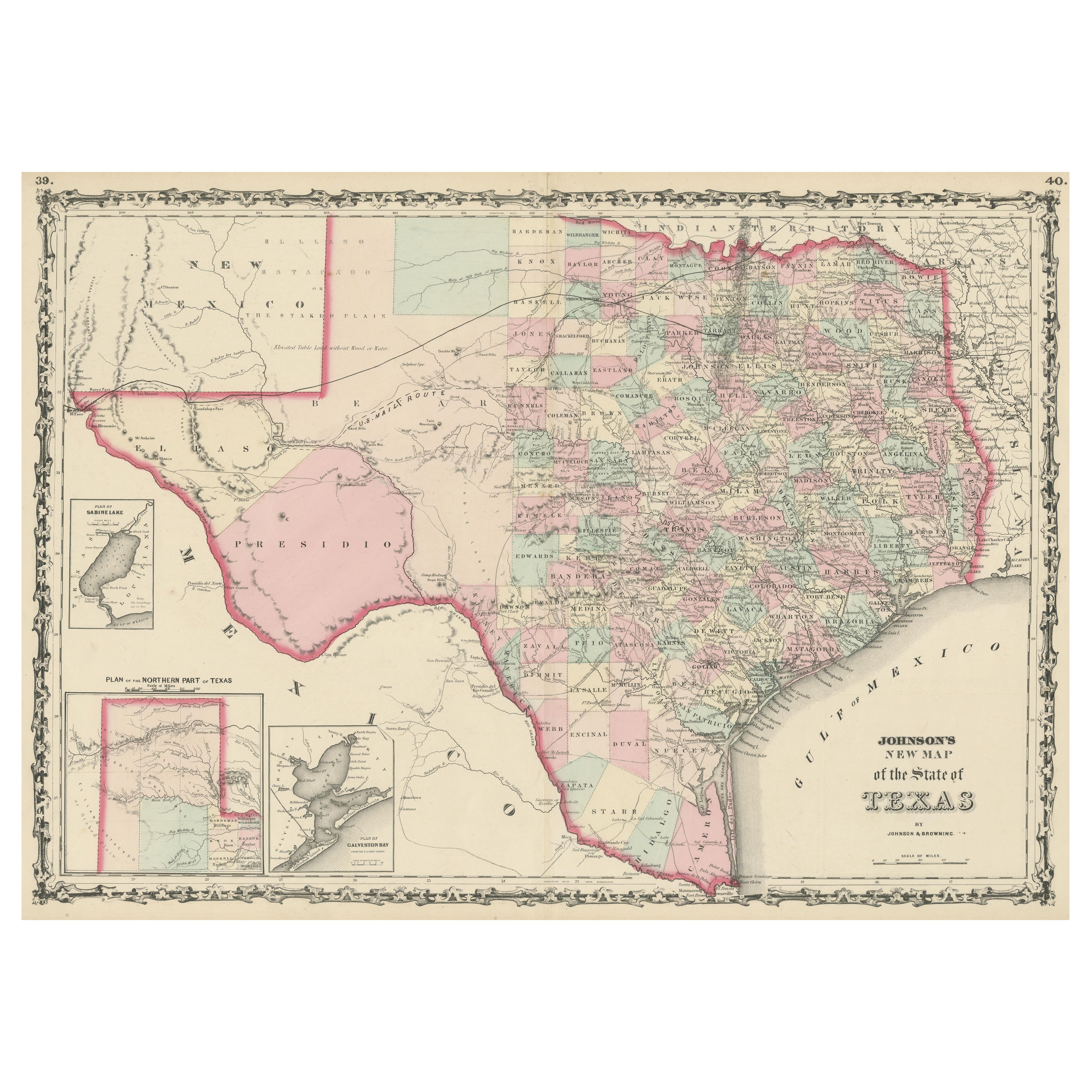
View AllLarge Antique Map of the State of Texas, 1861
Located in Langweer, NL
Antique map titled 'Johnson's New Map of the State of Texas' Large map of Texas, shows railroads, wagon roads, the U.S. Mail Route, rivers, ports, ...
Category
Antique Mid-19th Century American Maps
Materials
Paper

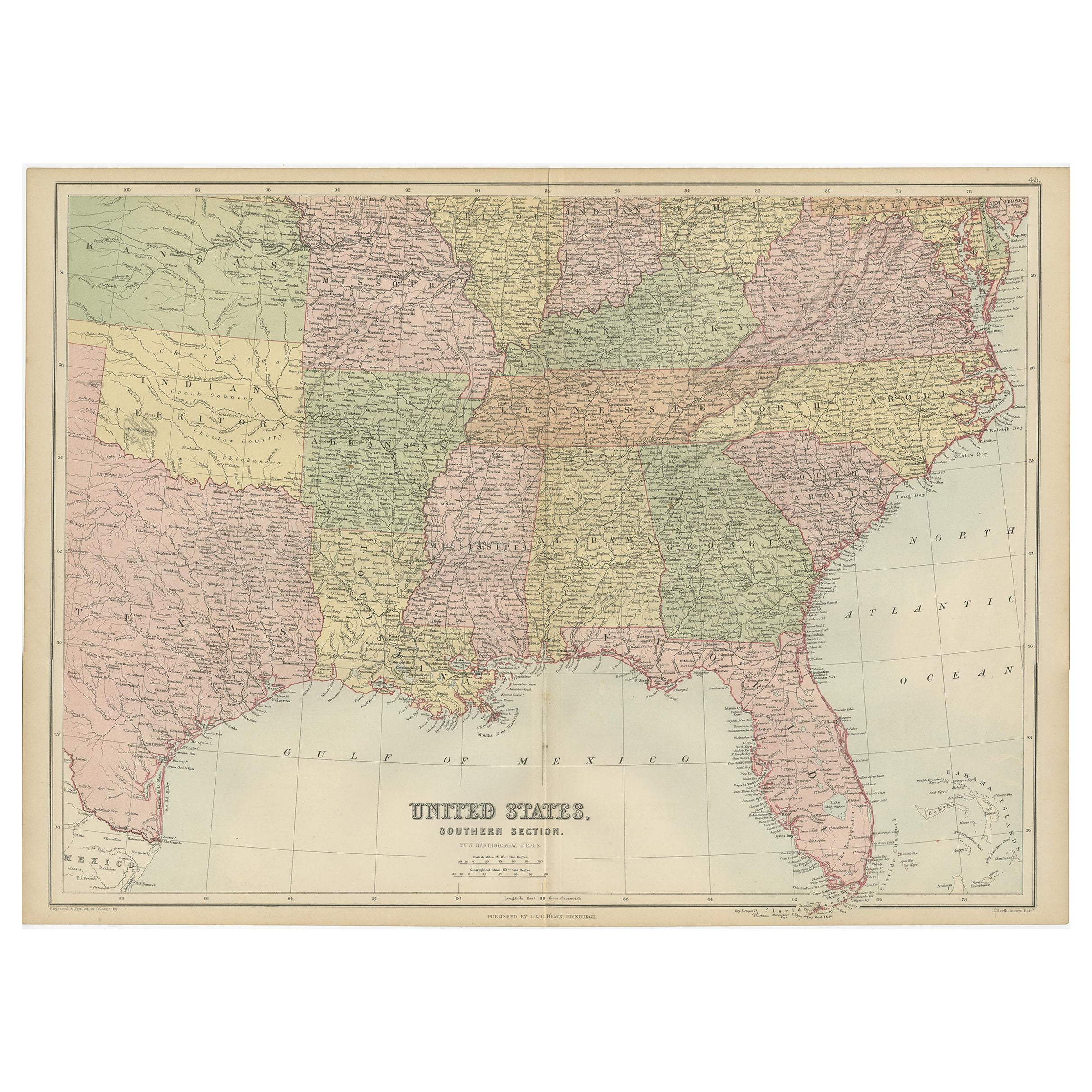
Antique Map of The United States Southern Section by A & C. Black, 1870
Located in Langweer, NL
Antique map titled 'United States Southern Section'. Original antique map of Map of The United States Southern Section. This map originates from ‘Black's General Atlas of The World’....
Category
Antique Late 19th Century Maps
Materials
Paper

$236 Sale Price
20% Off
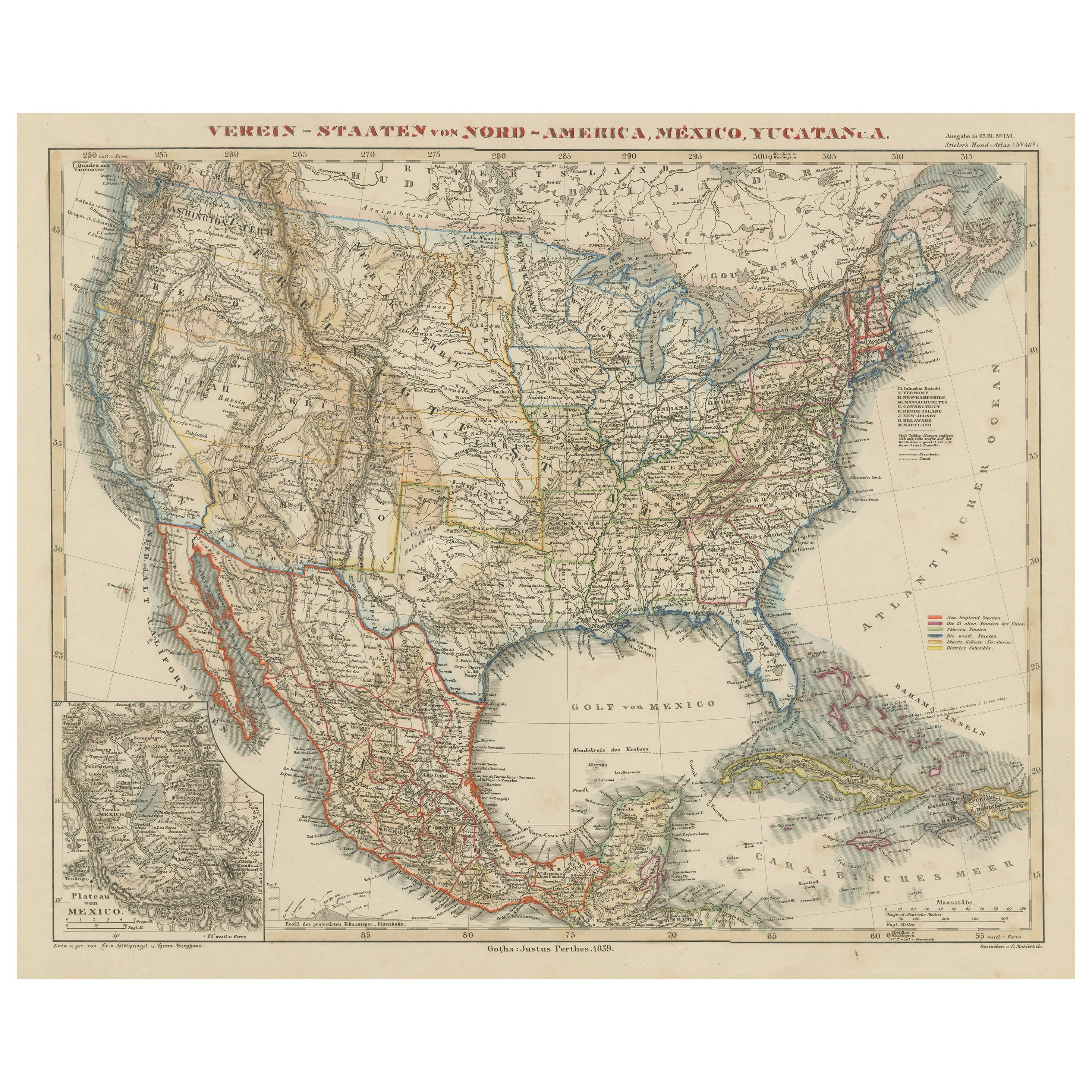
Antique Map of the United States with inset map of the region of Mexico City
Located in Langweer, NL
Antique map titled 'Verein-Staaten von Nord-America, Mexico, Yucatan u.a.'. Very detailed map of the United States of America showing the Caribbean. With an inset map of the surround...
Category
Antique Mid-19th Century Maps
Materials
Paper

$812 Sale Price
20% Off
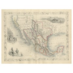
Texas California Mexico Map – Antique Tallis Map with Gold Region, c.1850
Located in Langweer, NL
Texas California Mexico Map – Antique Tallis Map with Gold Region, c.1850
This highly decorative and historically rich map titled 'Mexico, California and Texas' was published around...
Category
Antique Mid-19th Century Maps
Materials
Paper
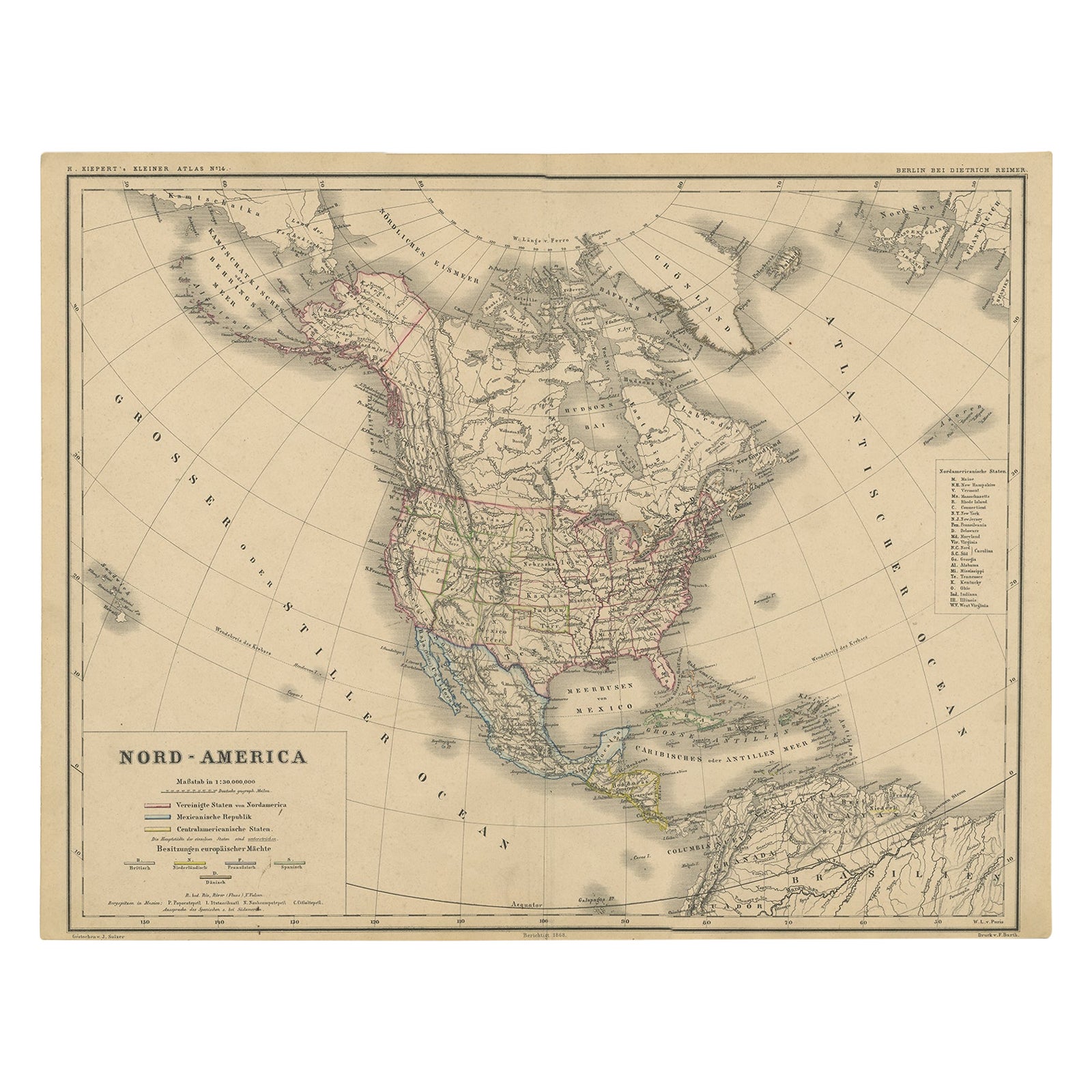
Old Original Antique German Map of North America, ca.1870
Located in Langweer, NL
Antique map titled 'Nord-America'.
Old map of North America. This map originates from 'H. Kiepert's Kleiner Atlas der Neueren Geographie für Schule und Haus'.
Artists and Engrave...
Category
Antique 1870s Maps
Materials
Paper

$463 Sale Price
20% Off
Antique Railroad Map of the United States by Rand, McNally & Co, 1900
Located in Langweer, NL
Antique map titled 'Rand, McNally & Co's New Official Railroad map of the United States with portions of The Dominion of Canada, The Republic of Mexico and the West Indies'. Large railroad map of the United States, sectionalised and laid on linen. Map shows state boundaries for the United States, Mexico, the West Indies, and lower portion of Canada; major cities and towns, military posts, Native American reservations, and railroads; Oklahoma and "Indian Territory." Inset: "Map of Alaska...
Category
20th Century Maps
Materials
Linen, Paper

$2,215 Sale Price
25% Off
Free Shipping
You May Also Like
Original Antique Map of the American State of Louisiana, 1903
Located in St Annes, Lancashire
Antique map of Louisiana
Published By A & C Black. 1903
Original colour
Good condition
Unframed.
Free shipping
Category
Antique Early 1900s English Maps
Materials
Paper

1847 Antique Map of Mexico, Texas and California by Samuel Augustus Mitchell
By Samuel Augustus Mitchell 1
Located in Colorado Springs, CO
Presented is the second edition of Samuel Augustus Mitchell's Map of Mexico, Including Yucatan & Upper California, an important map showing the progress of the Mexican-American War. ...
Category
Antique 1840s American Maps
Materials
Paper

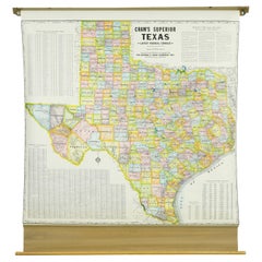
1850-1960 Cram's Superior Latest Federal Census Texas Map
By G. F. Cram Company
Located in New York, NY
The 1850-1960 Cram's Superior Latest Federal Census Texas Map, crafted from pine wood, steel, and canvas, is a valuable historical cartographic piece. Publi...
Category
Vintage 1910s American Maps
Materials
Canvas
Original Antique Map of the American State of Mississippi, 1903
Located in St Annes, Lancashire
Antique map of Mississippi
Published By A & C Black. 1903
Original colour
Good condition
Unframed.
Free shipping
Category
Antique Early 1900s English Maps
Materials
Paper

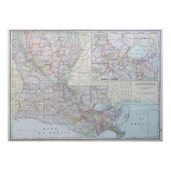
Large Original Antique Map of Louisiana, USA, C.1900
Located in St Annes, Lancashire
Fabulous map of Louisiana.
Original color.
Engraved and printed by the George F. Cram Company, Indianapolis.
Published, c.1900.
Unframed.
Repair ...
Category
Antique 1890s American Maps
Materials
Paper
Original Antique Map of United States, Grattan and Gilbert, 1843
Located in St Annes, Lancashire
Great map of United States
Drawn and engraved by Archer
Published by Grattan and Gilbert. 1843
Original colour
Unframed.
Category
Antique 1840s English Maps
Materials
Paper

More Ways To Browse
Used Furniture In Texas
Historical Documents
Used Southwestern Furniture
Louisiana Furniture
Arkansas Furniture
Louisiana Antique Furniture
Antique Furniture Austin
Used Furniture In Arkansas
Antique Oushak Carpets
Blue Coffee Tables
1945 Chair Juhl
Antique Three Leg Table
Folke Arstrom
Silver Over Copper
Vintage Barware Glasses
Antique Etched Glass
Antique French Shell
Coffee Table Black Italian Modern