French Provincial Maps

FRENCH PROVINCIAL STYLE

Removed from the fashions of the court, French Provincial style developed in the provinces of the country, such as Provence, Normandy, the Loire Valley and Bordeaux. Dating to the 17th and 18th centuries, French Provincial furniture was not as ostentatious as the designs being produced for the royal palaces, but elegant S-shape cabriole legs and ornate carvings elevated the sturdy chairs, sofas, tables and bedroom furniture intended for everyday use.

Although it varies by region, antique French Provincial furniture is unified by solid construction and an artisanal attention to design. While this furniture often followed the metropolitan trends — including the Rococo or neoclassical aesthetics of Louis XIV, Louis XV and Louis XVI — since it was produced in the French countryside it was more subdued with nods to its rustic settings.

Local materials like fruitwoods, oak, beech and walnut were used to construct large French Provincial armoires for storage and comfortable armchairs with rush-woven seats. Wrought-iron elements and carvings like floral details and scallop patterns were common as ornamentation. Furniture was frequently painted white or other muted colors that coordinated with gilt and would acquire a patina of age over time. Other wood was just stained with vibrant fabric such as toile de Jouy, which sometimes depicted pastoral scenes, adding color as upholstery.

The style arrived in the United States after World War I, with soldiers returning home wanting furniture like what they had seen in the rural homes and castles of France. In Grand Rapids, Michigan, designer John Widdicomb split from his family business, the Widdicomb Furniture Company, and had been focusing on Louis XV– and French Provincial–style furnishings since the early 1900s. Other American manufacturers such as Baker, Drexel, Henredon and Thomasville also responded to demand. Today antique French Provincial pieces and reproductions continue to be popular.

Find a collection of antique French Provincial dining tables, seating, decorative objects and other furniture on 1stDibs.

to
1
1
1
2
79
35
19
13
6
5
4
4
4
3
1
1
1
1
1
1
2
1
2
2
2
2
2
1
1
Style: French Provincial
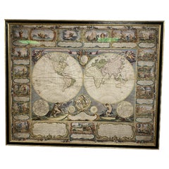
Colored wall map of the WORLD
By Chambon
Located in ZWIJNDRECHT, NL
“Mappe Monde, contenant les Parties Connues du Globe Terrestre” CHAMBON, Gobert-Denis (France, 17.. - 1781) Paris, Longchamps et Janvier, 1754 Size H. 115 x W. 145 cm. Gobert-Denis Chambon made copper engraving after the work of Guillaume De L’Isle, published in 1754 by Jean Janvier and S.G. Longschamps. A huge wall map of the world in two hemispheres printed on two sheets, depicting the Eastern and Western hemispheres supported by two male figures, decorated at the bottom right and left with two celestial hemispheres (boreal and southern) and at the bottom in the middle with an armillary sphere, in addition. This map is most notable for its depiction of the Sea of Japan labeled "Mer de Corée" and of "Mer de L'Ouest" or Sea of the West - a great sea, easily the size of the Mediterranean, to flow from the then-known Strait of Juan de Fuca...
Category

Mid-18th Century French Antique French Provincial Maps

Materials

Wood, Paper

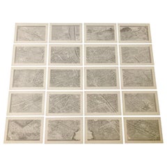
French 18th Century Map of Paris by Turgot
By Michel Etienne Turgot
Located in Los Angeles, CA
Complete Paris map set of etchings by Turgot. This printing is from the 1960s and have warm natural color to the paper. Frame each individually to your liking. The overall dimension ...
Category

1960s French Vintage French Provincial Maps

Materials

Paper

Related Items
Four 18th Century Engraved and Hand-Colored Maps by Weigel
By Christoph Weigel
Located in Copenhagen, K
Small collection of four engraved maps of Italy, Balkan and of Central Asia. Two are of Italy, one Corsica and Northern Italy and the other of the Southern Italian boot...
Category

18th Century German Antique French Provincial Maps

Materials

Paper

Plan of Paris, France, by A. Vuillemin, Antique Map, 1845
Located in Colorado Springs, CO
This large and detailed plan of Paris was published by Alexandre Vuillemin in 1845. The map conveys a wonderful amount of information and is decorated throughout with pictorial vigne...
Category

1840s American Antique French Provincial Maps

Materials

Paper

Map Exploring The World, Midi Format
Located in New York, NY
A compelling exploration of the ways that humans have mapped the world throughout history - now in a compact new edition Map: Exploring the World brings together more than 250...
Category

21st Century and Contemporary French Provincial Maps

Materials

Paper

Map Exploring The World, Midi Format
H 2 in W 9.63 in D 8.25 in
Monumental Framed Medieval Facsimile Map Of The World Fra Mauro Wood Wall Panel
Located in Forney, TX
A remarkable palatial nearly 7.5ft x 7.5ft facsimile of the important Map of the World (circa 1450) by Fra MauroFra Mauro (Italian; circa 1400–1464), featuring a solid wood framed hi...
Category

Early 20th Century French Provincial Maps

Materials

Linen, Wood, Paper

Large Original Vintage Map of The World, circa 1920
Located in St Annes, Lancashire
Great map of The World Original color. Good condition / minor foxing Published by Alexander Gross Unframed.
Category

1920s English Vintage French Provincial Maps

Materials

Paper

Large Original Antique Map of The World, Fullarton, C.1870
Located in St Annes, Lancashire
Great map of the World. Showing both hemispheres From the celebrated Royal Illustrated Atlas Lithograph. Original color. Published by Fullarton, Edinburgh, C.1870 Unframed. Rep...
Category

1870s Scottish Antique French Provincial Maps

Materials

Paper

World Relief Map
Located in Antwerp, BE
Large world relief map. Measures: Width 232 cm. Height 158 cm.
Category

Mid-20th Century German French Provincial Maps

Materials

Acrylic

World Relief Map
World Relief Map
H 62.21 in W 91.34 in D 0.79 in
Saint-Domingue (French Section): 18th Century Map from France Militaire Series
Located in Langweer, NL
This map is titled "St. Domingue (Partie Française)" and is part of the France Militaire series. It focuses on the French portion of Saint-Domingue, which corresponds to modern-day H...
Category

1790s Antique French Provincial Maps

Materials

Paper

French Furniture of the 18th Century
Located in valatie, NY
French Furniture of the 18th century by Pierre Verlet and Penelope Hunter-Stiebel (Translator). University Press of Virginia, Charlottesville, VA, 1991. First edition thus hardcover ...
Category

1990s American French Provincial Maps

Materials

Paper

French Furniture of the 18th Century
H 9.75 in W 7.25 in D 1.25 in
Map of Saint Helena Island: Early 18th-Century Copper Engraving by F. Bernard
Located in Langweer, NL
Map of Saint Helena Island: Early 18th-Century Copper Engraving by F. Bernard This rare and beautifully detailed copper engraving of Saint Helena Island dates from around 1722 and...
Category

1720s Antique French Provincial Maps

Materials

Paper

Antique Map of the World by Balbi '1847'
Located in Langweer, NL
Antique map titled 'Planisphère'. Original antique map of the world. This map originates from 'Abrégé de Géographie (..)' by Adrien Balbi. Pub...
Category

Mid-19th Century Antique French Provincial Maps

Materials

Paper

Antique Map of the World by Balbi '1847'
H 9.06 in W 11.23 in D 0.02 in
The World After the Battle of Corupedium: Hellenistic Kingdoms Map, 1880
Located in Langweer, NL
The map is titled "ORBIS TERRARUM post proelium Corupedinse," which translates to "The World after the Battle of Corupedium." This battle, which took place in 281 BC in Lydia, was th...
Category

1880s Antique French Provincial Maps

Materials

Paper

French Provincial maps for sale on 1stDibs.

Find a broad range of unique French Provincial maps for sale on 1stDibs. Many of these items were first offered in the Mid-20th Century, but contemporary artisans have continued to produce works inspired by this style. If you’re looking to add vintage maps created in this style to your space, the works available on 1stDibs include more furniture and collectibles and other home furnishings, frequently crafted with paper, wood and other materials. If you’re shopping for used French Provincial maps made in a specific country, there are Europe, and France pieces for sale on 1stDibs. While there are many designers and brands associated with original maps, popular names associated with this style include Chambon, and Michel Etienne Turgot. It’s true that these talented designers have at times inspired knockoffs, but our experienced specialists have partnered with only top vetted sellers to offer authentic pieces that come with a buyer protection guarantee. Prices for maps differ depending upon multiple factors, including designer, materials, construction methods, condition and provenance. On 1stDibs, the price for these items starts at $4,500 and tops out at $27,325 while the average work can sell for $15,912.

Recently Viewed

View All