Late Victorian Maps
to
2
2
76
35
18
13
6
5
5
4
4
3
1
1
2
2
1
1
2
2
2
2
2
Style: Late Victorian
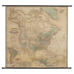
1868 "Lloyd's Topographical Railway Map of North America..." Hanging Wall Map
Located in Colorado Springs, CO
Presented is “Lloyd's Topographical Railway Map of North-America, or the United States Continent in 1900.” This map was published by J. T. Lloyd, in New York, in 1868. A large, hangi...
Category
1860s American Antique Late Victorian Maps
Materials
Linen, Paper
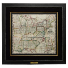
1866 Ensign & Bridgman's Rail Road Map of the United States
Located in Colorado Springs, CO
Presented is an 1866 issue of “Ensign & Bridgeman’s Rail Road Map of the United States, showing Depots & Stations.” First published in 1856, this is the third edition, following anot...
Category
1860s American Antique Late Victorian Maps
Materials
Paper
Related Items
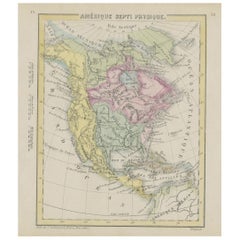
Small Map of the United States
Located in Langweer, NL
Antique map titled 'Amérique septe. Physique'. Small map of the United States. lithographed by C. Callewaert brothers in Brussels circa 1870.
Category
Mid-19th Century Antique Late Victorian Maps
Materials
Paper
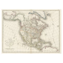
Antique Map of North America, 1821
Located in Langweer, NL
Antique map of America titled 'Carte de l'Amerique septentrionale'. Scarce map of North America, shortly after the Louisiana Purchase and the first ...
Category
19th Century Antique Late Victorian Maps
Materials
Paper
Antique Map of The United States of North America, Pacific States, 1882
Located in Langweer, NL
The map is from the same 1882 Blackie Atlas and focuses on the Pacific States of the United States of America during that period. Here are some details and historical context about t...
Category
1880s Antique Late Victorian Maps
Materials
Paper
$232 Sale Price
20% Off
H 14.97 in W 11.03 in D 0 in
Set of 2 Antique Maps of the United States by W. G. Blackie, 1859
Located in Langweer, NL
Antique map titled 'The United States of North America, Atlantic States and Valley of the Mississippi'. Original antique map of the United States of North America, Atlantic States an...
Category
Mid-19th Century Antique Late Victorian Maps
Materials
Paper
$372 Sale Price / set
20% Off
H 14.57 in W 21.26 in D 0.02 in
Antique Map of North America by Lapie '1842'
Located in Langweer, NL
Antique map titled 'Carte de l'Amérique septentrionale'. Map of North America, with an inset map of the Aleutian Islands. This map originates from 'Atlas universel de géographie anci...
Category
Mid-19th Century Antique Late Victorian Maps
Materials
Paper
Antique Map of the United States by Titus '1871'
Located in Langweer, NL
Antique map titled 'The United States of America'. Original antique map of the United States. This map originates from 'Atlas of Prebl...
Category
Late 19th Century Antique Late Victorian Maps
Materials
Paper
$745 Sale Price
20% Off
H 16.54 in W 26.78 in D 0.02 in
Antique Map of North America by Johnston, 1882
Located in Langweer, NL
Antique map titled 'North America'.
Old map of North America. This map originates from 'The Royal Atlas of Modern Geography, Exhibiting, in a Series of Entirely Original and Authen...
Category
19th Century Antique Late Victorian Maps
Materials
Paper
Antique Map of the United States by Balbi '1847'
Located in Langweer, NL
Antique map titled 'Etats-Unis'. Original antique map of the United States. This map originates from 'Abrégé de Géographie (..)' by Ad...
Category
Mid-19th Century Antique Late Victorian Maps
Materials
Paper
$186 Sale Price
20% Off
H 9.06 in W 11.23 in D 0.02 in
Antique Map of North America by Levasseur '1875'
Located in Langweer, NL
Antique map titled 'Carte générale de l'Amérique Septentrionale'. Large map of North America. This map originates from 'Atlas de Géographie Modern...
Category
Late 19th Century Antique Late Victorian Maps
Materials
Paper
$465 Sale Price
20% Off
H 18.71 in W 24.02 in D 0.02 in
Antique Map of North America by Dufour 'circa 1834'
Located in Langweer, NL
Antique map titled 'Amérique Septentrionale'. Uncommon map of North America. Published by or after A.H. Dufour, circa 1834. Source unknown, to be determined.
Category
Mid-19th Century Antique Late Victorian Maps
Materials
Paper
$186 Sale Price
20% Off
H 8.08 in W 10.44 in D 0.02 in
Antique Map of North America by Lowry '1852'
Located in Langweer, NL
Antique map titled 'North America'. Original map of North America. This map originates from 'Lowry's Table Atlas constructed and engraved from the...
Category
Mid-19th Century Antique Late Victorian Maps
Materials
Paper
Antique Map of the United States of America by Lapie '1842'
Located in Langweer, NL
Antique map titled 'Carte des États-Unis d'Amérique'. Map of the United States of America (USA). This map originates from 'Atlas universel...
Category
Mid-19th Century Antique Late Victorian Maps
Materials
Paper
$559 Sale Price
20% Off
H 19.89 in W 26.78 in D 0.02 in
Previously Available Items
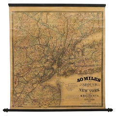
1870 "40 Miles Around New York" by H. H. Lloyd, Hanging Map on Original Rollers
Located in Colorado Springs, CO
This is an antique hanging map, “40 Miles Around New York,” published by H. H. Lloyd in New York in 1870. Presented on its original wooden rollers, this small-scale lithographed wall map is centered on Manhattan and its surrounding counties. Throughout the map, the counties are colored and the towns and cities well labeled. A reference key in the bottom margin provides symbols for railroads, railroad stations, proposed railways, aqueducts and canals, cemeteries, blacksmith shops, wheelwrights, grist mills, and sawmills. This map is especially notable for the countless railway lines and stations depicted, with distances in miles noted between stations. Lloyd’s “40 Miles Around New York” was first issued in 1867 as a folding pocket map.
This map offers interesting insight about the map trade of the times, revealing the competitive nature of print publishing. In the lower margin, Lloyd warns customers of another, similar sounding named map business, presumably map dealer and known rival J. T. Lloyd. He states, “reasons that are well known to many compel us to state that we have no relationship and never had any business connection whatever with another party who advertises ‘Lloyds Maps.’” He also reminds his customers against potential fraud, stressing “We do not collect money in advance for Maps which have never been, and can never be, published. Our agents are not allowed to collect before delivery in any case.”
Henry Huggins Lloyd was born in Blandford, Massachusetts, in 1828. With his brothers, James Lloyd and Myron Lloyd, he worked as H. H. Lloyd & Co., mapmakers and maps publishers based in New York City. H. H. Lloyd & Co. had an impressive map output, especially during the Civil War. He issued maps of coastal cities and harbors, military maps of the northern and southern states, maps of key battle states like Virginia and New York, as well as larger United States maps...
Category
1870s American Antique Late Victorian Maps
Materials
Linen, Wood, Paper
H 31 in W 28.75 in D 1 in
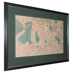
Large Antique Wimbledon Map, SW London, English, Framed Cartography, Victorian
Located in Hele, Devon, GB
This is an antique town map of Wimbledon, South West London. An English, framed atlas engraving of cartographic interest, dating to the late Victori...
Category
Late 19th Century British Antique Late Victorian Maps
Materials
Glass, Wood, Paper
H 23.04 in W 31.7 in D 0.79 in
19th Century Franklin Celestial Tabletop Globe by Nims and Company
By H.B. Nims & Co.
Located in Philadelphia, PA
The Franklin Globe.
A fine and rare H. B. Nims and Company 12-inch Celestial globe.
Manufactured in Troy, New York.
With 12 printed and hand tinted gores on a plaster sphe...
Category
Late 19th Century American Antique Late Victorian Maps
Late Victorian maps for sale on 1stDibs.
Find a broad range of unique Late Victorian maps for sale on 1stDibs. Many of these items were first offered in the 19th Century, but contemporary artisans have continued to produce works inspired by this style. If you’re looking to add vintage maps created in this style to your space, the works available on 1stDibs include more furniture and collectibles and other home furnishings, frequently crafted with paper and other materials. If you’re shopping for used Late Victorian maps made in a specific country, there are North America, and United States pieces for sale on 1stDibs. It’s true that these talented designers have at times inspired knockoffs, but our experienced specialists have partnered with only top vetted sellers to offer authentic pieces that come with a buyer protection guarantee. Prices for maps differ depending upon multiple factors, including designer, materials, construction methods, condition and provenance. On 1stDibs, the price for these items starts at $8,500 and tops out at $8,500 while the average work can sell for $8,500.
Recently Viewed
View AllMore Ways To Browse
Bavarian Porcelain Vases
Beer Tankard
Bjorn L
Black Cabinet With Flowers And Birds
Black Tansu Chest
Blue Morpho
Blue Opaline Crystal Vases
Bow Front Buffet
Boy And Girl Statues
Brass Donkey
Brass Hound
Bread Oven
Bronze Atlas Sculpture
Bronze Door Stop
Bronze Shakespeare Sculpture
Buddha Bell
Bull Terrier
Butlers Chest
