Items Similar to Very Large Double Page Detailed Map of Italy and Surrounding Regions, 1794

Want more images or videos?
Request additional images or videos from the seller
1 of 13
Very Large Double Page Detailed Map of Italy and Surrounding Regions, 1794
$1,906.80per set
$2,383.50per set20% Off
£1,413.04per set
£1,766.31per set20% Off
€1,592per set
€1,990per set20% Off
CA$2,603.15per set
CA$3,253.93per set20% Off
A$2,895.89per set
A$3,619.87per set20% Off
CHF 1,518.06per set
CHF 1,897.58per set20% Off
MX$35,387.12per set
MX$44,233.90per set20% Off
NOK 19,330.65per set
NOK 24,163.31per set20% Off
SEK 18,197.13per set
SEK 22,746.42per set20% Off
DKK 12,121.35per set
DKK 15,151.69per set20% Off
Shipping
Retrieving quote...The 1stDibs Promise:
Authenticity Guarantee,
Money-Back Guarantee,
24-Hour Cancellation
About the Item
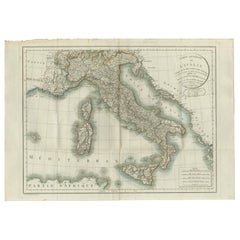
This is a large (two seperate sheets) and detailed map of Italy, including the southern parts of Germany, Dalmatia, the adjacent countries, and the Illyric Islands. The map is titled *Italy with the Addition of the Southern Parts of Germany as far as Pettau in Stiria, Murlakia, Dalmatia, the Adjacent Countries and all the Illyric Islands*, and was created by the renowned mapmaker Louis Stanislas d'Arcy Delarochette. It was published in London by William Faden in the year 1794.
### Mapmaker and Publisher:
Louis Stanislas d'Arcy Delarochette was a prominent cartographer during the late 18th century, known for his meticulous work in geography. This map was printed by William Faden, the leading English map publisher of his time, often working with cartographers of great repute to produce high-quality and accurate maps.
### Year of Publication:
1794, during the late 18th century, a period known for considerable political change in Europe, as well as advances in geographic knowledge due to exploration and mapping.
### Key Features of the Map:
1. **Detailed Coverage**: The map offers an extremely detailed depiction of Italy, covering not only the Italian peninsula but also neighboring areas such as southern Germany, Dalmatia, and the Illyrian provinces. It also includes islands such as Sardinia, Corsica, and Sicily.
2. **Accurate Topography**: This map emphasizes the physical geography of the region with shaded relief to depict mountainous areas, especially the Alps and Apennines. Rivers, lakes, and coastal features are also intricately detailed.
3. **Geopolitical Importance**: The map captures a critical period in European history. Italy, as shown here, is still fragmented into various states, duchies, and republics, prior to its unification in the 19th century. This makes it a valuable historical document for understanding Italy's pre-unification political landscape.
4. **Place Names**: The map is filled with place names, including cities, towns, and villages across Italy, Germany, and neighboring regions. Major cities such as Rome, Venice, Florence, Naples, and Milan are prominently marked. Additionally, important waterways, such as the Po River and the Adriatic Sea, are shown.
5. **Cartographic Aesthetics**: The map is not only functional but also visually striking, with color-coded regions to differentiate political boundaries. The hand-colored borders are a feature typical of high-quality maps from this period.
6. **Scale and Reference**: The map includes a reference scale in both Italian miles and British miles, allowing for easy calculation of distances. There is also a detailed legend explaining the different types of roads, regions, and boundaries depicted.
### Why This Map is Special:
This map is significant for several reasons. First, it offers a snapshot of Italy before its unification, providing valuable insights into the complex political and territorial divisions of the time. Second, it is a finely executed example of cartography from the late 18th century, a period when European mapmaking was becoming increasingly precise and detailed due to advances in surveying techniques. The inclusion of neighboring regions such as Dalmatia and southern Germany also highlights the geopolitical importance of Italy within the broader European context.
Finally, the map was produced by two renowned figures in the world of cartography: Louis Stanislas d'Arcy Delarochette, known for his meticulous geographic work, and William Faden, the leading map publisher of the era. Their collaboration produced a map that was both highly functional and aesthetically impressive, making it a valuable piece for collectors and historians alike.
- Dimensions:Height: 25.79 in (65.5 cm)Width: 36.23 in (92 cm)Depth: 0 in (0.02 mm)
- Sold As:Set of 2
- Materials and Techniques:Paper,Engraved
- Period:1790-1799
- Date of Manufacture:1794
- Condition:Condition: good, given age. Overall light foxing and soiling. Vertical folds as issued. General age-related toning and/or occasional minor defects from handling. Impressive large on strong paper. Please study scan carefully.
- Seller Location:Langweer, NL
- Reference Number:Seller: BG-13662-1 and BG-13662-21stDibs: LU3054341727322
About the Seller
5.0
Recognized Seller
These prestigious sellers are industry leaders and represent the highest echelon for item quality and design.
Platinum Seller
Premium sellers with a 4.7+ rating and 24-hour response times
Established in 2009
1stDibs seller since 2017
2,502 sales on 1stDibs
Typical response time: <1 hour
- ShippingRetrieving quote...Shipping from: Langweer, Netherlands
- Return Policy
Authenticity Guarantee
In the unlikely event there’s an issue with an item’s authenticity, contact us within 1 year for a full refund. DetailsMoney-Back Guarantee
If your item is not as described, is damaged in transit, or does not arrive, contact us within 7 days for a full refund. Details24-Hour Cancellation
You have a 24-hour grace period in which to reconsider your purchase, with no questions asked.Vetted Professional Sellers
Our world-class sellers must adhere to strict standards for service and quality, maintaining the integrity of our listings.Price-Match Guarantee
If you find that a seller listed the same item for a lower price elsewhere, we’ll match it.Trusted Global Delivery
Our best-in-class carrier network provides specialized shipping options worldwide, including custom delivery.More From This Seller
View AllAntique Map of Italy by Keizer & de Lat, 1788
Located in Langweer, NL
Antique map titled 'Kaart van Italie (..)'. Uncommon original antique map of Italy. This map originates from 'Nieuwe Natuur- Geschied- en Handelk...
Category
Antique Late 18th Century Maps
Materials
Paper

$313 Sale Price
25% Off
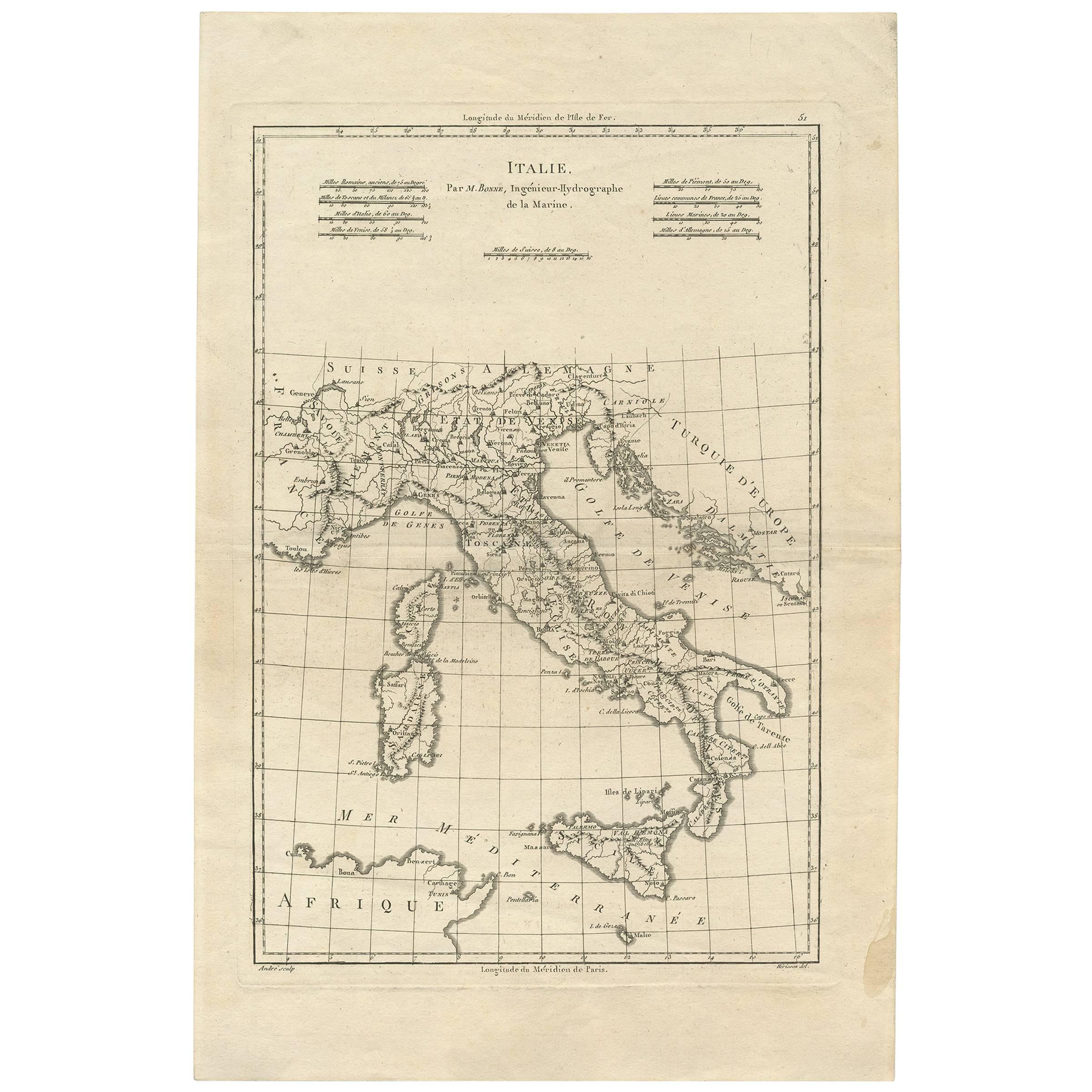
Antique Map of Italy by R. Bonne, circa 1780
Located in Langweer, NL
Beautiful map of Italy, Corsica, Sardinia and Sicily. Highly detailed, showing towns, rivers, some topographical features and political boundaries. Published by R. Bonne, circa 1780.
Category
Antique Late 18th Century Maps
Materials
Paper
$287 Sale Price
20% Off
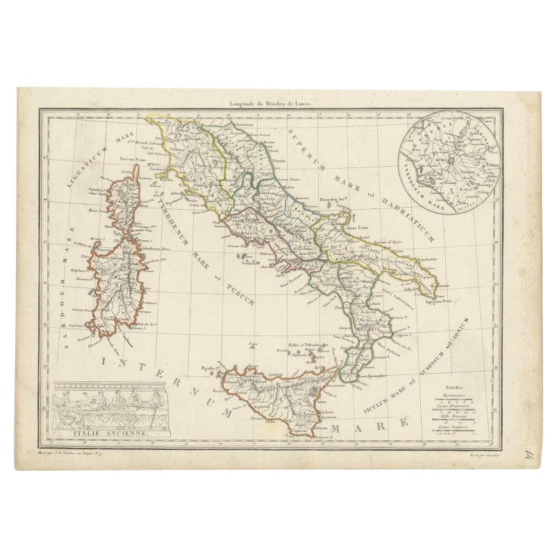
Antique Map of Italy with an Inset of Rome, 1812
Located in Langweer, NL
Antique map titled 'Italie Ancienne'.
Old map of ancient Italy, with an inset map of the region of Rome. This map originates from 'Atlas Supplementaire du Precis de la Geographie...
Category
Antique 19th Century Maps
Materials
Paper
$153 Sale Price
20% Off
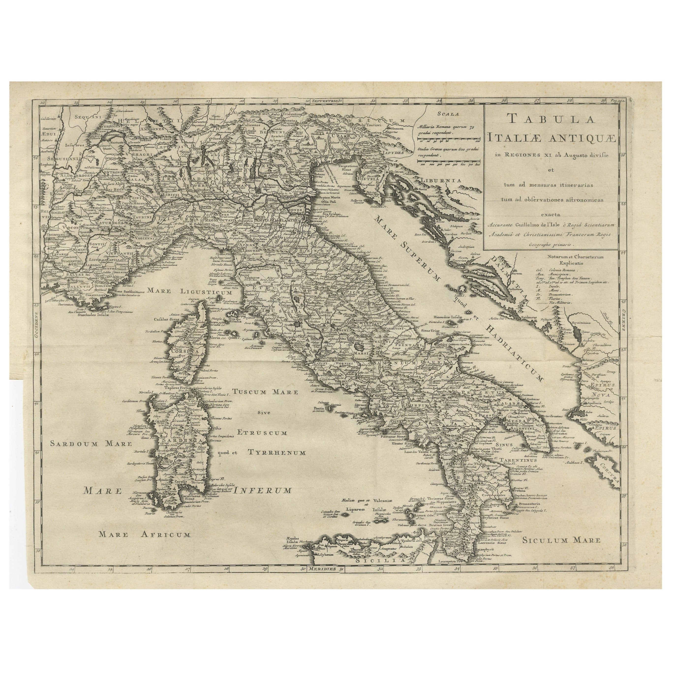
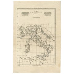
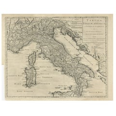
Antique Engraved Map of Italy in Roman Times, ca.1730
Located in Langweer, NL
Plain engr. map of Italy according to the division of Emperor Augustus by G. Delisle.
Title: "Tabula Italiae Antiquae In Regiones XI Ab Augusto Divisae Et Tum Ad Mensuras Itinerari...
Category
Antique 1730s Maps
Materials
Paper
$651 Sale Price
20% Off
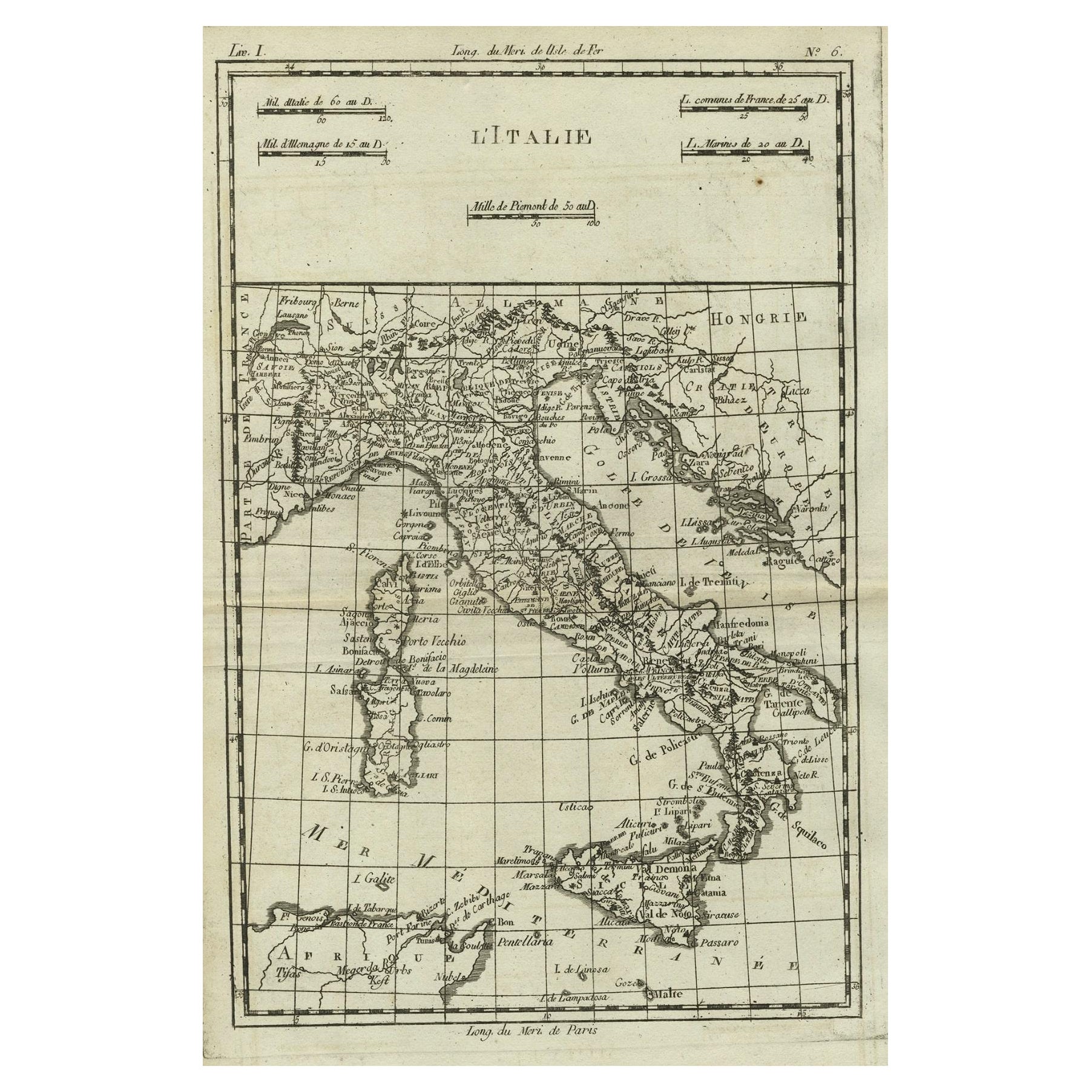
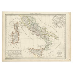
Antique Map of Italy, Corsica, Sardinia and Sicily, ca.1780
Located in Langweer, NL
Description: Antique map titled 'L'Italie.'
Map of Italy, Corsica, Sardinia and Sicily. Highly detailed, showing towns, rivers, some topographical features and political boundari...
Category
Antique 1780s Maps
Materials
Paper

$306 Sale Price
20% Off
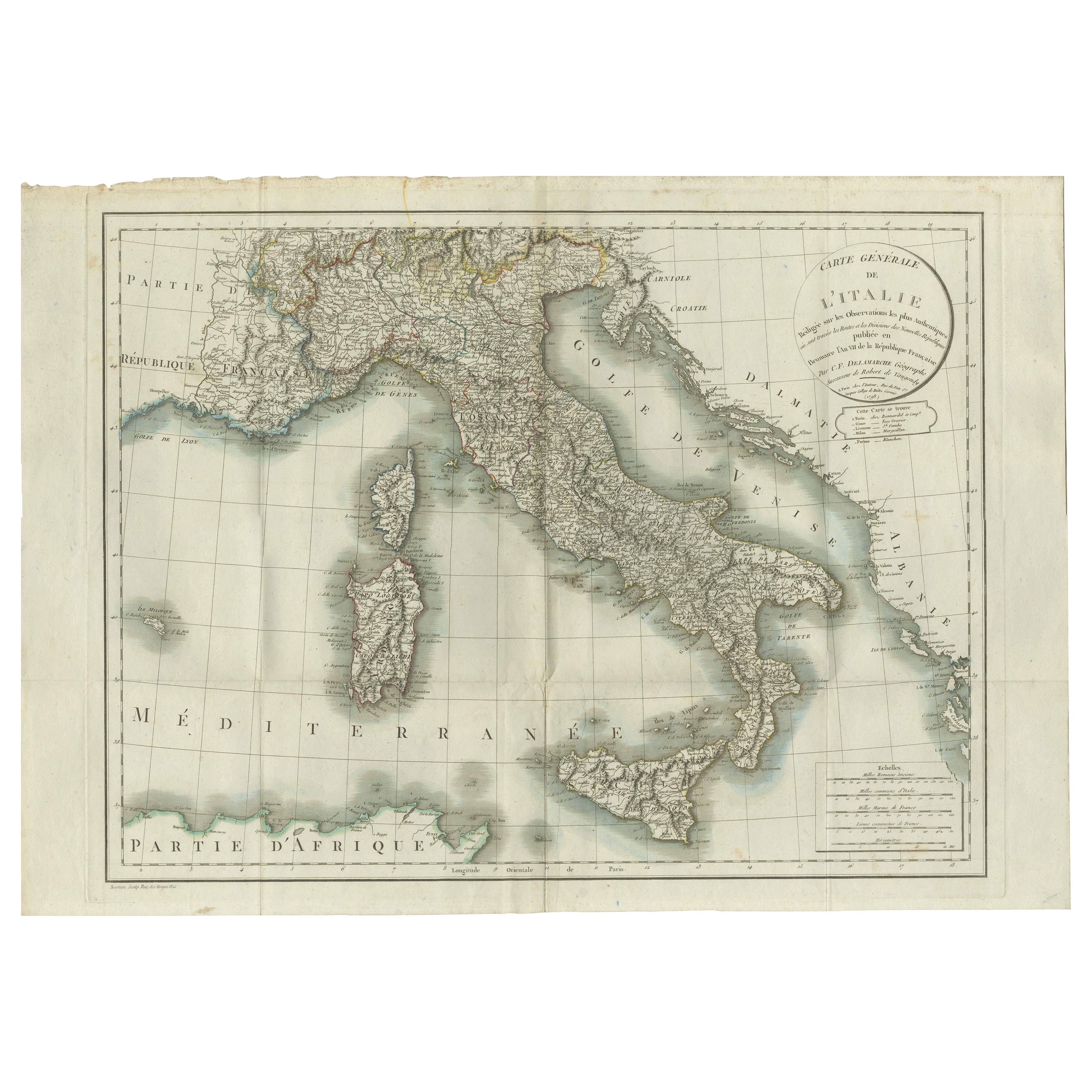
Map of Italy and Neighboring Regions by Delamarche – Antique Map, c.1800
Located in Langweer, NL
Antique Map of Italy and Surrounding Regions by Delamarche, circa 1800
This elegant and detailed antique map titled Carte Générale de l’Italie was drawn and engraved by the French g...
Category
Antique Early 1800s French Maps
Materials
Paper
You May Also Like
Large Original Antique Map of Italy. John Dower, 1861
Located in St Annes, Lancashire
Great map of Italy
Lithograph engraving by John Dower
Original colour
Published, 1861
Unframed
Good condition / repair to top right corner seen in last image
Category
Antique 1860s English Victorian Maps
Materials
Paper

The Kingdom of Naples and Southern Italy: A Hand-Colored 18th Century Homann Map
By Johann Baptist Homann
Located in Alamo, CA
"Novissima & exactissimus Totius Regni Neapolis Tabula Presentis Belli Satui Accommo Data" is a hand colored map of southern Italy and the ancient Kingdom of Naples created by Johann...
Category
Antique Early 18th Century German Maps
Materials
Paper

Antique Map of Italy Drawn & Engraved by R. Scott for Thomsons, Edinburgh 1814
Located in London, GB
This is a magnificent museum quality antique hand-coloured map of Italy, dating from 1814.
This historic and very rare antique map was drawn and engraved by R. Scott for Thomsons, New General Atlas, Edinburgh.
The map is very detailed and the various colours - yellow, grey and green - beautifully highlight the different natural and political divisions of Italy as it was before the Italian Unification...
Category
Antique 1810s Scottish Prints
Materials
Other

Large Original Antique Map of The South of Italy. John Dower, 1861
Located in St Annes, Lancashire
Great map of the South of Italy
Lithograph engraving by John Dower
Original colour
Published, 1861
Unframed
Good condition
Free shipping
Category
Antique 1860s English Victorian Maps
Materials
Paper

Italy, Sicily, Sardinia, Corsica and Dalmatian Coast: A 17th Century Dutch Map
By Theodorus Danckerts
Located in Alamo, CA
This hand colored 17th century Dutch map entitled "Novissima et Accuratissima totius Italiae Corsicae et Sardiniae Descriptio" by Theodore Danckerts depicts the Italian Peninsula in ...
Category
Antique Late 17th Century Dutch Maps
Materials
Paper

Large Original Antique Map of South Italy and Malta by Sidney Hall, 1847
Located in St Annes, Lancashire
Great map of South Italy and Malta
Drawn by Sidney Hall
Steel engraving by G.Aikman
Original color outline
Published by A & C Black. 1847
Un...
Category
Antique 1840s Scottish Maps
Materials
Paper

More Ways To Browse
Large Antique Fragment
Coffee Tables Europe
Marble Top Dining Tables
Nordiska Argentina
Pink And Black Rug
Black Wooden Chair
Orrefors Embassy
Black Ebonized
Elios Chair
Panache Designs
Plata Lappas
Red Retro Dining Set
Antique Bouquet
Antique Silver Glasses Case
Carlo Scarpa 1934 Chairs
Christofle Marly
1900 Antique Chairs
Glass Table Italian Round