Items Similar to Western & Eastern Hemisphere Maps – World Double Hemisphere Engravings 1857


Want more images or videos?
Request additional images or videos from the seller
1 of 13
Western & Eastern Hemisphere Maps – World Double Hemisphere Engravings 1857
$574.92per set
£426.04per set
€480per set
CA$784.87per set
A$873.13per set
CHF 457.71per set
MX$10,669.48per set
NOK 5,828.34per set
SEK 5,486.57per set
DKK 3,654.68per set
Shipping
Retrieving quote...The 1stDibs Promise:
Authenticity Guarantee,
Money-Back Guarantee,
24-Hour Cancellation
About the Item
Western & Eastern Hemisphere Maps – World Double Hemisphere Engravings 1857
These beautiful antique prints show two complementary hemispheric maps titled “Westliche Halbkugel” (Western Hemisphere) and “Oestliche Halbkugel” (Eastern Hemisphere). The Western Hemisphere map presents North and South America in fine detail, including the United States, Mexico, Central America, the Caribbean islands, and South America down to Tierra del Fuego. It also includes Polynesia across the Pacific, with labelled island groups reflecting mid-19th-century geographical knowledge.
The Eastern Hemisphere map depicts Europe, Asia, Africa, and Australia with clarity, showing political boundaries as they were recognised in 1857. Notable features include detailed coastlines, major rivers and mountain ranges, the delineation of colonial territories in Africa, and the extent of Russia across Siberia. Australia is labelled with its colonial divisions, and Southeast Asia is clearly defined, reflecting European perspectives of the time.
Both maps were engraved and published in 1857 in Gotha by Justus Perthes as part of Adolf Stieler’s famous Hand-Atlas. Stieler’s atlases were renowned for their accuracy, clarity, and elegance, used widely by scholars and travellers throughout the 19th century.
Technique: Copperplate engraving with original outline hand colouring used to differentiate national boundaries and enhance readability. The engraving is finely executed with German titles and notations, and each hemisphere is presented in a clean circular projection.
These maps are significant as they represent mid-19th-century cartography at its finest, capturing geopolitical realities before major events such as German unification or the Scramble for Africa reshaped borders.
Condition summary: Both maps are in excellent condition with minimal age toning, no tears or repairs, and strong, crisp impressions. Colours remain fresh and paper is firm throughout.
Framing tips: Frame these maps as a matching pair in identical dark wood or ebonised frames to create a powerful decorative display. Use wide ivory or cream mounts to provide a clean margin around each hemisphere. UV-protective glass is recommended to preserve colours and fine engraved detail for long-term enjoyment.
- Dimensions:Height: 14.77 in (37.5 cm)Width: 17.88 in (45.4 cm)Depth: 0.01 in (0.2 mm)
- Sold As:Set of 2
- Materials and Techniques:Paper,Engraved
- Place of Origin:
- Period:
- Date of Manufacture:1857
- Condition:Condition summary: Both maps are in excellent condition with minimal age toning, no tears or repairs, and strong, crisp impressions. Colours remain fresh and paper is firm throughout.
- Seller Location:Langweer, NL
- Reference Number:Seller: BG-05552-5, -61stDibs: LU3054345809042
About the Seller
5.0
Recognized Seller
These prestigious sellers are industry leaders and represent the highest echelon for item quality and design.
Platinum Seller
Premium sellers with a 4.7+ rating and 24-hour response times
Established in 2009
1stDibs seller since 2017
2,494 sales on 1stDibs
Typical response time: 1 hour
- ShippingRetrieving quote...Shipping from: Langweer, Netherlands
- Return Policy
Authenticity Guarantee
In the unlikely event there’s an issue with an item’s authenticity, contact us within 1 year for a full refund. DetailsMoney-Back Guarantee
If your item is not as described, is damaged in transit, or does not arrive, contact us within 7 days for a full refund. Details24-Hour Cancellation
You have a 24-hour grace period in which to reconsider your purchase, with no questions asked.Vetted Professional Sellers
Our world-class sellers must adhere to strict standards for service and quality, maintaining the integrity of our listings.Price-Match Guarantee
If you find that a seller listed the same item for a lower price elsewhere, we’ll match it.Trusted Global Delivery
Our best-in-class carrier network provides specialized shipping options worldwide, including custom delivery.More From This Seller
View AllAntique Map of The World in Hemispheres by W. G. Blackie, 1859
Located in Langweer, NL
Antique map titled 'The World in Hemispheres with other projections'. Original antique map of The World. This map originates from ‘The Imperial Atlas of Modern Geography’. Published ...
Category
Antique Mid-19th Century Maps
Materials
Paper

$293 Sale Price
30% Off
Antique Map of the World in two sheets, 1852
Located in Langweer, NL
Antique map titled 'The World on Mercator's Projection'. Two individual sheets of the world. This map originates from 'Lowry's table Atlas constructed and engraved from the most rece...
Category
Antique Mid-19th Century Maps
Materials
Paper

$239 Sale Price / set
20% Off
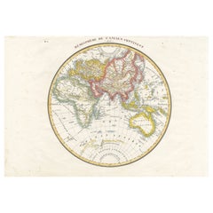
Antique Map of the Eastern Hemisphere by Wyld, 1842
Located in Langweer, NL
Antique map titled 'Eastern Hemisphere'. Large map depicting the continents Europe, Asia, Afrika and Australia.
Artists and Engravers: James Wyld (1812–1887) was a British geograph...
Category
Antique 19th Century Maps
Materials
Paper

$1,054 Sale Price
20% Off
Antique Map of The World in Hemispheres on Various Projections, 1882
Located in Langweer, NL
This stunning 1882 'Antique Map of The World in Hemispheres' showcases an exquisite blend of cartographic precision and artistic elegance. Crafted under the watchful eye of W.G. Blac...
Category
Antique 1880s Maps
Materials
Paper

$268 Sale Price
20% Off
Antique Map of the World in Hemispheres by Johnson, '1872'
Located in Langweer, NL
Antique map titled 'Johnson's Globular World. Original world map depicting the Eastern Hemisphere and the Western Hemisphere. This map originates fr...
Category
Antique Late 19th Century Maps
Materials
Paper

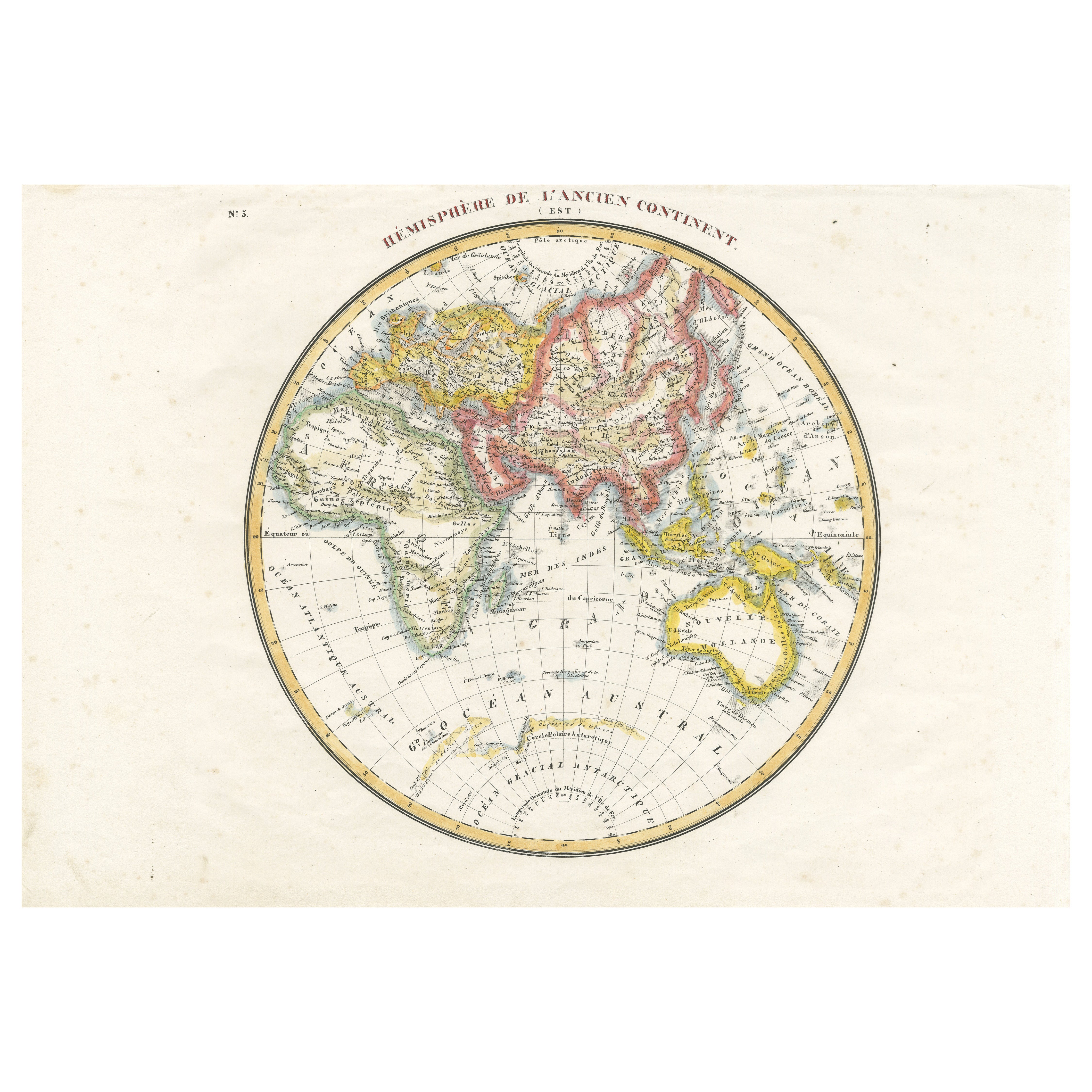
Antique Map of the Eastern Hemisphere by Lapie, France, circa 1830
Located in Langweer, NL
Antique Map of the Eastern Hemisphere by Lapie, France, circa 1830
This finely engraved and hand-colored antique map, titled Hémisphère de l'ancien continent (Eastern Hemisphere), w...
Category
Antique 1830s Maps
Materials
Paper
You May Also Like
Original Antique Map of The World by Thomas Clerk, 1817
Located in St Annes, Lancashire
Great map of The Eastern and Western Hemispheres
On 2 sheets
Copper-plate engraving
Drawn and engraved by Thomas Clerk, Edinburgh.
Published by Mackenzie And Dent, 1817
...
Category
Antique 1810s English Maps
Materials
Paper

Original Antique Map of The Eastern Hemisphere by Dower, circa 1835
Located in St Annes, Lancashire
Nice map of the Eastern Hemisphere
Drawn and engraved by J.Dower
Published by Orr & Smith. C.1835
Unframed.
Free shipping
Category
Antique 1830s English Maps
Materials
Paper

Original Antique Map of The World by Dower, circa 1835
Located in St Annes, Lancashire
Nice map of the World
Drawn and engraved by J.Dower
Published by Orr & Smith. C.1835
Unframed.
Free shipping
Category
Antique 1830s English Maps
Materials
Paper

Original Antique Map of The Western Hemisphere by Dower, circa 1835
Located in St Annes, Lancashire
Nice map of the Western Hemisphere
Drawn and engraved by J.Dower
Published by Orr & Smith. C.1835
Unframed.
Free shipping
Category
Antique 1830s English Maps
Materials
Paper

1864 Original illustrated planisphere - World Map - Geography
Located in PARIS, FR
Immerse yourself in the epic journey of the past with the Illustrated Historical Planisphere of 1864 by Charpentier! 🗺️ This cartographic treasure transports you through the intrica...
Category
1860s Prints and Multiples
Materials
Linen, Lithograph, Paper

Map of the World - Original Etching - 1820
Located in Roma, IT
Map of the World is an Original Etching realized by an unknown artist of 19th century in 1820.
Very good condition on two sheets of white paper joine...
Category
1820s Modern Figurative Prints
Materials
Etching

More Ways To Browse
Wood Minimalist Chair
Antique Imperial Furniture
Gold Modern Coffee Table
Large Side Tables
18th Century Gilded Furniture
Japanese Silver Ceramics
One Of A Kind Chair
Used Oak Dining Room Chairs
17th Century Plate
Childrens Vintage Poster
Chinese Ship
Nursery Art
Vintage Travel Poster Mid Century
Desk Key
Woven Silk Art
Carved Cabriole Table
Dark Antique Table
White Wooden Table