Items Similar to Wychmere Harbor Allens Harbor Map Circa 1890
Want more images or videos?
Request additional images or videos from the seller
1 of 16
Wychmere Harbor Allens Harbor Map Circa 1890
$475
£360.77
€416.81
CA$665.73
A$745.08
CHF 388.87
MX$9,086.09
NOK 4,977.04
SEK 4,711.41
DKK 3,110.62
Shipping
Retrieving quote...The 1stDibs Promise:
Authenticity Guarantee,
Money-Back Guarantee,
24-Hour Cancellation
About the Item
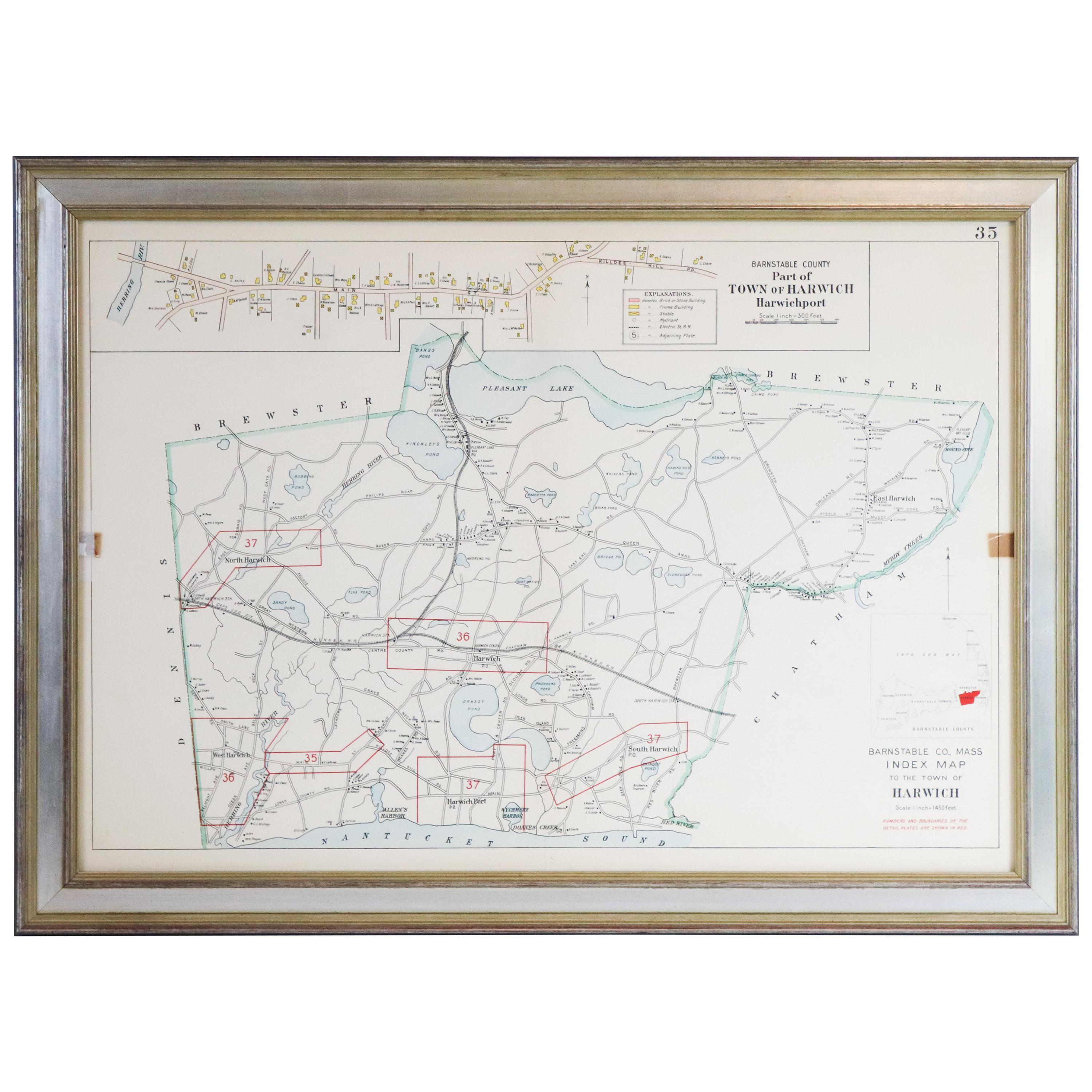
Map of Harwich Mass showing Wychmere Harbor, Doane's Creek, Allens Harbor, Herring River, Pleasant Lake, Grassy Pond, Paddocks Pond, Hinkleys Pond, etc., This is an original period map taken from a Barnstable county atlas 26"H - 35"W 10lbs
- Dimensions:Height: 26 in (66.04 cm)Width: 35 in (88.9 cm)Depth: 2 in (5.08 cm)
- Materials and Techniques:
- Place of Origin:
- Period:
- Date of Manufacture:1890
- Condition:
- Seller Location:Norwell, MA
- Reference Number:Seller: 24NV3421stDibs: LU1741243339552
About the Seller
5.0
Vetted Professional Seller
Every seller passes strict standards for authenticity and reliability
Established in 1967
1stDibs seller since 2015
405 sales on 1stDibs
Typical response time: 2 hours
- ShippingRetrieving quote...Shipping from: Norwell, MA
- Return Policy
Authenticity Guarantee
In the unlikely event there’s an issue with an item’s authenticity, contact us within 1 year for a full refund. DetailsMoney-Back Guarantee
If your item is not as described, is damaged in transit, or does not arrive, contact us within 7 days for a full refund. Details24-Hour Cancellation
You have a 24-hour grace period in which to reconsider your purchase, with no questions asked.Vetted Professional Sellers
Our world-class sellers must adhere to strict standards for service and quality, maintaining the integrity of our listings.Price-Match Guarantee
If you find that a seller listed the same item for a lower price elsewhere, we’ll match it.Trusted Global Delivery
Our best-in-class carrier network provides specialized shipping options worldwide, including custom delivery.More From This Seller
View AllMap of Harwich, Massachusetts
Located in Norwell, MA
Turn of the century map of Harwich, Massachusetts. Plate from a Cape Cod County Map book showing the Barnstable county town of Harwich including Allens Harbor, Pleasant Lake, Harwich...
Category
20th Century Maps

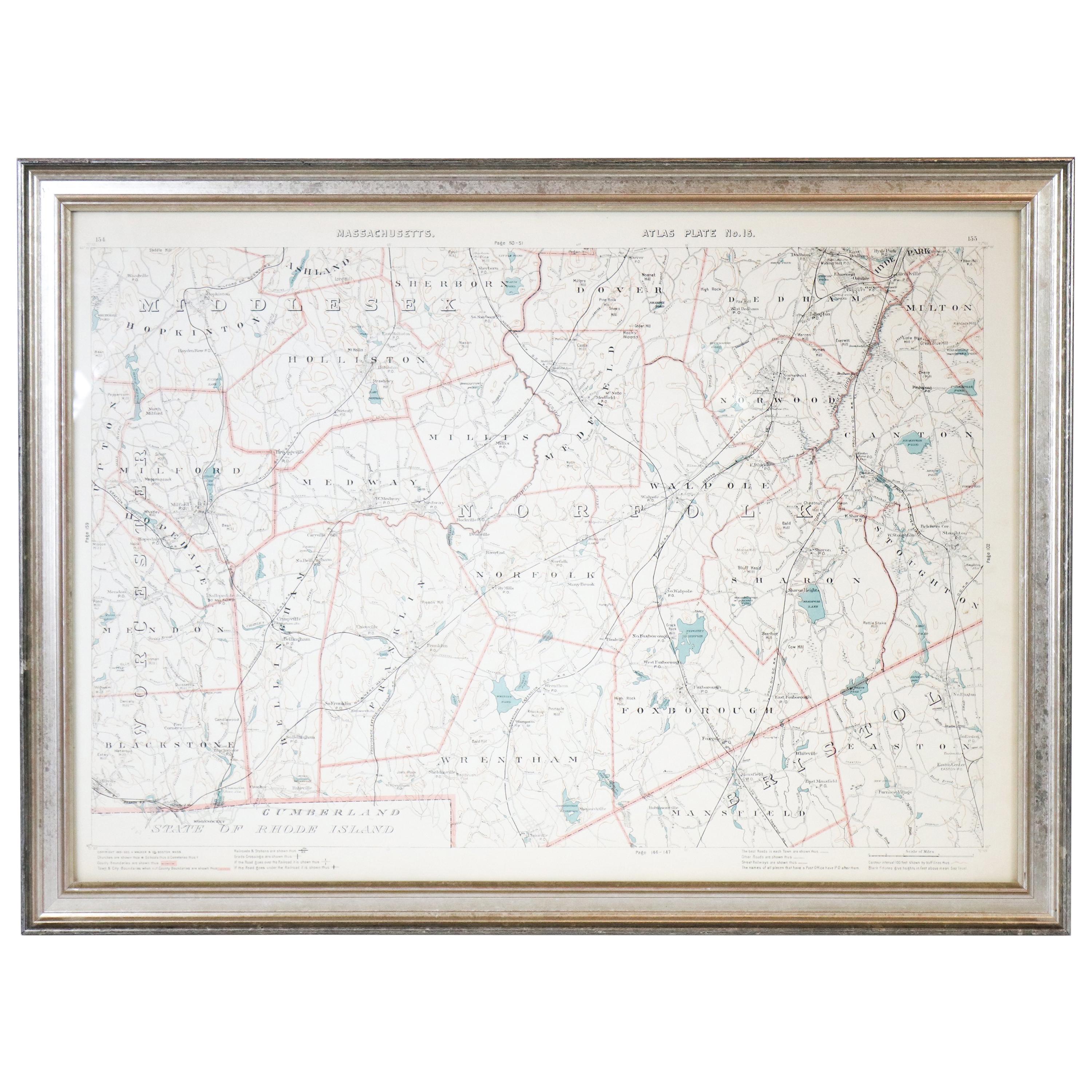
1891 Map of Norfolk County Massachusetts
Located in Norwell, MA
1891 map of Norfolk county Massachusetts including the towns of Wrentham, Franklin, Medfield, Sherborn, Norwood etc., measures: 23 x 31.
Category
Antique 19th Century Maps

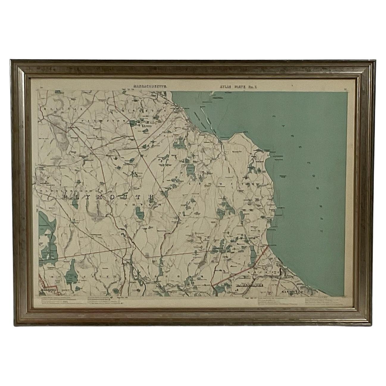
1891 Map of Plymouth County Mass
Located in Norwell, MA
Original 1891 map showing Sandwich, Bourne, Plymouth Carver, Middleborough, Plympton and Kingston. Showing Long Beach in Plymouth also as well as all shore points. Cape Cod Bay is ma...
Category
Antique 1890s North American Maps
Materials
Paper
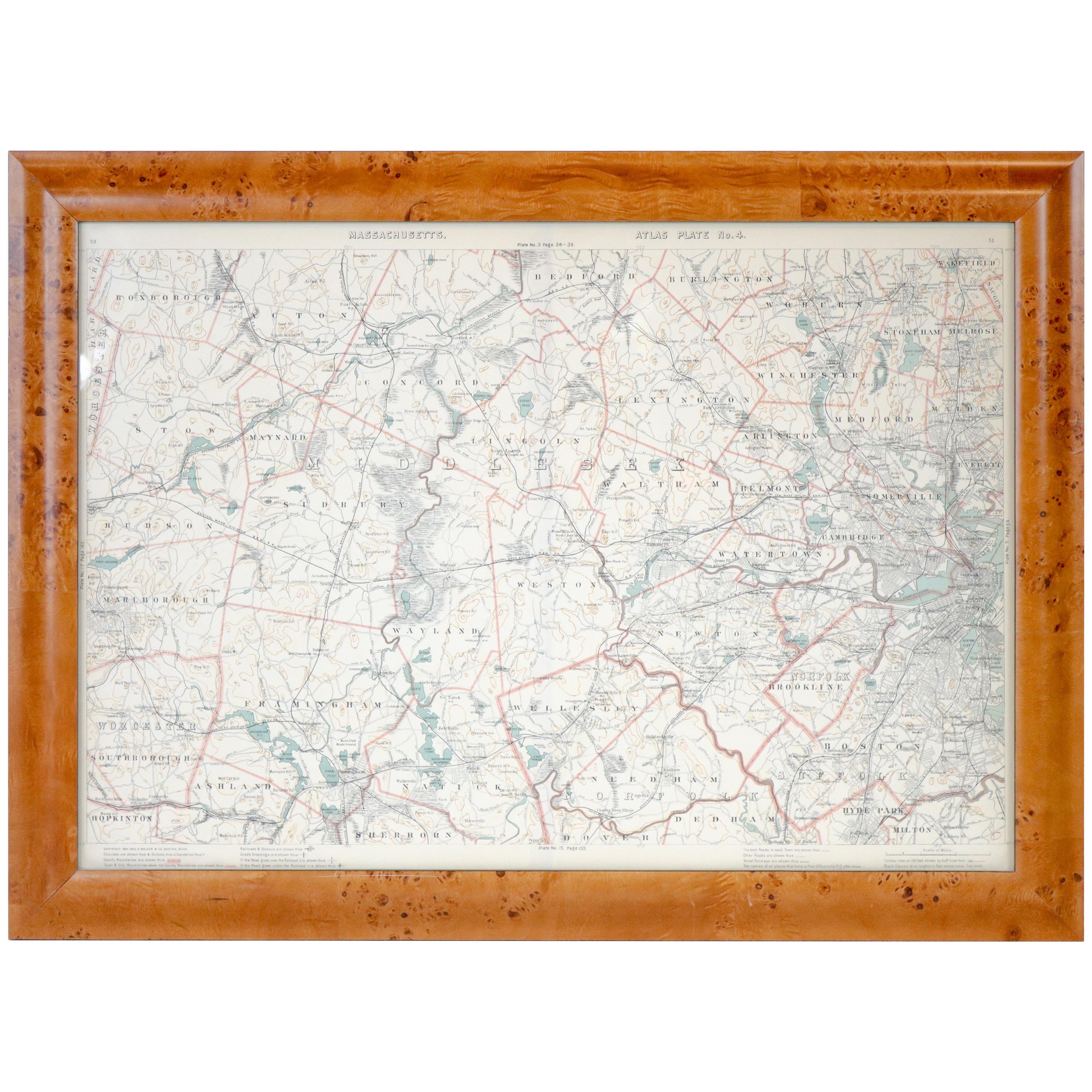
Original 1891 Walker Map
Located in Norwell, MA
Original 1891 map of Massachusetts by Walker. Towns include Cambridge, Boston, Dedham, Ashland, Brookline, Newton etc... burl wood frame. Measures...
Category
Antique 19th Century Maps

1873 Martha's Vineyard and Nantucket Chart
Located in Norwell, MA
Original chart of Nantucket and Martha's Vineyard by George Eldridge, Cartographer, 125 State Street, Boston. Dated 1873. Mounted to canvas. Also showing the coast of Cape Cod includ...
Category
Antique 1870s North American Maps
Materials
Paper

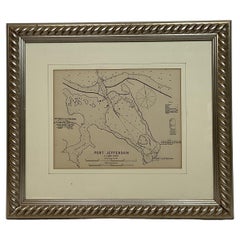
1901 Chart of Port Jefferson, New York
Located in Norwell, MA
Original chart by George Eldridge of Port Jefferson on Long Island, New York. The identified waters include Setauket Harbor, Mount Misery Point, and Match Rock. Two channels are mark...
Category
Antique Early 1900s North American Maps
Materials
Paper
You May Also Like
Original Antique Map of the American State of New York ( Southern Part ) 1903
Located in St Annes, Lancashire
Antique map of New York ( Southern Part )
Published By A & C Black. 1903
Original colour
Good condition
Unframed.
Free shipping
Category
Antique Early 1900s English Maps
Materials
Paper

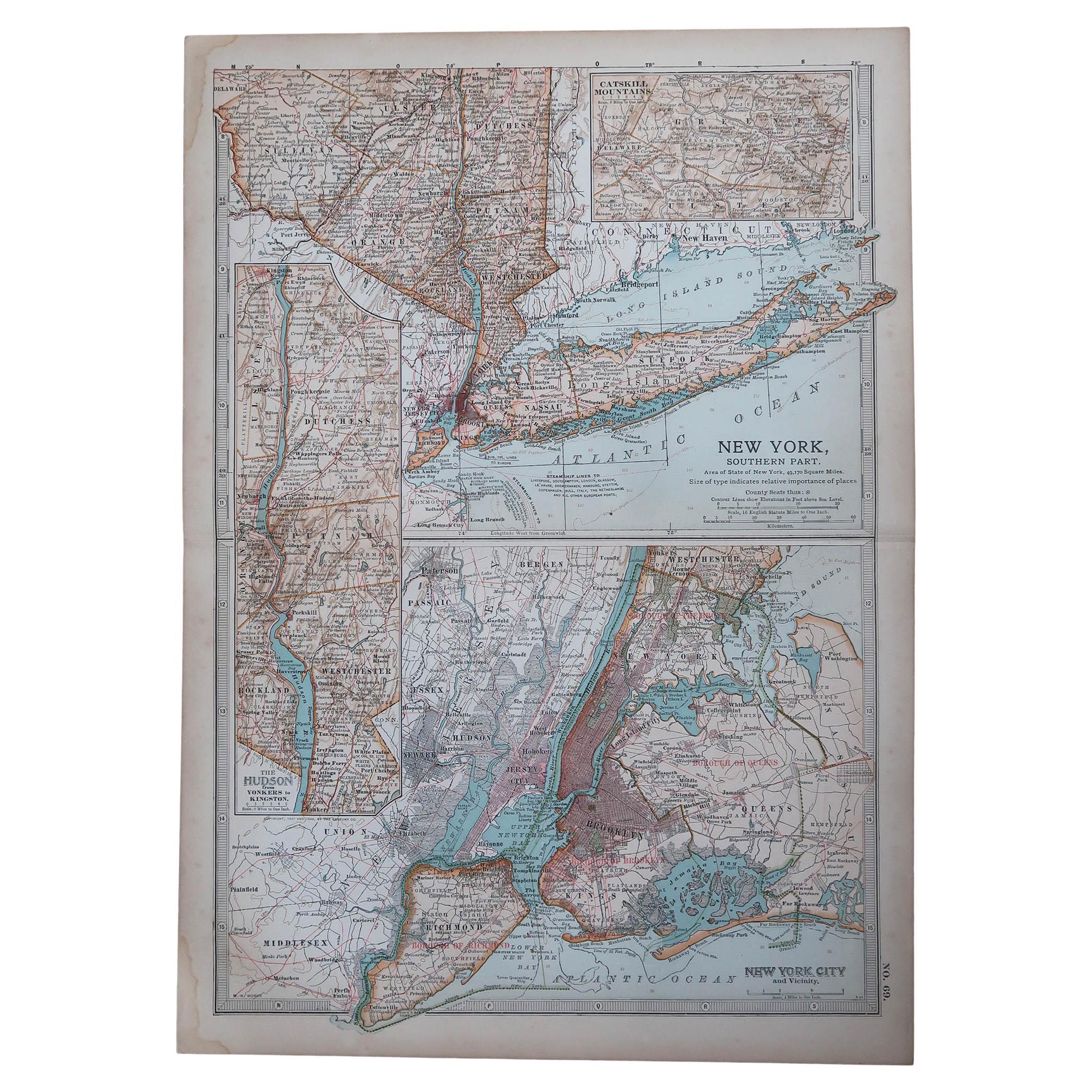
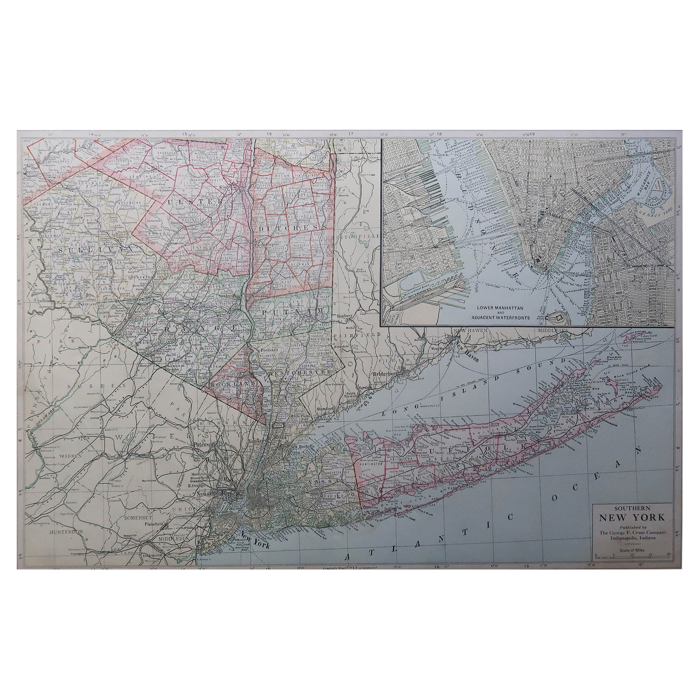
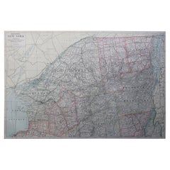
Large Original Antique Map of New York State( Southern ), USA, C.1900
Located in St Annes, Lancashire
Fabulous map of Southern New York . With a vignette of Lower Manhattan
Original color.
Engraved and printed by the George F. Cram Company, Indianapolis.
Published, C.1900.
Unfram...
Category
Antique 1890s American Maps
Materials
Paper

Large Original Antique Map of New York State ( Northern ), USA, C.1900
Located in St Annes, Lancashire
Fabulous map of Northern New York
Original color.
Engraved and printed by the George F. Cram Company, Indianapolis.
Published, C.1900.
Unframed.
Repairs to minor edge tears
Fr...
Category
Antique 1890s American Maps
Materials
Paper
Antique Map of American Cities, Vignette of New York City, circa 1920
Located in St Annes, Lancashire
Great maps of American Cities
Unframed
Original color
By John Bartholomew and Co. Edinburgh Geographical Institute
Published, circa 1920
Category
Vintage 1920s British Maps
Materials
Paper

Rare 18th C. Newport Map
Located in Sandwich, MA
Rare 18th C, Map titled "A plan of the town of Newport in the province of Rhode Island". Earliest printed plan of Newport, published for the use of the British just prior to their o...
Category
Antique 1770s American Maps
Materials
Paper

$19,500 / item
Large Original Antique Map of Massachusetts, USA, circa 1900
Located in St Annes, Lancashire
Fabulous map of Massachusetts
In 2 sheets. They can be joined but I have not done it
Original color
Engraved and printed by the George F. Cram ...
Category
Antique 1890s American Maps
Materials
Paper

More Ways To Browse
Carlo Scarpa 1934 Chairs
Christofle Marly
1900 Antique Chairs
Glass Table Italian Round
Alvar Aalto Poster
Geometric Metal Table
Post Modern High Chairs
Vintage Vine Rug
Cancel An Order
Antique Framing Square
Silver Metal Chair
Swedish Kilim
Vintage Scandanavian Chairs
Vintage Tropical Furniture
19th Century Red Glass
Antique French Console Table Tables
French 50s
Rusted Metal Art