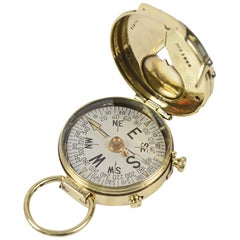
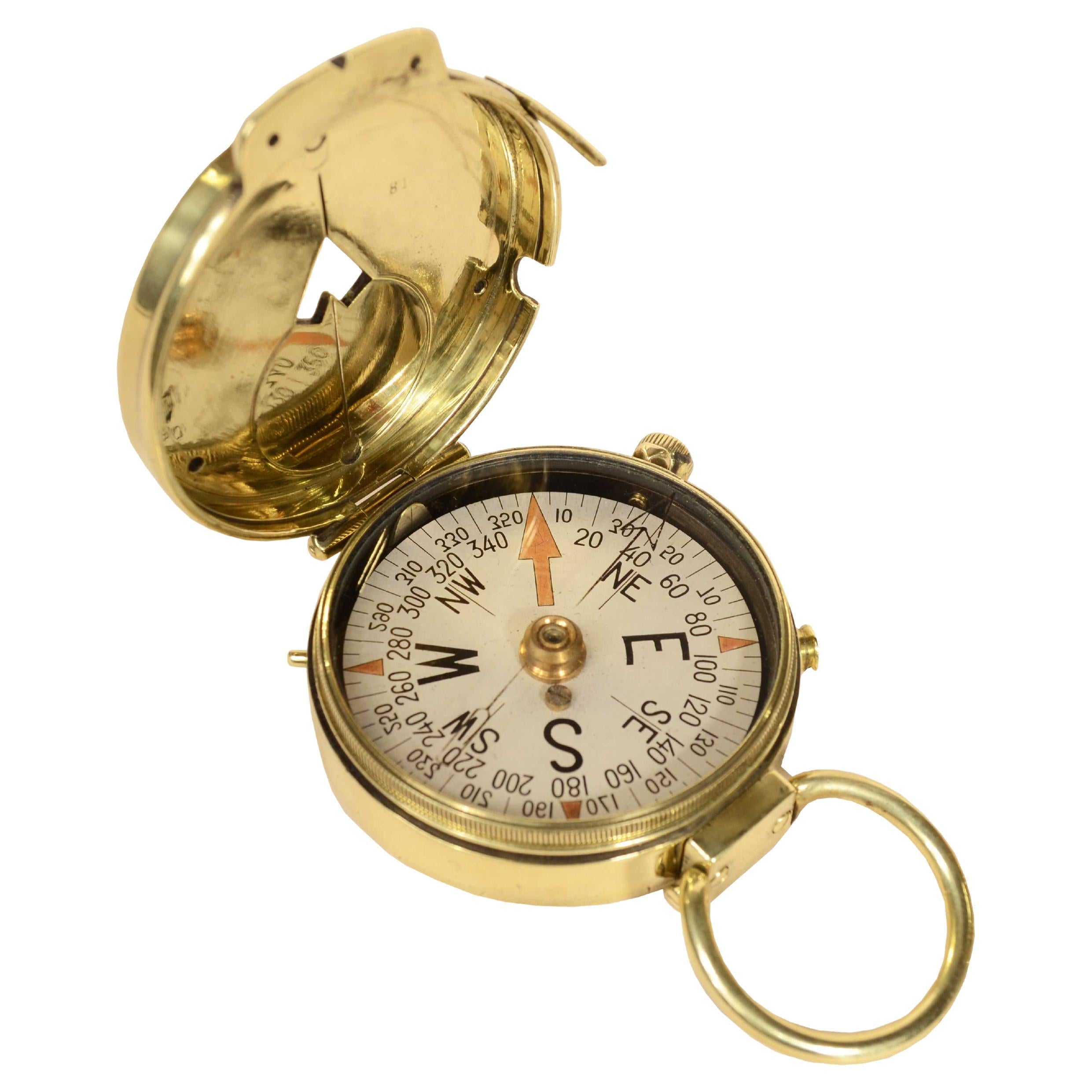
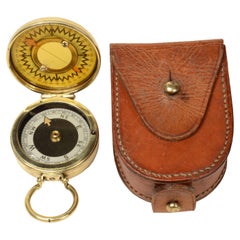
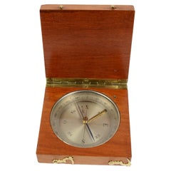
Survey Compass Swiss Made in 1918 for U.S. Engineer Corps
View Similar Items


Want more images or videos?
Request additional images or videos from the seller
1 of 17
Survey Compass Swiss Made in 1918 for U.S. Engineer Corps
Price:$471
$654.13List Price
About the Item
- Creator:Cruchon & Emons (Maker)
- Dimensions:Height: 0.71 in (1.8 cm)Diameter: 2.09 in (5.3 cm)
- Place of Origin:
- Period:1910-1919
- Date of Manufacture:1918
- Condition:
- Seller Location:Milan, IT
- Reference Number:1stDibs: LU1020213502892
About the Seller
5.0
Gold Seller
Premium sellers maintaining a 4.3+ rating and 24-hour response times
Established in 1999
1stDibs seller since 2014
398 sales on 1stDibs
Typical response time: 1 hour
Authenticity Guarantee
In the unlikely event there’s an issue with an item’s authenticity, contact us within 1 year for a full refund. DetailsMoney-Back Guarantee
If your item is not as described, is damaged in transit, or does not arrive, contact us within 7 days for a full refund. Details24-Hour Cancellation
You have a 24-hour grace period in which to reconsider your purchase, with no questions asked.Vetted Professional Sellers
Our world-class sellers must adhere to strict standards for service and quality, maintaining the integrity of our listings.Price-Match Guarantee
If you find that a seller listed the same item for a lower price elsewhere, we’ll match it.Trusted Global Delivery
Our best-in-class carrier network provides specialized shipping options worldwide, including custom delivery.More From This Seller
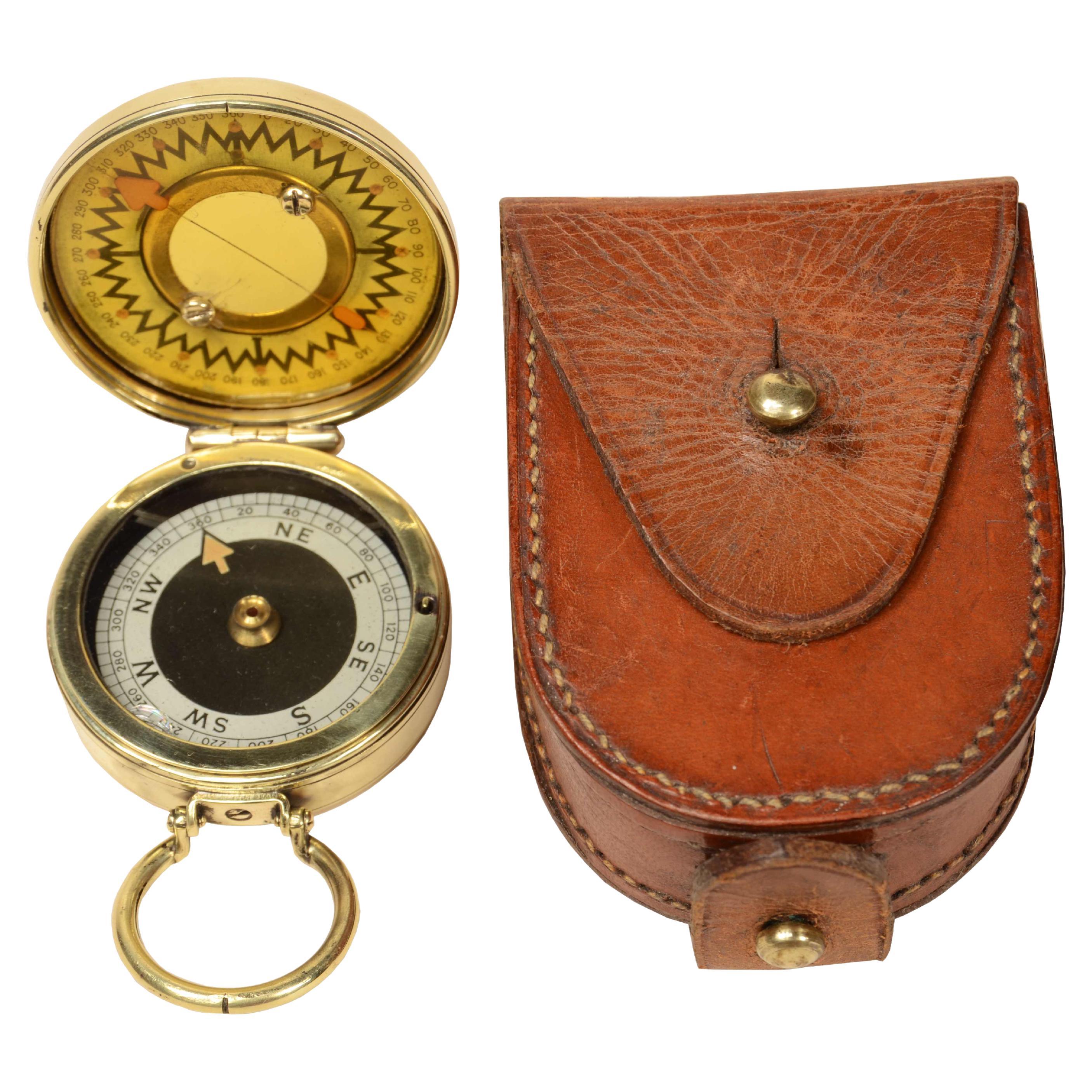
View AllGruchon & Emons Paris 1918 magnetic compass for U.S Engineer Corps
Located in Milan, IT
Rare nautical survey magnetic compass, brass pocket, signed Gruchon & Emons Paris No. 81 1918, made for U.S Engineer Corps and in use by officers during World War I. This is a smal...
Category
Vintage 1910s Scientific Instruments
Materials
Brass

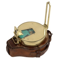
The Magnapole 1920s brass nautical travel surveying compass
Located in Milan, IT
Brass travel nautical surveying compass circa 1920, complete with original leather case, signed The Magnapole Patent 22598.
Small compass used away from magnetic fields to verify the...
Category
Vintage 1920s Nautical Objects
Materials
Brass
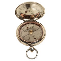
Nautical survey magnetic compass signed Elliott Bros London late 1800s
Located in Milan, IT
Rare magnetic nautical surveying compass, brass, late 19th century signed Elliott Bros London complete with leather case. This is a small compass, 7 cm diameter, typically used in re...
Category
Antique Late 19th Century Nautical Objects
Materials
Brass
Official U.S. Air Force compass of 1915 signed Ceebynite Short & Mason N.Y.
Located in Milan, IT
Pocket compass in use by 1915 U.S. Air Force officers made of brass in the shape of an onion clock, signed Ceebynite Short & Mason Taylor Rochester N.Y. The compass is equipped with ...
Category
Vintage 1910s Aviation Objects
Materials
Brass
Nautical magnetic compass made USA 1930s original wooden box
Located in Milan, IT
Nautical magnetic compass, made in the USA in the 1930s.
Bon état. Housed in its original box with wooden slot lid and mounted on gimbal.
Box measures 12x12x8.5 cm - inches 4.8x4.8x...
Category
Vintage 1930s Nautical Objects
Materials
Brass

End 19th Century Antique Magnetic Topographic Compass Made in Brass and Oak
Located in Milan, IT
Magnetic topographic compass, of oak and brass; instrument consisting of a magnetized needle free to rotate on a horizontal plane, marking with the tip of the needle the direction of magnetic north, compass card with eight winds complete with goniometric circle divided into 360 °, complete with the compass needle lock. Italian manufacture of the late 19th century. Very good condition. Measure 3.1x3.1 height 1.
Shipping is insured by Lloyd's London; our gift box is free (look at the last picture).
The invention of the compass is mysterious but it is well known that magnetite was discovered in Magnesia, a city of Asia Minor. We can find the first indications about the use in Europe of the magnetic force for orientation at the end of the XII century...
Category
Antique 1890s Italian Scientific Instruments
Materials
Oak
You May Also Like
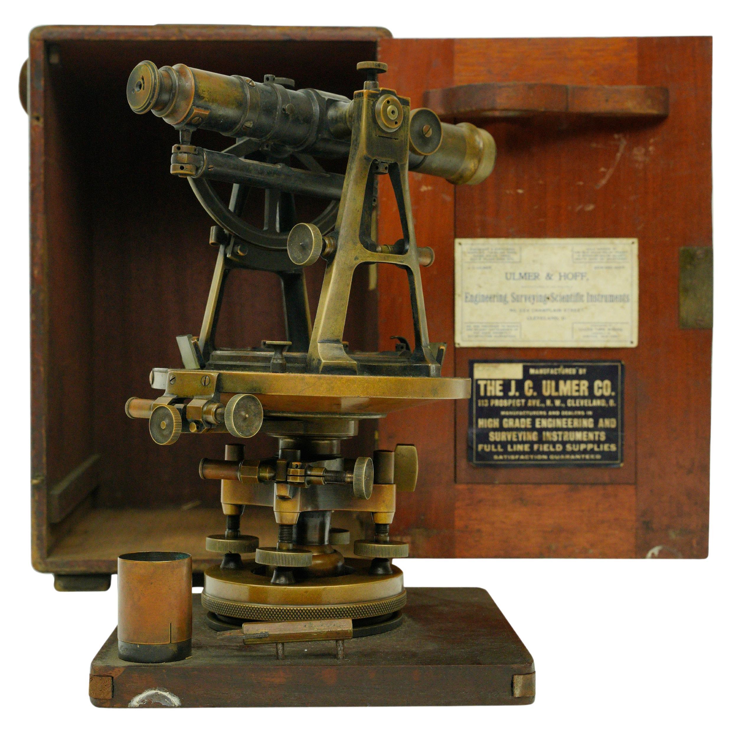
Antique J.C Ulmer Co. Survey Transit & Compass In Original Mahogany Box
Located in New York, NY
Brass and steel survey transit and compass in the original mahogany box. Made by J.C Ulmer Co. Good condition with appropriate wear from age. One availa...
Category
Early 20th Century American Industrial Scientific Instruments
Materials
Brass, Steel

U.S. Navy WWI Poster "We Clear the Way for Your Fighting Dollars, " 1918
Located in Colorado Springs, CO
This WWI poster features a US sailor after disembarking from a ship and ready for battle. In the background are powerful warships setting the scene. Below th...
Category
Vintage 1910s American Historical Memorabilia
Materials
Paper

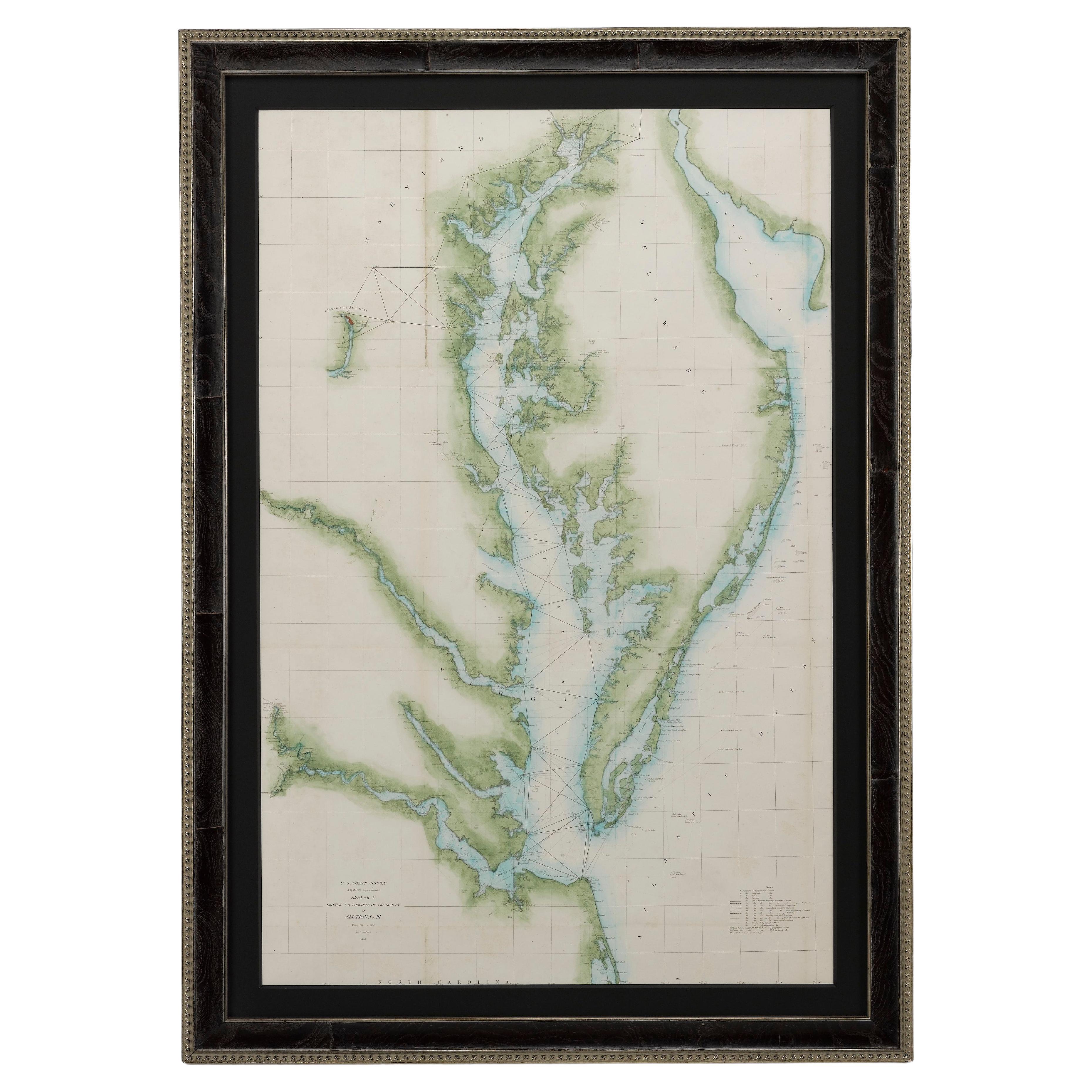
1856 U.S. Coast Survey Map of Chesapeake Bay and Delaware Bay
Located in Colorado Springs, CO
Presented is U.S. Coast Survey nautical chart or maritime map of Chesapeake Bay and Delaware Bay from 1856. The map depicts the region from Susquehanna, Maryland to the northern Outer Banks in North Carolina. It also shows from Richmond and Petersburg, Virginia to the Atlantic Ocean. The map is highly detailed with many cities and towns labeled throughout. Rivers, inlets, and bays are also labeled. Various charts illustrating more specific parts of the region are marked on the map using dotted lines. The lines form boxes, and the corresponding chart number and publication date are given. Extensive triangulation surveys were conducted the length of Chesapeake Bay and are illustrated here. Hampton Roads, Virginia is labeled, along with the James, York, and Rappahannock Rivers, which were all extensively surveyed.
The chart was published under the supervision of A. D. Bache, one of the most influential and prolific figures in the early history of the U.S. Coast Survey, for the 1856 Report of the Superintendent of the U.S. Coast Survey. Alexander Dallas Bache (1806-1867) was an American physicist, scientist, and surveyor. Bache served as the Superintendent of the U.S. Coast Survey from 1843 to 1865. Born in Philadelphia, Bache toured Europe and composed an important treatise on European Education. He also served as president of Philadelphia's Central High School and was a professor of natural history and chemistry at the University of Pennsylvania. Upon the death of Ferdinand Rudolph Hassler, Bache was appointed Superintendent of the United States Coast Survey.
The Office of the Coast Survey, founded in 1807 by President Thomas Jefferson and Secretary of Commerce Albert Gallatin...
Category
Antique 1850s American Maps
Materials
Paper

Large U.S. Coast and Geodetic Survey Chart A of the Atlantic Coast, 1877
Located in Nantucket, MA
Large U.S. Coast and Geodetic Survey Chart A of the Atlantic Coast, 1877, re-issued in February 1881, a printed paper laid down on linen navigational chart of the U.S. Atlantic coast...
Category
Antique 1880s American Other Maps
Materials
Linen

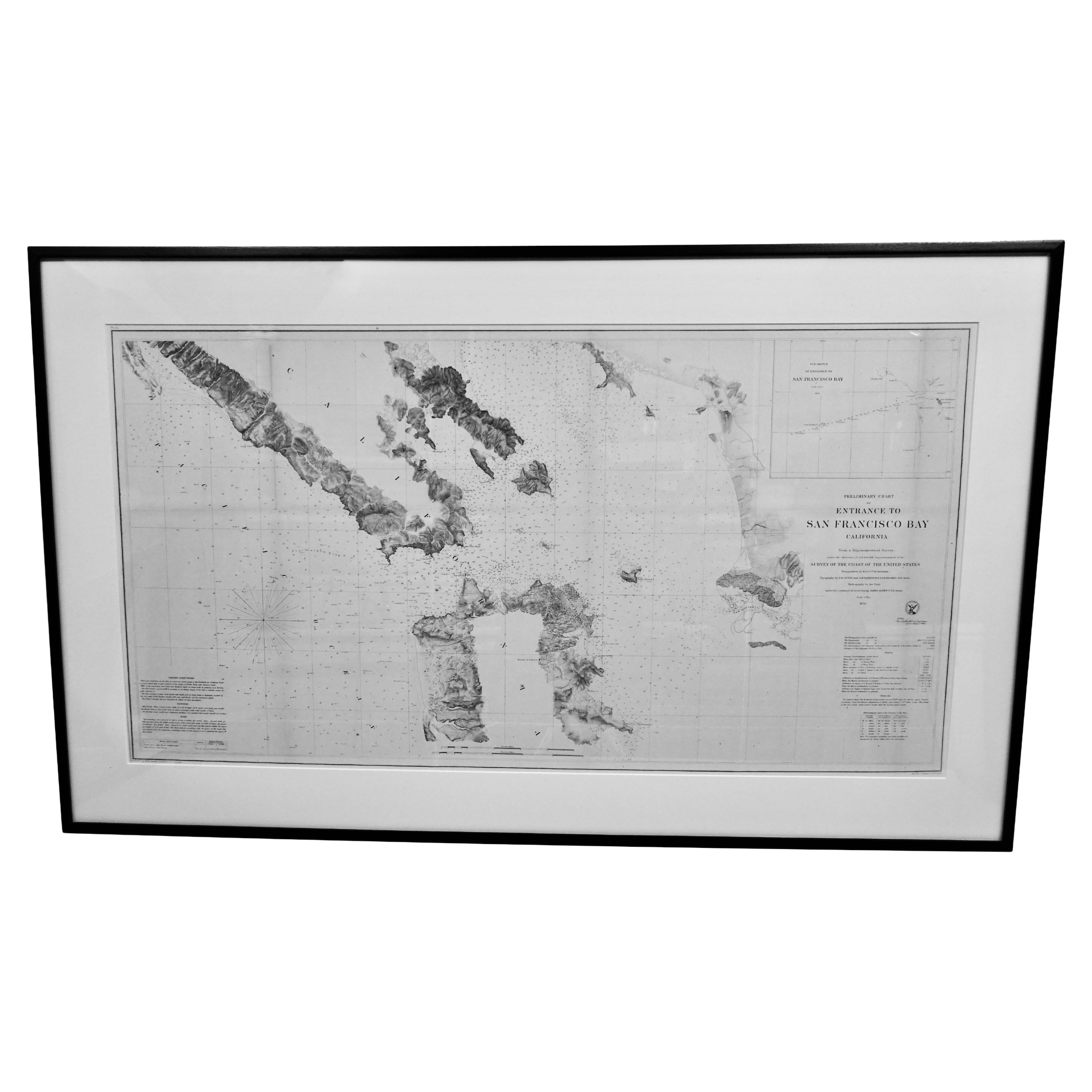
Scarce U.S. Coast Survey Map Depicting Entrance to San Francisco Bay Dated 1856
Located in San Francisco, CA
A fine example of the 1856 U.S. Coast lithographic survey nautical chart of the entrance to San Francisco bay and the city. Published in 1856 by the Office of the Coast Survey the of...
Category
Antique Mid-19th Century American Maps
Materials
Paper

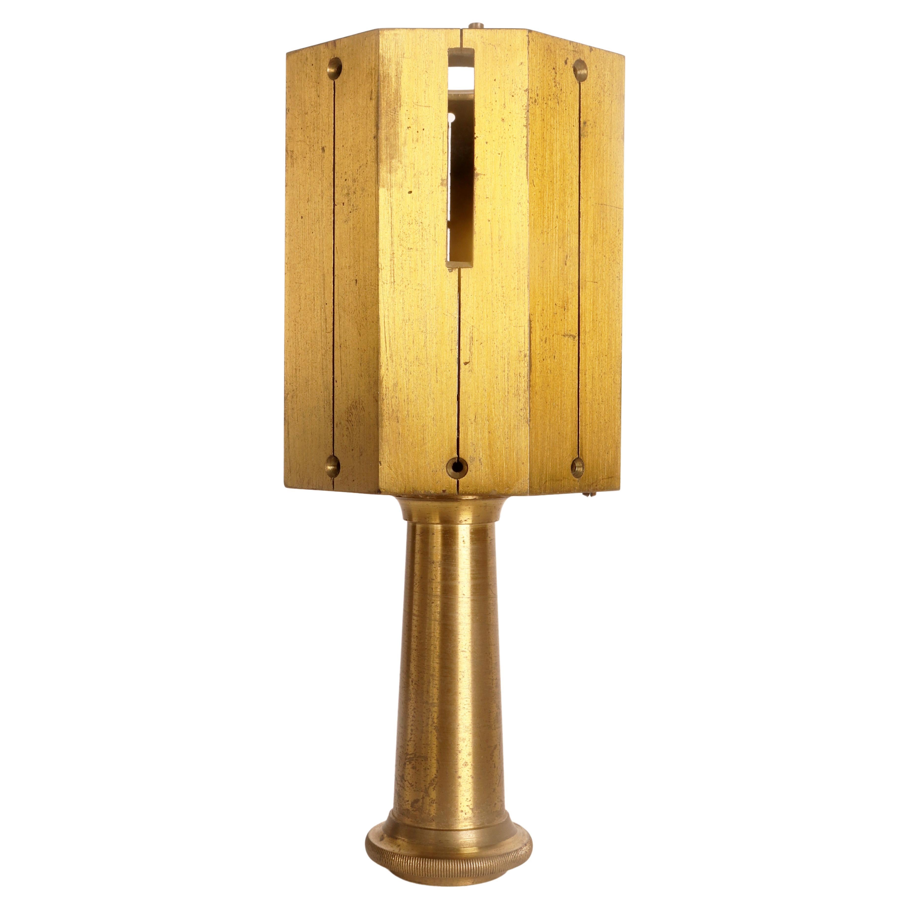
A land surveying square, France 1880.
Located in Milan, IT
Octagonal brass land surveying square. Each side has a slot, which allows to aim the distance and evaluate 90 and 45 degrees when measuring the field. ...
Category
Antique Late 19th Century French Scientific Instruments
Materials
Brass
Recently Viewed
View AllMore Ways To Browse
Surveying Instrument
Antique Survey Instruments
Antique Surveying Instruments
Antique Brass Surveying Instruments
Antique Nautical Compass With Box
Antique Magnetic Compass
Antique Balance Scales Scales
Antique Balancing Scales
Antique Scientific Scales
Anatomical Model
Botanical Model
Brass Scales
Telescopes
Antique Iron Scale
English Barrels
Antique Copper Scale
Instrument Dial
Antique Instrument Box