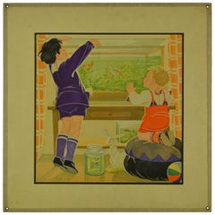
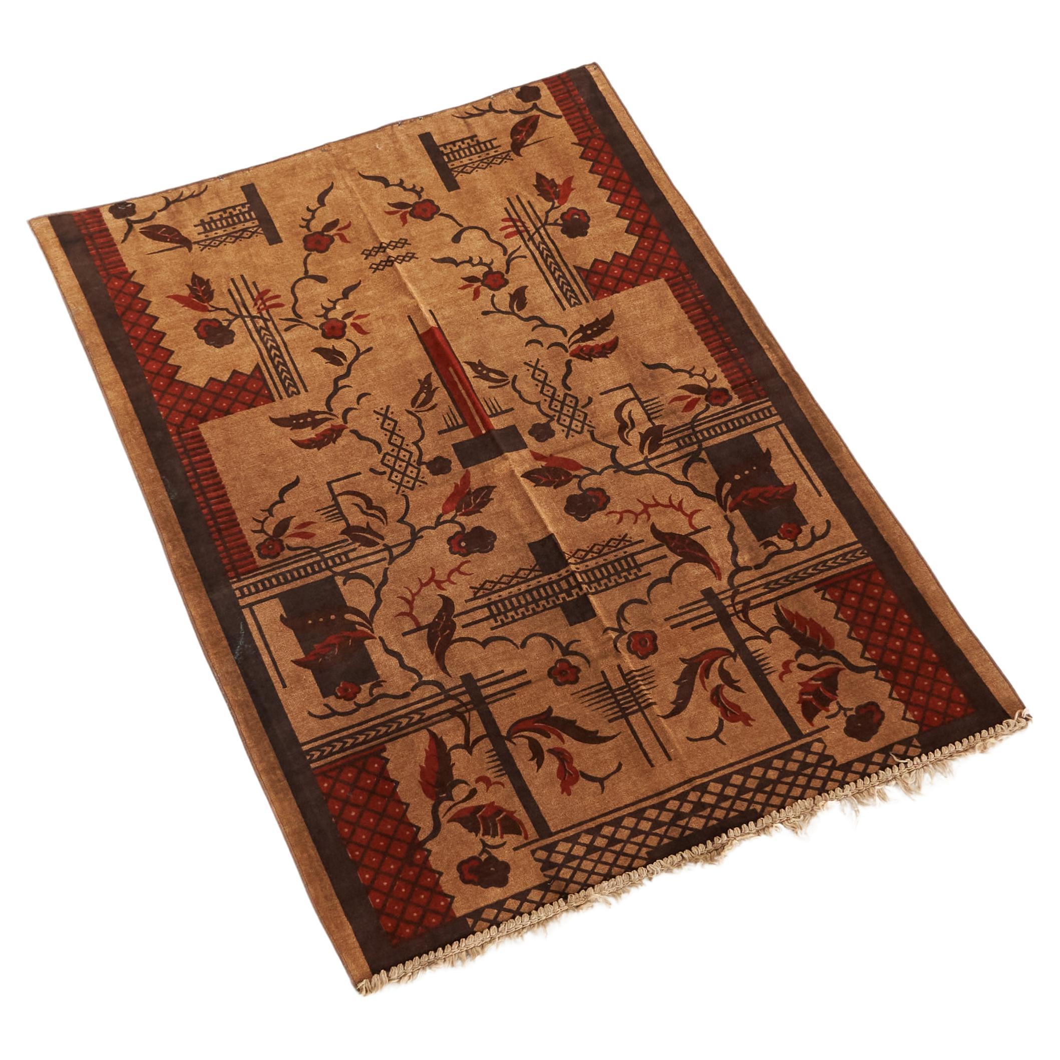
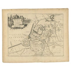
1930s Wall School Chart, Feeding the Fish, Midderigh - Bokhorst, Netherlands
View Similar Items

1 of 8
1930s Wall School Chart, Feeding the Fish, Midderigh - Bokhorst, Netherlands
Price:$200
$269.02List Price
About the Item
- Creator:B. Midderigh-Bokhorst 1 (Designer)
- Dimensions:Height: 18.71 in (47.5 cm)Width: 18.71 in (47.5 cm)Depth: 0.08 in (2 mm)
- Style:Art Deco (Of the Period)
- Materials and Techniques:
- Place of Origin:
- Period:
- Date of Manufacture:1936
- Condition:Wear consistent with age and use.
- Seller Location:Retie, BE
- Reference Number:1stDibs: LU1474214319761
Authenticity Guarantee
In the unlikely event there’s an issue with an item’s authenticity, contact us within 1 year for a full refund. DetailsMoney-Back Guarantee
If your item is not as described, is damaged in transit, or does not arrive, contact us within 7 days for a full refund. Details24-Hour Cancellation
You have a 24-hour grace period in which to reconsider your purchase, with no questions asked.Vetted Professional Sellers
Our world-class sellers must adhere to strict standards for service and quality, maintaining the integrity of our listings.Price-Match Guarantee
If you find that a seller listed the same item for a lower price elsewhere, we’ll match it.Trusted Global Delivery
Our best-in-class carrier network provides specialized shipping options worldwide, including custom delivery.You May Also Like
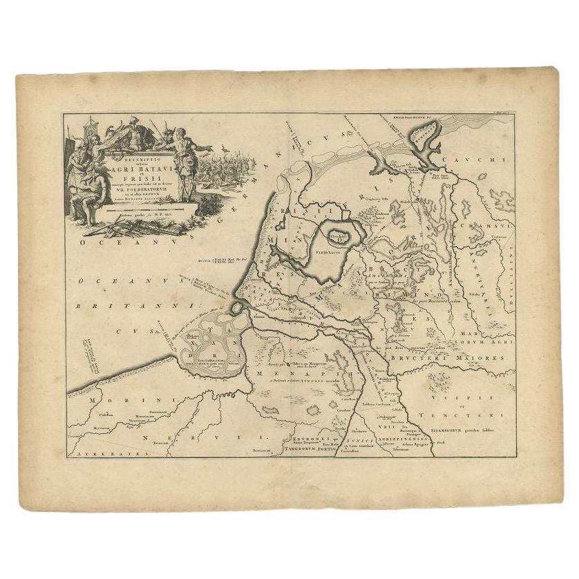
Antique Map of the Old Land of Batavia and FriesLand, The Netherlands, 1697
Located in Langweer, NL
Antique map Friesland titled 'Descriptio veteris Agri Batavi et Frisii (..)'. Old map of Friesland, the Netherlands. Depicts the old land of Batavia and Friesland. This map originate...
Category
Antique 17th Century Maps
Materials
Paper
$180 Sale Price
20% Off
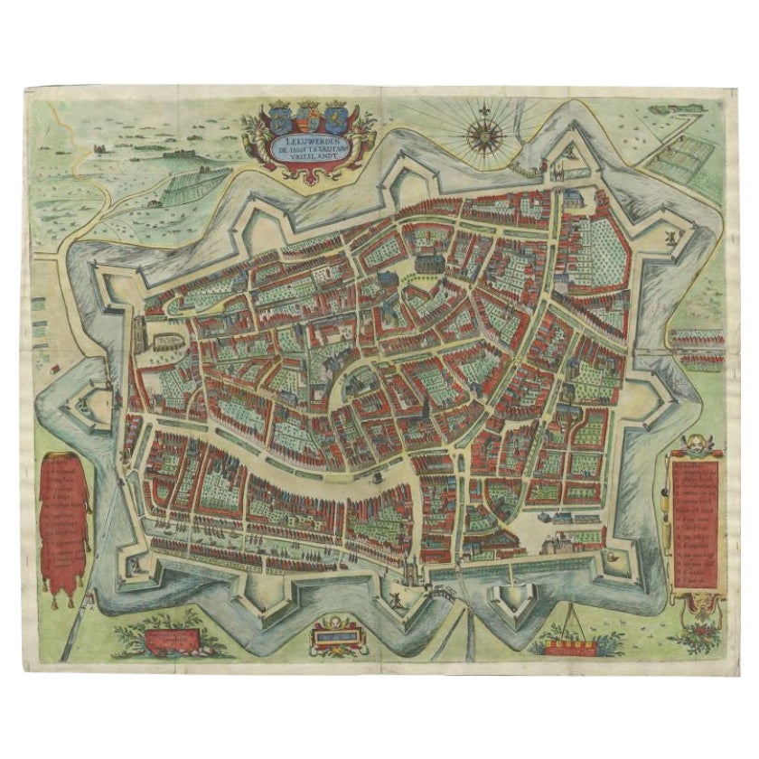
Handcolored Rare Map of Leeuwarden, Capital of Friesland, The Netherlands, 1622
Located in Langweer, NL
Antique map titled 'Leeuwerden de Hooftstadt van Vrieslandt'. Rare and old map of the city of Leeuwarden, Friesland.
Artists and Engravers: Published by Pieter Feddes van Harlingen...
Category
Antique 17th Century Maps
Materials
Paper
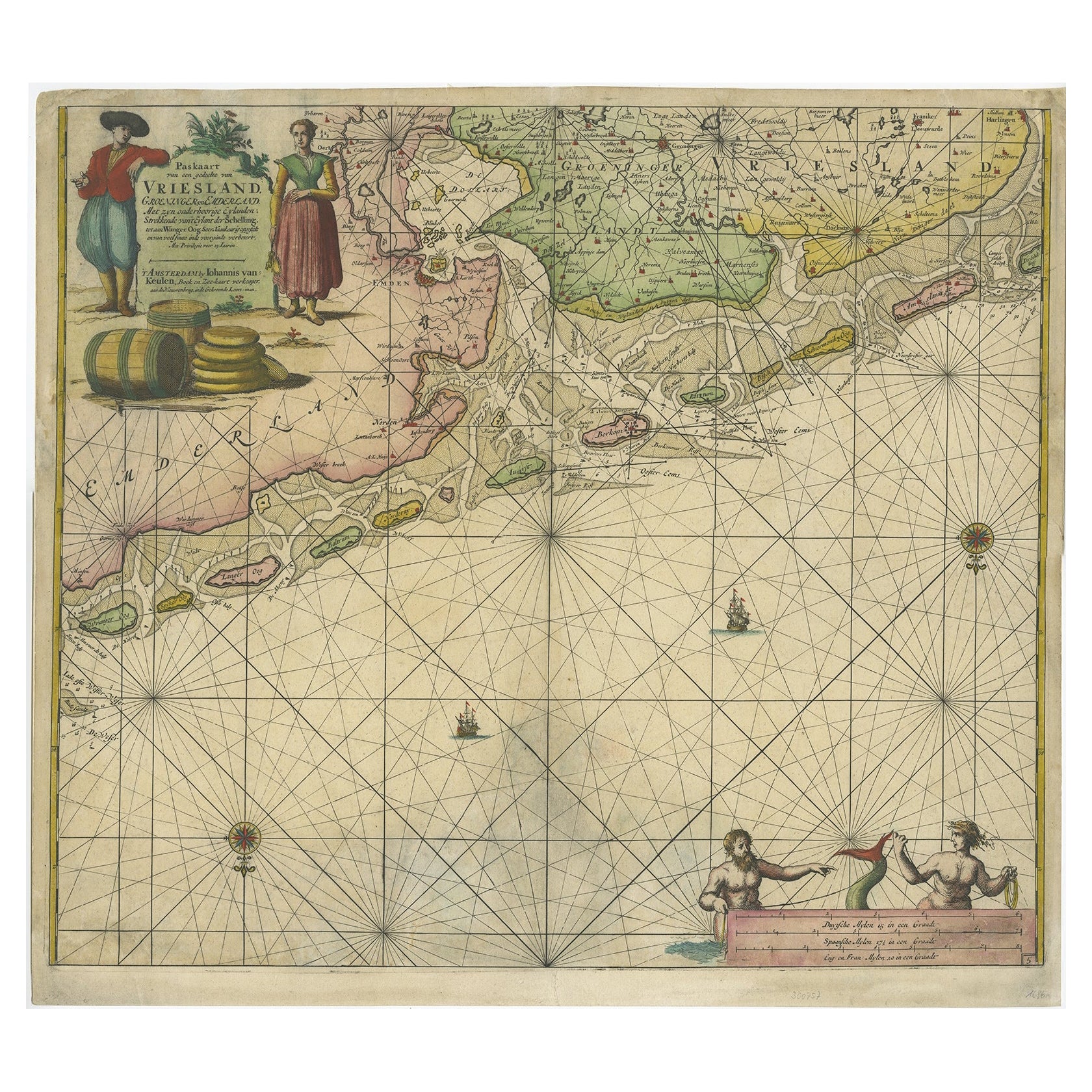
Old Decorative & Highly Detailed Sea Chart of the North Dutch-German Coast, 1681
Located in Langweer, NL
Antique map titled 'Paskaart van een gedeelte van Vriesland, Groeninger, en Emderland. Met zyn onderhoorige Eylanden; Strekkende van't Eylant der Schelling'.
Decorative and highl...
Category
Antique 1680s Maps
Materials
Paper
$1,578 Sale Price
20% Off
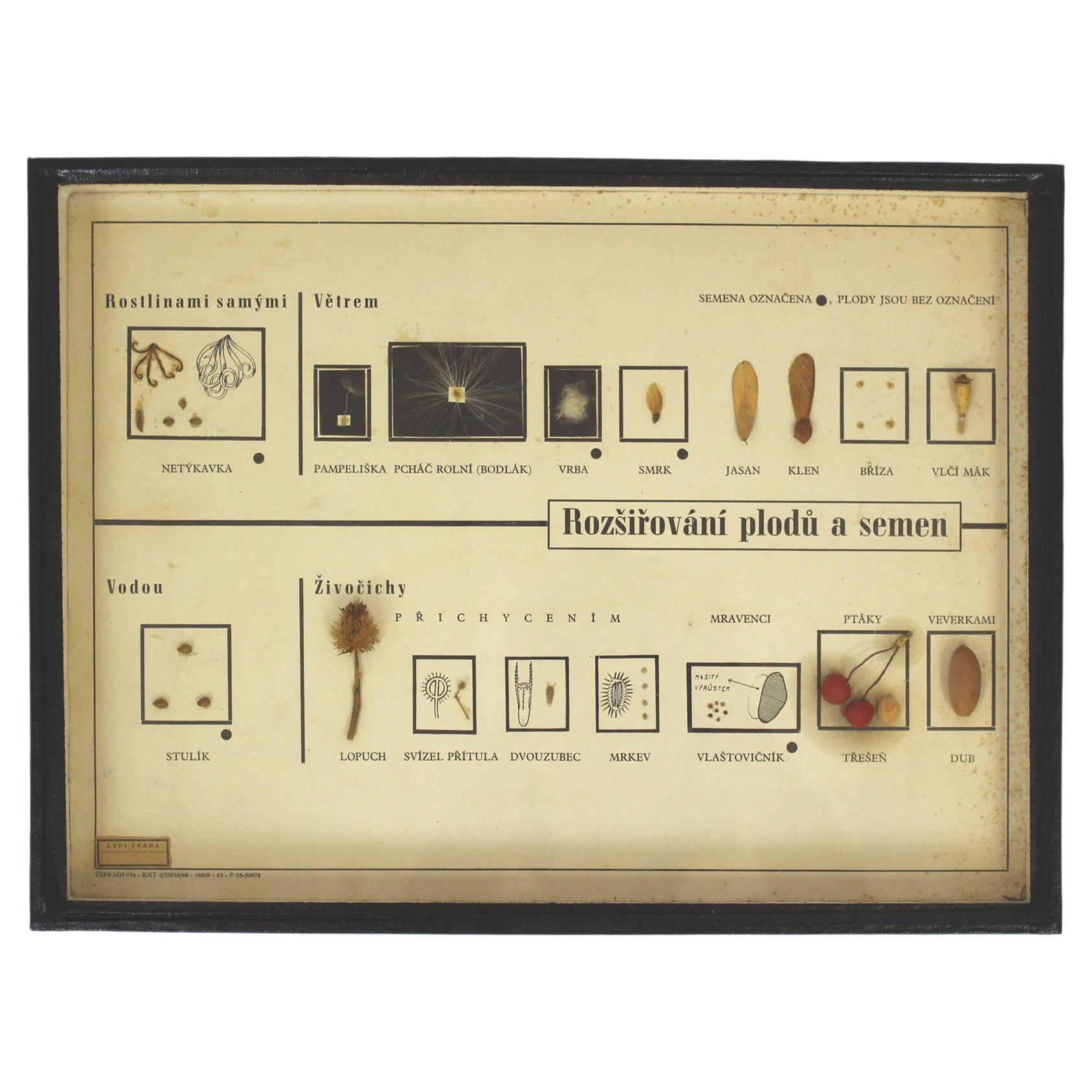
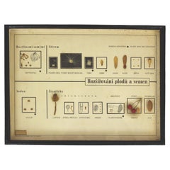
Vintage School Chart / Poster, Spreading the Seeds, 1960s
Located in Żory, PL
A school chart in a frame shows how seeds and fruits are spread (by plants, wind, water, animals). There are real fruits and seeds stuck inside. Czechoslovakia, 1960s.
Category
Mid-20th Century Industrial Decorative Art
Materials
Glass
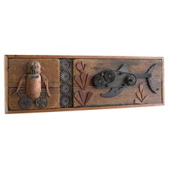
Steampunk wall Art "A day out Fishing" Monkey Fish The Netherlands, Summer- 1965
Located in Den Haag, NL
Decorative Steampunk wall Art "a day out fishing" The Netherlands, Summer- 1965 by Jeroen Ten Berge
Category
Vintage 1960s Dutch Mid-Century Modern Decorative Art
Materials
Brass, Steel
Set of 5 Large Original Vintage Sea Charts, circa 1920
Located in St Annes, Lancashire
5 great maps or charts of the oceans
I particularly like the color of these maps
Unframed
Original color
By John Bartholomew and Co. Edinburgh Geographical Institute
Published, ...
Category
Vintage 1920s British Maps
Materials
Paper
Recently Viewed
View AllMore Ways To Browse
Vintage Furniture Den Haag
Metal Wall Plaques
Mother Of Pearl Wall Art
Tiger Wall Art
Tile Plaque
Plaster Plaque
Oval Wall Plaque
Birds Eye Maple Frame
Diaz Costa
Chinese Carved Wall Panels
Chinoiserie Panel Pair
J Muller
Bird Metal Wall Art
Sea Shell Wall Art
Oyster Wall Art
Plaster Wall Panel
Antique Chinese Wall Hanging
Picasso Tile