Items Similar to American Maple Print of 13 Colonies

Want more images or videos?
Request additional images or videos from the seller
1 of 6
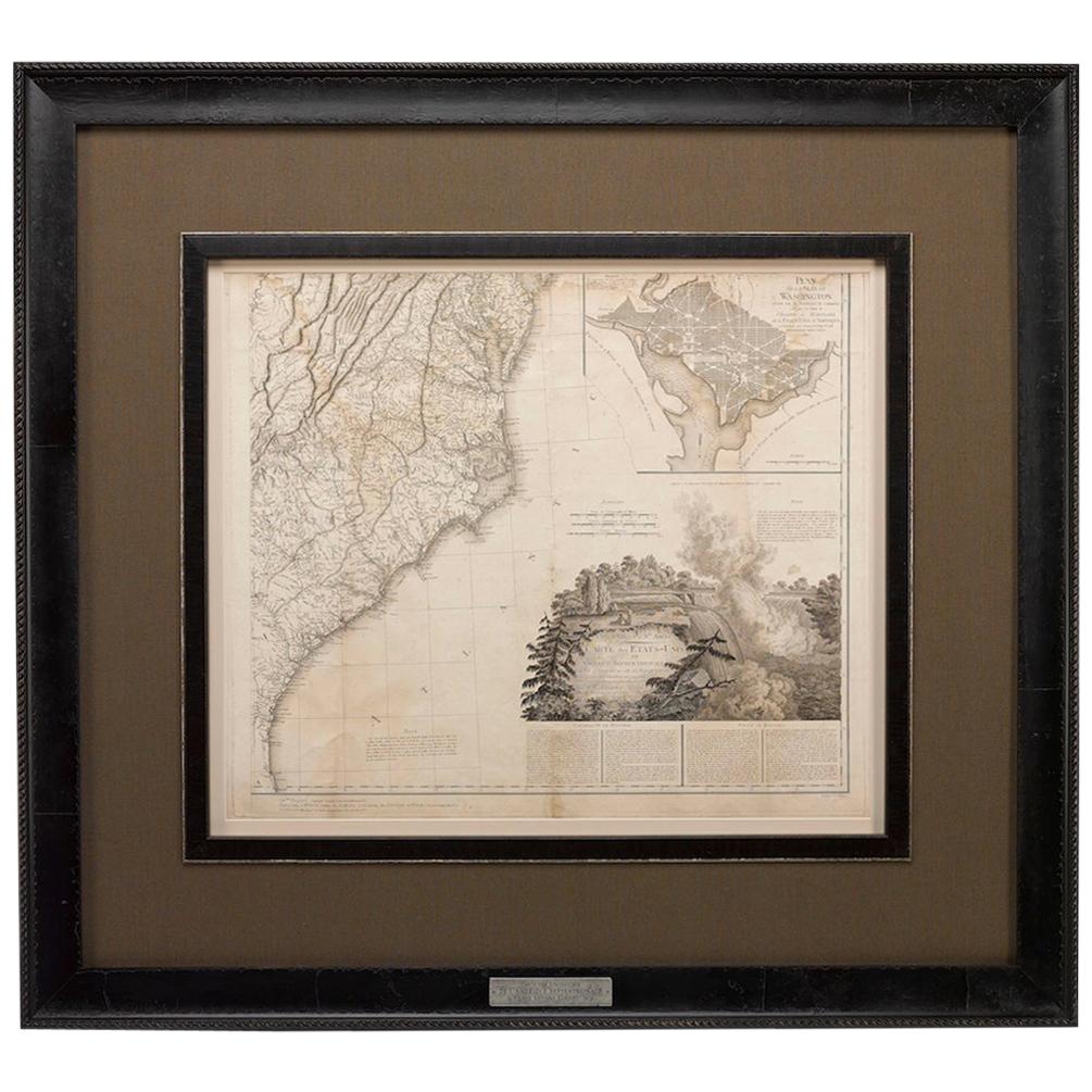
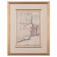
American Maple Print of 13 Colonies
$1,200
£905.12
€1,043.97
CA$1,693.83
A$1,885.10
CHF 981.43
MX$22,764.56
NOK 12,307.99
SEK 11,625.67
DKK 7,795.66
About the Item
American maple framed print of a map of the 13 Colonies
- Dimensions:Height: 18 in (45.72 cm)Width: 16 in (40.64 cm)
- Style:American Colonial (Of the Period)
- Materials and Techniques:
- Place of Origin:
- Period:
- Date of Manufacture:Mid-Late 1900s
- Condition:Wear consistent with age and use.
- Seller Location:Queens, NY
- Reference Number:Seller: 044499E1stDibs: LU977940737312
About the Seller
4.9
Recognized Seller
These prestigious sellers are industry leaders and represent the highest echelon for item quality and design.
Platinum Seller
Premium sellers with a 4.7+ rating and 24-hour response times
Established in 1939
1stDibs seller since 2013
993 sales on 1stDibs
Typical response time: <1 hour
- ShippingRetrieving quote...Shipping from: Long Island City, NY
- Return Policy
Authenticity Guarantee
In the unlikely event there’s an issue with an item’s authenticity, contact us within 1 year for a full refund. DetailsMoney-Back Guarantee
If your item is not as described, is damaged in transit, or does not arrive, contact us within 7 days for a full refund. Details24-Hour Cancellation
You have a 24-hour grace period in which to reconsider your purchase, with no questions asked.Vetted Professional Sellers
Our world-class sellers must adhere to strict standards for service and quality, maintaining the integrity of our listings.Price-Match Guarantee
If you find that a seller listed the same item for a lower price elsewhere, we’ll match it.Trusted Global Delivery
Our best-in-class carrier network provides specialized shipping options worldwide, including custom delivery.More From This Seller
View AllVintage Framed United States Map
Located in Queens, NY
Vintage aged paper map of the United States mounted on particle board and framed in a simple wooden frame.
Category
20th Century American Mid-Century Modern Maps
Materials
Wood, Paper

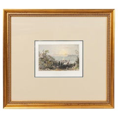
Hudson River Color Engraving of a Town
Located in Queens, NY
American Victorian colored engraving depicting the Hudson River and Sing-Sing by R. Wallis Titled "Village of Sing-Sing" in a gilt wooden frame and beige matting.
Category
Antique 19th Century American Country Paintings
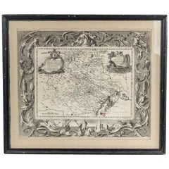
Italian Neo-Classic Map of Italy
Located in Queens, NY
Italian Neo-classic style framed print of map of Italy
Category
20th Century Italian Neoclassical Paintings
Materials
Paper
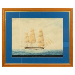
American Watercolor "Wasp" Painting
By John Clifton
Located in Queens, NY
American watercolor on paper depicting the clipper ship "Wasp" at sail within a molded maple frame (sgnd: John Clifton/ 1872).
Category
Antique 19th Century American Country Paintings
Materials
Maple, Paper
8 English Engravings of Various Medals
Located in Queens, NY
8 English engravings of various medals of King William III and Queen Mary in a gilt frame with dark brown matting (PRICED EACH) (Available individually)
Condition: Good; Wear consis...
Category
20th Century British Modern Paintings
Materials
Glass
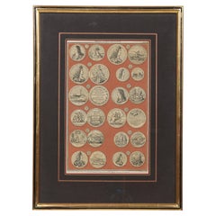
$12,000 / item
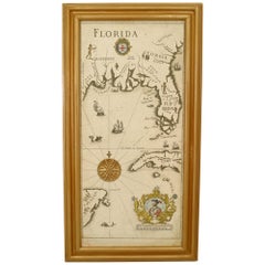
Mid-Century Modern Florida Gulf Coast Map
Located in Queens, NY
Mid-Century Modern (Italian) map print depicting 19th century Gulf Coast areas of Florida with crests and medallions in gold frames. (Companion piece: GRS118A)
Condition: Good; Wear...
Category
20th Century Italian Mid-Century Modern Paintings
Materials
Paper
You May Also Like
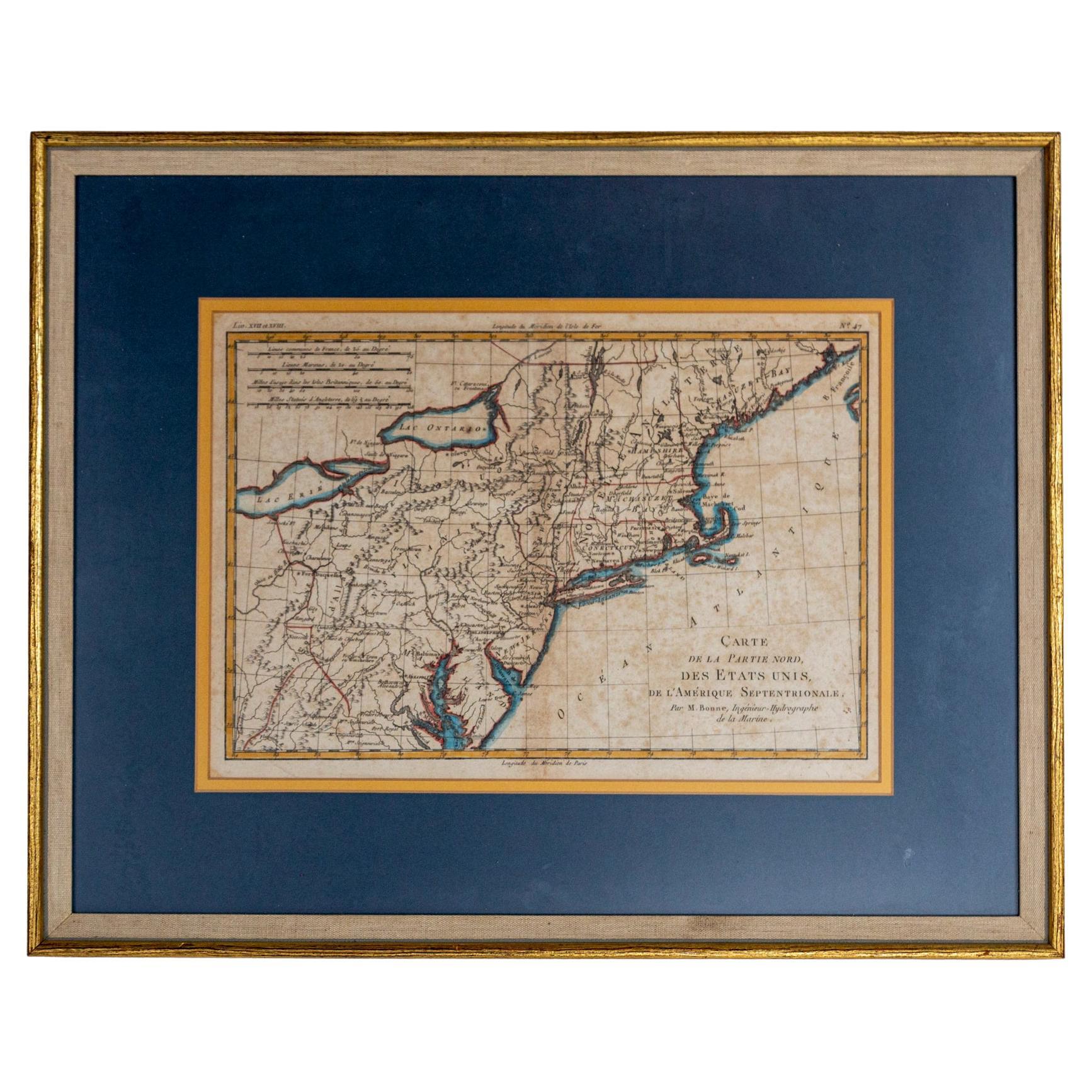
Hand-Colored French Map, Carte des Etats Unis, Par Bonne, Late 18th Century
By Rigobert Bonne
Located in Chappaqua, NY
Hand-colored French map, Carte de la Partie Nord, des Etats Unis, de l'Amérique Septentrionale, late 18th century. A French map of New England published at the end of the Revolutionary War...
Category
Antique Late 18th Century French Louis XVI Prints
Materials
Paper
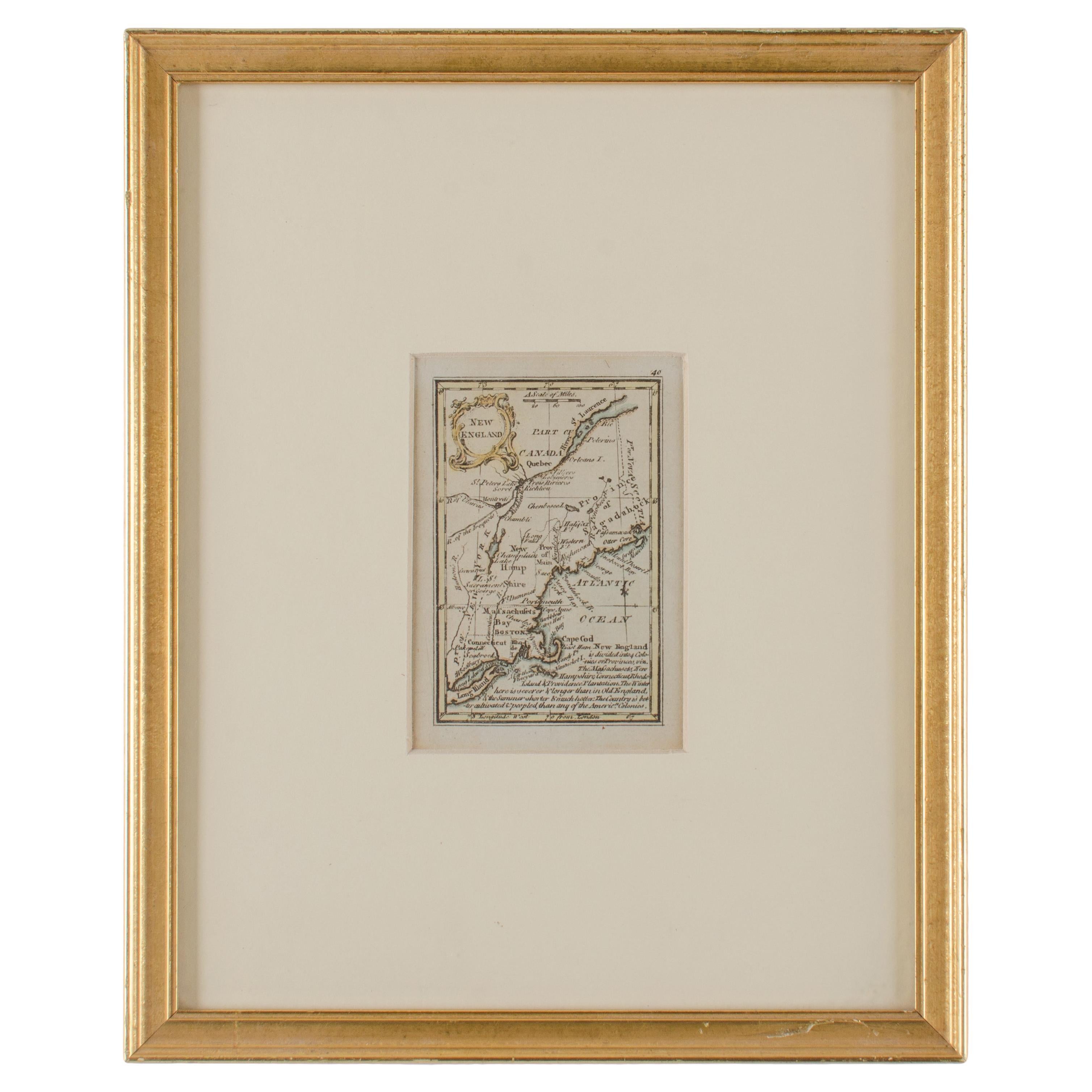
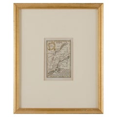
John Gibson - Map of New England
Located in Savannah, GA
A miniature map of New England from John Gibson’s The Atlas Minimus published in 1758.
John Gibson worked in London from 1748-1773 as a geographer and engraver, producing numerous ...
Category
Antique 1750s British Other Prints
Materials
Glass, Paper
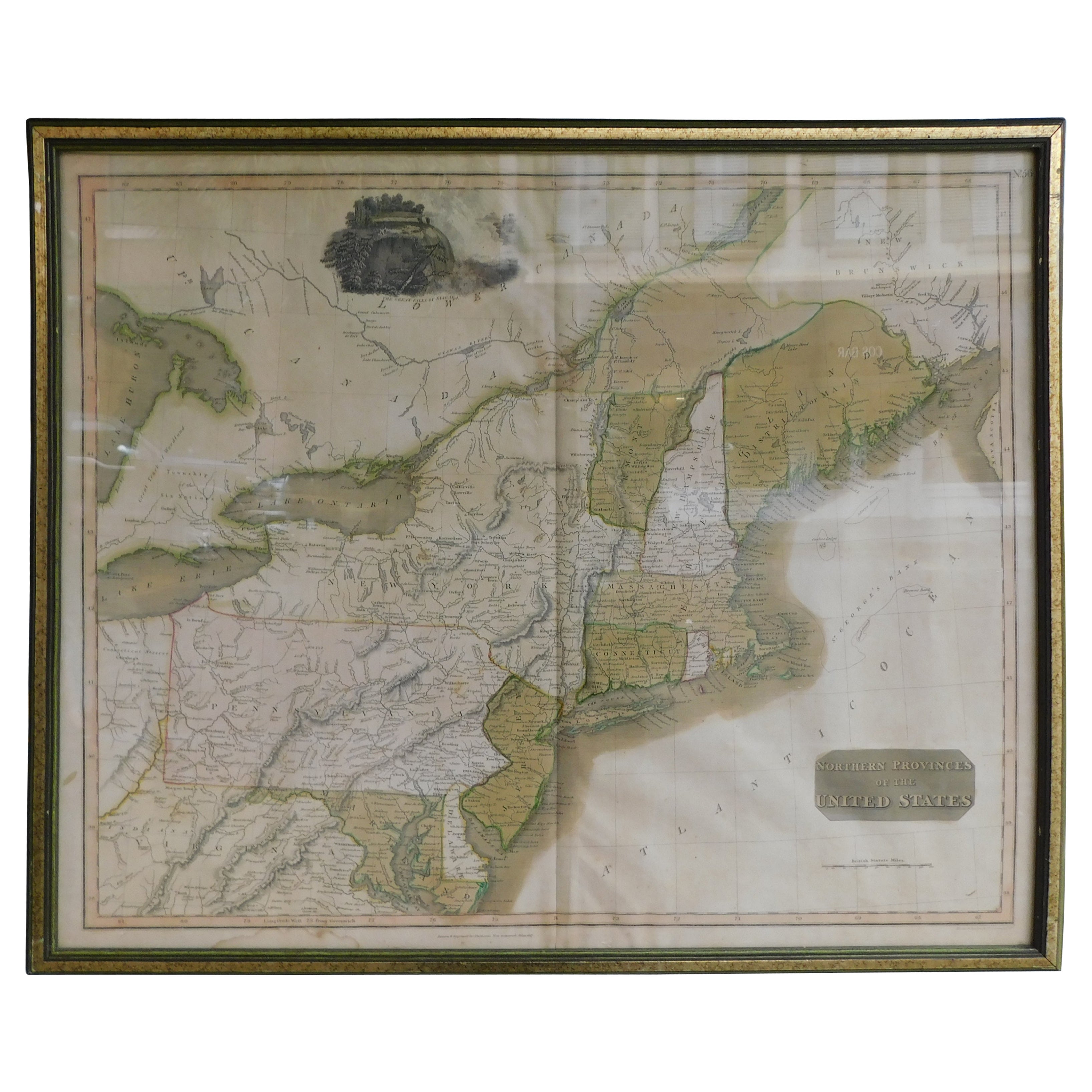
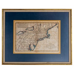
English Engraved Hand Colored Map of the North Eastern United States, circa 1817
Located in Charleston, SC
English copper engraved hand colored map of the North Eastern United States matted under glass in a gilt frame, Early 19th Century. Drawn and Engraved for Thomson's New General Atlas...
Category
Antique 1810s English George III Maps
Materials
Glass, Giltwood, Paint, Paper

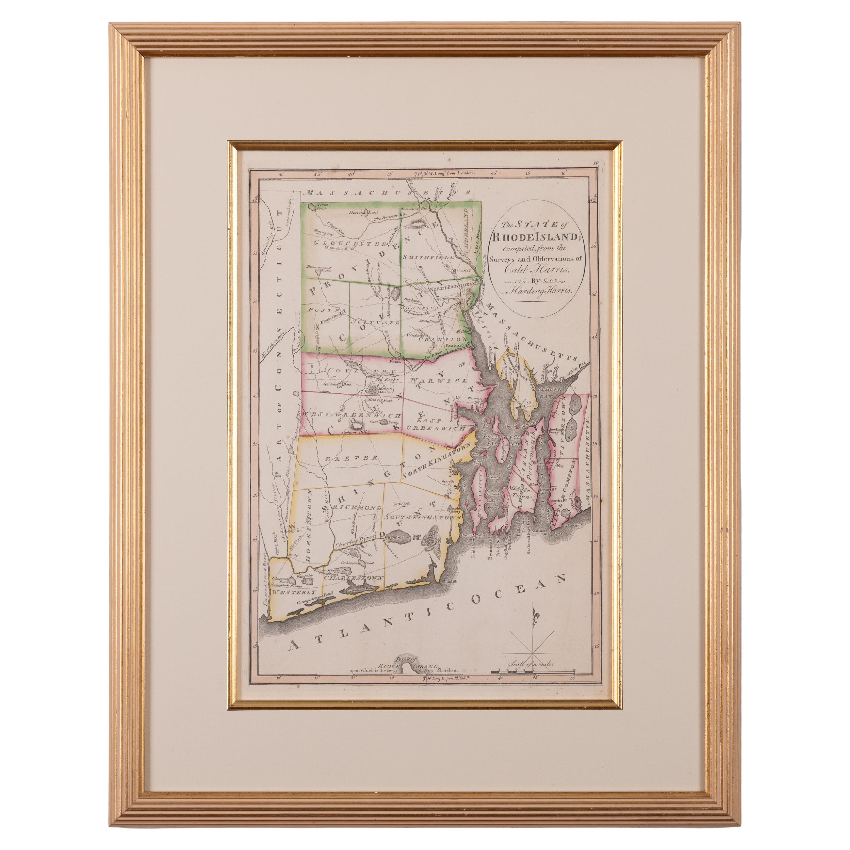
The State of Rhode Island Map - Caleb Harris & Harding Harris, 1818
Located in Savannah, GA
Mathew Carey
(American/Philadelphia, 1760-1839)
The State of Rhode Island compiled from the surveys and observations of Caleb Harris by Harding Harris. Engraving with hand-coloring...
Category
Antique 1810s American Other Prints
Materials
Glass, Wood, Paper
1812 United States Map, by Pierre Tardieu, Antique French Map Depicting the U.S.
By Pierre François Tardieu
Located in Colorado Springs, CO
1812 "United States of Nth America -- Carte des Etats-Unis De L'Amerique Septentrionale" Two-Sheet Map by Tardieu
This attractive map, published in Paris in 1812, is one of the most rare large format maps from the period. It features a view of the East Coast of the U.S. from Maryland to just below South Carolina. Additionally, Ellicott’s plan for the City of Washington D.C. is included at the top right and an illustration of Niagara Falls is shown at the bottom right with a description in both French and English. This extremely detailed map not only depicts the mountainous regions of the southeastern U.S., but also includes names of regions, rivers, and towns.
Based on the first state of Arrowsmith’s 4-sheet map of the United States, this map is completely engraved by Tardieu in Paris and showcases high quality engravings. This detailed map of the recently independent United States includes one of the largest and earliest examples of the Ellicott plan of Washington DC.
The artist, Pierre François Tardieu (PF Tardieu) was a very well-known map engraver, geographer, and illustrator. Awarded a bronze medal by King Louis-Phillipe for the accuracy and beauty of his map-making, Tardieu produced many fine works including maps of Louisiana...
Category
Antique 1810s French Maps
Materials
Paper

1854 Map of Massachusetts, Connecticut and Rhode Island, Antique Wall Map
Located in Colorado Springs, CO
This striking wall map was published in 1854 by Ensign, Bridgman & Fanning and has both full original hand-coloring and original hardware. This impression is both informative and highly decorative.
The states are divided into counties, outlined in red, green, and black, and subdivided into towns. Roads, canals, and railroad lines are prominently depicted, although they are not all labeled. The mapmakers also marked lighthouses, banks, churches, and prominent buildings, with a key at right. The map is an informative and comprehensive overview of the infrastructural development of New England prior to the Civil War. Physical geographies depicted include elevation, conveyed with hachure marks, rivers and lakes. The impression features an inset map of Boston...
Category
Antique 19th Century American Maps
Materials
Paper

More Ways To Browse
Maple Colonial Furniture
Georgian Dressing Table
German Baroque Commode
Gold Flasks
Grandfather Clock Finials
Greek Key Inlay
Moss Bowl
Mystery Box Vintage
Pantry Storage Cabinet
Pendulum Sculpture
Plaster Relief Panel
Pop Art Cabinet
Porcelain Mantle Clocks
Printers Cabinet
Qianlong Bowl
Red Lion Table
Rolling Cabinet Vintage
Roman Marble Plaque