Items Similar to American Election Map and 1960 Presidential Fact Sheet, Published 1960


Want more images or videos?
Request additional images or videos from the seller
1 of 5
American Election Map and 1960 Presidential Fact Sheet, Published 1960
$574.92
$718.6420% Off
£426.04
£532.5520% Off
€480
€60020% Off
CA$784.87
CA$981.0920% Off
A$873.13
A$1,091.4220% Off
CHF 457.71
CHF 572.1320% Off
MX$10,669.48
MX$13,336.8520% Off
NOK 5,828.34
NOK 7,285.4220% Off
SEK 5,486.57
SEK 6,858.2220% Off
DKK 3,654.68
DKK 4,568.3520% Off
Shipping
Retrieving quote...The 1stDibs Promise:
Authenticity Guarantee,
Money-Back Guarantee,
24-Hour Cancellation
About the Item
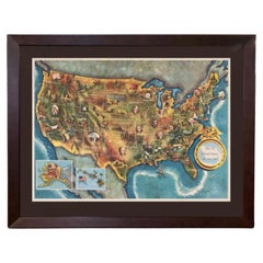
Title: “The 50 United States of America”
Subject: United States, Presidential Elections
Date: 1960 (dated)
Color: Printed Color
Size: 24.9 x 17.9 inches (63.2 x 45.5 cm)
This colorful map of the United States was drawn by Lorin Thompson and published by the General Foods Corporation. The map has an unusual coloring style with symbols of American history including past presidents, Native Americans, important buildings (White House, Statue of Liberty, Alamo), agriculture, industry, and more. Includes inset maps of Hawaii and Alaska with small American flags noting they were the final two states added to the Union. The verso shows a list of past presidents, pictures of the two candidates (Kennedy and Nixon), a 1960 election scoreboard, and a key to the 54 illustrations on the map on recto. Self-folding with cover title "Election Map and 1960 Presidential Fact Sheet...Yours Free with Any Purchase of Gravy Train."Condition:
A clean and colorful example, issued folding.
About the Seller
5.0
Recognized Seller
These prestigious sellers are industry leaders and represent the highest echelon for item quality and design.
Platinum Seller
Premium sellers with a 4.7+ rating and 24-hour response times
Established in 2009
1stDibs seller since 2017
2,494 sales on 1stDibs
Typical response time: 1 hour
- ShippingRetrieving quote...Shipping from: Langweer, Netherlands
- Return Policy
Authenticity Guarantee
In the unlikely event there’s an issue with an item’s authenticity, contact us within 1 year for a full refund. DetailsMoney-Back Guarantee
If your item is not as described, is damaged in transit, or does not arrive, contact us within 7 days for a full refund. Details24-Hour Cancellation
You have a 24-hour grace period in which to reconsider your purchase, with no questions asked.Vetted Professional Sellers
Our world-class sellers must adhere to strict standards for service and quality, maintaining the integrity of our listings.Price-Match Guarantee
If you find that a seller listed the same item for a lower price elsewhere, we’ll match it.Trusted Global Delivery
Our best-in-class carrier network provides specialized shipping options worldwide, including custom delivery.More From This Seller
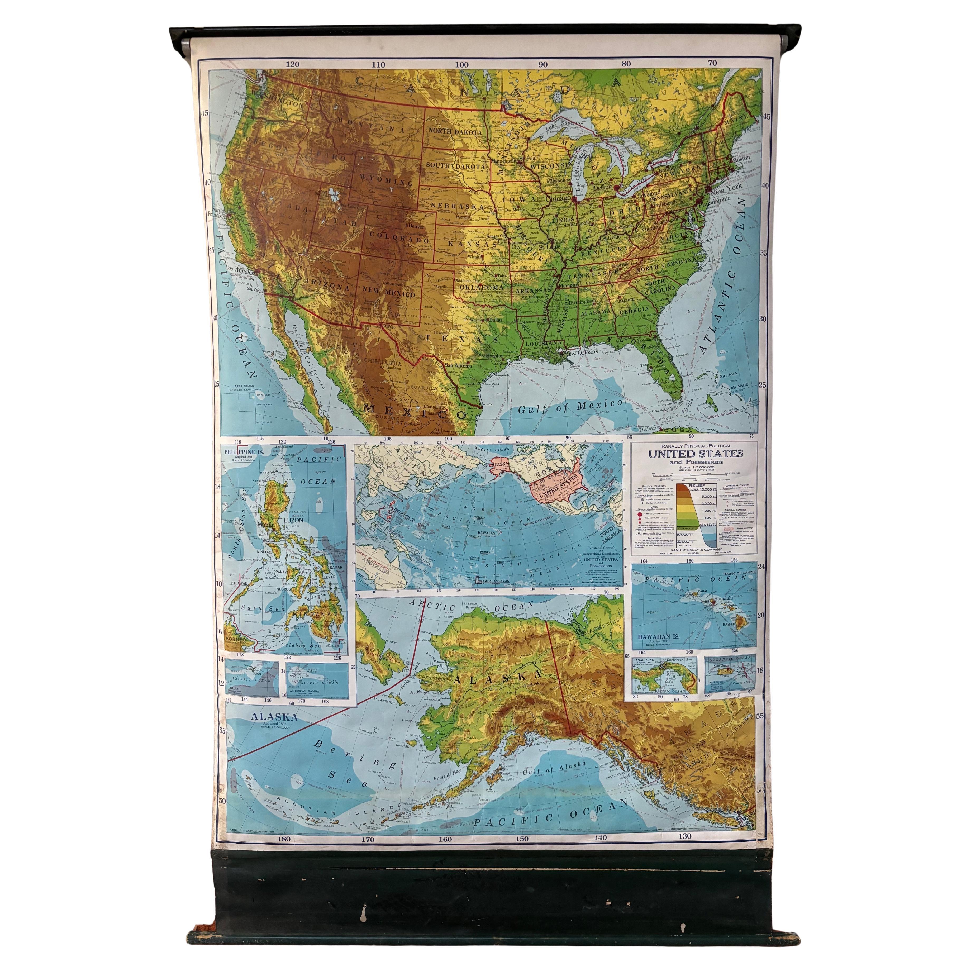
View AllOld Decorative Pictorial Map of the United States, circa 1953
Located in Langweer, NL
Antique map titled 'A Pictorial Map of the United States of America Showing Principal Regional Resources, Products, and Natural Features'.
This information-packed map was create by the General Drafting Company for the New Jersey Bell Telephone Company. The main map features over 700 drawings in full color including points of interest, natural resources, and agricultural products. At bottom are inset maps showing railroad lines, air routes, telephone lines, as well as a pictorial map of New Jersey...
Category
20th Century Maps
Materials
Paper

$718 Sale Price
20% Off
Antique Map Colton's United States of America
Located in Langweer, NL
Antique map titled 'Colton's United States of America'. Show railroads, canals, state capitals, major cities and towns, military posts, historic trails, Pony Express and U.S. mail routes; Dakota [Territory] extending deep into Nebraska, and Idaho [Territory] encompassing [modern day] Montana and Wyoming; Indian Territory...
Category
Antique Mid-19th Century Maps
Materials
Paper
$852 Sale Price
20% Off
Antique Map of the United States with Vignette of Washington
Located in Langweer, NL
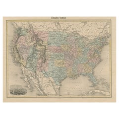
Antique map titled 'États-Unis'. A very attractive and detailed late 19th century map of the United States, with a fine decorative vignette of Washington. The extensive railway netwo...
Category
Antique Late 19th Century Maps
Materials
Paper
$459 Sale Price
20% Off
Antique Map of the United States of North America, c.1882
Located in Langweer, NL
Antique map titled 'United States of North America'. Old map of the United States of North America. This map originates from 'The Royal Atlas of Modern Geography, Exhibiting, in a Se...
Category
Antique 1880s Maps
Materials
Paper

$335 Sale Price
20% Off
Antique Map of the United States ' North East ' by Johnston '1909'
Located in Langweer, NL
Antique map titled 'United States of North America'. Original antique map of United States of North America ( North East ). This map orig...
Category
Early 20th Century Maps
Materials
Paper

$239 Sale Price
20% Off
Antique Map of the United States of America, also showing the Caribbean
Located in Langweer, NL
Antique map titled 'Verein-Staaten von Nord-America, Mexico, Yucatan u.a.'. Very detailed map of the United States of America showing the ...
Category
Antique Mid-19th Century Maps
Materials
Paper

$787 Sale Price
20% Off
You May Also Like
1960 "The 50 United States of America" Pictorial Map by Lorin Thompson
Located in Colorado Springs, CO
This colorful map of the United States was drawn by Lorin Thompson and published by the General Foods Corporation in 1960. The map was issued as a promotional pamphlet in advance of the 1960 presidential election. The cover title for the pamphlet reads: "Election Map and 1960 Presidential Fact Sheet...Yours Free with Any Purchase of Gravy Train."
The map has a unique pictorial style with bright colors and dynamic illustrations celebrating key moments of American history. The map is illustrated with past presidents, Native Americans, depictions of the "Golden Spike...
Category
Vintage 1960s Mid-Century Modern Prints
Materials
Paper
$1,750 Sale Price
22% Off
Vintage Framed United States Map
Located in Queens, NY
Vintage aged paper map of the United States mounted on particle board and framed in a simple wooden frame.
Category
20th Century American Mid-Century Modern Maps
Materials
Wood, Paper

United States 50’s Roll Up Map
Located in Philadelphia, PA
United States Roll Up Map. In nice original condition. Roll-up Function even works! Great Colors! Some losses to edges, canvas backing shows edge wear.
Category
Vintage 1950s American Mid-Century Modern Posters
Materials
Metal
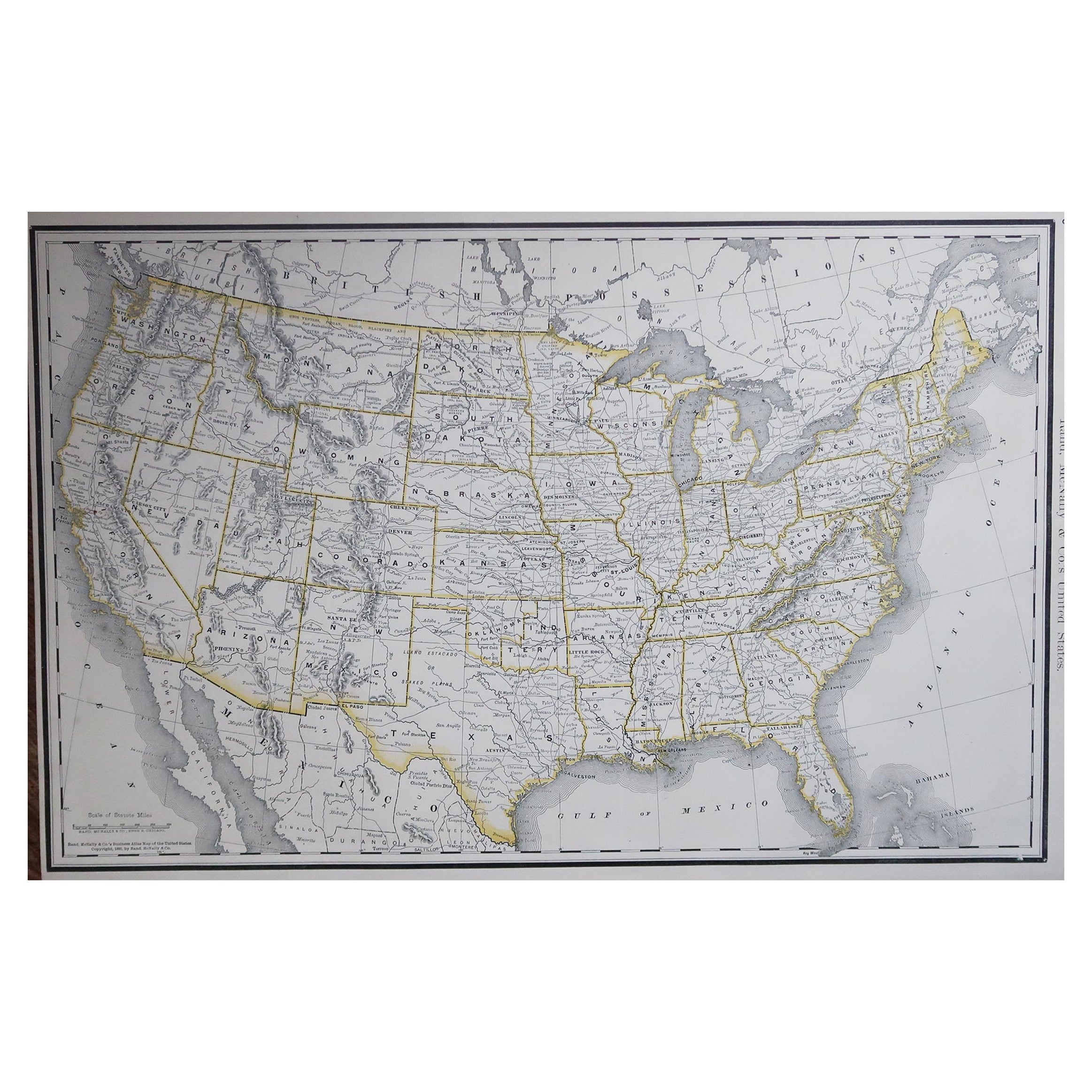
Large Original Antique Map of the United States of America. 1891
By Rand McNally & Co.
Located in St Annes, Lancashire
Fabulous map of The United States
Original color
By Rand, McNally & Co.
Dated 1891
Unframed
Free shipping.
Category
Antique 1890s American Maps
Materials
Paper

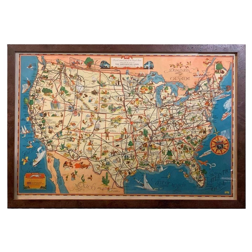
1939 "A Good-Natured Map of the United States" by Greyhound
Located in Colorado Springs, CO
Presented is an original 1939 map, titled “A Good-Natured Map of the United States Setting Forth the Services of the Greyhound Lines and a Few Principal Connecting Bus Lines.” This brightly colored pictographic map was one of several similar United States maps...
Category
Vintage 1930s American Art Deco Maps
Materials
Paper

Large University Chart “Political Map of North America” by Bacon
Located in Godshill, Isle of Wight
Large University Chart “Political Map of North America” by Bacon
W&A K Johnston’s Charts of Physical Maps By G W Bacon,
This is colourful Physical map ...
Category
Early 20th Century American Empire Posters
Materials
Linen

More Ways To Browse
Hawaii Flag
Kennedy Poster
Scoreboard Vintage
Vintage Imperial Airways
Vintage Pan Am Travel Posters
Akira Vintage Poster
Bergman Poster
Boris Bucan Vintage Poster
Disneyland Poster
Guinness Beer
Italian Drink Poster
Medical Chart
My Fair Lady Poster
Orangina Poster Vintage
Orangina Poster
Return Of The Jedi Poster
2001 A Space Odyssey Poster
2001 A Space Odyssey Vintage Poster