Items Similar to Antique Map of the Pyramids of Saqqara and Dahshur – Egypt, c.1770s

Want more images or videos?
Request additional images or videos from the seller
1 of 10
Antique Map of the Pyramids of Saqqara and Dahshur – Egypt, c.1770s
$209.73
£158.18
€180
CA$289.98
A$324.82
CHF 170.61
MX$3,949.73
NOK 2,160.46
SEK 2,050.86
DKK 1,370.28
About the Item
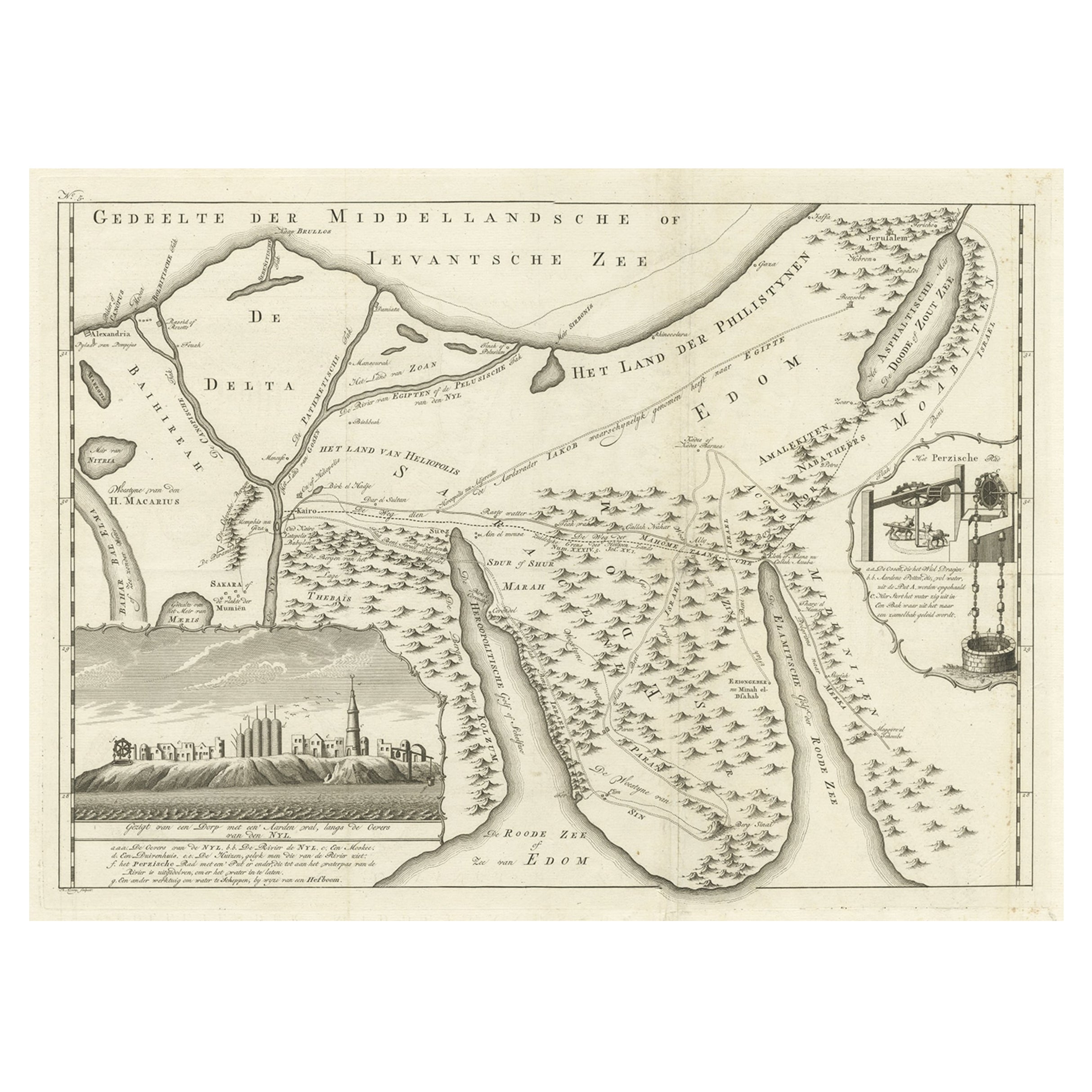
Antique Map of the Pyramids of Saqqara and Dahshur – Egypt, c.1710s
Description:
This rare early 18th-century engraving presents a bird’s-eye topographic plan of the pyramids of Saqqara and Dahshur in Lower Egypt. Titled in Dutch "Grondteekening der Pyramiden van Sakara en Dafhour," this map was created during a period of increasing European interest in ancient Egypt and likely originates from the Dutch edition of Cornelis de Bruijn’s *Reizen door de vermaardste Deelen van Klein Asia*, published in The Hague between 1711 and 1724, but it can also be used in later work.
The image illustrates the desert plateau landscape, with individual pyramids and tombs plotted in a schematic manner and marked with capital letters corresponding to an index (likely in the original text). The map captures not only the pyramids of Saqqara—home to the famous Step Pyramid of Djoser—but also the Red Pyramid and Bent Pyramid of Dahshur, forming part of the great necropolis of Memphis.
The illustration combines cartographic elements with artistic license, with mountainous terrain rendered in soft hachure and the pyramids depicted from an elevated diagonal perspective. The map offers a clear spatial overview of pyramid locations, paths, and surrounding structures, such as temples or ruins, drawn in outline.
Cornelis de Bruijn (1652–1726/27) was a Dutch traveler and artist known for his vivid engravings and pioneering travel literature. His works are among the earliest European attempts to systematically document ancient Egyptian monuments, predating the Napoleonic expeditions by nearly a century.
Condition:
Good condition. Vertical fold lines as issued. Minor wear to the outer margins. Printed area remains clean and crisp with good contrast.
Framing tips:
This print would benefit from a light ivory or sand-colored mat and a slim black or walnut frame. To enhance the historic character, consider a hand-gilded wooden frame or museum glass for archival presentation.
Technique: Copperplate engraving
Maker: After Cornelis de Bruijn, The Netherlands, early 18th century
- Dimensions:Height: 10.63 in (27 cm)Width: 14.77 in (37.5 cm)Depth: 0.01 in (0.2 mm)
- Materials and Techniques:Paper,Engraved
- Place of Origin:
- Period:
- Date of Manufacture:1776
- Condition:Good condition. Vertical fold lines as issued. Minor wear to the outer margins. Printed area remains clean and crisp with good contrast.
- Seller Location:Langweer, NL
- Reference Number:Seller: BG-14102-671stDibs: LU3054346058092
About the Seller
5.0
Recognized Seller
These prestigious sellers are industry leaders and represent the highest echelon for item quality and design.
Platinum Seller
Premium sellers with a 4.7+ rating and 24-hour response times
Established in 2009
1stDibs seller since 2017
2,517 sales on 1stDibs
Typical response time: <1 hour
- ShippingRetrieving quote...Shipping from: Langweer, Netherlands
- Return Policy
Authenticity Guarantee
In the unlikely event there’s an issue with an item’s authenticity, contact us within 1 year for a full refund. DetailsMoney-Back Guarantee
If your item is not as described, is damaged in transit, or does not arrive, contact us within 7 days for a full refund. Details24-Hour Cancellation
You have a 24-hour grace period in which to reconsider your purchase, with no questions asked.Vetted Professional Sellers
Our world-class sellers must adhere to strict standards for service and quality, maintaining the integrity of our listings.Price-Match Guarantee
If you find that a seller listed the same item for a lower price elsewhere, we’ll match it.Trusted Global Delivery
Our best-in-class carrier network provides specialized shipping options worldwide, including custom delivery.More From This Seller
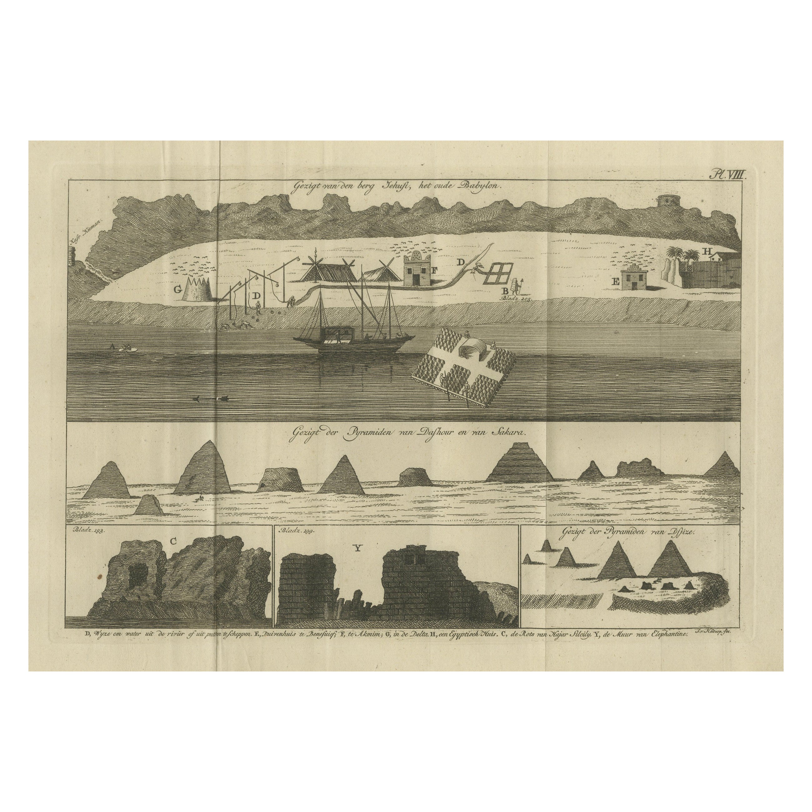
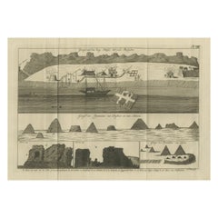
View AllViews of Saqqara, Dahshur, and Thebes Pyramids with Ancient Babylon – c.1710
Located in Langweer, NL
Views of Saqqara, Dahshur, and Thebes Pyramids with Ancient Babylon – c.1710
Description:
This compelling composite engraving from the early 18th century features multiple scenic vi...
Category
Antique Early 18th Century Dutch Prints
Materials
Paper
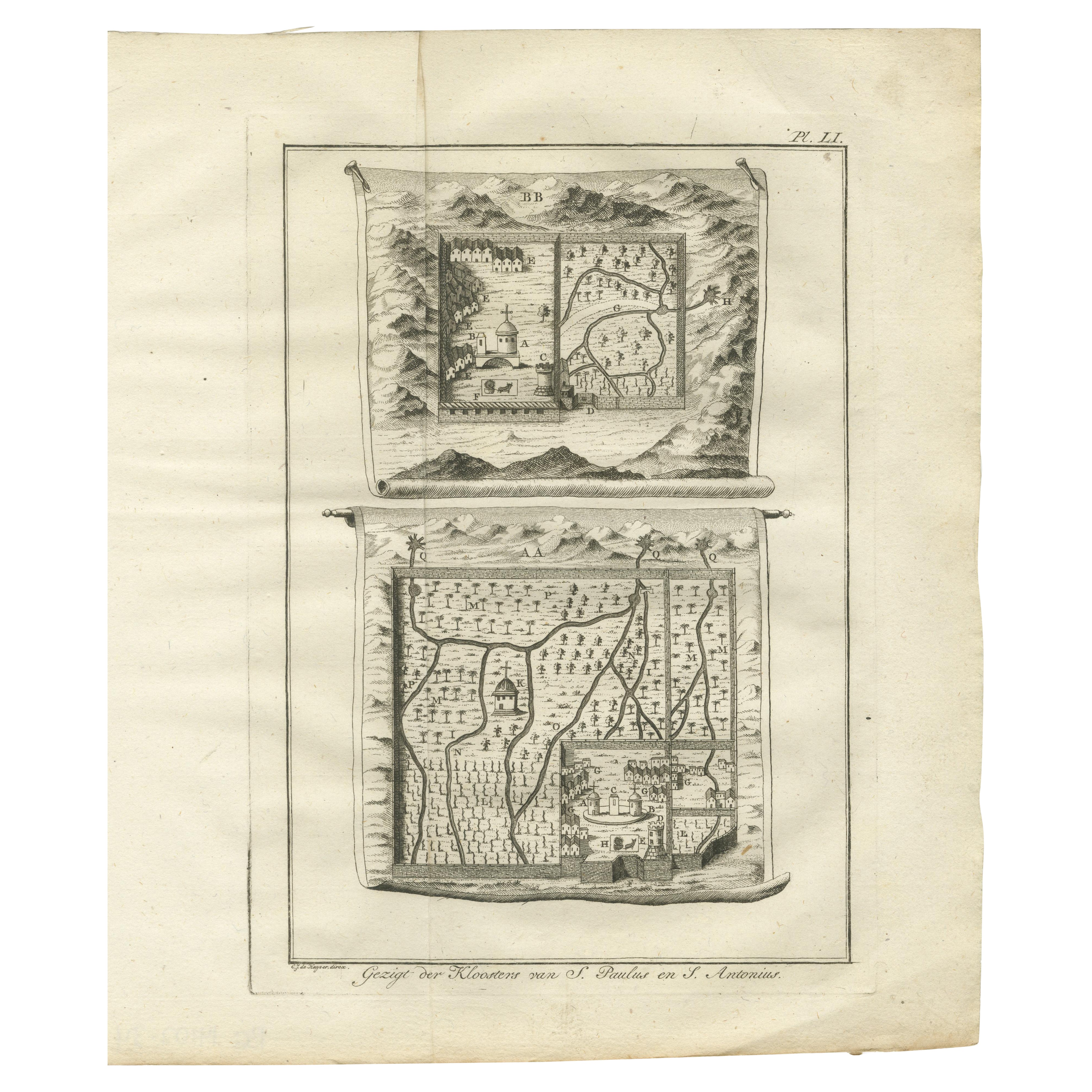
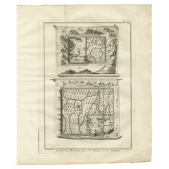
Monastery Maps of St. Paulus and St. Antonius in the Egyptian Desert – c.1776
Located in Langweer, NL
Monastery Maps of St. Paulus and St. Antonius in the Egyptian Desert – c.1776
Description:
This evocative 18th-century engraving depicts stylized maps of two important early Christi...
Category
Antique Late 18th Century Dutch Prints
Materials
Paper
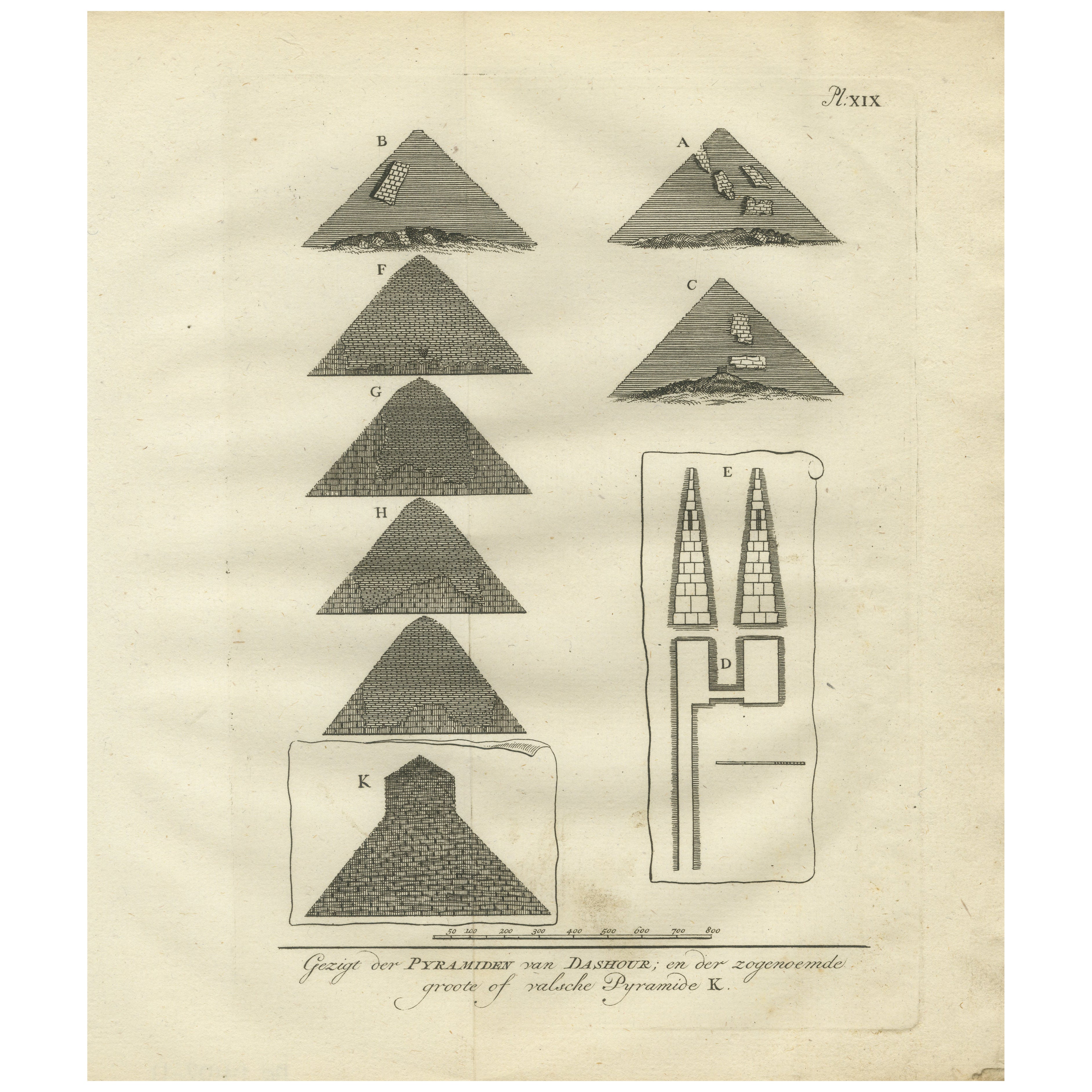
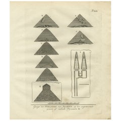
Views of the Pyramids at Dashur and Plan of the False Pyramid – Egypt, 1776
Located in Langweer, NL
Title: Views of the Pyramids at Dashur and Plan of the False Pyramid – Egypt Engraving, 1776
Description:
This original engraving from 1776 features a series of views and architectu...
Category
Antique Late 18th Century Dutch Prints
Materials
Paper
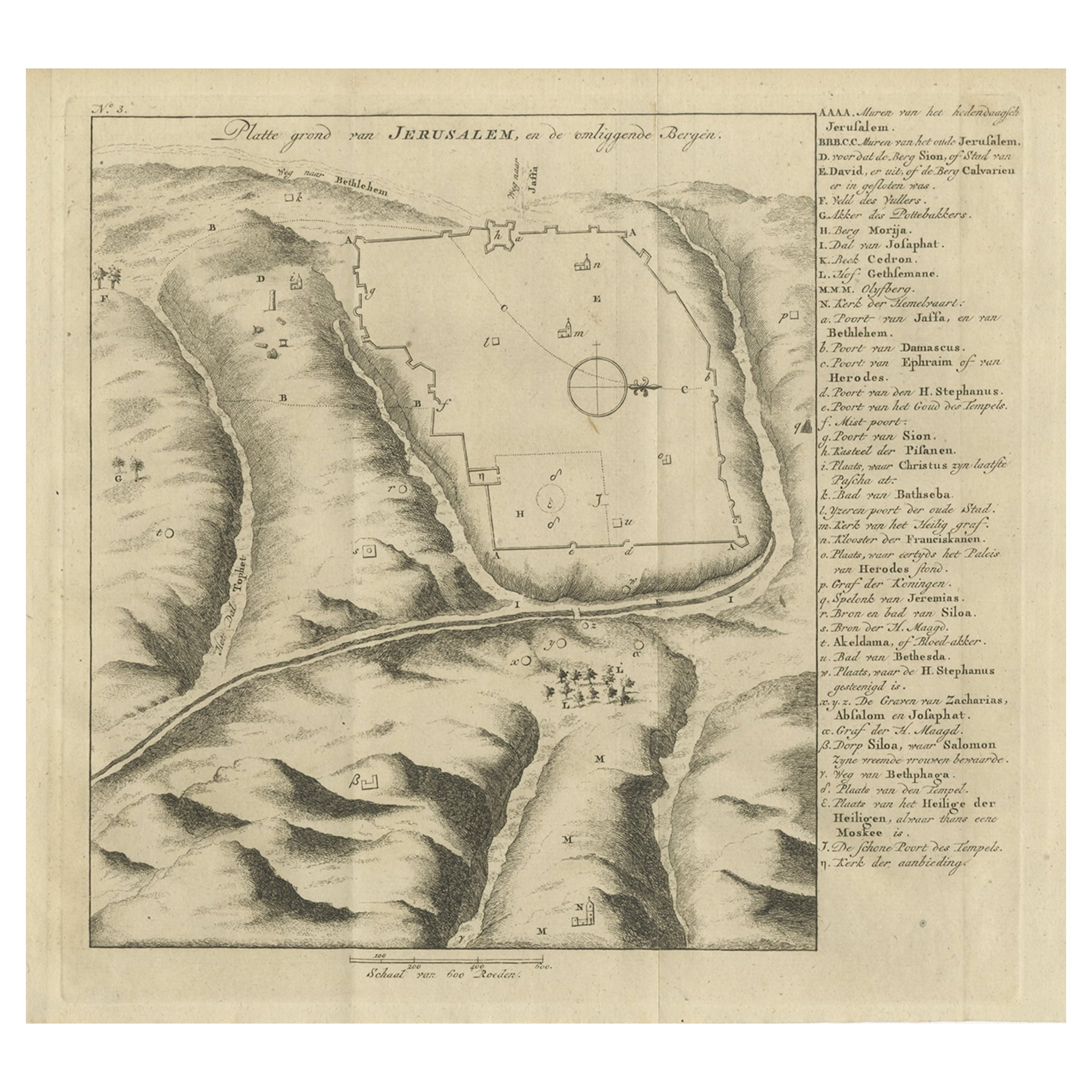
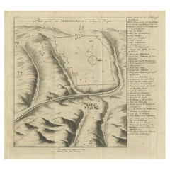
Antique Engraving of a Map or Plan of Jerusalem and Surrounding Mountains, 1773
Located in Langweer, NL
Antique map titled 'Platte grond van Jerusalem, en de omliggende Bergen'. Plan of the city of Jerusalem, with surrounding mountains. Originates from the first Dutch editon of an inte...
Category
Antique 18th Century Maps
Materials
Paper
$251 Sale Price
20% Off
Antique Map of The Nile, Egypt and the Red Sea by Bachiene, 1765
Located in Langweer, NL
Antique map titled 'De XIde Landkaart verbeeldende Egypte en de Woestyne der Schelf-Zee (..).' Map of Biblical Egypt and the Red Sea. With title cartouche, compass rose and scale. Th...
Category
Antique 18th Century Maps
Materials
Paper

$163 Sale Price
20% Off
Old Map of the Sinai Peninsula Showing the Mediterranean and the Red Sea, 1773
Located in Langweer, NL
Antique map of the Sinai Peninsula showing the Mediterranean Sea to the north and the Red Sea to the south.
The map is decorated with images of a Persian wheel and a view of a vi...
Category
Antique 1770s Maps
Materials
Paper

$419 Sale Price
20% Off
You May Also Like
Map of Nubia and Abissinia - Original Etching by Antonio Zatta - 1784
Located in Roma, IT
This Map of Nubia and Abissinia is an etching realized by Antonio Zatta in Venice in 1784.
The state of preservation of the artwork is good expect for the worn paper with some littl...
Category
1770s Landscape Prints
Materials
Etching

17th-18th Century Siege of Graves Mapping Engraving By Willian III
Located in Kingston, NY
RARE French 17th-18th Century Enhanced Siege of Graves Mapping Engraving BY William III, also widely known as William of Orange,
The Siege of Grave in Dutch Brabant started by Monsie...
Category
Antique 17th Century French Prints
Materials
Paper

Original Antique Map of Ancient Greece- Boeotia, Thebes, 1787
Located in St Annes, Lancashire
Great map of Ancient Greece. Showing the region of Boeotia, including Thebes
Drawn by J.D. Barbie Du Bocage
Copper plate engraving by P.F T...
Category
Antique 1780s French Other Maps
Materials
Paper

Late 18th Century First Edition Print 'Description de L'Egypt'
Located in Gloucestershire, GB
Wonderful illustrations from Egyptian tombs obtained during the late 18th Century French expedition to Egypt under Napoleon Bonaparte.
After Napoleon conquered Egypt in the early 18...
Category
Antique 19th Century French Prints
Materials
Paper
17th Century Topographical Map of Cote D'azur, Avignon, Frejus by Iohan Peeters
Located in New York, NY
Fine topographical 17th century map by Iohan Peeters of the towns of Avignon and Frejus in the Cote d'Azur-Provence-Alpes Region of Southeastern France.
Beautifully suited decorativ...
Category
Antique 17th Century Dutch Maps
Materials
Paper

17th Century Topographical Map, Champagne-Ardenne, Marsal, Maubert Iohan Peeters
Located in New York, NY
Fine topographical 17th century map by Iohan Peeters of Marsal and Maubert Fontaine in the Champagne-Ardennes Region of North Eastern France.
Fabulous period engraving for a Wine Ce...
Category
Antique 17th Century Dutch Maps
Materials
Paper
