Items Similar to Antique Print of Cape or Cabo Verde, Africa, c.1750

Want more images or videos?
Request additional images or videos from the seller
1 of 6
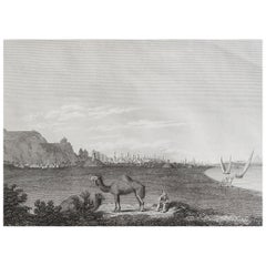
Antique Print of Cape or Cabo Verde, Africa, c.1750
$151.18
$188.9720% Off
£113.81
£142.2620% Off
€128
€16020% Off
CA$208.25
CA$260.3220% Off
A$233.23
A$291.5420% Off
CHF 121.70
CHF 152.1220% Off
MX$2,848.82
MX$3,561.0220% Off
NOK 1,548.33
NOK 1,935.4120% Off
SEK 1,459.49
SEK 1,824.3620% Off
DKK 974.35
DKK 1,217.9420% Off
About the Item
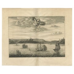
Antique print titled 'Gezigt van Kabo Verde' and 'Zydelings Gezigt van Kabo Verde'. Old print of Cabo Verde with a double view of the island coast. Engraved by J. van Schley for a Dutch edition of 'l'Histoire Generale des Voyages', by Antoine François Prévost (the Abbé Prévost).
Artists and Engravers: Jakob van der Schley (Amsterdam 1715-1779) was a Dutch draughtsman and engraver. He studied under Bernard Picart and became heavily influenced by his style.
Condition: Very good, general age-related toning. Please study image carefully.
Date: c.1750
Overall size: 19.7 x 25.4 cm.
Image size: 13.7 x 19.5 cm.
We sell original antique maps to collectors, historians, educators and interior decorators all over the world. Our collection includes a wide range of authentic antique maps from the 16th to the 20th centuries. Buying and collecting antique maps is a tradition that goes back hundreds of years. Antique maps have proved a richly rewarding investment over the past decade, thanks to a growing appreciation of their unique historical appeal. Today the decorative qualities of antique maps are widely recognized by interior designers who appreciate their beauty and design flexibility. Depending on the individual map, presentation, and context, a rare or antique map can be modern, traditional, abstract, figurative, serious or whimsical. We offer a wide range of authentic antique maps for any budget.
- Creator:Jakob van der Schley (Artist)
- Dimensions:Height: 10.01 in (25.4 cm)Width: 7.76 in (19.7 cm)Depth: 0 in (0.01 mm)
- Materials and Techniques:
- Period:
- Date of Manufacture:circa 1750
- Condition:Condition: Very good, general age-related toning. Please study image carefully.
- Seller Location:Langweer, NL
- Reference Number:Seller: CD-122881stDibs: LU3054329363332
About the Seller
5.0
Recognized Seller
These prestigious sellers are industry leaders and represent the highest echelon for item quality and design.
Platinum Seller
Premium sellers with a 4.7+ rating and 24-hour response times
Established in 2009
1stDibs seller since 2017
2,533 sales on 1stDibs
Typical response time: <1 hour
- ShippingRetrieving quote...Shipping from: Langweer, Netherlands
- Return Policy
Authenticity Guarantee
In the unlikely event there’s an issue with an item’s authenticity, contact us within 1 year for a full refund. DetailsMoney-Back Guarantee
If your item is not as described, is damaged in transit, or does not arrive, contact us within 7 days for a full refund. Details24-Hour Cancellation
You have a 24-hour grace period in which to reconsider your purchase, with no questions asked.Vetted Professional Sellers
Our world-class sellers must adhere to strict standards for service and quality, maintaining the integrity of our listings.Price-Match Guarantee
If you find that a seller listed the same item for a lower price elsewhere, we’ll match it.Trusted Global Delivery
Our best-in-class carrier network provides specialized shipping options worldwide, including custom delivery.More From This Seller
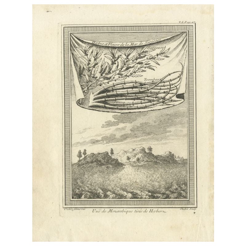
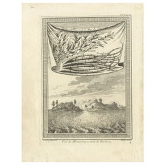
View AllAntique Print of Mozambique and the Sargasso Sea, Africa, circa 1746
Located in Langweer, NL
Antique print titled 'Vue de Mozanbique tirée de Herbert'. Copper engraving with a view on Mozambique. Also shows herbs and flowers of the Sargasso Sea. This print originates from 'H...
Category
Antique 18th Century Prints
Materials
Paper
$103 Sale Price
20% Off
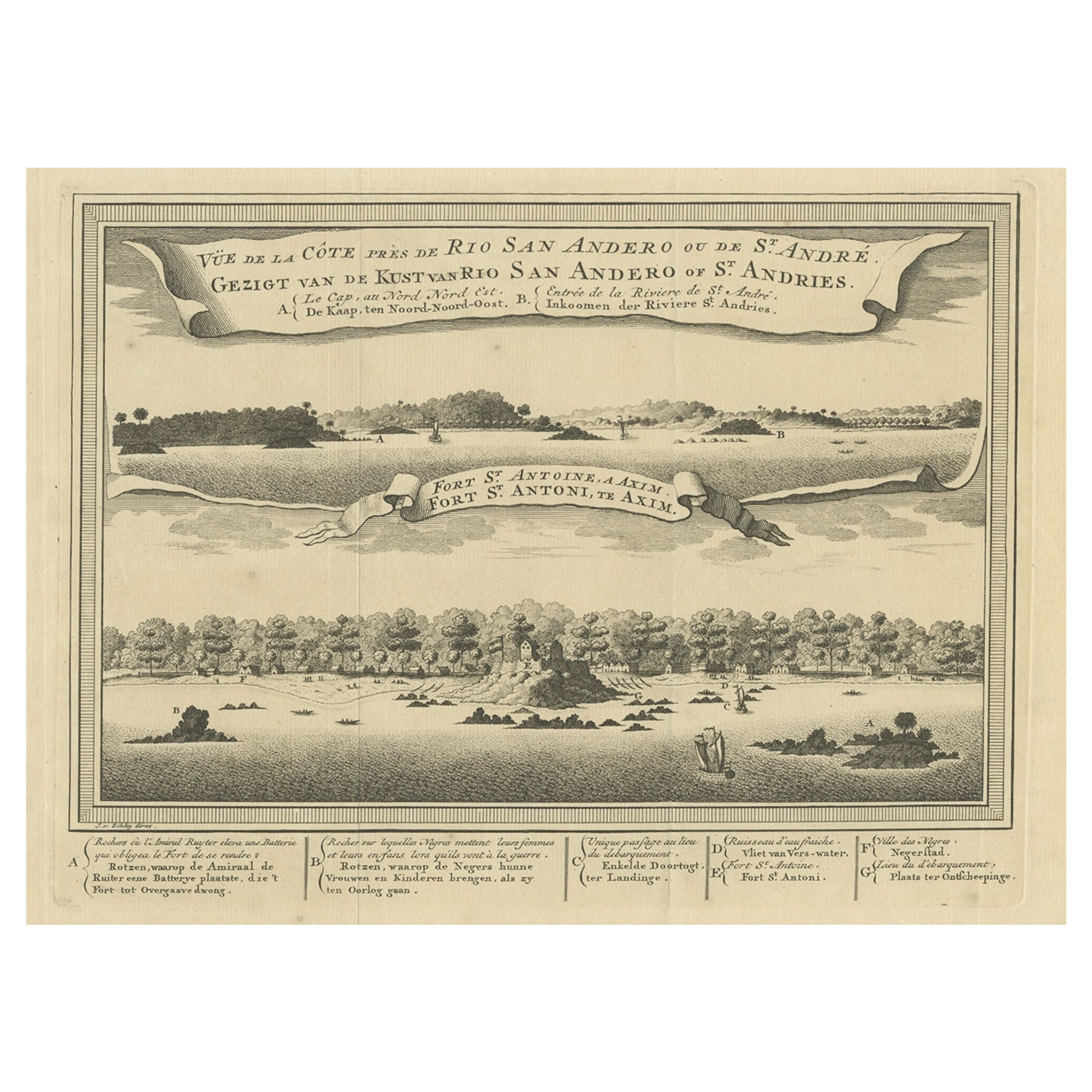
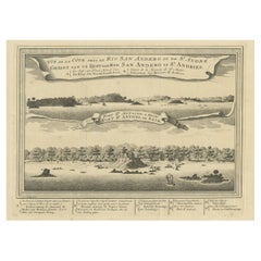
Antique Print of a Fort on the Ivory Coast and Axim, Africa, 1748
By Jakob van der Schley
Located in Langweer, NL
Antique print titled 'Vue de la Cote pres de Rio San Andero - Gezigt van de Kust van Rio San Andero' and 'Fort St. Antoine a Axim - Fort St. Antoni, te Axim'. View of the Ivory coast...
Category
Antique 18th Century Prints
Materials
Paper
$274 Sale Price
20% Off
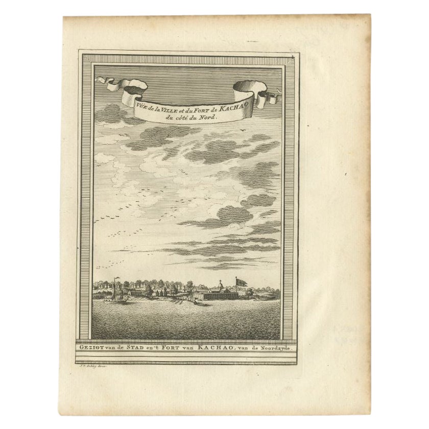
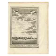
Antique Print of the City and Fortress of Kachao in Guinea Bissau, Africa, 1747
By Jakob van der Schley
Located in Langweer, NL
Antique print titled 'Gezigt van de Stad en 't Fort van Kachao'. View of the city and Fortress of Kachao, Guinea Bissau, Africa. Engraved by J. van Schley for a Dutch edition of 'l'H...
Category
Antique 18th Century Prints
Materials
Paper
$217 Sale Price
20% Off
Antique Print of the 'African Continent' by Wagner, circa 1745
Located in Langweer, NL
Antique print representing the continent 'Africa'. Shows two Africans and a crocodile. In the background three Africans near a hammock. This print is made after Jacopo Amigoni...
Category
Antique Mid-18th Century Prints
Materials
Paper
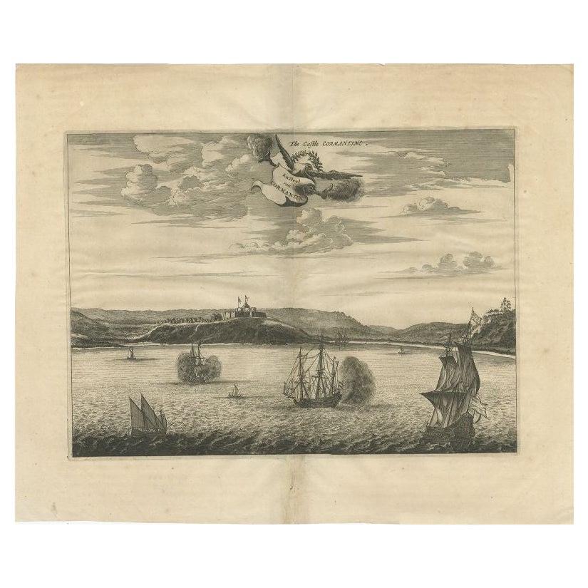
Antique Print of a Fort on the Gold Coast of Africa by Dapper, c.1670
Located in Langweer, NL
`Antique print titled 'Kasteel van Cormantin/The castle Cormantine'. Fine engraving depicting one of the forts on the Gold Coast of Africa. Cormantine Castle first was a British fort...
Category
Antique 17th Century Prints
Materials
Paper
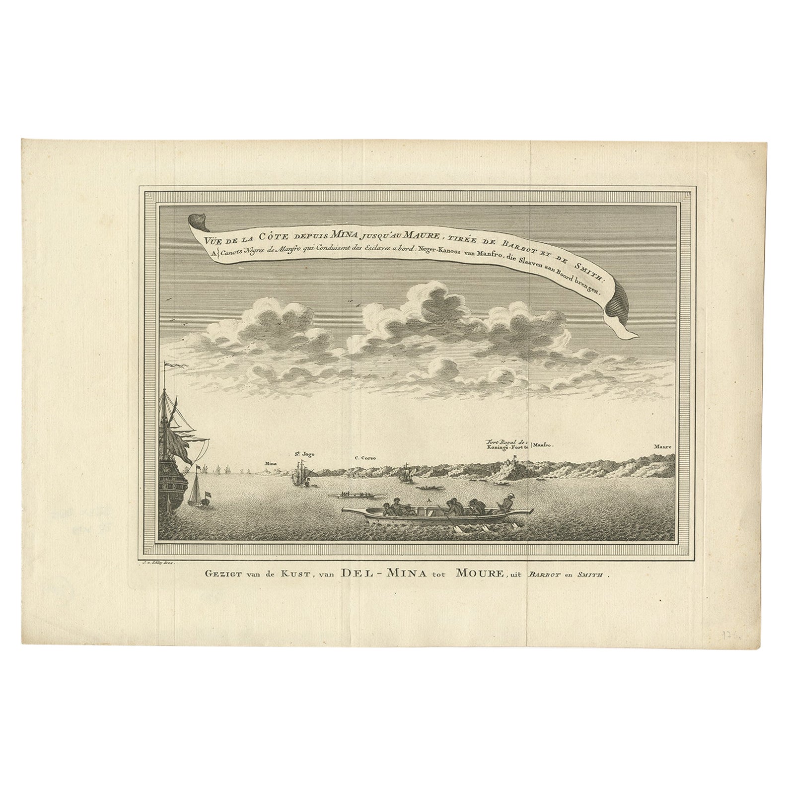
Antique Print of the Coast from Elmina to Moree, West-Africa, 1748
Located in Langweer, NL
Antique print titled 'Vue de la Côte depuis Mina jusquáu Maure - Gezigt van de Kust, van Del-Mina tot Moure'. View of the coast from Elmina to Moree. This print originates from 'Hist...
Category
Antique 18th Century Prints
Materials
Paper
$207 Sale Price
20% Off
You May Also Like
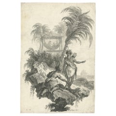
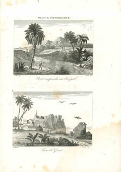
Views of Senegal - Original Lithograph - 19th century
Located in Roma, IT
Views of Senegal is an original lithograph artwork realized by an Anonymous engraver of the 19th century.
Printed in the series of "France Pittoresque".
Titled "France Pittoresqu...
Category
19th Century Modern Figurative Prints
Materials
Lithograph
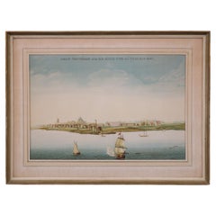
Very Large Hand-Drawn View of St Iago Cape Verde, by Frederici, 1783
Located in Amsterdam, NL
Johann Christian Friderici [= Frederici] (Heldburg 1766 - Cape Town 1804)
Prospect van het eyland, en de rheede van St. Iago. Geteekend van Johann Christian Friderici / Verbeelding van de inwoonders op St Iago
(View of the island, and the roadstead of St. Iago. Drawn by Johann Christian Friderci / Depiction of the inhabitants on St Iago)
?Porto Praia, Cape Verde...
Category
Antique Late 18th Century Cape Verdean Dutch Colonial Maps
Materials
Paper

Original Antique Print of Cairo, Egypt. Dated 1809
Located in St Annes, Lancashire
Wonderful image of Cairo
Fine copper-plate engraving
Published by Sherwood & Co.
Dated 1809
Unframed.
Free shipping
Category
Antique Early 1800s English Moorish Prints
Materials
Paper
Lithograph View on Nieuw Amsterdam J . Vingboons 1660s
Located in Den Haag, NL
Afther a gouache by J Vingboons 1660s Beautiful Lithograph from 1910/20
Nieuw Amsterdam ofte nue nieuw Lorx opt Teyland Man .
Very nice fresh colors . Comes with a old label on the...
Category
Antique 1650s Dutch American Colonial Prints
Materials
Paper
Engraving Print from the Panckoucke Encyclopédie Nautical Subject 1782-1832
Located in Milan, IT
Print by engraving on copper plate from the Panckoucke Encyclopédie méthodique, end of the 18th century,volume Marine Planches (more than 1,500 figures dealing with all subjects on the marina: planes, construction, carpentry, tree trunks, armaments of maneuvers, ropes, sails, artillery, ship maneuvers and combat tactics). This is the plate no. n. 24, pag. 69 fig. 341 ; with frame cm 38.3 x 31.5. Ship ropes are depicted. The Print has the "Benard direxit...
Category
Antique 1790s French Nautical Objects
Materials
Paper
Original Antique Print After Jan Luyken, Amsterdam, Genesis XXXI, 1724
Located in St Annes, Lancashire
Wonderful copper-plate engraving after Jan Luyken
Published by Marten Schagen, Amsterdam. 1724
Text on verso
The measurement given is the paper size.
Category
Antique 1720s Dutch Renaissance Prints
Materials
Paper
More Ways To Browse
American Iron Bed
Antique Cabin Decor
Antique Calendar Plates
Antique Double Bed Frame
Antique Enamel Kitchen Cabinets
Antique Hotel Key
Antique Ironstone Bowls
Antique Japanese Cast Iron
Antique Keyhole Cover
Antique Last Supper
Antique Mahogany Serving Tray
Antique Painted Writing Bureau
Antique Queen Bed Headboard
Antique Silver Chocolate Pot
Antique Soda
Antique Staffordshire Dogs
Antique Swedish Bureau
Antique Wood Bull