Items Similar to Antique Print with a Plan of Kunta Kinteh Island and views of Fort James, Gambia

Want more images or videos?
Request additional images or videos from the seller
1 of 6
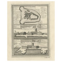
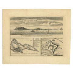
Antique Print with a Plan of Kunta Kinteh Island and views of Fort James, Gambia
$207.44
$259.3020% Off
£156.24
£195.3020% Off
€176
€22020% Off
CA$286.07
CA$357.5820% Off
A$321.38
A$401.7320% Off
CHF 167.92
CHF 209.9020% Off
MX$3,922.61
MX$4,903.2720% Off
NOK 2,132.12
NOK 2,665.1520% Off
SEK 2,006.95
SEK 2,508.6820% Off
DKK 1,339.65
DKK 1,674.5620% Off
About the Item
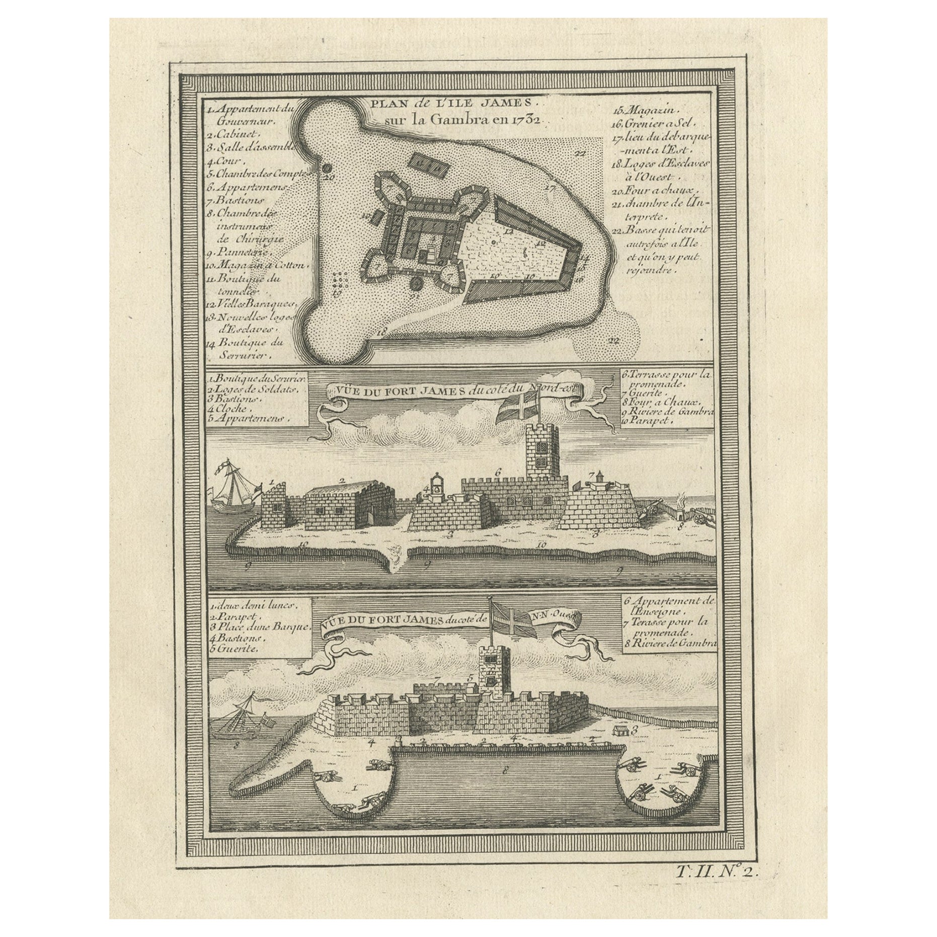
Antique print titled 'Plan of Iames Island in the Gambia - N.E. Prospect of Iames Fort - N.N.W. Prospect of Iames Fort'. Print with a plan of Kunta Kinteh Island on the Gambia River in 1732 - View of Fort James from the north east - View of Fort James from the NNW. Kunta Kinteh Island, formerly called James Island and St Andrew's Island, is an island in the Gambia River. As an important historical site in the West African slave trade, it is listed as a UNESCO World Heritage Site.
Source unknown, to be determined. Published circa 1760.
- Dimensions:Height: 14.1 in (35.8 cm)Width: 9.02 in (22.9 cm)Depth: 0.02 in (0.5 mm)
- Materials and Techniques:Paper,Engraved
- Period:
- Date of Manufacture:circa 1760
- Condition:Wear consistent with age and use. General age-relatedtoning. Shows some wear and foxing, blank verso. Please study image carefully.
- Seller Location:Langweer, NL
- Reference Number:Seller: BG-13188-41stDibs: LU3054331132952
About the Seller
5.0
Recognized Seller
These prestigious sellers are industry leaders and represent the highest echelon for item quality and design.
Platinum Seller
Premium sellers with a 4.7+ rating and 24-hour response times
Established in 2009
1stDibs seller since 2017
2,533 sales on 1stDibs
Typical response time: <1 hour
- ShippingRetrieving quote...Shipping from: Langweer, Netherlands
- Return Policy
Authenticity Guarantee
In the unlikely event there’s an issue with an item’s authenticity, contact us within 1 year for a full refund. DetailsMoney-Back Guarantee
If your item is not as described, is damaged in transit, or does not arrive, contact us within 7 days for a full refund. Details24-Hour Cancellation
You have a 24-hour grace period in which to reconsider your purchase, with no questions asked.Vetted Professional Sellers
Our world-class sellers must adhere to strict standards for service and quality, maintaining the integrity of our listings.Price-Match Guarantee
If you find that a seller listed the same item for a lower price elsewhere, we’ll match it.Trusted Global Delivery
Our best-in-class carrier network provides specialized shipping options worldwide, including custom delivery.More From This Seller
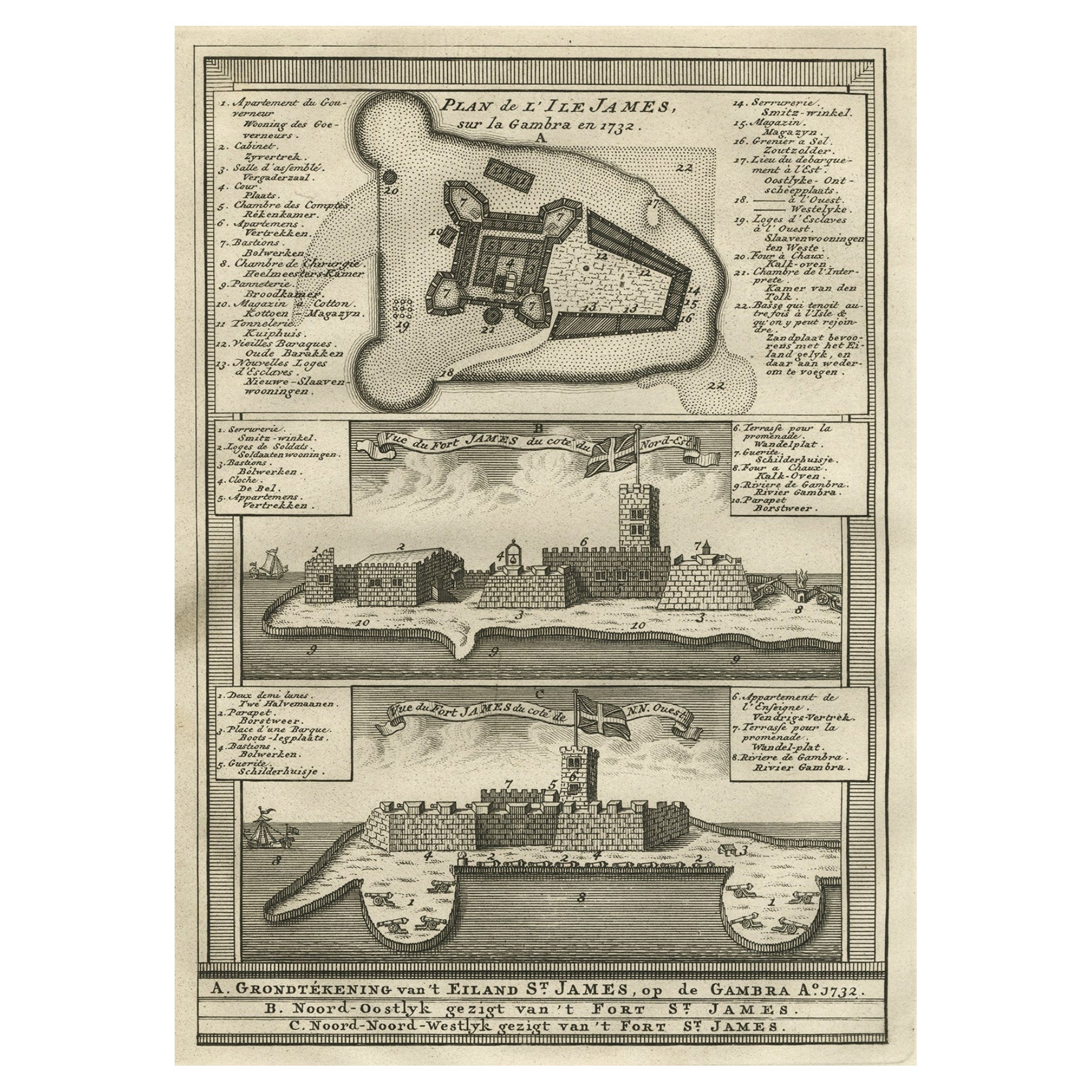
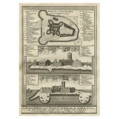
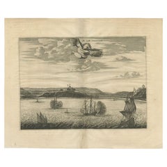
View AllOld Print of Fort James on Kunta Kinteh Island on the Gambia River, Africa, 1746
Located in Langweer, NL
Antique print titled 'Plan de l’lle James sur la Gambra en 1732, Vue de Fort James du côte du Nord-Est, Vue de Fort James du côte de N.N. Ouest'.
Old print of Kunta Kinteh Island on the Gambia...
Category
Antique 1740s Maps
Materials
Paper
$169 Sale Price
20% Off
Old Copperplate Engraving of Fort St. James on the Gambra River, Africa, c.1760
Located in Langweer, NL
Plan de l’Isle James sur la Gambra en 1732 (…).
Copperplate engraving/etching on Hand laid (Verge) paper.
Sheet size: 19,7 x 26,7 cm. Image size: 13,8 x 19,8 cm.
From vol. 3 o...
Category
Antique 1760s Maps
Materials
Paper
$150 Sale Price
20% Off
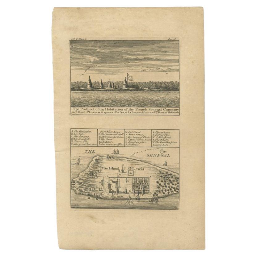
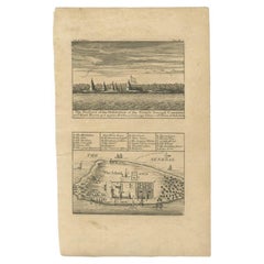
Antique Plan and View of Saint-Louis, Senegal, Africa, 1746
Located in Langweer, NL
Antique print titled ‘The Prospect of the Habitation of the French Senegal Company’. Plan and view of Saint-Louis, Senegal, Africa. This print originates from 'A Collection of Voyage...
Category
Antique 18th Century Prints
Materials
Paper
$282 Sale Price
20% Off
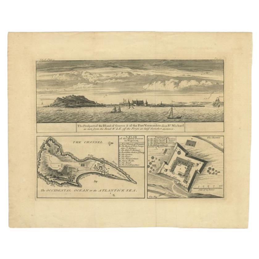
Antique Plan and Views of Gorée Island, Dakar, Senegal, 1746
Located in Langweer, NL
Antique print titled 'The Prospect of the Island of Goeree & The Fort Vermandois alias St. Michael (..)’. Plan and view of Gorée Island, Dakar, Senegal. This print originates from 'A...
Category
Antique 18th Century Prints
Materials
Paper
$339 Sale Price
20% Off
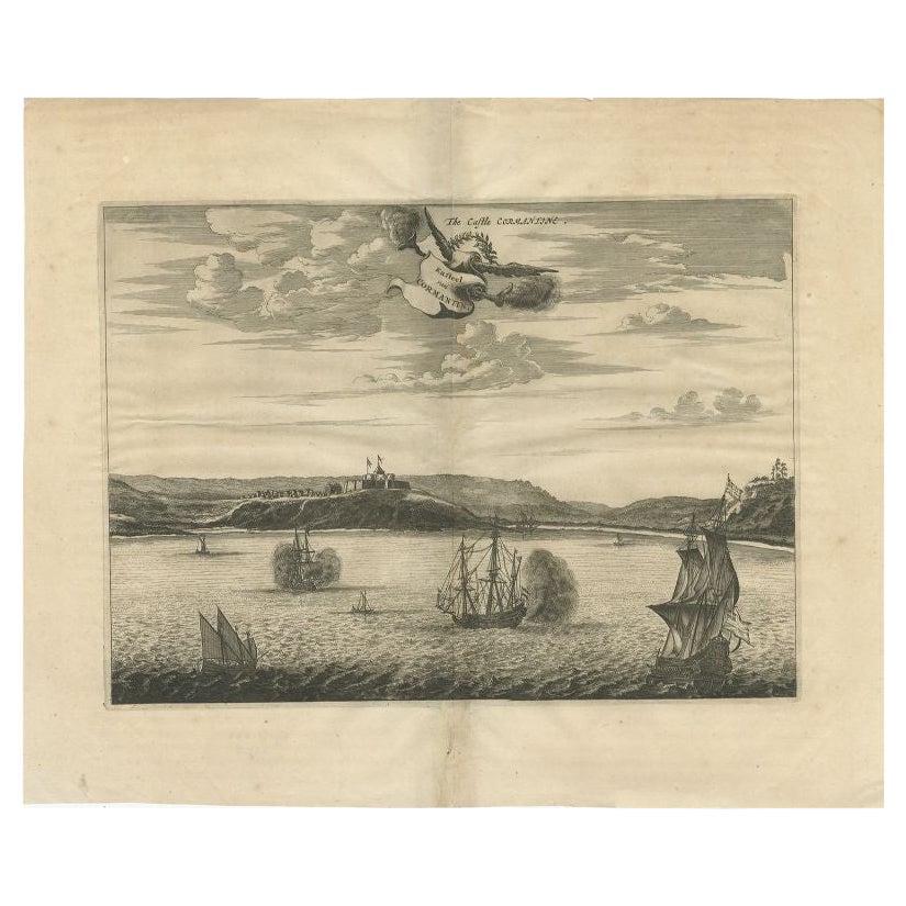
Antique Print of a Fort on the Gold Coast of Africa by Dapper, c.1670
Located in Langweer, NL
`Antique print titled 'Kasteel van Cormantin/The castle Cormantine'. Fine engraving depicting one of the forts on the Gold Coast of Africa. Cormantine Castle first was a British fort...
Category
Antique 17th Century Prints
Materials
Paper
Antique Map of Gorée Island ‘Senegal’ by J.N. Bellin, 1764
Located in Langweer, NL
Nautical antique chart of Gorée Senegal including a letter key to the island's fortifications. Gorée is known as the location of the House of Slaves built by an Afro-French Métis fam...
Category
Antique Mid-18th Century Maps
Materials
Paper

$306 Sale Price
20% Off
You May Also Like
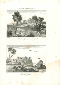
Ancient Map of Senegal - Original Etching - 19th Century
Located in Roma, IT
Map of Senegal is an original etching realized by an anonymous engraver of the 19th Century.
Printed in series of "France Pittoresque" at the top center.
The state of preservation ...
Category
19th Century Figurative Prints
Materials
Etching

Views of Senegal - Original Lithograph - 19th century
Located in Roma, IT
Views of Senegal is an original lithograph artwork realized by an Anonymous engraver of the 19th century.
Printed in the series of "France Pittoresque".
Titled "France Pittoresqu...
Category
19th Century Modern Figurative Prints
Materials
Lithograph
Antique Voc Print Holland Malaysia Old Map Melaka History, 1663
Located in Amsterdam, Noord Holland
From my own collection I offer this impressive Antique print of the city of Malakka
A very interesting piece for collectors . It is an museum piece from the Dutch Institute of Orien...
Category
Antique 17th Century European Paintings
Materials
Paper

$293 Sale Price
20% Off
17th-18th Century Siege of Graves Mapping Engraving By Willian III
Located in Kingston, NY
RARE French 17th-18th Century Enhanced Siege of Graves Mapping Engraving BY William III, also widely known as William of Orange,
The Siege of Grave in Dutch Brabant started by Monsie...
Category
Antique 17th Century French Prints
Materials
Paper

Map of Nubia and Abissinia - Original Etching by Antonio Zatta - 1784
Located in Roma, IT
This Map of Nubia and Abissinia is an etching realized by Antonio Zatta in Venice in 1784.
The state of preservation of the artwork is good expect for the worn paper with some littl...
Category
1770s Landscape Prints
Materials
Etching

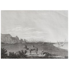
Original Antique Print of Cairo, Egypt. Dated 1809
Located in St Annes, Lancashire
Wonderful image of Cairo
Fine copper-plate engraving
Published by Sherwood & Co.
Dated 1809
Unframed.
Free shipping
Category
Antique Early 1800s English Moorish Prints
Materials
Paper
More Ways To Browse
Adam Court
Antique Bleached Oak Cabinet
Antique Cast Iron Lions Head
Antique Copper Australia
Antique Counterweights
Antique Feather Fan
Antique Fifes
Antique Figurine Clock
Antique Hasp Lock
Antique Horse Stirrups
Antique Ivory Beads
Antique Kangxi Bowl
Antique Lignum Vitae
Antique Limoges Porcelain Boxes
Antique Map Cabinet
Antique Mill Stone
Antique Pipe Box
Antique Porcelain Dolls