Items Similar to Antique Print of Various Island in French Polynesia, circa 1774
Want more images or videos?
Request additional images or videos from the seller
1 of 6
Antique Print of Various Island in French Polynesia, circa 1774
$228.44
$285.5520% Off
£170.99
£213.7320% Off
€192
€24020% Off
CA$313.77
CA$392.2120% Off
A$350.83
A$438.5420% Off
CHF 184.02
CHF 230.0320% Off
MX$4,249.38
MX$5,311.7320% Off
NOK 2,322.95
NOK 2,903.6820% Off
SEK 2,194.62
SEK 2,743.2820% Off
DKK 1,461.75
DKK 1,827.1920% Off
About the Item
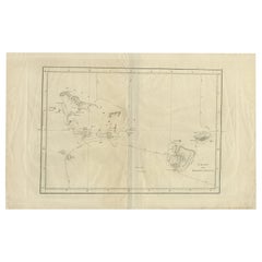
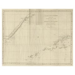
Two antique maps on one sheet titled 'Havre d'Ohamaneno a Ulietea' and Havre d'Oopoa a Ulietea'. Also with German subtitles. The upper image depicts Ohamaneno (Vaiaau) Harbour Raiatea (Ulietea) - Leeward Islands. The lower image depicts Oopoa (Opoa) Harbour, Raiatea (Ulietea) - Leeward Islands. Both located in French Polynesia, South Pacific. By Capt James Cook during his first voyage of discovery in 1769. This print originates from 'An Account of the Voyages Undertaken by the Order of His Present Majesty for Making Discoveries in the Southern Hemisphere and Successively Performed by Commodore Byron, Captain Wallis, Captain Carteret, and Captain Cook, in the Dolphin, the Swallow, and the Endeavor, Drawn Up from the Journals Which Were Kept by the Several Commanders, and from the Papers of Joseph Banks'.
Artists and Engravers: Published by J. Hawkesworth, Paris.
Condition: Good, general age-related toning. Please study image carefully.
Date: 1774
Overall Size: 20 x 27 cm.
Image Size: 15 x 21.5 cm
Whilst cartography holds a special place in our collection, we also offer thousands of antique prints covering fields of interest as diverse as architecture, natural history, religion, ethnology and many more. Antique prints have long been appreciated for both their aesthetic and investment value. They were the product of engraved, etched or lithographed plates. These plates were handmade out of wood or metal, which required an incredible level of skill, patience and craftsmanship. Whether you have a house with Victorian furniture or more contemporary decor an old engraving can enhance your living space. We offer a wide range of authentic antique prints for any budget.
- Dimensions:Height: 10.63 in (27 cm)Width: 7.88 in (20 cm)Depth: 0 in (0.01 mm)
- Materials and Techniques:
- Period:
- Date of Manufacture:1774
- Condition:Condition: Good, general age-related toning. Please study image carefully.
- Seller Location:Langweer, NL
- Reference Number:Seller: BGJC-1811stDibs: LU3054329332742
About the Seller
5.0
Recognized Seller
These prestigious sellers are industry leaders and represent the highest echelon for item quality and design.
Platinum Seller
Premium sellers with a 4.7+ rating and 24-hour response times
Established in 2009
1stDibs seller since 2017
2,565 sales on 1stDibs
Typical response time: <1 hour
- ShippingRetrieving quote...Shipping from: Langweer, Netherlands
- Return Policy
Authenticity Guarantee
In the unlikely event there’s an issue with an item’s authenticity, contact us within 1 year for a full refund. DetailsMoney-Back Guarantee
If your item is not as described, is damaged in transit, or does not arrive, contact us within 7 days for a full refund. Details24-Hour Cancellation
You have a 24-hour grace period in which to reconsider your purchase, with no questions asked.Vetted Professional Sellers
Our world-class sellers must adhere to strict standards for service and quality, maintaining the integrity of our listings.Price-Match Guarantee
If you find that a seller listed the same item for a lower price elsewhere, we’ll match it.Trusted Global Delivery
Our best-in-class carrier network provides specialized shipping options worldwide, including custom delivery.More From This Seller
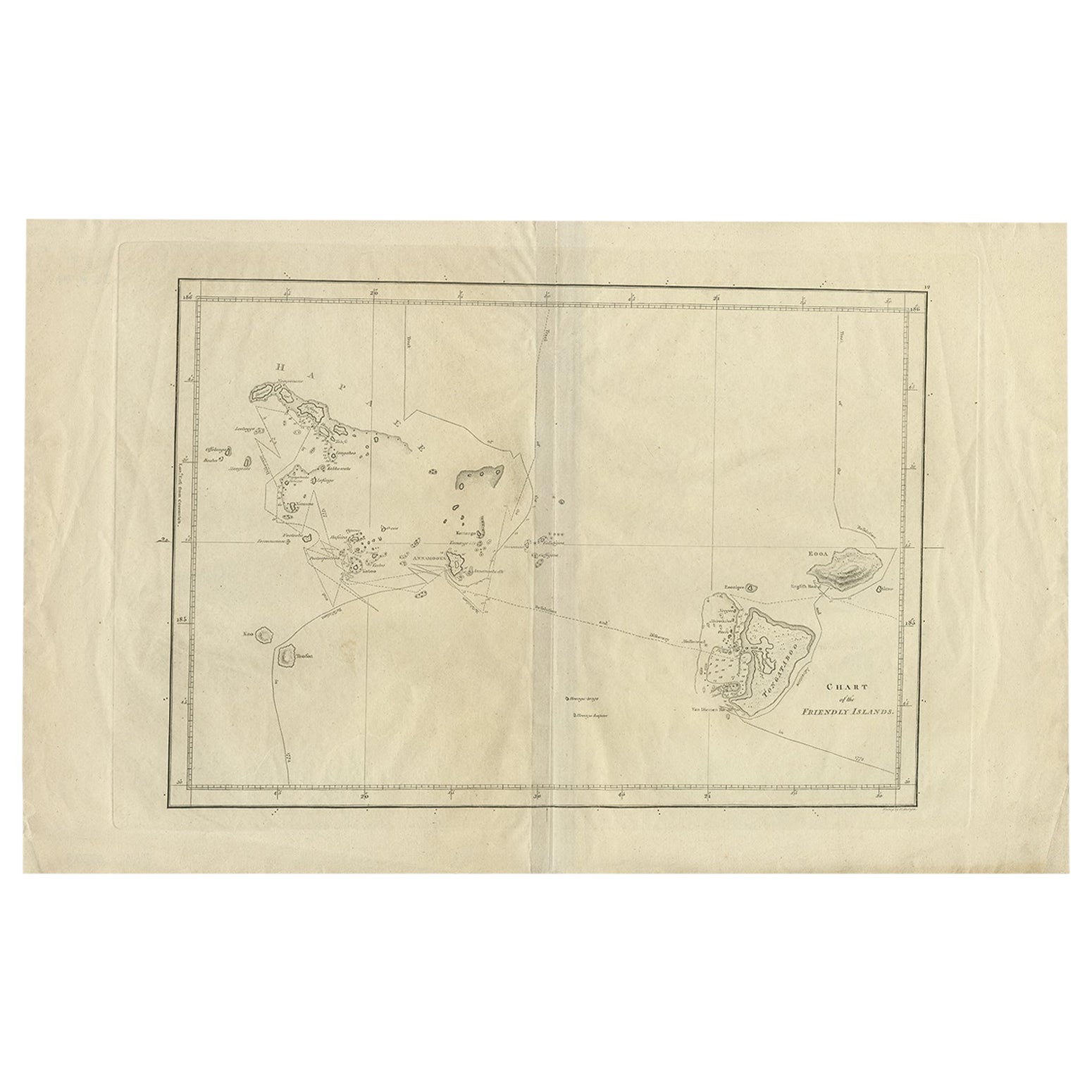
View AllAntique Chart of the Friendly Islands or Tonga in the Pacific Ocean, 1785
By James Cook
Located in Langweer, NL
Antique print titled 'Chart of the Friendly Islands'. Antique map of the Friendly Islands depicting Rotterdam or Anamocka, Middelburg or Eaoowe and Amsterdam or Tongatabu. Originates...
Category
Antique 18th Century Prints
Materials
Paper
$180 Sale Price
20% Off
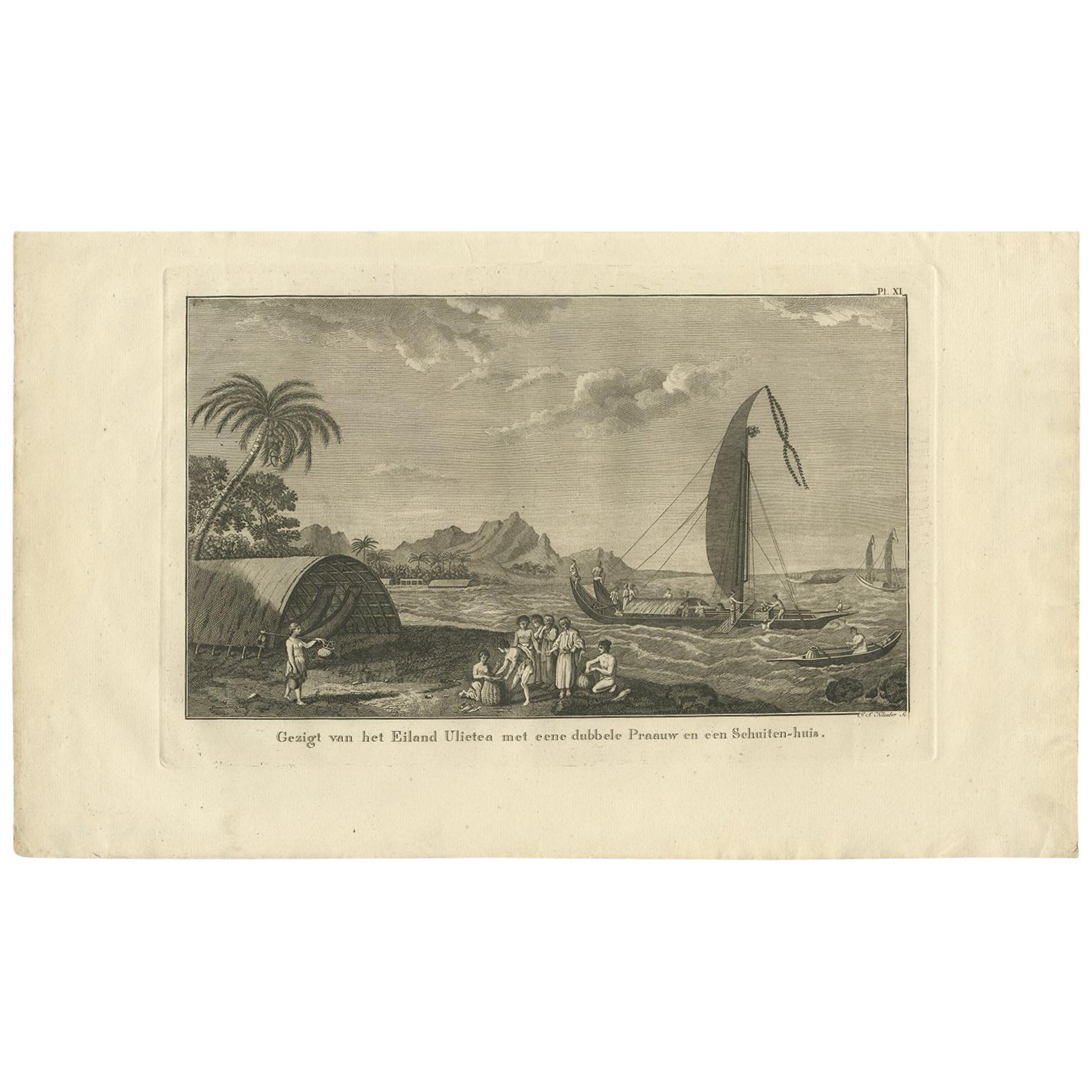
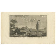
Antique Print of Ulietea in French Polynesia, Cook, 1803
Located in Langweer, NL
Antique print titled 'Gezigt van het Eiland Ulietea met eene dubbele Praauw en een Schuiten-huis'. This print depicts Ulietea, French Polynesia. Also depicts a proa. Originates from ...
Category
Antique Early 19th Century Dutch Prints
Materials
Paper
$237 Sale Price
20% Off
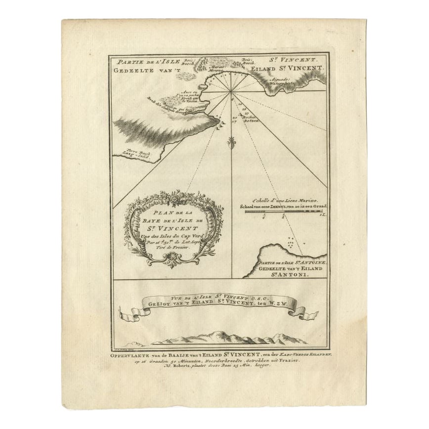
Antique Print of the Bay of the Island of St. Vincent, Capeverdian Islands
By Jakob van der Schley
Located in Langweer, NL
Antique print titled 'Oppervlakte van de Baaije van 't Eiland St. Vincent (..)'. View of the Bay of the Island of St. Vincent, one of the Capeverdian Islands. Originates from a Dutch...
Category
Antique 18th Century Prints
Materials
Paper

$133 Sale Price
20% Off
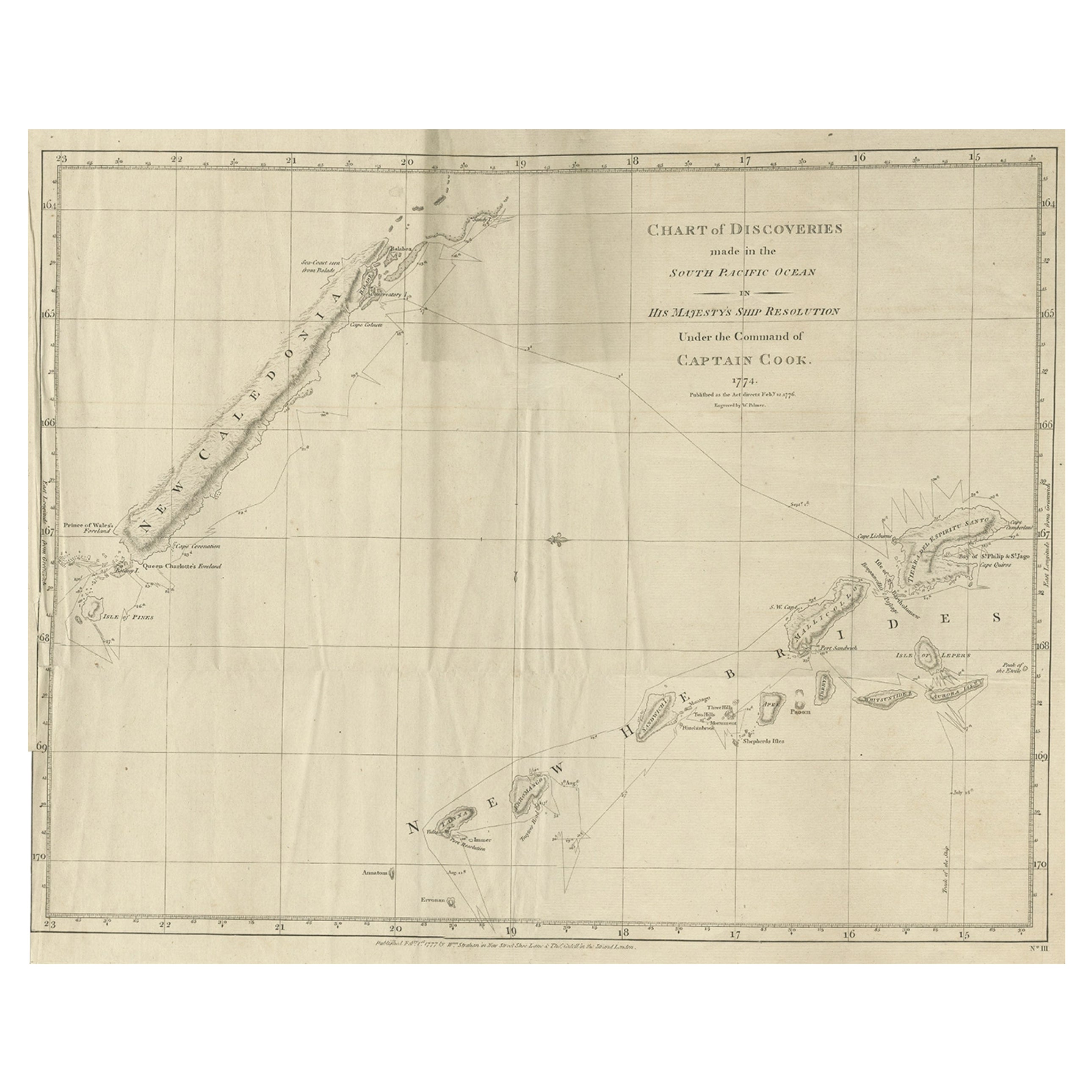
Rare Engraving of New Caledonia & New Hebrides from Capt. Cook's Travels, 1777
Located in Langweer, NL
Antique map titled 'Chart of Discoveries made in the South Pacific Ocean'.
Rare engraving from the official British Admiralty sanctioned edition of the accounts of Cook’s second voyage. All other later copies made of this image by other publishers were unauthorised, usually smaller and inferior in quality. Made after Cook's discovery of the island group on 4 September 1774, which he named New Caledonia...
Category
Antique 1770s Maps
Materials
Paper
$713 Sale Price
20% Off
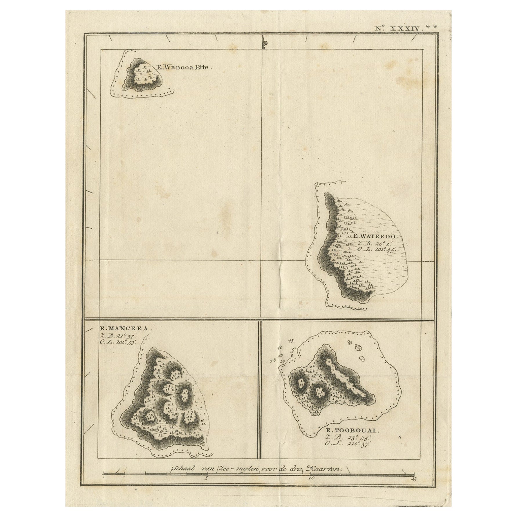
Antique Engraving of the Islands Wanooa, Wateeoo, Mangeea, Toobouai, Cook, 1803
Located in Langweer, NL
Antique map South Pacific Islands, Polynesia. Originates from 'Reizen Rondom de Waereld door James Cook (..)'.
Artists and Engravers: Translated by J.D. Pasteur. Published by Hon...
Category
Antique 19th Century Maps
Materials
Paper
$266 Sale Price
20% Off
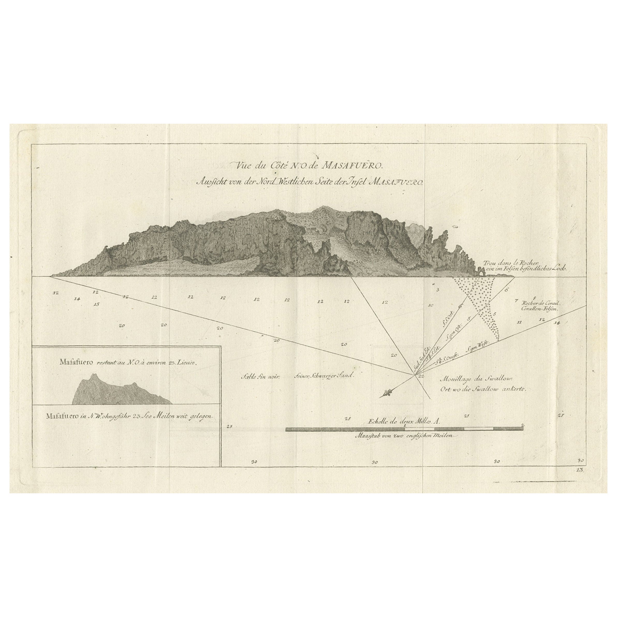
Antique Print of the North-West Coast of Masafuero or Alejandro Selkirk Island
Located in Langweer, NL
Antique print titled 'Vue de Cote N.O. de Masafuero'. Profile view of the north-west coast of Masafuero. It also shows the anchorage of the Swallow and depth soundings. Originates fr...
Category
Antique 18th Century Prints
Materials
Paper
$276 Sale Price
20% Off
You May Also Like
1844 French Antique Nautical print Engraved Portolano of Syrie by Antoine Roux
By Antoine Roux
Located in Milan, IT
Antique portolano, nautical map of Syrie engraved on a copper plate by Antoine Roux, Marseille France 1844, from his work Recueil des principaux plans des ports et de Rades de la Mer...
Category
Antique 1840s French Nautical Objects
Materials
Paper
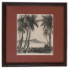
Aquatint Etching "Hawaii" by Listed Artist Alexander Samuel MacLeod
Located in San Diego, CA
Beautiful aquatint etching entitled "Hawaii" by listed artist Alexander Samuel MacLeod, circa 1940s. The piece is in very good vintage condition and is hand signed in pencil in the l...
Category
Early 20th Century American Drawings
Materials
Paper
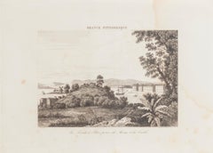
Map Of Martinique - Etching - 19th Century
Located in Roma, IT
Map Of Martinique is an etching realized by an anonymous engraver of the 19th Century.
Printed within the series "France Pittoresque" at the top center.
The state of preservation o...
Category
19th Century Modern Figurative Prints
Materials
Etching

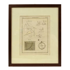
Engraving on Copper Print from the Volume Navigazione Nautical Subject 1790
Located in Milan, IT
Print by engraving on copper plate Tav III TIX fig. 17-22 from the volume Navigazione; with frame 28 x 33. Some calculations are depicted. Very good condition.
Shipping is insured by...
Category
Antique 1790s Italian Nautical Objects
Materials
Paper
La Pointe à Pitre prise du Morne - Original Lithograph - 19th Century
Located in Roma, IT
La Pointe à Pitre prise du Morne is an original lithograph realized by an Anonymous artist of the 19th Century.
Realized within the series of "France Pittor...
Category
19th Century Landscape Prints
Materials
Lithograph
Antique Voc Print Holland Malaysia Old Map Melaka History, 1663
Located in Amsterdam, Noord Holland
From my own collection I offer this impressive Antique print of the city of Malakka
A very interesting piece for collectors . It is an museum piece from the Dutch Institute of Orien...
Category
Antique 17th Century European Paintings
Materials
Paper

$293 Sale Price
20% Off
More Ways To Browse
Pompeii Wall Painting
Priest Japanese
Rooster Garden
Rosewood Record
Santo Head
Sarreid Brass Spain
Scandinavian China Cabinet
Sculpture Cheval
Sea Shell Glass Tables
Serpentine Secretary
Shishi Lion
Signed Ginger Jars
Spanish Baroque Columns
St Charles Kitchen
Sterling Cane
Stone Bench With Back
Stork Gold
Swatch 1993