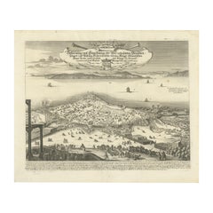
Items Similar to Dardanelles Strait, with a Perspective of the City of Constantinople, 1693

Want more images or videos?
Request additional images or videos from the seller
1 of 7
Dardanelles Strait, with a Perspective of the City of Constantinople, 1693
$325.30
$406.6320% Off
£239.98
£299.9820% Off
€272
€34020% Off
CA$450.33
CA$562.9120% Off
A$488.29
A$610.3620% Off
CHF 259.13
CHF 323.9120% Off
MX$6,013.92
MX$7,517.4120% Off
NOK 3,211.76
NOK 4,014.7020% Off
SEK 3,031.16
SEK 3,788.9520% Off
DKK 2,070.88
DKK 2,588.6020% Off
About the Item
Title: "Veue des Dardanelles de Constantinople, 1693"
Description: This historical copper engraving, crafted by Nicholas de Fer between 1646 and 1720 in Paris, is a remarkable depiction titled "Veue des Dardanelles de Constantinople."
It was included in de Fer's esteemed collection, "Les Forces de l'Europe," published in 1693. The detailed artwork offers a panoramic view of the strategic Dardanelles Strait, with a distant perspective of the city of Constantinople (modern-day Istanbul) in the backdrop.
The engraving not only captures the strategic importance of the Dardanelles, historically known as the Hellespont, but also serves as a valuable cartographic document of the era, showcasing the military and maritime strength of the region during the late 17th century.
- Dimensions:Height: 10.56 in (26.8 cm)Width: 15.75 in (40 cm)Depth: 0 in (0.02 mm)
- Materials and Techniques:Paper,Engraved
- Period:1690-1699
- Date of Manufacture:1693
- Condition:Good. Engraving on hand laid (verge) paper with original watermark. General age-related toning and/or occasional minor defects from handling. Please study scan carefully.
- Seller Location:Langweer, NL
- Reference Number:Seller: BG-137291stDibs: LU3054338822542
About the Seller
5.0
Recognized Seller
These prestigious sellers are industry leaders and represent the highest echelon for item quality and design.
Platinum Seller
Premium sellers with a 4.7+ rating and 24-hour response times
Established in 2009
1stDibs seller since 2017
2,620 sales on 1stDibs
Typical response time: <1 hour
- ShippingRetrieving quote...Shipping from: Langweer, Netherlands
- Return Policy
Authenticity Guarantee
In the unlikely event there’s an issue with an item’s authenticity, contact us within 1 year for a full refund. DetailsMoney-Back Guarantee
If your item is not as described, is damaged in transit, or does not arrive, contact us within 7 days for a full refund. Details24-Hour Cancellation
You have a 24-hour grace period in which to reconsider your purchase, with no questions asked.Vetted Professional Sellers
Our world-class sellers must adhere to strict standards for service and quality, maintaining the integrity of our listings.Price-Match Guarantee
If you find that a seller listed the same item for a lower price elsewhere, we’ll match it.Trusted Global Delivery
Our best-in-class carrier network provides specialized shipping options worldwide, including custom delivery.More From This Seller
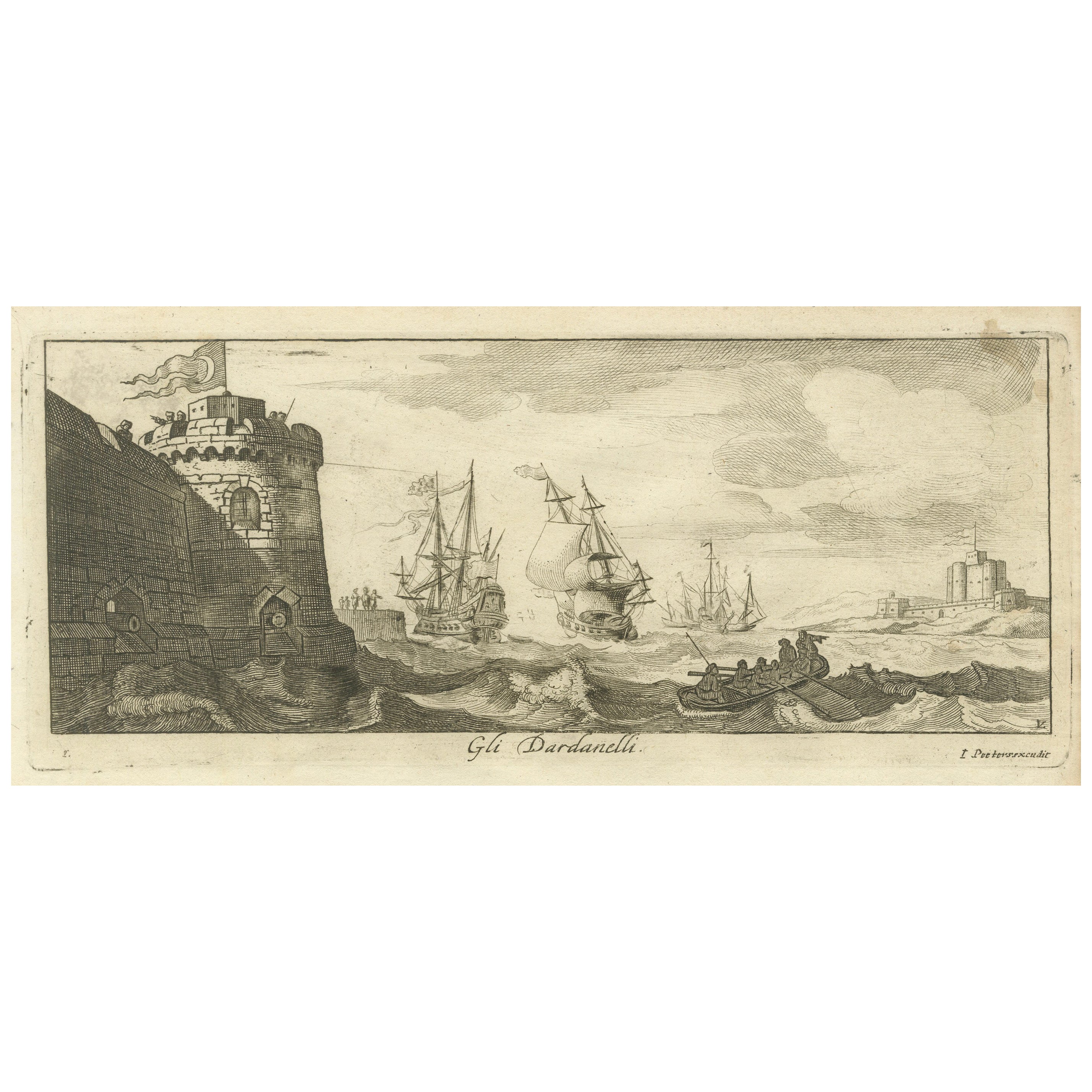
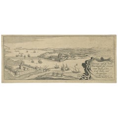
View AllEngraved View of the Dardanelles with Fortifications and Ships, ca. 1680
Located in Langweer, NL
Title: View of the Dardanelles with Fortifications and Ships, ca. 1680
Description: This copperplate engraving offers a detailed view of the Dardanelles Strait, emphasizing its s...
Category
Antique 1680s Prints
Materials
Paper

The Dardanelles in the Age of Sail: A Panoramic Etching, Ca.1765
Located in Langweer, NL
This rare and exquisite view depicts the strategic Dardanelles strait, the narrow passage between the Aegean and the Sea of Marmara with the distant cityscape of Istanbul. Part of th...
Category
Antique 1760s Prints
Materials
Paper

$1,148 Sale Price
20% Off
Free Shipping
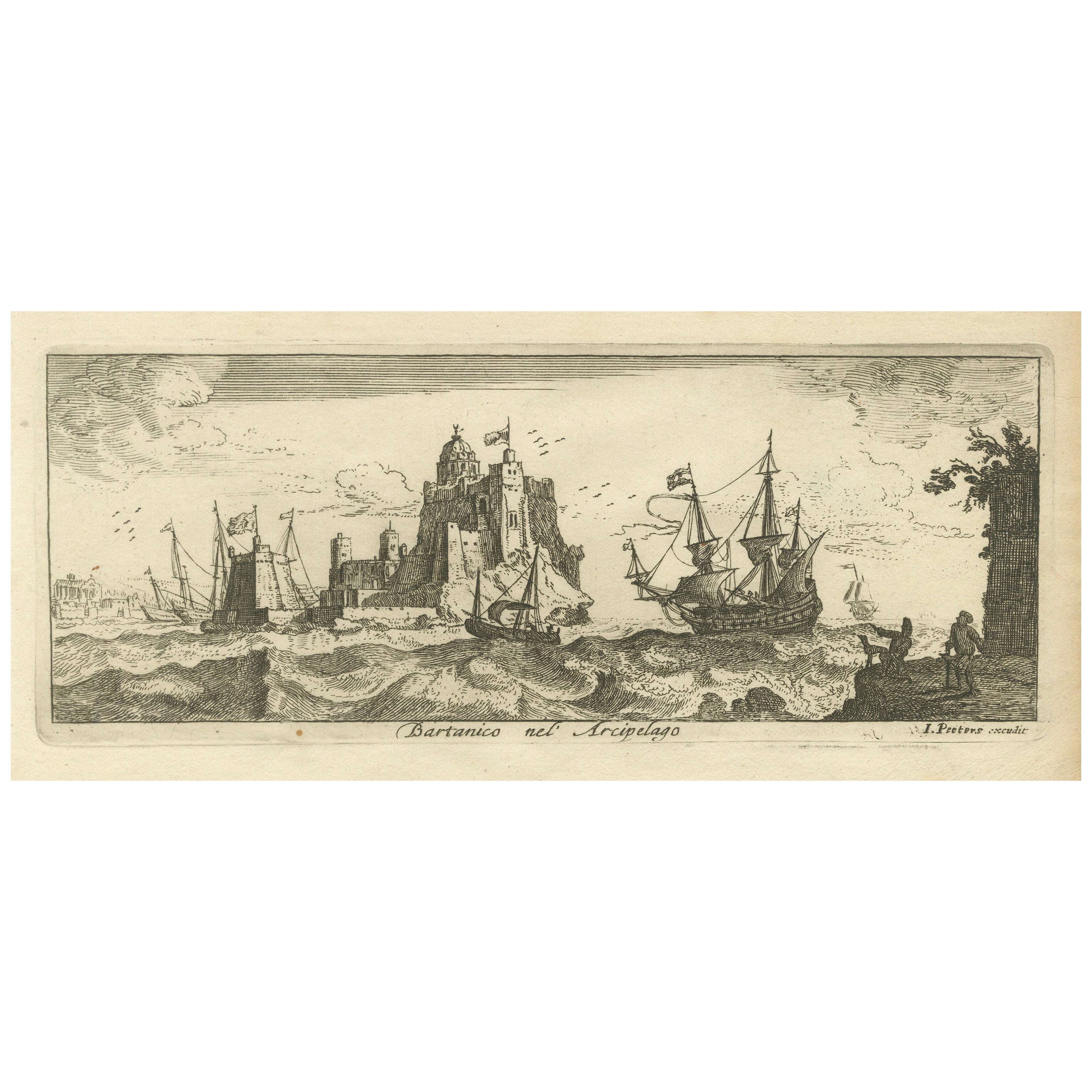
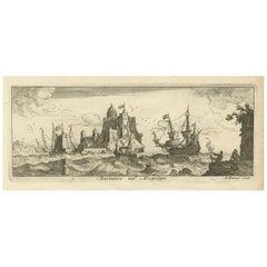
View of Bartanico in the Aegean Archipelago with Fortifications and Ships, 1680
Located in Langweer, NL
Title: View of Bartanico in the Aegean Archipelago with Fortifications and Ships, ca. 1680
Description: This copperplate engraving depicts a striking view of Bartanico (possibly P...
Category
Antique 1680s Prints
Materials
Paper
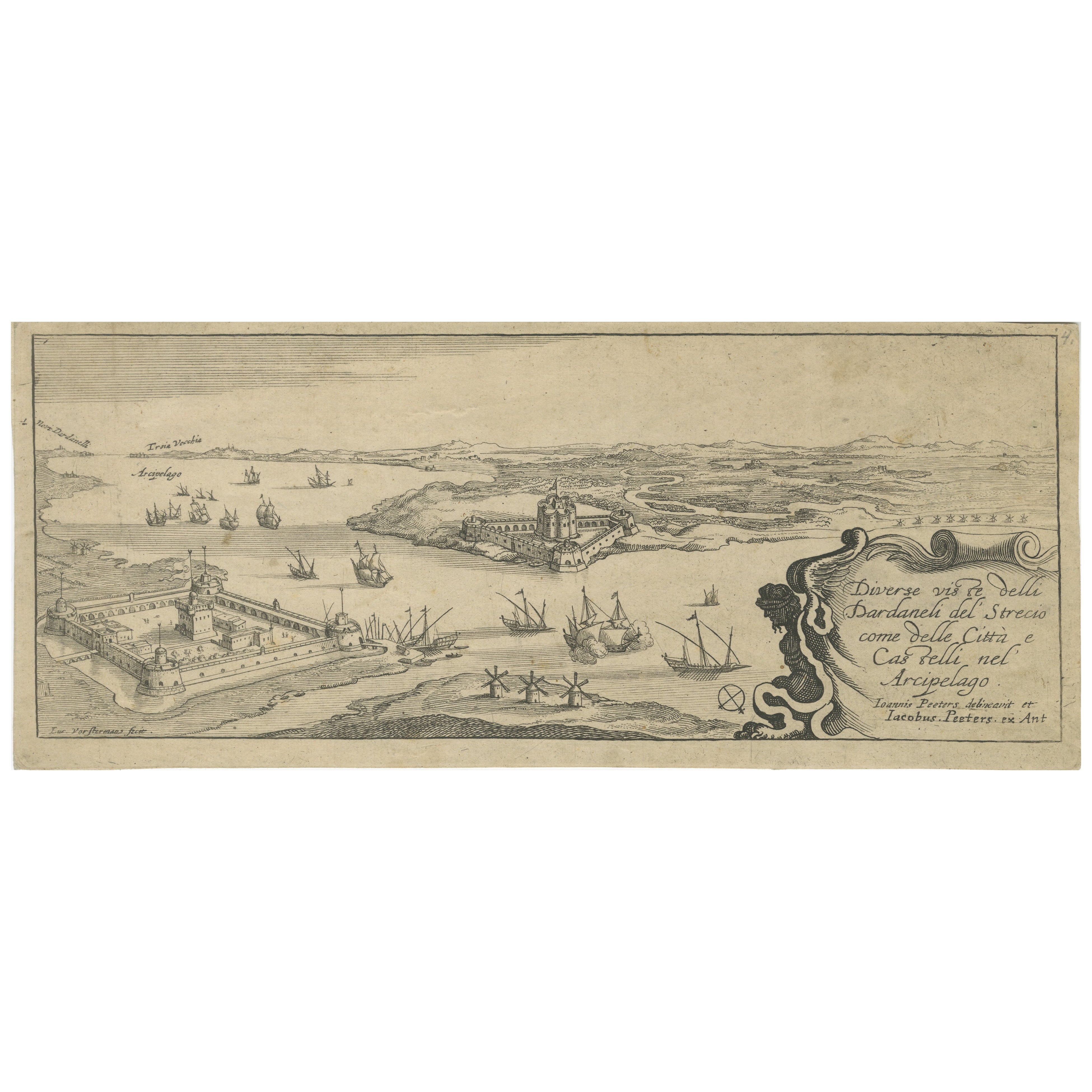
Title page from "Views of the Dardanelles", engraved by Jacob Peeters, ca. 1680
Located in Langweer, NL
Title:
Diverse viste delli Dardanelli del Strecio, come delle Città e Castelli nel Arcipelago – Title page of the series, engraved by Jacob Peeters after Jan Peeters, Antwerp, circ...
Category
Antique 1680s Prints
Materials
Paper
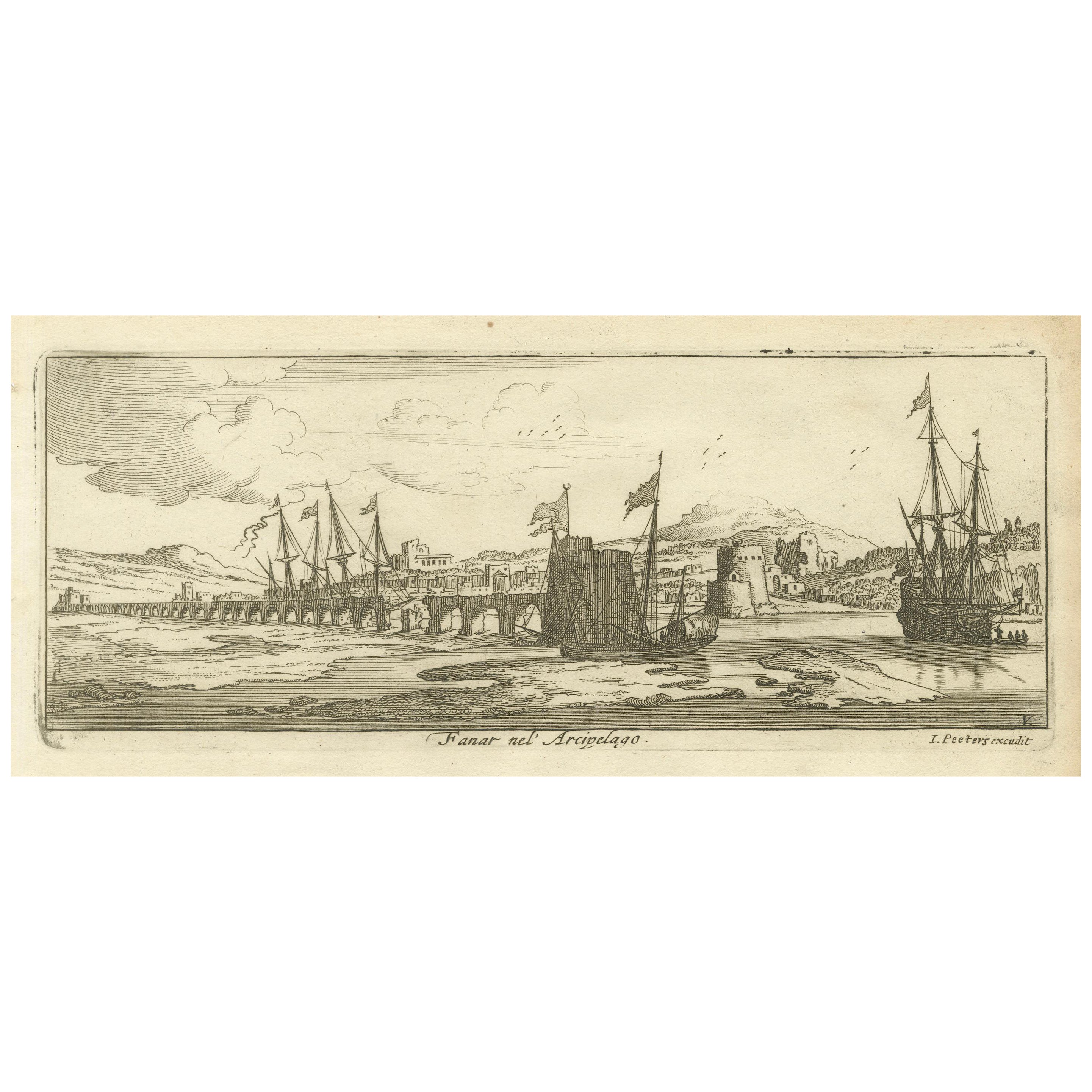
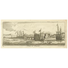
View of Fanar in the Aegean Archipelago with Bridge and Ships, ca. 1680
Located in Langweer, NL
Title: View of Fanar in the Aegean Archipelago with Bridge and Ships, ca. 1680
Description: This copperplate engraving showcases a detailed view of Fanar (possibly Fener or anothe...
Category
Antique 1680s Prints
Materials
Paper
Prince Henry's Naval and Land Battle during the Seven Years' War Engraved, 1667
Located in Langweer, NL
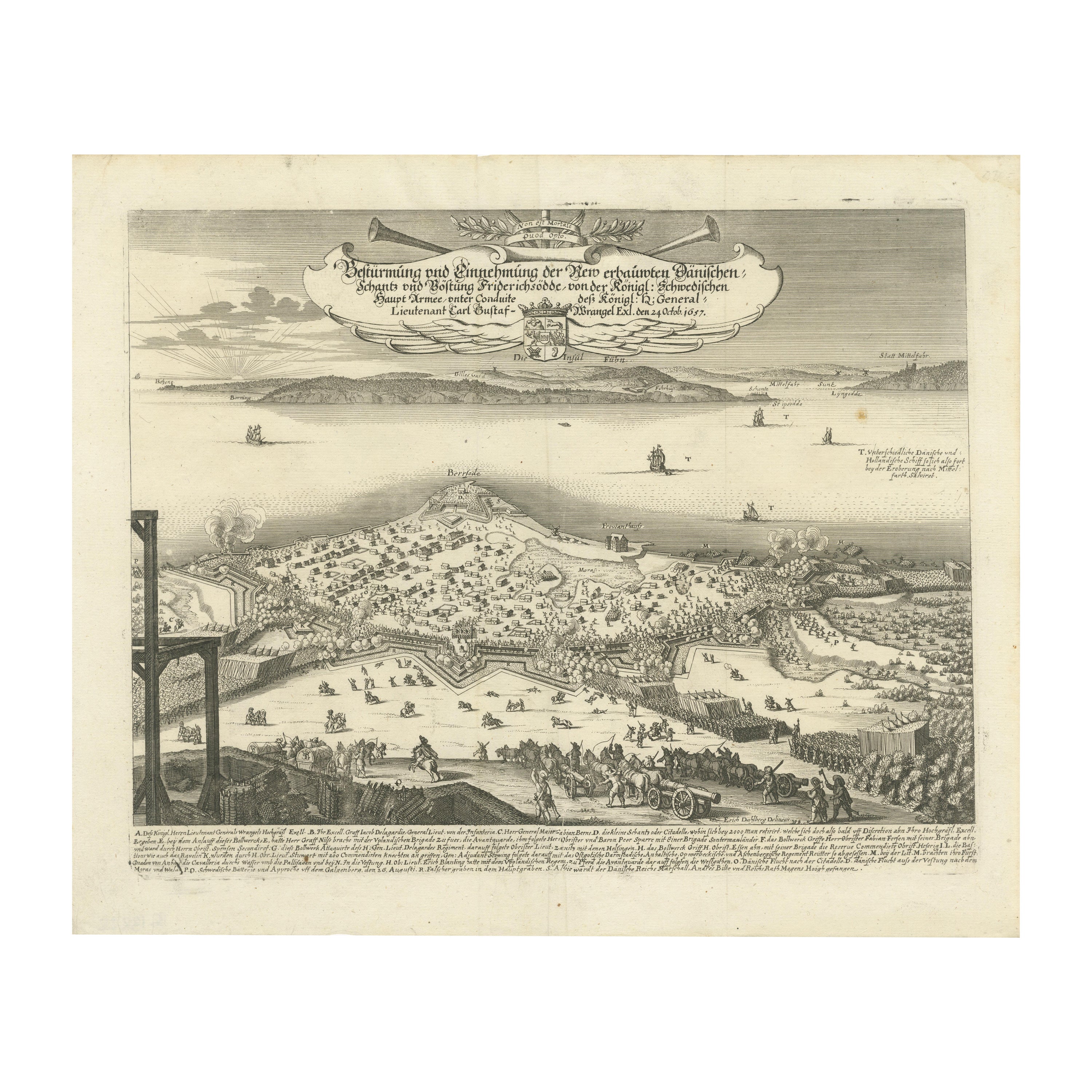
The engraving depicts the assault and capture of the Danish fortress Friderichsodde (now known as Fredericia) located on the island of Fyn. The scene, captured on October 24, 1657, vividly illustrates the Swedish main army's takeover under the command of General Carl Gustaf Wrangel. This historical event is meticulously documented in the artwork, which showcases not only the military action but also the strategic landscape and fortifications characteristic of the time.
Erik Jönsson Graf von Dahlberg, the artist behind this work, was a prominent Swedish field marshal, architect, and fortress builder. Born in 1625 and passing in 1703, Dahlberg's contributions to military and architectural fields were significant. He was renowned for his detailed and artistically valuable drawings which served as the basis for large-scale copperplate engravings. These engravings are of substantial topographical and architectural historical importance as they provide a detailed visual account of Swedish territories during the era.
In 1661, Dahlberg began work on his magnum opus—a comprehensive geographical and historical depiction of Swedish territories, which received royal privileges. His journey in 1667-1668 to Paris for the engraving of the initial plates reflects the international scope and ambition of his project. However, the work was intermittently paused when Dahlberg was tasked in 1674 with overseeing all Swedish fortress constructions, a role that significantly impacted his career and works. The project resumed and was published in 1684, highlighting a significant period of Swedish history and military achievements under his visual documentation.
MORE ABOUT THE BATTLE:
The image is an intricate engraving depicting a battle scene. Based on the details and the text in the cartouche, the scene illustrates a significant historical battle involving Prussian forces. The presence of multiple ships and extensive fortifications suggests a combined land and naval engagement.
Key Features in the Engraving:
1. Land Battle: The forefront of the image shows numerous troops, artillery pieces, and cavalry in action, depicting the intensity and scale of the land combat.
2. Naval Elements: Ships in the background indicate that this battle had a naval component, which would have been crucial for controlling trade routes or strategic waterways.
3. Fortifications: Extensive fortifications, including bastions and protective walls, suggest a well-defended location, possibly a city or a significant stronghold.
Historical Context:
From the text, it appears the battle involves "Prinz Heinrich," referring to Prince Henry of Prussia, who was an influential military leader during the reign of his brother, Frederick the Great. Under Frederick’s rule, Prussia engaged in several key conflicts, including the Seven Years' War (1756-1763), which saw major battles across Europe and involved complex alliances.
Given the level of detail and the era suggested by the style of ships and fortifications, the battle was of the significant engagements during the Seven Years' War, where Prince Henry played a critical role. His campaigns often involved maneuvering to protect Prussia from multiple fronts, including naval engagements in the Baltic.
Interpretation:
This engraving serves not only as a historical document but also as a piece of propaganda, likely glorifying the prowess and strategic capabilities of the Prussian military...
Category
Antique 1670s Prints
Materials
Paper
$440 Sale Price
20% Off
You May Also Like
18th Century French Map and City View of Joppe/Jaffa (Tel Aviv) by Sanson
By Nicholas Sanson d'Abbeville
Located in Alamo, CA
An original antique engraving entitled "Joppe; in ’t Hebreeusch by ouds Japho; hedendaags Japha, of Jaffa; volgens d’aftekening gedaan 1668", by Nicholas Sanson d'Abbeville (1600 - 1667). This is a view of the city of Joppe (in Hebrew Japho), now called Japha or Jaffa, the harbor portion of modern day Tel Aviv, Israel as it appeared in 1668 . It depicts a very busy harbor with numerous boats. A large ship on the left appears to be firing its canons and a small ship on the right appears to be sitting very low in the water, either heavily loaded with cargo or sinking. The town is seen on the far shore with a fortress on a hill across in the background. The map is printed from the original Sanson copperplate and was published in 1709 by his descendants.
The map is presented in an ornate brown wood frame embellished by gold-colored leaves and gold inner trim with a double mat; the outer mat is cream-colored and the inner mat is black. There is a central vertical fold, as issued. There are two small spots in the lower margin and one in the upper margin, as well as two tiny spots adjacent to the central fold. 1717 is written below the date 1668 in the inscription. The map is otherwise in very good condition.
Another map of the "Holy Land" (by Claes Visscher in 1663), with an identical style frame and mat is available. This pair of maps would make a wonderful display grouping. Please see Reference #LU117324709892.
Artist: Nicholas Sanson d'Abbeville (1600 - 1667) and his descendents were important French cartographer's active through the 17th century. Sanson started his career as a historian and initially utilized cartography to illustrate his historical treatises. His maps came to the attention of Cardinal Richelieu and then King Louis XIII of France, who became a supporter and sponsor. He subsequently appointed Sanson 'Geographe Ordinaire du Roi' the official map maker to the king. Sanson not only created maps for the king, but advised him on geographical issues and curated his map collection...
Category
Early 1700s Prints and Multiples
Materials
Engraving

Ancient View of the Bosphorus - Original Lithograph - Half of the 19th Century
Located in Roma, IT
Ancient View of the Bosphorus is an original modern artwork realized in the first half of the 19th Century.
Original B/W Lithograph on Ivory Paper.
Inscripted on the lower margin...
Category
Early 19th Century Modern Landscape Prints
Materials
Lithograph
Antique Voc Print Holland Malaysia Old Map Melaka History, 1663
Located in Amsterdam, Noord Holland
From my own collection I offer this impressive Antique print of the city of Malakka
A very interesting piece for collectors . It is an museum piece from the Dutch Institute of Orien...
Category
Antique 17th Century European Paintings
Materials
Paper

$293 Sale Price
20% Off
1597 German Map of Alexandria by Georg Braun and Frans Hogenberg
By Georg Braun and Frans Hogenberg
Located in Chapel Hill, NC
1597 Map of Alexandria by Georg Braun and Frans Hogenberg, Germany. From "Civitas Orbis Terrarum", part 2, published in Cologne by Bertram Buchholz. Printed in 2 parts. Title: "Alexa...
Category
Antique 16th Century German Renaissance Maps
Materials
Paper

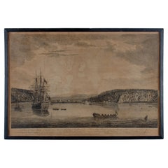
A View of Cape Rouge, Quebec, Canada, Mazell after Capt. Hervey Smyth, c.1760s
Located in Savannah, GA
A View of Cape Rouge, or Carouge, on the Saint Lawrence River, north of Quebec.
Engraving by Peter Mazell after a drawing by Captian Hervey Smyth, published c.1760's, London.
T...
Category
Antique 1760s Canadian British Colonial Prints
Materials
Paper
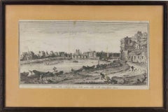
View of the City of Paris from the side of the island called... - Etching - 1748
Located in Roma, IT
Etching on paper realized in 1748.
Very good condition except for some minor foxing.
Includes a wooden frame cm. 27.5x41.5
Category
1740s Modern Abstract Prints
Materials
Etching
More Ways To Browse
Brass Animal Head
Brass Coat Of Arms
Brass Dice
Bronze Birds Of Prey Sculptures
Bronze Cupid And Psyche
Bronze Eagle Signed And Numbered
Bronze Lion Statues
Bronze Octopus
Bronze Saddles
Bronze Sculpture Animal Head
Bronze Terrier
Cabriole Leg Marble Top
Campaign China Cabinet
Canton Bowl
Capodimonte Pair
Car Radiators
Carved Antelope
Carved Carousel Horses