Items Similar to Hand-Colored French Map, Carte des Etats Unis, Par Bonne, Late 18th Century


Want more images or videos?
Request additional images or videos from the seller
1 of 6
Hand-Colored French Map, Carte des Etats Unis, Par Bonne, Late 18th Century
$950
£721.36
€824.93
CA$1,327.29
A$1,476.23
CHF 770.84
MX$17,964.19
NOK 9,844.85
SEK 9,232.73
DKK 6,156.74
Shipping
Retrieving quote...The 1stDibs Promise:
Authenticity Guarantee,
Money-Back Guarantee,
24-Hour Cancellation
About the Item
Hand-colored French map, Carte de la Partie Nord, des Etats Unis, de l'Amérique Septentrionale, late 18th century. A French map of New England published at the end of the Revolutionary War from Raynal's Atlas. Rigobert Bonne (1727-1795) was Royal Cartographer to France. Professionally framed and matted.
- Attributed to:Rigobert Bonne (Artist)
- Dimensions:Height: 16.5 in (41.91 cm)Width: 20.13 in (51.14 cm)Depth: 1 in (2.54 cm)
- Style:Louis XVI (Of the Period)
- Materials and Techniques:
- Place of Origin:
- Period:
- Date of Manufacture:Late 18th Century
- Condition:Wear consistent with age and use. Dimensions listed include frame. Image dimensions: 13-1/8 inches wide x 9-1/8 inches high.
- Seller Location:Chappaqua, NY
- Reference Number:1stDibs: LU1150228834252
About the Seller
4.9
Vetted Professional Seller
Every seller passes strict standards for authenticity and reliability
1stDibs seller since 2014
147 sales on 1stDibs
- ShippingRetrieving quote...Shipping from: Chappaqua, NY
- Return Policy
Authenticity Guarantee
In the unlikely event there’s an issue with an item’s authenticity, contact us within 1 year for a full refund. DetailsMoney-Back Guarantee
If your item is not as described, is damaged in transit, or does not arrive, contact us within 7 days for a full refund. Details24-Hour Cancellation
You have a 24-hour grace period in which to reconsider your purchase, with no questions asked.Vetted Professional Sellers
Our world-class sellers must adhere to strict standards for service and quality, maintaining the integrity of our listings.Price-Match Guarantee
If you find that a seller listed the same item for a lower price elsewhere, we’ll match it.Trusted Global Delivery
Our best-in-class carrier network provides specialized shipping options worldwide, including custom delivery.More From This Seller
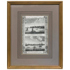
View AllFramed Print, English Harbor Views, Early 19th Century
Located in Chappaqua, NY
Framed print of English Harbor views, early 19th century, "View of Greenwich in Kent and View of Deptford in Kent." Custom frame and mat.
Category
Antique Early 19th Century English Prints
Materials
Paper
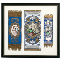
Antique Advertising or Display Banners "Sucre De Pomme, " France, circa 1880
Located in Chappaqua, NY
Three antique advertising or display banners "Sucre de Pomme de Rouen", France, circa 1880. Hand colored lithography with gilt detail. "Sucre de Pomme de Rouen" is a French confectio...
Category
Antique Late 19th Century Prints
Materials
Paper
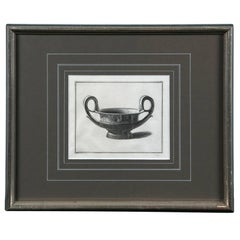
Framed Etching, Neoclassical Vessel, 19th Century
Located in Chappaqua, NY
Framed etching, neoclassical vessel, 19th century. Custom silver leaf frame and mat.
Category
Antique 19th Century European Neoclassical Prints
Materials
Paper
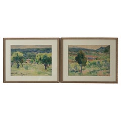
Pair Framed Watercolor Landscape Paintings, Provence, France, 1920's
Located in Chappaqua, NY
Pair Framed Watercolor Landscape Paintings, Provence, France, 1926. Charming 'plein air' paintings of the Provencal landscape. Original fra...
Category
Vintage 1920s French French Provincial Paintings
Materials
Paper
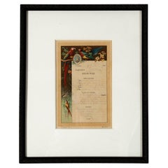
Antique Framed 'Dejeuner' (Lunch) Restaurant Menu, France, 1901
Located in Chappaqua, NY
Antique Framed 'Dejeuner' (Lunch) Restaurant Menu, France, 1901. First Class menu from the restaurant aboard the ship Compagnie Messageries Maritime, Port Marseille. This line sailed...
Category
Early 20th Century French Art Nouveau Decorative Art
Materials
Paper
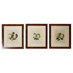
Set of 3 Framed Apple Study Lithographs, early 20th Century
Located in Chappaqua, NY
Set of 3 Apple Study Lithographs, early 20th Century. Hand-colored studies of apple varieties. Professionally framed and matted.
Category
Early 20th Century Neoclassical Prints
Materials
Wood, Paper
You May Also Like
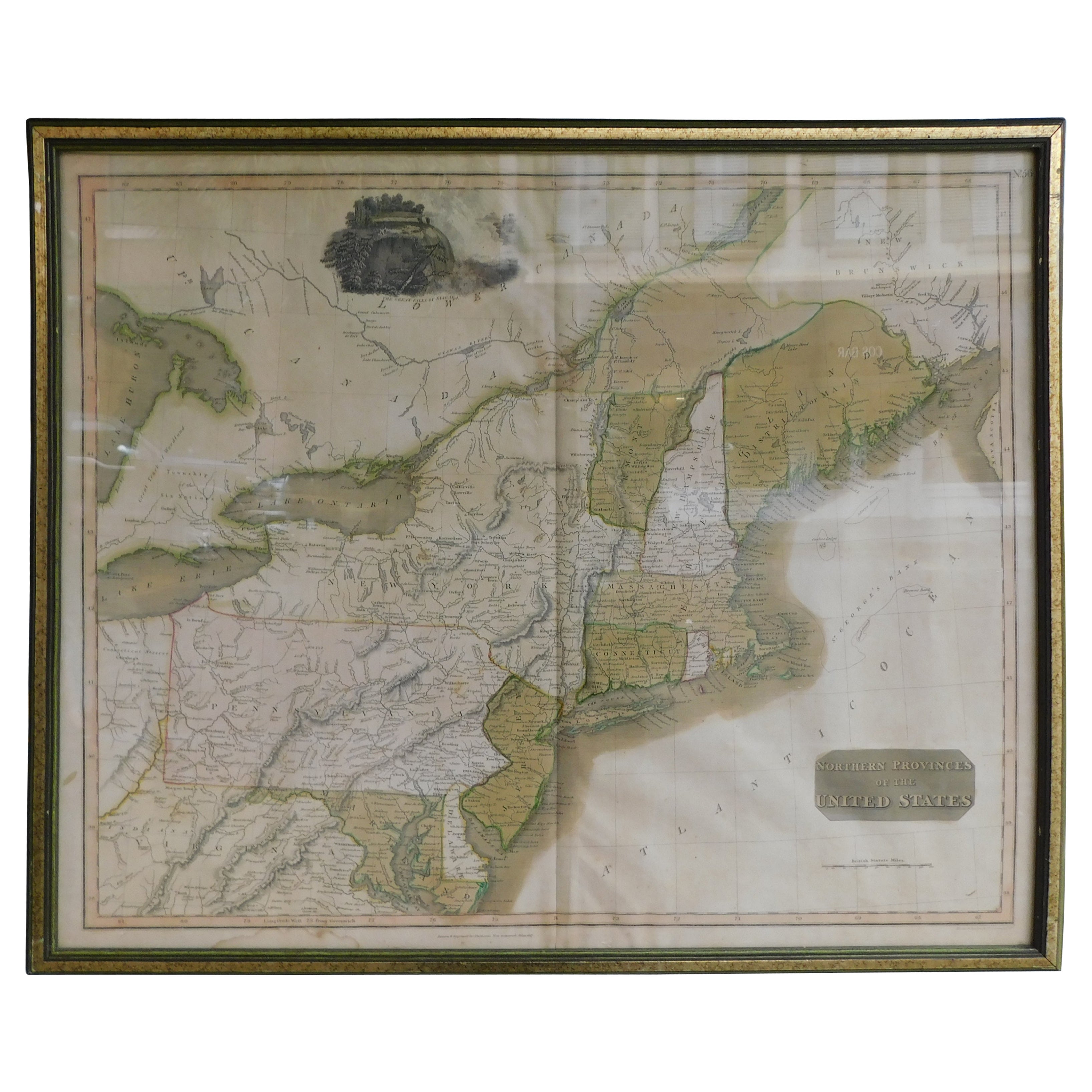
English Engraved Hand Colored Map of the North Eastern United States, circa 1817
Located in Charleston, SC
English copper engraved hand colored map of the North Eastern United States matted under glass in a gilt frame, Early 19th Century. Drawn and Engraved for Thomson's New General Atlas...
Category
Antique 1810s English George III Maps
Materials
Glass, Giltwood, Paint, Paper

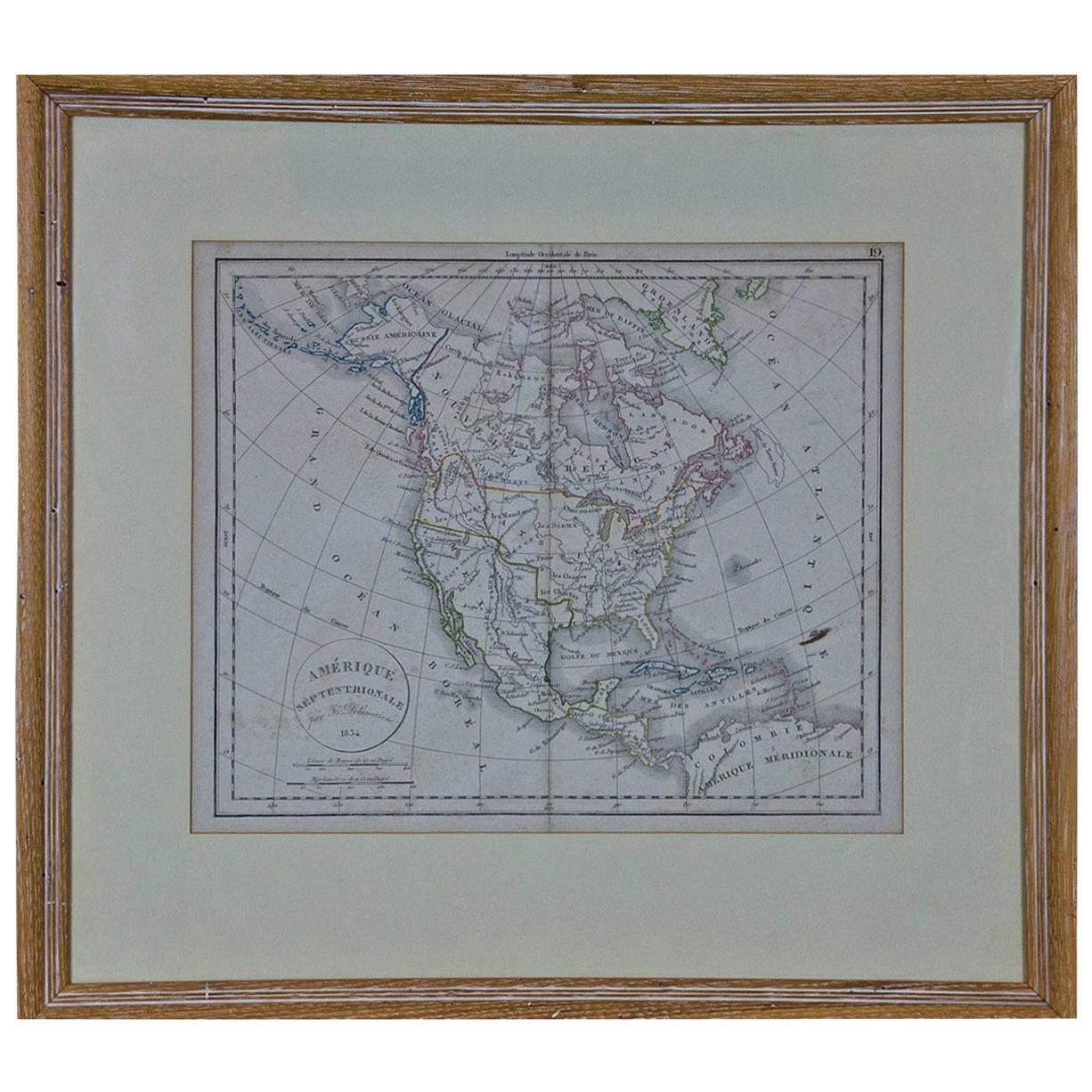
America "Amérique Septentrionale": A 19th Century French Map by Delamarche
By Maison Delamarche 1
Located in Alamo, CA
This framed mid 19th century map of North America entitled "Amérique Septentrionale" by Felix Delamarche was published in Paris in 1854 by Quay de l'Horloge du Palais, avec les Carte...
Category
Antique Mid-19th Century American Other Maps
Materials
Paper

1864 Map of North America, Antique Hand-Colored Map, by Adolphe Hippolyte Dufour
Located in Colorado Springs, CO
Offered is a map of North America entitled Amerique du Nord from 1864. This rare, separately published wall map was produced by Adolphe Hippolyte Dufour. This map includes vibrant an...
Category
Antique 1860s French Maps
Materials
Paper

Antique 18th Century Map of the Province of Pensilvania 'Pennsylvania State'
Located in Philadelphia, PA
A fine antique of the colony of Pennsylvania.
Noted at the top of the sheet as a 'Map of the province of Pensilvania'.
This undated and anonymous map is thought to be from the Gentleman's Magazine, London, circa 1775, although the general appearance could date it to the 1760's.
The southern boundary reflects the Mason-Dixon survey (1768), the western boundary is placed just west of Pittsburgh, and the northern boundary is not marked.
The map has a number of reference points that likely refer to companion text and appear to be connected to boundaries. The western and southern boundaries are marked Q, R, S, for example. A diagonal line runs from the Susquehanna R to the Lake Erie P. A broken line marked by many letters A, B, N, O, etc., appears in the east.
There are no latitude or longitude markings, blank verso.
Framed in a shaped contemporary gilt wooden frame and matted under a cream colored matte.
Bearing an old Graham Arader Gallery...
Category
Antique 18th Century British American Colonial Maps
Materials
Paper

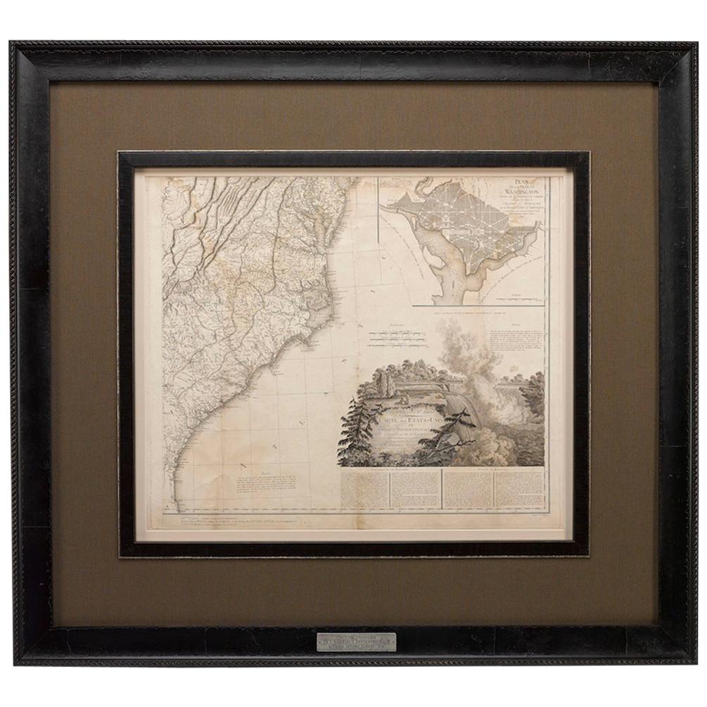
1812 United States Map, by Pierre Tardieu, Antique French Map Depicting the U.S.
By Pierre François Tardieu
Located in Colorado Springs, CO
1812 "United States of Nth America -- Carte des Etats-Unis De L'Amerique Septentrionale" Two-Sheet Map by Tardieu
This attractive map, published in Paris in 1812, is one of the most rare large format maps from the period. It features a view of the East Coast of the U.S. from Maryland to just below South Carolina. Additionally, Ellicott’s plan for the City of Washington D.C. is included at the top right and an illustration of Niagara Falls is shown at the bottom right with a description in both French and English. This extremely detailed map not only depicts the mountainous regions of the southeastern U.S., but also includes names of regions, rivers, and towns.
Based on the first state of Arrowsmith’s 4-sheet map of the United States, this map is completely engraved by Tardieu in Paris and showcases high quality engravings. This detailed map of the recently independent United States includes one of the largest and earliest examples of the Ellicott plan of Washington DC.
The artist, Pierre François Tardieu (PF Tardieu) was a very well-known map engraver, geographer, and illustrator. Awarded a bronze medal by King Louis-Phillipe for the accuracy and beauty of his map-making, Tardieu produced many fine works including maps of Louisiana...
Category
Antique 1810s French Maps
Materials
Paper

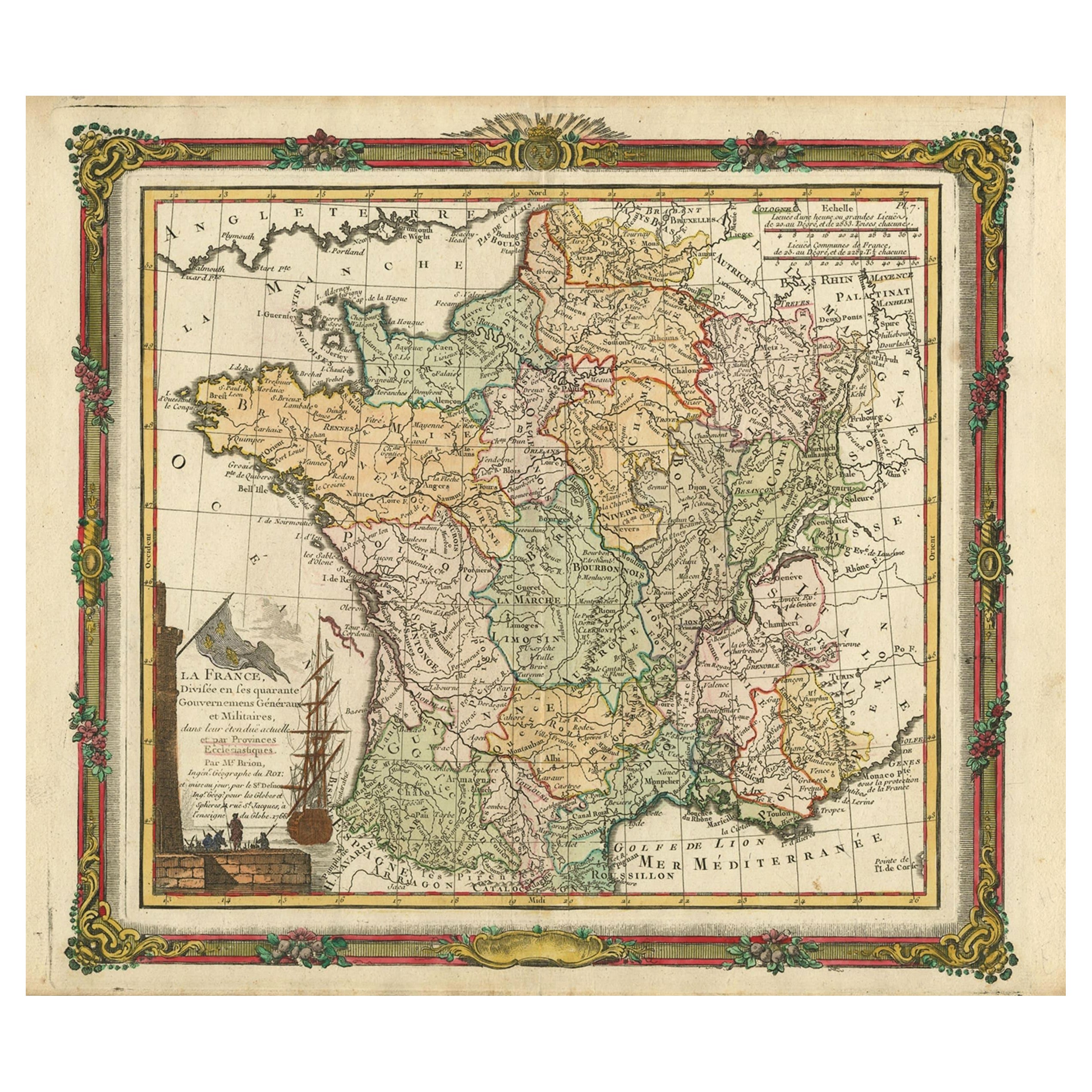
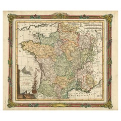
Antique Map of France with Decorative Border, 1766
Located in Langweer, NL
Antique map titled 'La France, divisée en ses quarante Gouvernemens Généraux.' Attractive map of France by Brion de la Tour, published by Desnos. The decorative border was printed fr...
Category
Antique 18th Century Maps
Materials
Paper
$412 Sale Price
20% Off