Items Similar to Historic View of Malacca: An original 1777 Engraving by Middleton
Video Loading
Want more images or videos?
Request additional images or videos from the seller
1 of 11
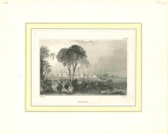
Historic View of Malacca: An original 1777 Engraving by Middleton
$354.96
$443.7020% Off
£264.05
£330.0720% Off
€296
€37020% Off
CA$486.06
CA$607.5720% Off
A$540.43
A$675.5420% Off
CHF 282.18
CHF 352.7320% Off
MX$6,578.35
MX$8,222.9320% Off
NOK 3,600.53
NOK 4,500.6620% Off
SEK 3,373.52
SEK 4,216.9020% Off
DKK 2,253.28
DKK 2,816.6120% Off
Shipping
Retrieving quote...The 1stDibs Promise:
Authenticity Guarantee,
Money-Back Guarantee,
24-Hour Cancellation
About the Item
"The City of Malacca in the East Indies" is from Charles Theodore Middleton's work, "A New and Complete System of Geography."
This book was published in 1777. Therefore, the engraving can be dated to around that time, likely published in or close to the year 1777.
The image is an antique copperplate print depicting the city of Malacca (now Melaka) in the East Indies. The engraving is from Charles Theodore Middleton's work, "A New and Complete System of Geography," which was printed for J. Cooke in Pater-noster Row, London.
Here are some notable features in the print:
1. Cityscape and Buildings: The city of Malacca is shown with a variety of buildings, including what appears to be a church or fort with a steeple or tower in the center, indicating European colonial influence.
2. Harbor and Ships: The foreground features several sailing ships and smaller boats in the harbor, suggesting Malacca's importance as a trading port.
3. Landscape: The background displays a range of hills or mountains, adding to the scenic view of the city.
4. Palm Trees: Dense clusters of palm trees are visible, emphasizing the tropical nature of the region.
5. Architectural Details: The print includes various architectural elements, likely representing significant structures of the time.
Malacca, also known as Melaka, during the period depicted in the engraving (likely the late 18th century) was a significant and bustling port city in Southeast Asia. Here are some key points about Malacca during this time:
Historical Context
1. **Colonial Rule**: In the late 18th century, Malacca was under Dutch colonial rule, having been seized from the Portuguese in 1641. The Dutch controlled Malacca until the early 19th century when it was handed over to the British.
2. **Strategic Location**: Malacca's strategic position along the Malacca Strait made it a crucial hub for maritime trade routes between the Indian Ocean and the South China Sea. It connected the East Indies, India, China, and Europe.
Economic Importance
1. **Trade Hub**: Malacca was a thriving center for trade, where merchants from various parts of the world, including Arabs, Indians, Chinese, and Europeans, exchanged goods such as spices, silk, textiles, and ceramics.
2. **Cultural Melting Pot**: The city was a melting pot of cultures and ethnicities due to its trade connections. This diversity influenced its culture, architecture, and cuisine.
### Social and Cultural Aspects
1. **Population**: The population was diverse, consisting of Malays, Chinese, Indians, Arabs, and Europeans. Each community contributed to the city’s vibrant cultural landscape.
2. **Architecture**: The architectural style in Malacca reflected its colonial history and diverse population. European colonial buildings coexisted with traditional Malay, Chinese, and Indian structures.
3. **Religion**: Various religions were practiced, including Islam, Christianity, Hinduism, and Buddhism, reflecting the diverse ethnic makeup of the city.
### Challenges
1. **Political Instability**: The region experienced political instability due to the shifting control among European colonial powers (Portuguese, Dutch, and British).
2. **Piracy**: The strategic location of the Malacca Strait also attracted pirates, posing a constant threat to maritime trade.
### Influence on the Region
1. **Economic Influence**: Malacca’s prosperity and strategic importance made it a model for other port cities in the region, influencing trade practices and urban development.
2. **Cultural Exchange**: The city facilitated cultural exchanges, leading to a blend of customs, traditions, and culinary practices that still influence the region today.
### Modern Legacy
1. **UNESCO World Heritage Site**: Today, Malacca is recognized as a UNESCO World Heritage Site for its historical significance and well-preserved colonial architecture.
2. **Tourism**: The city attracts tourists worldwide, keen to explore its rich history, diverse culture, and architectural heritage.
The engraving captures a snapshot of Malacca during its colonial period, highlighting its importance as a key trading port and cultural melting pot in Southeast Asia.
- Dimensions:Height: 8.67 in (22 cm)Width: 13.59 in (34.5 cm)Depth: 0.01 in (0.2 mm)
- Materials and Techniques:Paper,Engraved
- Period:1770-1779
- Date of Manufacture:1777
- Condition:Condition: Good, given age. Light soiling and occasional light creasing. General age-related toning and/or occasional minor defects from handling. Please study scan carefully.
- Seller Location:Langweer, NL
- Reference Number:Seller: BG-13599-591stDibs: LU3054340632002
About the Seller
5.0
Recognized Seller
These prestigious sellers are industry leaders and represent the highest echelon for item quality and design.
Platinum Seller
Premium sellers with a 4.7+ rating and 24-hour response times
Established in 2009
1stDibs seller since 2017
2,511 sales on 1stDibs
Typical response time: <1 hour
- ShippingRetrieving quote...Shipping from: Langweer, Netherlands
- Return Policy
Authenticity Guarantee
In the unlikely event there’s an issue with an item’s authenticity, contact us within 1 year for a full refund. DetailsMoney-Back Guarantee
If your item is not as described, is damaged in transit, or does not arrive, contact us within 7 days for a full refund. Details24-Hour Cancellation
You have a 24-hour grace period in which to reconsider your purchase, with no questions asked.Vetted Professional Sellers
Our world-class sellers must adhere to strict standards for service and quality, maintaining the integrity of our listings.Price-Match Guarantee
If you find that a seller listed the same item for a lower price elsewhere, we’ll match it.Trusted Global Delivery
Our best-in-class carrier network provides specialized shipping options worldwide, including custom delivery.More From This Seller
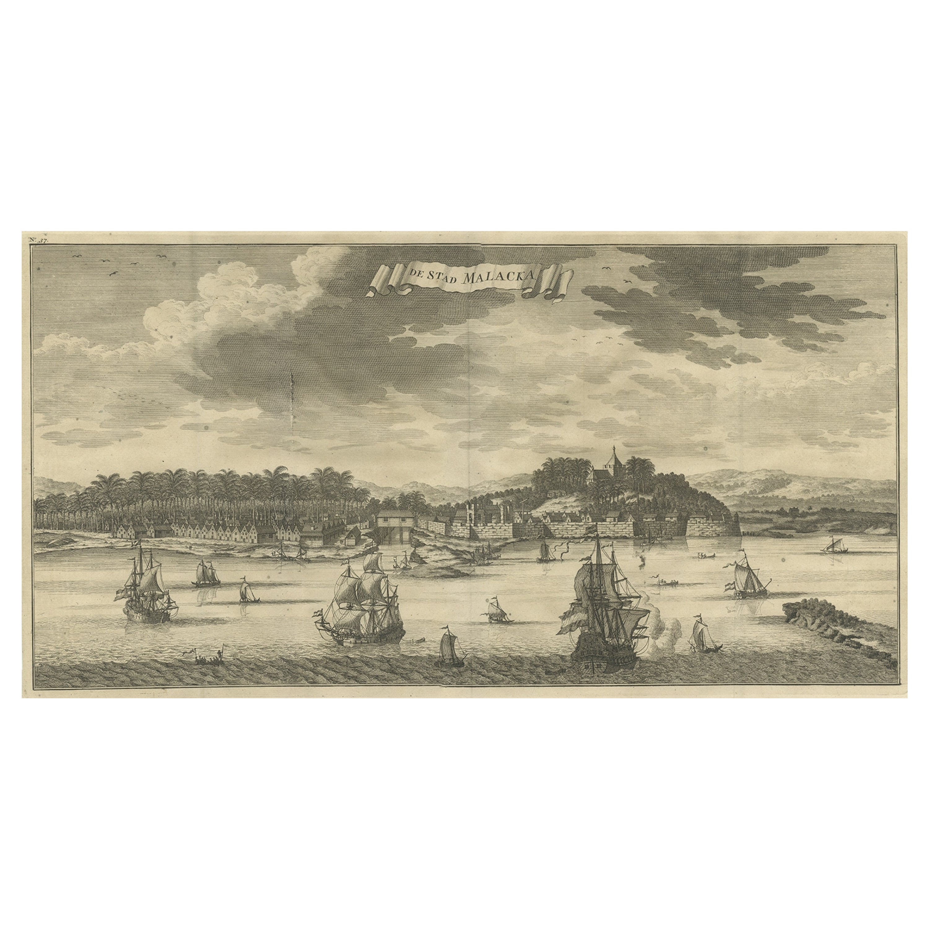
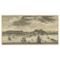
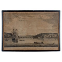
View AllAntique Panoramic View of the Town of Malacca, Malaysia, 1726
Located in Langweer, NL
Antique print Malaysia titled 'De Stad Malacka'.
Decorative panoramic view of the town of Malacca with European vessels in the foreground. The old C...
Category
Antique 1720s Maps
Materials
Paper
$713 Sale Price
30% Off
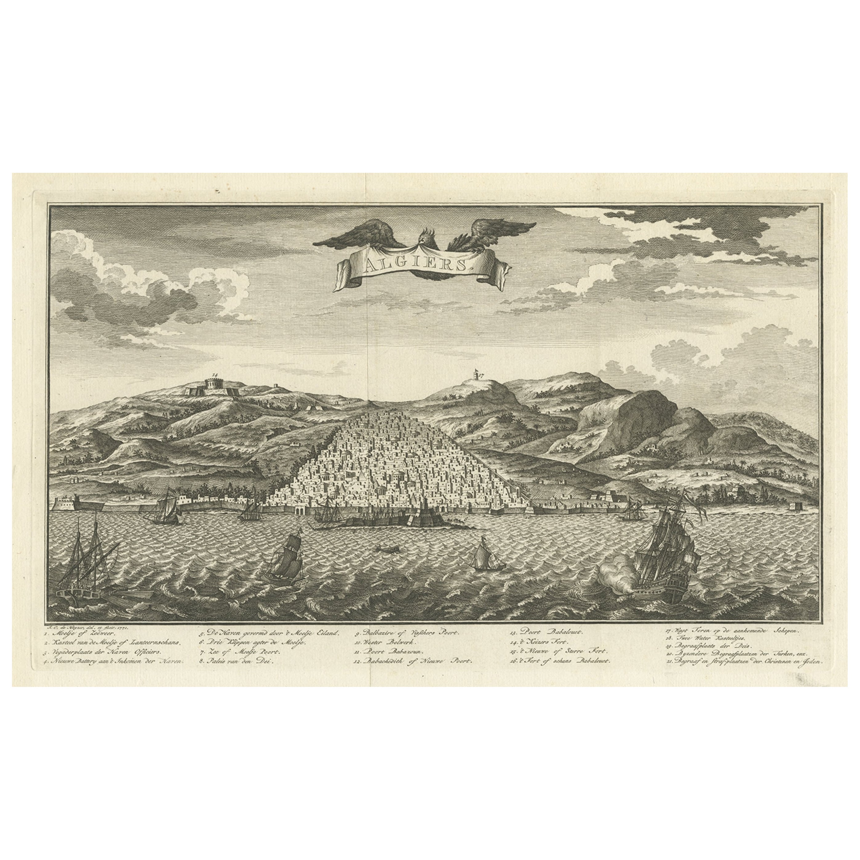
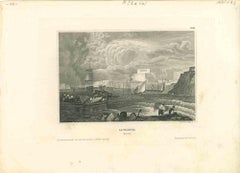
Original Antique Engraving of Algiers in Algeria, 1773
Located in Langweer, NL
Antique print titled 'Algiers'. Old print with a view of Algiers, Algeria. With Dutch legend. Originates from the first Dutch editon of an interesting travel account of Northern Afri...
Category
Antique 18th Century Prints
Materials
Paper
$470 Sale Price
20% Off
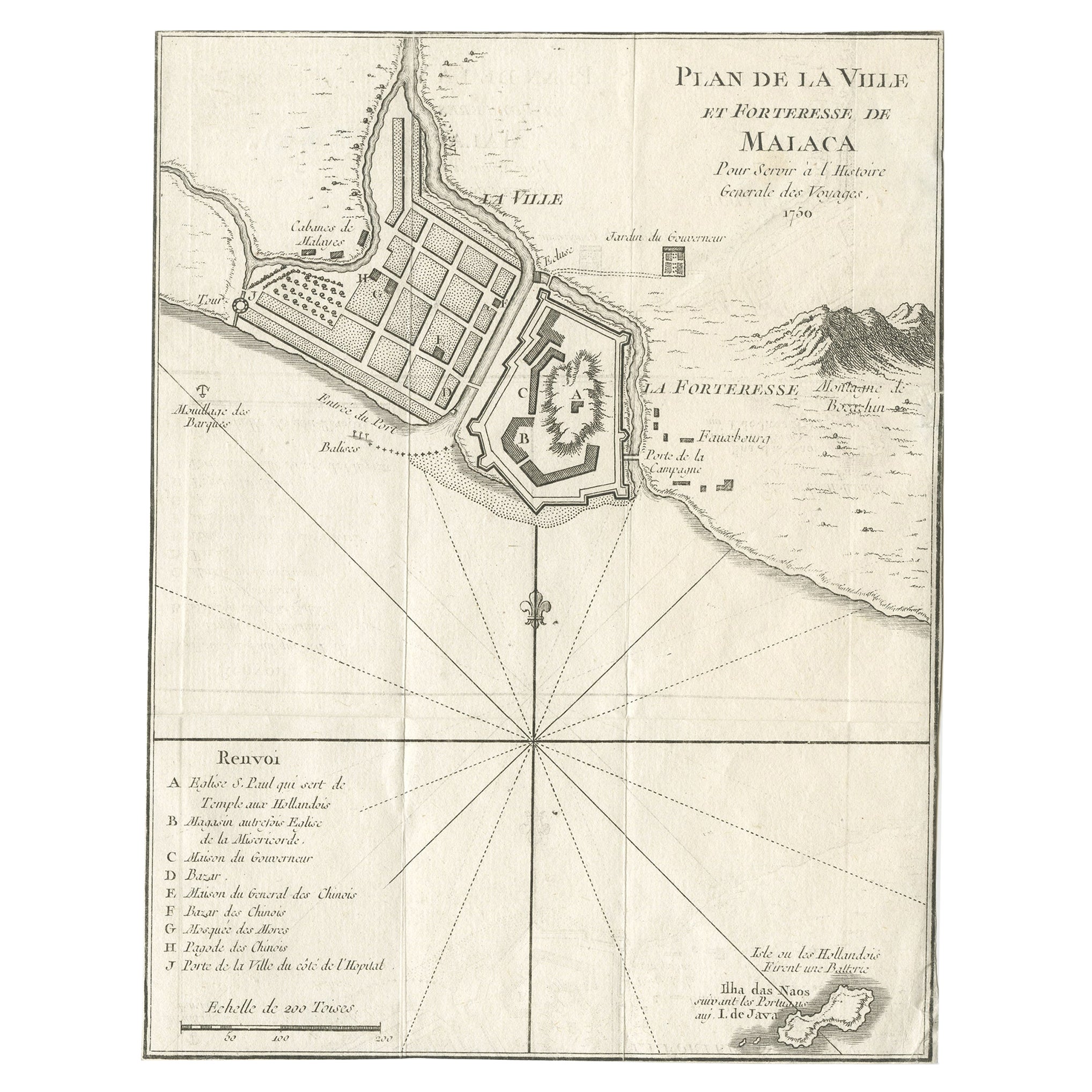
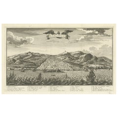
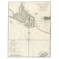
Detailed Original Antique Plan of the City and Fort of Malacca, Malaysia, 1764
Located in Langweer, NL
Description: Antique map titled 'Plan de la Ville et Forteresse de Malaca'. Detailed plan of the city and fort of Malacca on the southern Malay Peninsula, commanding the strategic st...
Category
Antique 1760s Maps
Materials
Paper
$182 Sale Price
20% Off
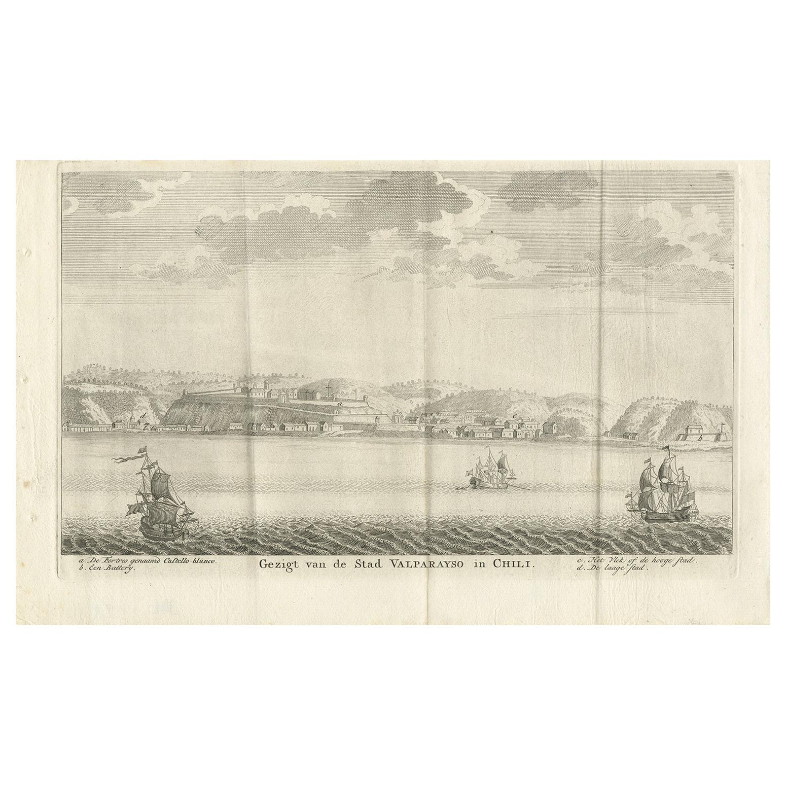
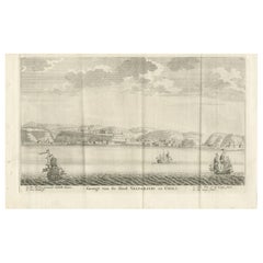
Antique Print of the City and Port of Valparaíso, Chile by Tirion '1767'
By Isaak Tirion
Located in Langweer, NL
Antique print titled 'Gezigt van de Stad Valparayso in Chili'. Detailed view of the city and port of Valparaíso, Chile. With Dutch key. As indicated by the presence of the fort and b...
Category
Antique Mid-18th Century Prints
Materials
Paper
$195 Sale Price
34% Off
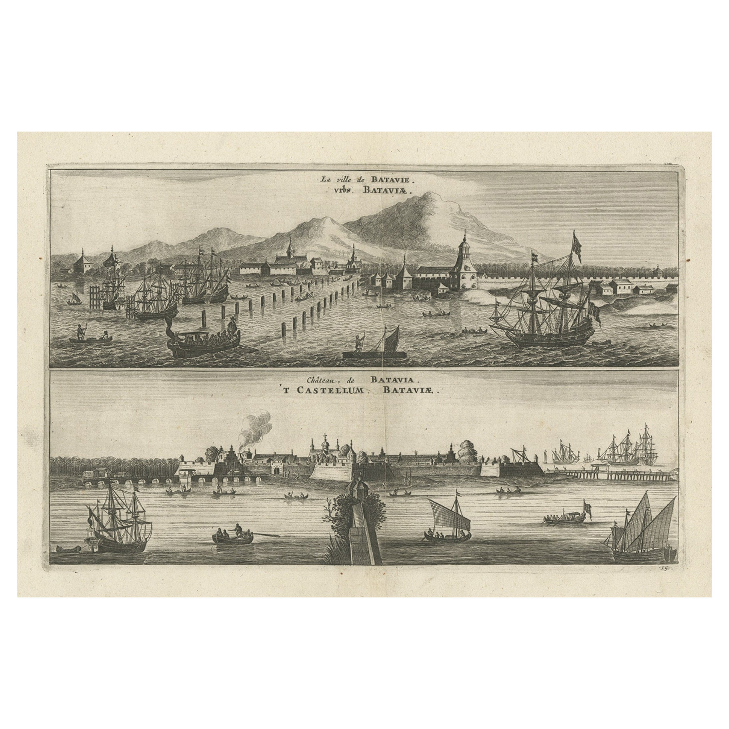
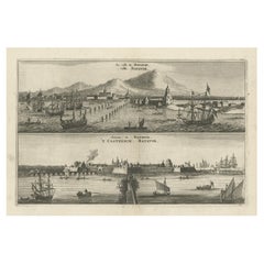
Old Print with a View on the City & Castle of Batavia 'Jakarta', Indonesia, 1668
Located in Langweer, NL
Antique print Indonesia titled ‘La ville de Batavie. De Stadt Batavia. Chateau de Batavia. ‘t Casteel van Batavia’.
Antique print with a view on the city of Djakarta, Indonesia. ...
Category
Antique 1660s Prints
Materials
Paper
$460 Sale Price
20% Off
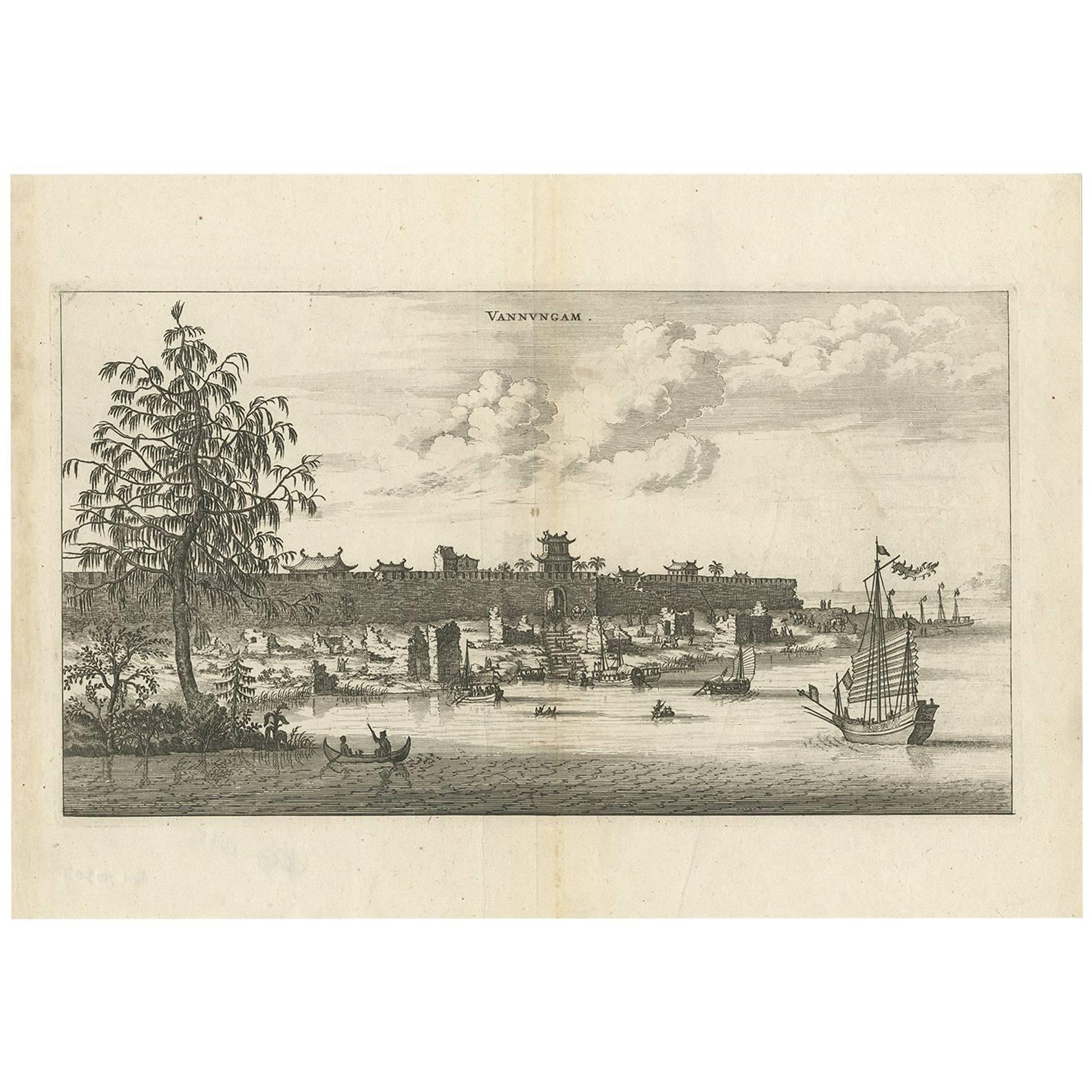
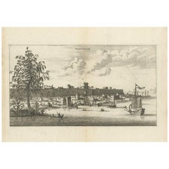
Antique Print of the City of Vannungam ‘China’ by J. Nieuhof, 1666
Located in Langweer, NL
Antique print titled 'Vannungam'. This plate shows a view on the Chinese city of Vannungam with its rampartss. Several ships are depicted. Behind the city wall palm...
Category
Antique Mid-17th Century Prints
Materials
Paper
$268 Sale Price
20% Off
You May Also Like
Antique Voc Print Holland Malaysia Old Map Melaka History, 1663
Located in Amsterdam, Noord Holland
From my own collection I offer this impressive Antique print of the city of Malakka
A very interesting piece for collectors . It is an museum piece from the Dutch Institute of Orien...
Category
Antique 17th Century European Paintings
Materials
Paper

$293 Sale Price
20% Off
18th Century French Map and City View of Joppe/Jaffa (Tel Aviv) by Sanson
By Nicholas Sanson d'Abbeville
Located in Alamo, CA
An original antique engraving entitled "Joppe; in ’t Hebreeusch by ouds Japho; hedendaags Japha, of Jaffa; volgens d’aftekening gedaan 1668", by Nicholas Sanson d'Abbeville (1600 - 1667). This is a view of the city of Joppe (in Hebrew Japho), now called Japha or Jaffa, the harbor portion of modern day Tel Aviv, Israel as it appeared in 1668 . It depicts a very busy harbor with numerous boats. A large ship on the left appears to be firing its canons and a small ship on the right appears to be sitting very low in the water, either heavily loaded with cargo or sinking. The town is seen on the far shore with a fortress on a hill across in the background. The map is printed from the original Sanson copperplate and was published in 1709 by his descendants.
The map is presented in an ornate brown wood frame embellished by gold-colored leaves and gold inner trim with a double mat; the outer mat is cream-colored and the inner mat is black. There is a central vertical fold, as issued. There are two small spots in the lower margin and one in the upper margin, as well as two tiny spots adjacent to the central fold. 1717 is written below the date 1668 in the inscription. The map is otherwise in very good condition.
Another map of the "Holy Land" (by Claes Visscher in 1663), with an identical style frame and mat is available. This pair of maps would make a wonderful display grouping. Please see Reference #LU117324709892.
Artist: Nicholas Sanson d'Abbeville (1600 - 1667) and his descendents were important French cartographer's active through the 17th century. Sanson started his career as a historian and initially utilized cartography to illustrate his historical treatises. His maps came to the attention of Cardinal Richelieu and then King Louis XIII of France, who became a supporter and sponsor. He subsequently appointed Sanson 'Geographe Ordinaire du Roi' the official map maker to the king. Sanson not only created maps for the king, but advised him on geographical issues and curated his map collection...
Category
Early 1700s Prints and Multiples
Materials
Engraving

17th-18th Century Siege of Graves Mapping Engraving By Willian III
Located in Kingston, NY
RARE French 17th-18th Century Enhanced Siege of Graves Mapping Engraving BY William III, also widely known as William of Orange,
The Siege of Grave in Dutch Brabant started by Monsie...
Category
Antique 17th Century French Prints
Materials
Paper

Ancient View of Batavia - Original Lithograph - Half of the 19th Century
Located in Roma, IT
Ancient View of Batavia is an original modern artwork realized in the first half of the 19th Century.
Original B/W Lithograph on Ivory Paper.
Inscripted on the lower margin in Ca...
Category
Early 19th Century Modern Landscape Prints
Materials
Lithograph
Ancient View of La Valetta - Original Lithograph - Early-19th Century
Located in Roma, IT
La Valetta is an original modern artwork realized in Italy in the first half of the 19th Century.
Original Lithograph on Ivory Paper.
Inscripted in capital letters on the lower ma...
Category
1850s Modern Figurative Prints
Materials
Lithograph
A View of Cape Rouge, Quebec, Canada, Mazell after Capt. Hervey Smyth, c.1760s
Located in Savannah, GA
A View of Cape Rouge, or Carouge, on the Saint Lawrence River, north of Quebec.
Engraving by Peter Mazell after a drawing by Captian Hervey Smyth, published c.1760's, London.
T...
Category
Antique 1760s Canadian British Colonial Prints
Materials
Paper
More Ways To Browse
Spice Tower
Antique Spice Tower
19th Century Bronze Stag
19th Century Carved Hutch
19th Century Chinese Bronze Urns
20th Century Terracotta Plates
70s Pillows
8 Foot Mirror
African Sculpture Antelope
African Wood Bed
Alfredo Barbini Fish
American Of Martinsville Chest Of Drawers
Anatomical Eye
Angel Putti Sculptures
Antique Bronze Hare
Antique Bronze Sink
Antique Bugle
Antique Campaign Writing Slope