Items Similar to Map of France, globe / Planisphere “Le Monde Politique”, National Geographic Ins
Video Loading
Want more images or videos?
Request additional images or videos from the seller
1 of 22
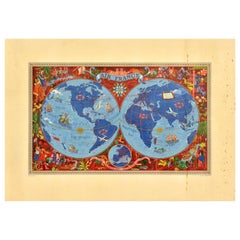
Map of France, globe / Planisphere “Le Monde Politique”, National Geographic Ins
$1,363.27
£1,028.16
€1,170
CA$1,884.85
A$2,111.34
CHF 1,108.95
MX$25,673.27
NOK 14,042.99
SEK 13,330.57
DKK 8,906.81
About the Item
Outstanding 19th-century French map designed and published by the French National Geographic Institute following the Aïtoff Wagner cartographic projection, a type of projection used to represent the Earth's surface on a plane. This projection has the particularity of being interrupted and equidistant in two directions (latitude and longitude), which means that the distances between points on the map are correct in certain specific areas. It was proposed by the cartographer Aïtoff in 1942 as a way to reduce the distortions that occur in traditional projections, especially in areas near the poles.
This French edition is framed at the top and bottom with a border of flags from around the world, adding even greater color and originality. It should also be noted that this is a physical-political map, as it combines two main types of geographic information: physical and political features. Physically, the natural elements of the Earth's surface, such as mountains, are shown, using specific colors, shading, and symbols to highlight topography and elevation differences. In addition to physical features, country borders are included. It therefore provides a comprehensive view of the world, combining nature and human political structures into a single visual resource. Its large size and framed with glass give it great weight.
Technical details
Print: French National Geographic Institute
Media technique: Print on paper
Period: Second half of the 19th century
Scale: 1:33,000,000
Country: France
Good condition commensurate with age and use
Overall dimensions: 98 x 138 x 3 cm
Unframed dimensions: 87 x 127 cm
- Creator:French House & Garden (Author)
- Dimensions:Height: 38.59 in (98 cm)Width: 54.34 in (138 cm)Depth: 1.19 in (3 cm)
- Style:Mid-Century Modern (Of the Period)
- Materials and Techniques:
- Place of Origin:
- Period:
- Date of Manufacture:1960
- Condition:Wear consistent with age and use.
- Seller Location:Valladolid, ES
- Reference Number:1stDibs: LU2943345196302
About the Seller
4.7
Gold Seller
Premium sellers maintaining a 4.3+ rating and 24-hour response times
Established in 1990
1stDibs seller since 2017
159 sales on 1stDibs
Typical response time: <1 hour
- ShippingRetrieving quote...Shipping from: VALLADOLID, Spain
- Return Policy
Authenticity Guarantee
In the unlikely event there’s an issue with an item’s authenticity, contact us within 1 year for a full refund. DetailsMoney-Back Guarantee
If your item is not as described, is damaged in transit, or does not arrive, contact us within 7 days for a full refund. Details24-Hour Cancellation
You have a 24-hour grace period in which to reconsider your purchase, with no questions asked.Vetted Professional Sellers
Our world-class sellers must adhere to strict standards for service and quality, maintaining the integrity of our listings.Price-Match Guarantee
If you find that a seller listed the same item for a lower price elsewhere, we’ll match it.Trusted Global Delivery
Our best-in-class carrier network provides specialized shipping options worldwide, including custom delivery.More From This Seller
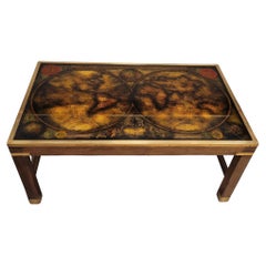
View AllFrench midcentury Coffee Table “Map/Globe”, Maison Jansen
By Maison Jansen
Located in Valladolid, ES
Beautiful coffee table or side table made by Maison Jansen around the 1970s, decorated with a striking map. This coffee table has a simple structure made of wood, with straight lines...
Category
Vintage 1970s French Mid-Century Modern Coffee and Cocktail Tables
Materials
Crystal, Brass
$2,693 Sale Price / item
20% Off
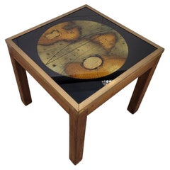
French Maison Jansen Side table / Coffee table “Map / Globe”
Located in Valladolid, ES
Beautiful and trendy side table made by Maison Jansen around the 1970s, decorated with a map that draws attention. This coffee table has a simple structure made of wood, with straig...
Category
Vintage 1970s End Tables
Materials
Crystal
$1,379 Sale Price
59% Off
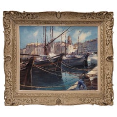
France Oil on panel “Marina”, French School
By French House & Garden
Located in Valladolid, ES
Exceptional painting depicting a Mediterranean seascape. The two fishing boats in the center of the composition stand out. In the far distance, a village with a small harbor, charact...
Category
Antique Early 1900s French Beaux Arts Paintings
Materials
Wood, Giltwood, Paint

Gabriel Deschamps French Oil on canvas “Saint Tropez”
By Gabriel Deschamps
Located in Valladolid, ES
Technique on stand: Oil on board
Title of the work: "Saint Tropez"
Author: Gabriel Dechamps (1919 – 2011)
Signed in the lower right corner
Period: Se...
Category
Vintage 1970s French Mid-Century Modern Paintings
Materials
Wood, Paint
$2,656 Sale Price
52% Off
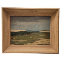
French painting "Mountain Landscape”, Madeleine Doillon -Toulouse
By Madeley
Located in Valladolid, ES
This gorgeous work by the French artist Madeleine Doillon-Toulouse presents a mountain landscape with an expressionist aesthetic. The expressionist landscape does not faithfully rep...
Category
Vintage 1940s French Mid-Century Modern Paintings
Materials
Wood, Paint
$2,125 Sale Price
29% Off
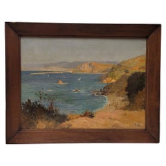
French Oil on cardboard “View of the Villefranche coast”Rene Charles Edmond His
Located in Valladolid, ES
This Amazinf and beautiful work by René His transports you to the Villefranche coast, an idyllic corner of southern France, where nature is displayed in all its splendor. The painti...
Category
Antique Early 1900s French Aesthetic Movement Paintings
Materials
Wood, Paint
$2,982 Sale Price
34% Off
You May Also Like
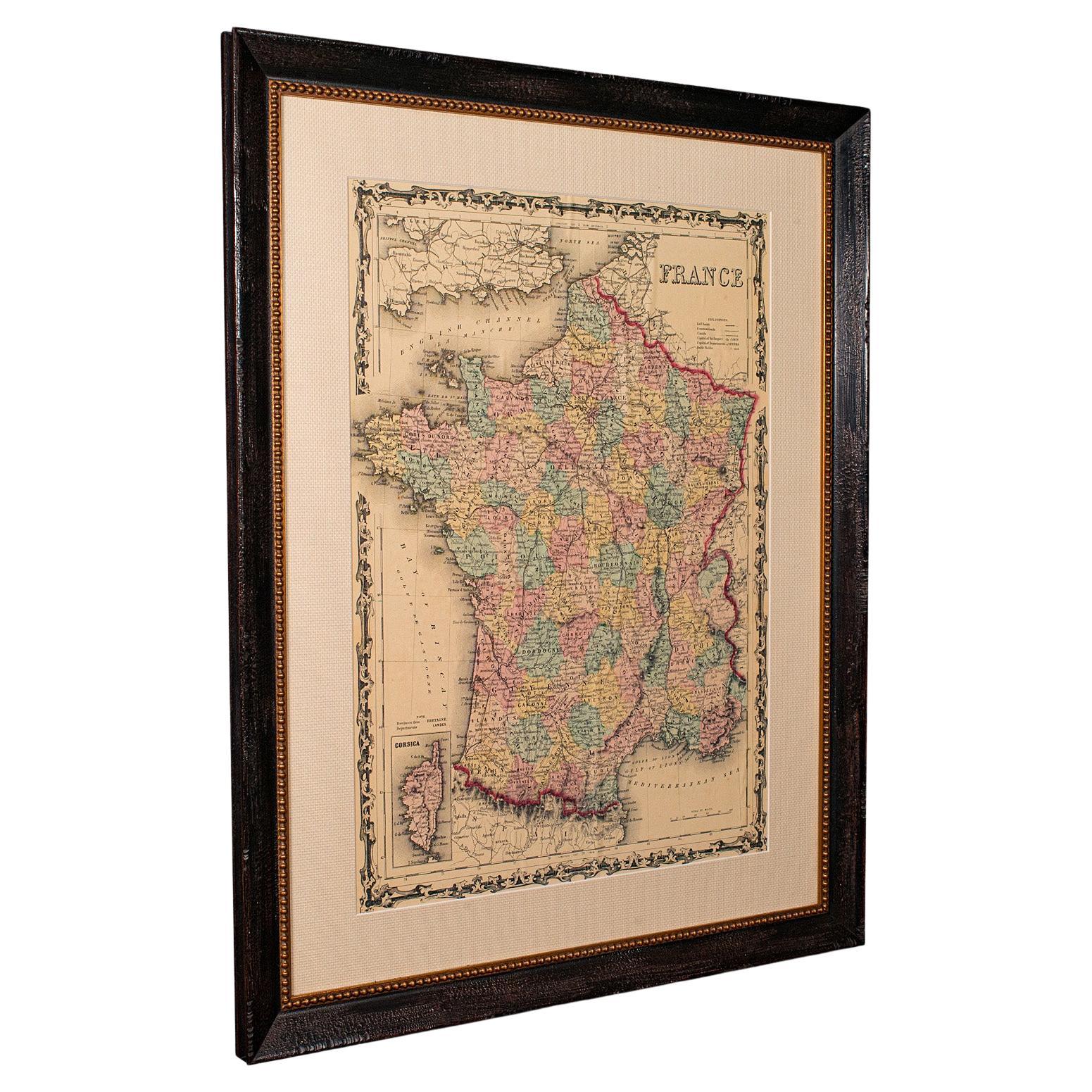
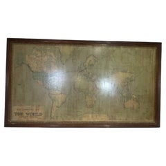
Large Vintage France Map, Continental, Historical Cartography, Late 20th Century
Located in Hele, Devon, GB
This is a large vintage map of France. A Continental, framed example of historical cartography, dating to the late 20th century, circa 1970.
Fas...
Category
Late 20th Century European Mid-Century Modern Prints
Materials
Glass, Wood, Paper

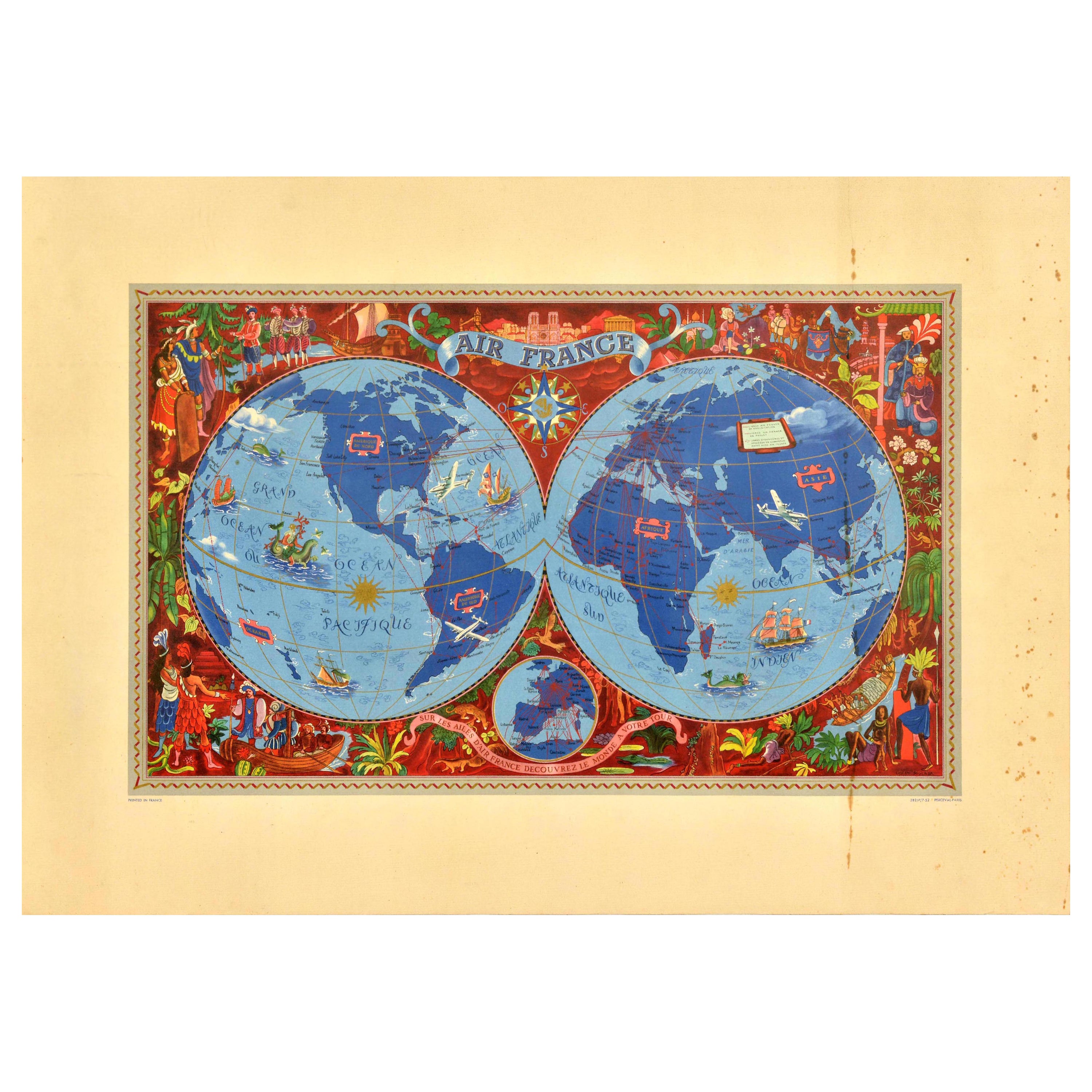
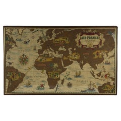
Original Vintage Travel Poster Air France Planisphere Illustrated Map Boucher
By Lucien Boucher
Located in London, GB
Original vintage travel poster advertising Air France featuring a stunning planisphere design by the French artist Lucien Boucher (1889-1971). C...
Category
Vintage 1950s French Posters
Materials
Paper
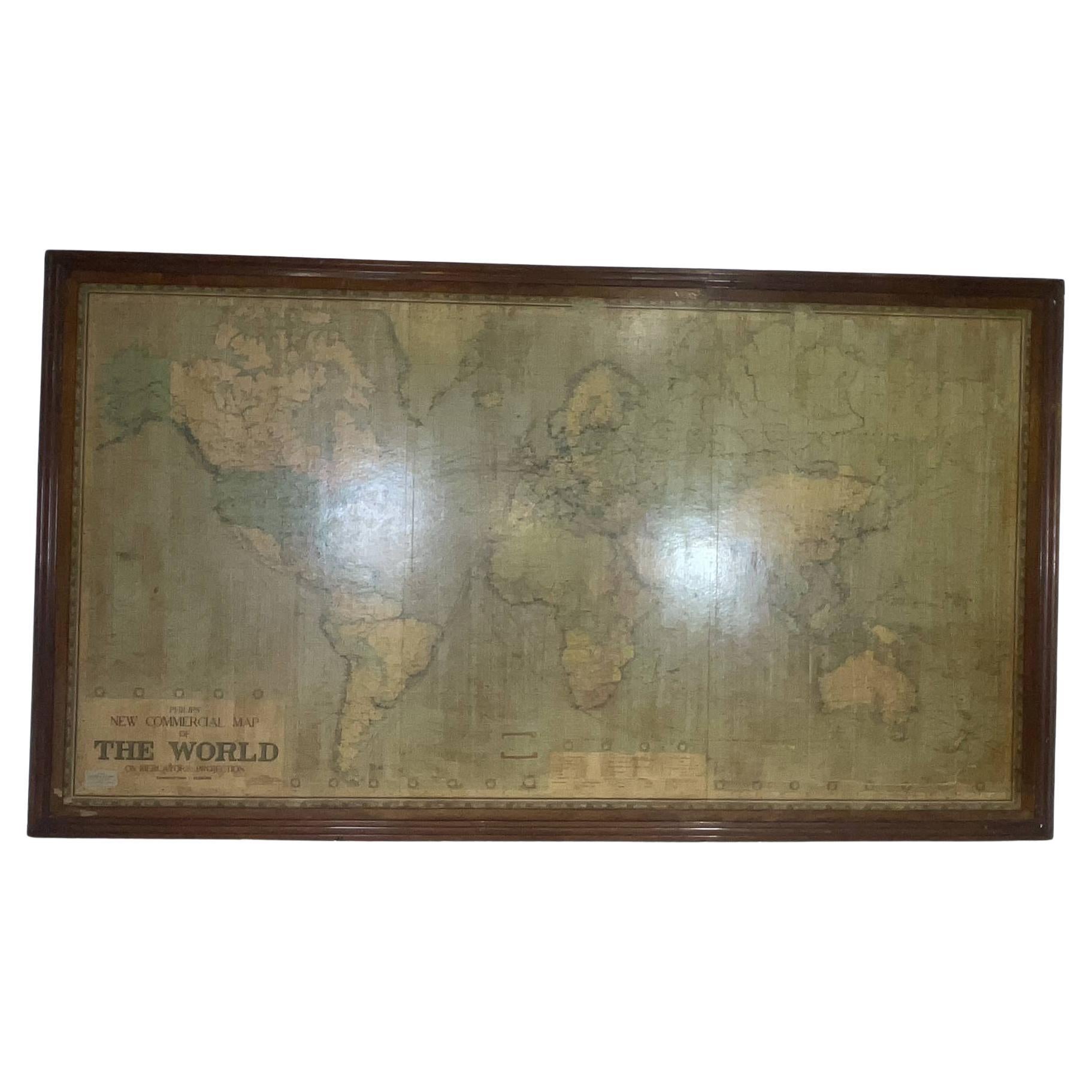
8 Foot Framed World Map by Philips
Located in Norwell, MA
1951 map of the world by George Philip and Son. Large beautiful map as it was in 1951. Nice patina mounted to a sturdy wood frame. Overall good condition. Very large in size. 90" W x...
Category
Vintage 1950s North American Maps
Materials
Paper
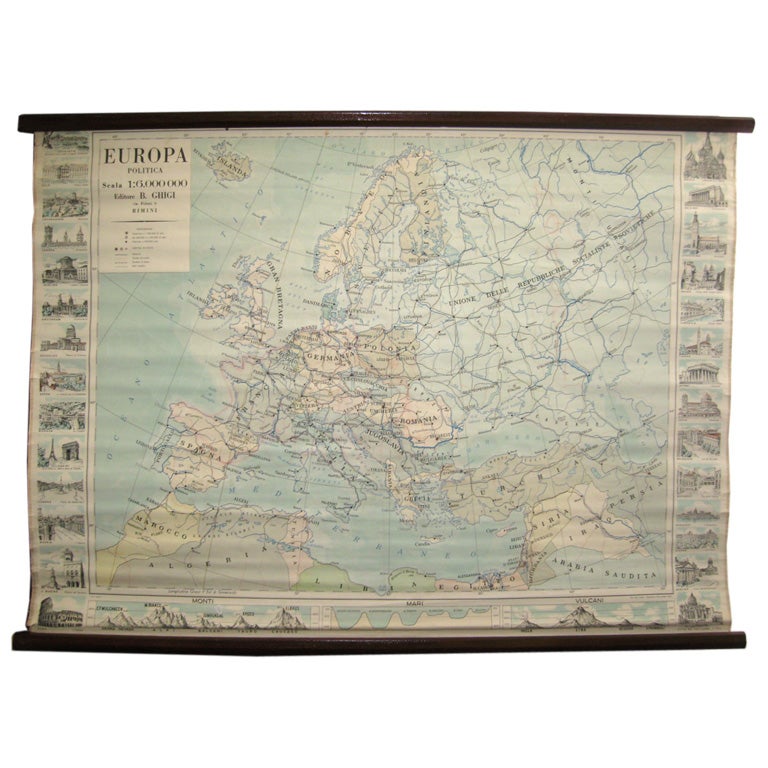
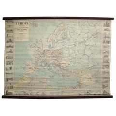
Map of Europe
Located in Los Angeles, CA
28 cities capitol drawings around the border of this Europe political map.
Category
Vintage 1950s Italian Mid-Century Modern Prints
$500
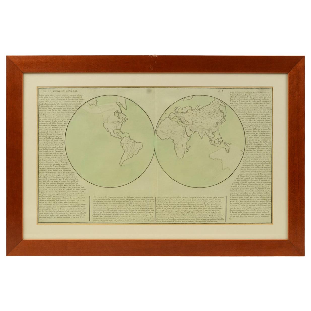
1850 Old French Map Depicting the Entire Earth's Surface Divided into Two Parts
Located in Milan, IT
Geographical map depicting the entire earth's surface divided into two parts that correspond to the two hemispheres or globes, the map deals with the earth in general. Detailed expla...
Category
Antique Mid-19th Century French Maps
Materials
Glass, Wood, Paper

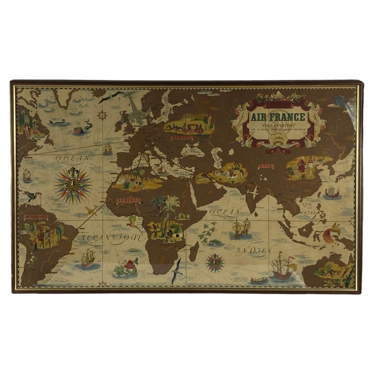
Lucien Boucher, Air France 'Nova et Vetera' Poster Map, Paris France, 1939
By Lucien Boucher
Located in Firenze, IT
Air France 'Nova et Vetera' poster map designed by Lucien Boucher
Paris France 1939
Advertising poster designed by Lucien Boucher for the Air France company and published in Paris by Perceval in 1939 at the dawn of World War II. It is one of the very first maps in the world of the French airline, founded in October 1933, to show its air routes from its Paris hub to major locations around the world. The Paris-New York route, still under study in 1939 (it would open in 1946), is shown here with a dotted line...
Category
Vintage 1930s French Modern Prints
Materials
Glass, Wood, Paper
More Ways To Browse
French Scales
Large Vintage Map
Carved Sandalwood
Cassina Bar Cart
Cast Plaster Foot
Cherub Commode
Chinese Comb
Chinese Crane Painting
Chinese Export Mug
Chinese Hat Chair
Chinese Jade Buddha
Chinese Lacquer Cabinet Bar
Chinese Lacquer Fan
Chinese Rank Badges
Chinese Scholars Cabinet
Chinoiserie Secretary
Clara Saint
Cloisonne Brass Box