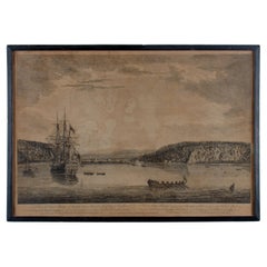
Items Similar to Resolution Bay in the Marquesas: Indigenous Canoes and European Exploration
Want more images or videos?
Request additional images or videos from the seller
1 of 8
Resolution Bay in the Marquesas: Indigenous Canoes and European Exploration
$96.08
$120.1020% Off
£70.76
£88.4520% Off
€80
€10020% Off
CA$130.71
CA$163.3820% Off
A$145.25
A$181.5620% Off
CHF 76.11
CHF 95.1420% Off
MX$1,781.17
MX$2,226.4720% Off
NOK 970.74
NOK 1,213.4220% Off
SEK 913.24
SEK 1,141.5420% Off
DKK 609.03
DKK 761.2820% Off
Shipping
Retrieving quote...The 1stDibs Promise:
Authenticity Guarantee,
Money-Back Guarantee,
24-Hour Cancellation
About the Item
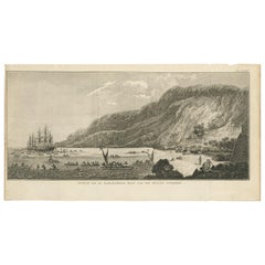
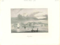
This engraving, titled "View of Resolution Bay, in the Marquesas", is a depiction of Resolution Bay in the Marquesas Islands. The scene shows traditional indigenous canoes in the foreground and a European ship in the distance, set against the dramatic cliffs of the bay.
This print was produced between 1784 and 1786. It originates from the publication "A New, Authentic, and Complete Account of Voyages Round the World, Undertaken and Performed by Royal Authority," which includes accounts of Captain Cook's voyages. The engravings in this collection, published by Alex Hogg in London, were created to document the famous explorations and encounters during Captain James Cook’s expeditions in the Pacific, making this print a product of that period.
This 18th-century engraving illustrates Resolution Bay in the Marquesas Islands, with a focus on both the natural rugged landscape and the indigenous maritime culture. The Marquesan canoes, with their triangular sails, are depicted in the foreground, showcasing the skilled seafaring of the indigenous people. In the distance, a European ship represents the arrival of explorers, likely from the voyages of Captain Cook or other European expeditions of the time.
This engraving was published by Alex Hogg, a London publisher who specialized in travel and geographical works. The inclusion of both indigenous canoes and the European ship suggests a focus on the meeting of cultures that occurred during the Pacific explorations of the 18th century, notably during Captain James Cook's voyages. Resolution Bay was named after Cook’s ship, the HMS Resolution, during his second voyage to the Pacific.
This scene represents both the natural beauty of the Marquesas Islands and the cross-cultural encounters between European explorers and the indigenous peoples of the Pacific. The prominence of the local canoes emphasizes the maritime tradition of the Marquesans, while the European ship in the background symbolizes the arrival of foreign powers and the beginning of a new chapter in the history of these islands.
- The engraving provides a detailed view of the Marquesan canoes, highlighting their design and construction, which were well adapted for navigating the waters of the Pacific.
- The rugged cliffs of Resolution Bay create a dramatic backdrop, emphasizing the natural grandeur of the Marquesas.
- The juxtaposition of indigenous and European vessels underscores the theme of exploration and the blending of different maritime traditions.
This engraving serves as both a geographical representation and an ethnographic record of the interactions between Europeans and the indigenous peoples of the Marquesas during a period of significant exploration and cultural exchange in the Pacific.
- Dimensions:Height: 9.45 in (24 cm)Width: 15.04 in (38.2 cm)Depth: 0 in (0.02 mm)
- Materials and Techniques:Paper,Engraved
- Period:1780-1789
- Date of Manufacture:circa 1785
- Condition:Condition: fair, given age. With soiling and water staining mostly outside the image. General age-related toning and minor defects from handling. Study images carefully.
- Seller Location:Langweer, NL
- Reference Number:Seller: BG-13597-511stDibs: LU3054341693372
About the Seller
5.0
Recognized Seller
These prestigious sellers are industry leaders and represent the highest echelon for item quality and design.
Platinum Seller
Premium sellers with a 4.7+ rating and 24-hour response times
Established in 2009
1stDibs seller since 2017
2,494 sales on 1stDibs
Typical response time: 1 hour
- ShippingRetrieving quote...Shipping from: Langweer, Netherlands
- Return Policy
Authenticity Guarantee
In the unlikely event there’s an issue with an item’s authenticity, contact us within 1 year for a full refund. DetailsMoney-Back Guarantee
If your item is not as described, is damaged in transit, or does not arrive, contact us within 7 days for a full refund. Details24-Hour Cancellation
You have a 24-hour grace period in which to reconsider your purchase, with no questions asked.Vetted Professional Sellers
Our world-class sellers must adhere to strict standards for service and quality, maintaining the integrity of our listings.Price-Match Guarantee
If you find that a seller listed the same item for a lower price elsewhere, we’ll match it.Trusted Global Delivery
Our best-in-class carrier network provides specialized shipping options worldwide, including custom delivery.More From This Seller
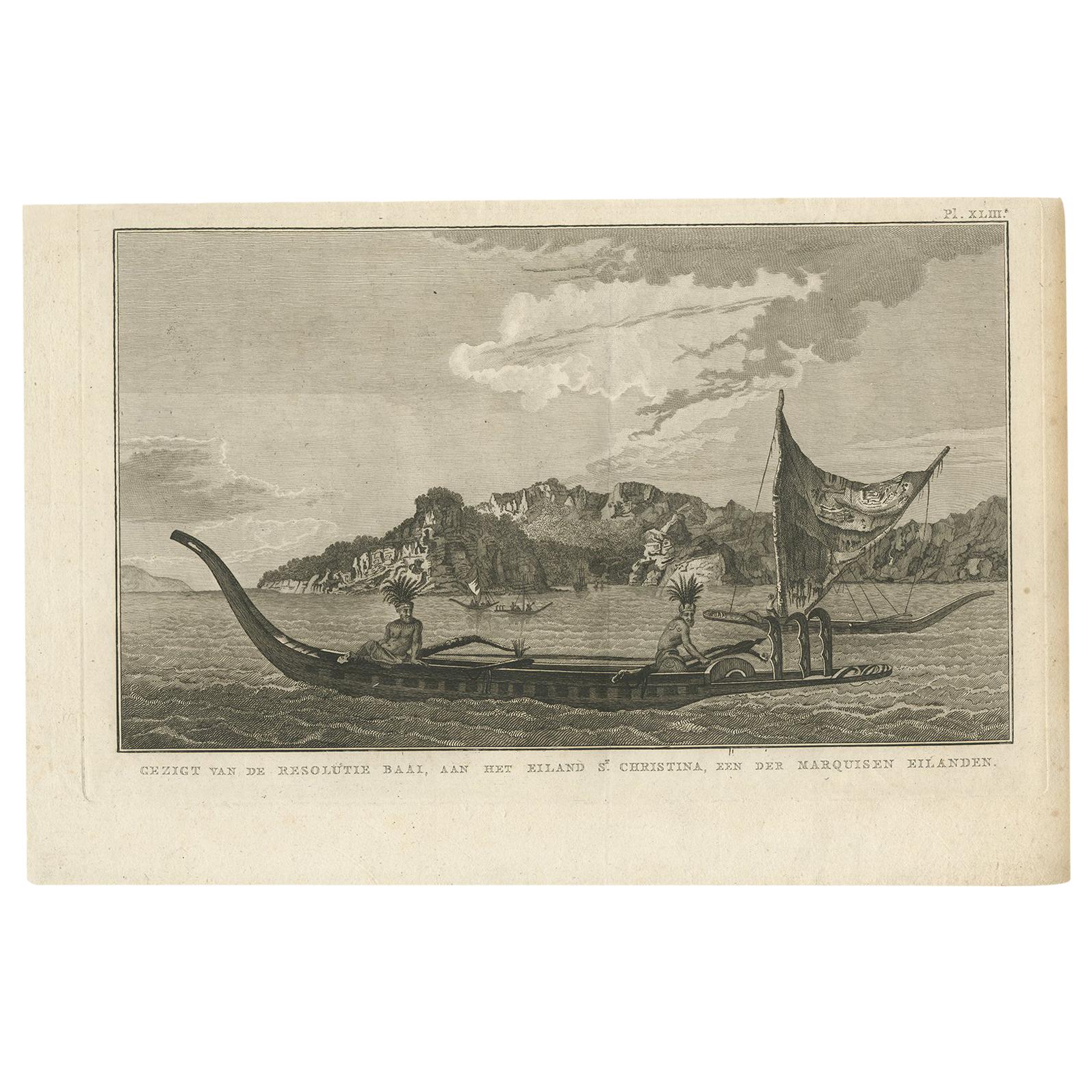
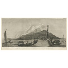
View AllResolution Bay on St. Christina: A Glimpse of the Marquesas in Cook's Voyages
Located in Langweer, NL
Antique print that translates from Dutch to "View of Resolution Bay, on the Island of St. Christina, one of the Marquesas Islands." This is a historical print from the Dutch edition ...
Category
Antique Early 19th Century Dutch Prints
Materials
Paper
$230 Sale Price
20% Off
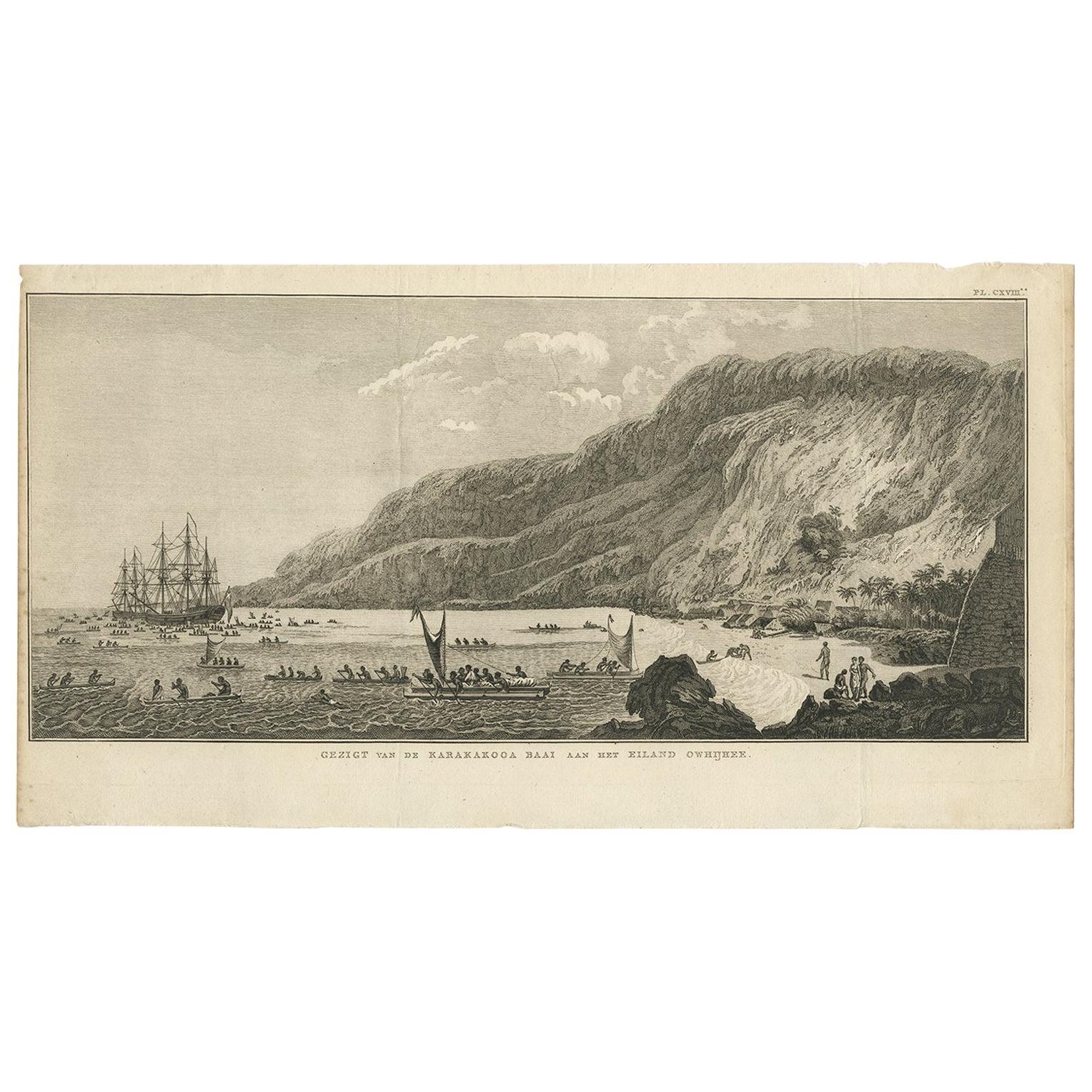
Antique Print of Karakakooa Bay by Cook, 1803
Located in Langweer, NL
Antique print titled 'Gezigt van de Karakakooa Baai aan het Eiland Owhijhee'. This print depicts Karakakooa Bay in Owyhee/Hawaï.
This engraving for sale depicts a scene of Karakako...
Category
Antique Early 19th Century Dutch Prints
Materials
Paper
$336 Sale Price
20% Off
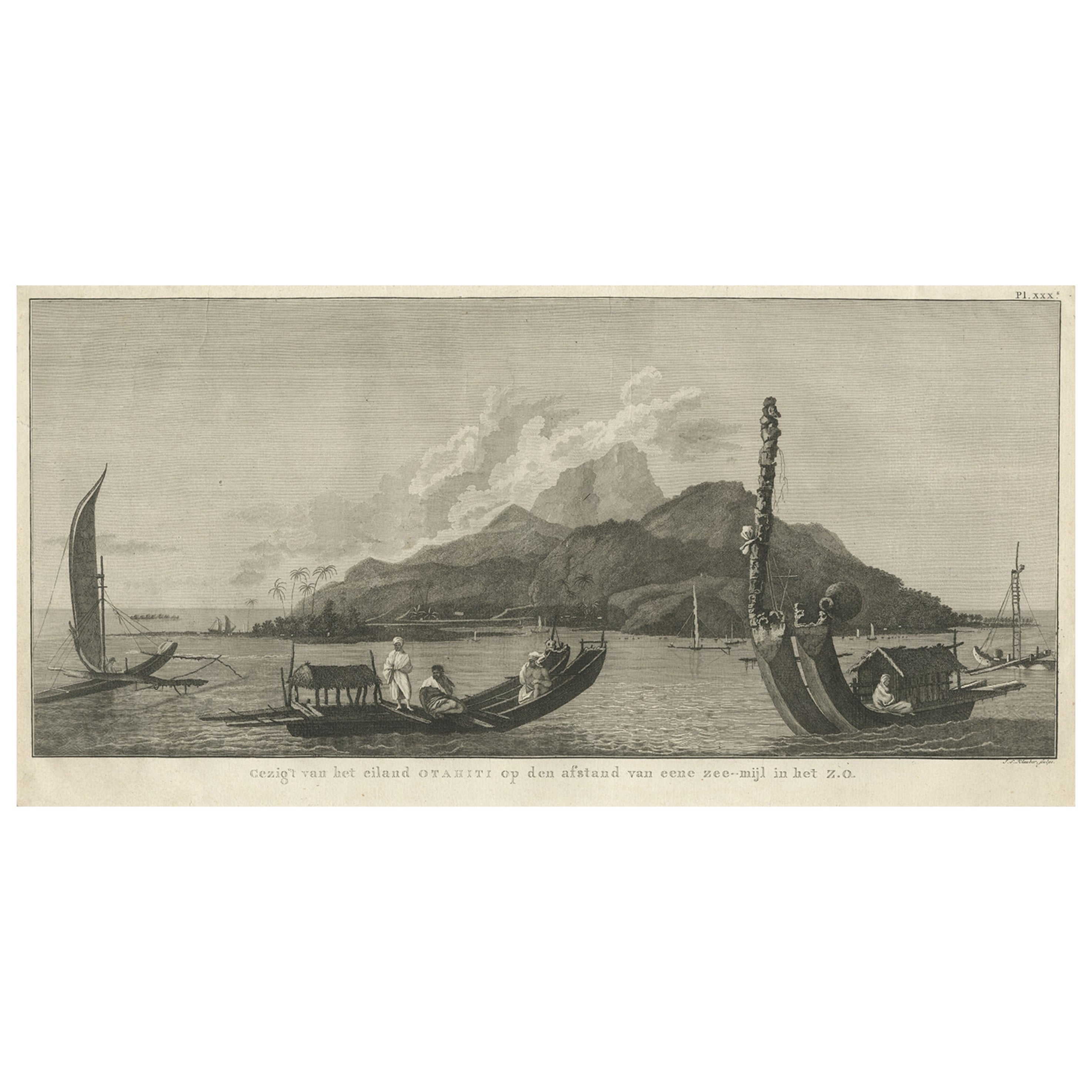
View of the Island of Tahiti, with Outrigger Canoes and Sailing Catamarans, 1803
Located in Langweer, NL
Antique print Polynesia titled 'Gezigt van het eiland Otahiti op den afstand van eene zee-mijl in het Z.O'.
View of the island of Tahiti, with outrigger canoes...
Category
Antique Early 1800s Prints
Materials
Paper
$634 Sale Price
20% Off
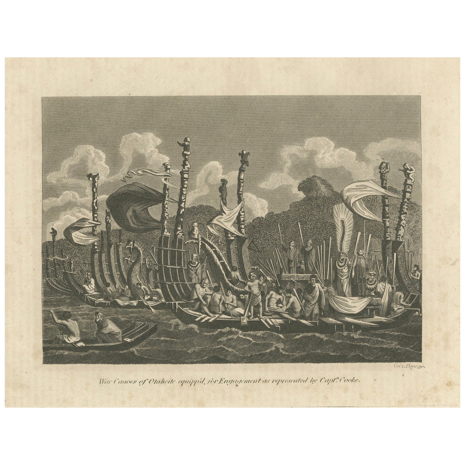
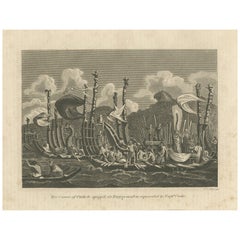
Naval Might of Tahiti: War Canoes Observed by Captain Cook, circa 1817
Located in Langweer, NL
Title: War Canoes of Otaheite equipp'd for Engagement as represented by Captn. Cooke
This detailed engraving depicts the "War Canoes of Otaheite (Tahiti), as represented by Capt'n C...
Category
Antique Early 19th Century Prints
Materials
Paper
$230 Sale Price
20% Off
Free Shipping
Voyage to the Pacific: Hawaiian War Canoe in Action, circa 1790
Located in Langweer, NL
The engraving captures a moment of traditional Hawaiian life, portraying native Hawaiians maneuvering a war canoe. The presence of traditional masks emphasizes the cultural significa...
Category
Antique Late 18th Century Prints
Materials
Paper
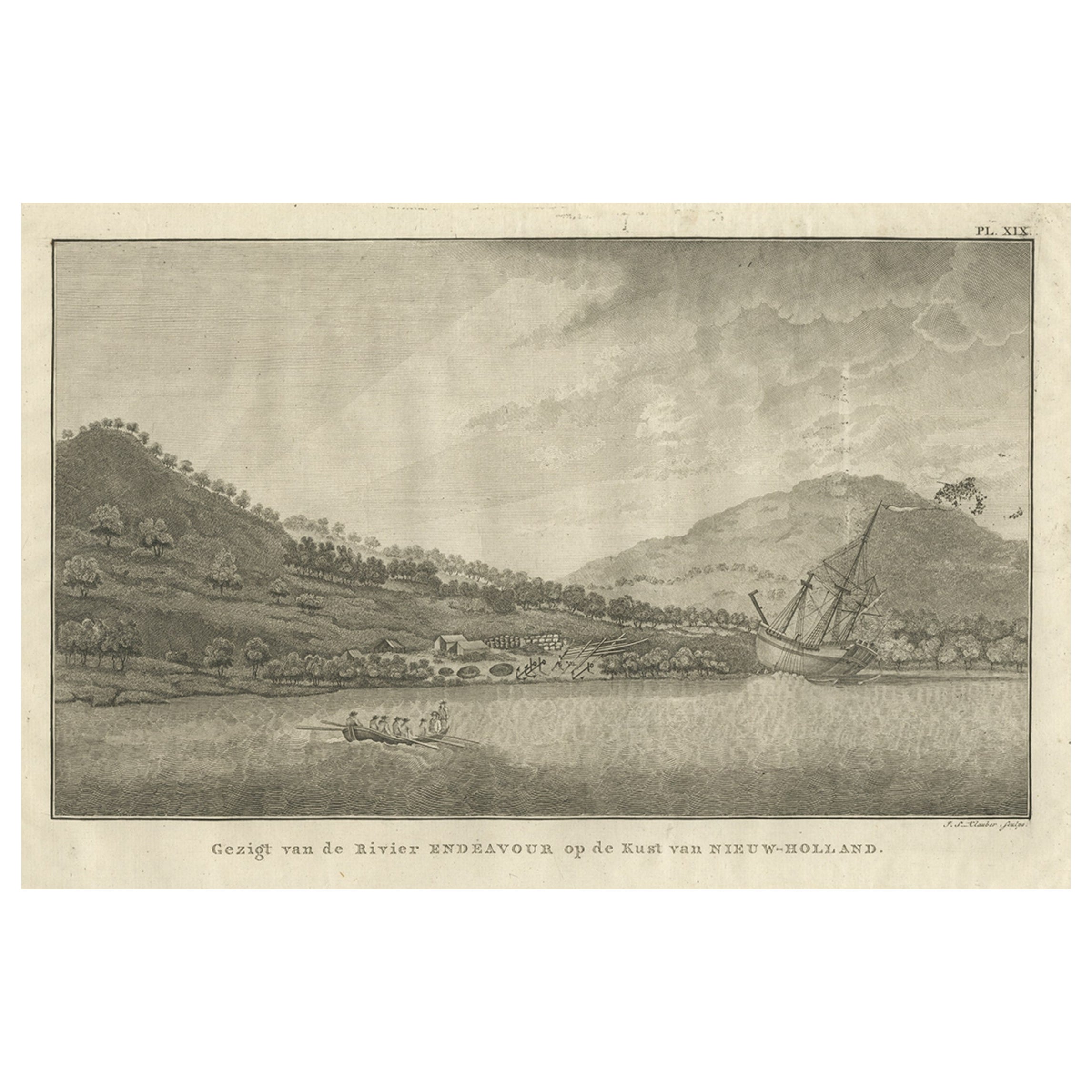
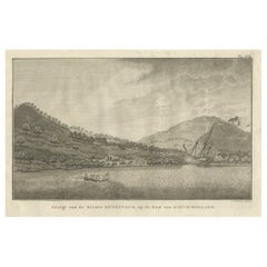
Captain Cook's Encampment in Australia where The Endeavour was Beached, 1803
Located in Langweer, NL
Antique print Australia titled 'Gezigt van de Rivier Endeavour op de Kust van Nieuw-Holland'.
View of an encampent on the shore of the Endeavour river on the coast of Australia where the Endeavour boat was beached. Originates from 'Reizen Rondom de Waereld door James Cook (..)'.
HMS Endeavour was a British Royal Navy research vessel that Lieutenant James Cook commanded to Australia and New Zealand on his first voyage of discovery from 1768 to 1771.
She was launched in 1764 as the collier Earl of Pembroke, with the Navy purchasing her in 1768 for a scientific mission to the Pacific Ocean and to explore the seas for the surmised Terra Australis Incognita or "unknown southern land". Commissioned as His Majesty's Bark Endeavour, she departed Plymouth in August 1768, rounded Cape Horn and reached Tahiti in time to observe the 1769 transit of Venus across the Sun. She then set sail into the largely uncharted ocean to the south, stopping at the islands of Huahine, Bora Bora, and Raiatea west of Tahiti to allow Cook to claim them for Great Britain. In September 1769, she anchored off New Zealand, becoming the first European vessel to reach the islands since Abel Tasman's Heemskerck 127 years earlier.
In April 1770, Endeavour became the first European ship to reach the east coast of Australia, with Cook going ashore at what is now known as Botany Bay. Endeavour then sailed north along the Australian coast. She narrowly avoided disaster after running aground on the Great Barrier Reef, and Cook had to throw her guns overboard to lighten her. Endeavour was beached on the Australian mainland for seven weeks to permit rudimentary repairs to her hull. Resuming her voyage, she limped into port in Batavia in October 1770, her crew sworn to secrecy about the lands that they had visited. From Batavia Endeavour continued westward, rounded the Cape of Good Hope on 13 March 1771 and reached the English port of Dover on 12 July, having been at sea for nearly three years.
The ship was largely forgotten after her Pacific voyage, spending the next three years hauling troops and cargo to and from the Falkland Islands. She was renamed in 1775 after being sold into private hands, and used to transport timber from the Baltic. Rehired as a British troop transport during the American War of Independence, she was finally scuttled in a blockade of Narragansett Bay, Rhode Island in 1778. Historical evidence indicates the ship was sunk just north of Goat Island in Newport Harbor, along with four other British transports.
Relics from Endeavour are displayed at maritime museums worldwide, including an anchor and six of her cannon. A replica of Endeavour was launched in 1994 and is berthed alongside the Australian National Maritime Museum in Sydney Harbour. The NASA Space Shuttle...
Category
Antique Early 1800s Prints
Materials
Paper
$526 Sale Price
40% Off
You May Also Like
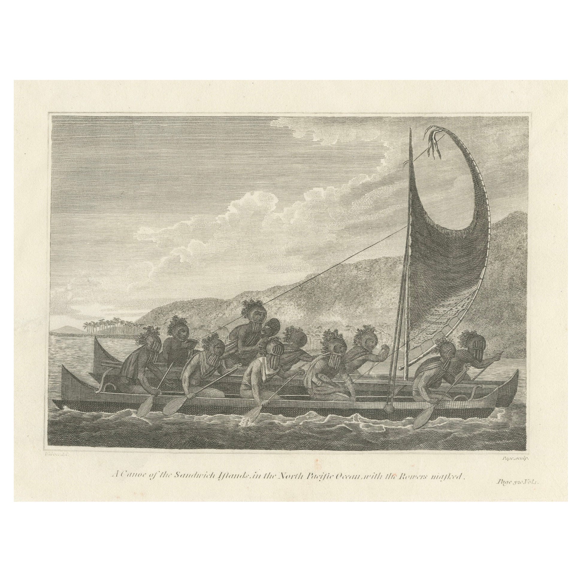
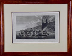
Sandwich Islands Canoe (Hawaii): Framed 18th C. Engraving Captain Cook's Journal
By John Webber
Located in Alamo, CA
"A Canoe of the Sandwich Islands, the Rowers Masked" is an engraving created by Charles Grignion, from a drawing by John Webber (1752-1793), who was the artist on Captain James Cook's 3rd and final voyage of discovery. It is Plate 65 in the atlas of "A Voyage to the Pacific Ocean Undertaken by the Command of His Majesty, for Making Discoveries in the Northern Hemisphere", the official British Admiralty sanctioned journal published upon completion of the voyage in London in 1784 by Strahan & Cadell.
This famous image of ten Hawaiian rowers transporting a priest who is carrying a feather-covered image of Kukailimoku, the Hawaiian god of war. The priests and paddlers are all wearing gourd masks in their double-hulled canoe with an upright lateen woven sail. Each hull was shaped from a single large Koa log harvested from island rainforests, where they were carved before being transported to the coast.
This engraving is presented in a Koa wood frame and a white mat. There are occasional faint spots, but the print is otherwise in very good condition. Koa is the same wood as was used to make the canoe. Koa wood is legendary in Hawaii. Not only is this amazing wood native to Hawaii, but it is known for the deep rich colors and varied grain pattern. Koa has an honored heritage in Hawaii and is highly revered and sacred. The word “koa” means “warrior” in Hawaiian. The warriors of King Kamehameha the Great, created canoes and weapons from a wood plentiful on the Big Island of Hawaii. This wood became synonymous with the warriors themselves, and it became known as koa. The frame measures 20.75" high, 26.75" wide and 0.88" deep.
There are three other engravings listed from the official journal of Captain Cook's 3rd voyage available that are presented in identical Koa wood frames and mat (LU117324682022, LU117324684052, LU117324684062). They would make a wonderful grouping for a display of 2, 3 or 4 prints. A discount is available for a grouping depending on the number of items included.
Hawaii was discovered by Captain Cook (1728-1779) during this voyage. Hawaii was originally called The Sandwich Islands in honor of The Earl of Sandwich...
Category
1780s Landscape Prints
Materials
Engraving
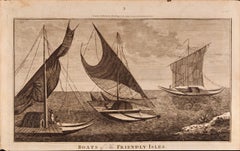
Boats of the Friendly Isles, Tonga: Original 18th C. Engraving from Captain Cook
By William Hodges
Located in Alamo, CA
"Boats of the Friendly Isles" is an original 18th century engraving from a drawing by William Hodges (1744-1797), who was the artist who accompanies Captain Cook on his second voyage...
Category
1780s Landscape Prints
Materials
Engraving
Captain Cook's Exploration of Tahiti 18th C. Hand-Colored Map by Bellin
By Jacques-Nicolas Bellin
Located in Alamo, CA
This beautiful 18th century hand-colored copper plate engraved map is entitled "Carte de l'Isle de Taiti, par le Lieutenant J. Cook" was created by Jacques Nicolas Bellin and publish...
Category
Antique Mid-18th Century French Maps
Materials
Paper

Cove Harbour - Original Lithograph - Mid-19th Century
Located in Roma, IT
Cove Harbour is an original modern artwork realized in Germany in the Mid-19th Century.
Original B/W Lithograph on Ivory Paper.
Inscripted on the lower central margin: Cove Harbou...
Category
Mid-19th Century Modern Figurative Prints
Materials
Lithograph
Ancient View of Havannah - Original Lithograph - Early 19th Century
Located in Roma, IT
Ancient View of Havannah is an original modern artwork realized in the first half of the 19th Century.
Original Lithograph on Ivory Paper.
Inscripted in capital letters on the lo...
Category
Early 19th Century Modern Figurative Prints
Materials
Lithograph
A View of Cape Rouge, Quebec, Canada, Mazell after Capt. Hervey Smyth, c.1760s
Located in Savannah, GA
A View of Cape Rouge, or Carouge, on the Saint Lawrence River, north of Quebec.
Engraving by Peter Mazell after a drawing by Captian Hervey Smyth, published c.1760's, London.
T...
Category
Antique 1760s Canadian British Colonial Prints
Materials
Paper